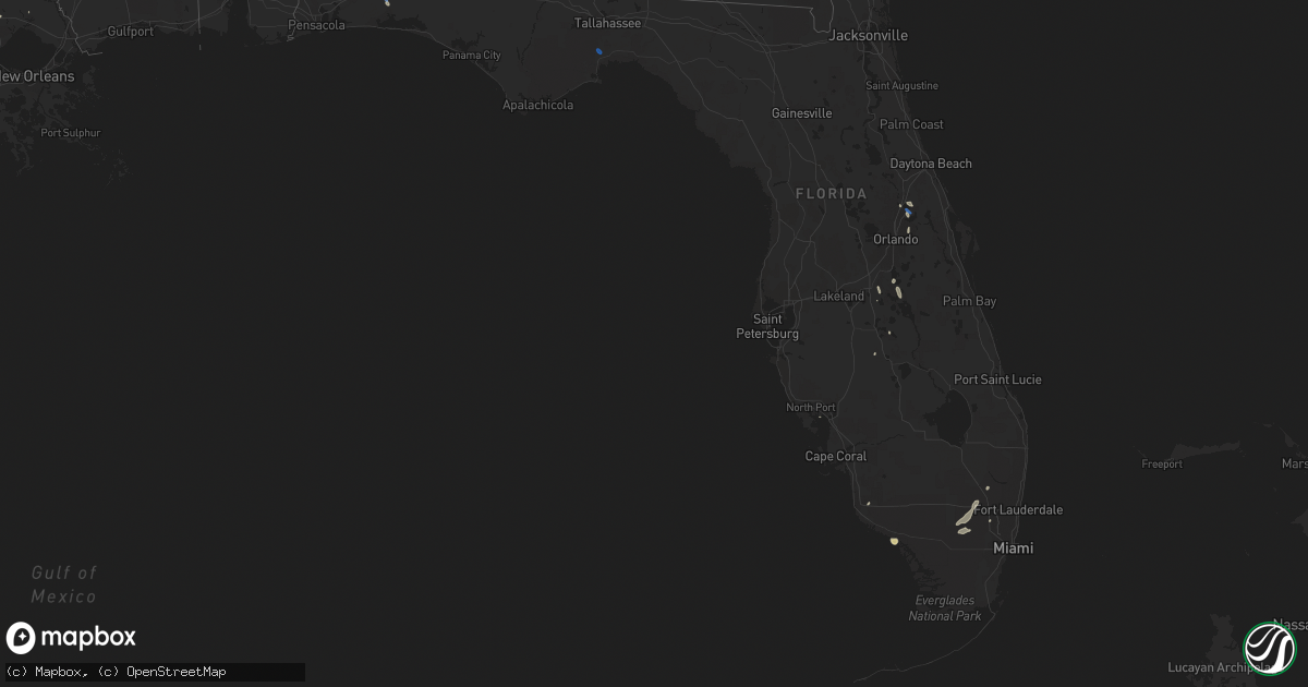
Hail Map in Florida on June 25, 2019
Get this storm
June 25 map
$229
one time, instant access
Download today. No call, no setup
Keep the $229
Bought the map and want the full workflow? Apply the entire $229 to a subscription within 7 days. None of it is wasted.
Every map, not just this one
This buys you this map. Subscription and you get every map we run, in the markets you choose from a few cities to whole states to nationwide. Plus real-time alerts the moment a storm fires.
Contact data
Name, contact info, occupancy, even credit band for addresses in the footprint. You go from where it hit to who to call.
Become the source they trust
Unlimited branding weather history reports on demand. You already have the documented answer ready for the property owner, and you are the one who showed up with it.
Property data and RoofTrace estimates
Pull up any address you have got, its value and the exact code rules for that jurisdiction, straight from One Click Code. Then RoofTrace estimates the squares, pitch, and roof value, priced the way you price.
Storm reports in Florida
Florida
| Date | Description |
|---|---|
| 06/25/20196:40 PM CDT | Trees down on hwy 10a and jackey rd in ponce de leon area. |
| 06/25/20196:37 PM CDT | Awos station kegi duke field |
| 06/25/20196:20 PM CDT | Numerous tree branches down that were two to three inches in diameter. Time estimated by radar. |
| 06/25/20196:05 PM CDT | Numerous reports of trees down on the north side of crestview... Fl. Reports and pictures via social media. |
| 06/25/20195:31 PM CDT | Wind gusts from nearby storms flipped over a small single airplane parked at the airport. Peak winds were measured up to 59 mph at the time. |
| 06/25/20195:31 PM CDT | Gust to 51 knots from the nnw. Updated for higher gust than occurred earlier. |
| 06/25/20194:59 PM CDT | Reports of multiple power lines and trees down in the molino area near highway 95a. Reports via social media. |
| 06/25/20194:00 PM CDT | Widespread tree and power line in crawfordville... Fl. |
| 06/25/20193:08 AM CDT | At 808 PM EDT, a severe thunderstorm was located 7 miles southeast of Wauchula, moving south at 15 mph. HAZARD...60 mph wind gusts and quarter size hail. SOURCE...Radar indicated. IMPACT...Hail damage to vehicles is expected. Expect wind damage to roofs, siding, and trees. Locations impacted include... Sweetwater, Zolfo Springs and Gardner. |
| 06/25/20192:08 AM CDT | At 707 PM EDT, a severe thunderstorm was located over Union Park, or over University Of Central Florida, moving south at 20 mph. HAZARD...60 mph wind gusts. SOURCE...Radar indicated. IMPACT...Expect damage to roofs, siding, and trees. Locations impacted include... Orlando, Winter Park, Wedgefield, Orlando International Airport and Avalon Park. |
| 06/25/20192:06 AM CDT | At 706 PM EDT, a severe thunderstorm was located over Bay Lake, moving southeast at 25 mph. HAZARD...60 mph wind gusts. SOURCE...Radar indicated. IMPACT...Expect damage to roofs, siding, and trees. Locations impacted include... Orlando, Kissimmee, Winter Garden, Windermere and Bay Lake. |
| 06/25/20191:39 AM CDT | At 639 PM CDT, a severe thunderstorm was located near Niceville, moving southeast at 20 mph. HAZARD...60 mph wind gusts. SOURCE...Radar indicated. IMPACT...Expect damage to roofs, siding, and trees. Locations impacted include... Santa Rosa Beach, Eglin Air Force Base, Freeport, Inlet Beach, Portland, Villa Tasso, Port Washington, Blue Mountain Beach, Seaside, Miramar Beach, Gulf Pines, Bunker, Grayton Beach, Seagrove Beach, Sandestin and Four Mile Village. |
| 06/25/20191:34 AM CDT | At 633 PM EDT, a severe thunderstorm was located over Sanford, moving southeast at 15 mph. A wind gust to 59 mph was recorded at the Sanford Airport at 631 PM. HAZARD...60 mph wind gusts. SOURCE...Radar indicated. IMPACT...Expect damage to roofs, siding, and trees. Locations impacted include... Orlando, Sanford, Altamonte Springs, Oviedo and Winter Springs. |
| 06/25/20191:28 AM CDT | At 628 PM CDT, a severe thunderstorm was located 6 miles north of Niceville, moving southeast at 25 mph. HAZARD...60 mph wind gusts and penny size hail. SOURCE...Radar indicated. IMPACT...Expect damage to roofs, siding, and trees. Locations impacted include... Niceville and Valparaiso. |
| 06/25/20191:09 AM CDT | At 609 PM CDT, severe thunderstorms were located along a line extending from 6 miles north of Eglin Air Force Base to 12 miles southwest of Geneva, moving southeast at 20 mph. HAZARD...60 mph wind gusts. SOURCE...Radar indicated. IMPACT...Expect damage to roofs, siding, and trees. Locations impacted include... Vernon, De Funiak Springs, Bonifay, Eglin Air Force Base, Union, Liberty, Live Oak, Freeport, Ponce De Leon, Caryville, Westville, Ebro, Oakwood Hills, Cluster Springs, Whitehead Crossroads, Cerrogordo, Gritney, Rock Hill, Glendale and Holmes Valley. |
| 06/25/201912:28 AM CDT | At 528 PM EDT, a severe thunderstorm was located near Dade-Collier Training Airport, or 28 miles west of Miramar, moving southwest at 40 mph. HAZARD...60 mph wind gusts and quarter size hail. SOURCE...Radar indicated. IMPACT...Hail damage to vehicles is expected. Expect wind damage to roofs, siding, and trees. Locations impacted include... Loop Road Ee Center, Dade-Collier Training Airport, Fortymile Bend and Big Cypress National Preserve. |
| 06/24/201911:41 PM CDT | At 440 PM EDT, a severe thunderstorm was located near Crawfordville, moving southeast at 20 mph. HAZARD...60 mph wind gusts. SOURCE...Radar indicated. IMPACT...Expect damage to roofs, siding, and trees. Locations impacted include... Crawfordville, St. Marks, Woodville, Wakulla, Newport, Shadeville, Hyde Park, Wakulla Springs, Arran, Hilliardville, Tully, Plum Orchard, Panacea, Shell Point, Port Leon, Medart, Wakulla Beach, Spring Creek, Bethel and Liveoak Island. |
| 06/24/201910:55 PM CDT | At 354 PM EDT, severe thunderstorms were located along a line extending from near Lion Country Safari Park to 7 miles southwest of Loxahatchee NWR, moving west at 10 mph. HAZARD...60 mph wind gusts and quarter size hail. SOURCE...Radar indicated. IMPACT...Hail damage to vehicles is expected. Expect wind damage to roofs, siding, and trees. Locations impacted include... Wellington, Lion Country Safari Park and Loxahatchee NWR. |
| 06/24/20197:15 PM CDT | Hardee county em reported that a large oak tree was down on mineral springs road east of zolfo springs. Dime size hail was also observed in the area. |
| 06/24/20197:05 PM CDT | Tree down on driftwood point road. |
All States Impacted by Hail Map on June 25, 2019
Cities Impacted by Hail Map on June 25, 2019
- Benedict, KS
- Fredonia, KS
- Eunice, NM
- Hemingford, NE
- Veteran, WY
- Lingle, WY
- Torrington, WY
- Harrison, NE
- Morrill, NE
- Selma, AL
- Marion Junction, AL
- Farwell, NE
- Van Tassell, WY
- Panhandle, TX
- Amarillo, TX
- Sargent, NE
- Burwell, NE
- Toronto, KS
- Lost Springs, WY
- Shawnee, WY
- Manville, WY
- Marion, AL
- Centreville, AL
- Lawley, AL
- Lockney, TX
- Tulia, TX
- Silverton, TX
- Kress, TX
- Knoxville, IA
- Otley, IA
- Centerville, IA
- Mystic, IA
- Aladdin, WY
- Naponee, NE
- Exline, IA
- Moulton, IA
- Glenwood, MO
- Cincinnati, IA
- Unionville, MO
- Coatsville, MO
- Livonia, MO
- Weston, WY
- Spearfish, SD
- Moorcroft, WY
- Hulett, WY
- Alva, WY
- Belle Fourche, SD
- Saint Onge, SD
- Beulah, WY
- Sundance, WY
- Prescott, IA
- Gruver, TX
- Beloit, WI
- Lusk, WY
- Yates Center, KS
- Wann, OK
- Elliott, IA
- Sylvan Grove, KS
- Albia, IA
- Peoria Heights, IL
- Trivoli, IL
- Hanna City, IL
- Brimfield, IL
- Farmington, IL
- Peoria, IL
- Edwards, IL
- Elmwood, IL
- Conehatta, MS
- Lodge Grass, MT
- Claude, TX
- Wayside, TX
- Delaware, OK
- Donaldsonville, LA
- Genoa, NE
- Douds, IA
- Selma, IA
- La Harpe, IL
- Dallas City, IL
- Palmer, NE
- Wolbach, NE
- Argenta, IL
- Quitaque, TX
- Skellytown, TX
- Burr Oak, KS
- Guide Rock, NE
- Crete, NE
- Lewis, IA
- Brodhead, WI
- Afton, WI
- Durand, IL
- Rockton, IL
- Janesville, WI
- Hamshire, TX
- Winnie, TX
- Happy, TX
- Coyanosa, TX
- Liberty, MS
- Alexander, KS
- Bazine, KS
- Heartwell, NE
- Beloit, KS
- Blue Hill, NE
- Nelson, NE
- Bladen, NE
- Kenesaw, NE
- Glasco, KS
- Holstein, NE
- Campbell, NE
- Hardy, NE
- Jamestown, KS
- Courtland, KS
- Superior, NE
- Esbon, KS
- Scandia, KS
- Ayr, NE
- Jewell, KS
- Red Cloud, NE
- Concordia, KS
- Roseland, NE
- Inavale, NE
- Republic, KS
- Belleville, KS
- Juniata, NE
- Minden, NE
- Formoso, KS
- Webber, KS
- Norway, KS
- Glenvil, NE
- Lawrence, NE
- Lebanon, KS
- Mankato, KS
- Hastings, NE
- Riverton, NE
- Edgar, MT
- Bridger, MT
- Joliet, MT
- Corning, IA
- Green, KS
- Clyde, KS
- Clifton, KS
- Bradshaw, NE
- York, NE
- Garryowen, MT
- Saint Xavier, MT
- Brownville, NE
- Watson, MO
- Rock Port, MO
- Peru, NE
- Van Horn, TX
- Hamilton, KS
- Virgil, KS
- Bingham, NE
- Blandinsville, IL
- Albion, NE
- Petersburg, NE
- Turpin, OK
- Hugoton, KS
- Liberal, KS
- Everglades City, FL
- Humeston, IA
- Osceola, IA
- Corydon, IA
- Woodburn, IA
- Weldon, IA
- Osceola, NE
- Copan, OK
- Caney, KS
- Forgan, OK
- Primrose, NE
- Spalding, NE
- Howard, KS
- Red Oak, IA
- Griswold, IA
- Shannon City, IA
- Villisca, IA
- Diagonal, IA
- Cumberland, IA
- Massena, IA
- Grant, IA
- Orient, IA
- Lenox, IA
- Fontanelle, IA
- Creston, IA
- Bridgewater, IA
- South Bend, IN
- Macomb, IL
- Sciota, IL
- Bardolph, IL
- Adair, IL
- Saint Paul, NE
- Cedar Point, KS
- Dickinson, TX
- Greensboro, AL
- Gallion, AL
- Orlando, FL
- Oviedo, FL
- Murray, IA
- Thayer, IA
- Broken Bow, NE
- Sturgis, SD
- Fort Davis, TX
- Kellerton, IA
- Mount Ayr, IA
- Golden City, MO
- Grapevine, AR
- Sheridan, AR
- White Hall, AR
- Solomon, KS
- Bennington, KS
- Miltonvale, KS
- Minneapolis, KS
- Seminole, TX
- Elba, NE
- Greeley, NE
- Archer, NE
- Clarks, NE
- Central City, NE
- Fullerton, NE
- Cedar Rapids, NE
- Scotia, NE
- Ericson, NE
- Ord, NE
- Comstock, NE
- Brock, NE
- Julian, NE
- Nebraska City, NE
- Talmage, NE
- Auburn, NE
- Leon, IA
- Port Barre, LA
- Palmetto, LA
- Memphis, MO
- Cantril, IA
- Milton, IA
- Marathon, TX
- Fort Stockton, TX
- Chicago, IL
- Chelsea, OK
- Melrose, IA
- Russell, IA
- Moravia, IA
- Plano, IA
- Longton, KS
- Elk City, KS
- Deadwood, SD
- Whitewood, SD
- Canton, IL
- Glasford, IL
- Glenrock, WY
- Danvers, IL
- Carlock, IL
- Bloomington, IL
- Hudson, IL
- Normal, IL
- Alma, KS
- Wamego, KS
- Whitehouse, TX
- Sanford, FL
- Osyka, MS
- Edgemont, SD
- Hattiesburg, MS
- Geneva, NE
- Davenport, NE
- Edgar, NE
- Sutton, NE
- Ong, NE
- Shickley, NE
- Assaria, KS
- Tampa, KS
- Vidor, TX
- Carthage, IL
- Colchester, IL
- Anita, IA
- Wiota, IA
- Chariton, IA
- Kahoka, MO
- Farmington, IA
- Luray, MO
- Mount Sterling, IA
- Bonaparte, IA
- Eckerman, MI
- Shelby, NE
- Rising City, NE
- Swanton, NE
- De Witt, NE
- Wilber, NE
- Piedmont, KS
- Melrose Park, IL
- Fairbury, NE
- Aurora, CO
- Hillsboro, IA
- Diller, NE
- Steele City, NE
- Odell, NE
- Jay Em, WY
- Benedict, NE
- Stromsburg, NE
- Polk, NE
- Hampton, NE
- Goodwell, OK
- Miami, TX
- Rolling Prairie, IN
- New Carlisle, IN
- Baton Rouge, LA
- Western, NE
- Denton, NE
- Plymouth, NE
- Hordville, NE
- McCool Junction, NE
- Anselmo, NE
- Taylor, NE
- Milford, NE
- Elyria, NE
- Daykin, NE
- Tobias, NE
- Milligan, NE
- Seward, NE
- Saint Edward, NE
- Friend, NE
- Lindsay, NE
- Surprise, NE
- Silver Creek, NE
- Pleasant Dale, NE
- Cordova, NE
- Newman Grove, NE
- Waco, NE
- Marquette, NE
- Fairmont, NE
- Dorchester, NE
- Beaver Crossing, NE
- Belgrade, NE
- Martell, NE
- Utica, NE
- North Loup, NE
- Hallam, NE
- Dunning, NE
- Columbus, NE
- Ashton, NE
- Arcadia, NE
- Bartlett, NE
- Exeter, NE
- Roca, NE
- Goehner, NE
- Neodesha, KS
- Altoona, KS
- Mercer, MO
- Lineville, IA
- West Point, IL
- Bowen, IL
- Ellsworth, NE
- London Mills, IL
- Canton, KS
- S Coffeyville, OK
- Coffeyville, KS
- Canton, TX
- Lorimor, IA
- Nauvoo, IL
- Argyle, IA
- Keokuk, IA
- Wayland, MO
- Hamilton, IL
- Montrose, IA
- Clinton, LA
- Marysville, KS
- Bloomfield, IA
- Floris, IA
- Independence, KS
- Enterprise, KS
- Abilene, KS
- Marietta, IL
- Molino, FL
- Humboldt, KS
- Savonburg, KS
- Erie, KS
- Norwalk, IA
- Baker, FL
- Metamora, IL
- Elk Falls, KS
- Michigan City, IN
- Burns, KS
- Laurel Hill, FL
- Larned, KS
- Agra, KS
- Republican City, NE
- Kensington, KS
- Phillipsburg, KS
- Bloomington, NE
- El Dorado, KS
- Morganville, KS
- Salina, KS
- Lindsborg, KS
- New Cambria, KS
- Gypsum, KS
- Tescott, KS
- Clay Center, KS
- Glendo, WY
- Ewing, NE
- Ness City, KS
- Petal, MS
- Greensburg, LA
- Lead, SD
- Herington, KS
- Balko, OK
- Beaver, OK
- Spearman, TX
- Manhattan, KS
- Riley, KS
- Carbon, IA
- Van Wert, IA
- Seymour, IA
- Benton, IA
- Udell, IA
- Unionville, IA
- Drakesville, IA
- Ellston, IA
- Tingley, IA
- Cromwell, IA
- Powersville, MO
- Derby, IA
- Promise City, IA
- Afton, IA
- Davis City, IA
- Truro, IA
- Decatur, IA
- New Virginia, IA
- Lamoni, IA
- Clio, IA
- Redding, IA
- Allerton, IA
- Garden Grove, IA
- Millerton, IA
- Clearfield, IA
- Grand River, IA
- Blythedale, MO
- Cainsville, MO
- Marengo, IA
- Amana, IA
- New Sharon, IA
- Chambers, NE
- Gresham, NE
- Ulysses, NE
- Chanute, KS
- Agenda, KS
- Canyon, TX
- Cumming, IA
- Sedgwick, CO
- Baldwin City, KS
- Grove, OK
- Palmer, KS
- La Porte, IN
- Oelrichs, SD
- Hot Springs, SD
- Nowata, OK
- Helena, AR
- Clarendon, TX
- Groom, TX
- East Peoria, IL
- Donnellson, IA
- Mendon, IL
- Sutter, IL
- Eureka, IL
- Stanton, IA
- Denham Springs, LA
- Augusta, IL
- Plymouth, IL
- Basco, IL
- Raymond, NE
- Valparaiso, NE
- Niota, IL
- North Liberty, IN
- Randolph, KS
- Devils Tower, WY
- Mill Creek, IN
- Oak Park, IL
- Otter, MT
- Worthington, MO
- Burdett, KS
- Greenfield, IA
- Saint Francisville, LA
- Carson, IA
- Tyler, TX
- Carencro, LA
- Smithfield, IL
- Thayer, KS
- Covington, LA
- Haddam, KS
- West Blocton, AL
- Brierfield, AL
- Three Oaks, MI
- Lakeville, IN
- New Buffalo, MI
- Bremen, IN
- Forest, MS
- Lake, MS
- Decatur, MS
- Piedmont, SD
- Good Hope, IL
- Westmoreland, KS
- Eureka, KS
- Casey, IA
- Adair, IA
- Loraine, IL
- Avon, IL
- Industry, IL
- Bushnell, IL
- Crestview, FL
- Douglas, WY
- Natchez, MS
- Ursa, IL
- Grinnell, KS
- Decker, MT
- Leonardville, KS
- Springfield, LA
- Naples, FL
- Tennessee, IL
- Lomax, IL
- Ainsworth, IA
- Cuba, KS
- Fromberg, MT
- Gloster, MS
- Saint James, LA
- Fort Scott, KS
- Morrowville, KS
- Grenola, KS
- Lancaster, MO
- Hope, KS
- Magnolia, MS
- Amite, LA
- Prairie City, IL
- Nappanee, IN
- Columbia, MS
- Narka, KS
- Vinita, OK
- Eglin Afb, FL
- Newcastle, WY
- Chapman, KS
- Randall, KS
- Laverne, OK
- Joplin, MO
- Garland, NE
- Birmingham, IA
- Keosauqua, IA
- Iola, KS
- Washington, KS
- Liberty, KS
- Wahoo, NE
- Independence, LA
- Holden, LA
- Newberry, MI
- Lucas, IA
- Pulaski, IA
- Blockton, IA
- Nodaway, IA
- Sharpsburg, IA
- Emerson, IA
- Paola, KS
- Monticello, MS
- Monroe, IA
- Follett, TX
- Frostproof, FL
- Carthage, MO
- Perryton, TX
- Atlantic, IA
- Home, KS
- Fall River, KS
- Sherrill, AR
- Plattsmouth, NE
- Durham, KS
- Hermanville, MS
- Plainville, KS
- Barnes City, IA
- Washington, IL
- Hollywood, FL
- Franklin, NE
- Oak, NE
- Fairfield, NE
- Foxworth, MS
- Lettsworth, LA
- Mapleton, IL
- Woodbine, KS
- Gillett, AR
- Purvis, MS
- Wever, IA
- Karnack, TX
- Ellis, KS
- Dayton, TX
- Woodville, MS
- Sedan, KS
- Uniontown, AL
- Safford, AL
- Hammond, LA
- Prairieville, LA
- Gonzales, LA
- Morton, MS
- De Witt, AR
- Inland, NE
- Trumbull, NE
- Benton, AR
- Prattsville, AR
- Carterville, MO
- Webb City, MO
- La Harpe, KS
- Thomaston, AL
- Dewey, OK
- Port Charlotte, FL
- Quitman, MS
- Stinnett, TX
- Dundee, MS
- New Market, IA
- Bay Minette, AL
- Lonoke, AR
- Carlisle, AR
- Westville, FL
- Broadus, MT
- Miami, FL
- Faunsdale, AL
- Linden, AL
- Morganza, LA
- Batchelor, LA
- Kenansville, FL
- Merriman, NE
- Kissimmee, FL
- Marion, KS
- Hobbs, NM
- Alliance, NE
- Angora, NE
- Richton, MS
- Port Bolivar, TX
- Defuniak Springs, FL
- Exira, IA
- Saint Gabriel, LA
- Troup, TX
- Deltona, FL
- Seneca, MO
- Table Grove, IL
- Angola, LA
- La Cygne, KS
- McCune, KS
- Pittsburg, KS
- Halstead, KS
- Zolfo Springs, FL
- Havana, KS
- Cherryvale, KS
- Franklinton, LA
- Jasper, MO
- Fairview, IL
- Yates City, IL
- Uniontown, KS
- Redfield, KS
- Zachary, LA
- Maurepas, LA
- Clinton, IL
- Maroa, IL
- Pella, IA
- Pleasantville, IA
- Casper, WY
- Arbela, MO
- Fort Madison, IA
- Cuba, IL
- Warsaw, IL
- Omaha, NE
- Olsburg, KS
- Elmdale, KS
- Orange, TX
- Bremen, KS
- Oketo, KS
- Lake Wales, FL
- Roanoke, IL
- Sunray, TX
- England, AR
- Humnoke, AR
- Wabbaseka, AR
- Jansen, NE
- Columbus, KS
- Indianola, IA
- Haines City, FL
- Gove, KS
- Piqua, KS
- Borger, TX
- Kismet, KS
- Rolla, KS
- Guymon, OK
- Lance Creek, WY
- Lucas, KS
- Crawfordville, FL
- Aurora, KS
- Ipava, IL
- Elvaston, IL
- Peru, IA


