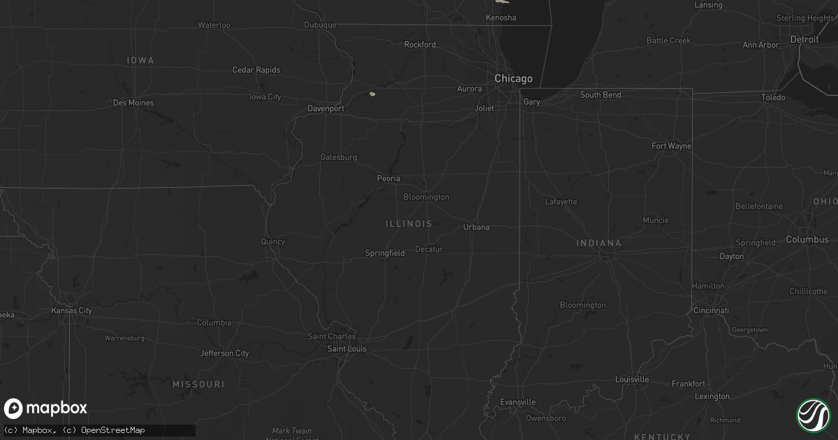
Hail Map in Illinois on June 22, 2016
Get this storm
June 22 map
$229
one time, instant access
Download today. No call, no setup
Keep the $229
Bought the map and want the full workflow? Apply the entire $229 to a subscription within 7 days. None of it is wasted.
Every map, not just this one
This buys you this map. Subscription and you get every map we run, in the markets you choose from a few cities to whole states to nationwide. Plus real-time alerts the moment a storm fires.
Contact data
Name, contact info, occupancy, even credit band for addresses in the footprint. You go from where it hit to who to call.
Become the source they trust
Unlimited branding weather history reports on demand. You already have the documented answer ready for the property owner, and you are the one who showed up with it.
Property data and RoofTrace estimates
Pull up any address you have got, its value and the exact code rules for that jurisdiction, straight from One Click Code. Then RoofTrace estimates the squares, pitch, and roof value, priced the way you price.
Storm reports in Illinois
Illinois
| Date | Description |
|---|---|
| 06/22/20161:15 AM CDT | 2 significantly damaged homes. One on n2850th rd just west of e 29th rd. This home was shifted slightly off its foundation. The other home is on e 29th rd in the vicini |
| 06/21/201611:43 PM CDT | Possible tornado damage to the school grounds on the north side of town... Including the dugout of the roof blow off. One half mile norheast of town on il-49 a couple o |
| 06/21/201610:55 PM CDT | A local report indicates a tornado near 4 WNW PIPER CITY |
| 06/21/201610:49 PM CDT | Tornado east of forest. |
| 06/21/201610:24 PM CDT | A local report indicates a tornado near 3 SE PONTIAC |
| 06/21/201610:20 PM CDT | Damage at a trailer park with reports of people trapped. Two minor injuries. |
| 06/21/201610:17 PM CDT | Tornado near pontiac. |
| 06/21/201610:15 PM CDT | A local report indicates a tornado near 5 NW PONTIAC |
| 06/21/201610:15 PM CDT | A local report indicates 68 MPH wind near PONTIAC |
| 06/21/20169:35 PM CDT | This is from june 22. Damage was done to the press box at ward field of olivet nazarene university. |
| 06/21/20169:29 PM CDT | A local report indicates a tornado near 3 ENE MAZON |
| 06/21/20169:15 PM CDT | In stavenger... Tree down blocking n 32nd street. Numerous trees down east of town. Corn flattened east of town. |
| 06/21/20169:10 PM CDT | Fire department responding to people trapped in a house with no injuries reported. |
| 06/21/20169:05 PM CDT | Several power lines and trees down in town. Time estimated from radar. |
| 06/21/20169:04 PM CDT | Power lines down and corn flattened near 29th road. |
| 06/21/20169:00 PM CDT | Tree down on a home at 147th and kedzie. Posted on nws chicago facebook. Time estimated based on radar. |
| 06/21/20168:59 PM CDT | South of i-80. |
| 06/21/20168:57 PM CDT | Two structures reported with no roofs on n 2950th road. Possible tornado damage. |
| 06/21/20168:48 PM CDT | A local report indicates a tornado near 3 NNE OTTAWA |
| 06/21/20168:36 PM CDT | Several large trees down in town and minor roof damage to 1 residence...time estimated from radar. |
| 06/21/20168:36 PM CDT | Several mature trees snapped off 20 feet off the ground at residence. Shingles pealed off in spots on both sides of the roof. Nearby corn is flattened. Time estimated b |
| 06/21/20168:35 PM CDT | 32 reports of tree limbs down across the city of chicago. Time estimated. |
| 06/21/20168:33 PM CDT | Delayed report. Tornado did damage to a residence with tree damage also found. Tornado was on the ground from 833 pm to 837 pm. Category was ef0. |
| 06/21/20168:33 PM CDT | A local report indicates a tornado near 5 NW OTTAWA |
| 06/21/20168:32 PM CDT | Semi on its side between princeton and dover |
| 06/21/20168:29 PM CDT | A local report indicates a tornado near 3 NW SHERIDAN |
| 06/21/20168:15 PM CDT | Damage to a gas station canopy. Time estimated. |
| 06/21/20168:12 PM CDT | Tornado lifted east of cherry. |
| 06/21/20168:11 PM CDT | Tornado south of leland. |
| 06/21/20168:07 PM CDT | Brief tornado - funnel has lifted |
| 06/21/20168:04 PM CDT | Brief tornado - funnel has lifted. Additional delayed information... Tornado was on the ground for one minute - 804 pm to 805 pm. |
| 06/21/20167:58 PM CDT | Tornado 1.5 miles northeast of earlville on e1401 road. |
| 06/21/20167:55 PM CDT | Tornado briefly touched down and then lifted |
| 06/21/20167:40 PM CDT | Tornado briefly touched down and then lifted. It lasted from 740 pm to 742 pm. |
| 06/21/20167:38 PM CDT | Tornado near shaw road with tree damage. |
| 06/21/20167:12 PM CDT | Brief touchdown. |
All States Impacted by Hail Map on June 22, 2016
Cities Impacted by Hail Map on June 22, 2016
- Montrose, MN
- Waverly, MN
- Delano, MN
- Lonsdale, MN
- Webster, MN
- Dundas, MN
- Faribault, MN
- Northfield, MN
- New Prague, MN
- Howard Lake, MN
- Maple Plain, MN
- Wingina, VA
- Buckingham, VA
- Cumberland, VA
- Dillwyn, VA
- Kilkenny, MN
- Montgomery, MN
- Racine, WI
- Franksville, WI
- Elk Mound, WI
- Eau Claire, WI
- Chippewa Falls, WI
- Nerstrand, MN
- Belle Plaine, MN
- Toponas, CO
- Asheboro, NC
- Colfax, WI
- Mound, MN
- Long Lake, MN
- Le Center, MN
- Manns Harbor, NC
- Macon, NC
- Concord, NC
- Rock Falls, IL
- Prophetstown, IL
- Tampico, IL
- Howardsville, VA
- Scottsville, VA
- Wayzata, MN
- Rocky Mount, NC
- Warrenton, NC
- Henderson, NC
- Hollister, NC
- Louisburg, NC
- Battleboro, NC
- Bunn, NC
- Zebulon, NC
- Sims, NC
- Wilson, NC
- Middlesex, NC
- Bailey, NC
- Raleigh, NC
- Jordan, MN
- Kenyon, MN
- West Concord, MN
- Damascus, VA
- Abingdon, VA
- Meadowview, VA
- Powhatan, VA
- Farmville, VA
- Arrington, VA
- Norwood, VA
- Shipman, VA
- Amelia Court House, VA
- Gladstone, VA


