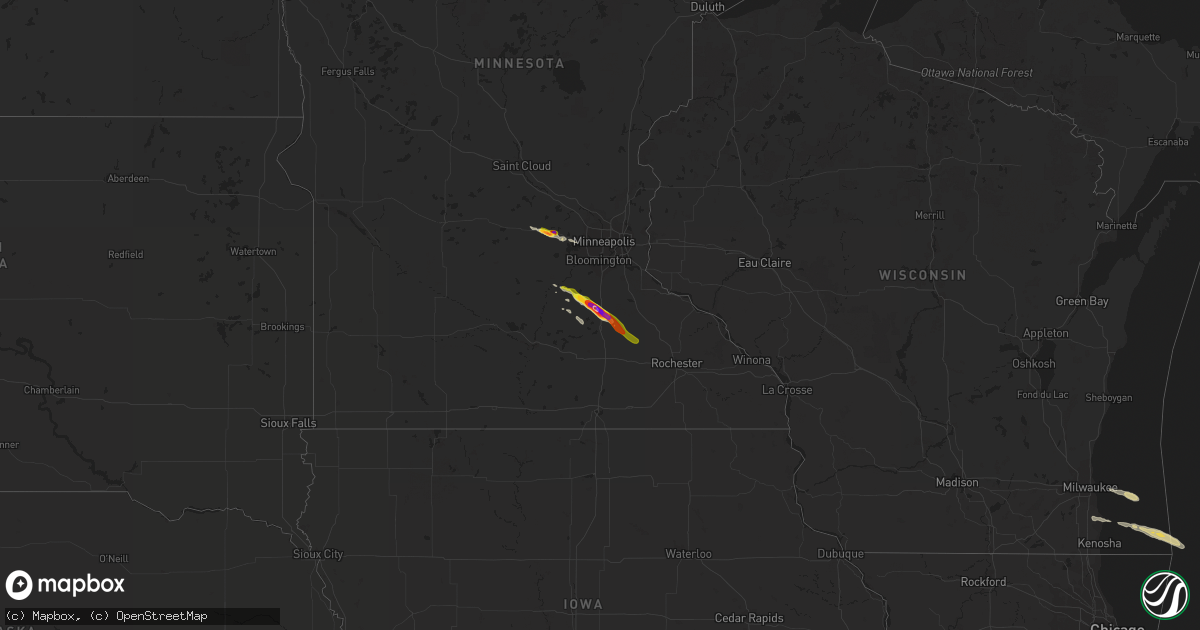
Hail Map on June 22, 2016
Get this storm
June 22 map
$229
one time, instant access
Download today. No call, no setup
Keep the $229
Bought the map and want the full workflow? Apply the entire $229 to a subscription within 7 days. None of it is wasted.
Every map, not just this one
This buys you this map. Subscription and you get every map we run, in the markets you choose from a few cities to whole states to nationwide. Plus real-time alerts the moment a storm fires.
Contact data
Name, contact info, occupancy, even credit band for addresses in the footprint. You go from where it hit to who to call.
Become the source they trust
Unlimited branding weather history reports on demand. You already have the documented answer ready for the property owner, and you are the one who showed up with it.
Property data and RoofTrace estimates
Pull up any address you have got, its value and the exact code rules for that jurisdiction, straight from One Click Code. Then RoofTrace estimates the squares, pitch, and roof value, priced the way you price.
States Impacted by Hail Map on June 22, 2016
Storm reports
Indiana
| Date | Description |
|---|---|
| 06/22/20167:25 AM CDT | 50' tree blown down. |
| 06/22/20163:12 AM CDT | A local report indicates 60 MPH wind near 1 WNW BROOKVILLE |
| 06/22/20162:47 AM CDT | Metal panels blown off of the southwest section of avery dennison. Semi trailers moved. |
| 06/22/20162:20 AM CDT | Metal panels blown off of the southwest section of avery dennison. Semi trailers moved. |
| 06/22/20162:16 AM CDT | A local report indicates 60 MPH wind near 4 SSE MCCORDSVILLE |
| 06/22/20162:00 AM CDT | Five large trees uprooted along carrollton avenue. All laying down to the southeast. |
| 06/22/20161:38 AM CDT | 6 to 7 electric poles in a row snapped in half or tilted. Corrected time. |
| 06/22/20161:29 AM CDT | Large tree and several large limbs down. |
| 06/22/20161:15 AM CDT | A local report indicates 70 MPH wind near 7 NW WEST LAFAYETTE |
| 06/22/20161:15 AM CDT | 11 trees down through wayne county. |
| 06/22/201612:50 AM CDT | About 20 or more trees in the area about 30 feet up off the ground have been topped out. Several utility lines and 18 to 24-inch diameter tree limbs down at alexandria |
| 06/22/201612:47 AM CDT | Located at county road 375 west and 600 north |
| 06/22/201612:25 AM CDT | Utility lines blown down at intersection of 1100 west and division road. Winds estimated at 60 mph. |
| 06/22/201612:24 AM CDT | A local report indicates 59 MPH wind near 2 S TIPTON |
| 06/22/201612:15 AM CDT | Barn destroyed and trees damaged on south side of bluffton. Exact location unknown. Report from twitter. |
| 06/22/201612:10 AM CDT | Tower down across the road at union and stewart streets |
| 06/22/201612:00 AM CDT | Trees downed on sr-5. |
| 06/21/201611:58 PM CDT | Barn wall blown out with several trees down on a property near intersection of us route 31 and county road 400n. |
| 06/21/201611:57 PM CDT | A local report indicates a tornado near 3 NNE MAJENICA |
| 06/21/201611:55 PM CDT | Roof blown off barn. |
| 06/21/201611:55 PM CDT | Roofs damaged. |
| 06/21/201611:54 PM CDT | Trees laying in opposite direction of other damage. |
| 06/21/201611:54 PM CDT | Silo blown down... Garage doors broken... Barn damage. |
| 06/21/201611:54 PM CDT | Trees and power lines downed. Awning blown off of a house. |
| 06/21/201611:53 PM CDT | Located at state route 26 and county road 750 west |
| 06/21/201611:51 PM CDT | A local report indicates a tornado near 2 NNW MAJENICA |
| 06/21/201611:50 PM CDT | Two hog barns collapsed...house damaged. Time is approximate. |
| 06/21/201611:48 PM CDT | Large tree limbs down that resulted in damage to house/shed. |
| 06/21/201611:46 PM CDT | 60 ft tall pine tree downed. |
| 06/21/201611:46 PM CDT | Road is blocked by downed trees. |
| 06/21/201611:45 PM CDT | Reported at andrews... In. |
| 06/21/201611:45 PM CDT | Large limb downed. Did significant structural damage to the roof. |
| 06/21/201611:41 PM CDT | Tree blown down onto a car at 100 north and state route 29. Time estimated based on radar. |
| 06/21/201611:39 PM CDT | Relayed by media. Time estimated based on radar. |
| 06/21/201611:38 PM CDT | Six inch diameter tree blown down on state road 29. Time is estimated based on radar. |
| 06/21/201611:33 PM CDT | Trees and power lines downed too. Dime size hail. |
| 06/21/201611:30 PM CDT | Tree blown down onto house |
| 06/21/201611:28 PM CDT | Time of occurrence is approximate |
| 06/21/201611:27 PM CDT | Two inch diameter tree down on state road 39 between 5203 and 5240 state road 39. |
| 06/21/201611:25 PM CDT | Two power poles downed. |
| 06/21/201611:19 PM CDT | A local report indicates 100 MPH wind near 4 NW BATTLE GROUND |
| 06/21/201611:15 PM CDT | Numerous trees down between chalmers and brookston. |
| 06/21/201611:15 PM CDT | Structure damage... Trees and power lines downed. |
| 06/21/201611:15 PM CDT | A local report indicates 66 MPH wind near 1 W BROOKSTON |
| 06/21/201611:12 PM CDT | At county road 600 n 375 w |
| 06/21/201611:10 PM CDT | Trees down in monticello. |
| 06/21/201611:10 PM CDT | Major structural damage to a bar in chalmers. |
| 06/21/201611:03 PM CDT | Numerous trees downed with reports of an rv destroyed and barn damage. |
| 06/21/201611:03 PM CDT | Grain storage building flattened. Numerous trees downed. |
| 06/21/201611:03 PM CDT | Semi turned over and numerous trees downed. |
| 06/21/201611:00 PM CDT | Tree down across 7th street and kings highway. |
| 06/21/201611:00 PM CDT | Major structural damage. Barn roof removed and in the trees... Outbuildings downed. Numerous trees downed as well. . |
| 06/21/201611:00 PM CDT | Trees into power lines. |
| 06/21/201610:38 PM CDT | Power lines downed. |
| 06/21/201610:38 PM CDT | Third of a roof of a large commercial building was blown off. |
| 06/21/201610:17 PM CDT | Trees downed. |
| 06/21/201610:10 PM CDT | Trees and power lines downed. |
| 06/21/201610:00 PM CDT | Trees downed. |
| 06/21/201610:00 PM CDT | Large tree down. 57 mph wind gust measured. |
| 06/21/20169:40 PM CDT | Tree down on a house. |
| 06/21/20169:38 PM CDT | Trees and power lines down on catalpa street in south bend. No details on tree size/health. |
Virginia
| Date | Description |
|---|---|
| 06/22/20162:30 PM CDT | Several trees down. |
| 06/22/20162:10 PM CDT | Report from post office employee |
| 06/22/201612:40 PM CDT | A few trees down. |
| 06/22/20166:25 AM CDT | Trees downed near osborne rd and us-1. |
| 06/22/20166:00 AM CDT | Numerous trees down on va-603 between winterpock and skinquarter. |
| 06/22/20165:55 AM CDT | Power lines down along lucks rd near powhite pkwy. |
| 06/22/20165:40 AM CDT | Trees down at pine grove and va-604. |
| 06/22/20165:25 AM CDT | Trees down along genito road... Just north of amelia courthouse. |
| 06/22/20165:15 AM CDT | Trees downed along anderson hwy near cumberland courthouse. Hail as large as a quarter also reported at this location. |
| 06/22/20165:10 AM CDT | Time is radar estimated. |
| 06/22/20164:58 AM CDT | Photo relayed from media via social media report. |
Ohio
| Date | Description |
|---|---|
| 06/22/20164:54 AM CDT | Large tree down blocking state route 669. Time estimated from radar |
| 06/22/20164:43 AM CDT | Trees down east of somerset. Time estimated from radar. |
| 06/22/20164:35 AM CDT | Collapse of barn and siding damage to a home. Damage to large trees on the same property. |
| 06/22/20164:30 AM CDT | Tobacco barn and several trees knocked down at 9141 day hill arnheim rd. |
| 06/22/20163:53 AM CDT | Kellogg ave. Closed at lanter ln by a tree in the roadway. |
| 06/22/20163:52 AM CDT | Tree fell on a parked car. |
| 06/22/20163:51 AM CDT | Tree down on 2 houses. |
| 06/22/20163:40 AM CDT | Tree down across part of oh-775 |
| 06/22/20163:00 AM CDT | One tree down at harrison pike and paul st. |
| 06/22/20162:53 AM CDT | Major damage to the grandview buildings and supply near piketon. Damage consistent with winds of 80 mph. |
| 06/22/20162:48 AM CDT | Multiple large limbs down. |
| 06/22/20162:39 AM CDT | Two trees down...one fell on house. |
| 06/22/20162:31 AM CDT | Damage to barn and outbuilding. Tree damage as well including damage to an apple orchard. Time estimated. |
| 06/22/20162:29 AM CDT | Numerous large trees snapped at bush road cemetary... As well as limbs scattered throughout the area. |
| 06/22/20162:28 AM CDT | Large limbs down and minor damage to siding of home. |
| 06/22/20162:22 AM CDT | Two homes suffered structural damage. One of the homes suffered partial uplift of the roof and a significant loss of the covering of the roof. The garage was also heavi |
| 06/22/20162:22 AM CDT | A local report indicates 74 MPH wind near 5 SW SABINA |
| 06/22/20162:21 AM CDT | Several large trees down. |
| 06/22/20162:21 AM CDT | Tree damage at bush cemetary was extensive... And consisted of both snapped and uprooted trees thrown in multiple directions. A well-defined swirl was noted in the corn |
| 06/22/20162:20 AM CDT | Odot garage station measured gust. |
| 06/22/20162:20 AM CDT | Damage to barns and other pieces of farm equipment. Time estimated by radar. |
| 06/22/20162:20 AM CDT | Siding was removed from multiple sides of a two story home. Large tree limbs were also knocked down near this residence. |
| 06/22/20162:19 AM CDT | Three large tree branches down |
| 06/22/20162:18 AM CDT | Two trees down on northbound 62 south of stahl rd. |
| 06/22/20162:15 AM CDT | Tree snapped. |
| 06/22/20162:15 AM CDT | Large tree limbs down covering state route 22...making it impassable. |
| 06/22/20162:05 AM CDT | Widespread significant wind damage to large trees and siding of homes. |
| 06/22/20162:05 AM CDT | Multiple trees and poles broken at us42 and 73. Time estimated by radar. |
| 06/22/20162:02 AM CDT | Numerous trees downed. |
| 06/22/20162:00 AM CDT | Most of roof torn off barn with barn wall collapsed. Significant tree damage on same property. In the 5600 block of north clarksville road. |
| 06/22/20162:00 AM CDT | Significant and widespread straight line wind damage to large trees and out buildings. |
| 06/22/20161:55 AM CDT | Large tree and numerous large branches down. Time estimated. |
| 06/22/20161:55 AM CDT | Widespread significant wind damage extending through springboro and five points. |
| 06/22/20161:54 AM CDT | Top of tree fell onto a porch. Several other large limbs down in the area. |
| 06/22/20161:54 AM CDT | Tree snapped. Time estimated from radar. |
| 06/22/20161:53 AM CDT | Large tree snapped in madison township in the 6500 block of germantown road. |
| 06/22/20161:53 AM CDT | Major damage to the grandview buildings and supply near piketon. Damage consistent with winds of 80 mph. |
| 06/22/20161:53 AM CDT | Large trees down on houses. |
| 06/22/20161:51 AM CDT | A few trees downed. Large limbs downed. |
| 06/22/20161:49 AM CDT | One large tree limb down. |
| 06/22/20161:48 AM CDT | One tree down at harrisburg pike and paul st. Corrected time and street name. |
| 06/22/20161:45 AM CDT | Large tree down due to thunderstorm wind at milford center. |
| 06/22/20161:45 AM CDT | A few trees downed. Large limbs downed. |
| 06/22/20161:38 AM CDT | Large 20 inch diameter tree blown down. |
| 06/22/20161:33 AM CDT | A local report indicates 61 MPH wind near KDAY DAYTON COX APT |
| 06/22/20161:31 AM CDT | A power pole and wires down at kimmel road and wastler road. Several other trees and limbs down in the clayton area. |
| 06/22/20161:31 AM CDT | Large branch down |
| 06/22/20161:30 AM CDT | Trees down. |
| 06/22/20161:15 AM CDT | Large limbs blown down from a healthy ash tree near morse road in clintonville. |
| 06/22/20161:15 AM CDT | Damage to farm storage units and slight damage to a house. Time estimated by radar. |
| 06/22/20161:14 AM CDT | A couple large branches down. |
| 06/22/20161:10 AM CDT | Tree down along state route 669 |
| 06/22/20161:06 AM CDT | A couple large limbs down. |
| 06/22/201612:54 AM CDT | Large tree down blocking state route 669. Time estimated from radar |
| 06/22/201612:45 AM CDT | A few trees downed. Large limbs downed. |
| 06/22/201612:43 AM CDT | Trees down east of somerset. Time estimated from radar. |
| 06/22/201612:35 AM CDT | 1 tree down across road. |
| 06/22/201612:20 AM CDT | Multiple trees and limbs down in the area. |
| 06/21/201611:50 PM CDT | Power poles downed. |
| 06/21/201611:50 PM CDT | Sr 31 closed between richwood miller rd and turner rd due to a tree down. |
North Carolina
| Date | Description |
|---|---|
| 06/22/20164:19 PM CDT | Tree fell on house on vanderhorst dr. Occupants inside but no injuries. |
| 06/22/20164:11 PM CDT | Powerlines down near hwy 49 and lacoma ln. |
| 06/22/20163:36 PM CDT | Several large tree limbs down. Also... Large tree down next door... Blocking the driveway. Nickel size hail also observed. |
| 06/22/20163:17 PM CDT | Tree reported down blocking roadway at nc hwy 49 and tot hill farm rd. |
| 06/22/20163:17 PM CDT | Tree down blocking road at back creek church rd and stutts rd. |
| 06/22/20162:30 PM CDT | 58mph winds damaged rotor blades on 2 tied down helicopters at the salisbury rowan county airport. |
| 06/22/20162:25 PM CDT | A couple trees blown down on st pauls church rd and glover rd. |
| 06/22/201610:52 AM CDT | Approximately 4x8 foot sign blown into roadway on greenville blvd |
| 06/22/20164:00 AM CDT | Tree downed across hwy 561 at williams road. |
| 06/22/20163:55 AM CDT | Tree down across mountain view rd in the grove hill area. |
| 06/22/201612:00 AM CDT | Tree down on a car. No injuries reported. |
| 06/21/201611:37 PM CDT | Trained skywarn spotter reports nickel to quarter-size hail falling. |
| 06/21/201610:52 PM CDT | Approximately 4x8 foot sign blown into roadway on greenville blvd |
| 06/21/201610:49 PM CDT | Tree down partially covering roadway near arlington blvd and mulberry ln |
| 06/21/201610:35 PM CDT | . |
| 06/21/201610:29 PM CDT | Spotters perronal weather station reported 83 mph. |
| 06/21/201610:25 PM CDT | Spotter reported large tree limbs and trees down in his yard. |
| 06/21/201610:20 PM CDT | . |
| 06/21/201610:15 PM CDT | Powerlines downed at old raleigh road and rock ride sims road. |
| 06/21/201610:15 PM CDT | . |
| 06/21/201610:00 PM CDT | Tree down on outbuilding. |
| 06/21/201610:00 PM CDT | . The duration of the hail event was 15 minutes. |
| 06/21/20169:35 PM CDT | Tree down near the 300 block of bunn elementary school road. |
| 06/21/20169:35 PM CDT | Public report of quarter-size hail near the intersection of hwy 97 and old battleboro rd... Relayed via local media social media page. |
| 06/21/20169:35 PM CDT | Tree down on highway 98 just outside bunn. |
| 06/21/20169:23 PM CDT | Tree down on hart road. |
| 06/21/20169:10 PM CDT | Multiple trees down in louisburg. |
| 06/21/20169:08 PM CDT | Tree down on mays crossroads road near franklinton. |
| 06/21/20168:55 PM CDT | Tree down. |
Kentucky
| Date | Description |
|---|---|
| 06/22/201612:24 PM CDT | A few trees were reported blown down on highway 1862. |
| 06/22/201611:47 AM CDT | Tree down along ky 80. |
| 06/22/20166:20 AM CDT | Trees down on sunshine lane. |
| 06/22/20166:20 AM CDT | Trees down on elk fork bough camp branch. Time based on radar. |
| 06/22/20165:45 AM CDT | Tree down on house...minor damage |
| 06/22/20165:40 AM CDT | Multiple trees down |
| 06/22/20164:56 AM CDT | Several trees downed. |
| 06/22/20164:55 AM CDT | Trees down in maysville. |
Minnesota
| Date | Description |
|---|---|
| 06/22/20166:54 PM CDT | Relayed from media via social media |
| 06/22/20166:15 PM CDT | Large tree down on main street. Fell on boat. Numerous branches down in vicinity. |
| 06/21/20168:20 PM CDT | 6-8 inch diameter branch down on hwy 56. Time estimated. |
| 06/21/20168:15 PM CDT | Video shared via facebook of several large tree branches snapped off... A couple of trees uprooted... And some corn that was flattened near kenyon. |
| 06/21/20168:01 PM CDT | Large 2 ft diameter tree down. |
| 06/21/20168:00 PM CDT | Numerous large branches down. |
| 06/21/20167:55 PM CDT | . |
| 06/21/20167:45 PM CDT | . |
| 06/21/20167:41 PM CDT | . |
| 06/21/20167:18 PM CDT | . |
Illinois
| Date | Description |
|---|---|
| 06/22/20161:15 AM CDT | 2 significantly damaged homes. One on n2850th rd just west of e 29th rd. This home was shifted slightly off its foundation. The other home is on e 29th rd in the vicini |
| 06/21/201611:43 PM CDT | Possible tornado damage to the school grounds on the north side of town... Including the dugout of the roof blow off. One half mile norheast of town on il-49 a couple o |
| 06/21/201610:55 PM CDT | A local report indicates a tornado near 4 WNW PIPER CITY |
| 06/21/201610:49 PM CDT | Tornado east of forest. |
| 06/21/201610:24 PM CDT | A local report indicates a tornado near 3 SE PONTIAC |
| 06/21/201610:20 PM CDT | Damage at a trailer park with reports of people trapped. Two minor injuries. |
| 06/21/201610:17 PM CDT | Tornado near pontiac. |
| 06/21/201610:15 PM CDT | A local report indicates a tornado near 5 NW PONTIAC |
| 06/21/201610:15 PM CDT | A local report indicates 68 MPH wind near PONTIAC |
| 06/21/20169:35 PM CDT | This is from june 22. Damage was done to the press box at ward field of olivet nazarene university. |
| 06/21/20169:29 PM CDT | A local report indicates a tornado near 3 ENE MAZON |
| 06/21/20169:15 PM CDT | In stavenger... Tree down blocking n 32nd street. Numerous trees down east of town. Corn flattened east of town. |
| 06/21/20169:10 PM CDT | Fire department responding to people trapped in a house with no injuries reported. |
| 06/21/20169:05 PM CDT | Several power lines and trees down in town. Time estimated from radar. |
| 06/21/20169:04 PM CDT | Power lines down and corn flattened near 29th road. |
| 06/21/20169:00 PM CDT | Tree down on a home at 147th and kedzie. Posted on nws chicago facebook. Time estimated based on radar. |
| 06/21/20168:59 PM CDT | South of i-80. |
| 06/21/20168:57 PM CDT | Two structures reported with no roofs on n 2950th road. Possible tornado damage. |
| 06/21/20168:48 PM CDT | A local report indicates a tornado near 3 NNE OTTAWA |
| 06/21/20168:36 PM CDT | Several large trees down in town and minor roof damage to 1 residence...time estimated from radar. |
| 06/21/20168:36 PM CDT | Several mature trees snapped off 20 feet off the ground at residence. Shingles pealed off in spots on both sides of the roof. Nearby corn is flattened. Time estimated b |
| 06/21/20168:35 PM CDT | 32 reports of tree limbs down across the city of chicago. Time estimated. |
| 06/21/20168:33 PM CDT | A local report indicates a tornado near 5 NW OTTAWA |
| 06/21/20168:33 PM CDT | Delayed report. Tornado did damage to a residence with tree damage also found. Tornado was on the ground from 833 pm to 837 pm. Category was ef0. |
| 06/21/20168:32 PM CDT | Semi on its side between princeton and dover |
| 06/21/20168:29 PM CDT | A local report indicates a tornado near 3 NW SHERIDAN |
| 06/21/20168:15 PM CDT | Damage to a gas station canopy. Time estimated. |
| 06/21/20168:12 PM CDT | Tornado lifted east of cherry. |
| 06/21/20168:11 PM CDT | Tornado south of leland. |
| 06/21/20168:07 PM CDT | Brief tornado - funnel has lifted |
| 06/21/20168:04 PM CDT | Brief tornado - funnel has lifted. Additional delayed information... Tornado was on the ground for one minute - 804 pm to 805 pm. |
| 06/21/20167:58 PM CDT | Tornado 1.5 miles northeast of earlville on e1401 road. |
| 06/21/20167:55 PM CDT | Tornado briefly touched down and then lifted |
| 06/21/20167:40 PM CDT | Tornado briefly touched down and then lifted. It lasted from 740 pm to 742 pm. |
| 06/21/20167:38 PM CDT | Tornado near shaw road with tree damage. |
| 06/21/20167:12 PM CDT | Brief touchdown. |
Texas
| Date | Description |
|---|---|
| 06/21/201610:24 PM CDT | A local report indicates 58 MPH wind near 3 SW DALHART |
Michigan
| Date | Description |
|---|---|
| 06/21/20169:23 PM CDT | Reported at benton heights... Mi. |
West Virginia
| Date | Description |
|---|---|
| 06/22/201612:35 PM CDT | One tree down in mabscott and another in crab orchard. |
| 06/22/20166:30 AM CDT | Trees down along the mud river in hamlin. Time estimated from radar. |
| 06/22/20166:28 AM CDT | Tree down on a house in south charleston. No injuries. |
| 06/22/20166:18 AM CDT | Trees and wires down on rocky fork road near big tyler road |
| 06/22/20166:15 AM CDT | Hickory tree down. |
| 06/22/20166:12 AM CDT | Tree across both lanes of i64 west bound near the rest area in hurricane. |
| 06/22/20165:50 AM CDT | Semi truck blown over by wind on route 35 near the mason putnam county lines |
| 06/22/20165:17 AM CDT | Multiple trees down in edray |
| 06/22/20164:53 AM CDT | Multiple trees down in area from media photos |
| 06/22/20164:50 AM CDT | Large limbs down along route 20 in dianna. Power outage at diana |
| 06/22/20164:50 AM CDT | Significant tree damage. Four wood power poles snapped. Some shingles removed from house. |
| 06/22/20164:50 AM CDT | Multiple trees down in cowen. Report of large tree into a house. |
| 06/22/20164:30 AM CDT | Carport and camper blown over by thunderstorm wind |
| 06/22/20164:22 AM CDT | Multiple trees down on little left hand run rd. |
| 06/22/20164:21 AM CDT | Trees down. Some roofing material removed from house along little left hand run. |
| 06/22/20164:18 AM CDT | Nws damage survey confirms 100-110 mph microburst wind damage along mud fork road. Large swath of trees 12-18 inches in diameter snapped at the trunk. |
| 06/22/20164:15 AM CDT | Single wide trailer knocked off its foundation on blackberry lane off young hollow rd . Many trees down in the area including some blocking rt 21 at young hollow rd. |
| 06/22/20164:15 AM CDT | I-77 mile marker 118 4-6 diameter tree laying on highway |
| 06/22/20164:07 AM CDT | Nws damage survey confirms ef-1 tornado along blackberry lane to the southwest of kenna. The tornado flipped over a singlewide trailer and snapped several trees at the |
| 06/22/20163:43 AM CDT | Trees down along route 33 in pricetown. |
| 06/22/20162:57 AM CDT | Trees down in weston... Including one on a house |
| 06/22/20162:42 AM CDT | Trees down in weston... Including one on a house...corrected time based on radar |
| 06/22/20162:20 AM CDT | Tree down along canton road between canton and west union... Time estimated from radar |
| 06/22/20162:00 AM CDT | Tree down along hebron road. Time estimated from radar. |
Cities Impacted by Hail Map on June 22, 2016
- Montrose, MN
- Waverly, MN
- Delano, MN
- Lonsdale, MN
- Webster, MN
- Dundas, MN
- Faribault, MN
- Northfield, MN
- New Prague, MN
- Howard Lake, MN
- Maple Plain, MN
- Wingina, VA
- Buckingham, VA
- Cumberland, VA
- Dillwyn, VA
- Kilkenny, MN
- Montgomery, MN
- Racine, WI
- Franksville, WI
- Elk Mound, WI
- Eau Claire, WI
- Chippewa Falls, WI
- Nerstrand, MN
- Belle Plaine, MN
- Toponas, CO
- Asheboro, NC
- Colfax, WI
- Mound, MN
- Long Lake, MN
- Le Center, MN
- Manns Harbor, NC
- Macon, NC
- Concord, NC
- Rock Falls, IL
- Prophetstown, IL
- Tampico, IL
- Howardsville, VA
- Scottsville, VA
- Wayzata, MN
- Rocky Mount, NC
- Warrenton, NC
- Henderson, NC
- Hollister, NC
- Louisburg, NC
- Battleboro, NC
- Bunn, NC
- Zebulon, NC
- Sims, NC
- Wilson, NC
- Middlesex, NC
- Bailey, NC
- Raleigh, NC
- Jordan, MN
- Kenyon, MN
- West Concord, MN
- Damascus, VA
- Abingdon, VA
- Meadowview, VA
- Powhatan, VA
- Farmville, VA
- Arrington, VA
- Norwood, VA
- Shipman, VA
- Amelia Court House, VA
- Gladstone, VA