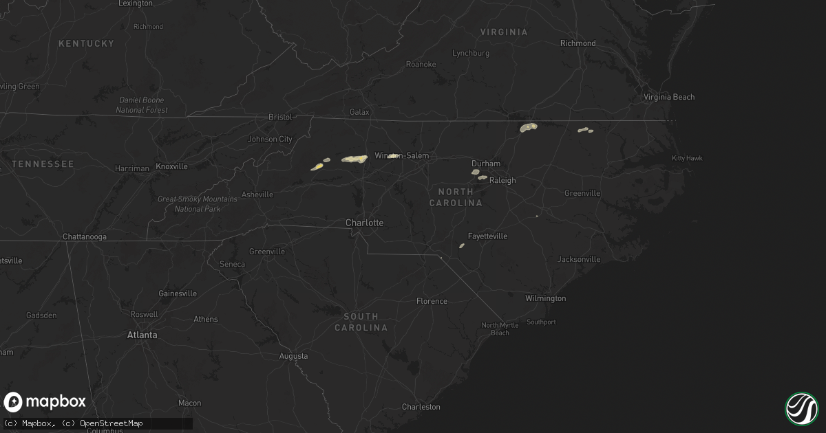
Hail Map in North Carolina on June 19, 2025
Get this storm
June 19 map
$229
one time, instant access
Download today. No call, no setup
Keep the $229
Bought the map and want the full workflow? Apply the entire $229 to a subscription within 7 days. None of it is wasted.
Every map, not just this one
This buys you this map. Subscription and you get every map we run, in the markets you choose from a few cities to whole states to nationwide. Plus real-time alerts the moment a storm fires.
Contact data
Name, contact info, occupancy, even credit band for addresses in the footprint. You go from where it hit to who to call.
Become the source they trust
Unlimited branding weather history reports on demand. You already have the documented answer ready for the property owner, and you are the one who showed up with it.
Property data and RoofTrace estimates
Pull up any address you have got, its value and the exact code rules for that jurisdiction, straight from One Click Code. Then RoofTrace estimates the squares, pitch, and roof value, priced the way you price.
Storm reports in North Carolina
North Carolina
| Date | Description |
|---|---|
| 06/19/20256:55 PM CDT | Trees and powerlines down on poe road. |
| 06/19/20256:50 PM CDT | Tree down on powerlines. |
| 06/19/20256:38 PM CDT | Several trees and powerlines downed in the rhoney/blackburn communities including on rhoney school rd... Hwy 10 and whitener rd. |
| 06/19/20256:38 PM CDT | Updates previous tstm wnd dmg report from 7 nne vale. Several trees and powerlines downed in the rhoney/blackburn communities including on rhoney school rd... Hwy 10... |
| 06/19/20256:30 PM CDT | Local em reported multiple trees and power poles down along the i-85 corridor in the county due to straight line winds. I-85 was closed for short time but is back open |
| 06/19/20256:20 PM CDT | Multiple trees down include one on a house. Several homes around the area had roof damage. |
| 06/19/20256:09 PM CDT | Fallen trees damaged power equipment near the intersection of watson dr. And terrace ave. |
| 06/19/20256:00 PM CDT | Wind damaged a trailer along hwy 15 n. |
| 06/19/20255:55 PM CDT | Numerous trees were blown down along enon rd and culbreth rd. |
| 06/19/20255:48 PM CDT | A tree was blown down along surl-mount tirzah rd. |
| 06/19/20255:43 PM CDT | A tree was blown down near the intersection of dick holeman rd and ned moore rd. |
| 06/19/20255:43 PM CDT | A tree was blown down along ned moore rd. |
| 06/19/20255:36 PM CDT | Tree down on yarborough mills road. Time estimated from radar. |
| 06/19/20255:27 PM CDT | Tree down at intersection of highway 49 and highway 86 south in prospect hill. Time estimated from radar. |
| 06/19/20255:25 PM CDT | Trees down near bowman dairy road and old route 421 road. |
| 06/19/20255:24 PM CDT | Several trees were blown down along south nc hwy 87... Many between southern high school rd and woods chapel rd. |
| 06/19/20255:18 PM CDT | Several trees were blown down along friendship patterson mill rd... Many between s nc hwy 62 and nc 49. |
| 06/19/20254:45 PM CDT | A tree was blown down along azalea dr. Near argonne blvd. |
| 06/19/20254:40 PM CDT | A tree was blown down near the intersection of wayne rd and alamance rd. |
| 06/19/20254:20 PM CDT | A tree was blown down at the 400 block of north bunker hill rd. |
| 06/19/20254:08 PM CDT | A tree was blown down along merganser way. Adar. |
| 06/19/20254:08 PM CDT | A tree was blown down along merganser way. |
| 06/19/20254:04 PM CDT | A tree was blown down along airport rd. Near barkwood dr. |
| 06/19/20254:00 PM CDT | Several trees down in the west wend area and near downtown winston-salem including on fourth street. |
| 06/19/20253:59 PM CDT | A tree was blown down along clover st. In winston-salem. Numerous other trees were blown down in the winston-salem area. |
| 06/19/20253:55 PM CDT | Numerous trees down in western and northwestern winston-salem. Trees reported down on austin lane... Hedgecock avenue... And bartram road. |
| 06/19/20253:55 PM CDT | Numerous trees down in western and northwestern winston-salem. Trees reported down on austin lane... Hedgecock avenue... And bartram road. |
| 06/19/20253:52 PM CDT | A tree was blown down along jeannine dr. |
| 06/19/20253:28 PM CDT | A number of trees were downed across far northwest iredell county in the union grove area. This includes trees on grassy knob rd... Union grove rd... Sandy springs rd.. |
| 06/19/20253:24 PM CDT | Tree down in the 300 block of linneys mills rd. |
| 06/19/20253:20 PM CDT | Over a dozen large trees either snapped or uprooted near the hamptonville airport. In addition... Portions of the tin roof on a hangar were blown off. |
| 06/19/20253:13 PM CDT | Tree down at howards bridge rd and mitch rd. |
| 06/19/20253:09 PM CDT | Tree down in the 1000 block of myers mill rd. |
| 06/19/20253:04 PM CDT | Tree down at edmiston road. |
| 06/19/20252:32 PM CDT | A few trees blown down along indian grave road. |
| 06/19/20252:24 PM CDT | Tree down on utility equipment. |
| 06/19/20251:20 PM CDT | Numerous trees down from ferguson to moravian falls and to windy gap south of wilkesboro. Time is estimated from radar. |
| 06/19/20251:20 PM CDT | Tree is down near the intersection of woodville road and caterpillar trail in mount airy... Nc. Time is estimated from radar. |
| 06/19/20251:15 PM CDT | Tree is down near farm lane in ararat... Nc. |
| 06/19/20251:15 PM CDT | Multiple reports of trees down across the northern part of the county. |
| 06/19/20251:15 PM CDT | Tree is down near the dead end of key road in ararat... Nc. Time is estimated from radar. |
| 06/19/20251:15 PM CDT | Delayed report: tree is down near the intersection of reeves mill road and massey road in mount airy... Nc. Time is estimated from radar. |
| 06/19/20251:10 PM CDT | 911 call center in surry county reported a tree and power lines are down and blocking greenhill road near mount airy... Nc. |
| 06/19/20251:10 PM CDT | Tree is down near the intersection of springs road and north hills drive in mount airy... Nc. Time is estimated from radar. |
| 06/19/20251:05 PM CDT | Tree down on powerlines on boone trail road. |
| 06/19/20251:05 PM CDT | Tree is down near the intersection of waterford way and cody trail near dobson... Nc. Time is estimated from radar. |
| 06/19/20251:03 PM CDT | Tree down on pipers gap road. |
| 06/19/20251:00 PM CDT | 911 call center in surry county reported a tree had fallen in the road near the intersection of brindle road and caves mill road near dobson. |
| 06/19/202512:55 PM CDT | 911 call center in surry county... Nc reported a tree down across the road near the intersection of kapps mill road and david barker road near elkin. |
| 06/19/202510:10 AM CDT | Multiple trees down in mount olive. |
| 06/18/202510:10 PM CDT | Corrects previous tstm wnd dmg report from 1 nne mount olive. Multiple trees down in mount olive. |
| 06/18/202510:10 PM CDT | Tree down on powerlines. |
| 06/18/20259:45 PM CDT | Tree down on powerlines near wrye branch road. |
| 06/18/20259:25 PM CDT | A tree was blown down and blocking both lanes of traffic near the intersection of nc-222 and pelt rd. |
| 06/18/20259:20 PM CDT | Tree down on powerlines north of saratoga. |
| 06/18/20259:17 PM CDT | One tree blown down near the 200 block of hopedale st. |
| 06/18/20258:55 PM CDT | Tree down on smith road. |
| 06/18/20258:40 PM CDT | Tree down on powerlines on covered bridge road. |
| 06/18/20258:38 PM CDT | Social media picture of several large limbs snapped at a residence... One of which fell on and damaged a fence. |
| 06/18/20258:35 PM CDT | Tree down on lake wilson road. |
| 06/18/20258:30 PM CDT | Tree down on powerlines. |
| 06/18/20258:25 PM CDT | Tree down and power outages in the pine hollow area. |
| 06/18/20258:21 PM CDT | A power lines reported down on banner elk rd near nc 50. |
| 06/18/20258:13 PM CDT | A tree was blown down along woodards dairy rd. Near flower hill rd. |
| 06/18/20258:10 PM CDT | Corrects previous tstm wnd dmg report from 1 e emit. Power lines down near the intersection of barnes rd and brooke ln. |
| 06/18/20258:07 PM CDT | A tree was blown down near the intersection of johnson pond rd and brozak dr. |
| 06/18/20258:05 PM CDT | 4 trees and 1 powerline were knocked down. Power went out for the entire town of murfreesboro. |
| 06/18/20258:00 PM CDT | A tree was blown down across knightdale eagle rock rd near wendell falls. |
| 06/18/20257:43 PM CDT | A tree was blown down across blenheim dr. Near manuel st. |
| 06/18/20257:42 PM CDT | Tree down along deberrys mill rd. |
| 06/18/20257:38 PM CDT | Trees down in cary. |
| 06/18/20257:32 PM CDT | Tree fell down across nc-186 near margarettsville nc. |
| 06/18/20257:26 PM CDT | Tree fell down along peanut market rd. |
| 06/18/20257:15 PM CDT | Tree down. |
| 06/18/20257:12 PM CDT | Tree across road. |
| 06/18/20257:10 PM CDT | Tree fell down across warner bridge rd. |
| 06/18/20257:10 PM CDT | Multiple trees down across gaston. |
| 06/18/20257:10 PM CDT | Tree down in cul de sac. |
| 06/18/20257:10 PM CDT | Power lines down in the street and large oak tree in the roadway. |
| 06/18/20257:05 PM CDT | Tree down in road. |
| 06/18/20257:00 PM CDT | Tree down across heartland drive blocking the road. |
All States Impacted by Hail Map on June 19, 2025
Cities Impacted by Hail Map on June 19, 2025
- Hernando, MS
- Coldwater, MS
- Senatobia, MS
- Tupelo, MS
- Pontotoc, MS
- Sarah, MS
- Como, MS
- Sledge, MS
- Dundee, MS
- Coahoma, MS
- Crenshaw, MS
- Sardis, MS
- Batesville, MS
- Marks, MS
- Pope, MS
- Courtland, MS
- Lambert, MS
- Enid, MS
- Riceville, IA
- Chester, IA
- Clarksdale, MS
- Friars Point, MS
- Helena, AR
- Alligator, MS
- Duck Hill, MS
- Crumrod, AR
- Duncan, MS
- Snow Lake, AR
- Dunnellon, FL
- Gunnison, MS
- Ocala, FL
- Shelby, MS
- Watson, AR
- Rosedale, MS
- Redfield, AR
- England, AR
- Tucker, AR
- Sherrill, AR
- Hensley, AR
- Beulah, MS
- Boones Mill, VA
- Ponce De Leon, FL
- Jefferson, AR
- Benoit, MS
- Sheridan, AR
- Hardy, VA
- Wirtz, VA
- Rocky Mount, VA
- Lenoir, NC
- Vernon, FL
- White Hall, AR
- Greenville, MS
- Rohwer, AR
- Collinsville, VA
- Martinsville, VA
- Taylorsville, NC
- Moravian Falls, NC
- Fieldale, VA
- Basking Ridge, NJ
- Far Hills, NJ
- Lutz, FL
- Tampa, FL
- Pine Bluff, AR
- Elkton, VA
- McGaheysville, VA
- Harrisonburg, VA
- Keezletown, VA
- Shenandoah, VA
- New Market, VA
- Broadway, VA
- Stanley, VA
- Etlan, VA
- Syria, VA
- Banco, VA
- Madison, VA
- Grady, AR
- Stanfordville, NY
- Clinton Corners, NY
- Valparaiso, FL
- Eglin Afb, FL
- Yorktown, AR
- Reva, VA
- Boston, VA
- Culpeper, VA
- Amenia, NY
- Pine Plains, NY
- Oakville, CT
- Castleton, VA
- Woodville, VA
- Millerton, NY
- Norman, AR
- Bonnerdale, AR
- Waterbury, CT
- Thomaston, CT
- Middlebury, CT
- Watertown, CT
- Short Hills, NJ
- South Orange, NJ
- Millburn, NJ
- Springfield, NJ
- Vauxhall, NJ
- Maplewood, NJ
- Terryville, CT
- Plymouth, CT
- Bristol, CT
- Burlington, CT
- Grapevine, AR
- Lebanon, NJ
- Whitehouse Station, NJ
- Plant City, FL
- Annandale, NJ
- Defuniak Springs, FL
- Niceville, FL
- Brandy Station, VA
- Wolcott, CT
- Newark, NJ
- Irvington, NJ
- Amissville, VA
- Troy, AL
- Luray, VA
- Sperryville, VA
- Haywood, VA
- Rixeyville, VA
- Rileyville, VA
- Bentonville, VA
- Washington, VA
- Huntly, VA
- Marshall, VA
- Flint Hill, VA
- Warrenton, VA
- Hume, VA
- Remington, VA
- Jeffersonton, VA
- Chester Gap, VA
- Markham, VA
- Catharpin, VA
- Delaplane, VA
- Chantilly, VA
- Broad Run, VA
- Centreville, VA
- Haymarket, VA
- Elkwood, VA
- Linden, VA
- Gainesville, VA
- Manassas, VA
- Nokesville, VA
- Bealeton, VA
- Midland, VA
- Catlett, VA
- The Plains, VA
- Bristow, VA
- Little River, AL
- Ariton, AL
- Elkton, FL
- Sharon, CT
- Belzoni, MS
- Marshallville, GA
- Front Royal, VA
- Aldie, VA
- Upperville, VA
- Middleburg, VA
- Goldvein, VA
- Sumerduck, VA
- Herndon, VA
- Sterling, VA
- Ashburn, VA
- Clifton, VA
- Triangle, VA
- Fairfax Station, VA
- Woodbridge, VA
- Fairfax, VA
- Quantico, VA
- Stafford, VA
- Dumfries, VA
- McLean, VA
- Reston, VA
- Great Falls, VA
- Burke, VA
- Springfield, VA
- Vienna, VA
- Oakton, VA
- Annandale, VA
- Leesburg, VA
- Lorton, VA
- Potomac, MD
- Gaithersburg, MD
- Germantown, MD
- Poolesville, MD
- Occoquan, VA
- Rockville, MD
- Marbury, MD
- Bethesda, MD
- Accokeek, MD
- La Plata, MD
- Arlington, VA
- Dunn Loring, VA
- Falls Church, VA
- Cabin John, MD
- Alexandria, VA
- Indian Head, MD
- Fort Belvoir, VA
- Bryans Road, MD
- Hazelhurst, WI
- Minocqua, WI
- Dillwyn, VA
- Farmville, VA
- Hiddenite, NC
- Union Grove, NC
- Saint Augustine, FL
- Nanjemoy, MD
- Elba, AL
- Fredericksburg, VA
- Port Tobacco, MD
- White Plains, MD
- Waldorf, MD
- Pomfret, MD
- Union Bridge, MD
- Mount Airy, MD
- New Windsor, MD
- Woodbine, MD
- Sykesville, MD
- Westminster, MD
- Reisterstown, MD
- Finksburg, MD
- Hampstead, MD
- Upperco, MD
- Glyndon, MD
- Owings Mills, MD
- Cockeysville, MD
- Parkton, MD
- Sparks Glencoe, MD
- Monkton, MD
- Phoenix, MD
- Jarrettsville, MD
- Forest Hill, MD
- Baldwin, MD
- Fallston, MD
- White Hall, MD
- Street, MD
- Pylesville, MD
- Whiteford, MD
- Delta, PA
- Fawn Grove, PA
- Chevy Chase, MD
- Fort Washington, MD
- Fort Myer, VA
- Glen Echo, MD
- Derwood, MD
- Washington, DC
- Lake Tomahawk, WI
- Charlottesville, VA
- Caddo Gap, AR
- Donalsonville, GA
- Hamptonville, NC
- North Wilkesboro, NC
- Plainfield, NJ
- Watchung, NJ
- Dunellen, NJ
- Lizella, GA
- Macon, GA
- Statesville, NC
- Summit, NJ
- Brandywine, MD
- Clinton, MD
- Oxon Hill, MD
- Temple Hills, MD
- Silver Spring, MD
- Bryantown, MD
- Garrett Park, MD
- Naval Anacost Annex, DC
- Kensington, MD
- Greenbelt, MD
- Capitol Heights, MD
- Riverdale, MD
- Annapolis Junction, MD
- Andrews Air Force Base, MD
- Savage, MD
- Laurel, MD
- Brentwood, MD
- Burtonsville, MD
- Jessup, MD
- Fort George G Meade, MD
- Lanham, MD
- Bowie, MD
- Sandy Spring, MD
- College Park, MD
- Glenn Dale, MD
- Suitland, MD
- Beltsville, MD
- Bladensburg, MD
- Ashton, MD
- Cheltenham, MD
- District Heights, MD
- Fulton, MD
- Takoma Park, MD
- Columbia, MD
- Mount Rainier, MD
- Spencerville, MD
- Hyattsville, MD
- Olney, MD
- Upper Marlboro, MD
- Bel Air, MD
- Darlington, MD
- Drumore, PA
- Peach Bottom, PA
- Rising Sun, MD
- Conowingo, MD
- Oxford, PA
- Port Deposit, MD
- Nottingham, PA
- Kirkwood, PA
- Colora, MD
- North East, MD
- Quarryville, PA
- Rison, AR
- Mount Ida, AR
- Jack, AL
- Airville, PA
- New Park, PA
- Olin, NC
- Union, NJ
- Adel, GA
- Harmony, NC
- Scotch Plains, NJ
- Fanwood, NJ
- Churchville, MD
- Havre De Grace, MD
- Perryville, MD
- Elkton, MD
- Lincoln University, PA
- Cochranville, PA
- Wilmot, NH
- Danbury, NH
- Opp, AL
- Deltona, FL
- Osteen, FL
- Keswick, VA
- McKenzie, AL
- Staten Island, NY
- Jersey City, NJ
- Bayonne, NJ
- New York, NY
- Brooklyn, NY
- Flushing, NY
- Elmhurst, NY
- East Elmhurst, NY
- Astoria, NY
- Ozone Park, NY
- Middle Village, NY
- Kew Gardens, NY
- Ridgewood, NY
- Maspeth, NY
- Sunnyside, NY
- Woodhaven, NY
- South Richmond Hill, NY
- Long Island City, NY
- Forest Hills, NY
- Corona, NY
- Richmond Hill, NY
- Woodside, NY
- Jackson Heights, NY
- Rego Park, NY
- Newark, DE
- Landenberg, PA
- West Grove, PA
- Avondale, PA
- Coatesville, PA
- Hockessin, DE
- West Chester, PA
- Kennett Square, PA
- Toughkenamon, PA
- Harwood, MD
- Deale, MD
- Crofton, MD
- West River, MD
- Gambrills, MD
- Odenton, MD
- Owings, MD
- Lothian, MD
- Friendship, MD
- Tracys Landing, MD
- Dunkirk, MD
- Davidsonville, MD
- Harmans, MD
- Glen Burnie, MD
- Hanover, MD
- Crownsville, MD
- Edgewater, MD
- Severna Park, MD
- Arnold, MD
- Riva, MD
- Pasadena, MD
- Galesville, MD
- Shady Side, MD
- Churchton, MD
- Millersville, MD
- Annapolis, MD
- Severn, MD
- Gibson Island, MD
- Springfield, NH
- Wilmington, DE
- Chadds Ford, PA
- Yorklyn, DE
- Geneva, FL
- Valparaiso, IN
- Chesterton, IN
- New Edinburg, AR
- Oden, AR
- Kinston, AL
- Langley, AR
- Portage, IN
- Wilmar, AR
- Florala, AL
- Foxworth, MS
- Kokomo, MS
- Hill, NH
- New Smyrna Beach, FL
- Rockland, DE
- Montchanin, DE
- Bronx, NY
- Hoboken, NJ
- Jamaica, NY
- College Point, NY
- Whitestone, NY
- Bellerose, NY
- Oakland Gardens, NY
- Queens Village, NY
- Hollis, NY
- Fresh Meadows, NY
- Bayside, NY
- Thornton, PA
- Marcus Hook, PA
- Garnet Valley, PA
- Claymont, DE
- Glen Mills, PA
- Chester Heights, PA
- Chester, PA
- Aston, PA
- Wallingford, PA
- Brookhaven, PA
- Newtown Square, PA
- Media, PA
- Cheyney, PA
- Bristol, NH
- Claiborne, MD
- Stevensville, MD
- Saint Michaels, MD
- Wittman, MD
- Easton, MD
- Chester, MD
- Mcdaniel, MD
- Grasonville, MD
- Queenstown, MD
- Rock Hall, MD
- Chestertown, MD
- Wye Mills, MD
- Centreville, MD
- Fort Howard, MD
- Curtis Bay, MD
- Sparrows Point, MD
- Worton, MD
- Still Pond, MD
- Galena, MD
- Earleville, MD
- Sudlersville, MD
- Kennedyville, MD
- Church Hill, MD
- Warwick, MD
- Millington, MD
- Cordova, MD
- Queen Anne, MD
- Crumpton, MD
- Georgetown, MD
- Little Neck, NY
- Garden City, NY
- Great Neck, NY
- Floral Park, NY
- New Hyde Park, NY
- Glen Oaks, NY
- Roslyn, NY
- Carle Place, NY
- Manhasset, NY
- Roslyn Heights, NY
- Albertson, NY
- Williston Park, NY
- Hicksville, NY
- Levittown, NY
- Old Westbury, NY
- Westbury, NY
- Mineola, NY
- East Meadow, NY
- Old Bethpage, NY
- Greenvale, NY
- Glenwood Landing, NY
- Melville, NY
- Syosset, NY
- Bethpage, NY
- Jericho, NY
- Port Washington, NY
- Glen Head, NY
- Plainview, NY
- Sea Cliff, NY
- Glen Cove, NY
- Locust Valley, NY
- Mill Neck, NY
- East Norwich, NY
- Oyster Bay, NY
- Woodbury, NY
- Huntington, NY
- Farmingdale, NY
- Pearl River, LA
- Samson, AL
- Trinidad, CO
- Model, CO
- Moss Point, MS
- Winston Salem, NC
- Lewisville, NC
- Warren, AR
- Columbia, MS
- Clemmons, NC
- Swarthmore, PA
- Crum Lynne, PA
- Woodlyn, PA
- Broomall, PA
- Folcroft, PA
- Clifton Heights, PA
- Springfield, PA
- Norwood, PA
- Prospect Park, PA
- Folsom, PA
- Morton, PA
- Glenolden, PA
- Holmes, PA
- Ridley Park, PA
- Sharon Hill, PA
- Drexel Hill, PA
- Bala Cynwyd, PA
- Gladwyne, PA
- Havertown, PA
- Merion Station, PA
- Haverford, PA
- Wynnewood, PA
- Philadelphia, PA
- Bryn Mawr, PA
- Lansdowne, PA
- Narberth, PA
- Upper Darby, PA
- Ardmore, PA
- Darby, PA
- Essex, MD
- Gunpowder, MD
- Betterton, MD
- Ridgely, MD
- Barclay, MD
- Goldsboro, MD
- Chesapeake City, MD
- Denton, MD
- Henderson, MD
- Greensboro, MD
- Ingleside, MD
- Cecilton, MD
- Massey, MD
- Marydel, MD
- Clayton, DE
- Middletown, DE
- New Castle, DE
- Townsend, DE
- Bear, DE
- Odessa, DE
- Smyrna, DE
- Wyncote, PA
- Bryn Athyn, PA
- Bensalem, PA
- Jenkintown, PA
- Cheltenham, PA
- Huntingdon Valley, PA
- Elkins Park, PA
- Feasterville Trevose, PA
- Glenside, PA
- Abington, PA
- Monticello, AR
- Tripoli, WI
- Nashville, GA
- Vancleave, MS
- Glenwood, AR
- Alva, FL
- Lehigh Acres, FL
- Millen, GA
- New Hampton, NH
- Cold Spring Harbor, NY
- Huntington Station, NY
- Centerport, NY
- Greenlawn, NY
- Kings Park, NY
- Smithtown, NY
- East Northport, NY
- Commack, NY
- Northport, NY
- Saint James, NY
- Delaware City, DE
- Saint Georges, DE
- Smithville, OK
- Chauncey, GA
- Punta Gorda, FL
- Sylvania, GA
- Watersmeet, MI
- Mena, AR
- Umpire, AR
- Douglas, GA
- Jakin, GA
- Willacoochee, GA
- Iron River, MI
- Tomahawk, WI
- Salem, NJ
- Port Penn, DE
- Pennsville, NJ
- Penns Grove, NJ
- Woodstown, NJ
- Pedricktown, NJ
- Blue Bell, PA
- Watson, OK
- Pearson, GA
- Abita Springs, LA
- Covington, LA
- Ponchatoula, LA
- Springfield, LA
- Biloxi, MS
- Diberville, MS
- Newhope, AR
- Milan, GA
- Eastman, GA
- Winona, KS
- Holly, CO
- Fort White, FL
- Ambler, PA
- Devon, PA
- Berwyn, PA
- Paoli, PA
- King Of Prussia, PA
- Wayne, PA
- Lake City, FL
- Lake Placid, FL
- Conshohocken, PA
- Colby, KS
- Boncarbo, CO
- North Fort Myers, FL
- Lawrence Township, NJ
- Long Beach, MS
- Bryant Pond, ME
- Rumford, ME
- Gulfport, MS
- Prince George, VA
- Hopewell, VA
- Norristown, PA
- Malvern, PA
- Keshena, WI
- Merrill, WI
- Wausau, WI
- Bush, LA
- Trenton, NJ
- Princeton, NJ
- Princeton Junction, NJ
- Pennington, NJ
- Bassett, NE
- Madisonville, LA
- Pass Christian, MS
- Star City, AR
- Gillett, WI
- Matawan, NJ
- Holmdel, NJ
- Hazlet, NJ
- Morganville, NJ
- Keyport, NJ
- Suring, WI
- Arkansas City, AR
- Westfield, NJ
- Big Timber, MT
- Baton Rouge, LA
- Elizabeth, NJ
- Cecil, WI
- Burwell, NE
- Keansburg, NJ
- Weston, CO
- Medora, ND
- Fairfield, ND
- Monument, KS
- Belfield, ND
- Oberlin, KS
- Loman, MN
- Littlefork, MN
- Hahira, GA
- Two Dot, MT
- Middletown, NJ
- Herrick, SD
- Burke, SD
- Big Falls, MN
- Atwood, KS
- Effie, LA
- Manson, NC
- Norlina, NC
- Warrenton, NC
- Saint Charles, SD
- Bonesteel, SD
- Herndon, KS
- Dickinson, ND
- Independence, LA
- Amite, LA
- Danbury, NE
- Husser, LA
- Fenton, MI
- Watford City, ND
- Denham Springs, LA
- Walker, LA
- Jonesville, LA
- Keysville, VA
- Chisago City, MN
- Lindstrom, MN
- Mohall, ND
- Sherwood, ND
- Macon, NC
- Oakley, KS
- South Heart, ND
- Broken Bow, OK
- Holly, MI
- Highland, MI
- Hartland, MI
- Baker, FL
- Osceola, WI
- Shafer, MN
- De Pere, WI
- Center City, MN
- Tickfaw, LA
- Antler, ND
- Raton, NM
- Star Prairie, WI
- New Richmond, WI
- Somerset, WI
- Ethel, LA
- Clinton, LA
- Killdeer, ND
- Mandaree, ND
- Greenleaf, WI
- Lebanon, NE
- Norcatur, KS
- Loranger, LA
- Atkinson, NE
- Stuart, NE
- Henderson, NC
- Middleburg, NC
- Erwinville, LA
- Baker, LA
- Slaughter, LA
- Baldwin, WI
- Hammond, WI
- Hosmer, SD
- Roscoe, SD
- Nome, ND
- Enderlin, ND
- Kathryn, ND
- Fort Ransom, ND
- Lisbon, ND
- Zachary, LA
- Linden, MI
- Bowdle, SD
- Woodville, WI
- Jennings, KS
- Lefor, ND
- Gladstone, ND
- Spring Valley, WI
- Wilson, WI
- Collettsville, NC
- Carrboro, NC
- Chapel Hill, NC
- Pride, LA
- Greenwell Springs, LA
- Reedsville, WI
- Jackson, NC
- Garysburg, NC
- Regent, ND
- Elmwood, WI
- Apex, NC
- Cary, NC
- Milnor, ND
- Conway, NC
- Valentine, TX
- Cook, MN
- Ryder, ND
- Glenwood City, WI
- Norton, KS
- Mott, ND
- Plum City, WI
- Maiden Rock, WI
- Arkansaw, WI
- Ipswich, SD
- Bennettsville, SC
- Wallace, SC
- Roseglen, ND
- Onaka, SD
- Mcleod, ND
- Wyndmere, ND
- Durham, NC
- Denhoff, ND
- Barney, ND
- Mcclusky, ND
- Mercer, ND
- Butte, ND
- Pepin, WI
- Menomonie, WI
- Nelson, WI
- Durand, WI
- Ord, NE
- Ericson, NE
- Faulkton, SD
- Glenfield, ND
- Hankinson, ND
- Mantador, ND
- Lidgerwood, ND
- Mooreton, ND
- Anamoose, ND
- Martin, ND
- Red Springs, NC
- Raeford, NC
- Goodrich, ND
- Sierra Blanca, TX
- Grassy Butte, ND
- New Leipzig, ND
- Elyria, NE
- Reads Landing, MN
- Wabasha, MN
- Alma, WI
- Fairmount, ND
- Cresbard, SD
- Harvey, ND
- Hurdsfield, ND
- Kellogg, MN
- Driscoll, ND
- Chaseley, ND
- Mansfield, SD
- Northville, SD
- Columbus, NE
- Altura, MN
- North Loup, NE
- Minnesota City, MN
- Cochrane, WI
- Rockham, SD
- Ashton, SD
- Rosholt, SD
- Tintah, MN
- Wheaton, MN
- Steele, ND
- Fessenden, ND
- Bowdon, ND
- Doland, SD
- McColl, SC
- Gibson, NC
- Sykeston, ND
- Cathay, ND
- Turton, SD
- Scotia, NE
- Rollingstone, MN
- Mellette, SD
- Braddock, ND
- Fairchild, WI
- Osseo, WI
- Redfield, SD
- Aberdeen, SD
- Carson, ND
- Dawson, ND
- Clark, SD
- Brentford, SD
- Conde, SD
- Wahpeton, ND
- Ashton, NE
- Stratford, SD
- Humbird, WI
- Merrillan, WI
- Willow Lake, SD
- Warner, SD
- Elba, NE
- Loup City, NE
- Donnelly, MN
- Dumont, MN
- Chokio, MN
- Page, ND
- Woodworth, ND
- Selfridge, ND
- Pingree, ND
- Tappen, ND
- Carrington, ND
- Raymond, SD
- Bryant, SD
- Farwell, NE
- Erie, ND
- Ayr, ND
- Parshall, ND
- Napoleon, ND
- Garden City, SD
- Seaboard, NC
- Gackle, ND
- Saint Paul, NE
- Frankfort, SD
- Carpenter, SD
- Goldsboro, NC
- Elgin, ND
- Amenia, ND
- Horsham, PA
- Montgomeryville, PA
- Southampton, PA
- Lansdale, PA
- Chalfont, PA
- Jamison, PA
- North Wales, PA
- Doylestown, PA
- Willow Grove, PA
- Hatboro, PA
- Warminster, PA
- Richboro, PA
- Warrington, PA
- Furlong, PA
- Flourtown, PA
- Gwynedd, PA
- Fort Washington, PA
- Phoenixville, PA
- Spring House, PA
- Dresher, PA
- Oreland, PA
- Plymouth Meeting, PA
- Bridgeport, PA
- Collegeville, PA
- Lafayette Hill, PA
- Villanova, PA
- Newtown, PA
- Langhorne, PA
- Lehr, ND
- Fredonia, ND
- Vienna, SD
- Pipestone, MN
- Castlewood, SD
- Hayti, SD
- Lake Norden, SD
- David City, NE
- Ruthton, MN
- Wolbach, NE
- Henry, SD
- Appleton, MN
- Hazel, SD
- Danvers, MN
- Dwight, NE
- Brainard, NE
- Watertown, SD
- Montevideo, MN
- Estelline, SD
- Valparaiso, NE
- Weston, NE
- Milan, MN
- Ceresco, NE
- Arlington, SD
- Erwin, SD
- Badger, SD
- Moorhead, MN
- Dallas Center, IA
- Wahoo, NE
- Palmer, NE
- Raymond, NE
- Marshfield, WI
- Stratford, WI
- Clear Lake, SD
- Rushmore, MN
- Horace, ND
- Maynard, MN
- Clara City, MN
- Bruce, SD
- Brookings, SD
- Toronto, SD
- Grimes, IA
- Waukee, IA
- Waverly, NE
- Ashland, NE
- Tyler, MN
- Wolverton, MN
- Greenwood, NE
- Davey, NE
- Ithaca, NE
- Lincoln, NE
- Comstock, MN
- Sabin, MN
- Christine, ND
- Barnesville, MN
- Walcott, ND
- Colfax, ND
- Kent, MN
- Abercrombie, ND
- Breckenridge, MN
- Rothsay, MN
- Fergus Falls, MN
- White, SD
- Aurora, SD
- Volga, SD
- Astoria, SD
- Elkton, SD
- Hendricks, MN
- Sheldon, WI
- Conrath, WI
- Ladysmith, WI
- Franklin, MN
- Morton, MN
- Redwood Falls, MN
- Groton, SD
- Brandt, SD
- Crofton, NE
- Alvo, NE
- Avoca, NE
- Weeping Water, NE
- Elmwood, NE
- Murdock, NE
- Plattsmouth, NE
- South Bend, NE
- Springfield, NE
- Gretna, NE
- Murray, NE
- Memphis, NE
- Nehawka, NE
- Louisville, NE
- Manley, NE
- Yutan, NE
- Cedar Creek, NE
- Andover, SD
- Gilman, WI
- Slayton, MN
- Lake Wilson, MN
- Holcombe, WI
- Lake Benton, MN
- Fordyce, NE
- Renville, MN
- Foxhome, MN
- Campbell, MN
- Dalton, MN
- Underwood, MN
- Ivanhoe, MN
- Arco, MN
- Currie, MN
- Avoca, MN
- Pierpont, SD
- Danube, MN
- Webster, SD
- Saint Helena, NE
- Forest City, IA
- Tony, WI
- Lublin, WI
- Withee, WI
- Elbow Lake, MN
- Wendell, MN
- Battle Lake, MN
- Ashby, MN
- Union, NE
- Balaton, MN
- Holland, MN
- Westbrook, MN
- Dovray, MN
- Fulda, MN
- Russell, MN
- Bristol, SD
- Heron Lake, MN
- Windom, MN
- Evansville, MN
- Thurman, IA
- Percival, IA
- Pacific Junction, IA
- Garvin, MN
- Sidney, IA
- Tabor, IA
- Farragut, IA
- Imogene, IA
- Brandon, MN
- Alexandria, MN
- Garfield, MN
- Estherville, IA
- Dolliver, IA
- Randolph, IA
- Shenandoah, IA
- Hawkins, WI
- Kennan, WI
- Nelson, MN
- Osakis, MN
- Armstrong, IA
- Essex, IA
- Farwell, MN
- Westboro, WI
- Medford, WI
- Villard, MN
- Sauk Centre, MN
- West Union, MN
- Coin, IA
- Carlos, MN
- Correll, MN
- Clarinda, IA
- Dunnell, MN
- Ceylon, MN
- Yorktown, IA
- Jackson, MN
- Sherburn, MN
- Alpha, MN
- Spirit Lake, IA
- Superior, IA
- Graettinger, IA
- Emmetsburg, IA
- Wallingford, IA
- Swea City, IA
- Glenwood, IA
- Malvern, IA
- College Springs, IA
- Riverton, IA
- Braddyville, IA
- Blanchard, IA
- Shambaugh, IA
- Northboro, IA
- Ringsted, IA
- Fenton, IA
- Bancroft, IA
- Lone Rock, IA
- Melrose, MN
- Thorp, WI
- Freeport, MN
- Burt, IA
- Algona, IA
- Raymond, MN
- Whittemore, IA
- Murdock, MN
- Benson, MN
- Albany, MN
- Kerkhoven, MN
- Pennock, MN
- Wesley, IA
- Bode, IA
- West Bend, IA
- Lu Verne, IA
- Garner, IA
- Cylinder, IA
- Corwith, IA
- Livermore, IA
- Ottosen, IA
- Cold Spring, MN
- Saint Cloud, MN
- Kanawha, IA
- Renwick, IA
- Goldfield, IA
- Clarion, IA
- Rowan, IA
- Belmond, IA
- Rutland, IA
- Eagle Grove, IA
- Thor, IA
- Hardy, IA
- Humboldt, IA
- Britt, IA
- Swaledale, IA
- Alexander, IA
- Goodell, IA
- Thornton, IA
- Klemme, IA
- Meservey, IA
- Sheffield, IA
- Kimball, MN
- South Haven, MN
- Clearwater, MN
- Fairfax, MN
- Gibbon, MN
- Winthrop, MN
- Dexter, IA
- Winterset, IA
- Stuart, IA
- Greenfield, IA
- Lafayette, MN
- Dakota City, IA
- Latimer, IA
- Woolstock, IA
- Vincent, IA
- Alden, IA
- Williams, IA
- Galt, IA
- Blairsburg, IA
- Coulter, IA
- Iowa Falls, IA
- Dows, IA
- Hampton, IA
- Ackley, IA
- Bradford, IA
- Geneva, IA
- Hector, MN
- Saint Peter, MN
- Stewart, MN
- Buffalo Lake, MN
- Gaylord, MN
- Webster City, IA
- Nicollet, MN
- Westside, IA
- Carroll, IA
- Arcadia, IA
- Eldora, IA
- Steamboat Rock, IA
- Kamrar, IA
- Albion, IA
- Liscomb, IA
- Ellsworth, IA
- Union, IA
- Le Sueur, MN
- Glidden, IA
- Coon Rapids, IA
- Hubbard, IA
- Conrad, IA
- Saint Anthony, IA
- Clemons, IA
- Radcliffe, IA
- Jewell, IA
- Buffalo Center, IA
- Grundy Center, IA
- New Providence, IA
- Marshalltown, IA
- Guthrie Center, IA
- Lakota, IA
- Scranton, IA
- Beaman, IA
- Whitten, IA
- Story City, IA
- Cleveland, MN
- Kasota, MN
- Zearing, IA
- McCallsburg, IA
- Garden City, IA
- Gladbrook, IA
- Gowrie, IA
- Nevada, IA
- Yale, IA
- Bagley, IA
- Jefferson, IA
- Jamaica, IA
- Madison Lake, MN
- Churdan, IA
- Farnhamville, IA
- Lohrville, IA
- Roland, IA
- Ralston, IA
- Elysian, MN
- Thompson, IA
- State Center, IA
- Colo, IA
- Gilman, IA
- Panora, IA
- Paton, IA
- Leland, IA
- Ventura, IA
- Fertile, IA
- Clear Lake, IA
- Janesville, MN
- Mason City, IA
- Linden, IA
- Dawson, IA
- Melbourne, IA
- Le Grand, IA
- Haverhill, IA
- Perry, IA
- Minburn, IA
- Rockwell, IA
- Rhodes, IA
- Rippey, IA
- Collins, IA
- Redfield, IA
- Ogden, IA
- Adel, IA
- Baxter, IA
- Ferguson, IA
- Earlham, IA
- Hanlontown, IA
- Bouton, IA
- Grand Junction, IA
- Dana, IA
- Dougherty, IA
- Van Meter, IA
- Northwood, IA
- Boone, IA
- Woodward, IA
- Urbandale, IA
- Clive, IA
- Madrid, IA
- Booneville, IA
- Granger, IA
- Marble Rock, IA
- Greene, IA
- Rockford, IA
- Norcross, MN
- Herman, MN
- Woden, IA
- Titonka, IA


