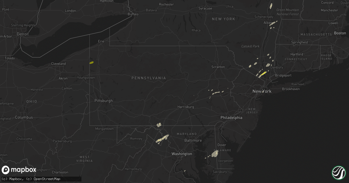
Hail Map in Pennsylvania on June 19, 2017
Get this storm
June 19 map
$229
one time, instant access
Download today. No call, no setup
Keep the $229
Bought the map and want the full workflow? Apply the entire $229 to a subscription within 7 days. None of it is wasted.
Every map, not just this one
This buys you this map. Subscription and you get every map we run, in the markets you choose from a few cities to whole states to nationwide. Plus real-time alerts the moment a storm fires.
Contact data
Name, contact info, occupancy, even credit band for addresses in the footprint. You go from where it hit to who to call.
Become the source they trust
Unlimited branding weather history reports on demand. You already have the documented answer ready for the property owner, and you are the one who showed up with it.
Property data and RoofTrace estimates
Pull up any address you have got, its value and the exact code rules for that jurisdiction, straight from One Click Code. Then RoofTrace estimates the squares, pitch, and roof value, priced the way you price.
Storm reports in Pennsylvania
Pennsylvania
| Date | Description |
|---|---|
| 06/19/20176:20 PM CDT | Estimated quarter size hail. Time estimated by radar. |
| 06/19/20174:52 PM CDT | Multiple trees broken and uprooted at 598 millerstown road in elk township |
| 06/19/20174:52 PM CDT | Ef0 tornado confirmed. See public information statement for details. |
| 06/19/20174:18 PM CDT | Tree fell on a house on blue spruce lane |
| 06/19/20173:37 PM CDT | Downed trees and poles |
| 06/19/20172:39 PM CDT | Two ft diameter trees and wires down on snyder and hauck road |
| 06/19/20172:18 PM CDT | Trees down at route 209 and canal street intersection. |
| 06/19/20172:18 PM CDT | Downed trees and wires throughout the county. |
| 06/19/20172:17 PM CDT | Tree and building damage at intersection of route 100 and kearnsville road |
| 06/19/20172:14 PM CDT | Wrecked patio furniture and metal flashing torn from a roof on carpet road |
| 06/19/20172:12 PM CDT | Trees snapped and uprooted. |
| 06/19/20172:12 PM CDT | Tree and building damage at the intersection of route 100 and lyon valley road |
| 06/19/20172:00 PM CDT | Several reports of trees and wires down throughout the county. |
| 06/19/20171:45 PM CDT | Trees and wires down on mine road and rte 241 intersection |
| 06/19/20171:45 PM CDT | Trees and large limbs down on timber and hillcrest |
| 06/19/20171:36 PM CDT | Ef-0 tornado with estimated 2.1 mile long path along southern slope of blue mountain |
| 06/19/20171:30 PM CDT | Tree down on a house in ephrata |
| 06/19/20171:30 PM CDT | Multiple trees down along route 422 between lebanon and palmyra |
| 06/19/20171:30 PM CDT | Several reports of trees and wires down throughout the county. |
| 06/19/20171:30 PM CDT | Several trees down throughout the county. |
| 06/19/20171:23 PM CDT | Trees down |
| 06/19/20171:10 PM CDT | Trees down |
| 06/19/20171:10 PM CDT | Trees down on cars |
| 06/19/20171:05 PM CDT | Trees down |
| 06/19/20171:03 PM CDT | Trees down |
| 06/19/201712:53 PM CDT | Trees and wires down |
| 06/19/201712:50 PM CDT | Tree on wires on wayne ave |
| 06/19/201712:48 PM CDT | Tree on wires on 4th street |
| 06/19/201712:45 PM CDT | Trees down in village of pineford |
| 06/19/201712:45 PM CDT | Trees and wires down on hill drive |
| 06/19/201712:45 PM CDT | Trees and wires down on high rock road |
| 06/19/201712:45 PM CDT | Trees and wires down on rte 283 westbound at mm 10.2 |
| 06/19/201712:45 PM CDT | Trees and wiires down at intersection of hilltop and sand hill roads |
| 06/19/201712:42 PM CDT | Trees down along route 441 near three mile island |
| 06/19/201712:35 PM CDT | Trees and wires down in warrington township |
| 06/19/201712:30 PM CDT | Trees and wires down in warrington township |
| 06/19/201712:28 PM CDT | 12 trees down on carlisle road |
| 06/19/201712:20 PM CDT | Trees down |
| 06/19/201712:19 PM CDT | Numerous trees down along pine grove road in aspers |
| 06/19/201712:15 PM CDT | Transformer and wires down near bendersville post office |
| 06/19/201712:05 PM CDT | Pole snappped wires down blocking roadway |
| 06/19/201712:00 PM CDT | Tree on wires on 4th street |
| 06/19/201711:50 AM CDT | Numerous trees down over rte 147 between halifax and millersburg |
| 06/19/201711:28 AM CDT | Tree down |
| 06/19/201711:25 AM CDT | Wires down |
| 06/19/201710:40 AM CDT | Tree down on wires at powells valley road and radel road |
All States Impacted by Hail Map on June 19, 2017
Cities Impacted by Hail Map on June 19, 2017
- Kempton, PA
- New Tripoli, PA
- Burlington, WI
- Galva, IL
- Goochland, VA
- Powhatan, VA
- Plymouth, IN
- Argos, IN
- Imperial, TX
- Fort Stockton, TX
- Middletown, NY
- Castleton On Hudson, NY
- Nassau, NY
- Schodack Landing, NY
- Akron, MI
- Fairgrove, MI
- Chaparral, NM
- Bunnlevel, NC
- Lillington, NC
- Spring Lake, NC
- Whitney, TX
- East Troy, WI
- Elkhorn, WI
- El Paso, TX
- Canutillo, TX
- Clifton, TX
- Aquilla, TX
- Greencastle, PA
- Mercersburg, PA
- Clear Spring, MD
- Monson, ME
- Cordova, MD
- Ruby, SC
- Mount Croghan, SC
- Jefferson, SC
- Pageland, SC
- Rohrersville, MD
- Knoxville, MD
- Brownsville, MD
- Fort Hancock, TX
- Jackson Springs, NC
- Anthony, TX
- Sunland Park, NM
- Santa Teresa, NM
- East Millinocket, ME
- Putnam Valley, NY
- Hopewell Junction, NY
- Mahopac, NY
- Stormville, NY
- Carmel, NY
- Haverstraw, NY
- West Haverstraw, NY
- Croton On Hudson, NY
- Warrenton, VA
- Denton, MD
- Harrington, DE
- New Liberty, IA
- Stockton, IA
- Charlotte Hall, MD
- Newburg, MD
- Sand Lake, NY
- West Sand Lake, NY
- East Greenbush, NY
- Averill Park, NY
- Shoemakersville, PA
- Burkittsville, MD
- Jefferson, MD
- Davenport, IA
- Rock Island, IL
- Moline, IL
- Slatington, PA
- Schnecksville, PA
- Germansville, PA
- Ridgeway, WI
- Cambridge, IL
- Fort Bragg, NC
- Raeford, NC
- Easton, MD
- East Nassau, NY
- Las Cruces, NM
- Slate Hill, NY
- New Hampton, NY
- Cortlandt Manor, NY
- New City, NY
- Gansevoort, NY
- Schuylerville, NY
- Saratoga Springs, NY
- Anthony, NM
- Big Island, VA
- Ranger, TX
- Sugar Land, TX
- Richmond, TX
- North Judson, IN
- Abbott, TX
- Hillsboro, TX
- Mescalero, NM
- Hamilton, TX
- Marathon, TX
- Felton, DE
- Greensboro, MD
- Walkerton, IN
- Suffern, NY
- Spring Valley, NY
- Montrose, NY
- Monsey, NY
- Garnerville, NY
- Yorktown Heights, NY
- Pomona, NY
- Desdemona, TX
- Poughquag, NY
- Lagrangeville, NY
- Verbank, NY
- Weed, CA
- Gazelle, CA
- Mcarthur, CA
- Brewster, NY
- Patterson, NY
- Canterbury, NH
- Conway, NC
- Whitehall, PA
- Northampton, PA
- Coplay, PA
- Hanover, NM
- Harpers Ferry, WV
- Brooklyn, NY
- Candor, NC
- Ellerbe, NC
- Meridian, TX
- Morgan, TX
- Orion, IL
- Pawling, NY
- Bingham, ME
- Macdoel, CA
- Gorman, TX
- Caro, MI
- Jonesville, MI
- Covington, TX
- Blum, TX
- Creedmoor, NC
- Deming, NM
- Pewaukee, WI
- Castleton, VA
- Rixeyville, VA
- Ridgeville, SC
- Whitewater, WI
- Palmyra, WI
- Amawalk, NY
- Katonah, NY
- Granite Springs, NY
- Wanatah, IN
- Mimbres, NM
- Southfields, NY
- Fort Montgomery, NY
- Litchfield, CT
- Brooklyn, WI
- Gilford, NH
- Mirror Lake, NH
- Laconia, NH
- Lynn Center, IL
- Charles Town, WV
- Ranson, WV
- Hamburg, PA
- Brunswick, MD
- Millville, WV
- Berryville, VA
- Shenandoah Junction, WV
- Middletown, MD
- Summit Point, WV
- Keedysville, MD
- Sharpsburg, MD
- Kearneysville, WV
- Hamlet, IN
- Union Mills, IN
- Silver City, NM
- Gabbs, NV
- Osco, IL
- Jonesboro, TX
- Reese, MI
- Marshall, VA
- Amissville, VA
- Apex, NC
- Durham, NC
- Dousman, WI
- Stillwater, NY
- Brownville, ME
- Aberdeen, NC
- Union, NH
- Rochester, IN
- Pen Argyl, PA
- Nazareth, PA
- Millbrook, NY
- Pleasant Valley, NY
- Dagsboro, DE
- Abbot, ME
- Torrington, CT
- Norfolk, CT
- Goshen, CT
- Winsted, CT
- Sloatsburg, NY
- Tuxedo Park, NY
- Kansasville, WI
- Salem, WI
- Union Grove, WI
- Kenosha, WI
- Angier, NC
- Coats, NC
- Missouri City, TX
- Millsboro, DE
- Tamaqua, PA
- Tower City, PA
- Milford, IN
- Leesburg, IN
- Guilford, ME
- New Portland, ME
- Gardiner, NY
- Wallkill, NY
- Maybrook, NY
- Montgomery, NY
- Campbell Hall, NY
- Grimesland, NC
- Greenville, NC
- Ridgely, MD
- Federalsburg, MD
- Preston, MD
- Greenwood, DE
- Bayard, NM
- Coal Valley, IL
- Watertown, CT
- Dover Foxcroft, ME
- Petersburg, NY
- Goode, VA
- Bedford, VA
- Coleman Falls, VA
- Monroe, VA
- Lynchburg, VA
- New Ringgold, PA
- Gatesville, TX
- Grovertown, IN
- Concord, NH
- Highland Falls, NY
- Linden, NC
- La Fayette, IL
- Java, VA
- Vanceboro, NC
- Cartersville, VA
- Alturas, CA
- Ely, NV
- Spring Creek, NV
- Adamsville, PA
- Jamestown, PA
- Hartstown, PA
- Waukesha, WI
- Wauconda, IL
- Island Lake, IL
- Crystal Lake, IL
- Barrington, IL
- Mchenry, IL
- Brillion, WI
- Reedsville, WI
- Alpine, TX
- White Sands Missile Range, NM


