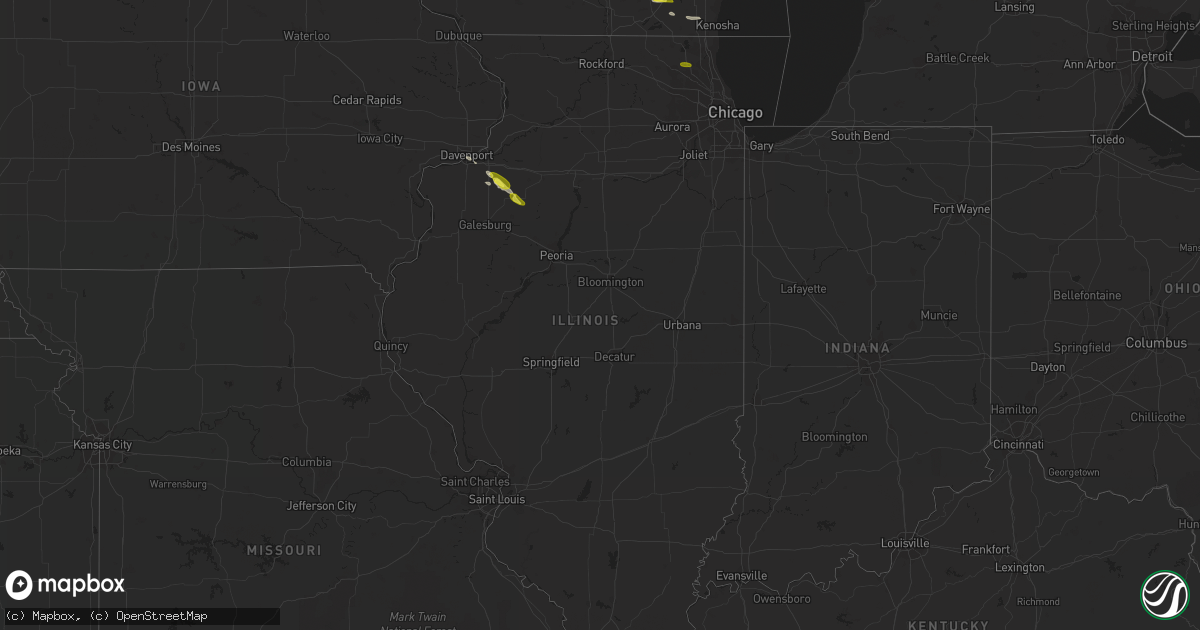
Hail Map in Illinois on June 19, 2017
Get this storm
June 19 map
$229
one time, instant access
Download today. No call, no setup
Keep the $229
Bought the map and want the full workflow? Apply the entire $229 to a subscription within 7 days. None of it is wasted.
Every map, not just this one
This buys you this map. Subscription and you get every map we run, in the markets you choose from a few cities to whole states to nationwide. Plus real-time alerts the moment a storm fires.
Contact data
Name, contact info, occupancy, even credit band for addresses in the footprint. You go from where it hit to who to call.
Become the source they trust
Unlimited branding weather history reports on demand. You already have the documented answer ready for the property owner, and you are the one who showed up with it.
Property data and RoofTrace estimates
Pull up any address you have got, its value and the exact code rules for that jurisdiction, straight from One Click Code. Then RoofTrace estimates the squares, pitch, and roof value, priced the way you price.
Storm reports in Illinois
Illinois
| Date | Description |
|---|---|
| 06/19/20176:50 PM CDT | 45-50 mph winds brought down two 6 inch tree limbs. |
| 06/19/20176:28 PM CDT | Numerous large trees and power lines downed. Time estimated by radar. |
| 06/19/20175:26 PM CDT | Had several reports from around cambridge ranging from pea to quarter. |
| 06/19/20174:52 PM CDT | A few tree limbs of 9 to 12 inches in diameter are down. Some houses are without power. |
| 06/19/20174:02 PM CDT | Dime to quarter |
| 06/19/20173:17 PM CDT | Rt12 and rt126. |
| 06/18/20178:10 PM CDT | Large tree limb down at intersection of 2nd and springfield. Relayed by wcia-tv |
| 06/18/20177:54 PM CDT | Large tree branch down. Relayed by wand-tv |
All States Impacted by Hail Map on June 19, 2017
Cities Impacted by Hail Map on June 19, 2017
- Kempton, PA
- New Tripoli, PA
- Burlington, WI
- Galva, IL
- Goochland, VA
- Powhatan, VA
- Plymouth, IN
- Argos, IN
- Imperial, TX
- Fort Stockton, TX
- Middletown, NY
- Castleton On Hudson, NY
- Nassau, NY
- Schodack Landing, NY
- Akron, MI
- Fairgrove, MI
- Chaparral, NM
- Bunnlevel, NC
- Lillington, NC
- Spring Lake, NC
- Whitney, TX
- East Troy, WI
- Elkhorn, WI
- El Paso, TX
- Canutillo, TX
- Clifton, TX
- Aquilla, TX
- Greencastle, PA
- Mercersburg, PA
- Clear Spring, MD
- Monson, ME
- Cordova, MD
- Ruby, SC
- Mount Croghan, SC
- Jefferson, SC
- Pageland, SC
- Rohrersville, MD
- Knoxville, MD
- Brownsville, MD
- Fort Hancock, TX
- Jackson Springs, NC
- Anthony, TX
- Sunland Park, NM
- Santa Teresa, NM
- East Millinocket, ME
- Putnam Valley, NY
- Hopewell Junction, NY
- Mahopac, NY
- Stormville, NY
- Carmel, NY
- Haverstraw, NY
- West Haverstraw, NY
- Croton On Hudson, NY
- Warrenton, VA
- Denton, MD
- Harrington, DE
- New Liberty, IA
- Stockton, IA
- Charlotte Hall, MD
- Newburg, MD
- Sand Lake, NY
- West Sand Lake, NY
- East Greenbush, NY
- Averill Park, NY
- Shoemakersville, PA
- Burkittsville, MD
- Jefferson, MD
- Davenport, IA
- Rock Island, IL
- Moline, IL
- Slatington, PA
- Schnecksville, PA
- Germansville, PA
- Ridgeway, WI
- Cambridge, IL
- Fort Bragg, NC
- Raeford, NC
- Easton, MD
- East Nassau, NY
- Las Cruces, NM
- Slate Hill, NY
- New Hampton, NY
- Cortlandt Manor, NY
- New City, NY
- Gansevoort, NY
- Schuylerville, NY
- Saratoga Springs, NY
- Anthony, NM
- Big Island, VA
- Ranger, TX
- Sugar Land, TX
- Richmond, TX
- North Judson, IN
- Abbott, TX
- Hillsboro, TX
- Mescalero, NM
- Hamilton, TX
- Marathon, TX
- Felton, DE
- Greensboro, MD
- Walkerton, IN
- Suffern, NY
- Spring Valley, NY
- Montrose, NY
- Monsey, NY
- Garnerville, NY
- Yorktown Heights, NY
- Pomona, NY
- Desdemona, TX
- Poughquag, NY
- Lagrangeville, NY
- Verbank, NY
- Weed, CA
- Gazelle, CA
- Mcarthur, CA
- Brewster, NY
- Patterson, NY
- Canterbury, NH
- Conway, NC
- Whitehall, PA
- Northampton, PA
- Coplay, PA
- Hanover, NM
- Harpers Ferry, WV
- Brooklyn, NY
- Candor, NC
- Ellerbe, NC
- Meridian, TX
- Morgan, TX
- Orion, IL
- Pawling, NY
- Bingham, ME
- Macdoel, CA
- Gorman, TX
- Caro, MI
- Jonesville, MI
- Covington, TX
- Blum, TX
- Creedmoor, NC
- Deming, NM
- Pewaukee, WI
- Castleton, VA
- Rixeyville, VA
- Ridgeville, SC
- Whitewater, WI
- Palmyra, WI
- Amawalk, NY
- Katonah, NY
- Granite Springs, NY
- Wanatah, IN
- Mimbres, NM
- Southfields, NY
- Fort Montgomery, NY
- Litchfield, CT
- Brooklyn, WI
- Gilford, NH
- Mirror Lake, NH
- Laconia, NH
- Lynn Center, IL
- Charles Town, WV
- Ranson, WV
- Hamburg, PA
- Brunswick, MD
- Millville, WV
- Berryville, VA
- Shenandoah Junction, WV
- Middletown, MD
- Summit Point, WV
- Keedysville, MD
- Sharpsburg, MD
- Kearneysville, WV
- Hamlet, IN
- Union Mills, IN
- Silver City, NM
- Gabbs, NV
- Osco, IL
- Jonesboro, TX
- Reese, MI
- Marshall, VA
- Amissville, VA
- Apex, NC
- Durham, NC
- Dousman, WI
- Stillwater, NY
- Brownville, ME
- Aberdeen, NC
- Union, NH
- Rochester, IN
- Pen Argyl, PA
- Nazareth, PA
- Millbrook, NY
- Pleasant Valley, NY
- Dagsboro, DE
- Abbot, ME
- Torrington, CT
- Norfolk, CT
- Goshen, CT
- Winsted, CT
- Sloatsburg, NY
- Tuxedo Park, NY
- Kansasville, WI
- Salem, WI
- Union Grove, WI
- Kenosha, WI
- Angier, NC
- Coats, NC
- Missouri City, TX
- Millsboro, DE
- Tamaqua, PA
- Tower City, PA
- Milford, IN
- Leesburg, IN
- Guilford, ME
- New Portland, ME
- Gardiner, NY
- Wallkill, NY
- Maybrook, NY
- Montgomery, NY
- Campbell Hall, NY
- Grimesland, NC
- Greenville, NC
- Ridgely, MD
- Federalsburg, MD
- Preston, MD
- Greenwood, DE
- Bayard, NM
- Coal Valley, IL
- Watertown, CT
- Dover Foxcroft, ME
- Petersburg, NY
- Goode, VA
- Bedford, VA
- Coleman Falls, VA
- Monroe, VA
- Lynchburg, VA
- New Ringgold, PA
- Gatesville, TX
- Grovertown, IN
- Concord, NH
- Highland Falls, NY
- Linden, NC
- La Fayette, IL
- Java, VA
- Vanceboro, NC
- Cartersville, VA
- Alturas, CA
- Ely, NV
- Spring Creek, NV
- Adamsville, PA
- Jamestown, PA
- Hartstown, PA
- Waukesha, WI
- Wauconda, IL
- Island Lake, IL
- Crystal Lake, IL
- Barrington, IL
- Mchenry, IL
- Brillion, WI
- Reedsville, WI
- Alpine, TX
- White Sands Missile Range, NM


