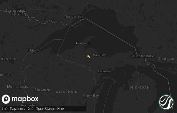
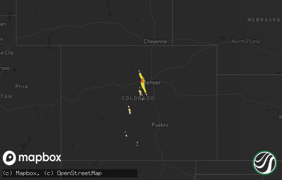
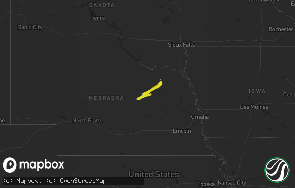
Hail Map in Michigan on June 18, 2014
The weather event in Michigan on June 18, 2014 includes Hail map. 19 states and 561 cities were impacted and suffered possible damage. The total estimated number of properties impacted is 31,973.

Hail
31,973
Estimated number of impacted properties by a 1.00" hail or larger3,404
Estimated number of impacted properties by a 1.75" hail or larger0
Estimated number of impacted properties by a 2.50" hail or largerStorm reports in Michigan
Michigan
| Date | Description |
|---|---|
| 06/18/20143:48 PM CDT | 6 inch diameter tree downed at 11 mile. |
| 06/18/20143:27 PM CDT | Downed tree on house at 1166 bradley. Time estimated per radar. |
| 06/18/20143:27 PM CDT | Estimated 8 inch tree snapped at base. Time estimated per radar. |
| 06/18/20143:27 PM CDT | 4 to 6 diameter tree limbs down on forge rd and 8 inch diameter limbs down on bellows rd. Time estimated per radar. |
| 06/18/20143:25 PM CDT | Power lines down at 15 mile and mound roads. Time estimated per radar. |
| 06/18/20143:25 PM CDT | Estimated 12 inch tree limb down at the intersection of auburn rd and adams rd. Time estimated per radar. |
| 06/18/20143:13 PM CDT | Multiple power lines down. Cook and grandview and east cook. |
| 06/18/20143:10 PM CDT | 1 foot diamter tree down on south maple road. Time estimated per radar. |
| 06/18/20143:05 PM CDT | Large tree branches down blocking road on m50. Time estimated per radar. |
| 06/18/20143:05 PM CDT | Trees down. |
| 06/18/20142:56 PM CDT | Power line down on keene dr. Burton... Mi |
| 06/18/20142:50 PM CDT | Large tree limb down |
| 06/18/20142:47 PM CDT | Power lines down. |
| 06/18/20142:43 PM CDT | Downed tree blocking road at bauer rd and cunningham lake rd. Time estimated per radar |
| 06/18/20142:28 PM CDT | Downed power lines. Time estimated per radar. |
| 06/18/20142:15 PM CDT | Tree down blocking norhtbound oakwood. Relayed via social media. |
| 06/18/20142:14 PM CDT | Trees uprooted just south of the adrian airport. |
| 06/18/20142:14 PM CDT | A local report indicates 81 MPH wind near ADRIAN |
| 06/18/20142:00 PM CDT | Tree down over road. Time estimated per radar. |
| 06/18/20141:58 PM CDT | Trees down over road. Time estimated per radar. |
| 06/18/20141:30 PM CDT | Three trees down...two trees were on two vehicles. |
| 06/18/20141:20 PM CDT | Tree limbs and phone lines reported down in the 800 and 900 blocks on w michigan ave. |
| 06/18/20141:20 PM CDT | A tree reported down in eagle township. |
| 06/18/20141:15 PM CDT | Multiple trees down in edwardsburg. Time estimated from radar. |
| 06/18/20141:15 PM CDT | Large tree down. Half of an old barn demolished with wood driven into ground. |
| 06/18/20141:00 PM CDT | Utility line and a single tree down in mendon. |
| 06/18/201412:59 PM CDT | Tree blocking road at s 8th st. And w q ave. Time estimated from radar. |
| 06/18/201412:48 PM CDT | Downed tree blocking road near 2400 south 8th st. In oshtemo. Time estimated from radar. |
| 06/18/201412:43 PM CDT | Tree reported down at 8th st and ml ave. |
| 06/18/201412:42 PM CDT | Large tree reported blocking 8th street just north of stadium drive. |
| 06/18/201412:42 PM CDT | Large tree blocking half of the road at 6500 west b ave. |
| 06/18/201412:39 PM CDT | A snapped tree blocked a driveway on lincoln lake road in lowell. |
| 06/18/201412:35 PM CDT | A few large trees down in antwerp twp. Time estimated from radar. |
| 06/18/201412:35 PM CDT | A tree fell in front of a house on thompson drive in lowell. Time estimated from radar. |
| 06/18/201412:22 PM CDT | Snapped and shredded trees on sir charles drive in rockford. |
| 06/18/201412:17 PM CDT | A tree fell in the road in front of 210 college ave ne in grand rapids. Time estimated from radar. |
| 06/18/201411:45 AM CDT | Four trees were reported down in park township. The largest diameter was 36 inches. |
| 06/18/20148:15 AM CDT | A local report indicates 1.25 inch wind near 1 WNW BYRON CENTER |
| 06/18/20148:13 AM CDT | A local report indicates 1.50 inch wind near 1 NW BYRON CENTER |
| 06/18/20148:07 AM CDT | A local report indicates 1.75 inch wind near 4 SSW GRANDVILLE |
| 06/18/20148:00 AM CDT | A local report indicates 1.00 inch wind near 2 ESE JAMESTOWN |
All States Impacted by Hail Map on June 18, 2014
Cities Impacted by Hail Map on June 18, 2014
- Celina, OH
- Fleming, CO
- Cochranton, PA
- Utica, PA
- Carlton, PA
- Kinsman, OH
- Bucklin, KS
- Rome, OH
- Orwell, OH
- Roscoe, SD
- Ipswich, SD
- Faulkton, SD
- San Antonio, TX
- Whitsett, TX
- Poteet, TX
- Floresville, TX
- Calliham, TX
- Three Rivers, TX
- Campbellton, TX
- Pleasanton, TX
- Jourdanton, TX
- Falls City, TX
- Christine, TX
- Silverton, TX
- Gothenburg, NE
- Brady, NE
- Sudan, TX
- Muleshoe, TX
- Healy, KS
- Hoxie, KS
- Park, KS
- Grinnell, KS
- Grainfield, KS
- Quinter, KS
- Gove, KS
- Scott City, KS
- Lubbock, TX
- Slaton, TX
- Wilson, TX
- Tahoka, TX
- Wyoming, MI
- Hudsonville, MI
- Grand Rapids, MI
- Byron Center, MI
- Grandville, MI
- Sutherland, NE
- Paxton, NE
- Belleville, PA
- Meadville, PA
- North Platte, NE
- Hershey, NE
- Whitewater, WI
- Milton, WI
- Meadow, SD
- Renville, MN
- Olivia, MN
- Danube, MN
- Toledo, OH
- Rossford, OH
- Holland, OH
- Fredericksburg, TX
- Leicester, NC
- Lawton, MI
- Marcellus, MI
- Decatur, MI
- Herreid, SD
- Mound City, SD
- Pollock, SD
- Glenham, SD
- Tyrone, PA
- Philipsburg, PA
- Lewistown, PA
- Huntingdon, PA
- Petersburg, PA
- Ford, KS
- Elsie, NE
- Titusville, PA
- Pleasantville, PA
- Franklin, PA
- Big Springs, NE
- Ogallala, NE
- Darlington, WI
- Hollandale, WI
- Mineral Point, WI
- Blanchardville, WI
- Windsor, OH
- Middlefield, OH
- North Bloomfield, OH
- Fowler, MI
- Ovid, MI
- Saint Johns, MI
- Laingsburg, MI
- Westphalia, MI
- Dewitt, MI
- Appleton, MN
- Madison, MN
- Correll, MN
- Minneola, KS
- Springlake, TX
- Olton, TX
- Earth, TX
- Chappell, NE
- Julesburg, CO
- Brule, NE
- Ovid, CO
- Kendalia, TX
- Boerne, TX
- Bergheim, TX
- Spring Branch, TX
- Jetmore, KS
- Rocksprings, TX
- Del Rio, TX
- Keystone, NE
- Grand Valley, PA
- Spartansburg, PA
- Grant, NE
- Wessington Springs, SD
- Kimball, SD
- Gann Valley, SD
- Shippenville, PA
- Clarion, PA
- Knox, PA
- Sligo, PA
- McIntosh, SD
- Isabel, SD
- Arnold, NE
- Stapleton, NE
- Maxwell, NE
- Milesville, SD
- Winthrop, MN
- Brownton, MN
- Gibbon, MN
- Gaylord, MN
- Yorkshire, OH
- Versailles, OH
- Saint Henry, OH
- Fort Loramie, OH
- New Weston, OH
- Rossburg, OH
- Maria Stein, OH
- Osgood, OH
- Vandalia, MI
- Cassopolis, MI
- Jones, MI
- Dowagiac, MI
- Russia, OH
- Houston, OH
- Minster, OH
- Dupree, SD
- Frankton, IN
- Atlanta, IN
- Noblesville, IN
- Arcadia, IN
- Anderson, IN
- Elwood, IN
- Cicero, IN
- Tipton, IN
- Laurel, NE
- Whiteface, TX
- Morton, TX
- Levelland, TX
- Ashley, ND
- Eureka, SD
- Long Lake, SD
- Easton, MD
- Sycamore, OH
- Iliff, CO
- Sedgwick, CO
- Haxtun, CO
- Crook, CO
- Sterling, CO
- Buchanan, ND
- Pingree, ND
- Sidney, OH
- Coldwater, OH
- Union City, OH
- Gettysburg, OH
- Bradford, OH
- Chickasaw, OH
- Anna, OH
- Portland, IN
- Fort Recovery, OH
- New Bremen, OH
- Saint Marys, OH
- Greenville, OH
- New Knoxville, OH
- Burkettsville, OH
- Covington, OH
- Piqua, OH
- Union City, IN
- Centerville, PA
- Logan, KS
- Lenora, KS
- Lisbon, ND
- Verona, ND
- Fort Ransom, ND
- Sheldon, ND
- Stirum, ND
- Kathryn, ND
- Oakes, ND
- Nome, ND
- Gwinner, ND
- Enderlin, ND
- Litchville, ND
- Mount Cory, OH
- Bluffton, OH
- Pandora, OH
- Aurora, NE
- Selby, SD
- Zeeland, ND
- Java, SD
- Milroy, MN
- Echo, MN
- Cottonwood, MN
- Vesta, MN
- Wood Lake, MN
- Perryton, TX
- Turton, SD
- Madrid, NE
- Dickens, NE
- Tryon, NE
- Brackettville, TX
- Ord, NE
- Ravenna, NE
- Pleasanton, NE
- Van Orin, IL
- Ohio, IL
- Sublette, IL
- Amboy, IL
- La Moille, IL
- Mendota, IL
- Arlington, IL
- Cozad, NE
- Lexington, NE
- McVeytown, PA
- Northfield, MN
- Webster, MN
- Athens, TN
- Wheatfield, IN
- Hill City, KS
- Penokee, KS
- Fowler, KS
- Dodge City, KS
- Watauga, SD
- McLaughlin, SD
- Selfridge, ND
- Fort Yates, ND
- Walker, SD
- Atlantic, PA
- Conneaut Lake, PA
- Wimberley, TX
- Dripping Springs, TX
- Fishers, IN
- Bird Island, MN
- Franklin, MN
- Brush, CO
- Akron, CO
- Merino, CO
- Hillrose, CO
- Atwood, CO
- Eagle Butte, SD
- Gettysburg, SD
- Masterson, TX
- Helenville, WI
- Delavan, WI
- Jefferson, WI
- Elkhorn, WI
- Palmyra, WI
- Johnson Creek, WI
- Edgerton, WI
- Mukwonago, WI
- Janesville, WI
- Oconomowoc, WI
- Cambridge, WI
- Cottage Grove, WI
- North Prairie, WI
- Lake Mills, WI
- Eagle, WI
- Deerfield, WI
- Sullivan, WI
- Oregon, WI
- East Troy, WI
- Walworth, WI
- Waterloo, WI
- Avalon, WI
- Darien, WI
- Stoughton, WI
- Dousman, WI
- Fort Atkinson, WI
- Floydada, TX
- Helotes, TX
- Queen Anne, MD
- Cordova, MD
- Hanston, KS
- Ness City, KS
- Hartington, NE
- Newcastle, NE
- Saegertown, PA
- Oil City, PA
- Tidioute, PA
- Jamestown, PA
- Hydetown, PA
- Cooperstown, PA
- Hartstown, PA
- Linesville, PA
- Tionesta, PA
- Townville, PA
- West Hickory, PA
- Guys Mills, PA
- Hye, TX
- Stonewall, TX
- Round Mountain, TX
- Johnson City, TX
- Willow City, TX
- Frankfort, SD
- Gardendale, TX
- Andrews, TX
- Goldsmith, TX
- Bulverde, TX
- Comfort, TX
- Llano, TX
- Blanco, TX
- Centre, AL
- Burnside, PA
- Coalport, PA
- Rossiter, PA
- Glen Hope, PA
- Cherry Tree, PA
- Beccaria, PA
- Glen Campbell, PA
- Irvona, PA
- La Jose, PA
- Mahaffey, PA
- Punxsutawney, PA
- Zionsville, IN
- Whitestown, IN
- Lebanon, IN
- Sheridan, IN
- Westfield, IN
- Mountain Home, TX
- Harper, TX
- Junction, TX
- Fort Pierre, SD
- Cherry Creek, SD
- Midland, SD
- Hayes, SD
- Eddyville, NE
- Zeeland, MI
- Caledonia, MI
- Jenison, MI
- Pikesville, MD
- Annapolis Junction, MD
- Woodstock, MD
- Middle River, MD
- Bowie, MD
- Catonsville, MD
- West Friendship, MD
- Harmans, MD
- Glyndon, MD
- Millersville, MD
- Hanover, MD
- Pasadena, MD
- College Park, MD
- Mount Airy, MD
- Linthicum Heights, MD
- Glen Burnie, MD
- Ellicott City, MD
- Marriottsville, MD
- Glenn Dale, MD
- Cooksville, MD
- Odenton, MD
- Gambrills, MD
- Greenbelt, MD
- Glen Arm, MD
- Westminster, MD
- White Marsh, MD
- Essex, MD
- Baltimore, MD
- Upperco, MD
- Kingsville, MD
- Towson, MD
- Chestertown, MD
- Hampstead, MD
- Randallstown, MD
- Perry Hall, MD
- Columbia, MD
- Sparrows Point, MD
- Joppa, MD
- Nottingham, MD
- Rosedale, MD
- Savage, MD
- Fort George G Meade, MD
- Beltsville, MD
- Lutherville Timonium, MD
- Gunpowder, MD
- Woodbine, MD
- Reisterstown, MD
- Severn, MD
- Crownsville, MD
- Lanham, MD
- Davidsonville, MD
- Halethorpe, MD
- Finksburg, MD
- Aberdeen Proving Ground, MD
- Brooklyn, MD
- Gwynn Oak, MD
- Owings Mills, MD
- Severna Park, MD
- Parkville, MD
- Fort Howard, MD
- Dundalk, MD
- Sykesville, MD
- Curtis Bay, MD
- Elkridge, MD
- Crofton, MD
- Laurel, MD
- Jessup, MD
- Windsor Mill, MD
- Clayton, MI
- Blissfield, MI
- Deerfield, MI
- Palmyra, MI
- Adrian, MI
- Sand Creek, MI
- Mclean, NE
- Osmond, NE
- Wayland, MI
- Sparta, MI
- Dorr, MI
- Coopersville, MI
- Conklin, MI
- Marne, MI
- Comstock Park, MI
- Allendale, MI
- Amherst, TX
- Andover, OH
- Dorset, OH
- Oconto, NE
- Seneca, PA
- Cranberry, PA
- Venus, PA
- Fowler, OH
- Farmdale, OH
- West Farmington, OH
- Trumbull, NE
- Inland, NE
- Hastings, NE
- Argyle, WI
- Sharon, WI
- Greensburg, KS
- Mullinville, KS
- Kinsley, KS
- Anselmo, NE
- Garden City, TX
- Stanton, TX
- Midland, TX
- Connelly Springs, NC
- Hickory, NC
- Coshocton, OH
- Warsaw, OH
- Stoneboro, PA
- Novelty, OH
- Fredonia, PA
- Clarks Mills, PA
- Rock Creek, OH
- Grove City, PA
- Beachwood, OH
- Montville, OH
- Jackson Center, PA
- Greenville, PA
- Chagrin Falls, OH
- Chardon, OH
- Chesterland, OH
- Gates Mills, OH
- Jefferson, OH
- Polk, PA
- Hiram, OH
- Sandy Lake, PA
- Bristolville, OH
- Mercer, PA
- Burton, OH
- Transfer, PA
- Garrettsville, OH
- Huntsburg, OH
- Hadley, PA
- Newbury, OH
- Cleveland, OH
- Williamsfield, OH
- Geneva, IL
- Sugar Grove, IL
- Dekalb, IL
- Plano, IL
- Aurora, IL
- Big Rock, IL
- Batavia, IL
- Yorkville, IL
- Elburn, IL
- North Aurora, IL
- Oswego, IL
- Montgomery, IL
- Mooseheart, IL
- Maple Park, IL
- Bristol, IL
- Saint Charles, IL
- Wasco, IL
- Newton Falls, OH
- Ravenna, OH
- Callaway, NE
- Bancroft, MI
- Owosso, MI
- Durand, MI
- Morrice, MI
- Pennsylvania Furnace, PA
- Reedsville, PA
- Granville, PA
- Spruce Creek, PA
- Burnham, PA
- Allensville, PA
- Mill Creek, PA
- Morgan, MN
- Sleepy Eye, MN
- Leaf River, IL
- Forreston, IL
- Stillman Valley, IL
- Chana, IL
- Byron, IL
- Oregon, IL
- Mount Morris, IL
- Rochelle, IL
- Newton, NC
- Maiden, NC
- Lincolnton, NC
- Great Bend, KS
- Pawnee Rock, KS
- Sunray, TX
- Savanna, IL
- Hanover, IL
- Elizabeth, IL
- Sabula, IA
- Miles, IA
- Brigantine, NJ
- Atlantic City, NJ
- Ventnor City, NJ
- Fountaintown, IN
- Morristown, IN
- Greenfield, IN
- New Palestine, IN
- Fairland, IN
- Shelbyville, IN
- Mico, TX
- Aurora, CO
- Englewood, CO
- Denver, CO
- Windham, OH
- Middleville, MI
- Freeport, MI
- Alto, MI
- Offerle, KS
- Sylvania, OH
- Franklin, NC
- Otis, CO


