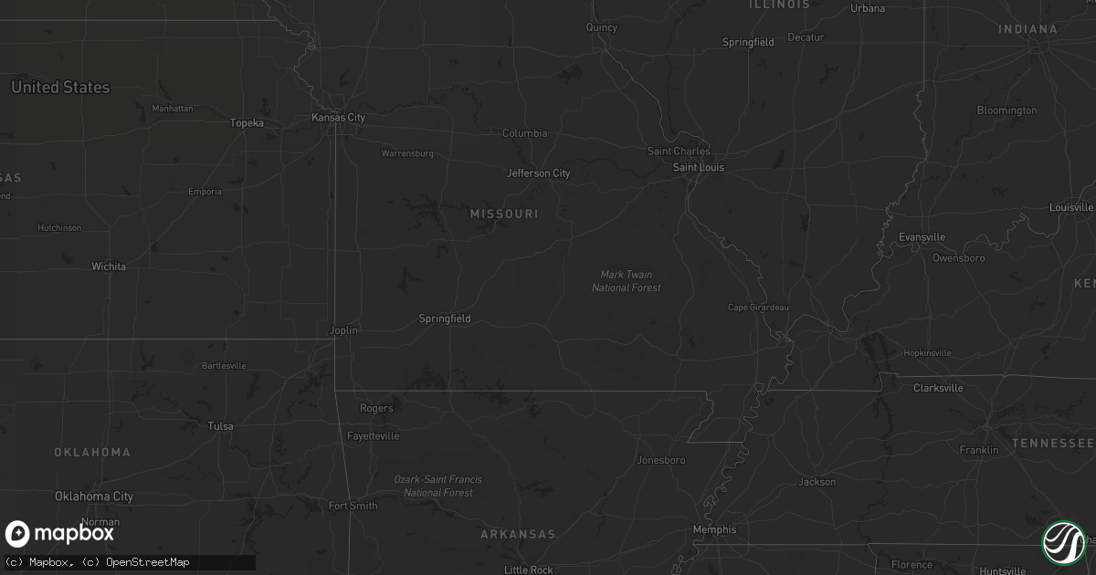
Hail Map in Minnesota on June 18, 2012
Get this storm
June 18 map
$229
one time, instant access
Download today. No call, no setup
Keep the $229
Bought the map and want the full workflow? Apply the entire $229 to a subscription within 7 days. None of it is wasted.
Every map, not just this one
This buys you this map. Subscription and you get every map we run, in the markets you choose from a few cities to whole states to nationwide. Plus real-time alerts the moment a storm fires.
Contact data
Name, contact info, occupancy, even credit band for addresses in the footprint. You go from where it hit to who to call.
Become the source they trust
Unlimited branding weather history reports on demand. You already have the documented answer ready for the property owner, and you are the one who showed up with it.
Property data and RoofTrace estimates
Pull up any address you have got, its value and the exact code rules for that jurisdiction, straight from One Click Code. Then RoofTrace estimates the squares, pitch, and roof value, priced the way you price.
Storm reports in Minnesota
Minnesota
| Date | Description |
|---|---|
| 06/18/20126:51 AM CDT | Several two to three inch diameter branches severed and several trees down near intersection of hwy 13 and 150th st. |
| 06/18/20126:30 AM CDT | Quarter to ping pong ball sized hail reported near intersection of orleans and harriet. |
| 06/18/20126:22 AM CDT | A local report indicates 1.00 inch wind near 2 SW STILLWATER |
| 06/18/20126:20 AM CDT | Reported near intersection of lake elmo ave and hwy 5. Time estimated. |
| 06/18/20125:55 AM CDT | A local report indicates 1.00 inch wind near VADNAIS HEIGHTS |
| 06/18/20124:35 AM CDT | 1 ft diameter tree downed near intersection of bailey road and radio drive. Time estimated. |
| 06/18/20124:33 AM CDT | Reported at stanton airfield |
| 06/18/20124:30 AM CDT | 2 ft diameter tree downed in southeast st. Paul near maplewood border. Time estimated. |
| 06/18/20124:30 AM CDT | 18 inch diameter tree uprooted. |
| 06/18/20124:29 AM CDT | Reported at st paul downtown airport |
| 06/18/20124:25 AM CDT | Large tree limbs snapped in half. Small trees down. Time estimated. Media also reporting utility poles down in south st paul near interstate 494. |
| 06/18/20124:25 AM CDT | Large trees down. Road to neighborhood blocked near intersection of hwy 494 and co rd 56. Time estimated. |
| 06/18/20124:25 AM CDT | A local report indicates 1.00 inch wind near DUNDAS |
| 06/18/20124:23 AM CDT | 30 ft tall pine tree uprooted. Branches broken off other trees. |
| 06/18/20124:21 AM CDT | Leaves shredded. Lasted for 7 minutes. |
| 06/18/20124:20 AM CDT | Fifty five inch diameter oak tree snapped off above main stump. Main stump 150 inches in diameter at the base. Damage occurred on italy path. |
| 06/18/20124:15 AM CDT | 30 ft tree down. Wood fence blown over. Near intersection of shannon parkway and hwy 46. Time estimated by radar. |
| 06/18/20124:10 AM CDT | 10 inch diameter tree downed |
| 06/18/20124:10 AM CDT | 14 power poles knocked down or snapped in half along pilot knob road between county rd 42 and county road 46...closing road. Time estimated. |
| 06/18/20124:05 AM CDT | Tree down on knox between 82nd and american blvd. Tin shed blown to next yard near 100 st. Time estimated. |
| 06/18/20124:05 AM CDT | Several trees down on bursville parkway at hwy 35w. Time estimated. |
| 06/18/20124:03 AM CDT | A local report indicates 60 MPH wind near PRIOR LAKE |
| 06/18/20124:00 AM CDT | Several trees down at intersection of hwy 13 and 150th st. |
| 06/18/20124:00 AM CDT | Aprswxnet sensor. Time estimated. |
| 06/18/20124:00 AM CDT | Numerous large trees downed. Time corrected. |
| 06/18/20123:59 AM CDT | Measured by spotter at co rd 2 and 21. Reported by emergency manager. |
| 06/18/20123:55 AM CDT | 50 to 60 trees down. Power lines down. |
| 06/18/20123:55 AM CDT | A local report indicates 83 MPH wind near BELLE PLAINE |
| 06/18/20123:55 AM CDT | A local report indicates 1.00 inch wind near LE SUEUR |
| 06/18/20123:55 AM CDT | A local report indicates 1.00 inch wind near BELLE PLAINE |
| 06/18/20123:52 AM CDT | Mndot road sensor |
| 06/18/20123:48 AM CDT | Six to eight inch tree limbs severed. Telephone pole leaning against tree. |
| 06/18/20123:45 AM CDT | Numerous medium to large maple...oak and pine trees toppled. Some trees over two feet in diameter. At least 30 trees felled with numerous six inch diameter or slightly |
| 06/18/20123:35 AM CDT | Large tree on house. Time estimated by radar. |
| 06/18/20123:30 AM CDT | Enough hail to make the ground white |
| 06/18/20123:20 AM CDT | Numerous large trees downed |
| 06/18/20122:15 AM CDT | Minor damage to corn. |
| 06/18/20122:05 AM CDT | A local report indicates 60 MPH wind near 6 S MARSHALL |
| 06/18/20122:05 AM CDT | Hail was accompanied by 50 to 60 mph winds. Some damage to crops. |
| 06/18/20122:01 AM CDT | Damage to camper from hail. |
| 06/18/20121:57 AM CDT | A local report indicates 2.00 inch wind near 3 NE RUSSELL |
| 06/18/20121:55 AM CDT | A local report indicates 1.75 inch wind near RUSSELL |
| 06/18/20121:55 AM CDT | Windows broken out...roof damaged and vehicles damaged by hail. |
| 06/18/20121:54 AM CDT | A local report indicates 1.50 inch wind near 1 E RUSSELL |
| 06/18/20121:54 AM CDT | A local report indicates 60 MPH wind near 3 SE RUSSELL |
| 06/18/20121:50 AM CDT | A local report indicates 1.00 inch wind near RUSSELL |
| 06/18/20121:48 AM CDT | A local report indicates 1.00 inch wind near 3 WNW RUSSELL |
| 06/18/20121:37 AM CDT | A local report indicates 1.50 inch wind near 3 SW ARCO |
All States Impacted by Hail Map on June 18, 2012
Cities Impacted by Hail Map on June 18, 2012
- Dagmar, MT
- Mosinee, WI
- Ringle, WI
- Moran, MI
- Manistique, MI
- Marion, WI
- Clintonville, WI
- Poplar, MT
- Flaxville, MT
- Suring, WI
- Marinette, WI
- Coleman, WI
- Pound, WI
- Lena, WI
- Peshtigo, WI
- Russell, MN
- Marshall, MN
- Lynd, MN
- Laona, WI
- Crandon, WI
- Wabeno, WI
- Redstone, MT
- Erwin, SD
- Lake Preston, SD
- De Smet, SD
- Arlington, SD
- Stanley, WI
- Alma, WI
- Nelson, WI
- Willard, WI
- Augusta, WI
- Eleva, WI
- Fairchild, WI
- Mondovi, WI
- Osseo, WI
- Independence, WI
- Strum, WI
- Fall Creek, WI
- Larsen, WI
- Neenah, WI
- Schofield, WI
- Watertown, SD
- Lonsdale, MN
- Montgomery, MN
- Kilkenny, MN
- Northfield, MN
- Faribault, MN
- Dundas, MN
- New Prague, MN
- Jordan, MN
- Shakopee, MN
- Waupaca, WI
- Roscoe, SD
- Menomonie, WI
- Spencer, OH
- Sullivan, OH
- Homerville, OH
- Wellington, OH
- Roma, TX
- Williston, ND
- Webster, MN
- Elton, WI
- Bryant, WI
- Bowler, WI
- Antigo, WI
- White Lake, WI
- Maple City, MI
- Empire, MI
- Fairfax, MN
- Brandt, SD
- Clear Lake, SD
- Toronto, SD
- Bryant, SD
- Willow Lake, SD
- Volga, SD
- Brookings, SD
- Bruce, SD
- Medford, WI
- Escanaba, MI
- Gladstone, MI
- Hosmer, SD
- Eureka, SD
- Leola, SD
- Rudyard, MI
- Grenora, ND
- Bainville, MT
- Medicine Lake, MT
- Froid, MT
- Cogswell, ND
- Farmington, MN
- Lakeville, MN
- Elcho, WI
- Selby, SD
- Huron, OH
- Wakeman, OH
- Vermilion, OH
- Berlin Heights, OH
- Middleville, MI
- Spring Valley, WI
- Ellsworth, WI
- Elmwood, WI
- Plum City, WI
- Maiden Rock, WI
- Edgar, WI
- Marathon, WI
- Wausau, WI
- Traverse City, MI
- Colfax, WI
- Porterfield, WI
- Crivitz, WI
- Wallace, MI
- Menominee, MI
- Watertown, MN
- Waconia, MN
- Mayer, MN
- Athens, WI
- Rib Lake, WI
- Merrill, WI
- Frederick, SD
- Grenville, SD
- Webster, SD
- Newport, MI
- Eau Galle, WI
- New Town, ND
- Mandaree, ND
- Keene, ND
- Gulliver, MI
- Willmar, MN
- Tawas City, MI
- Goodhue, MN
- Red Wing, MN
- Wallace, SD
- Bradley, SD
- Brockton, MT
- Mount Crawford, VA
- Bridgewater, VA
- Wessington, SD
- Wolsey, SD
- Westport, SD
- Keshena, WI
- Williston, OH
- Martin, OH
- Genoa, OH
- Curtice, OH
- Millbury, OH
- Clay Center, OH
- Wayne, OH
- Fostoria, OH
- Bowling Green, OH
- Risingsun, OH
- Jerry City, OH
- Cygnet, OH
- Weston, OH
- Portage, OH
- Bloomdale, OH
- West Millgrove, OH
- Rudolph, OH
- Maumee, OH
- Holland, OH
- Monclova, OH
- Java, SD
- Ipswich, SD
- Bowdle, SD
- Barnard, SD
- Hecla, SD
- Oakes, ND
- Columbia, SD
- Cornell, MI
- Colby, WI
- Abbotsford, WI
- Tyler, MN
- Arco, MN
- Lake Benton, MN
- Greenwich, OH
- New London, OH
- Orr, MN
- Crane Lake, MN
- Custer, WI
- Iola, WI
- Amherst Junction, WI
- Beldenville, WI
- Balaton, MN
- Newberry, MI
- Naubinway, MI
- Trout Lake, MI
- Hitchcock, SD
- Bonduel, WI
- Black Creek, WI
- Shiocton, WI
- Nichols, WI
- Roscommon, MI
- Fife Lake, MI
- Grayling, MI
- Sleepy Eye, MN
- Redwood Falls, MN
- Morgan, MN
- Morton, MN
- Lafayette, MN
- Gibbon, MN
- Wabasso, MN
- Winthrop, MN
- Franklin, MN
- Galion, OH
- Pepin, WI
- Appleton, MN
- Correll, MN
- Madison, MN
- Bellingham, MN
- Saint Ignace, MI
- Cadillac, MI
- Aurora, SD
- Ruthton, MN
- Elkton, SD
- Interlochen, MI
- Grawn, MI
- Appleton, WI
- Fremont, WI
- Hortonville, WI
- Barryton, MI
- Sears, MI
- Veblen, SD
- Durand, WI
- Milbank, SD
- Saint Peter, MN
- Hendricks, MN
- Walnut Grove, MN
- Tracy, MN
- Renville, MN
- Estelline, SD
- Astoria, SD
- Bird Island, MN
- New Ulm, MN
- Minneota, MN
- Green Isle, MN
- Porter, MN
- Canby, MN
- Belview, MN
- Gaylord, MN
- Norwood Young America, MN
- Wood Lake, MN
- New Germany, MN
- Sacred Heart, MN
- Carpenter, SD
- Lester Prairie, MN
- Hector, MN
- Granite Falls, MN
- Young America, MN
- Stewart, MN
- Arlington, MN
- Glencoe, MN
- Clarkfield, MN
- Dawson, MN
- Plato, MN
- Clements, MN
- Lamberton, MN
- Gary, SD
- Iroquois, SD
- Castlewood, SD
- Yale, SD
- Cottonwood, MN
- Hamburg, MN
- Cologne, MN
- Henderson, MN
- Lucan, MN
- Hanley Falls, MN
- Lake Norden, SD
- Le Sueur, MN
- Danube, MN
- Saint Lawrence, SD
- Ivanhoe, MN
- Ghent, MN
- Huron, SD
- Hayti, SD
- Milroy, MN
- Seaforth, MN
- Boyd, MN
- Olivia, MN
- Badger, SD
- Vesta, MN
- White, SD
- Nicollet, MN
- Echo, MN
- Brownton, MN
- Raymond, SD
- Almond, WI
- Tulare, SD
- Roslyn, SD
- Gould City, MI
- Sault Sainte Marie, MI
- Kincheloe, MI
- Kinross, MI
- Rapid River, MI
- New Richmond, WI
- Mountain, WI
- Britton, SD
- Peever, SD
- Florence, SD
- Polk, OH
- Ashland, OH
- Saint Paul, MN
- Raymondville, TX
- Loyal, WI
- Owen, WI
- Curtiss, WI
- Unity, WI
- Stevens Point, WI
- Clark, SD
- Little Suamico, WI
- Abrams, WI
- Marvin, SD
- Garden City, SD
- Henry, SD
- Baileys Harbor, WI
- Stillwater, MN
- Bark River, MI
- Spalding, MI
- Daggett, MI
- Garden, MI
- Wilson, MI
- Perronville, MI
- Carney, MI
- Stephenson, MI
- Powers, MI
- Homestead, MT
- Oak Harbor, OH
- Collins, OH
- Norwalk, OH
- Oshkosh, WI
- Humbird, WI
- Wessington Springs, SD
- Bloomer, WI
- Grand Rapids, MI
- Birnamwood, WI
- Aniwa, WI
- Watford City, ND
- Dorchester, WI
- Stetsonville, WI
- Rosholt, WI
- Tigerton, WI
- Ogdensburg, WI
- Scandinavia, WI
- Amherst, WI
- Hastings, MN
- Falmouth, MI
- Merritt, MI
- Lake City, MI
- Walbridge, OH
- Perrysburg, OH
- Swanton, OH
- Neapolis, OH
- Kansas, OH
- Whitehouse, OH
- Tontogany, OH
- Haskins, OH
- Grand Rapids, OH
- Waterville, OH
- Liberty Center, OH
- Milton Center, OH
- Tiffin, OH
- Custar, OH
- McClure, OH
- North Baltimore, OH
- Cannon Falls, MN
- Algoma, WI
- Sturgeon Bay, WI
- Sheboygan, WI
- Belle Plaine, MN
- Carver, MN
- Onsted, MI
- Adrian, MI
- Tipton, MI
- Havana, ND
- Forman, ND
- Cayuga, ND
- Rutland, ND
- Lidgerwood, ND
- Grand Marais, MN
- New Effington, SD
- Chippewa Falls, WI
- Newton, WI
- Cleveland, WI
- Withee, WI
- Reserve, MT
- Hager City, WI
- Prescott, WI
- Cosmos, MN
- Millersburg, OH
- Killbuck, OH
- Kiel, WI
- Valders, WI
- Whitelaw, WI
- Manitowoc, WI
- Eau Claire, WI
- West Alexander, PA
- Doland, SD
- Deerbrook, WI
- Le Center, MN
- Hatley, WI
- Eland, WI
- Brussels, WI
- Oconto, WI
- Callands, VA
- Chatham, VA
- Welch, MN
- Hampton, MN
- Randolph, MN
- Brillion, WI
- Weyauwega, WI
- Elk Mound, WI
- Arkansaw, WI
- Boyd, WI
- Cornell, WI
- Thorp, WI
- Lublin, WI
- Gilman, WI
- Gleason, WI
- Irma, WI
- Ortley, SD
- Waubay, SD
- Dugspur, VA
- Hillsville, VA
- Fremont, MI
- Lake City, MN
- Stockholm, WI
- Wilmot, SD
- Houlton, WI
- Bayport, MN
- Hudson, WI
- Vermillion, MN
- Elko New Market, MN
- Kenyon, MN
- Prior Lake, MN
- Rosemount, MN
- Nerstrand, MN
- Dennison, MN
- Bay City, WI
- Cottage Grove, MN
- River Falls, WI
- Afton, MN
- South Shore, SD
- Cedar, MI
- Fish Creek, WI
- Eden, SD
- Somerset, WI
- Lake Elmo, MN
- Chaska, MN
- Chanhassen, MN
- Excelsior, MN
- Galax, VA
- Mattoon, WI
- Lakeland, MN
- Willernie, MN
- Killdeer, ND
- New London, WI
- Allendale, MI
- Marne, MI
- Coopersville, MI
- Pickford, MI
- Concepcion, TX
- Independence, VA
- Neopit, WI
- Pearson, WI
- Jim Falls, WI
- Cadott, WI
- Summit Lake, WI
- Rothschild, WI
- Tomahawk, WI
- Gresham, WI
- Brokaw, WI
- Greenwood, WI
- Athelstane, WI
- Pickerel, WI
- Stratford, WI
- Spencer, WI
- Aberdeen, SD
- Vienna, SD
- Hazel, SD
- Marshfield, WI
- Lowell, MI
- Delton, MI
- Ada, MI
- Shelbyville, MI
- Wayland, MI
- Alto, MI
- Caledonia, MI
- Hastings, MI
- Kabetogama, MN
- Littlefork, MN
- Rio Grande City, TX
- Coshocton, OH
- West Salem, OH
- Jeromesville, OH
- Wooster, OH
- Dayton, VA
- Plainfield, WI
- Bancroft, WI
- Malone, WI
- Chilton, WI
- Blomkest, MN
- Lake Lillian, MN
- Roseglen, ND
- Boyceville, WI
- Knapp, WI
- Pemberville, OH
- Shreve, OH
- Big Prairie, OH
- Amherst, OH
- Kingsley, MI
- Reedsville, WI
- Hopkins, MI
- Eagle Butte, SD
- Premont, TX
- Amberg, WI
- Benson, MN
- Weyers Cave, VA
- Realitos, TX
- Monroeville, OH
- Montague, MI
- Whitehall, MI
- Whitehall, WI
- Blair, WI
- Hixton, WI
- Milan, OH
- Forestville, WI
- Claremont, SD
- Houghton, SD
- Krakow, WI
- Gettysburg, SD
- Ellendale, ND
- Minneapolis, MN
- Greenleaf, WI
- Warsaw, OH
- Odessa, MN
- Hinton, VA
- Ellison Bay, WI
- Hilbert, WI
- Wild Rose, WI
- Berlin, WI
- Menasha, WI
- Kaukauna, WI
- Winneconne, WI
- Pine River, WI
- Butte Des Morts, WI
- Stockbridge, WI
- Sherwood, WI
- Omro, WI
- Poy Sippi, WI
- Dupree, SD
- Barbeau, MI
- Wells, MI
- Engadine, MI
- Dafter, MI
- Nahma, MI
- Ravenna, MI
- Muskegon, MI
- Twin Brooks, SD
- Holcombe, WI
- Claysville, PA
- Atwater, MN
- Osseo, MN
- Maple Grove, MN
- Woodville, OH
- Luckey, OH
- Wheaton, MN
- Summit, SD
- Beulah, MI
- Buckley, MI
- Montevideo, MN
- Attica, OH
- Alma Center, WI
- Two Rivers, WI
- Freeport, MI
- Elmore, OH
- Pulaski, WI
- Oconto Falls, WI
- Sobieski, WI
- Manawa, WI
- San Diego, TX
- Gillett, WI
- Twin Lake, MI
- International Falls, MN
- Lake Ann, MI
- Kandiyohi, MN
- Altoona, WI
- Hutchinson, MN
- Dassel, MN
- Silver Lake, MN
- Cokato, MN
- Bailey, MI
- Grant, MI
- Conklin, MI
- Corona, SD
- Elkhart Lake, WI
- Neillsville, WI
- Inver Grove Heights, MN
- South Saint Paul, MN
- Thompsonville, MI
- Honor, MI
- Grand Haven, MI
- Sparta, MI
- Comstock Park, MI
- Sand Lake, MI
- Litchfield, MN
- Grove City, MN
- Hessel, MI
- Hewitt, WI
- Chili, WI
- Saint Paul Park, MN
- Newport, MN
- Cleveland, MN
- Frontenac, MN
- Sisseton, SD
- Ringgold, VA
- Kennan, WI
- Roberts, WI
- Manitou Beach, MI
- Tecumseh, MI
- Brooklyn, MI
- Nova, OH
- Kimball, SD
- Rock, MI
- Brantwood, WI
- Vulcan, MI
- Hopkins, MN
- Minnetonka, MN
- Eden Prairie, MN
- Traphill, NC
- Wausaukee, WI
- Kewaunee, WI
- Miller, SD
- Holton, MI
- Hermansville, MI
- Maple Plain, MN
- Victoria, MN
- Saint Bonifacius, MN
- Mound, MN
- Egg Harbor, WI
- Sister Bay, WI


