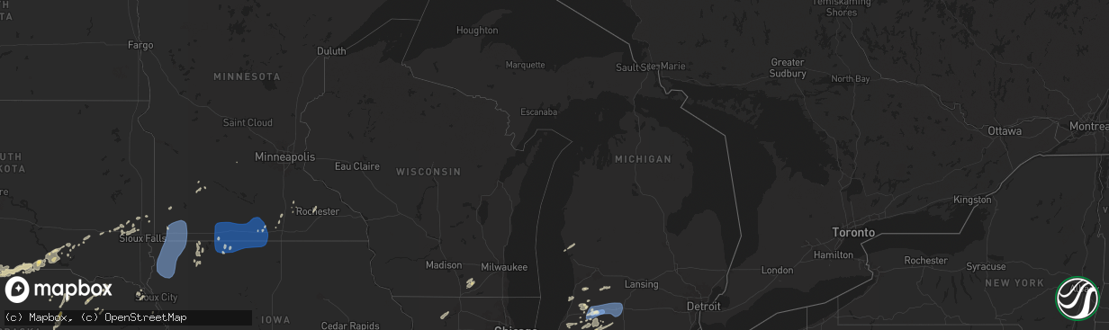
Hail Map in Michigan on June 16, 2024
The weather event in Michigan on June 16, 2024 includes Wind and Hail maps. 23 states and 530 cities were impacted and suffered possible damage. The total estimated number of properties impacted is 0.
Want more than just the map?
Turn this storm into a full workflow.
- Owner + property data so you know who to knock
- OnDemand branded weather history reports to win the "did we even have hail?" argument
- RoofTrace estimate so reps stop guessing numbers at the door
Bought this map? Upgrade within 7 days and we'll credit the $230. (10-15 min setup call)
Wind
Hail
0
Estimated number of impacted properties by a 1.00" hail or larger0
Estimated number of impacted properties by a 1.75" hail or larger0
Estimated number of impacted properties by a 2.50" hail or largerStorm reports in Michigan
Michigan
| Date | Description |
|---|---|
| 06/15/202411:30 PM CDT | Nickle to quarter sized hail. |
| 06/15/202411:02 PM CDT | Trees down. |
| 06/15/202410:15 PM CDT | Multiple photos of trees down across portage and southern kalamazoo area. Time estimated by radar indicated downburst and initial power outage reports. |
| 06/15/202410:00 PM CDT | Trees down with radar indicated microburst. Corroborated with consumers energy power outages. |
| 06/15/20249:55 PM CDT | Multiple reports of trees and wires down across battle creek. |
| 06/15/20249:29 PM CDT | Trees down. |
| 06/15/20249:22 PM CDT | Asos station kazo kalamazoo/bc intl airport. |
| 06/15/20249:20 PM CDT | Report from mping: 3-inch tree limbs broken; power poles broken. |
| 06/15/20249:15 PM CDT | Multiple photos of trees down across the kalamazoo and portage area. Time estimated by radar indicated downburst... Initial power outage reports... And kazo asos wind o |
| 06/15/20249:12 PM CDT | County dispatch reported trees and powerlines down across cass county resulting in numerous power outages. Time estimated by radar. |
| 06/15/20248:37 PM CDT | Damage to house. |
| 06/15/20248:20 PM CDT | *** 2 inj *** st. Joseph county mi dispatch reported that numerous trees and powerlines down in three rivers with power out. Several vehicle accidents from people runni |
| 06/15/20248:15 PM CDT | Photos of multiple trees down across keeler township. Time estimated by radar. |
| 06/15/20248:15 PM CDT | Photos of multiple trees down across keeler township. Time estimated by radar. |
| 06/15/20248:05 PM CDT | Berrien county dispatch reported trees and powerlines down across the county. Time and centralized location estimated by radar. |
All States Impacted by Hail Map on June 16, 2024
Cities Impacted by Hail Map on June 16, 2024
- Woodrow, CO
- Lindon, CO
- Anton, CO
- Brush, CO
- Akron, CO
- Cope, CO
- Otis, CO
- Yuma, CO
- Martin, SD
- Long Valley, SD
- Parmelee, SD
- Norris, SD
- White River, SD
- Okaton, SD
- Murdo, SD
- Saint Francis, SD
- Junction City, KS
- Dwight, KS
- Manhattan, KS
- Alta Vista, KS
- Burdick, KS
- Gotebo, OK
- Herington, KS
- Mountain View, OK
- Council Grove, KS
- Cordell, OK
- Peabody, KS
- Florence, KS
- Wilsey, KS
- Galva, KS
- Canton, KS
- Saint George, KS
- Rector, AR
- Whitehall, MI
- Muskegon, MI
- Holton, MI
- Twin Lake, MI
- Murphy, NC
- Oakville, IA
- Keithsburg, IL
- Joy, IL
- New Boston, IL
- Aledo, IL
- Kennett, MO
- Seaton, IL
- Blue Grass, IA
- Reynolds, IL
- Stockton, IA
- Fruitland, IA
- Taylor Ridge, IL
- Atalissa, IA
- Buffalo, IA
- Andalusia, IL
- Illinois City, IL
- Durant, IA
- Alexis, IL
- Wilton, IA
- New Liberty, IA
- Little York, IL
- Muscatine, IA
- Montpelier, IA
- Moscow, IA
- Dixon, IA
- Walcott, IA
- Galesburg, IL
- Moline, IL
- Davenport, IA
- Rock Island, IL
- Milan, IL
- New Windsor, IL
- Viola, IL
- Cambridge, IL
- Oneida, IL
- North Henderson, IL
- Woodhull, IL
- Orion, IL
- Sherrard, IL
- Alpha, IL
- Coal Valley, IL
- Galva, IL
- Wataga, IL
- Ophiem, IL
- Lynn Center, IL
- Rio, IL
- Victoria, IL
- Matherville, IL
- Altona, IL
- Gerlaw, IL
- Henderson, IL
- Monmouth, IL
- Sikeston, MO
- Andover, IL
- Eldridge, IA
- Osco, IL
- Pleasant Valley, IA
- Long Grove, IA
- Bettendorf, IA
- Le Claire, IA
- East Moline, IL
- Hampton, IL
- Geneseo, IL
- Colona, IL
- Silvis, IL
- Donahue, IA
- Port Byron, IL
- Carbon Cliff, IL
- Princeton, IA
- Rapids City, IL
- Hillsdale, IL
- Bertrand, MO
- Charleston, MO
- Jonesboro, IL
- Atkinson, IL
- Sparta, TN
- Smithville, TN
- Annawan, IL
- Kewanee, IL
- Mounds, IL
- Jennings, LA
- Sheffield, IL
- Neponset, IL
- Spencer, TN
- Anna, IL
- Toulon, IL
- Lake Arthur, LA
- Pulaski, IL
- La Fayette, IL
- Wyoming, IL
- Buda, IL
- Colquitt, GA
- Mount Morris, IL
- Richfield, KS
- Mineral, IL
- Wyanet, IL
- Princeton, IL
- Bradford, IL
- Leaf River, IL
- Tiskilwa, IL
- Crosby, MS
- Crossville, TN
- Pikeville, TN
- Byron, IL
- Winnebago, IL
- Walnut, IL
- Ohio, IL
- Prophetstown, IL
- Tampico, IL
- Crane Lake, MN
- Orr, MN
- Putnam, IL
- Rock Island, TN
- Hartsville, TN
- Lebanon, TN
- Cobden, IL
- Sulphur, LA
- Natchez, MS
- Dunlap, TN
- Castalian Springs, TN
- Clinton, MS
- Bolton, MS
- Delavan, WI
- Whitewater, WI
- Avalon, WI
- Jonesville, LA
- Elkhorn, WI
- Elkhart, KS
- Nashville, TN
- Old Hickory, TN
- Madison, TN
- Darien, WI
- Jena, LA
- Alexandria, LA
- Woodworth, LA
- Boyce, LA
- Carthage, TN
- Riddleton, TN
- Pollock, LA
- Forkland, AL
- Watertown, TN
- Smithland, KY
- Grand Rivers, KY
- Tiline, KY
- Salem, KY
- Marion, KY
- Fredonia, KY
- Eddyville, KY
- Greensboro, AL
- Sawyerville, AL
- McCook, NE
- Nara Visa, NM
- Amistad, NM
- Duncanville, AL
- Tuscaloosa, AL
- Culbertson, NE
- Perry, FL
- Salem, FL
- Marathon, TX
- Gloster, MS
- Dequincy, LA
- Manter, KS
- Rockfield, KY
- Bowling Green, KY
- Forest Hill, LA
- Glenmora, LA
- Three Oaks, MI
- New Buffalo, MI
- Union Pier, MI
- College Grove, TN
- Eagleville, TN
- Hermitage, TN
- Antioch, TN
- La Vergne, TN
- Murfreesboro, TN
- South Haven, MI
- Saint Joseph, MI
- Berrien Springs, MI
- Cairo, GA
- Thomasville, GA
- Grand Junction, MI
- Sodus, MI
- Eau Claire, MI
- Bangor, MI
- Bloomingdale, MI
- Gobles, MI
- Allegan, MI
- Paw Paw, MI
- Lawrence, MI
- Trenton, KY
- Guthrie, KY
- Wayland, MI
- Middleville, MI
- Decatur, MI
- Cassopolis, MI
- Vandalia, MI
- Hastings, MI
- Kalamazoo, MI
- Mattawan, MI
- Jones, MI
- Marcellus, MI
- Portage, MI
- Hayes Center, NE
- Oxford, NE
- Maywood, NE
- Lawton, MI
- Schoolcraft, MI
- Scotts, MI
- Galesburg, MI
- Climax, MI
- Augusta, MI
- Richland, MI
- Springview, NE
- Orleans, NE
- Alliance, NE
- Sparks, NE
- Dowagiac, MI
- Burke, SD
- Berrien Center, MI
- Alma, NE
- Battle Creek, MI
- East Leroy, MI
- Ceresco, MI
- Athens, MI
- Ellsworth, NE
- Winner, SD
- Herrick, SD
- Valentine, NE
- Colome, SD
- Gregory, SD
- Marshall, MI
- Burlington, MI
- Charlotte, MI
- Burt, MI
- Saginaw, MI
- Fairgrove, MI
- Saint Charles, MI
- Montrose, MI
- Olivet, MI
- Bridgeport, MI
- Pigeon, MI
- Ovid, MI
- Reese, MI
- Munger, MI
- Bath, MI
- Owosso, MI
- Chesaning, MI
- Dimondale, MI
- Lansing, MI
- Oakley, MI
- Eaton Rapids, MI
- East Lansing, MI
- Henderson, MI
- Laingsburg, MI
- Ashby, NE
- Platte, SD
- Hay Springs, NE
- Three Rivers, MI
- Merriman, NE
- Geddes, SD
- Corsica, SD
- Cody, NE
- Rushville, NE
- Hemingford, NE
- Kimball, NE
- Dix, NE
- Dallas, SD
- Harrison, SD
- Vicksburg, MI
- Ethan, SD
- Chappell, NE
- Crook, CO
- Mission, SD
- Mitchell, SD
- Bridgewater, SD
- Gordon, NE
- Bingham, NE
- Constantine, MI
- Sedgwick, CO
- Nenzel, NE
- Bristol, IN
- Fairfax, SD
- Bonesteel, SD
- Alexandria, SD
- Emery, SD
- Oshkosh, NE
- Crookston, NE
- Mills, NE
- Armour, SD
- Elkhart, IN
- Spencer, SD
- White Pigeon, MI
- Parkston, SD
- Dimock, SD
- Kilgore, NE
- Lewellen, NE
- Union, MI
- Whitman, NE
- Salem, SD
- Hyannis, NE
- Montrose, SD
- Centreville, MI
- Mendon, MI
- Saint Charles, SD
- Brule, NE
- Colton, SD
- Lake Andes, SD
- Chester, SD
- Hamilton, MI
- Lemoyne, NE
- Canistota, SD
- Lakeville, IN
- North Liberty, IN
- South Bend, IN
- Arthur, NE
- Holland, MI
- Dell Rapids, SD
- Colman, SD
- Ogallala, NE
- Hartford, SD
- Humboldt, SD
- Keystone, NE
- Hopkins, MI
- Egan, SD
- Trent, SD
- Mishawaka, IN
- Crooks, SD
- Baltic, SD
- Lyons, SD
- Garretson, SD
- Elsie, NE
- Wallace, NE
- Sutherland, IA
- Colon, MI
- Leonidas, MI
- Burwell, NE
- Luverne, MN
- Hartley, IA
- Everly, IA
- Royal, IA
- Royal, NE
- Paxton, NE
- Bartlett, NE
- Sturgis, MI
- Belview, MN
- Chambers, NE
- Winnetoon, NE
- Brunswick, NE
- Sutherland, NE
- Creighton, NE
- Woodstock, MN
- Lucan, MN
- North Platte, NE
- Milford, IA
- Sherwood, MI
- Oneill, NE
- Harris, IA
- Wabasso, MN
- Hershey, NE
- Redwood Falls, MN
- Lake Park, IA
- Adrian, MN
- Bigelow, MN
- Rushmore, MN
- Lismore, MN
- Worthington, MN
- Ellsworth, MN
- Kenneth, MN
- Magnolia, MN
- Round Lake, MN
- Wilmont, MN
- Reading, MN
- Iona, MN
- Fulda, MN
- Edgerton, MN
- Brewster, MN
- Sibley, IA
- Rock Rapids, IA
- George, IA
- Little Rock, IA
- Kanaranzi, MN
- Lakefield, MN
- Melvin, IA
- Ashton, IA
- Ocheyedan, IA
- Okabena, MN
- Wallingford, IA
- Graettinger, IA
- Terril, IA
- Spirit Lake, IA
- Doon, IA
- Alvord, IA
- Rock Valley, IA
- Ireton, IA
- Hull, IA
- Boyden, IA
- Matlock, IA
- Remsen, IA
- Sioux Center, IA
- Archer, IA
- Le Mars, IA
- Sheldon, IA
- Granville, IA
- Maurice, IA
- Sanborn, IA
- Hawarden, IA
- Oyens, IA
- Alton, IA
- Hospers, IA
- Orange City, IA
- Estherville, IA
- Bloomfield, NE
- Mullen, NE
- Alpha, MN
- Sherburn, MN
- Jackson, MN
- Crofton, NE
- Hutchinson, MN
- Dolliver, IA
- Armstrong, IA
- Ringsted, IA
- Thedford, NE
- Mountain Lake, MN
- Trimont, MN
- Dunnell, MN
- Odin, MN
- Neligh, NE
- Plainview, NE
- Superior, IA
- Ceylon, MN
- Ormsby, MN
- Saint James, MN
- Welcome, MN
- Fairmont, MN
- Allen, NE
- Waterbury, NE
- Newcastle, NE
- Ponca, NE
- Swea City, IA
- Fenton, IA
- Truman, MN
- Granada, MN
- Pierce, NE
- Osmond, NE
- Ledyard, IA
- Elmore, MN
- Blue Earth, MN
- Winnebago, MN
- Lakota, IA
- Buffalo Center, IA
- Delavan, MN
- Jackson, NE
- Bancroft, IA
- Thompson, IA
- Rake, IA
- Frost, MN
- Bricelyn, MN
- Wells, MN
- Scarville, IA
- Kiester, MN
- Easton, MN
- Minnesota Lake, MN
- Mapleton, MN
- Amboy, MN
- Johnstown, NE
- Atkinson, NE
- Walthill, NE
- Winnebago, NE
- West Point, NE
- Oakland, NE
- Ellendale, MN
- Elsmere, NE
- Owatonna, MN
- North Bend, NE
- Rogers, NE
- West Concord, MN
- Kenyon, MN
- Claremont, MN
- Morse Bluff, NE
- Linwood, NE
- Ewing, NE
- Byron, MN
- Rochester, MN
- Alden, MN
- Hartland, MN
- New Richland, MN
- Grand Island, NE
- Yutan, NE
- Edwardsburg, MI
- Mead, NE
- Saint Libory, NE
- Osceola, IN


