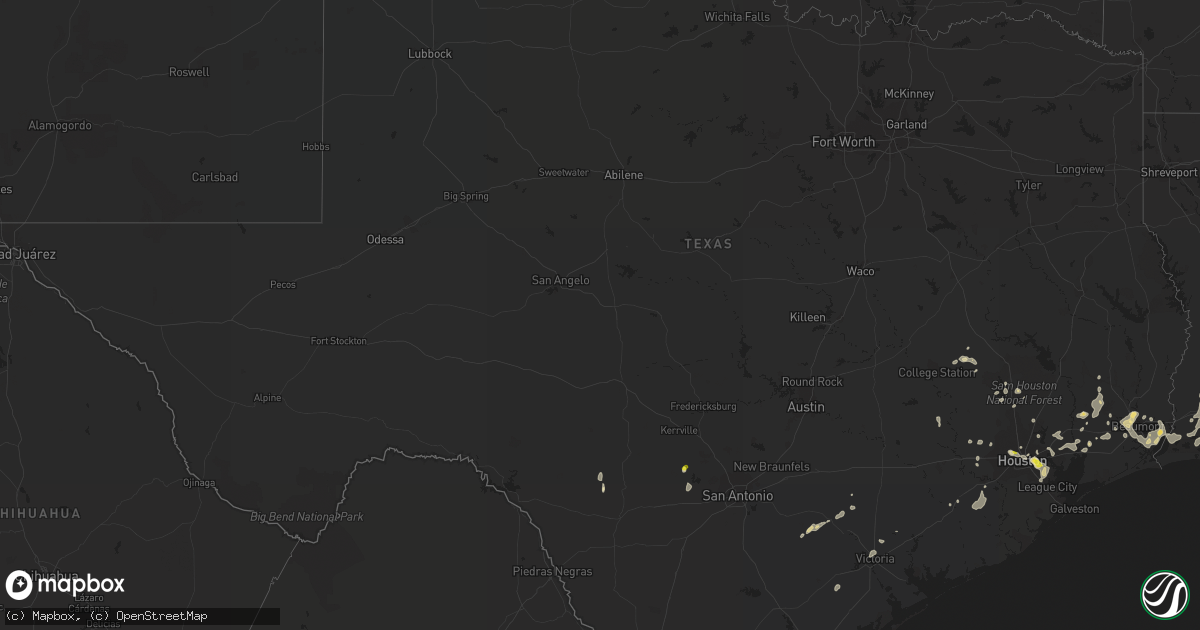
Hail Map in Texas on June 15, 2021
Get this storm
June 15 map
$229
one time, instant access
Download today. No call, no setup
Keep the $229
Bought the map and want the full workflow? Apply the entire $229 to a subscription within 7 days. None of it is wasted.
Every map, not just this one
This buys you this map. Subscription and you get every map we run, in the markets you choose from a few cities to whole states to nationwide. Plus real-time alerts the moment a storm fires.
Contact data
Name, contact info, occupancy, even credit band for addresses in the footprint. You go from where it hit to who to call.
Become the source they trust
Unlimited branding weather history reports on demand. You already have the documented answer ready for the property owner, and you are the one who showed up with it.
Property data and RoofTrace estimates
Pull up any address you have got, its value and the exact code rules for that jurisdiction, straight from One Click Code. Then RoofTrace estimates the squares, pitch, and roof value, priced the way you price.
Storm reports in Texas
Texas
| Date | Description |
|---|---|
| 06/15/20216:50 PM CDT | Mesonet station xcrb crab lake. |
| 06/15/20216:45 PM CDT | Roof of industrial building sustained significant damage due to thunderstorm wind gusts. |
| 06/15/20216:40 PM CDT | A local report indicates 1.00 inch wind near 4 NNW DEER PARK |
| 06/15/20216:27 PM CDT | Roof damage to industrial building as a result of thunderstorm wind gusts. |
| 06/15/20216:27 PM CDT | Roof damage to industrial building due to thunderstorm wind gusts. |
| 06/15/20216:26 PM CDT | Report from mping: quarter |
| 06/15/20216:07 PM CDT | Pea to quarter sized hail reported in the garden oaks/oak forest neighborhood. |
| 06/15/20216:01 PM CDT | Report from mping: quarter |
| 06/15/20216:00 PM CDT | Quarter size hail. |
| 06/15/20216:00 PM CDT | A local report indicates 1.00 inch wind near 4 ENE HILSHIRE VILLAGE |
| 06/15/20215:58 PM CDT | Report from mping: quarter |
| 06/15/20215:50 AM CDT | At 1049 PM CDT, a severe thunderstorm was located near Laguna, or 20 miles northwest of Uvalde, moving south at 15 mph. HAZARD...60 mph wind gusts and quarter size hail. SOURCE...Radar indicated. IMPACT...Hail damage to vehicles is expected. Expect wind damage to roofs, siding, and trees. Locations impacted include... Uvalde, Laguna, Reagan Wells, Montell, Cline and Uvalde Estates. |
| 06/15/20212:53 AM CDT | At 752 PM CDT, a severe thunderstorm was located near Bandera, moving southwest at 10 mph. HAZARD...60 mph wind gusts and nickel size hail. SOURCE...Radar indicated. IMPACT...Expect damage to roofs, siding, and trees. Locations impacted include... Bandera, Hill Country State Natural Area, Bandera Falls, Lakehills and Lake Medina Shores. |
| 06/15/20212:33 AM CDT | At 733 PM CDT, a severe thunderstorm was located near Bedias, or 16 miles south of Madisonville, moving west at 15 mph. HAZARD...60 mph wind gusts and quarter size hail. SOURCE...Trained weather spotters. IMPACT...Hail damage to vehicles is expected. Expect wind damage to roofs, siding, and trees. Locations impacted include... Eastern College Station, eastern Bryan, Bedias, Wixon Valley, Iola and Carlos. |
| 06/15/20212:14 AM CDT | At 714 PM CDT, a severe thunderstorm was located over Deer Park, moving southeast at 10 mph. HAZARD...60 mph wind gusts and quarter size hail. SOURCE...Radar indicated. IMPACT...Hail damage to vehicles is expected. Expect wind damage to roofs, siding, and trees. Locations impacted include... Pasadena, northern League City, southern Baytown, La Porte, Deer Park, South Houston, Seabrook, Webster, Beach City, Kemah, Clear Lake, eastern South Belt / Ellington, Nassau Bay, Taylor Lake Village, El Lago, Shoreacres, Clear Lake Shores, Morgan's Point, The Johnson Space Center and Ellington Field. |
| 06/15/20212:02 AM CDT | At 700 PM CDT, severe thunderstorms were located along a line extending from near Baytown to Crystal Beach. Movement was southwest at 30 mph. Strong outflow winds can be expected in advance of the main line of storms as well. HAZARD...60 mph wind gusts. SOURCE...Radar indicated. IMPACT...Expect damage to roofs, siding, and trees. Locations impacted include... League City, Galveston Causeway, Galveston Island West End, Texas City, southern Friendswood, Dickinson, La Marque, Santa Fe, Webster, Hitchcock, Kemah, Galveston Pier 21, Nassau Bay, Bayou Vista, Clear Lake Shores, Jamaica Beach, Tiki Island, San Leon, Scholes Field and Port Bolivar. |
| 06/15/20211:28 AM CDT | At 628 PM CDT, a severe thunderstorm was located over eastern Houston Ship Channel, or near Cloverleaf, moving southeast at 20 mph. HAZARD...60 mph wind gusts and quarter size hail. SOURCE...Radar indicated. IMPACT...Hail damage to vehicles is expected. Expect wind damage to roofs, siding, and trees. Locations impacted include... Pasadena, Baytown, La Porte, Deer Park, Seabrook, Galena Park, Jacinto City, Beach City, Kemah, Cloverleaf, Channelview, Second Ward, Highlands, Greater Fifth Ward, northern Clear Lake, Taylor Lake Village, El Lago, Shoreacres, Clear Lake Shores and Morgan's Point. |
| 06/15/202112:57 AM CDT | At 557 PM CDT, a severe thunderstorm was located over Central Northwest, or over Greater Heights, moving southeast at 10 mph. HAZARD...60 mph wind gusts and penny size hail. SOURCE...Radar indicated. IMPACT...Expect damage to roofs, siding, and trees. Locations impacted include... Bellaire, West University Place, Galena Park, Jacinto City, Hunters Creek Village, Piney Point Village, Midtown Houston, Downtown Houston, Northside / Northline, Greenway / Upper Kirby Area, Second Ward, Greater Heights, Neartown / Montrose, Greater Eastwood, Near Northside Houston, Greater Fifth Ward, Memorial Park, Greater Third Ward, Fourth Ward and University Place. |
| 06/15/202112:39 AM CDT | At 538 PM CDT, severe thunderstorms were located along a line extending from near Sour Lake to near Bevil Oaks to near Beaumont to near La Belle, moving southwest at 15 mph. HAZARD...60 mph wind gusts and quarter size hail. SOURCE...Radar indicated. IMPACT...Hail damage to vehicles is expected. Expect wind damage to roofs, siding, and trees. Locations impacted include... Beaumont, Sour Lake, Nome, Hamshire, Bevil Oaks, China and Fannett.This includes Interstate 10 in Texas between mile markers 853 and832. |
| 06/15/202112:37 AM CDT | At 536 PM CDT, a severe thunderstorm was located near Gillett, or 13 miles northwest of Yorktown, moving southwest at 25 mph. HAZARD...60 mph wind gusts and quarter size hail. SOURCE...Radar indicated. IMPACT...Hail damage to vehicles is expected. Expect wind damage to roofs, siding, and trees. Locations impacted include... Kenedy, Karnes City, Runge, Falls City, Cestohowa, Hobson, Cotton Patch, Gruenau, New Davy, Ecleto, Helena and Pana Maria. |
| 06/14/202111:48 PM CDT | At 448 PM CDT, a severe thunderstorm was located near Sabine National Wildlife, moving southwest at 20 mph. HAZARD...60 mph wind gusts and penny size hail. SOURCE...Radar indicated. IMPACT...Expect damage to roofs, siding, and trees. Locations impacted include... Cameron, Johnsons Bayou, Sabine National Wildlife, Holly Beach, Hackberry and Constance Beach. |
| 06/14/202111:29 PM CDT | At 428 PM CDT, a severe thunderstorm was located near Sabine National Wildlife, moving southwest at 20 mph. HAZARD...60 mph wind gusts and penny size hail. SOURCE...Radar indicated. IMPACT...Expect damage to roofs, siding, and trees. Locations impacted include... Sabine National Wildlife, Hackberry and Constance Beach. |
| 06/14/20217:55 PM CDT | Mostly dime to nickel sized hail with a few hailstones up to quarter sized. |
| 06/14/20217:52 PM CDT | Downed power lines due to strong winds. |
| 06/14/20217:35 PM CDT | Public reported a measured wind speed of 62 mph... With a power outage shortly after. Also noted some downed trees. |
| 06/14/20217:02 PM CDT | Weatherflow crab lake site. |
All States Impacted by Hail Map on June 15, 2021
Cities Impacted by Hail Map on June 15, 2021
- Conway, SC
- Myrtle Beach, SC
- Beaumont, TX
- Clarkson, NE
- Schuyler, NE
- Dayton, TX
- Humble, TX
- Alachua, FL
- Trenton, NC
- Pollocksville, NC
- Arthur, NE
- Charter Oak, IA
- Bandera, TX
- Tuskegee, AL
- Auburn, AL
- Hull, TX
- Wilmington, NC
- Pink Hill, NC
- Port Neches, TX
- Bridge City, TX
- Cameron, LA
- Vidor, TX
- Orange, TX
- Groves, TX
- Port Arthur, TX
- Nederland, TX
- Lumberton, TX
- Houston, TX
- Galena Park, TX
- Kings Bay, GA
- Yulee, FL
- Saint Marys, GA
- Atlantic Beach, FL
- Jacksonville, FL
- Fernandina Beach, FL
- Sour Lake, TX
- Saratoga, TX
- Batson, TX
- Kountze, TX
- Napoleonville, LA
- Labadieville, LA
- Morgan City, LA
- Kaplan, LA
- Gueydan, LA
- Bowman, SC
- Orangeburg, SC
- Santee, SC
- Panama City, FL
- Lynn Haven, FL
- Port Saint Lucie, FL
- Vance, SC
- Holly Hill, SC
- Wewahitchka, FL
- Valdosta, GA
- Guyton, GA
- Lake City, FL
- Grand Chenier, LA
- Creole, LA
- Dequincy, LA
- Elloree, SC
- Bristol, FL
- Shiner, TX
- Gainesville, FL
- Camp Wood, TX
- Uvalde, TX
- Yoakum, TX
- Brooker, FL
- Crawfordville, FL
- Warren, TX
- Folly Beach, SC
- Simla, CO
- Agate, CO
- Fountain, FL
- Blountstown, FL
- Youngstown, FL
- Clarksville, FL
- Shelton, NE
- Ellabell, GA
- Brooklet, GA
- Raton, NM
- Willis, TX
- Conroe, TX
- Baytown, TX
- Liberty, TX
- Eglin Afb, FL
- Galivants Ferry, SC
- Gresham, SC
- Montgomery, TX
- Live Oak, FL
- Fleming Island, FL
- Anahuac, TX
- Wallisville, TX
- Hankamer, TX
- Saint Martinville, LA
- Grosse Tete, LA
- Donaldsonville, LA
- Belle Rose, LA
- Saint James, LA
- Engelhard, NC
- Pamplico, SC
- Greenville, FL
- Inez, TX
- Victoria, TX
- Saint Matthews, SC
- Cameron, SC
- Charleston, SC
- White Springs, FL
- McAlpin, FL
- O'Brien, FL
- Raiford, FL
- Lawtey, FL
- Moscow, ID
- Sopchoppy, FL
- Hosford, FL
- Abbeville, LA
- Milton, FL
- Rocky Point, NC
- Center Tuftonboro, NH
- Ossipee, NH
- Wolfeboro, NH
- Mirror Lake, NH
- Moultonborough, NH
- East Wakefield, NH
- Sanbornville, NH
- Rincon, GA
- Notasulga, AL
- Crosby, TX
- Edna, TX
- Whiteville, NC
- Summerton, SC
- Iola, TX
- Gillett, TX
- Yorktown, TX
- West Newbury, MA
- Haverhill, MA
- Winnabow, NC
- Pine Ridge, SD
- Schleswig, IA
- Green Pond, SC
- Brenham, TX
- Chappell Hill, TX
- Fort Walton Beach, FL
- Mary Esther, FL
- Effingham, SC
- Smiley, TX
- Westhoff, TX
- Pasadena, TX
- Hackberry, LA
- Richmond, TX
- Gibbon, NE
- Starke, FL
- Lake Butler, FL
- Oriental, NC
- Merritt, NC
- Cuero, TX
- Lulu, FL
- Richlands, NC
- Chacon, NM
- Sulphur, LA
- Madison, FL
- San Diego, TX
- Hurlburt Field, FL
- Bedias, TX
- Bellwood, NE
- Devers, TX
- Salisbury, MA
- Newburyport, MA
- Pensacola, FL
- Waldo, FL
- Hawthorne, FL
- Earleton, FL
- Pawleys Island, SC
- Theodore, AL
- Irvington, AL
- Walterboro, SC
- Isle Of Palms, SC
- Mount Pleasant, SC
- Folsom, NM
- Bayboro, NC
- Saucier, MS
- Tallahassee, FL
- Monticello, FL
- Saint Marks, FL
- Cross, SC
- Lee, FL
- Hyannis, NE
- Santa Rosa Beach, FL
- China, TX
- Ridgeville, SC
- Defuniak Springs, FL
- Fort Benton, MT
- Deer Park, TX
- West Newfield, ME
- La Porte, TX
- Webster, TX
- Friendswood, TX
- Micanopy, FL
- Dorchester, SC
- Summerville, SC
- Harleyville, SC
- David City, NE
- Columbia, NC
- Bolivia, NC
- Cypress, TX
- Crowley, LA
- Morse, LA
- Estherwood, LA
- Vernon, FL
- Ponce De Leon, FL
- Ebro, FL
- Amesbury, MA
- Swansboro, NC
- Newport, NC
- Okatie, SC
- Hardeeville, SC
- Elberta, AL
- Freeport, FL
- De Soto, GA
- Ruffin, SC
- Green Cove Springs, FL
- Saint George, GA
- Pinopolis, SC
- Niceville, FL
- Baker, LA
- Baton Rouge, LA
- Katy, TX
- Mico, TX
- Hondo, TX
- McClellanville, SC
- Awendaw, SC
- Rogers, NE
- North Charleston, SC
- Johns Island, SC
- Ravenel, SC
- Gulfport, MS
- Guy, TX
- Boling, TX
- Needville, TX
- Wharton, TX
- Santo Domingo Pueblo, NM
- Convent, LA
- Darrow, LA
- Plattenville, LA
- Sorrento, LA
- Gonzales, LA
- Fort White, FL
- Fairfield, NC
- Lovell, ME
- Stoneham, ME
- Navarre, FL
- Goliad, TX
- Havelock, NC
- Wellborn, FL
- Quitman, GA
- Stella, NC
- Lamont, FL
- Coden, AL
- Mobile, AL
- Bayou La Batre, AL
- Grand Bay, AL
- Fulshear, TX
- Highlands, TX
- Hampstead, NC
- Cobb, GA
- Leslie, GA
- Libby, MT
- Pooler, GA
- Port Wentworth, GA
- Edisto Island, SC
- Jamestown, SC
- Bonneau, SC
- Cordesville, SC
- Moncks Corner, SC
- Huger, SC
- Brookshire, TX
- Waller, TX
- Palatka, FL
- Hockley, TX
- Hollywood, SC
- Lillian, AL
- Porter, TX
- New Caney, TX
- Maurice, LA
- Malvern, IA
- Capulin, NM
- Karnes City, TX
- Ecleto, TX
- Richards, TX
- Kinston, NC
- Mount Olive, NC
- Albertson, NC
- Center Harbor, NH
- Mora, NM
- Wood River, NE
- New Bern, NC
- Bluffton, SC
- Carolina Beach, NC
- Ocate, NM
- Panacea, FL
- Lake Park, GA
- Jennings, FL
- Welsh, LA
- Panama City Beach, FL
- Bell City, LA
- Lake Charles, LA
- Iowa, LA
- Middleburg, FL
- Hampton, FL
- Archer, FL
- Newberry, FL
- Newbury, MA
- Bryceville, FL
- Jacksonville Beach, FL
- Neptune Beach, FL
- Sullivans Island, SC
- Ong, NE
- Edgar, NE
- Meredith, NH
- New Hampton, NH
- Maysville, NC


