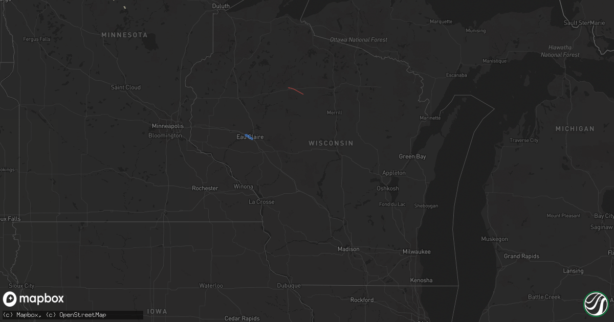
Hail Map in Wisconsin on June 14, 2019
Get this storm
June 14 map
$229
one time, instant access
Download today. No call, no setup
Keep the $229
Bought the map and want the full workflow? Apply the entire $229 to a subscription within 7 days. None of it is wasted.
Every map, not just this one
This buys you this map. Subscription and you get every map we run, in the markets you choose from a few cities to whole states to nationwide. Plus real-time alerts the moment a storm fires.
Contact data
Name, contact info, occupancy, even credit band for addresses in the footprint. You go from where it hit to who to call.
Become the source they trust
Unlimited branding weather history reports on demand. You already have the documented answer ready for the property owner, and you are the one who showed up with it.
Property data and RoofTrace estimates
Pull up any address you have got, its value and the exact code rules for that jurisdiction, straight from One Click Code. Then RoofTrace estimates the squares, pitch, and roof value, priced the way you price.
Storm reports in Wisconsin
Wisconsin
| Date | Description |
|---|---|
| 06/14/20196:54 PM CDT | Start point of kennan/ogema tornado. Time estimated from radar. |
| 06/14/20196:20 PM CDT | Trees & light poles down on chippewa valley technical college campus. Photos via twitter. Time estimated via radar. |
| 06/14/20196:15 PM CDT | Tree branches down... Picture via facebook. |
| 06/14/20196:15 PM CDT | Medium to large tree branches down on uw-eau claire campus. Pictures via twitter. |
| 06/14/20195:50 PM CDT | Tree branches down... Photo via twitter. |
| 06/14/20192:17 AM CDT | At 717 PM CDT, a severe thunderstorm was located 7 miles northwest of Plum City, or 15 miles northeast of Red Wing, moving southeast at 25 mph. HAZARD...60 mph wind gusts and quarter size hail. SOURCE...Radar indicated. IMPACT...Hail damage to vehicles is expected. Expect wind damage to roofs, siding, and trees. Locations impacted include... Plum City and El Paso. |
| 06/14/20192:02 AM CDT | At 701 PM CDT, a severe thunderstorm was located near Strum, or 15 miles east of Mondovi, moving southeast at 25 mph. HAZARD...60 mph wind gusts and quarter size hail. SOURCE...Radar indicated. IMPACT...Hail damage to vehicles is expected. Expect wind damage to roofs, siding, and trees. This severe thunderstorm will be near... Osseo around 715 PM CDT.Other locations impacted by this severe thunderstorm include Hixton,York, I 94 Exit 98, North Branch, I 94 Exit 105, Hixton Alma Center KO A and Eleva. |
| 06/14/20191:57 AM CDT | At 657 PM CDT, a severe thunderstorm was located near Strum, or 12 miles northeast of Mondovi, moving southeast at 20 mph. HAZARD...Ping pong ball size hail and 60 mph wind gusts. SOURCE...Radar indicated. IMPACT...People and animals outdoors will be injured. Expect hail damage to roofs, siding, windows, and vehicles. Expect wind damage to roofs, siding, and trees. Locations impacted include... Foster and Allen. This includes Interstate 94 in Wisconsin between mile markers 80 and86. |
| 06/14/20191:29 AM CDT | At 629 PM CDT, a severe thunderstorm was located over Augusta, or 22 miles northeast of Whitehall, moving southeast at 25 mph. HAZARD...60 mph wind gusts and quarter size hail. SOURCE...Radar indicated. IMPACT...Hail damage to vehicles is expected. Expect wind damage to roofs, siding, and trees. This severe thunderstorm will be near... Price around 640 PM CDT. Fairchild around 650 PM CDT. Humbird around 655 PM CDT.Other locations impacted by this severe thunderstorm include WildcatMound, Highway 10 And 12, Highway 10 And Bald Peak Road, Alma Center,Levis, Requa and Merrillan. |
| 06/14/20191:25 AM CDT | At 624 PM CDT, a severe thunderstorm was located near Augusta, or 20 miles southeast of Eau Claire, moving southeast at 25 mph. HAZARD...60 mph wind gusts and quarter size hail. SOURCE...Radar indicated. IMPACT...Hail damage to vehicles is expected. Expect wind damage to roofs, siding, and trees. Locations impacted include... Augusta and Fairchild. |
| 06/13/20197:36 PM CDT | End point for kennan/ogema tornado. Time estimated from radar. |
| 06/13/20197:35 PM CDT | Damage to overhead doors on outbuilding. Pushed a shed off foundation and removed shingles. Rolled tractor onto its side. Time estimated from radar. |
| 06/13/20197:34 PM CDT | Softwood tree and several branches broken. Time estimated from radar. |
| 06/13/20197:11 PM CDT | Shingles blown off roof and trees down. Time estimated from radar. This report corrects previous thunderstorm wind damage report from 1 s catawba. |
| 06/13/20197:09 PM CDT | Chicken coop flipped over and tin roof blown off shed. Time estimated from radar. This report corrects previous thunderstorm wind damage report from 1 wsw catawba. |
| 06/13/20197:09 PM CDT | Tornado damage: shingles blown off roof and trees down. Radar estimated time. |
| 06/13/20197:09 PM CDT | Tornado damage: chicken coop flipped over and tin roof blown off of shed. Radar estimated time. |
| 06/13/20197:02 PM CDT | Several hardwood tree branches broken. Time estimated from radar. |
All States Impacted by Hail Map on June 14, 2019
Cities Impacted by Hail Map on June 14, 2019
- Floydada, TX
- Matador, TX
- Floweree, MT
- Satanta, KS
- Harvard, NE
- Colby, KS
- Valier, MT
- Dutton, MT
- Geyser, MT
- Power, MT
- Brady, MT
- Highwood, MT
- Carter, MT
- Conrad, MT
- Minneapolis, KS
- Shepherd, MT
- Deer Creek, OK
- Medford, OK
- Monument, KS
- Levant, KS
- Plains, KS
- Ong, NE
- Superior, NE
- Hardy, NE
- Winnett, MT
- Newkirk, OK
- Geneva, NE
- McCool Junction, NE
- Pine River, MN
- Richfield, KS
- Guide Rock, NE
- Mott, ND
- New Leipzig, ND
- Lawrence, NE
- Alpine, TX
- Scandia, KS
- Hackensack, MN
- Sublette, KS
- Blue Hill, NE
- Ohiowa, NE
- Cut Bank, MT
- Geraldine, MT
- Henderson, NE
- Aurora, NE
- Braman, OK
- Nardin, OK
- Saronville, NE
- Grafton, NE
- Shickley, NE
- Fairmont, NE
- Sutton, NE
- Roaring Springs, TX
- York, NE
- Granada, CO
- Walsh, CO
- Fort Davis, TX
- Weskan, KS
- Sharon Springs, KS
- Roundup, MT
- Grover, CO
- Manchester, OK
- Terry, MT
- Rush, CO
- Browning, MT
- Kadoka, SD
- Tribune, KS
- Two Buttes, CO
- Lead, SD
- Burlington, OK
- Jet, OK
- Wakita, OK
- New Salem, ND
- Exeter, NE
- Cordova, NE
- Friend, NE
- Courtland, KS
- Republic, KS
- Culbertson, NE
- Fort Stockton, TX
- Calhan, CO
- Yoder, CO
- Hemingford, NE
- Sheridan Lake, CO
- Webber, KS
- Ryder, ND
- Leoti, KS
- Lamont, OK
- Fairchild, WI
- Mankato, KS
- Hebron, ND
- Elkhart, KS
- Moscow, KS
- Grass Range, MT
- North Loup, NE
- Ashton, NE
- Hugo, CO
- Nelson, NE
- Edgar, NE
- Holly, CO
- Angora, NE
- Johnson, KS
- Montezuma, KS
- Waco, NE
- Lamar, CO
- Fort Benton, MT
- Great Falls, MT
- Bridgeport, NE
- Kismet, KS
- Zortman, MT
- Rexford, KS
- Edgemont, SD
- Bison, SD
- Beaver Crossing, NE
- Las Animas, CO
- Syracuse, KS
- Garrison, ND
- Roseglen, ND
- Parshall, ND
- Backus, MN
- Blackwell, OK
- Newell, SD
- Norris, SD
- Red Cloud, NE
- Byers, CO
- Deer Trail, CO
- Utica, NE
- Seward, NE
- Custer, SD
- Ramah, CO
- Valentine, NE
- New Town, ND
- Marathon, TX
- Wellington, CO
- Marmarth, ND
- Rhame, ND
- Ponca City, OK
- Miltonvale, KS
- Clay Center, KS
- Littlefield, TX
- Fieldton, TX
- Olton, TX
- Hale Center, TX
- Goehner, NE
- Davenport, NE
- Belt, MT
- Eau Claire, WI
- Altoona, WI
- Ogema, WI
- Kennan, WI
- Catawba, WI
- Cimarron, KS
- Ingalls, KS
- Holcomb, KS
- Garden City, KS
- Jetmore, KS
- Wallace, KS
- Marienthal, KS
- Scott City, KS
- Winona, KS
- Mulvane, KS
- Spearville, KS
- Protection, KS
- Arlington, KS
- Minneola, KS
- Valley Center, KS
- Freeport, KS
- Attica, KS
- Anthony, KS
- Harper, KS
- Andale, KS
- Caldwell, KS
- Dodge City, KS
- Wichita, KS
- Conway Springs, KS
- Sharon, KS
- Sedgwick, KS
- Wilmore, KS
- Haviland, KS
- Nashville, KS
- Haven, KS
- Bucklin, KS
- Mayfield, KS
- Murdock, KS
- Peck, KS
- Cunningham, KS
- Colwich, KS
- Bluff City, KS
- Wright, KS
- Zenda, KS
- Kingman, KS
- Sun City, KS
- Isabel, KS
- Milan, KS
- Clearwater, KS
- Ford, KS
- Waldron, KS
- Spivey, KS
- Pretty Prairie, KS
- Iuka, KS
- Cheney, KS
- Medicine Lodge, KS
- Viola, KS
- Argonia, KS
- Greensburg, KS
- Norwich, KS
- Garden Plain, KS
- Haysville, KS
- Wellington, KS
- Lake City, KS
- Sawyer, KS
- Hazelton, KS
- Mullinville, KS
- Derby, KS
- Danville, KS
- Coats, KS
- Kechi, KS
- Coldwater, KS
- Milton, KS
- Pratt, KS
- Goddard, KS
- Mount Hope, KS
- Maize, KS
- Mcconnell Afb, KS
- Belle Plaine, KS
- Turon, KS
- Little River, KS
- Hutchinson, KS
- Nickerson, KS
- Inman, KS
- Mcpherson, KS
- Sterling, KS
- Lyons, KS
- Windom, KS
- Buhler, KS


