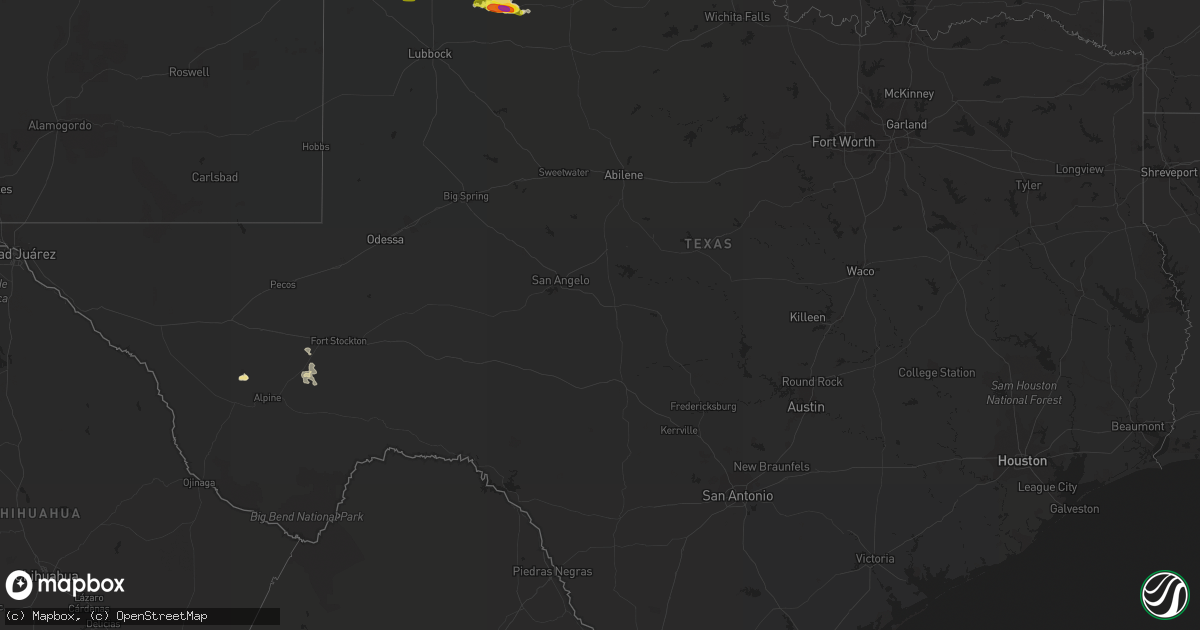
Hail Map in Texas on June 14, 2019
Get this storm
June 14 map
$229
one time, instant access
Download today. No call, no setup
Keep the $229
Bought the map and want the full workflow? Apply the entire $229 to a subscription within 7 days. None of it is wasted.
Every map, not just this one
This buys you this map. Subscription and you get every map we run, in the markets you choose from a few cities to whole states to nationwide. Plus real-time alerts the moment a storm fires.
Contact data
Name, contact info, occupancy, even credit band for addresses in the footprint. You go from where it hit to who to call.
Become the source they trust
Unlimited branding weather history reports on demand. You already have the documented answer ready for the property owner, and you are the one who showed up with it.
Property data and RoofTrace estimates
Pull up any address you have got, its value and the exact code rules for that jurisdiction, straight from One Click Code. Then RoofTrace estimates the squares, pitch, and roof value, priced the way you price.
Storm reports in Texas
Texas
| Date | Description |
|---|---|
| 06/14/20196:38 AM CDT | At 1137 PM CDT, a severe thunderstorm was located over Grow, or 12 miles south of Paducah, moving east at 35 mph. HAZARD...60 mph wind gusts and quarter size hail. SOURCE...Radar indicated. IMPACT...Hail damage to vehicles is expected. Expect wind damage to roofs, siding, and trees. Locations impacted include... Finney, Grow, Delwin and Chalk. |
| 06/14/20194:39 AM CDT | At 939 PM CDT, a severe thunderstorm was located over Dougherty, or 14 miles east of Floydada, moving east at 20 mph. HAZARD...Ping pong ball size hail and 60 mph wind gusts. SOURCE...Radar indicated. IMPACT...People and animals outdoors will be injured. Expect hail damage to roofs, siding, windows, and vehicles. Expect wind damage to roofs, siding, and trees. Locations impacted include... Matador, Dougherty and Roaring Springs. |
| 06/14/20192:24 AM CDT | At 724 PM CDT, a severe thunderstorm was located 6 miles south of Halfway, or 8 miles west of Hale Center, moving east at 25 mph. HAZARD...70 mph wind gusts and quarter size hail. SOURCE...Radar indicated. IMPACT...Hail damage to vehicles is expected. Expect considerable tree damage. Wind damage is also likely to mobile homes, roofs, and outbuildings. Locations impacted include... Plainview, Hale Center, Cotton Center, Halfway and Seth Ward. |
| 06/14/20191:35 AM CDT | At 635 PM CDT, a severe thunderstorm was located 23 miles north of Marathon, or 29 miles northeast of Alpine, moving east at 15 mph. HAZARD...60 mph wind gusts and quarter size hail. SOURCE...Radar indicated. IMPACT...Hail damage to vehicles is expected. Expect wind damage to roofs, siding, and trees. Locations impacted include... Sierra Madera. |
| 06/14/20191:27 AM CDT | At 626 PM CDT, a severe thunderstorm was located 6 miles north of Amherst, or 9 miles south of Earth, moving northeast at 20 mph. HAZARD...70 mph wind gusts and quarter size hail. SOURCE...Radar indicated. IMPACT...Hail damage to vehicles is expected. Expect considerable tree damage. Wind damage is also likely to mobile homes, roofs, and outbuildings. Locations impacted include... Olton, Fieldton and Springlake. |
| 06/13/201911:28 PM CDT | At 428 PM CDT, a severe thunderstorm was located 19 miles west of Fort Stockton, and is nearly stationary. HAZARD...60 mph wind gusts and quarter size hail. SOURCE...Radar indicated. IMPACT...Hail damage to vehicles is expected. Expect wind damage to roofs, siding, and trees. Locations impacted include... Firestone Test Track.This includes Interstate 10 between mile markers 245 and 256. |
| 06/13/20199:46 PM CDT | A local report indicates 66 MPH wind near PERSIMMON GAP |
| 06/13/20198:15 PM CDT | Report shared via facebook |
All States Impacted by Hail Map on June 14, 2019
Cities Impacted by Hail Map on June 14, 2019
- Floydada, TX
- Matador, TX
- Floweree, MT
- Satanta, KS
- Harvard, NE
- Colby, KS
- Valier, MT
- Dutton, MT
- Geyser, MT
- Power, MT
- Brady, MT
- Highwood, MT
- Carter, MT
- Conrad, MT
- Minneapolis, KS
- Shepherd, MT
- Deer Creek, OK
- Medford, OK
- Monument, KS
- Levant, KS
- Plains, KS
- Ong, NE
- Superior, NE
- Hardy, NE
- Winnett, MT
- Newkirk, OK
- Geneva, NE
- McCool Junction, NE
- Pine River, MN
- Richfield, KS
- Guide Rock, NE
- Mott, ND
- New Leipzig, ND
- Lawrence, NE
- Alpine, TX
- Scandia, KS
- Hackensack, MN
- Sublette, KS
- Blue Hill, NE
- Ohiowa, NE
- Cut Bank, MT
- Geraldine, MT
- Henderson, NE
- Aurora, NE
- Braman, OK
- Nardin, OK
- Saronville, NE
- Grafton, NE
- Shickley, NE
- Fairmont, NE
- Sutton, NE
- Roaring Springs, TX
- York, NE
- Granada, CO
- Walsh, CO
- Fort Davis, TX
- Weskan, KS
- Sharon Springs, KS
- Roundup, MT
- Grover, CO
- Manchester, OK
- Terry, MT
- Rush, CO
- Browning, MT
- Kadoka, SD
- Tribune, KS
- Two Buttes, CO
- Lead, SD
- Burlington, OK
- Jet, OK
- Wakita, OK
- New Salem, ND
- Exeter, NE
- Cordova, NE
- Friend, NE
- Courtland, KS
- Republic, KS
- Culbertson, NE
- Fort Stockton, TX
- Calhan, CO
- Yoder, CO
- Hemingford, NE
- Sheridan Lake, CO
- Webber, KS
- Ryder, ND
- Leoti, KS
- Lamont, OK
- Fairchild, WI
- Mankato, KS
- Hebron, ND
- Elkhart, KS
- Moscow, KS
- Grass Range, MT
- North Loup, NE
- Ashton, NE
- Hugo, CO
- Nelson, NE
- Edgar, NE
- Holly, CO
- Angora, NE
- Johnson, KS
- Montezuma, KS
- Waco, NE
- Lamar, CO
- Fort Benton, MT
- Great Falls, MT
- Bridgeport, NE
- Kismet, KS
- Zortman, MT
- Rexford, KS
- Edgemont, SD
- Bison, SD
- Beaver Crossing, NE
- Las Animas, CO
- Syracuse, KS
- Garrison, ND
- Roseglen, ND
- Parshall, ND
- Backus, MN
- Blackwell, OK
- Newell, SD
- Norris, SD
- Red Cloud, NE
- Byers, CO
- Deer Trail, CO
- Utica, NE
- Seward, NE
- Custer, SD
- Ramah, CO
- Valentine, NE
- New Town, ND
- Marathon, TX
- Wellington, CO
- Marmarth, ND
- Rhame, ND
- Ponca City, OK
- Miltonvale, KS
- Clay Center, KS
- Littlefield, TX
- Fieldton, TX
- Olton, TX
- Hale Center, TX
- Goehner, NE
- Davenport, NE
- Belt, MT
- Eau Claire, WI
- Altoona, WI
- Ogema, WI
- Kennan, WI
- Catawba, WI
- Cimarron, KS
- Ingalls, KS
- Holcomb, KS
- Garden City, KS
- Jetmore, KS
- Wallace, KS
- Marienthal, KS
- Scott City, KS
- Winona, KS
- Mulvane, KS
- Spearville, KS
- Protection, KS
- Arlington, KS
- Minneola, KS
- Valley Center, KS
- Freeport, KS
- Attica, KS
- Anthony, KS
- Harper, KS
- Andale, KS
- Caldwell, KS
- Dodge City, KS
- Wichita, KS
- Conway Springs, KS
- Sharon, KS
- Sedgwick, KS
- Wilmore, KS
- Haviland, KS
- Nashville, KS
- Haven, KS
- Bucklin, KS
- Mayfield, KS
- Murdock, KS
- Peck, KS
- Cunningham, KS
- Colwich, KS
- Bluff City, KS
- Wright, KS
- Zenda, KS
- Kingman, KS
- Sun City, KS
- Isabel, KS
- Milan, KS
- Clearwater, KS
- Ford, KS
- Waldron, KS
- Spivey, KS
- Pretty Prairie, KS
- Iuka, KS
- Cheney, KS
- Medicine Lodge, KS
- Viola, KS
- Argonia, KS
- Greensburg, KS
- Norwich, KS
- Garden Plain, KS
- Haysville, KS
- Wellington, KS
- Lake City, KS
- Sawyer, KS
- Hazelton, KS
- Mullinville, KS
- Derby, KS
- Danville, KS
- Coats, KS
- Kechi, KS
- Coldwater, KS
- Milton, KS
- Pratt, KS
- Goddard, KS
- Mount Hope, KS
- Maize, KS
- Mcconnell Afb, KS
- Belle Plaine, KS
- Turon, KS
- Little River, KS
- Hutchinson, KS
- Nickerson, KS
- Inman, KS
- Mcpherson, KS
- Sterling, KS
- Lyons, KS
- Windom, KS
- Buhler, KS


