Hail Map in Texas on June 13, 2012
Get this storm
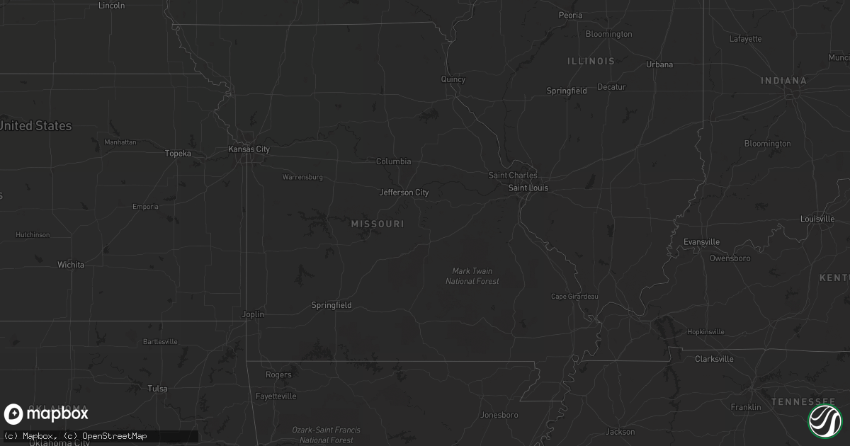
June 13 map
$229
one time, instant access
Download today. No call, no setup
Keep the $229
Bought the map and want the full workflow? Apply the entire $229 to a subscription within 7 days. None of it is wasted.
Every map, not just this one
This buys you this map. Subscription and you get every map we run, in the markets you choose from a few cities to whole states to nationwide. Plus real-time alerts the moment a storm fires.
Contact data
Name, contact info, occupancy, even credit band for addresses in the footprint. You go from where it hit to who to call.
Become the source they trust
Unlimited branding weather history reports on demand. You already have the documented answer ready for the property owner, and you are the one who showed up with it.
Property data and RoofTrace estimates
Pull up any address you have got, its value and the exact code rules for that jurisdiction, straight from One Click Code. Then RoofTrace estimates the squares, pitch, and roof value, priced the way you price.
Storm reports in Texas
Texas
| Date | Description |
|---|---|
| 06/13/20126:51 PM CDT | I30 @ jim miller rd |
| 06/13/20126:45 PM CDT | I30 @ samuels |
| 06/13/20126:45 PM CDT | E of white rock lake |
| 06/13/20126:40 PM CDT | Golfball hail in uptown dallas |
| 06/13/20126:36 PM CDT | Hwy 114 @ hwy 121 |
| 06/13/20126:29 PM CDT | Hwy 75 @ walnut hill |
| 06/13/20126:25 PM CDT | Hwy 75 @ forest |
| 06/13/20126:24 PM CDT | A local report indicates 1.00 inch wind near HIGHLAND PARK |
| 06/13/20126:23 PM CDT | Continuous golfball hail falling 2 ne university park |
| 06/13/20126:23 PM CDT | Damage at northpark center due to hail. Skylights were broken. |
| 06/13/20126:21 PM CDT | Extreme swern richardson |
| 06/13/20126:17 PM CDT | Hwy 75 @ forest |
| 06/13/20126:14 PM CDT | Quarter size hail at coit and banner |
| 06/13/20126:08 PM CDT | Hwy 75 @ forest |
| 06/13/20125:52 PM CDT | Golfball hail at trinity mills/dallas north tollway |
| 06/13/20125:50 PM CDT | 1mi sw of plano |
| 06/13/201212:18 PM CDT | Portions of a metal roof peeled back on the trinity community center. |
| 06/13/20124:15 AM CDT | Quarter to golfball size hail reported near whitehouse. |
| 06/13/20124:15 AM CDT | Half dollar size hail reported 3 miles east of the houston county airport along highway 7. |
| 06/13/20123:30 AM CDT | Half dollar size hail reported 3 miles east of the houston county airport along highway 7. |
| 06/13/20123:30 AM CDT | Half dollar size hail reported 3 miles east of the houston county airport along highway 7. |
| 06/13/20122:20 AM CDT | Trees downed in pollok near hwy 69 and hwy 7. Glass was also broken out of a school in pollok. |
| 06/13/201212:05 AM CDT | Jasper county sheriff reports multiple trees down near steinhagen lake along county road 150. |
| 06/12/20129:30 PM CDT | Windows were broken and vehicles dented from golfball sized hail in marathon. |
| 06/12/20128:57 PM CDT | Ping pong ball size hail 3 miles south of midlothian. |
| 06/12/20128:52 PM CDT | Baseball hail at hwy 67 and 9th street in midlothian |
| 06/12/20128:42 PM CDT | Golfball hail highway 287...3 miles east of highway 67. |
| 06/12/20128:38 PM CDT | Slightly larger than quarters in midlothian |
| 06/12/20128:34 PM CDT | Hail to 3.25 inches in parker. |
| 06/12/20128:19 PM CDT | Softball hail and trees/shrubs down in leonard |
| 06/12/20128:08 PM CDT | 2-inch hail in duncanville |
| 06/12/20128:08 PM CDT | Winds toppled 3 mobile homes near the town of randolph. There were 3 injuries of unknown severity at this time. |
| 06/12/20128:03 PM CDT | Quarter hail at hwy 380 and new hope road |
| 06/12/20127:53 PM CDT | At joe pool lake. |
| 06/12/20127:52 PM CDT | Intersection of i-20 and robinson rd. Windshields broken. Lowering of cloud base and aprnt slight rotation. |
| 06/12/20127:47 PM CDT | A local report indicates 1.75 inch wind near GRAND PRAIRIE |
| 06/12/20127:47 PM CDT | Belt line rd @ warrior |
| 06/12/20127:47 PM CDT | Reported at northpark mall. |
| 06/12/20127:40 PM CDT | Lockheed martin fire control facility on marshall drive. |
| 06/12/20127:36 PM CDT | Broken car windows and heavy tree damage in lakewood |
| 06/12/20127:26 PM CDT | A local report indicates 2.50 inch wind near IRVING |
| 06/12/20127:20 PM CDT | Winds estimated at 55mph. Heavy rain. Intersection of carrier blvd and jefferson. |
| 06/12/20127:07 PM CDT | @ irving eoc |
| 06/12/20127:06 PM CDT | Walnut hill @ beltline |
| 06/12/20127:05 PM CDT | Tennis ball to baseball size hail on esters road in irving. Lasted about 5 minutes. |
| 06/12/20127:05 PM CDT | Buckner blvd @ bruton rd |
All States Impacted by Hail Map on June 13, 2012
Cities Impacted by Hail Map on June 13, 2012
- Burkeville, TX
- Marathon, TX
- Fort Davis, TX
- Alpine, TX
- Fort McCoy, FL
- Hawthorne, FL
- Citra, FL
- Gregory, SD
- Whitehouse, TX
- Mabank, TX
- Miller, SD
- Wolsey, SD
- Wessington Springs, SD
- Virgil, SD
- Wessington, SD
- Saint Lawrence, SD
- Gann Valley, SD
- Grand Cane, LA
- Logansport, LA
- Mansfield, LA
- Mohall, ND
- Center, ND
- Frederick, SD
- Verona, ND
- Lamoure, ND
- Mckinney, TX
- Irving, TX
- Fort Worth, TX
- Grand Prairie, TX
- Dallas, TX
- Midlothian, TX
- Duncanville, TX
- Cedar Hill, TX
- Arlington, TX
- Herman, MN
- Barrett, MN
- Elbow Lake, MN
- Anderson, SC
- Ector, TX
- Wolfe City, TX
- Leonard, TX
- Randolph, TX
- Celeste, TX
- Greenville, TX
- Bonham, TX
- Whitewright, TX
- Savoy, TX
- Trenton, TX
- Robeline, LA
- Marthaville, LA
- Elgin, ND
- New Leipzig, ND
- Noonan, ND
- Wildrose, ND
- Mcgregor, ND
- Crosby, ND
- Litchville, ND
- Valentine, TX
- Balmorhea, TX
- Lidgerwood, ND
- Sherwood, ND
- Wylie, TX
- Allen, TX
- Plano, TX
- Shreveport, LA
- Bethany, LA
- Sachse, TX
- Princeton, TX
- Melissa, TX
- Reeves, LA
- Ragley, LA
- Nebo, NC
- Marion, NC
- Glen Ullin, ND
- Grey Eagle, MN
- Harrison, SD
- Platte, SD
- Westport, SD
- Bunnell, FL
- Starr, SC
- Belton, SC
- Bronson, FL
- Morriston, FL
- Hamill, SD
- Raiford, FL
- Lawtey, FL
- Blairsville, GA
- Saltillo, TX
- Winnsboro, TX
- Mount Vernon, TX
- Deridder, LA
- Paris, TX
- Eden Valley, MN
- Richmond, MN
- Paynesville, MN
- Cold Spring, MN
- Riverdale, GA
- Stanton, ND
- Fortuna, ND
- Ambrose, ND
- Malakoff, TX
- Athens, TX
- Berlin, ND
- Marion, ND
- Dickey, ND
- Edgeley, ND
- Bonifay, FL
- Mott, ND
- Columbia, SD
- Aberdeen, SD
- Ipswich, SD
- Livingston, TX
- Chester, TX
- Woodville, TX
- Richardson, TX
- Portal, ND
- Mount Pleasant, TX
- Boyceville, WI
- Wheeler, WI
- Ridgeland, WI
- Brady, TX
- Peever, SD
- Sulphur Bluff, TX
- Talco, TX
- Columbus, ND
- Troup, TX
- Tyler, TX
- Bullard, TX
- Hecla, SD
- McCook, NE
- Indianola, NE
- Groveland, FL
- New Smyrna Beach, FL
- Veblen, SD
- Britton, SD
- Sauk Centre, MN
- Melrose, MN
- Saint Francis, MN
- Isanti, MN
- Cambridge, MN
- Flint, TX
- Mandan, ND
- Kenmare, ND
- Westhope, ND
- Tolley, ND
- Antler, ND
- Barnard, SD
- San Augustine, TX
- Broaddus, TX
- Florien, LA
- Many, LA
- Rotan, TX
- Centreville, MS
- Hartwell, GA
- Beulah, ND
- Golden Valley, ND
- Zap, ND
- Atwood, KS
- Lowry, MN
- Villard, MN
- Alexandria, MN
- Osakis, MN
- Glenwood, MN
- White Lake, SD
- Armour, SD
- Kimball, SD
- Pukwana, SD
- Corsica, SD
- Geddes, SD
- Kinder, LA
- Chamberlain, SD
- Lake Creek, TX
- Crescent City, FL
- Georgetown, FL
- Bronson, TX
- Lignite, ND
- Oakes, ND
- Mims, FL
- Titusville, FL
- Hartsville, SC
- Atlanta, GA
- Monroeville, AL
- Pierson, FL
- Green Cove Springs, FL
- Elkton, FL
- Saint Augustine, FL
- Palatka, FL
- Stanchfield, MN
- Braham, MN
- Elwood, NE
- Central, SC
- Kensington, MN
- Farwell, MN
- Cashiers, NC
- Highlands, NC
- Wheaton, MN
- Rosholt, SD
- Forman, ND
- Fort Ransom, ND
- Lisbon, ND
- Gwinner, ND
- Alexandria, LA
- Pineville, LA
- Gladstone, ND
- Paisley, FL
- Browns Valley, MN
- Dazey, ND
- Scranton, SC
- Hebron, ND
- Richardton, ND
- Spicer, MN
- New London, MN
- Atwater, MN
- Roscoe, MN
- Crawfordville, FL
- Sopchoppy, FL
- Colmesneil, TX
- Warren, TX
- Wishek, ND
- Anacoco, LA
- Longville, LA
- Leesville, LA
- Ralph, SD
- Lemmon, SD
- Hettinger, ND
- Lodgepole, SD
- Kulm, ND
- Poplar, MT
- Nesmith, SC
- Andrews, SC
- Leola, SD
- Okeechobee, FL
- Grenville, NM
- Pearson, GA
- Axson, GA
- Homerville, GA
- Pollock, LA
- Bentley, LA
- Dodge, ND
- New Salem, ND
- Carson, ND
- Almont, ND
- Freeport, MN
- Belgrade, MN
- Albany, MN
- Elrosa, MN
- Brooten, MN
- Cooper, TX
- Pattonville, TX
- Deport, TX
- Bedford, TX
- Euless, TX
- Cayuga, ND
- Rush City, MN
- Harris, MN
- Milnor, ND
- Jud, ND
- Lufkin, TX
- Lower Brule, SD
- Manning, ND
- La Salle, TX
- Edna, TX
- Stanley, ND
- Jasper, TX
- Smithfield, NE
- Acme, LA
- Rochelle, TX
- Deer Park, WI
- Amery, WI
- Reva, SD
- Havana, ND
- Crockett, TX
- Sisseton, SD
- Marksville, LA
- Lovelady, TX
- Ludlow, SD
- Grapeland, TX
- Kennard, TX
- Larue, TX
- Fredonia, ND
- Hinsdale, MT
- Taylor, ND
- Halliday, ND
- Grasston, MN
- Greeleyville, SC
- Palermo, ND
- Plaza, ND
- Souris, ND
- Graceville, MN
- Beardsley, MN
- Forest Park, GA
- Hazen, ND
- Oacoma, SD
- Kirbyville, TX
- Brooker, FL
- Yale, SD
- Carpenter, SD
- Flaxton, ND
- Elloree, SC
- Hull, IA
- Weston, CO
- Trinidad, CO
- Boncarbo, CO
- Sanford, FL
- Huron, SD
- Cogswell, ND
- Pollok, TX
- Houghton, SD
- Henderson, TX
- Garland, TX
- Addison, TX
- Ray, ND
- Oberlin, LA
- Liberty, SC
- Pendleton, SC
- Tennessee Colony, TX
- Conway, SC
- Wimbledon, ND
- Rogers, ND
- Avon, MN
- Grove City, MN
- Saint Martin, MN
- Grantsburg, WI
- Pine City, MN
- Hurst, TX
- Effingham, SC
- Prairie City, SD
- Seville, FL
- Ashley, ND
- Hampton, GA
- Elizabeth, CO
- Elbert, CO
- Williamston, SC
- Pelzer, SC
- Battle Lake, MN
- Charleston, SC
- North Charleston, SC
- Oxford, FL
- Marion, SC
- Sellers, SC
- Deltona, FL
- Sturgeon Lake, MN
- Mcgregor, MN
- Osceola, WI
- Somerset, WI
- Star Prairie, WI
- New Richmond, WI
- Inwood, IA
- Red Oak, TX
- Evans, LA
- Rutland, ND
- McBee, SC
- Bishopville, SC
- Price, TX
- Kathryn, ND
- Claremont, SD
- Roscoe, SD
- Dresser, WI
- Centuria, WI
- Saint Croix Falls, WI
- Bowbells, ND
- Wolf Point, MT
- Balsam Lake, WI
- Dunn Center, ND
- Florence, SC
- Jonesboro, GA
- Dallas, WI
- Chetek, WI
- Hemphill, TX
- Alamo, ND
- Luck, WI
- Southlake, TX
- Grapevine, TX
- Society Hill, SC
- Cheraw, SC
- Trinity, TX
- Glen Saint Mary, FL
- Washburn, ND
- Hosford, FL
- Alpena, SD
- Deland, FL
- Mora, MN
- Ogilvie, MN
- Anna, TX
- Sapphire, NC
- Vero Beach, FL
- Zahl, ND
- San Mateo, FL
- Pomona Park, FL
- Satsuma, FL
- East Palatka, FL
- Morganton, NC
- Flasher, ND
- Carrabelle, FL
- Charleston Afb, SC
- Hanahan, SC
- Enderlin, ND
- Nome, ND
- Millen, GA
- Repton, AL
- Pelican, LA
- Cooperstown, ND
- Astor, FL
- Altoona, FL
- Killdeer, ND
- Seneca, SC
- Ellendale, ND
- Ladonia, TX
- Williston, FL
- Johns Island, SC
- Summerville, SC
- Lohn, TX
- Natchitoches, LA
- Fort Thompson, SD
- Hitchcock, SD
- Hoffman, MN
- Barry, MN
- Altha, FL
- Alvord, IA
- Ross, ND
- Powers Lake, ND
- Six Mile, SC
- Wendell, MN
- Bowman, ND
- Wyndmere, ND
- Bemidji, MN
- Bison, SD
- Sulphur Springs, TX
- Fergus Falls, MN
- Campbell, MN
- Mead, OK
- Greenwood, LA
- Humphrey, NE
- Glenmora, LA
- Claire City, SD
- Lake City, SD
- Capitan, NM
- Henriette, MN
- Brook Park, MN
- Eustis, NE
- Pecos, TX
- Rembert, SC
- Merryville, LA
- Kaplan, LA
- Tivoli, TX
- Norwood, LA
- Clayton, WI
- Linton, ND
- Burtrum, MN
- Evansville, MN
- Brandon, MN
- Morris, MN
- Long Prairie, MN
- Horace, ND
- Eustace, TX
- Saint Joseph, MN
- Pineland, TX
- Piedmont, SC
- Hinckley, MN
- Finlayson, MN
- Sandstone, MN
- Roberts, WI
- Hammond, WI
- Montpelier, ND
- Hiawassee, GA
- Selfridge, ND
- Bushnell, FL
- Hankinson, ND
- Braddock, ND
- Prairie Farm, WI
- Crystal River, FL
- Woonsocket, SD
- Chandler, TX
- Siren, WI
- Webster, WI
- Townville, SC
- Milltown, WI
- Willow River, MN
- Geneva, FL
- Barney, ND
- Welsh, LA
- Jamestown, ND
- Lake City, SC
- Holdingford, MN
- Bowlus, MN
- Hutchins, TX
- Hammond, MT
- Waxahachie, TX


