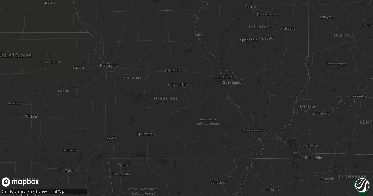
Hail Map in South Carolina on June 13, 2012
Get this storm
June 13 map
$229
one time, instant access
Download today. No call, no setup
Keep the $229
Bought the map and want the full workflow? Apply the entire $229 to a subscription within 7 days. None of it is wasted.
Every map, not just this one
This buys you this map. Subscription and you get every map we run, in the markets you choose from a few cities to whole states to nationwide. Plus real-time alerts the moment a storm fires.
Contact data
Name, contact info, occupancy, even credit band for addresses in the footprint. You go from where it hit to who to call.
Become the source they trust
Unlimited branding weather history reports on demand. You already have the documented answer ready for the property owner, and you are the one who showed up with it.
Property data and RoofTrace estimates
Pull up any address you have got, its value and the exact code rules for that jurisdiction, straight from One Click Code. Then RoofTrace estimates the squares, pitch, and roof value, priced the way you price.
Storm reports in South Carolina
South Carolina
| Date | Description |
|---|---|
| 06/13/20125:59 PM CDT | Public reported one tree down in saint stephen. Time estimated by radar. |
| 06/13/20125:50 PM CDT | Large trees down. |
| 06/13/20125:42 PM CDT | Sheriff reported several trees down just east of branchville on several roads. |
| 06/13/20125:40 PM CDT | 5 large trees across roadway. 2 other trees fell on 2 houses.. One person was trapped in vehicle by fallen power lines. 2 out buildings sustained a small to moderate am |
| 06/13/20125:28 PM CDT | Dispatch reported trees down in bowman. |
| 06/13/20124:58 PM CDT | Highway patrol reported a couple of trees down on old river road blocking the highway near the west end of the state park. |
| 06/13/20124:32 PM CDT | Publics reported a couple of trees down on mccords ferry road. |
| 06/13/20123:59 PM CDT | Public reports large limbs and powerlines down just southwest of ashland. Power still out. Dime to nickel size hail also reported. |
| 06/13/20123:49 PM CDT | Public reported nickel to quarter size hail from moree road to funderburk road along with estimated 40 to 50 mph winds. |
| 06/13/20123:46 PM CDT | Highway patrol reported a couple of trees down on congaree road below mcentire ang. |
| 06/13/20123:11 PM CDT | One tree down along belvedere road and main road. Time estimated by radar. |
| 06/13/20122:51 PM CDT | Ten large trees down and fence damage near woodland road and wayne scott court. Time estimated by radar. |
| 06/13/20122:51 PM CDT | One tree down along the intersection of castlereagh road and dogwood road. Time estimated by radar. |
| 06/13/20122:37 PM CDT | Public reported quarter size hail near mile marker 209 on interstate 26. |
| 06/13/20122:32 PM CDT | Severeal small trees down along crown pointe street. Time estimated by radar. |
| 06/13/20126:11 AM CDT | Three power poles snapped along sc hwy 81 near travis road. |
| 06/13/20125:46 AM CDT | A local report indicates 1.00 inch wind near 4 S ANDERSON |
| 06/13/20125:46 AM CDT | Large limbs blown down. |
| 06/13/20125:30 AM CDT | A small tree split in half by wind. Large branches down. Pea to dime size hail. |
| 06/13/20125:30 AM CDT | A local report indicates 1.00 inch wind near 5 NW ANDERSON |
| 06/13/20125:30 AM CDT | Trees down on dixon and dunn road. |
| 06/13/20124:54 AM CDT | Tree in the roadway near the intersection of sauer farm road and paige road. |
| 06/13/20124:51 AM CDT | Multiple trees blown down across cobbs glen country club golf course. |
| 06/13/20124:10 AM CDT | Tree in roadway at hardwood road and palmetto road. |
| 06/13/20124:10 AM CDT | Tree in roadway near the intersection of bryant road and whipporwill lane. Time determined by radar. |
| 06/13/20124:08 AM CDT | Tree in roadway at bryant road and river road. |
All States Impacted by Hail Map on June 13, 2012
Cities Impacted by Hail Map on June 13, 2012
- Burkeville, TX
- Marathon, TX
- Fort Davis, TX
- Alpine, TX
- Fort McCoy, FL
- Hawthorne, FL
- Citra, FL
- Gregory, SD
- Whitehouse, TX
- Mabank, TX
- Miller, SD
- Wolsey, SD
- Wessington Springs, SD
- Virgil, SD
- Wessington, SD
- Saint Lawrence, SD
- Gann Valley, SD
- Grand Cane, LA
- Logansport, LA
- Mansfield, LA
- Mohall, ND
- Center, ND
- Frederick, SD
- Verona, ND
- Lamoure, ND
- Mckinney, TX
- Irving, TX
- Fort Worth, TX
- Grand Prairie, TX
- Dallas, TX
- Midlothian, TX
- Duncanville, TX
- Cedar Hill, TX
- Arlington, TX
- Herman, MN
- Barrett, MN
- Elbow Lake, MN
- Anderson, SC
- Ector, TX
- Wolfe City, TX
- Leonard, TX
- Randolph, TX
- Celeste, TX
- Greenville, TX
- Bonham, TX
- Whitewright, TX
- Savoy, TX
- Trenton, TX
- Robeline, LA
- Marthaville, LA
- Elgin, ND
- New Leipzig, ND
- Noonan, ND
- Wildrose, ND
- Mcgregor, ND
- Crosby, ND
- Litchville, ND
- Valentine, TX
- Balmorhea, TX
- Lidgerwood, ND
- Sherwood, ND
- Wylie, TX
- Allen, TX
- Plano, TX
- Shreveport, LA
- Bethany, LA
- Sachse, TX
- Princeton, TX
- Melissa, TX
- Reeves, LA
- Ragley, LA
- Nebo, NC
- Marion, NC
- Glen Ullin, ND
- Grey Eagle, MN
- Harrison, SD
- Platte, SD
- Westport, SD
- Bunnell, FL
- Starr, SC
- Belton, SC
- Bronson, FL
- Morriston, FL
- Hamill, SD
- Raiford, FL
- Lawtey, FL
- Blairsville, GA
- Saltillo, TX
- Winnsboro, TX
- Mount Vernon, TX
- Deridder, LA
- Paris, TX
- Eden Valley, MN
- Richmond, MN
- Paynesville, MN
- Cold Spring, MN
- Riverdale, GA
- Stanton, ND
- Fortuna, ND
- Ambrose, ND
- Malakoff, TX
- Athens, TX
- Berlin, ND
- Marion, ND
- Dickey, ND
- Edgeley, ND
- Bonifay, FL
- Mott, ND
- Columbia, SD
- Aberdeen, SD
- Ipswich, SD
- Livingston, TX
- Chester, TX
- Woodville, TX
- Richardson, TX
- Portal, ND
- Mount Pleasant, TX
- Boyceville, WI
- Wheeler, WI
- Ridgeland, WI
- Brady, TX
- Peever, SD
- Sulphur Bluff, TX
- Talco, TX
- Columbus, ND
- Troup, TX
- Tyler, TX
- Bullard, TX
- Hecla, SD
- McCook, NE
- Indianola, NE
- Groveland, FL
- New Smyrna Beach, FL
- Veblen, SD
- Britton, SD
- Sauk Centre, MN
- Melrose, MN
- Saint Francis, MN
- Isanti, MN
- Cambridge, MN
- Flint, TX
- Mandan, ND
- Kenmare, ND
- Westhope, ND
- Tolley, ND
- Antler, ND
- Barnard, SD
- San Augustine, TX
- Broaddus, TX
- Florien, LA
- Many, LA
- Rotan, TX
- Centreville, MS
- Hartwell, GA
- Beulah, ND
- Golden Valley, ND
- Zap, ND
- Atwood, KS
- Lowry, MN
- Villard, MN
- Alexandria, MN
- Osakis, MN
- Glenwood, MN
- White Lake, SD
- Armour, SD
- Kimball, SD
- Pukwana, SD
- Corsica, SD
- Geddes, SD
- Kinder, LA
- Chamberlain, SD
- Lake Creek, TX
- Crescent City, FL
- Georgetown, FL
- Bronson, TX
- Lignite, ND
- Oakes, ND
- Mims, FL
- Titusville, FL
- Hartsville, SC
- Atlanta, GA
- Monroeville, AL
- Pierson, FL
- Green Cove Springs, FL
- Elkton, FL
- Saint Augustine, FL
- Palatka, FL
- Stanchfield, MN
- Braham, MN
- Elwood, NE
- Central, SC
- Kensington, MN
- Farwell, MN
- Cashiers, NC
- Highlands, NC
- Wheaton, MN
- Rosholt, SD
- Forman, ND
- Fort Ransom, ND
- Lisbon, ND
- Gwinner, ND
- Alexandria, LA
- Pineville, LA
- Gladstone, ND
- Paisley, FL
- Browns Valley, MN
- Dazey, ND
- Scranton, SC
- Hebron, ND
- Richardton, ND
- Spicer, MN
- New London, MN
- Atwater, MN
- Roscoe, MN
- Crawfordville, FL
- Sopchoppy, FL
- Colmesneil, TX
- Warren, TX
- Wishek, ND
- Anacoco, LA
- Longville, LA
- Leesville, LA
- Ralph, SD
- Lemmon, SD
- Hettinger, ND
- Lodgepole, SD
- Kulm, ND
- Poplar, MT
- Nesmith, SC
- Andrews, SC
- Leola, SD
- Okeechobee, FL
- Grenville, NM
- Pearson, GA
- Axson, GA
- Homerville, GA
- Pollock, LA
- Bentley, LA
- Dodge, ND
- New Salem, ND
- Carson, ND
- Almont, ND
- Freeport, MN
- Belgrade, MN
- Albany, MN
- Elrosa, MN
- Brooten, MN
- Cooper, TX
- Pattonville, TX
- Deport, TX
- Bedford, TX
- Euless, TX
- Cayuga, ND
- Rush City, MN
- Harris, MN
- Milnor, ND
- Jud, ND
- Lufkin, TX
- Lower Brule, SD
- Manning, ND
- La Salle, TX
- Edna, TX
- Stanley, ND
- Jasper, TX
- Smithfield, NE
- Acme, LA
- Rochelle, TX
- Deer Park, WI
- Amery, WI
- Reva, SD
- Havana, ND
- Crockett, TX
- Sisseton, SD
- Marksville, LA
- Lovelady, TX
- Ludlow, SD
- Grapeland, TX
- Kennard, TX
- Larue, TX
- Fredonia, ND
- Hinsdale, MT
- Taylor, ND
- Halliday, ND
- Grasston, MN
- Greeleyville, SC
- Palermo, ND
- Plaza, ND
- Souris, ND
- Graceville, MN
- Beardsley, MN
- Forest Park, GA
- Hazen, ND
- Oacoma, SD
- Kirbyville, TX
- Brooker, FL
- Yale, SD
- Carpenter, SD
- Flaxton, ND
- Elloree, SC
- Hull, IA
- Weston, CO
- Trinidad, CO
- Boncarbo, CO
- Sanford, FL
- Huron, SD
- Cogswell, ND
- Pollok, TX
- Houghton, SD
- Henderson, TX
- Garland, TX
- Addison, TX
- Ray, ND
- Oberlin, LA
- Liberty, SC
- Pendleton, SC
- Tennessee Colony, TX
- Conway, SC
- Wimbledon, ND
- Rogers, ND
- Avon, MN
- Grove City, MN
- Saint Martin, MN
- Grantsburg, WI
- Pine City, MN
- Hurst, TX
- Effingham, SC
- Prairie City, SD
- Seville, FL
- Ashley, ND
- Hampton, GA
- Elizabeth, CO
- Elbert, CO
- Williamston, SC
- Pelzer, SC
- Battle Lake, MN
- Charleston, SC
- North Charleston, SC
- Oxford, FL
- Marion, SC
- Sellers, SC
- Deltona, FL
- Sturgeon Lake, MN
- Mcgregor, MN
- Osceola, WI
- Somerset, WI
- Star Prairie, WI
- New Richmond, WI
- Inwood, IA
- Red Oak, TX
- Evans, LA
- Rutland, ND
- McBee, SC
- Bishopville, SC
- Price, TX
- Kathryn, ND
- Claremont, SD
- Roscoe, SD
- Dresser, WI
- Centuria, WI
- Saint Croix Falls, WI
- Bowbells, ND
- Wolf Point, MT
- Balsam Lake, WI
- Dunn Center, ND
- Florence, SC
- Jonesboro, GA
- Dallas, WI
- Chetek, WI
- Hemphill, TX
- Alamo, ND
- Luck, WI
- Southlake, TX
- Grapevine, TX
- Society Hill, SC
- Cheraw, SC
- Trinity, TX
- Glen Saint Mary, FL
- Washburn, ND
- Hosford, FL
- Alpena, SD
- Deland, FL
- Mora, MN
- Ogilvie, MN
- Anna, TX
- Sapphire, NC
- Vero Beach, FL
- Zahl, ND
- San Mateo, FL
- Pomona Park, FL
- Satsuma, FL
- East Palatka, FL
- Morganton, NC
- Flasher, ND
- Carrabelle, FL
- Charleston Afb, SC
- Hanahan, SC
- Enderlin, ND
- Nome, ND
- Millen, GA
- Repton, AL
- Pelican, LA
- Cooperstown, ND
- Astor, FL
- Altoona, FL
- Killdeer, ND
- Seneca, SC
- Ellendale, ND
- Ladonia, TX
- Williston, FL
- Johns Island, SC
- Summerville, SC
- Lohn, TX
- Natchitoches, LA
- Fort Thompson, SD
- Hitchcock, SD
- Hoffman, MN
- Barry, MN
- Altha, FL
- Alvord, IA
- Ross, ND
- Powers Lake, ND
- Six Mile, SC
- Wendell, MN
- Bowman, ND
- Wyndmere, ND
- Bemidji, MN
- Bison, SD
- Sulphur Springs, TX
- Fergus Falls, MN
- Campbell, MN
- Mead, OK
- Greenwood, LA
- Humphrey, NE
- Glenmora, LA
- Claire City, SD
- Lake City, SD
- Capitan, NM
- Henriette, MN
- Brook Park, MN
- Eustis, NE
- Pecos, TX
- Rembert, SC
- Merryville, LA
- Kaplan, LA
- Tivoli, TX
- Norwood, LA
- Clayton, WI
- Linton, ND
- Burtrum, MN
- Evansville, MN
- Brandon, MN
- Morris, MN
- Long Prairie, MN
- Horace, ND
- Eustace, TX
- Saint Joseph, MN
- Pineland, TX
- Piedmont, SC
- Hinckley, MN
- Finlayson, MN
- Sandstone, MN
- Roberts, WI
- Hammond, WI
- Montpelier, ND
- Hiawassee, GA
- Selfridge, ND
- Bushnell, FL
- Hankinson, ND
- Braddock, ND
- Prairie Farm, WI
- Crystal River, FL
- Woonsocket, SD
- Chandler, TX
- Siren, WI
- Webster, WI
- Townville, SC
- Milltown, WI
- Willow River, MN
- Geneva, FL
- Barney, ND
- Welsh, LA
- Jamestown, ND
- Lake City, SC
- Holdingford, MN
- Bowlus, MN
- Hutchins, TX
- Hammond, MT
- Waxahachie, TX


