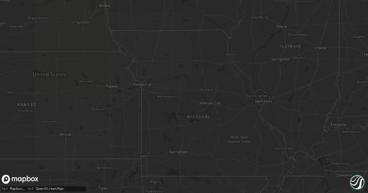
Hail Map on June 13, 2012
Get this storm
June 13 map
$229
one time, instant access
Download today. No call, no setup
Keep the $229
Bought the map and want the full workflow? Apply the entire $229 to a subscription within 7 days. None of it is wasted.
Every map, not just this one
This buys you this map. Subscription and you get every map we run, in the markets you choose from a few cities to whole states to nationwide. Plus real-time alerts the moment a storm fires.
Contact data
Name, contact info, occupancy, even credit band for addresses in the footprint. You go from where it hit to who to call.
Become the source they trust
Unlimited branding weather history reports on demand. You already have the documented answer ready for the property owner, and you are the one who showed up with it.
Property data and RoofTrace estimates
Pull up any address you have got, its value and the exact code rules for that jurisdiction, straight from One Click Code. Then RoofTrace estimates the squares, pitch, and roof value, priced the way you price.
States Impacted by Hail Map on June 13, 2012
Storm reports
North Carolina
| Date | Description |
|---|---|
| 06/12/20128:45 PM CDT | Multiple trees and power lines down. |
| 06/12/20128:39 PM CDT | Quarter size hail reported near nebo. |
Kansas
| Date | Description |
|---|---|
| 06/13/20126:19 PM CDT | A local report indicates 1.00 inch wind near ATWOOD |
South Carolina
| Date | Description |
|---|---|
| 06/13/20125:59 PM CDT | Public reported one tree down in saint stephen. Time estimated by radar. |
| 06/13/20125:50 PM CDT | Large trees down. |
| 06/13/20125:42 PM CDT | Sheriff reported several trees down just east of branchville on several roads. |
| 06/13/20125:40 PM CDT | 5 large trees across roadway. 2 other trees fell on 2 houses.. One person was trapped in vehicle by fallen power lines. 2 out buildings sustained a small to moderate am |
| 06/13/20125:28 PM CDT | Dispatch reported trees down in bowman. |
| 06/13/20124:58 PM CDT | Highway patrol reported a couple of trees down on old river road blocking the highway near the west end of the state park. |
| 06/13/20124:32 PM CDT | Publics reported a couple of trees down on mccords ferry road. |
| 06/13/20123:59 PM CDT | Public reports large limbs and powerlines down just southwest of ashland. Power still out. Dime to nickel size hail also reported. |
| 06/13/20123:49 PM CDT | Public reported nickel to quarter size hail from moree road to funderburk road along with estimated 40 to 50 mph winds. |
| 06/13/20123:46 PM CDT | Highway patrol reported a couple of trees down on congaree road below mcentire ang. |
| 06/13/20123:11 PM CDT | One tree down along belvedere road and main road. Time estimated by radar. |
| 06/13/20122:51 PM CDT | Ten large trees down and fence damage near woodland road and wayne scott court. Time estimated by radar. |
| 06/13/20122:51 PM CDT | One tree down along the intersection of castlereagh road and dogwood road. Time estimated by radar. |
| 06/13/20122:37 PM CDT | Public reported quarter size hail near mile marker 209 on interstate 26. |
| 06/13/20122:32 PM CDT | Severeal small trees down along crown pointe street. Time estimated by radar. |
| 06/13/20126:11 AM CDT | Three power poles snapped along sc hwy 81 near travis road. |
| 06/13/20125:46 AM CDT | Large limbs blown down. |
| 06/13/20125:46 AM CDT | A local report indicates 1.00 inch wind near 4 S ANDERSON |
| 06/13/20125:30 AM CDT | Trees down on dixon and dunn road. |
| 06/13/20125:30 AM CDT | A small tree split in half by wind. Large branches down. Pea to dime size hail. |
| 06/13/20125:30 AM CDT | A local report indicates 1.00 inch wind near 5 NW ANDERSON |
| 06/13/20124:54 AM CDT | Tree in the roadway near the intersection of sauer farm road and paige road. |
| 06/13/20124:51 AM CDT | Multiple trees blown down across cobbs glen country club golf course. |
| 06/13/20124:10 AM CDT | Tree in roadway near the intersection of bryant road and whipporwill lane. Time determined by radar. |
| 06/13/20124:10 AM CDT | Tree in roadway at hardwood road and palmetto road. |
| 06/13/20124:08 AM CDT | Tree in roadway at bryant road and river road. |
Florida
| Date | Description |
|---|---|
| 06/13/20126:55 PM CDT | Large tree limb fell on a house and a small fiberglass boat was overturned by winds estimated at 40 to 50 mph by two spotters in the st johns park area. |
| 06/13/20126:02 PM CDT | Large tree down on highway 20 at gordon chapel road |
| 06/13/20125:15 PM CDT | Estimated quarter sized hail near the intersection of county roads 326 and 337. |
| 06/12/20128:00 PM CDT | A small tree was reported down at walnut avenue and forest park street west of bunnell. |
South Dakota
| Date | Description |
|---|---|
| 06/13/20126:55 PM CDT | A local report indicates 60 MPH wind near 9 SW WESSINGTON |
| 06/13/20126:45 PM CDT | Resident reported golf ball sized hail |
| 06/13/20126:30 PM CDT | A local report indicates 1.75 inch wind near 19 WNW WESSINGTON SPRIN |
| 06/13/20126:30 PM CDT | Resident called local sheriffs office with report of golf ball sized hail which was relayed to nws |
| 06/13/20126:27 PM CDT | Volunteer firefighter reported 70 mph wind gusts with golf ball sized hail |
| 06/13/20126:20 PM CDT | A local report indicates 1.75 inch wind near 8 NNE GANN VALLEY |
| 06/13/20125:55 PM CDT | A local report indicates 1.75 inch wind near 9 SW OACOMA |
| 06/13/20125:47 PM CDT | Resident reported a few golf ball sized hail stones |
| 06/12/20129:45 PM CDT | Quarter sized hail and 50 to 60 mph winds. |
| 06/12/20129:35 PM CDT | A local report indicates 1.75 inch wind near 4 W HARRISON |
| 06/12/20129:30 PM CDT | Hail lasted until about 950 pm. Only 0.17 inch rainfall. |
| 06/12/20129:25 PM CDT | A local report indicates 1.75 inch wind near 4 W HARRISON |
| 06/12/20129:20 PM CDT | Estimated 40-50 mph winds |
| 06/12/20129:15 PM CDT | A local report indicates 2.75 inch wind near 7 W HARRISON |
| 06/12/20129:02 PM CDT | A local report indicates 1.00 inch wind near 7 NNE PLATTE |
| 06/12/20129:02 PM CDT | A local report indicates 1.00 inch wind near 7 ENE PLATTE |
| 06/12/20128:37 PM CDT | A local report indicates 1.00 inch wind near 7 N LODGEPOLE |
| 06/12/20128:31 PM CDT | A local report indicates 1.75 inch wind near 7 N PLATTE |
| 06/12/20128:20 PM CDT | A local report indicates 3.00 inch wind near 10 S KIMBALL |
| 06/12/20127:50 PM CDT | Hail lasted less than a minute. |
| 06/12/20127:26 PM CDT | A local report indicates 1.75 inch wind near 2 NW BROADLAND |
| 06/12/20127:15 PM CDT | A local report indicates 1.00 inch wind near 16 SSW WESSINGTON |
| 06/12/20127:15 PM CDT | A local report indicates 1.00 inch wind near 9 WSW KIMBALL |
| 06/12/20127:05 PM CDT | A local report indicates 1.75 inch wind near SSE WOLSEY |
| 06/12/20127:03 PM CDT | A local report indicates 1.00 inch wind near 6 S WOLSEY |
North Dakota
| Date | Description |
|---|---|
| 06/13/20125:03 PM CDT | Most hail was dime sized with some quarter sized hail that covered the ground. |
| 06/13/20125:05 AM CDT | A few dime to quarter sized hail and brief but very strong winds. |
| 06/12/201211:32 PM CDT | A local report indicates 65 MPH wind near 7 NW BISMARCK |
| 06/12/201211:21 PM CDT | A local report indicates 60 MPH wind near BISMARCK |
| 06/12/201211:20 PM CDT | Heavy rain and pea size hail. |
| 06/12/201211:18 PM CDT | Bismarck airport. |
| 06/12/201211:14 PM CDT | A local report indicates 65 MPH wind near 7 NNW BISMARCK |
| 06/12/20129:25 PM CDT | Hailed off and on for 20 minutes. |
| 06/12/20128:55 PM CDT | A local report indicates 1.00 inch wind near 5 S SHERWOOD |
| 06/12/20127:55 PM CDT | Nickel to ping pong ball size hail. On going during call. |
| 06/12/20127:35 PM CDT | Brief heavy hail then rain. |
| 06/12/20127:16 PM CDT | Ping pong to golfball size hail. Some car and home damage from hail. |
Georgia
| Date | Description |
|---|---|
| 06/13/20125:42 PM CDT | Public reported up to quarter sized hail covering the ground near pine top road. |
| 06/13/20126:28 AM CDT | Multiple trees down across watsadler campground. |
| 06/12/20127:45 PM CDT | Trained spotter reported quarter sized hail near smyrna. |
| 06/12/20127:30 PM CDT | 911 center reports numerous trees and powerlines down across the county including trees and lines down along thornhedge dr. |
| 06/12/20127:25 PM CDT | Security detail at the southern regional medical center reported quarter sized hail at the facility. |
Louisiana
| Date | Description |
|---|---|
| 06/13/201212:30 AM CDT | Tree downed north of town. |
| 06/12/20129:39 PM CDT | Trees down in shreveport |
| 06/12/20129:20 PM CDT | Power lines down 15 miles sw of florien. South toledo bend reservoir |
| 06/12/20127:45 PM CDT | Bearegard electric company reports trees down on birch drive in new llano |
| 06/12/20127:41 PM CDT | Trees down in marthaville. |
| 06/12/20127:31 PM CDT | Allen parish sheriff reports quarter size hail in reeves and multiple power outages. |
| 06/12/20127:22 PM CDT | Public reports 1.5 inch hail in deridder |
| 06/12/20127:19 PM CDT | Bearegard electric company reports trees down on park road in deridder. Time estimated by radar. |
| 06/12/20127:13 PM CDT | Beauregard sheriff reported golfball size hail in deridder as well as numerous power outages |
Nebraska
| Date | Description |
|---|---|
| 06/12/20128:12 PM CDT | Mostly golf ball sized hail |
| 06/12/20128:05 PM CDT | Golf ball size hail reported in town. Hail lasted for approximately 10 minutes and ended at 815 pm. |
| 06/12/20128:05 PM CDT | Hail varied in size mostly dime sized with quarter sized hail mixed in. |
Texas
| Date | Description |
|---|---|
| 06/13/20126:51 PM CDT | I30 @ jim miller rd |
| 06/13/20126:45 PM CDT | I30 @ samuels |
| 06/13/20126:45 PM CDT | E of white rock lake |
| 06/13/20126:40 PM CDT | Golfball hail in uptown dallas |
| 06/13/20126:36 PM CDT | Hwy 114 @ hwy 121 |
| 06/13/20126:29 PM CDT | Hwy 75 @ walnut hill |
| 06/13/20126:25 PM CDT | Hwy 75 @ forest |
| 06/13/20126:24 PM CDT | A local report indicates 1.00 inch wind near HIGHLAND PARK |
| 06/13/20126:23 PM CDT | Continuous golfball hail falling 2 ne university park |
| 06/13/20126:23 PM CDT | Damage at northpark center due to hail. Skylights were broken. |
| 06/13/20126:21 PM CDT | Extreme swern richardson |
| 06/13/20126:17 PM CDT | Hwy 75 @ forest |
| 06/13/20126:14 PM CDT | Quarter size hail at coit and banner |
| 06/13/20126:08 PM CDT | Hwy 75 @ forest |
| 06/13/20125:52 PM CDT | Golfball hail at trinity mills/dallas north tollway |
| 06/13/20125:50 PM CDT | 1mi sw of plano |
| 06/13/201212:18 PM CDT | Portions of a metal roof peeled back on the trinity community center. |
| 06/13/20124:15 AM CDT | Quarter to golfball size hail reported near whitehouse. |
| 06/13/20124:15 AM CDT | Half dollar size hail reported 3 miles east of the houston county airport along highway 7. |
| 06/13/20123:30 AM CDT | Half dollar size hail reported 3 miles east of the houston county airport along highway 7. |
| 06/13/20123:30 AM CDT | Half dollar size hail reported 3 miles east of the houston county airport along highway 7. |
| 06/13/20122:20 AM CDT | Trees downed in pollok near hwy 69 and hwy 7. Glass was also broken out of a school in pollok. |
| 06/13/201212:05 AM CDT | Jasper county sheriff reports multiple trees down near steinhagen lake along county road 150. |
| 06/12/20129:30 PM CDT | Windows were broken and vehicles dented from golfball sized hail in marathon. |
| 06/12/20128:57 PM CDT | Ping pong ball size hail 3 miles south of midlothian. |
| 06/12/20128:52 PM CDT | Baseball hail at hwy 67 and 9th street in midlothian |
| 06/12/20128:42 PM CDT | Golfball hail highway 287...3 miles east of highway 67. |
| 06/12/20128:38 PM CDT | Slightly larger than quarters in midlothian |
| 06/12/20128:34 PM CDT | Hail to 3.25 inches in parker. |
| 06/12/20128:19 PM CDT | Softball hail and trees/shrubs down in leonard |
| 06/12/20128:08 PM CDT | Winds toppled 3 mobile homes near the town of randolph. There were 3 injuries of unknown severity at this time. |
| 06/12/20128:08 PM CDT | 2-inch hail in duncanville |
| 06/12/20128:03 PM CDT | Quarter hail at hwy 380 and new hope road |
| 06/12/20127:53 PM CDT | At joe pool lake. |
| 06/12/20127:52 PM CDT | Intersection of i-20 and robinson rd. Windshields broken. Lowering of cloud base and aprnt slight rotation. |
| 06/12/20127:47 PM CDT | A local report indicates 1.75 inch wind near GRAND PRAIRIE |
| 06/12/20127:47 PM CDT | Reported at northpark mall. |
| 06/12/20127:47 PM CDT | Belt line rd @ warrior |
| 06/12/20127:40 PM CDT | Lockheed martin fire control facility on marshall drive. |
| 06/12/20127:36 PM CDT | Broken car windows and heavy tree damage in lakewood |
| 06/12/20127:26 PM CDT | A local report indicates 2.50 inch wind near IRVING |
| 06/12/20127:20 PM CDT | Winds estimated at 55mph. Heavy rain. Intersection of carrier blvd and jefferson. |
| 06/12/20127:07 PM CDT | @ irving eoc |
| 06/12/20127:06 PM CDT | Walnut hill @ beltline |
| 06/12/20127:05 PM CDT | Tennis ball to baseball size hail on esters road in irving. Lasted about 5 minutes. |
| 06/12/20127:05 PM CDT | Buckner blvd @ bruton rd |
Cities Impacted by Hail Map on June 13, 2012
- Burkeville, TX
- Marathon, TX
- Fort Davis, TX
- Alpine, TX
- Fort McCoy, FL
- Hawthorne, FL
- Citra, FL
- Gregory, SD
- Whitehouse, TX
- Mabank, TX
- Miller, SD
- Wolsey, SD
- Wessington Springs, SD
- Virgil, SD
- Wessington, SD
- Saint Lawrence, SD
- Gann Valley, SD
- Grand Cane, LA
- Logansport, LA
- Mansfield, LA
- Mohall, ND
- Center, ND
- Frederick, SD
- Verona, ND
- Lamoure, ND
- Mckinney, TX
- Irving, TX
- Fort Worth, TX
- Grand Prairie, TX
- Dallas, TX
- Midlothian, TX
- Duncanville, TX
- Cedar Hill, TX
- Arlington, TX
- Herman, MN
- Barrett, MN
- Elbow Lake, MN
- Anderson, SC
- Ector, TX
- Wolfe City, TX
- Leonard, TX
- Randolph, TX
- Celeste, TX
- Greenville, TX
- Bonham, TX
- Whitewright, TX
- Savoy, TX
- Trenton, TX
- Robeline, LA
- Marthaville, LA
- Elgin, ND
- New Leipzig, ND
- Noonan, ND
- Wildrose, ND
- Mcgregor, ND
- Crosby, ND
- Litchville, ND
- Valentine, TX
- Balmorhea, TX
- Lidgerwood, ND
- Sherwood, ND
- Wylie, TX
- Allen, TX
- Plano, TX
- Shreveport, LA
- Bethany, LA
- Sachse, TX
- Princeton, TX
- Melissa, TX
- Reeves, LA
- Ragley, LA
- Nebo, NC
- Marion, NC
- Glen Ullin, ND
- Grey Eagle, MN
- Harrison, SD
- Platte, SD
- Westport, SD
- Bunnell, FL
- Starr, SC
- Belton, SC
- Bronson, FL
- Morriston, FL
- Hamill, SD
- Raiford, FL
- Lawtey, FL
- Blairsville, GA
- Saltillo, TX
- Winnsboro, TX
- Mount Vernon, TX
- Deridder, LA
- Paris, TX
- Eden Valley, MN
- Richmond, MN
- Paynesville, MN
- Cold Spring, MN
- Riverdale, GA
- Stanton, ND
- Fortuna, ND
- Ambrose, ND
- Malakoff, TX
- Athens, TX
- Berlin, ND
- Marion, ND
- Dickey, ND
- Edgeley, ND
- Bonifay, FL
- Mott, ND
- Columbia, SD
- Aberdeen, SD
- Ipswich, SD
- Livingston, TX
- Chester, TX
- Woodville, TX
- Richardson, TX
- Portal, ND
- Mount Pleasant, TX
- Boyceville, WI
- Wheeler, WI
- Ridgeland, WI
- Brady, TX
- Peever, SD
- Sulphur Bluff, TX
- Talco, TX
- Columbus, ND
- Troup, TX
- Tyler, TX
- Bullard, TX
- Hecla, SD
- McCook, NE
- Indianola, NE
- Groveland, FL
- New Smyrna Beach, FL
- Veblen, SD
- Britton, SD
- Sauk Centre, MN
- Melrose, MN
- Saint Francis, MN
- Isanti, MN
- Cambridge, MN
- Flint, TX
- Mandan, ND
- Kenmare, ND
- Westhope, ND
- Tolley, ND
- Antler, ND
- Barnard, SD
- San Augustine, TX
- Broaddus, TX
- Florien, LA
- Many, LA
- Rotan, TX
- Centreville, MS
- Hartwell, GA
- Beulah, ND
- Golden Valley, ND
- Zap, ND
- Atwood, KS
- Lowry, MN
- Villard, MN
- Alexandria, MN
- Osakis, MN
- Glenwood, MN
- White Lake, SD
- Armour, SD
- Kimball, SD
- Pukwana, SD
- Corsica, SD
- Geddes, SD
- Kinder, LA
- Chamberlain, SD
- Lake Creek, TX
- Crescent City, FL
- Georgetown, FL
- Bronson, TX
- Lignite, ND
- Oakes, ND
- Mims, FL
- Titusville, FL
- Hartsville, SC
- Atlanta, GA
- Monroeville, AL
- Pierson, FL
- Green Cove Springs, FL
- Elkton, FL
- Saint Augustine, FL
- Palatka, FL
- Stanchfield, MN
- Braham, MN
- Elwood, NE
- Central, SC
- Kensington, MN
- Farwell, MN
- Cashiers, NC
- Highlands, NC
- Wheaton, MN
- Rosholt, SD
- Forman, ND
- Fort Ransom, ND
- Lisbon, ND
- Gwinner, ND
- Alexandria, LA
- Pineville, LA
- Gladstone, ND
- Paisley, FL
- Browns Valley, MN
- Dazey, ND
- Scranton, SC
- Hebron, ND
- Richardton, ND
- Spicer, MN
- New London, MN
- Atwater, MN
- Roscoe, MN
- Crawfordville, FL
- Sopchoppy, FL
- Colmesneil, TX
- Warren, TX
- Wishek, ND
- Anacoco, LA
- Longville, LA
- Leesville, LA
- Ralph, SD
- Lemmon, SD
- Hettinger, ND
- Lodgepole, SD
- Kulm, ND
- Poplar, MT
- Nesmith, SC
- Andrews, SC
- Leola, SD
- Okeechobee, FL
- Grenville, NM
- Pearson, GA
- Axson, GA
- Homerville, GA
- Pollock, LA
- Bentley, LA
- Dodge, ND
- New Salem, ND
- Carson, ND
- Almont, ND
- Freeport, MN
- Belgrade, MN
- Albany, MN
- Elrosa, MN
- Brooten, MN
- Cooper, TX
- Pattonville, TX
- Deport, TX
- Bedford, TX
- Euless, TX
- Cayuga, ND
- Rush City, MN
- Harris, MN
- Milnor, ND
- Jud, ND
- Lufkin, TX
- Lower Brule, SD
- Manning, ND
- La Salle, TX
- Edna, TX
- Stanley, ND
- Jasper, TX
- Smithfield, NE
- Acme, LA
- Rochelle, TX
- Deer Park, WI
- Amery, WI
- Reva, SD
- Havana, ND
- Crockett, TX
- Sisseton, SD
- Marksville, LA
- Lovelady, TX
- Ludlow, SD
- Grapeland, TX
- Kennard, TX
- Larue, TX
- Fredonia, ND
- Hinsdale, MT
- Taylor, ND
- Halliday, ND
- Grasston, MN
- Greeleyville, SC
- Palermo, ND
- Plaza, ND
- Souris, ND
- Graceville, MN
- Beardsley, MN
- Forest Park, GA
- Hazen, ND
- Oacoma, SD
- Kirbyville, TX
- Brooker, FL
- Yale, SD
- Carpenter, SD
- Flaxton, ND
- Elloree, SC
- Hull, IA
- Weston, CO
- Trinidad, CO
- Boncarbo, CO
- Sanford, FL
- Huron, SD
- Cogswell, ND
- Pollok, TX
- Houghton, SD
- Henderson, TX
- Garland, TX
- Addison, TX
- Ray, ND
- Oberlin, LA
- Liberty, SC
- Pendleton, SC
- Tennessee Colony, TX
- Conway, SC
- Wimbledon, ND
- Rogers, ND
- Avon, MN
- Grove City, MN
- Saint Martin, MN
- Grantsburg, WI
- Pine City, MN
- Hurst, TX
- Effingham, SC
- Prairie City, SD
- Seville, FL
- Ashley, ND
- Hampton, GA
- Elizabeth, CO
- Elbert, CO
- Williamston, SC
- Pelzer, SC
- Battle Lake, MN
- Charleston, SC
- North Charleston, SC
- Oxford, FL
- Marion, SC
- Sellers, SC
- Deltona, FL
- Sturgeon Lake, MN
- Mcgregor, MN
- Osceola, WI
- Somerset, WI
- Star Prairie, WI
- New Richmond, WI
- Inwood, IA
- Red Oak, TX
- Evans, LA
- Rutland, ND
- McBee, SC
- Bishopville, SC
- Price, TX
- Kathryn, ND
- Claremont, SD
- Roscoe, SD
- Dresser, WI
- Centuria, WI
- Saint Croix Falls, WI
- Bowbells, ND
- Wolf Point, MT
- Balsam Lake, WI
- Dunn Center, ND
- Florence, SC
- Jonesboro, GA
- Dallas, WI
- Chetek, WI
- Hemphill, TX
- Alamo, ND
- Luck, WI
- Southlake, TX
- Grapevine, TX
- Society Hill, SC
- Cheraw, SC
- Trinity, TX
- Glen Saint Mary, FL
- Washburn, ND
- Hosford, FL
- Alpena, SD
- Deland, FL
- Mora, MN
- Ogilvie, MN
- Anna, TX
- Sapphire, NC
- Vero Beach, FL
- Zahl, ND
- San Mateo, FL
- Pomona Park, FL
- Satsuma, FL
- East Palatka, FL
- Morganton, NC
- Flasher, ND
- Carrabelle, FL
- Charleston Afb, SC
- Hanahan, SC
- Enderlin, ND
- Nome, ND
- Millen, GA
- Repton, AL
- Pelican, LA
- Cooperstown, ND
- Astor, FL
- Altoona, FL
- Killdeer, ND
- Seneca, SC
- Ellendale, ND
- Ladonia, TX
- Williston, FL
- Johns Island, SC
- Summerville, SC
- Lohn, TX
- Natchitoches, LA
- Fort Thompson, SD
- Hitchcock, SD
- Hoffman, MN
- Barry, MN
- Altha, FL
- Alvord, IA
- Ross, ND
- Powers Lake, ND
- Six Mile, SC
- Wendell, MN
- Bowman, ND
- Wyndmere, ND
- Bemidji, MN
- Bison, SD
- Sulphur Springs, TX
- Fergus Falls, MN
- Campbell, MN
- Mead, OK
- Greenwood, LA
- Humphrey, NE
- Glenmora, LA
- Claire City, SD
- Lake City, SD
- Capitan, NM
- Henriette, MN
- Brook Park, MN
- Eustis, NE
- Pecos, TX
- Rembert, SC
- Merryville, LA
- Kaplan, LA
- Tivoli, TX
- Norwood, LA
- Clayton, WI
- Linton, ND
- Burtrum, MN
- Evansville, MN
- Brandon, MN
- Morris, MN
- Long Prairie, MN
- Horace, ND
- Eustace, TX
- Saint Joseph, MN
- Pineland, TX
- Piedmont, SC
- Hinckley, MN
- Finlayson, MN
- Sandstone, MN
- Roberts, WI
- Hammond, WI
- Montpelier, ND
- Hiawassee, GA
- Selfridge, ND
- Bushnell, FL
- Hankinson, ND
- Braddock, ND
- Prairie Farm, WI
- Crystal River, FL
- Woonsocket, SD
- Chandler, TX
- Siren, WI
- Webster, WI
- Townville, SC
- Milltown, WI
- Willow River, MN
- Geneva, FL
- Barney, ND
- Welsh, LA
- Jamestown, ND
- Lake City, SC
- Holdingford, MN
- Bowlus, MN
- Hutchins, TX
- Hammond, MT
- Waxahachie, TX