Hail Map in Louisiana on June 13, 2012
Get this storm
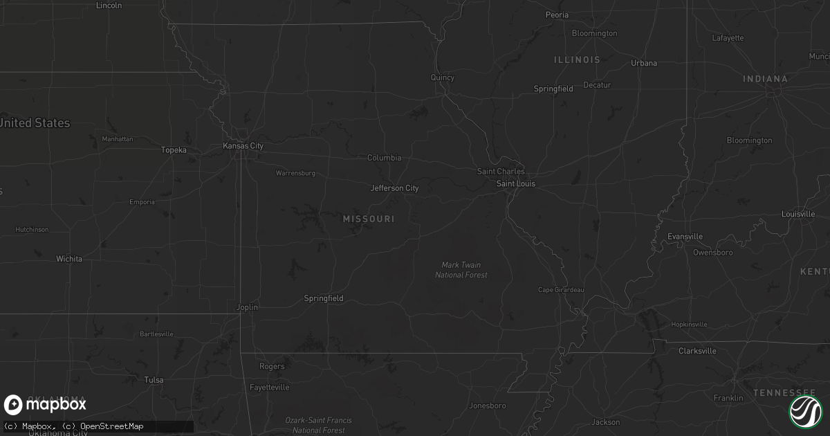
June 13 map
$229
one time, instant access
Download today. No call, no setup
Keep the $229
Bought the map and want the full workflow? Apply the entire $229 to a subscription within 7 days. None of it is wasted.
Every map, not just this one
This buys you this map. Subscription and you get every map we run, in the markets you choose from a few cities to whole states to nationwide. Plus real-time alerts the moment a storm fires.
Contact data
Name, contact info, occupancy, even credit band for addresses in the footprint. You go from where it hit to who to call.
Become the source they trust
Unlimited branding weather history reports on demand. You already have the documented answer ready for the property owner, and you are the one who showed up with it.
Property data and RoofTrace estimates
Pull up any address you have got, its value and the exact code rules for that jurisdiction, straight from One Click Code. Then RoofTrace estimates the squares, pitch, and roof value, priced the way you price.
Storm reports in Louisiana
Louisiana
| Date | Description |
|---|---|
| 06/13/201212:30 AM CDT | Tree downed north of town. |
| 06/12/20129:39 PM CDT | Trees down in shreveport |
| 06/12/20129:20 PM CDT | Power lines down 15 miles sw of florien. South toledo bend reservoir |
| 06/12/20127:45 PM CDT | Bearegard electric company reports trees down on birch drive in new llano |
| 06/12/20127:41 PM CDT | Trees down in marthaville. |
| 06/12/20127:31 PM CDT | Allen parish sheriff reports quarter size hail in reeves and multiple power outages. |
| 06/12/20127:22 PM CDT | Public reports 1.5 inch hail in deridder |
| 06/12/20127:19 PM CDT | Bearegard electric company reports trees down on park road in deridder. Time estimated by radar. |
| 06/12/20127:13 PM CDT | Beauregard sheriff reported golfball size hail in deridder as well as numerous power outages |
All States Impacted by Hail Map on June 13, 2012
Cities Impacted by Hail Map on June 13, 2012
- Burkeville, TX
- Marathon, TX
- Fort Davis, TX
- Alpine, TX
- Fort McCoy, FL
- Hawthorne, FL
- Citra, FL
- Gregory, SD
- Whitehouse, TX
- Mabank, TX
- Miller, SD
- Wolsey, SD
- Wessington Springs, SD
- Virgil, SD
- Wessington, SD
- Saint Lawrence, SD
- Gann Valley, SD
- Grand Cane, LA
- Logansport, LA
- Mansfield, LA
- Mohall, ND
- Center, ND
- Frederick, SD
- Verona, ND
- Lamoure, ND
- Mckinney, TX
- Irving, TX
- Fort Worth, TX
- Grand Prairie, TX
- Dallas, TX
- Midlothian, TX
- Duncanville, TX
- Cedar Hill, TX
- Arlington, TX
- Herman, MN
- Barrett, MN
- Elbow Lake, MN
- Anderson, SC
- Ector, TX
- Wolfe City, TX
- Leonard, TX
- Randolph, TX
- Celeste, TX
- Greenville, TX
- Bonham, TX
- Whitewright, TX
- Savoy, TX
- Trenton, TX
- Robeline, LA
- Marthaville, LA
- Elgin, ND
- New Leipzig, ND
- Noonan, ND
- Wildrose, ND
- Mcgregor, ND
- Crosby, ND
- Litchville, ND
- Valentine, TX
- Balmorhea, TX
- Lidgerwood, ND
- Sherwood, ND
- Wylie, TX
- Allen, TX
- Plano, TX
- Shreveport, LA
- Bethany, LA
- Sachse, TX
- Princeton, TX
- Melissa, TX
- Reeves, LA
- Ragley, LA
- Nebo, NC
- Marion, NC
- Glen Ullin, ND
- Grey Eagle, MN
- Harrison, SD
- Platte, SD
- Westport, SD
- Bunnell, FL
- Starr, SC
- Belton, SC
- Bronson, FL
- Morriston, FL
- Hamill, SD
- Raiford, FL
- Lawtey, FL
- Blairsville, GA
- Saltillo, TX
- Winnsboro, TX
- Mount Vernon, TX
- Deridder, LA
- Paris, TX
- Eden Valley, MN
- Richmond, MN
- Paynesville, MN
- Cold Spring, MN
- Riverdale, GA
- Stanton, ND
- Fortuna, ND
- Ambrose, ND
- Malakoff, TX
- Athens, TX
- Berlin, ND
- Marion, ND
- Dickey, ND
- Edgeley, ND
- Bonifay, FL
- Mott, ND
- Columbia, SD
- Aberdeen, SD
- Ipswich, SD
- Livingston, TX
- Chester, TX
- Woodville, TX
- Richardson, TX
- Portal, ND
- Mount Pleasant, TX
- Boyceville, WI
- Wheeler, WI
- Ridgeland, WI
- Brady, TX
- Peever, SD
- Sulphur Bluff, TX
- Talco, TX
- Columbus, ND
- Troup, TX
- Tyler, TX
- Bullard, TX
- Hecla, SD
- McCook, NE
- Indianola, NE
- Groveland, FL
- New Smyrna Beach, FL
- Veblen, SD
- Britton, SD
- Sauk Centre, MN
- Melrose, MN
- Saint Francis, MN
- Isanti, MN
- Cambridge, MN
- Flint, TX
- Mandan, ND
- Kenmare, ND
- Westhope, ND
- Tolley, ND
- Antler, ND
- Barnard, SD
- San Augustine, TX
- Broaddus, TX
- Florien, LA
- Many, LA
- Rotan, TX
- Centreville, MS
- Hartwell, GA
- Beulah, ND
- Golden Valley, ND
- Zap, ND
- Atwood, KS
- Lowry, MN
- Villard, MN
- Alexandria, MN
- Osakis, MN
- Glenwood, MN
- White Lake, SD
- Armour, SD
- Kimball, SD
- Pukwana, SD
- Corsica, SD
- Geddes, SD
- Kinder, LA
- Chamberlain, SD
- Lake Creek, TX
- Crescent City, FL
- Georgetown, FL
- Bronson, TX
- Lignite, ND
- Oakes, ND
- Mims, FL
- Titusville, FL
- Hartsville, SC
- Atlanta, GA
- Monroeville, AL
- Pierson, FL
- Green Cove Springs, FL
- Elkton, FL
- Saint Augustine, FL
- Palatka, FL
- Stanchfield, MN
- Braham, MN
- Elwood, NE
- Central, SC
- Kensington, MN
- Farwell, MN
- Cashiers, NC
- Highlands, NC
- Wheaton, MN
- Rosholt, SD
- Forman, ND
- Fort Ransom, ND
- Lisbon, ND
- Gwinner, ND
- Alexandria, LA
- Pineville, LA
- Gladstone, ND
- Paisley, FL
- Browns Valley, MN
- Dazey, ND
- Scranton, SC
- Hebron, ND
- Richardton, ND
- Spicer, MN
- New London, MN
- Atwater, MN
- Roscoe, MN
- Crawfordville, FL
- Sopchoppy, FL
- Colmesneil, TX
- Warren, TX
- Wishek, ND
- Anacoco, LA
- Longville, LA
- Leesville, LA
- Ralph, SD
- Lemmon, SD
- Hettinger, ND
- Lodgepole, SD
- Kulm, ND
- Poplar, MT
- Nesmith, SC
- Andrews, SC
- Leola, SD
- Okeechobee, FL
- Grenville, NM
- Pearson, GA
- Axson, GA
- Homerville, GA
- Pollock, LA
- Bentley, LA
- Dodge, ND
- New Salem, ND
- Carson, ND
- Almont, ND
- Freeport, MN
- Belgrade, MN
- Albany, MN
- Elrosa, MN
- Brooten, MN
- Cooper, TX
- Pattonville, TX
- Deport, TX
- Bedford, TX
- Euless, TX
- Cayuga, ND
- Rush City, MN
- Harris, MN
- Milnor, ND
- Jud, ND
- Lufkin, TX
- Lower Brule, SD
- Manning, ND
- La Salle, TX
- Edna, TX
- Stanley, ND
- Jasper, TX
- Smithfield, NE
- Acme, LA
- Rochelle, TX
- Deer Park, WI
- Amery, WI
- Reva, SD
- Havana, ND
- Crockett, TX
- Sisseton, SD
- Marksville, LA
- Lovelady, TX
- Ludlow, SD
- Grapeland, TX
- Kennard, TX
- Larue, TX
- Fredonia, ND
- Hinsdale, MT
- Taylor, ND
- Halliday, ND
- Grasston, MN
- Greeleyville, SC
- Palermo, ND
- Plaza, ND
- Souris, ND
- Graceville, MN
- Beardsley, MN
- Forest Park, GA
- Hazen, ND
- Oacoma, SD
- Kirbyville, TX
- Brooker, FL
- Yale, SD
- Carpenter, SD
- Flaxton, ND
- Elloree, SC
- Hull, IA
- Weston, CO
- Trinidad, CO
- Boncarbo, CO
- Sanford, FL
- Huron, SD
- Cogswell, ND
- Pollok, TX
- Houghton, SD
- Henderson, TX
- Garland, TX
- Addison, TX
- Ray, ND
- Oberlin, LA
- Liberty, SC
- Pendleton, SC
- Tennessee Colony, TX
- Conway, SC
- Wimbledon, ND
- Rogers, ND
- Avon, MN
- Grove City, MN
- Saint Martin, MN
- Grantsburg, WI
- Pine City, MN
- Hurst, TX
- Effingham, SC
- Prairie City, SD
- Seville, FL
- Ashley, ND
- Hampton, GA
- Elizabeth, CO
- Elbert, CO
- Williamston, SC
- Pelzer, SC
- Battle Lake, MN
- Charleston, SC
- North Charleston, SC
- Oxford, FL
- Marion, SC
- Sellers, SC
- Deltona, FL
- Sturgeon Lake, MN
- Mcgregor, MN
- Osceola, WI
- Somerset, WI
- Star Prairie, WI
- New Richmond, WI
- Inwood, IA
- Red Oak, TX
- Evans, LA
- Rutland, ND
- McBee, SC
- Bishopville, SC
- Price, TX
- Kathryn, ND
- Claremont, SD
- Roscoe, SD
- Dresser, WI
- Centuria, WI
- Saint Croix Falls, WI
- Bowbells, ND
- Wolf Point, MT
- Balsam Lake, WI
- Dunn Center, ND
- Florence, SC
- Jonesboro, GA
- Dallas, WI
- Chetek, WI
- Hemphill, TX
- Alamo, ND
- Luck, WI
- Southlake, TX
- Grapevine, TX
- Society Hill, SC
- Cheraw, SC
- Trinity, TX
- Glen Saint Mary, FL
- Washburn, ND
- Hosford, FL
- Alpena, SD
- Deland, FL
- Mora, MN
- Ogilvie, MN
- Anna, TX
- Sapphire, NC
- Vero Beach, FL
- Zahl, ND
- San Mateo, FL
- Pomona Park, FL
- Satsuma, FL
- East Palatka, FL
- Morganton, NC
- Flasher, ND
- Carrabelle, FL
- Charleston Afb, SC
- Hanahan, SC
- Enderlin, ND
- Nome, ND
- Millen, GA
- Repton, AL
- Pelican, LA
- Cooperstown, ND
- Astor, FL
- Altoona, FL
- Killdeer, ND
- Seneca, SC
- Ellendale, ND
- Ladonia, TX
- Williston, FL
- Johns Island, SC
- Summerville, SC
- Lohn, TX
- Natchitoches, LA
- Fort Thompson, SD
- Hitchcock, SD
- Hoffman, MN
- Barry, MN
- Altha, FL
- Alvord, IA
- Ross, ND
- Powers Lake, ND
- Six Mile, SC
- Wendell, MN
- Bowman, ND
- Wyndmere, ND
- Bemidji, MN
- Bison, SD
- Sulphur Springs, TX
- Fergus Falls, MN
- Campbell, MN
- Mead, OK
- Greenwood, LA
- Humphrey, NE
- Glenmora, LA
- Claire City, SD
- Lake City, SD
- Capitan, NM
- Henriette, MN
- Brook Park, MN
- Eustis, NE
- Pecos, TX
- Rembert, SC
- Merryville, LA
- Kaplan, LA
- Tivoli, TX
- Norwood, LA
- Clayton, WI
- Linton, ND
- Burtrum, MN
- Evansville, MN
- Brandon, MN
- Morris, MN
- Long Prairie, MN
- Horace, ND
- Eustace, TX
- Saint Joseph, MN
- Pineland, TX
- Piedmont, SC
- Hinckley, MN
- Finlayson, MN
- Sandstone, MN
- Roberts, WI
- Hammond, WI
- Montpelier, ND
- Hiawassee, GA
- Selfridge, ND
- Bushnell, FL
- Hankinson, ND
- Braddock, ND
- Prairie Farm, WI
- Crystal River, FL
- Woonsocket, SD
- Chandler, TX
- Siren, WI
- Webster, WI
- Townville, SC
- Milltown, WI
- Willow River, MN
- Geneva, FL
- Barney, ND
- Welsh, LA
- Jamestown, ND
- Lake City, SC
- Holdingford, MN
- Bowlus, MN
- Hutchins, TX
- Hammond, MT
- Waxahachie, TX


