Hail Map in South Dakota on June 12, 2011
Get this storm
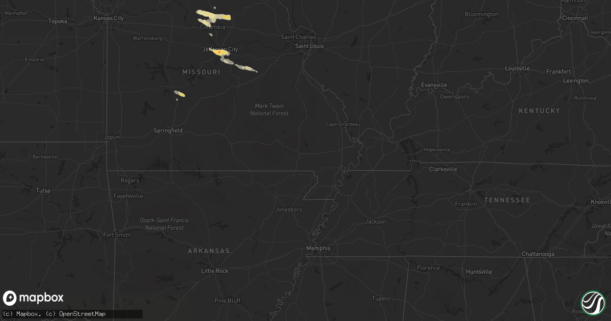
June 12 map
$229
one time, instant access
Download today. No call, no setup
Keep the $229
Bought the map and want the full workflow? Apply the entire $229 to a subscription within 7 days. None of it is wasted.
Every map, not just this one
This buys you this map. Subscription and you get every map we run, in the markets you choose from a few cities to whole states to nationwide. Plus real-time alerts the moment a storm fires.
Contact data
Name, contact info, occupancy, even credit band for addresses in the footprint. You go from where it hit to who to call.
Become the source they trust
Unlimited branding weather history reports on demand. You already have the documented answer ready for the property owner, and you are the one who showed up with it.
Property data and RoofTrace estimates
Pull up any address you have got, its value and the exact code rules for that jurisdiction, straight from One Click Code. Then RoofTrace estimates the squares, pitch, and roof value, priced the way you price.
Storm reports in South Dakota
South Dakota
| Date | Description |
|---|---|
| 06/12/20116:35 PM CDT | A local report indicates 60 MPH wind near 5 NNE SCENIC |
| 06/12/20116:05 PM CDT | A local report indicates 65 MPH wind near 4 SE FOLSOM |
| 06/12/20115:40 PM CDT | A local report indicates 60 MPH wind near 3 SE FAIRBURN |
| 06/12/20115:30 PM CDT | A local report indicates 60 MPH wind near 2 W FAIRBURN |
| 06/12/20114:50 PM CDT | A local report indicates 1.00 inch wind near 7 W DOWNTOWN HOT SPRING |
| 06/12/201112:32 AM CDT | A local report indicates 1.00 inch wind near 4 E VETAL |
| 06/11/201111:35 PM CDT | Time estimated |
| 06/11/20119:55 PM CDT | Dime-sized hail for appx 10 minutes as well |
| 06/11/20119:36 PM CDT | Pea sized hail |
| 06/11/20119:06 PM CDT | A local report indicates 70 MPH wind near 2 S MURDO |
| 06/11/20119:05 PM CDT | Dime sized hail also |
| 06/11/20118:25 PM CDT | A local report indicates 60 MPH wind near 1 E RALPH |
| 06/11/20118:05 PM CDT | Pea hail and raining heavily. |
| 06/11/20117:50 PM CDT | A local report indicates 1.00 inch wind near 1 N REDIG |
| 06/11/20117:50 PM CDT | Two road construction signs and some cones were blown 500 feet into a field. |
| 06/11/20117:20 PM CDT | Wind moved unoccupied outhouse 100 yards. |
| 06/11/20117:12 PM CDT | Reported by indian butte raws...inbs2. Time estimated based on radar. Tornadic signature on radar passed about 3 miles to the north. |
All States Impacted by Hail Map on June 12, 2011
Cities Impacted by Hail Map on June 12, 2011
- Pickens, SC
- Six Mile, SC
- Central, SC
- Jefferson City, MO
- Fairfax Station, VA
- Woodbridge, VA
- Clifton, VA
- Manassas, VA
- Valentine, NE
- Crookston, NE
- Bartow, FL
- Atkinson, NE
- Baldwin, MD
- Fallston, MD
- New Salem, ND
- Elgin, ND
- Carson, ND
- Custer, MT
- Worden, MT
- Devils Tower, WY
- Moorcroft, WY
- Harrisburg, MO
- Fayette, MO
- Clark, MO
- Hallsville, MO
- Columbia, MO
- Sturgeon, MO
- Higbee, MO
- Mission, SD
- Saint Francis, SD
- Tunas, MO
- Windyville, MO
- Buffalo, MO
- Lusk, WY
- Mott, ND
- Weston, WY
- Broadus, MT
- Alzada, MT
- Freeman, SD
- Berryville, VA
- Roanoke Rapids, NC
- Owings Mills, MD
- Reisterstown, MD
- Clinton, NC
- Pembroke, GA
- Ellabell, GA
- Okeechobee, FL
- Columbiana, AL
- Tuthill, SD
- Martin, SD
- Parmelee, SD
- Quincy, FL
- Kilgore, NE
- New Cambria, MO
- Bucklin, MO
- Brookfield, MO
- Pine Ridge, SD
- Wounded Knee, SD
- Batesland, SD
- Allen, SD
- Volborg, MT
- Mandan, ND
- Mount Wolf, PA
- York, PA
- Colonial Beach, VA
- King George, VA
- Port Royal, VA
- Loretto, VA
- Blairsville, GA
- Selby, SD
- Colome, SD
- Springview, NE
- Winner, SD
- Murdo, SD
- Courtland, VA
- Lefor, ND
- Lemmon, SD
- Hettinger, ND
- Richardton, ND
- Hebron, ND
- Lodgepole, SD
- New Leipzig, ND
- Glen Ullin, ND
- Regent, ND
- Jarrettsville, MD
- Hydes, MD
- Forest Hill, MD
- Ashland, MO
- Adel, GA
- Almont, ND
- Ten Sleep, WY
- Dupree, SD
- Metter, GA
- Register, GA
- Halifax, PA
- Liverpool, PA
- Duncannon, PA
- Newport, PA
- White Owl, SD
- Chula, MO
- Rothville, MO
- Chillicothe, MO
- Wheeling, MO
- Laclede, MO
- Jameson, MO
- Gallatin, MO
- Marceline, MO
- Sumner, MO
- Mendon, MO
- Lock Springs, MO
- Trenton, MO
- Meadville, MO
- Jamesport, MO
- Lance Creek, WY
- Hulett, WY
- Mentone, TX
- Jal, NM
- Wilton, ND
- Newport News, VA
- Live Oak, FL
- Platte, SD
- Miami, FL
- Ethan, SD
- Taylorsville, NC
- Statesboro, GA
- Belle Fourche, SD
- Virginia Beach, VA
- Bismarck, ND
- Harrison, SD
- Ree Heights, SD
- Gann Valley, SD
- Lohman, MO
- Bonnots Mill, MO
- Lake Lure, NC
- Mountain Rest, SC
- Long Creek, SC
- Mexico, MO
- Centralia, MO
- Thompson, MO
- Smithwick, SD
- Manville, WY
- Whitney, NE
- Crawford, NE
- Dillwyn, VA
- Gadsden, SC
- Eastover, SC
- Tabor, SD
- Faith, SD
- Grand Ridge, FL
- Merriman, NE
- Meadow, SD
- Buckingham, VA
- Eureka, SD
- Chesapeake, VA
- Center, ND
- Big Cove Tannery, PA
- McConnellsburg, PA
- Needmore, PA
- Hancock, MD
- Big Pool, MD
- Mercersburg, PA
- Clear Spring, MD
- Eagle Butte, SD
- Lake Toxaway, NC
- Rosman, NC
- Alexander City, AL
- Tamassee, SC
- Newell, SD
- Smithfield, NC
- Fort Lauderdale, FL
- Oneill, NE
- Page, NE
- Hammond, MT
- Ludlow, SD
- Gladstone, VA
- Wingina, VA
- Marion, SD
- Bridgewater, SD
- Bristol, FL
- Lehr, ND
- White River, SD
- Irene, SD
- Centerville, SD
- Viborg, SD
- Wakonda, SD
- Salem, SC
- Polkton, NC
- Wadesboro, NC
- Corsica, SD
- Armour, SD
- Flasher, ND
- Bland, MO
- Owensville, MO
- Belle, MO
- Chipley, FL
- Graceville, FL
- Bonifay, FL
- Sandy Ridge, NC
- Patrick Springs, VA
- Stuart, VA
- Spencer, VA
- Alexandria, SD
- Emery, SD
- Parkston, SD
- Littleton, NC
- Edgemont, SD
- Sunset, SC
- Mills, NE
- Lynchburg, VA
- Madison Heights, VA
- Buffalo, SD
- New England, ND
- Turkey, NC
- Elizabethtown, PA
- York Haven, PA
- Middletown, PA
- Bainbridge, PA
- Manchester, PA
- Schuyler, VA
- Middleburg, VA
- Harpers Ferry, WV
- Millville, WV
- Purcellville, VA
- Charles Town, WV
- Marydel, MD
- Barclay, MD
- Sudlersville, MD
- Galena, MD
- Ingleside, MD
- Church Hill, MD
- Denton, MD
- Ridgely, MD
- Greensboro, MD
- Millington, MD
- Kennedyville, MD
- Henderson, MD
- Goldsboro, MD
- Centreville, MD
- Fort Stewart, GA
- Hoven, SD
- Hawthorne, FL
- Solomons, MD
- Lusby, MD
- Hollywood, MD
- California, MD
- Mechanicsville, MD
- Saint Leonard, MD
- Dowell, MD
- Kiln, MS
- Upperville, VA
- Bluemont, VA
- Round Hill, VA
- Oelrichs, SD
- Linneus, MO
- Purdin, MO
- Prairie City, SD
- Faulkton, SD
- Effingham, SC
- Florence, SC
- Hinsdale, MT
- Kearneysville, WV
- Shenandoah Junction, WV
- Gerrardstown, WV
- Ranson, WV
- Hamilton, VA
- Martinsburg, WV
- Inwood, WV
- Hedgesville, WV
- Lovettsville, VA
- Waterford, VA
- Cody, NE
- Nenzel, NE
- Parrish, FL
- Rowland, NC
- Rockford, AL
- Weogufka, AL
- Armstrong, MO
- Bassett, NE
- Franklin, GA
- Woodland, AL
- Roanoke, AL
- Alva, WY
- Aladdin, WY
- Sundance, WY
- Rocheport, MO
- Meadows Of Dan, VA
- Waynesboro, VA
- Fort Defiance, VA
- Staunton, VA
- Fishersville, VA
- Mount Sidney, VA
- Charlottesville, VA
- Verona, VA
- Greenwood, VA
- Crimora, VA
- Grottoes, VA
- Afton, VA
- Crozet, VA
- Forest, VA
- Winnett, MT
- Aylett, VA
- Lead, SD
- Dundee, FL
- Lake Wales, FL
- Kadoka, SD
- Oldtown, MD
- Paw Paw, WV
- Levels, WV
- Great Cacapon, WV
- Slanesville, WV
- Bonesteel, SD
- Hazen, ND
- Beulah, ND
- Zap, ND
- Garrison, ND
- Chambers, NE
- Poplarville, MS
- Seminole, TX
- Claremont, NC
- Holden, LA
- Williamsport, MD
- Hagerstown, MD
- Warfordsburg, PA
- Lenoir, NC
- Bay Saint Louis, MS
- Waveland, MS
- Hickory, NC
- Conover, NC
- Issue, MD
- Pembroke Pines, FL
- Hollywood, FL
- Hialeah, FL
- Hahira, GA
- Catonsville, MD
- Rhame, ND
- Bowman, ND
- Hurley, SD
- Tyndall, SD
- Lemoyne, PA
- New Cumberland, PA
- Camp Hill, PA
- Carrabelle, FL
- Lake Butler, FL
- Ewing, NE
- Norris, SD
- Zebulon, NC
- Sparks, GA
- Franklinton, LA
- Millerstown, PA
- Carrollton, VA
- Smithfield, VA
- Onaka, SD
- Seneca, SD
- Lake City, FL
- Harrington, DE
- Shipman, VA
- Burke, SD
- Geddes, SD
- Willards, MD
- Newark, MD
- Whaleyville, MD
- Berlin, MD
- Anniston, AL
- Franklintown, PA
- Dillsburg, PA
- Shelby, AL
- Sylacauga, AL
- Suffolk, VA
- Crescent City, FL
- Enning, SD
- Crewe, VA
- Rice, VA
- Jetersville, VA
- Burkeville, VA
- Hendersonville, NC
- Penrose, NC
- Starke, FL
- Melrose, FL
- Keystone Heights, FL
- Green Cove Springs, FL
- Interlachen, FL
- Homerville, GA
- Du Pont, GA
- Jackson, NC
- Rich Square, NC
- Street, MD
- Pylesville, MD
- Bel Air, MD
- Whiteford, MD
- Delta, PA
- Stuart, NE
- Indian Head, MD
- Lorton, VA
- Wood, SD
- Reva, SD
- Wright, WY
- Gillette, WY
- Fawn Grove, PA
- Airville, PA
- Fort Myers, FL
- Lehigh Acres, FL
- Blackstone, VA
- Ford, VA
- Wilsons, VA
- Amelia Court House, VA
- Orrville, AL
- Fairfax, VA
- Haymarket, VA
- Chantilly, VA
- Catharpin, VA
- The Plains, VA
- Marshall, VA
- Broad Run, VA
- Centreville, VA
- Delaplane, VA
- Summit Point, WV
- Aldie, VA
- Utica, SD
- Peachland, NC
- Bridgewater, VA
- Mount Crawford, VA
- Ralph, SD
- Wagner, SD
- Shawboro, NC
- Shiloh, NC
- Frankford, DE
- Pittsville, MD
- Bishopville, MD
- Koeltztown, MO
- Westphalia, MO
- Freeburg, MO
- Centreville, MS
- Saint Anthony, ND
- Brogue, PA
- White Hall, MD
- Aberdeen, MD
- Monkton, MD
- Wrightsville, PA
- Parkville, MD
- New Bloomfield, PA
- Perryman, MD
- Hummelstown, PA
- Darlington, MD
- Highspire, PA
- Elliottsburg, PA
- Abingdon, MD
- Shermans Dale, PA
- Belcamp, MD
- Carlisle, PA
- Red Lion, PA
- Perry Hall, MD
- Landisburg, PA
- Wellsville, PA
- Marysville, PA
- McAlisterville, PA
- Millersburg, PA
- Upper Falls, MD
- Mechanicsburg, PA
- Etters, PA
- Kingsville, MD
- Dauphin, PA
- Joppa, MD
- Lewisberry, PA
- Felton, PA
- Fork, MD
- Harrisburg, PA
- Windsor, PA
- Summerdale, PA
- Thompsontown, PA
- Glen Arm, MD
- Mount Pleasant Mills, PA
- Marietta, PA
- Enola, PA
- Phoenix, MD
- Holtwood, PA
- Aberdeen Proving Ground, MD
- Nottingham, MD
- Havre De Grace, MD
- Dover, PA
- Emigsville, PA
- Churchville, MD
- Berkeley Springs, WV
- Cross Junction, VA
- Bloomery, WV
- Caret, VA
- Naper, NE
- Gregory, SD
- Dallas, SD
- Jayess, MS
- Ruth, MS
- Liberty, MS
- Newhebron, MS
- Magee, MS
- Fairplay, MD
- Bunnell, FL
- Saint Thomas, MO
- Centertown, MO
- Loose Creek, MO
- Holts Summit, MO
- Amidon, ND
- Summit, MS
- Lineville, AL
- Cuba, MO
- Bourbon, MO
- Menno, SD
- Olivet, SD
- Bighorn, MT
- Chadron, NE
- New Park, PA
- Harrisonville, PA
- Waterfall, PA
- Wells Tannery, PA
- Newtown, VA
- Rappahannock Academy, VA
- Tappahannock, VA
- Champlain, VA
- Saint Stephens Church, VA
- Hustle, VA
- Newburg, MD
- Bowling Green, VA
- Milford, VA
- Montross, VA
- Glyndon, MD
- Rozet, WY
- Fairburn, SD
- Dutton, VA
- Gloucester, VA
- Gladys, VA
- Pomona Park, FL
- Olyphant, PA
- Jermyn, PA
- Ideal, SD
- Witten, SD
- Plainview, NE
- Brunswick, NE
- Lake Andes, SD
- Zirconia, NC
- Stewartstown, PA
- Fredericksburg, VA
- Mccomb, MS
- Magnolia, MS
- Deland, FL
- Willacoochee, GA
- Pass Christian, MS
- Jasper, FL
- Amite, LA
- Eglin Afb, FL
- Pamplico, SC
- Royal, NE
- Orchard, NE
- Pembroke, NC
- Stem, NC
- Louisburg, MO
- Chattahoochee, FL
- Bedford, VA
- Union Mills, NC
- Walhalla, SC
- Loranger, LA
- Baldwin, ND
- Mitchell, SD
- Catawba, NC
- Eastpoint, FL
- Norfolk, NE
- Pierce, NE
- Hoskins, NE
- Goodwater, AL
- Ashland, AL
- Zachary, LA
- Victoria, VA
- Parkton, MD
- Porcupine, SD
- Dante, SD
- Lantry, SD
- Lesterville, SD
- Dickinson, ND
- Buffalo Gap, SD
- Orlando, FL
- Shannon, NC
- Red Springs, NC
- Raeford, NC
- Raleigh, MS
- Tripp, SD
- Saucier, MS
- Harrisonburg, VA
- Eudora, AR
- Denham Springs, LA
- Presho, SD
- Vivian, SD
- Manderson, SD
- Rushville, NE
- Wanblee, SD
- Punta Gorda, FL
- Hot Springs, SD
- Flat Rock, NC
- Union Center, SD
- Osmond, NE
- Pearson, GA
- Axson, GA
- Naples, FL
- Long Lake, SD
- Ridgeview, SD
- Reeder, ND
- Herrick, SD
- Norman Park, GA
- Ellenton, GA
- Richfield, PA
- Cocolamus, PA
- Gloster, MS
- Smithdale, MS
- Zeeland, ND
- Franklinville, NC
- Sarasota, FL
- Urbana, MO
- Fort Meade, FL
- Estill, SC
- Newport, NE
- Claxton, GA
- Glennville, GA
- Ludowici, GA
- Port Republic, VA
- Stony Point, NC
- Guyton, GA
- Damascus, GA
- Blakely, GA
- Midland, SD
- Sumter, SC
- Myakka City, FL
- Amelia, NE
- Climax, NC
- Liberty, NC
- Draper, SD
- Defuniak Springs, FL
- Camp Crook, SD
- Four Oaks, NC
- Earleville, MD
- Felton, DE
- Odum, GA
- Jesup, GA
- Gaston, NC
- Okaton, SD
- Cherry Creek, SD
- Mifflintown, PA
- Deatsville, AL
- Reidsville, GA
- Wake, VA
- Hardyville, VA
- Pompeys Pillar, MT
- Wadley, AL
- Wedowee, AL
- Ramseur, NC
- Harrisburg, NE
- Bell, FL
- Trenton, FL
- Gordon, NE
- Mount Olive, MS
- Volin, SD
- Salem, SD
- Tiger, GA


