Hail Map on June 12, 2011
Get this storm
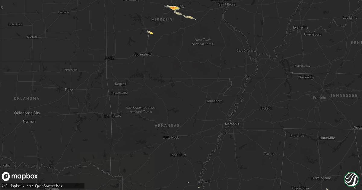
June 12 map
$229
one time, instant access
Download today. No call, no setup
Keep the $229
Bought the map and want the full workflow? Apply the entire $229 to a subscription within 7 days. None of it is wasted.
Every map, not just this one
This buys you this map. Subscription and you get every map we run, in the markets you choose from a few cities to whole states to nationwide. Plus real-time alerts the moment a storm fires.
Contact data
Name, contact info, occupancy, even credit band for addresses in the footprint. You go from where it hit to who to call.
Become the source they trust
Unlimited branding weather history reports on demand. You already have the documented answer ready for the property owner, and you are the one who showed up with it.
Property data and RoofTrace estimates
Pull up any address you have got, its value and the exact code rules for that jurisdiction, straight from One Click Code. Then RoofTrace estimates the squares, pitch, and roof value, priced the way you price.
States Impacted by Hail Map on June 12, 2011
Storm reports
Wyoming
| Date | Description |
|---|---|
| 06/12/20116:18 PM CDT | Marble to quarter size hail covered the ground. Also heavy rain. |
| 06/12/20116:10 PM CDT | A local report indicates 70 MPH wind near DEVILS TOWER |
| 06/12/20116:10 PM CDT | A local report indicates 70 MPH wind near 3 SE DEVILS TOWER |
| 06/12/20116:10 PM CDT | A local report indicates 1.25 inch wind near 3 SE DEVILS TOWER |
| 06/12/20116:10 PM CDT | A local report indicates 1.25 inch wind near DEVILS TOWER |
| 06/12/20116:05 PM CDT | A local report indicates 60 MPH wind near CARLILE |
| 06/12/20116:05 PM CDT | 5 to 10 minutes of wind broke off limbs on cottonwood trees...up to 25 inches in diameter. Also had dime size hail. |
| 06/12/20115:15 PM CDT | A local report indicates 60 MPH wind near 18 NW WRIGHT |
| 06/12/20115:15 PM CDT | A local report indicates 60 MPH wind near 18 NE WRIGHT |
| 06/12/20115:07 PM CDT | A local report indicates 1.00 inch wind near 17 S TEN SLEEP |
| 06/12/20115:06 PM CDT | Quarter to golf ball sized hail. |
| 06/12/20115:03 PM CDT | Reported on west side of town |
| 06/12/20114:55 PM CDT | A local report indicates 1.00 inch wind near 19 WNW ROCKYPOINT |
| 06/12/20114:30 PM CDT | A local report indicates a tornado near MULE CREEK JUNCTION |
| 06/12/20114:10 PM CDT | A local report indicates a tornado near 9 SE MULE CREEK JUNCTIO |
| 06/12/20113:58 PM CDT | A local report indicates a tornado near MULE CREEK JUNCTION |
| 06/12/20113:34 PM CDT | Small tree branches blown down. |
| 06/12/20113:27 PM CDT | Power outage at this location due to strong winds. |
North Carolina
| Date | Description |
|---|---|
| 06/12/20116:00 PM CDT | Several trees down in northern stanly county and a power pole on a car. |
| 06/12/20116:00 PM CDT | One tree reported down on nc highway 109 near eldorado |
| 06/12/20115:50 PM CDT | Conover fd reported multiple trees down in claremont in the i-40 area. |
| 06/12/20115:48 PM CDT | Tree down |
| 06/12/20115:20 PM CDT | 911 comm reports one tree down in bethlehem. |
| 06/12/20114:05 PM CDT | A few trees down in nw part of county. |
| 06/12/20114:02 PM CDT | Power lines down |
| 06/12/20114:00 PM CDT | A few large limbs down in road near intersection of us hwy 70 and us hwy 21. |
| 06/12/20113:49 PM CDT | One tree down |
| 06/12/20113:41 PM CDT | One tree down on i-40. |
| 06/12/20113:36 PM CDT | Hail up to the size of quarters on oxford school road between catawba and i-40. |
| 06/12/20113:20 PM CDT | One tree down |
| 06/12/20113:15 PM CDT | Fire marshall office reported 2 trees down 5-6 miles apart in the northeast part of the county. |
| 06/12/20113:11 PM CDT | Tree down |
| 06/12/20112:55 PM CDT | The stokes county sheriffs office reports a tree blown down along k fork road. |
| 06/12/20112:33 PM CDT | At least five trees down...mainly around and s of hendersonville. One on a house near etowah. |
| 06/12/20112:25 PM CDT | The stokes county sheriffs office reported a tree blown down on anglin mill road. |
| 06/12/20112:25 PM CDT | The stokes county sheriffs office reported a tree blown down onto powerlines along amostown rd. |
| 06/12/20112:24 PM CDT | Two trees blown down along shepherds crossroads. |
| 06/12/20111:30 PM CDT | Countywide fire/ems dispatch reported multiple calls of trees down in the skyland area. |
| 06/11/20118:56 PM CDT | Trees down |
| 06/11/20118:47 PM CDT | Trees down |
| 06/11/20118:39 PM CDT | Tree blown down. Time estimated. |
| 06/11/20118:34 PM CDT | Tree limb down on a power pole with fire on third st near 74 business. Power out in area. Time estimated. |
| 06/11/20118:26 PM CDT | Trees down |
| 06/11/20118:08 PM CDT | Trees down on highway |
| 06/11/20117:54 PM CDT | Tree down. Time estimated. |
| 06/11/20117:44 PM CDT | Several trees down along highway 1 south near the south carolina line. |
| 06/11/20117:39 PM CDT | Large tree down on nc highway 145 near diggs rd |
| 06/11/20117:34 PM CDT | Multiple trees blown down on power lines on nc highway 109 near global rd. Transformer fire reported. Time estimated. |
| 06/11/20117:22 PM CDT | Tree on a car in wadesboro on highway 74 with a person trapped. A portion of highway 74 is closed. Numerous trees down in the area. |
| 06/11/20117:19 PM CDT | Five large trees down in clayton. |
| 06/11/20117:00 PM CDT | Tree reported down on blonnie ross rd west of burnsville. Time estimated. |
Virginia
| Date | Description |
|---|---|
| 06/12/20116:55 PM CDT | Two trees down on west river road. |
| 06/12/20116:00 PM CDT | Widespread trees and powerlines down. 911 center inundated with calls. |
| 06/12/20115:51 PM CDT | A local report indicates 1.75 inch wind near 2 WNW ROLLINS FORK |
| 06/12/20115:33 PM CDT | Tree down near intersection of kings hwy and james madison pkwy |
| 06/12/20115:20 PM CDT | Very heavy rain and high winds |
| 06/12/20115:02 PM CDT | Tree down |
| 06/12/20114:53 PM CDT | Tree down on mount laurel road near clover |
| 06/12/20114:47 PM CDT | A tree was blown down along state route 746. |
| 06/12/20114:40 PM CDT | Received a report from the public of 2 trees down along father judge road. |
| 06/12/20114:00 PM CDT | Tree onto house on manasses circle in vienna |
| 06/12/20113:58 PM CDT | One tree blown down onto a power line along lewis ford road. |
| 06/12/20113:56 PM CDT | One tree blown down along oak ridge road. |
| 06/12/20113:55 PM CDT | Tree down on main st |
| 06/12/20113:52 PM CDT | Tree down on compton rd at briarcroft rd |
| 06/12/20113:49 PM CDT | A tree was blown down along county road 781. |
| 06/12/20113:45 PM CDT | Tree down on singletons way |
| 06/12/20113:34 PM CDT | One tree down on candlers mountain road. |
| 06/12/20113:33 PM CDT | Power lines down on lynx drive. |
| 06/12/20113:30 PM CDT | Tree down at intersection of route 45 and salem church road. |
| 06/12/20113:27 PM CDT | Cedar tree blown down in backyard of observers house located along mayfield drive |
| 06/12/20113:27 PM CDT | Several trees down in apartment complex off lakeside drive near the intersection of route 501 |
| 06/12/20113:25 PM CDT | Several large branches downed in the neighborhood... Knocking out power. Half inch hail was also observed... Along with 1.84 inches of rain in 30 minutes. |
| 06/12/20113:15 PM CDT | Bedford county sheriffs department has reported multiple trees down along forest road near the bedford city limits. |
| 06/12/20113:15 PM CDT | Several trees were blown down on mayfield drive. |
| 06/12/20113:15 PM CDT | A very large oak tree was uprooted on gaddy road. |
| 06/12/20113:09 PM CDT | Trees down along polecat hill road |
| 06/12/20113:09 PM CDT | Trees down along snickersville turnpike |
| 06/12/20113:05 PM CDT | Trees down along st louis road and foxcroft rd |
| 06/12/20113:05 PM CDT | One tree was down on a home along woodcreek road. |
| 06/12/20113:00 PM CDT | Tree on house in 20000 block of furr rd |
| 06/12/20112:53 PM CDT | Tree down |
| 06/12/20112:45 PM CDT | A tree was blown down along state route 648. |
| 06/12/20112:44 PM CDT | Trees and wires down in the 38000 block of va route 9 |
| 06/12/20112:42 PM CDT | Large limb down into southbound lane of va route 9 |
| 06/12/20112:40 PM CDT | Thunderstorm wind gust measured with a home weather station. |
| 06/12/20112:36 PM CDT | Trees down for a one mile stretch along route 151 between piney river and clifford |
| 06/12/20112:33 PM CDT | Wires down. |
| 06/12/20112:27 PM CDT | Cedar tree blown down in backyard of observers house located along mayfield drive |
| 06/12/20112:27 PM CDT | Several trees down in apartment complex off lakeside drive near the intersection of route 501 |
| 06/12/20112:16 PM CDT | One tree blown down in patrick springs. |
| 06/12/20112:01 PM CDT | Received a report of golfball size hail causing damage to screen fixtures of a home. |
| 06/12/20111:52 PM CDT | Trees down along charlottesville bypass hwy 250 |
| 06/12/20111:00 PM CDT | Fallen trees caused significant damage to several mobile homes and vehicles in the country estates trailer park |
Florida
| Date | Description |
|---|---|
| 06/12/20115:59 PM CDT | Public report of nickel to one inch size hail near w lake wales rd s. |
| 06/12/20115:45 PM CDT | 40x20 stables destroyed and blown approximately 30 feet from original location. |
| 06/12/20114:00 PM CDT | The law enforcement reported that powerlines were blown down in the northwest portion of the county. The time given was based on radar. |
| 06/12/20113:46 PM CDT | The law enforcment received reports of half dollar sized hail and tree damage near county road 751 southwest of jasper. |
| 06/12/20113:10 PM CDT | A skywarn spotter reported that established trees were downed across sunrise and weston. Numerous pieces of foliage in varying sizes from small up to large palm fronds |
| 06/12/20113:10 PM CDT | A member of the public reported increasing hail sizes near the intersection of indian trace and bonaventure in weston. Dime-sized hail began around 400 pm edt and incre |
| 06/12/20113:10 PM CDT | A member of the public estimated wind gusts around 60 mph near the intersection of indian trace and bonaventure in weston at 410 pm edt. |
| 06/12/20113:04 PM CDT | A member of the public reported golf ball-sized hail on griffin road in weston. Estimated wind speeds of 50 mph were also reported. |
| 06/12/20113:00 PM CDT | A broadcast media weatherbug station recorded a wind gust of 62 mph at falcon cove middle school. Time estimated from radar data. |
| 06/12/20113:00 PM CDT | A member of the public reported golf ball-sized hail near the intersection of i-75 and sheridan street. |
| 06/12/20112:49 PM CDT | An off-duty national weather service employee reported wind speeds estimated to be greater than 60 mph and quarter-sized hail. |
| 06/12/20112:46 PM CDT | An off-duty national weather service employee reported quarter-sized hail in pembroke pines. |
| 06/12/20112:38 PM CDT | An off-duty national weather service employee reported quarter-sized hail in miramar near sw 18th street. |
Missouri
| Date | Description |
|---|---|
| 06/12/20116:57 AM CDT | A local report indicates 1.75 inch wind near 3 E MEXICO |
| 06/12/20116:15 AM CDT | Hail ranged between quarter size and half dollar size. |
| 06/12/20116:12 AM CDT | A local report indicates 2.00 inch wind near JEFFERSON CITY |
Texas
| Date | Description |
|---|---|
| 06/12/20116:44 PM CDT | A local report indicates 58 MPH wind near COYANOSA |
| 06/11/20117:55 PM CDT | Gusts estimated at gomez. |
| 06/11/20117:50 PM CDT | Zero visibility in blowing dust. |
| 06/11/20117:35 PM CDT | A local report indicates 62 MPH wind near SEAGRAVES |
| 06/11/20117:10 PM CDT | A local report indicates 61 MPH wind near SEMINOLE |
Pennsylvania
| Date | Description |
|---|---|
| 06/12/20112:51 PM CDT | Tree limbs and power lines down |
| 06/12/20112:50 PM CDT | Construction trailer blown onto roadway |
| 06/12/20112:30 PM CDT | Ef0 tornado. |
| 06/12/20112:25 PM CDT | Ef1 tornado. |
| 06/12/20112:25 PM CDT | Trees down. Metal shed blown onto route 79 |
| 06/12/20112:20 PM CDT | Trees down. Tree on house in windsor township |
| 06/12/20112:15 PM CDT | Numerous trees down in york township |
| 06/12/20112:12 PM CDT | Trees down |
| 06/12/20112:12 PM CDT | Trees down. Possible funnel cloud reported just north of wrightsville. |
| 06/12/20112:12 PM CDT | Numerous reports of trees down in springettsbury township |
| 06/12/20112:07 PM CDT | One inch size hail at etters... Pa |
| 06/12/20112:07 PM CDT | One inch size hail at etters... Pa |
| 06/12/201112:55 PM CDT | A local report indicates 1.00 inch wind near HALIFAX |
| 06/12/201112:45 PM CDT | A local report indicates 1.00 inch wind near NEW BUFFALO |
Montana
| Date | Description |
|---|---|
| 06/12/20116:50 PM CDT | 3 large grain bins destroyed. Moving van tipped over. Power lines knocked down. |
| 06/12/20116:45 PM CDT | A local report indicates 65 MPH wind near 2 SW ALBION |
| 06/12/20116:35 PM CDT | Rain wrapped tornado approximately 300 yards wide. |
| 06/12/20116:15 PM CDT | A local report indicates 1.00 inch wind near 8 NNE POWDERVILLE |
| 06/12/20116:10 PM CDT | Spotter reports golfball size hail on hwy 212 west of alzada. |
| 06/12/20116:10 PM CDT | Spotter reports golfball size hail on hwy 212 west of alzada. |
| 06/12/20115:55 PM CDT | A local report indicates 2.50 inch wind near 4 S HAMMOND |
| 06/12/20114:53 PM CDT | Hailed for 10 minutes...pea to ping pong ball sized. |
| 06/12/20114:43 PM CDT | A local report indicates 2.75 inch wind near 1 ESE BIDDLE |
| 06/12/20114:42 PM CDT | Several pea sized stones with a few larger. The largest stone was 1 inch in diameter. |
| 06/12/20114:40 PM CDT | A local report indicates 4.25 inch wind near BIDDLE |
| 06/12/20114:30 PM CDT | A local report indicates 4.25 inch wind near BIDDLE |
| 06/11/20119:05 PM CDT | Measured quarter sized hail with storm. |
South Dakota
| Date | Description |
|---|---|
| 06/12/20116:35 PM CDT | A local report indicates 60 MPH wind near 5 NNE SCENIC |
| 06/12/20116:05 PM CDT | A local report indicates 65 MPH wind near 4 SE FOLSOM |
| 06/12/20115:40 PM CDT | A local report indicates 60 MPH wind near 3 SE FAIRBURN |
| 06/12/20115:30 PM CDT | A local report indicates 60 MPH wind near 2 W FAIRBURN |
| 06/12/20114:50 PM CDT | A local report indicates 1.00 inch wind near 7 W DOWNTOWN HOT SPRING |
| 06/12/201112:32 AM CDT | A local report indicates 1.00 inch wind near 4 E VETAL |
| 06/11/201111:35 PM CDT | Time estimated |
| 06/11/20119:55 PM CDT | Dime-sized hail for appx 10 minutes as well |
| 06/11/20119:36 PM CDT | Pea sized hail |
| 06/11/20119:06 PM CDT | A local report indicates 70 MPH wind near 2 S MURDO |
| 06/11/20119:05 PM CDT | Dime sized hail also |
| 06/11/20118:25 PM CDT | A local report indicates 60 MPH wind near 1 E RALPH |
| 06/11/20118:05 PM CDT | Pea hail and raining heavily. |
| 06/11/20117:50 PM CDT | Two road construction signs and some cones were blown 500 feet into a field. |
| 06/11/20117:50 PM CDT | A local report indicates 1.00 inch wind near 1 N REDIG |
| 06/11/20117:20 PM CDT | Wind moved unoccupied outhouse 100 yards. |
| 06/11/20117:12 PM CDT | Reported by indian butte raws...inbs2. Time estimated based on radar. Tornadic signature on radar passed about 3 miles to the north. |
Nebraska
| Date | Description |
|---|---|
| 06/12/20112:45 AM CDT | The thunderstorm wind gusts downed tree limbs. |
| 06/11/201110:24 PM CDT | Reported along hwy 20 between crawford and whitney. |
Alabama
| Date | Description |
|---|---|
| 06/12/20114:45 PM CDT | A few trees were blown down in millbrook. Winds estimated around 50 mph. |
| 06/12/20114:15 PM CDT | A few trees were blown down in deatsville. Winds were estimated around 50 mph. |
Georgia
| Date | Description |
|---|---|
| 06/12/20114:53 PM CDT | Warning point reported trees down. |
| 06/12/20114:45 PM CDT | County warning point reported 3 trees down near post office. Time estimated by radar. |
| 06/12/20112:20 PM CDT | Several trees down...many cut in half |
| 06/11/20118:25 PM CDT | 4 trees down including 1 tree on a house in hahira. Some powerlines down as well. |
Mississippi
| Date | Description |
|---|---|
| 06/12/20113:40 PM CDT | 2 homes with roof damage and numerous trees down in stringer. |
| 06/12/20113:20 PM CDT | Multiple trees downed in the topeka area...including one that fell on a house. Time estimated. |
| 06/12/20112:35 PM CDT | A utility pole was snapped along old canton rd in the deerfield area. Pea sized hail also occurred during the storm. |
| 06/11/20117:26 PM CDT | An oak tree and small pine tree blown down by microburst on west side of harrison county just north of i-10. |
| 06/11/20117:26 PM CDT | An oak tree and small pine tree blown down by microburst on west side of harrison county just north of i-10. |
South Carolina
| Date | Description |
|---|---|
| 06/12/20115:45 PM CDT | Trees down |
| 06/12/20115:02 PM CDT | A tree fell onto power lines and took down some poles as well |
| 06/12/20114:52 PM CDT | Tree down |
| 06/12/20114:05 PM CDT | Tree down on a house on james court. |
| 06/12/20113:52 PM CDT | Brief sustained wind of 50 mph |
| 06/12/20113:44 PM CDT | Trees down on old liberty rd and hwy 135 south. |
| 06/12/20113:25 PM CDT | Tree blown down blocking hwy 912 near calahan mountain rd |
| 06/12/20113:25 PM CDT | Tree blown down blocking hwy 912 near calahan mountain rd |
| 06/12/20113:19 PM CDT | Multiple trees down on mountain view and meadow fork roads |
| 06/12/20113:10 PM CDT | Trees down near intersection of sc highway 11 and boones creek road. |
| 06/12/20112:53 PM CDT | Trees down and structural damage on deborahs way. |
| 06/12/20112:45 PM CDT | 3 large trees down on property along forest road. |
| 06/12/20112:43 PM CDT | About 20 trees uprooted and down across highlands highway...sc route 28. |
| 06/12/20112:25 PM CDT | Golf ball sized hail falling at hw-11 at lake keowee. Hail is still occurring. |
| 06/12/20118:48 AM CDT | Trees down at intersection of salters town road and highway us 76 |
| 06/11/20119:21 PM CDT | Trees down in the northbound lane of i-95 at mile marker 121 |
| 06/11/20118:48 PM CDT | Public reported 1.00 inch hail. |
| 06/11/20118:48 PM CDT | Trees down at 1200 block of pleasant grove road |
| 06/11/20118:48 PM CDT | Trees down on u.s. Highway 76 at east brewington road |
| 06/11/20118:46 PM CDT | Trees down on arnette road |
| 06/11/20118:45 PM CDT | Trees down on gaddys mill road |
| 06/11/20118:21 PM CDT | Trees down on airbase road and congaree road near mcentire ang base |
| 06/11/20117:56 PM CDT | Trees down |
West Virginia
| Date | Description |
|---|---|
| 06/12/20112:22 PM CDT | Trees down in the bakerton area |
| 06/12/20112:12 PM CDT | Tree blown over across railroad tracks near stubbs road. |
| 06/12/20112:10 PM CDT | Tree knocked down onto powerlines at 15000 block of leetown road. |
| 06/12/20111:21 PM CDT | Large limbs down with a lot of small limb debris |
| 06/12/20111:20 PM CDT | A few trees down |
North Dakota
| Date | Description |
|---|---|
| 06/11/201110:20 PM CDT | A local report indicates 70 MPH wind near 3 N BISMARCK |
| 06/11/20119:50 PM CDT | Two outbuildings had roofs blown off. One of them had walls collapsed...but had doors open on south side when storm hit. All debris was blown to northeast. Damage occur |
| 06/11/20119:37 PM CDT | Reported by county sheriff |
| 06/11/20119:34 PM CDT | Reported by county sheriff |
| 06/11/20119:30 PM CDT | Ef2 tornado touched down 8 miles south-southwest of elgin around 830 pm mdt and moved north-northeast. It lifted 3 miles south-southeast of elgin...at around 845 pm mdt |
| 06/11/20119:00 PM CDT | Spotter reported a tornado was on the ground for 10 to 15 seconds. |
| 06/11/20118:45 PM CDT | Storm chaser reported tornado on the ground moving northeast. |
| 06/11/20118:30 PM CDT | Pea to quarter size hail... Heavy rain |
| 06/11/20118:25 PM CDT | Still getting pea size hail. |
| 06/11/20118:08 PM CDT | A local report indicates 1.75 inch wind near CROWN BUTTE LAKE |
| 06/11/20117:36 PM CDT | Still hailing. |
| 06/11/20117:25 PM CDT | Observer reported a tornado touched down in his farm fields. It was a brief touch down...no more than a few minutes. There have been other reports of rotation of the wa |
Maryland
| Date | Description |
|---|---|
| 06/12/20116:00 PM CDT | Trees down and power outages. |
| 06/12/20115:48 PM CDT | Large tree fell on a vehicle with people trapped inside the vehicle. No injuries. |
| 06/12/20115:48 PM CDT | Thunderstorm wind gusts were estimated to be 60 to 65 mph in ridgely. |
| 06/12/20115:48 PM CDT | A local report indicates 1.00 inch wind near E COLONIAL BEACH |
| 06/12/20115:10 PM CDT | Trees down in church hill. |
| 06/12/20114:45 PM CDT | Tree down across road. |
| 06/12/20114:44 PM CDT | Tree down near serenity ln and sweetman rd |
| 06/12/20114:40 PM CDT | Multiple trees down and various wind damage reported in and around indian head. |
| 06/12/20114:40 PM CDT | Trellis was destroyed. |
| 06/12/20114:12 PM CDT | Trees down in eastern parts of baltimore. |
| 06/12/20114:03 PM CDT | Multiple trees down in northern parts of baltimore. |
| 06/12/20113:50 PM CDT | Over a dozen large trees uprooted and damaged. Powerlines down nearby. |
| 06/12/20113:50 PM CDT | Rated ef-0. Max winds 80 mph. Concentrated tree damage surrounding a historic property near riverside pkwy and u.s. 40-pulaski hgwy. Nearly 3 dozen trees snapped or upr |
| 06/12/20113:27 PM CDT | Trees down near sandy hook road and walters mill road. |
| 06/12/20113:27 PM CDT | Trees down near sandy hook rd and tucker rd. |
| 06/12/20113:27 PM CDT | Md-rt 543 near gibson rd closed due to downed trees |
| 06/12/20113:27 PM CDT | Vehicles blocked between two trees knocked down near the 2900 block of grier nursery road. |
| 06/12/20113:20 PM CDT | Multiple trees down over a large area near grier nursery road and holy cross road. |
| 06/12/20113:20 PM CDT | Several large trees 6 to 12 inches in diameter uprooted in a 1 mile area. Smaller trees have also been uprooted or damaged. |
| 06/12/20113:18 PM CDT | A local report indicates 1.00 inch wind near 4 ESE EDGEWOOD |
| 06/12/20113:18 PM CDT | A local report indicates 1.00 inch wind near 1 SSW PYLESVILLE |
| 06/12/20113:07 PM CDT | Rated ef-0. Max winds 70 mph. Sporadic tree damage along a 1.7 mile path from street to near millers rd. Max path width 75 yds. No damage to structures. |
| 06/12/20112:30 PM CDT | Tree blocking intersection of hg trueman road and southern connector blvd in lusby... Md. |
| 06/12/20112:25 PM CDT | Tree knocked down and blocking roadway at intersection of clarkes landing road and placid harbor road. |
| 06/12/20111:56 PM CDT | Large tree down on power lines on mill point rd |
Cities Impacted by Hail Map on June 12, 2011
- Pickens, SC
- Six Mile, SC
- Central, SC
- Jefferson City, MO
- Fairfax Station, VA
- Woodbridge, VA
- Clifton, VA
- Manassas, VA
- Valentine, NE
- Crookston, NE
- Bartow, FL
- Atkinson, NE
- Baldwin, MD
- Fallston, MD
- New Salem, ND
- Elgin, ND
- Carson, ND
- Custer, MT
- Worden, MT
- Devils Tower, WY
- Moorcroft, WY
- Harrisburg, MO
- Fayette, MO
- Clark, MO
- Hallsville, MO
- Columbia, MO
- Sturgeon, MO
- Higbee, MO
- Mission, SD
- Saint Francis, SD
- Tunas, MO
- Windyville, MO
- Buffalo, MO
- Lusk, WY
- Mott, ND
- Weston, WY
- Broadus, MT
- Alzada, MT
- Freeman, SD
- Berryville, VA
- Roanoke Rapids, NC
- Owings Mills, MD
- Reisterstown, MD
- Clinton, NC
- Pembroke, GA
- Ellabell, GA
- Okeechobee, FL
- Columbiana, AL
- Tuthill, SD
- Martin, SD
- Parmelee, SD
- Quincy, FL
- Kilgore, NE
- New Cambria, MO
- Bucklin, MO
- Brookfield, MO
- Pine Ridge, SD
- Wounded Knee, SD
- Batesland, SD
- Allen, SD
- Volborg, MT
- Mandan, ND
- Mount Wolf, PA
- York, PA
- Colonial Beach, VA
- King George, VA
- Port Royal, VA
- Loretto, VA
- Blairsville, GA
- Selby, SD
- Colome, SD
- Springview, NE
- Winner, SD
- Murdo, SD
- Courtland, VA
- Lefor, ND
- Lemmon, SD
- Hettinger, ND
- Richardton, ND
- Hebron, ND
- Lodgepole, SD
- New Leipzig, ND
- Glen Ullin, ND
- Regent, ND
- Jarrettsville, MD
- Hydes, MD
- Forest Hill, MD
- Ashland, MO
- Adel, GA
- Almont, ND
- Ten Sleep, WY
- Dupree, SD
- Metter, GA
- Register, GA
- Halifax, PA
- Liverpool, PA
- Duncannon, PA
- Newport, PA
- White Owl, SD
- Chula, MO
- Rothville, MO
- Chillicothe, MO
- Wheeling, MO
- Laclede, MO
- Jameson, MO
- Gallatin, MO
- Marceline, MO
- Sumner, MO
- Mendon, MO
- Lock Springs, MO
- Trenton, MO
- Meadville, MO
- Jamesport, MO
- Lance Creek, WY
- Hulett, WY
- Mentone, TX
- Jal, NM
- Wilton, ND
- Newport News, VA
- Live Oak, FL
- Platte, SD
- Miami, FL
- Ethan, SD
- Taylorsville, NC
- Statesboro, GA
- Belle Fourche, SD
- Virginia Beach, VA
- Bismarck, ND
- Harrison, SD
- Ree Heights, SD
- Gann Valley, SD
- Lohman, MO
- Bonnots Mill, MO
- Lake Lure, NC
- Mountain Rest, SC
- Long Creek, SC
- Mexico, MO
- Centralia, MO
- Thompson, MO
- Smithwick, SD
- Manville, WY
- Whitney, NE
- Crawford, NE
- Dillwyn, VA
- Gadsden, SC
- Eastover, SC
- Tabor, SD
- Faith, SD
- Grand Ridge, FL
- Merriman, NE
- Meadow, SD
- Buckingham, VA
- Eureka, SD
- Chesapeake, VA
- Center, ND
- Big Cove Tannery, PA
- McConnellsburg, PA
- Needmore, PA
- Hancock, MD
- Big Pool, MD
- Mercersburg, PA
- Clear Spring, MD
- Eagle Butte, SD
- Lake Toxaway, NC
- Rosman, NC
- Alexander City, AL
- Tamassee, SC
- Newell, SD
- Smithfield, NC
- Fort Lauderdale, FL
- Oneill, NE
- Page, NE
- Hammond, MT
- Ludlow, SD
- Gladstone, VA
- Wingina, VA
- Marion, SD
- Bridgewater, SD
- Bristol, FL
- Lehr, ND
- White River, SD
- Irene, SD
- Centerville, SD
- Viborg, SD
- Wakonda, SD
- Salem, SC
- Polkton, NC
- Wadesboro, NC
- Corsica, SD
- Armour, SD
- Flasher, ND
- Bland, MO
- Owensville, MO
- Belle, MO
- Chipley, FL
- Graceville, FL
- Bonifay, FL
- Sandy Ridge, NC
- Patrick Springs, VA
- Stuart, VA
- Spencer, VA
- Alexandria, SD
- Emery, SD
- Parkston, SD
- Littleton, NC
- Edgemont, SD
- Sunset, SC
- Mills, NE
- Lynchburg, VA
- Madison Heights, VA
- Buffalo, SD
- New England, ND
- Turkey, NC
- Elizabethtown, PA
- York Haven, PA
- Middletown, PA
- Bainbridge, PA
- Manchester, PA
- Schuyler, VA
- Middleburg, VA
- Harpers Ferry, WV
- Millville, WV
- Purcellville, VA
- Charles Town, WV
- Marydel, MD
- Barclay, MD
- Sudlersville, MD
- Galena, MD
- Ingleside, MD
- Church Hill, MD
- Denton, MD
- Ridgely, MD
- Greensboro, MD
- Millington, MD
- Kennedyville, MD
- Henderson, MD
- Goldsboro, MD
- Centreville, MD
- Fort Stewart, GA
- Hoven, SD
- Hawthorne, FL
- Solomons, MD
- Lusby, MD
- Hollywood, MD
- California, MD
- Mechanicsville, MD
- Saint Leonard, MD
- Dowell, MD
- Kiln, MS
- Upperville, VA
- Bluemont, VA
- Round Hill, VA
- Oelrichs, SD
- Linneus, MO
- Purdin, MO
- Prairie City, SD
- Faulkton, SD
- Effingham, SC
- Florence, SC
- Hinsdale, MT
- Kearneysville, WV
- Shenandoah Junction, WV
- Gerrardstown, WV
- Ranson, WV
- Hamilton, VA
- Martinsburg, WV
- Inwood, WV
- Hedgesville, WV
- Lovettsville, VA
- Waterford, VA
- Cody, NE
- Nenzel, NE
- Parrish, FL
- Rowland, NC
- Rockford, AL
- Weogufka, AL
- Armstrong, MO
- Bassett, NE
- Franklin, GA
- Woodland, AL
- Roanoke, AL
- Alva, WY
- Aladdin, WY
- Sundance, WY
- Rocheport, MO
- Meadows Of Dan, VA
- Waynesboro, VA
- Fort Defiance, VA
- Staunton, VA
- Fishersville, VA
- Mount Sidney, VA
- Charlottesville, VA
- Verona, VA
- Greenwood, VA
- Crimora, VA
- Grottoes, VA
- Afton, VA
- Crozet, VA
- Forest, VA
- Winnett, MT
- Aylett, VA
- Lead, SD
- Dundee, FL
- Lake Wales, FL
- Kadoka, SD
- Oldtown, MD
- Paw Paw, WV
- Levels, WV
- Great Cacapon, WV
- Slanesville, WV
- Bonesteel, SD
- Hazen, ND
- Beulah, ND
- Zap, ND
- Garrison, ND
- Chambers, NE
- Poplarville, MS
- Seminole, TX
- Claremont, NC
- Holden, LA
- Williamsport, MD
- Hagerstown, MD
- Warfordsburg, PA
- Lenoir, NC
- Bay Saint Louis, MS
- Waveland, MS
- Hickory, NC
- Conover, NC
- Issue, MD
- Pembroke Pines, FL
- Hollywood, FL
- Hialeah, FL
- Hahira, GA
- Catonsville, MD
- Rhame, ND
- Bowman, ND
- Hurley, SD
- Tyndall, SD
- Lemoyne, PA
- New Cumberland, PA
- Camp Hill, PA
- Carrabelle, FL
- Lake Butler, FL
- Ewing, NE
- Norris, SD
- Zebulon, NC
- Sparks, GA
- Franklinton, LA
- Millerstown, PA
- Carrollton, VA
- Smithfield, VA
- Onaka, SD
- Seneca, SD
- Lake City, FL
- Harrington, DE
- Shipman, VA
- Burke, SD
- Geddes, SD
- Willards, MD
- Newark, MD
- Whaleyville, MD
- Berlin, MD
- Anniston, AL
- Franklintown, PA
- Dillsburg, PA
- Shelby, AL
- Sylacauga, AL
- Suffolk, VA
- Crescent City, FL
- Enning, SD
- Crewe, VA
- Rice, VA
- Jetersville, VA
- Burkeville, VA
- Hendersonville, NC
- Penrose, NC
- Starke, FL
- Melrose, FL
- Keystone Heights, FL
- Green Cove Springs, FL
- Interlachen, FL
- Homerville, GA
- Du Pont, GA
- Jackson, NC
- Rich Square, NC
- Street, MD
- Pylesville, MD
- Bel Air, MD
- Whiteford, MD
- Delta, PA
- Stuart, NE
- Indian Head, MD
- Lorton, VA
- Wood, SD
- Reva, SD
- Wright, WY
- Gillette, WY
- Fawn Grove, PA
- Airville, PA
- Fort Myers, FL
- Lehigh Acres, FL
- Blackstone, VA
- Ford, VA
- Wilsons, VA
- Amelia Court House, VA
- Orrville, AL
- Fairfax, VA
- Haymarket, VA
- Chantilly, VA
- Catharpin, VA
- The Plains, VA
- Marshall, VA
- Broad Run, VA
- Centreville, VA
- Delaplane, VA
- Summit Point, WV
- Aldie, VA
- Utica, SD
- Peachland, NC
- Bridgewater, VA
- Mount Crawford, VA
- Ralph, SD
- Wagner, SD
- Shawboro, NC
- Shiloh, NC
- Frankford, DE
- Pittsville, MD
- Bishopville, MD
- Koeltztown, MO
- Westphalia, MO
- Freeburg, MO
- Centreville, MS
- Saint Anthony, ND
- Brogue, PA
- White Hall, MD
- Aberdeen, MD
- Monkton, MD
- Wrightsville, PA
- Parkville, MD
- New Bloomfield, PA
- Perryman, MD
- Hummelstown, PA
- Darlington, MD
- Highspire, PA
- Elliottsburg, PA
- Abingdon, MD
- Shermans Dale, PA
- Belcamp, MD
- Carlisle, PA
- Red Lion, PA
- Perry Hall, MD
- Landisburg, PA
- Wellsville, PA
- Marysville, PA
- McAlisterville, PA
- Millersburg, PA
- Upper Falls, MD
- Mechanicsburg, PA
- Etters, PA
- Kingsville, MD
- Dauphin, PA
- Joppa, MD
- Lewisberry, PA
- Felton, PA
- Fork, MD
- Harrisburg, PA
- Windsor, PA
- Summerdale, PA
- Thompsontown, PA
- Glen Arm, MD
- Mount Pleasant Mills, PA
- Marietta, PA
- Enola, PA
- Phoenix, MD
- Holtwood, PA
- Aberdeen Proving Ground, MD
- Nottingham, MD
- Havre De Grace, MD
- Dover, PA
- Emigsville, PA
- Churchville, MD
- Berkeley Springs, WV
- Cross Junction, VA
- Bloomery, WV
- Caret, VA
- Naper, NE
- Gregory, SD
- Dallas, SD
- Jayess, MS
- Ruth, MS
- Liberty, MS
- Newhebron, MS
- Magee, MS
- Fairplay, MD
- Bunnell, FL
- Saint Thomas, MO
- Centertown, MO
- Loose Creek, MO
- Holts Summit, MO
- Amidon, ND
- Summit, MS
- Lineville, AL
- Cuba, MO
- Bourbon, MO
- Menno, SD
- Olivet, SD
- Bighorn, MT
- Chadron, NE
- New Park, PA
- Harrisonville, PA
- Waterfall, PA
- Wells Tannery, PA
- Newtown, VA
- Rappahannock Academy, VA
- Tappahannock, VA
- Champlain, VA
- Saint Stephens Church, VA
- Hustle, VA
- Newburg, MD
- Bowling Green, VA
- Milford, VA
- Montross, VA
- Glyndon, MD
- Rozet, WY
- Fairburn, SD
- Dutton, VA
- Gloucester, VA
- Gladys, VA
- Pomona Park, FL
- Olyphant, PA
- Jermyn, PA
- Ideal, SD
- Witten, SD
- Plainview, NE
- Brunswick, NE
- Lake Andes, SD
- Zirconia, NC
- Stewartstown, PA
- Fredericksburg, VA
- Mccomb, MS
- Magnolia, MS
- Deland, FL
- Willacoochee, GA
- Pass Christian, MS
- Jasper, FL
- Amite, LA
- Eglin Afb, FL
- Pamplico, SC
- Royal, NE
- Orchard, NE
- Pembroke, NC
- Stem, NC
- Louisburg, MO
- Chattahoochee, FL
- Bedford, VA
- Union Mills, NC
- Walhalla, SC
- Loranger, LA
- Baldwin, ND
- Mitchell, SD
- Catawba, NC
- Eastpoint, FL
- Norfolk, NE
- Pierce, NE
- Hoskins, NE
- Goodwater, AL
- Ashland, AL
- Zachary, LA
- Victoria, VA
- Parkton, MD
- Porcupine, SD
- Dante, SD
- Lantry, SD
- Lesterville, SD
- Dickinson, ND
- Buffalo Gap, SD
- Orlando, FL
- Shannon, NC
- Red Springs, NC
- Raeford, NC
- Raleigh, MS
- Tripp, SD
- Saucier, MS
- Harrisonburg, VA
- Eudora, AR
- Denham Springs, LA
- Presho, SD
- Vivian, SD
- Manderson, SD
- Rushville, NE
- Wanblee, SD
- Punta Gorda, FL
- Hot Springs, SD
- Flat Rock, NC
- Union Center, SD
- Osmond, NE
- Pearson, GA
- Axson, GA
- Naples, FL
- Long Lake, SD
- Ridgeview, SD
- Reeder, ND
- Herrick, SD
- Norman Park, GA
- Ellenton, GA
- Richfield, PA
- Cocolamus, PA
- Gloster, MS
- Smithdale, MS
- Zeeland, ND
- Franklinville, NC
- Sarasota, FL
- Urbana, MO
- Fort Meade, FL
- Estill, SC
- Newport, NE
- Claxton, GA
- Glennville, GA
- Ludowici, GA
- Port Republic, VA
- Stony Point, NC
- Guyton, GA
- Damascus, GA
- Blakely, GA
- Midland, SD
- Sumter, SC
- Myakka City, FL
- Amelia, NE
- Climax, NC
- Liberty, NC
- Draper, SD
- Defuniak Springs, FL
- Camp Crook, SD
- Four Oaks, NC
- Earleville, MD
- Felton, DE
- Odum, GA
- Jesup, GA
- Gaston, NC
- Okaton, SD
- Cherry Creek, SD
- Mifflintown, PA
- Deatsville, AL
- Reidsville, GA
- Wake, VA
- Hardyville, VA
- Pompeys Pillar, MT
- Wadley, AL
- Wedowee, AL
- Ramseur, NC
- Harrisburg, NE
- Bell, FL
- Trenton, FL
- Gordon, NE
- Mount Olive, MS
- Volin, SD
- Salem, SD
- Tiger, GA