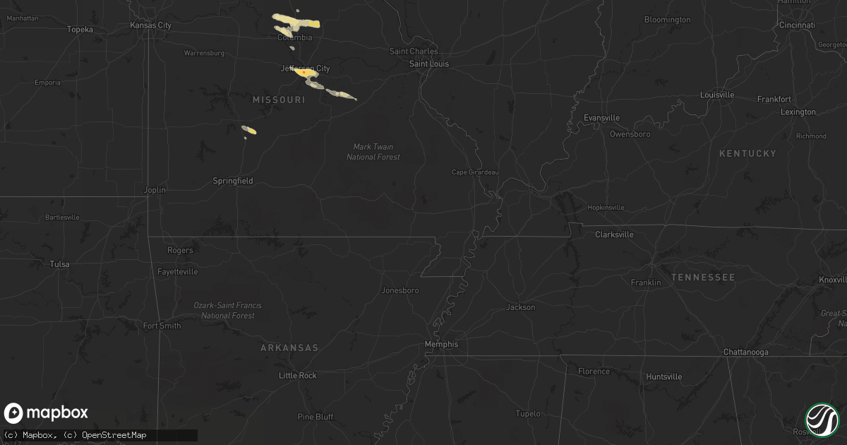
Hail Map in Virginia on June 12, 2011
Get this storm
June 12 map
$229
one time, instant access
Download today. No call, no setup
Keep the $229
Bought the map and want the full workflow? Apply the entire $229 to a subscription within 7 days. None of it is wasted.
Every map, not just this one
This buys you this map. Subscription and you get every map we run, in the markets you choose from a few cities to whole states to nationwide. Plus real-time alerts the moment a storm fires.
Contact data
Name, contact info, occupancy, even credit band for addresses in the footprint. You go from where it hit to who to call.
Become the source they trust
Unlimited branding weather history reports on demand. You already have the documented answer ready for the property owner, and you are the one who showed up with it.
Property data and RoofTrace estimates
Pull up any address you have got, its value and the exact code rules for that jurisdiction, straight from One Click Code. Then RoofTrace estimates the squares, pitch, and roof value, priced the way you price.
Storm reports in Virginia
Virginia
| Date | Description |
|---|---|
| 06/12/20116:55 PM CDT | Two trees down on west river road. |
| 06/12/20116:00 PM CDT | Widespread trees and powerlines down. 911 center inundated with calls. |
| 06/12/20115:51 PM CDT | A local report indicates 1.75 inch wind near 2 WNW ROLLINS FORK |
| 06/12/20115:33 PM CDT | Tree down near intersection of kings hwy and james madison pkwy |
| 06/12/20115:20 PM CDT | Very heavy rain and high winds |
| 06/12/20115:02 PM CDT | Tree down |
| 06/12/20114:53 PM CDT | Tree down on mount laurel road near clover |
| 06/12/20114:47 PM CDT | A tree was blown down along state route 746. |
| 06/12/20114:40 PM CDT | Received a report from the public of 2 trees down along father judge road. |
| 06/12/20114:00 PM CDT | Tree onto house on manasses circle in vienna |
| 06/12/20113:58 PM CDT | One tree blown down onto a power line along lewis ford road. |
| 06/12/20113:56 PM CDT | One tree blown down along oak ridge road. |
| 06/12/20113:55 PM CDT | Tree down on main st |
| 06/12/20113:52 PM CDT | Tree down on compton rd at briarcroft rd |
| 06/12/20113:49 PM CDT | A tree was blown down along county road 781. |
| 06/12/20113:45 PM CDT | Tree down on singletons way |
| 06/12/20113:34 PM CDT | One tree down on candlers mountain road. |
| 06/12/20113:33 PM CDT | Power lines down on lynx drive. |
| 06/12/20113:30 PM CDT | Tree down at intersection of route 45 and salem church road. |
| 06/12/20113:27 PM CDT | Cedar tree blown down in backyard of observers house located along mayfield drive |
| 06/12/20113:27 PM CDT | Several trees down in apartment complex off lakeside drive near the intersection of route 501 |
| 06/12/20113:25 PM CDT | Several large branches downed in the neighborhood... Knocking out power. Half inch hail was also observed... Along with 1.84 inches of rain in 30 minutes. |
| 06/12/20113:15 PM CDT | Bedford county sheriffs department has reported multiple trees down along forest road near the bedford city limits. |
| 06/12/20113:15 PM CDT | A very large oak tree was uprooted on gaddy road. |
| 06/12/20113:15 PM CDT | Several trees were blown down on mayfield drive. |
| 06/12/20113:09 PM CDT | Trees down along polecat hill road |
| 06/12/20113:09 PM CDT | Trees down along snickersville turnpike |
| 06/12/20113:05 PM CDT | Trees down along st louis road and foxcroft rd |
| 06/12/20113:05 PM CDT | One tree was down on a home along woodcreek road. |
| 06/12/20113:00 PM CDT | Tree on house in 20000 block of furr rd |
| 06/12/20112:53 PM CDT | Tree down |
| 06/12/20112:45 PM CDT | A tree was blown down along state route 648. |
| 06/12/20112:44 PM CDT | Trees and wires down in the 38000 block of va route 9 |
| 06/12/20112:42 PM CDT | Large limb down into southbound lane of va route 9 |
| 06/12/20112:40 PM CDT | Thunderstorm wind gust measured with a home weather station. |
| 06/12/20112:36 PM CDT | Trees down for a one mile stretch along route 151 between piney river and clifford |
| 06/12/20112:33 PM CDT | Wires down. |
| 06/12/20112:27 PM CDT | Several trees down in apartment complex off lakeside drive near the intersection of route 501 |
| 06/12/20112:27 PM CDT | Cedar tree blown down in backyard of observers house located along mayfield drive |
| 06/12/20112:16 PM CDT | One tree blown down in patrick springs. |
| 06/12/20112:01 PM CDT | Received a report of golfball size hail causing damage to screen fixtures of a home. |
| 06/12/20111:52 PM CDT | Trees down along charlottesville bypass hwy 250 |
| 06/12/20111:00 PM CDT | Fallen trees caused significant damage to several mobile homes and vehicles in the country estates trailer park |
All States Impacted by Hail Map on June 12, 2011
Cities Impacted by Hail Map on June 12, 2011
- Pickens, SC
- Six Mile, SC
- Central, SC
- Jefferson City, MO
- Fairfax Station, VA
- Woodbridge, VA
- Clifton, VA
- Manassas, VA
- Valentine, NE
- Crookston, NE
- Bartow, FL
- Atkinson, NE
- Baldwin, MD
- Fallston, MD
- New Salem, ND
- Elgin, ND
- Carson, ND
- Custer, MT
- Worden, MT
- Devils Tower, WY
- Moorcroft, WY
- Harrisburg, MO
- Fayette, MO
- Clark, MO
- Hallsville, MO
- Columbia, MO
- Sturgeon, MO
- Higbee, MO
- Mission, SD
- Saint Francis, SD
- Tunas, MO
- Windyville, MO
- Buffalo, MO
- Lusk, WY
- Mott, ND
- Weston, WY
- Broadus, MT
- Alzada, MT
- Freeman, SD
- Berryville, VA
- Roanoke Rapids, NC
- Owings Mills, MD
- Reisterstown, MD
- Clinton, NC
- Pembroke, GA
- Ellabell, GA
- Okeechobee, FL
- Columbiana, AL
- Tuthill, SD
- Martin, SD
- Parmelee, SD
- Quincy, FL
- Kilgore, NE
- New Cambria, MO
- Bucklin, MO
- Brookfield, MO
- Pine Ridge, SD
- Wounded Knee, SD
- Batesland, SD
- Allen, SD
- Volborg, MT
- Mandan, ND
- Mount Wolf, PA
- York, PA
- Colonial Beach, VA
- King George, VA
- Port Royal, VA
- Loretto, VA
- Blairsville, GA
- Selby, SD
- Colome, SD
- Springview, NE
- Winner, SD
- Murdo, SD
- Courtland, VA
- Lefor, ND
- Lemmon, SD
- Hettinger, ND
- Richardton, ND
- Hebron, ND
- Lodgepole, SD
- New Leipzig, ND
- Glen Ullin, ND
- Regent, ND
- Jarrettsville, MD
- Hydes, MD
- Forest Hill, MD
- Ashland, MO
- Adel, GA
- Almont, ND
- Ten Sleep, WY
- Dupree, SD
- Metter, GA
- Register, GA
- Halifax, PA
- Liverpool, PA
- Duncannon, PA
- Newport, PA
- White Owl, SD
- Chula, MO
- Rothville, MO
- Chillicothe, MO
- Wheeling, MO
- Laclede, MO
- Jameson, MO
- Gallatin, MO
- Marceline, MO
- Sumner, MO
- Mendon, MO
- Lock Springs, MO
- Trenton, MO
- Meadville, MO
- Jamesport, MO
- Lance Creek, WY
- Hulett, WY
- Mentone, TX
- Jal, NM
- Wilton, ND
- Newport News, VA
- Live Oak, FL
- Platte, SD
- Miami, FL
- Ethan, SD
- Taylorsville, NC
- Statesboro, GA
- Belle Fourche, SD
- Virginia Beach, VA
- Bismarck, ND
- Harrison, SD
- Ree Heights, SD
- Gann Valley, SD
- Lohman, MO
- Bonnots Mill, MO
- Lake Lure, NC
- Mountain Rest, SC
- Long Creek, SC
- Mexico, MO
- Centralia, MO
- Thompson, MO
- Smithwick, SD
- Manville, WY
- Whitney, NE
- Crawford, NE
- Dillwyn, VA
- Gadsden, SC
- Eastover, SC
- Tabor, SD
- Faith, SD
- Grand Ridge, FL
- Merriman, NE
- Meadow, SD
- Buckingham, VA
- Eureka, SD
- Chesapeake, VA
- Center, ND
- Big Cove Tannery, PA
- McConnellsburg, PA
- Needmore, PA
- Hancock, MD
- Big Pool, MD
- Mercersburg, PA
- Clear Spring, MD
- Eagle Butte, SD
- Lake Toxaway, NC
- Rosman, NC
- Alexander City, AL
- Tamassee, SC
- Newell, SD
- Smithfield, NC
- Fort Lauderdale, FL
- Oneill, NE
- Page, NE
- Hammond, MT
- Ludlow, SD
- Gladstone, VA
- Wingina, VA
- Marion, SD
- Bridgewater, SD
- Bristol, FL
- Lehr, ND
- White River, SD
- Irene, SD
- Centerville, SD
- Viborg, SD
- Wakonda, SD
- Salem, SC
- Polkton, NC
- Wadesboro, NC
- Corsica, SD
- Armour, SD
- Flasher, ND
- Bland, MO
- Owensville, MO
- Belle, MO
- Chipley, FL
- Graceville, FL
- Bonifay, FL
- Sandy Ridge, NC
- Patrick Springs, VA
- Stuart, VA
- Spencer, VA
- Alexandria, SD
- Emery, SD
- Parkston, SD
- Littleton, NC
- Edgemont, SD
- Sunset, SC
- Mills, NE
- Lynchburg, VA
- Madison Heights, VA
- Buffalo, SD
- New England, ND
- Turkey, NC
- Elizabethtown, PA
- York Haven, PA
- Middletown, PA
- Bainbridge, PA
- Manchester, PA
- Schuyler, VA
- Middleburg, VA
- Harpers Ferry, WV
- Millville, WV
- Purcellville, VA
- Charles Town, WV
- Marydel, MD
- Barclay, MD
- Sudlersville, MD
- Galena, MD
- Ingleside, MD
- Church Hill, MD
- Denton, MD
- Ridgely, MD
- Greensboro, MD
- Millington, MD
- Kennedyville, MD
- Henderson, MD
- Goldsboro, MD
- Centreville, MD
- Fort Stewart, GA
- Hoven, SD
- Hawthorne, FL
- Solomons, MD
- Lusby, MD
- Hollywood, MD
- California, MD
- Mechanicsville, MD
- Saint Leonard, MD
- Dowell, MD
- Kiln, MS
- Upperville, VA
- Bluemont, VA
- Round Hill, VA
- Oelrichs, SD
- Linneus, MO
- Purdin, MO
- Prairie City, SD
- Faulkton, SD
- Effingham, SC
- Florence, SC
- Hinsdale, MT
- Kearneysville, WV
- Shenandoah Junction, WV
- Gerrardstown, WV
- Ranson, WV
- Hamilton, VA
- Martinsburg, WV
- Inwood, WV
- Hedgesville, WV
- Lovettsville, VA
- Waterford, VA
- Cody, NE
- Nenzel, NE
- Parrish, FL
- Rowland, NC
- Rockford, AL
- Weogufka, AL
- Armstrong, MO
- Bassett, NE
- Franklin, GA
- Woodland, AL
- Roanoke, AL
- Alva, WY
- Aladdin, WY
- Sundance, WY
- Rocheport, MO
- Meadows Of Dan, VA
- Waynesboro, VA
- Fort Defiance, VA
- Staunton, VA
- Fishersville, VA
- Mount Sidney, VA
- Charlottesville, VA
- Verona, VA
- Greenwood, VA
- Crimora, VA
- Grottoes, VA
- Afton, VA
- Crozet, VA
- Forest, VA
- Winnett, MT
- Aylett, VA
- Lead, SD
- Dundee, FL
- Lake Wales, FL
- Kadoka, SD
- Oldtown, MD
- Paw Paw, WV
- Levels, WV
- Great Cacapon, WV
- Slanesville, WV
- Bonesteel, SD
- Hazen, ND
- Beulah, ND
- Zap, ND
- Garrison, ND
- Chambers, NE
- Poplarville, MS
- Seminole, TX
- Claremont, NC
- Holden, LA
- Williamsport, MD
- Hagerstown, MD
- Warfordsburg, PA
- Lenoir, NC
- Bay Saint Louis, MS
- Waveland, MS
- Hickory, NC
- Conover, NC
- Issue, MD
- Pembroke Pines, FL
- Hollywood, FL
- Hialeah, FL
- Hahira, GA
- Catonsville, MD
- Rhame, ND
- Bowman, ND
- Hurley, SD
- Tyndall, SD
- Lemoyne, PA
- New Cumberland, PA
- Camp Hill, PA
- Carrabelle, FL
- Lake Butler, FL
- Ewing, NE
- Norris, SD
- Zebulon, NC
- Sparks, GA
- Franklinton, LA
- Millerstown, PA
- Carrollton, VA
- Smithfield, VA
- Onaka, SD
- Seneca, SD
- Lake City, FL
- Harrington, DE
- Shipman, VA
- Burke, SD
- Geddes, SD
- Willards, MD
- Newark, MD
- Whaleyville, MD
- Berlin, MD
- Anniston, AL
- Franklintown, PA
- Dillsburg, PA
- Shelby, AL
- Sylacauga, AL
- Suffolk, VA
- Crescent City, FL
- Enning, SD
- Crewe, VA
- Rice, VA
- Jetersville, VA
- Burkeville, VA
- Hendersonville, NC
- Penrose, NC
- Starke, FL
- Melrose, FL
- Keystone Heights, FL
- Green Cove Springs, FL
- Interlachen, FL
- Homerville, GA
- Du Pont, GA
- Jackson, NC
- Rich Square, NC
- Street, MD
- Pylesville, MD
- Bel Air, MD
- Whiteford, MD
- Delta, PA
- Stuart, NE
- Indian Head, MD
- Lorton, VA
- Wood, SD
- Reva, SD
- Wright, WY
- Gillette, WY
- Fawn Grove, PA
- Airville, PA
- Fort Myers, FL
- Lehigh Acres, FL
- Blackstone, VA
- Ford, VA
- Wilsons, VA
- Amelia Court House, VA
- Orrville, AL
- Fairfax, VA
- Haymarket, VA
- Chantilly, VA
- Catharpin, VA
- The Plains, VA
- Marshall, VA
- Broad Run, VA
- Centreville, VA
- Delaplane, VA
- Summit Point, WV
- Aldie, VA
- Utica, SD
- Peachland, NC
- Bridgewater, VA
- Mount Crawford, VA
- Ralph, SD
- Wagner, SD
- Shawboro, NC
- Shiloh, NC
- Frankford, DE
- Pittsville, MD
- Bishopville, MD
- Koeltztown, MO
- Westphalia, MO
- Freeburg, MO
- Centreville, MS
- Saint Anthony, ND
- Brogue, PA
- White Hall, MD
- Aberdeen, MD
- Monkton, MD
- Wrightsville, PA
- Parkville, MD
- New Bloomfield, PA
- Perryman, MD
- Hummelstown, PA
- Darlington, MD
- Highspire, PA
- Elliottsburg, PA
- Abingdon, MD
- Shermans Dale, PA
- Belcamp, MD
- Carlisle, PA
- Red Lion, PA
- Perry Hall, MD
- Landisburg, PA
- Wellsville, PA
- Marysville, PA
- McAlisterville, PA
- Millersburg, PA
- Upper Falls, MD
- Mechanicsburg, PA
- Etters, PA
- Kingsville, MD
- Dauphin, PA
- Joppa, MD
- Lewisberry, PA
- Felton, PA
- Fork, MD
- Harrisburg, PA
- Windsor, PA
- Summerdale, PA
- Thompsontown, PA
- Glen Arm, MD
- Mount Pleasant Mills, PA
- Marietta, PA
- Enola, PA
- Phoenix, MD
- Holtwood, PA
- Aberdeen Proving Ground, MD
- Nottingham, MD
- Havre De Grace, MD
- Dover, PA
- Emigsville, PA
- Churchville, MD
- Berkeley Springs, WV
- Cross Junction, VA
- Bloomery, WV
- Caret, VA
- Naper, NE
- Gregory, SD
- Dallas, SD
- Jayess, MS
- Ruth, MS
- Liberty, MS
- Newhebron, MS
- Magee, MS
- Fairplay, MD
- Bunnell, FL
- Saint Thomas, MO
- Centertown, MO
- Loose Creek, MO
- Holts Summit, MO
- Amidon, ND
- Summit, MS
- Lineville, AL
- Cuba, MO
- Bourbon, MO
- Menno, SD
- Olivet, SD
- Bighorn, MT
- Chadron, NE
- New Park, PA
- Harrisonville, PA
- Waterfall, PA
- Wells Tannery, PA
- Newtown, VA
- Rappahannock Academy, VA
- Tappahannock, VA
- Champlain, VA
- Saint Stephens Church, VA
- Hustle, VA
- Newburg, MD
- Bowling Green, VA
- Milford, VA
- Montross, VA
- Glyndon, MD
- Rozet, WY
- Fairburn, SD
- Dutton, VA
- Gloucester, VA
- Gladys, VA
- Pomona Park, FL
- Olyphant, PA
- Jermyn, PA
- Ideal, SD
- Witten, SD
- Plainview, NE
- Brunswick, NE
- Lake Andes, SD
- Zirconia, NC
- Stewartstown, PA
- Fredericksburg, VA
- Mccomb, MS
- Magnolia, MS
- Deland, FL
- Willacoochee, GA
- Pass Christian, MS
- Jasper, FL
- Amite, LA
- Eglin Afb, FL
- Pamplico, SC
- Royal, NE
- Orchard, NE
- Pembroke, NC
- Stem, NC
- Louisburg, MO
- Chattahoochee, FL
- Bedford, VA
- Union Mills, NC
- Walhalla, SC
- Loranger, LA
- Baldwin, ND
- Mitchell, SD
- Catawba, NC
- Eastpoint, FL
- Norfolk, NE
- Pierce, NE
- Hoskins, NE
- Goodwater, AL
- Ashland, AL
- Zachary, LA
- Victoria, VA
- Parkton, MD
- Porcupine, SD
- Dante, SD
- Lantry, SD
- Lesterville, SD
- Dickinson, ND
- Buffalo Gap, SD
- Orlando, FL
- Shannon, NC
- Red Springs, NC
- Raeford, NC
- Raleigh, MS
- Tripp, SD
- Saucier, MS
- Harrisonburg, VA
- Eudora, AR
- Denham Springs, LA
- Presho, SD
- Vivian, SD
- Manderson, SD
- Rushville, NE
- Wanblee, SD
- Punta Gorda, FL
- Hot Springs, SD
- Flat Rock, NC
- Union Center, SD
- Osmond, NE
- Pearson, GA
- Axson, GA
- Naples, FL
- Long Lake, SD
- Ridgeview, SD
- Reeder, ND
- Herrick, SD
- Norman Park, GA
- Ellenton, GA
- Richfield, PA
- Cocolamus, PA
- Gloster, MS
- Smithdale, MS
- Zeeland, ND
- Franklinville, NC
- Sarasota, FL
- Urbana, MO
- Fort Meade, FL
- Estill, SC
- Newport, NE
- Claxton, GA
- Glennville, GA
- Ludowici, GA
- Port Republic, VA
- Stony Point, NC
- Guyton, GA
- Damascus, GA
- Blakely, GA
- Midland, SD
- Sumter, SC
- Myakka City, FL
- Amelia, NE
- Climax, NC
- Liberty, NC
- Draper, SD
- Defuniak Springs, FL
- Camp Crook, SD
- Four Oaks, NC
- Earleville, MD
- Felton, DE
- Odum, GA
- Jesup, GA
- Gaston, NC
- Okaton, SD
- Cherry Creek, SD
- Mifflintown, PA
- Deatsville, AL
- Reidsville, GA
- Wake, VA
- Hardyville, VA
- Pompeys Pillar, MT
- Wadley, AL
- Wedowee, AL
- Ramseur, NC
- Harrisburg, NE
- Bell, FL
- Trenton, FL
- Gordon, NE
- Mount Olive, MS
- Volin, SD
- Salem, SD
- Tiger, GA


