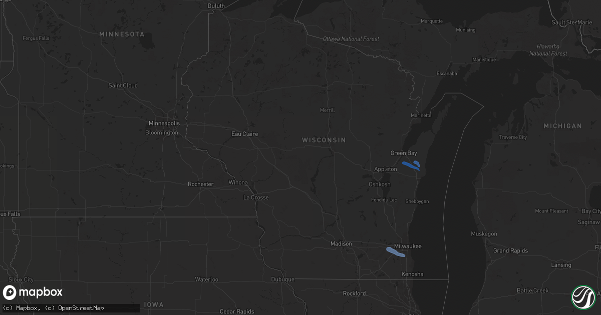
Hail Map in Wisconsin on June 11, 2020
Get this storm
June 11 map
$229
one time, instant access
Download today. No call, no setup
Keep the $229
Bought the map and want the full workflow? Apply the entire $229 to a subscription within 7 days. None of it is wasted.
Every map, not just this one
This buys you this map. Subscription and you get every map we run, in the markets you choose from a few cities to whole states to nationwide. Plus real-time alerts the moment a storm fires.
Contact data
Name, contact info, occupancy, even credit band for addresses in the footprint. You go from where it hit to who to call.
Become the source they trust
Unlimited branding weather history reports on demand. You already have the documented answer ready for the property owner, and you are the one who showed up with it.
Property data and RoofTrace estimates
Pull up any address you have got, its value and the exact code rules for that jurisdiction, straight from One Click Code. Then RoofTrace estimates the squares, pitch, and roof value, priced the way you price.
Storm reports in Wisconsin
Wisconsin
| Date | Description |
|---|---|
| 06/11/20205:31 PM CDT | Fallen tree at 29th st and ryan rd in oak creek. Time estimated from radar. Report relayed via social media. |
| 06/11/20205:18 PM CDT | 6 inch diameter tree limb down between richard st and dodie dr on the west side of s grand ave. |
| 06/11/20205:17 PM CDT | 2 inch diameter tree limbs down. |
| 06/11/20205:16 PM CDT | 4 inch diameter tree limbs down. |
| 06/11/20203:29 PM CDT | Tree branches on wires. Time estimated by radar. |
| 06/11/20203:16 PM CDT | Tree down in kossuth. Time estimated by radar. |
| 06/11/20203:09 PM CDT | Tree down. Time estimated by radar. |
| 06/11/20203:06 PM CDT | Trees and power lines down in new denmark. Time estimated by radar. |
| 06/11/20201:39 PM CDT | Via social media photo from wsaw tv-7. |
| 06/11/202012:12 AM CDT | At 511 PM CDT, a severe thunderstorm was located near North Prairie, or near Wales, moving east at 45 mph. HAZARD...60 mph wind gusts. SOURCE...Radar indicated. IMPACT...Expect damage to roofs, siding, and trees. Locations impacted include... Milwaukee, Racine, Waukesha, New Berlin, Greenfield, Oak Creek, Mount Pleasant, Muskego, South Milwaukee, Cudahy, Greendale, Hales Corners, Mukwonago, Sturtevant, Wales, Wind Lake, North Prairie, Wind Point, Big Bend and Waterford North.People attending Outdoor Testing at Aurora South Shore in Cudahyshould seek safe shelter immediately! |
| 06/10/202011:38 PM CDT | At 438 PM CDT, a severe thunderstorm was located over Johnson Creek, or near Lake Mills, moving east at 45 mph. HAZARD...60 mph wind gusts. SOURCE...Radar indicated. IMPACT...Expect damage to roofs, siding, and trees. Locations impacted include... Watertown, Hartland, Jefferson, Mukwonago, Delafield, Lake Mills, Wales, Okauchee Lake, Oconomowoc, Merton, Johnson Creek, Dousman, North Prairie, Lac La Belle, Ixonia, Rome, Nashotah, Milford, Sullivan and Oconomowoc Lake.People attending Outdoor Testing at Aurora in Summit should seek safeshelter immediately! |
| 06/10/202010:04 PM CDT | At 303 PM CDT, a severe thunderstorm was located near Denmark, or 10 miles southeast of Green Bay, moving east at 45 mph. HAZARD...60 mph wind gusts and quarter size hail. SOURCE...Radar indicated. IMPACT...Hail damage to vehicles is expected. Expect wind damage to roofs, siding, and trees. This severe thunderstorm will be near... Two Creeks around 325 PM CDT.Other locations impacted by this severe thunderstorm include Krok,Mishicot, Maribel, Larrabee, Curran, Morrison, Ellisville, Humboldt,Ledgeview and East Krok. |
All States Impacted by Hail Map on June 11, 2020
Cities Impacted by Hail Map on June 11, 2020
- Guymon, OK
- Goodwell, OK
- Grafton, ND
- Glasston, ND
- Cavalier, ND
- Neche, ND
- Bathgate, ND
- Hamilton, ND
- Plains, KS
- Kismet, KS
- Prospect, OR
- Argyle, MN
- Bend, OR
- La Pine, OR
- Saint Thomas, ND
- Drayton, ND
- Minto, ND
- Trail, OR
- Sarasota, FL
- Venice, FL
- Warm Springs, OR
- Maupin, OR
- Dodge City, KS
- Ford, KS
- Wright, KS
- Satanta, KS
- Stephen, MN
- Ruskin, FL
- Idleyld Park, OR
- Ashland, OR
- Pratt, KS
- Cunningham, KS
- Medford, OR
- Central Point, OR
- Alamogordo, NM
- Chemult, OR
- Las Cruces, NM
- Rotonda West, FL
- North Port, FL
- Shady Cove, OR
- Spearville, KS
- Greenleaf, WI
- Mishicot, WI
- Maribel, WI
- Denmark, WI
- De Pere, WI
- Two Rivers, WI
- Muskego, WI
- Franklin, WI
- Big Bend, WI
- Wales, WI
- Mukwonago, WI
- North Prairie, WI
- New Berlin, WI
- Waukesha, WI
- Eagle Point, OR
- Crescent, OR


