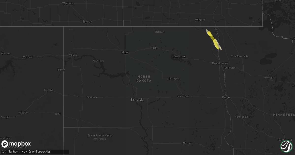
Hail Map in North Dakota on June 11, 2020
Get this storm
June 11 map
$229
one time, instant access
Download today. No call, no setup
Keep the $229
Bought the map and want the full workflow? Apply the entire $229 to a subscription within 7 days. None of it is wasted.
Every map, not just this one
This buys you this map. Subscription and you get every map we run, in the markets you choose from a few cities to whole states to nationwide. Plus real-time alerts the moment a storm fires.
Contact data
Name, contact info, occupancy, even credit band for addresses in the footprint. You go from where it hit to who to call.
Become the source they trust
Unlimited branding weather history reports on demand. You already have the documented answer ready for the property owner, and you are the one who showed up with it.
Property data and RoofTrace estimates
Pull up any address you have got, its value and the exact code rules for that jurisdiction, straight from One Click Code. Then RoofTrace estimates the squares, pitch, and roof value, priced the way you price.
Storm reports in North Dakota
North Dakota
| Date | Description |
|---|---|
| 06/11/20203:57 PM CDT | Large amount of half dollar sized hail stripped the leaves off of trees. |
| 06/10/202011:29 PM CDT | At 428 PM CDT, severe thunderstorms were located along a line extending from near Herrick to near Cashel, moving southeast at 35 mph. HAZARD...Half dollar size hail. SOURCE...Radar indicated. IMPACT...Damage to vehicles is expected. Severe thunderstorms will be near... Big Woods around 445 PM CDT. Oslo and Argyle around 455 PM CDT. Alvarado around 500 PM CDT. March around 505 PM CDT. Warren around 510 PM CDT.This includes Interstate 29 between mile markers 167 and 184. |
| 06/10/202010:37 PM CDT | At 337 PM CDT, a severe thunderstorm was located near Cavalier, or 28 miles north of Grafton, moving southeast at 45 mph. HAZARD...60 mph wind gusts and quarter size hail. SOURCE...Radar indicated. IMPACT...Hail damage to vehicles is expected. Expect wind damage to roofs, siding, and trees. This severe thunderstorm will be near... Hamilton around 340 PM CDT. Glasston around 350 PM CDT. St. Thomas around 355 PM CDT. Bowesmont around 400 PM CDT. Drayton, Robbin and Herrick around 410 PM CDT.Other locations impacted by this severe thunderstorm include AmericanCrystal Sugar.This includes Interstate 29 between mile markers 174 and 200. |
All States Impacted by Hail Map on June 11, 2020
Cities Impacted by Hail Map on June 11, 2020
- Guymon, OK
- Goodwell, OK
- Grafton, ND
- Glasston, ND
- Cavalier, ND
- Neche, ND
- Bathgate, ND
- Hamilton, ND
- Plains, KS
- Kismet, KS
- Prospect, OR
- Argyle, MN
- Bend, OR
- La Pine, OR
- Saint Thomas, ND
- Drayton, ND
- Minto, ND
- Trail, OR
- Sarasota, FL
- Venice, FL
- Warm Springs, OR
- Maupin, OR
- Dodge City, KS
- Ford, KS
- Wright, KS
- Satanta, KS
- Stephen, MN
- Ruskin, FL
- Idleyld Park, OR
- Ashland, OR
- Pratt, KS
- Cunningham, KS
- Medford, OR
- Central Point, OR
- Alamogordo, NM
- Chemult, OR
- Las Cruces, NM
- Rotonda West, FL
- North Port, FL
- Shady Cove, OR
- Spearville, KS
- Greenleaf, WI
- Mishicot, WI
- Maribel, WI
- Denmark, WI
- De Pere, WI
- Two Rivers, WI
- Muskego, WI
- Franklin, WI
- Big Bend, WI
- Wales, WI
- Mukwonago, WI
- North Prairie, WI
- New Berlin, WI
- Waukesha, WI
- Eagle Point, OR
- Crescent, OR


