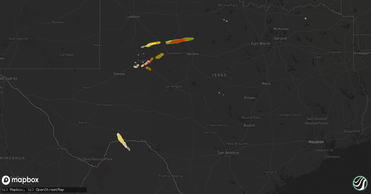
Hail Map in Texas on June 11, 2014
Get this storm
June 11 map
$229
one time, instant access
Download today. No call, no setup
Keep the $229
Bought the map and want the full workflow? Apply the entire $229 to a subscription within 7 days. None of it is wasted.
Every map, not just this one
This buys you this map. Subscription and you get every map we run, in the markets you choose from a few cities to whole states to nationwide. Plus real-time alerts the moment a storm fires.
Contact data
Name, contact info, occupancy, even credit band for addresses in the footprint. You go from where it hit to who to call.
Become the source they trust
Unlimited branding weather history reports on demand. You already have the documented answer ready for the property owner, and you are the one who showed up with it.
Property data and RoofTrace estimates
Pull up any address you have got, its value and the exact code rules for that jurisdiction, straight from One Click Code. Then RoofTrace estimates the squares, pitch, and roof value, priced the way you price.
Storm reports in Texas
Texas
| Date | Description |
|---|---|
| 06/11/20146:58 PM CDT | A local report indicates 60 MPH wind near SWEETWATER |
| 06/11/20146:50 PM CDT | 18 wheeler blown over on us 84 |
| 06/11/20146:38 PM CDT | 5-7 foot long mesquite braches across sr 208 |
| 06/11/20146:37 PM CDT | Powerlines down in loraine |
| 06/11/20146:30 PM CDT | Jack-knifed 18 wheeler on i-20 |
| 06/11/20146:23 PM CDT | A local report indicates 2.75 inch wind near COLORADO CITY |
| 06/11/20146:20 PM CDT | Spotter reported roof blown off the wallace school in colorado city. |
| 06/11/20146:20 PM CDT | Highline wires downed south of westbrook |
| 06/11/20146:20 PM CDT | Grain silo blown across fm 1983 |
| 06/11/20146:17 PM CDT | 60-65mph winds reported near sh 163 and cr 3337 |
| 06/11/20146:13 PM CDT | A local report indicates 60 MPH wind near 16 NNW STERLING CITY |
| 06/11/20145:30 PM CDT | Spotter reports quarter to slightly larger than quarter size hail in lees. |
| 06/11/20145:15 AM CDT | Measured at sherman-denison airport. Kgyi awos observation. |
| 06/11/201412:25 AM CDT | A local report indicates 1.00 inch wind near WOLF CREEK PARK |
| 06/10/201411:55 PM CDT | A local report indicates 1.00 inch wind near 3 S LIPSCOMB |
| 06/10/201410:58 PM CDT | A local report indicates 60 MPH wind near LIPSCOMB |
| 06/10/20149:00 PM CDT | Metal roof peeled back. Insulation in the fields. Numerous tree limbs down. |
| 06/10/20149:00 PM CDT | A local report indicates 75 MPH wind near 3 ENE WALL |
| 06/10/20148:45 PM CDT | A local report indicates 64 MPH wind near 1 E WALL |
| 06/10/20148:30 PM CDT | Metal roof peeled back on a home near blumentritt road and loop 306. |
| 06/10/20148:26 PM CDT | Home weather station measured 73 mph near goodfellow afb. |
| 06/10/20148:24 PM CDT | A tornado was observed north of fm 388 and just west of loop 306. The tornado moved east southeast across loop 306 before dissipating. The nws survey has rated this tor |
| 06/10/20148:20 PM CDT | Widespread damage to utility poles... Trees...and roofs across the city. |
| 06/10/20148:20 PM CDT | A local report indicates 1.75 inch wind near LUEDERS |
| 06/10/20148:20 PM CDT | Ef0 tornado damage surveyed in the paulann area of north san angelo. Minor damage was observed to fences...roof coverings...trees...and road signs. |
| 06/10/20148:15 PM CDT | A local report indicates 74 MPH wind near 7 NW SAN ANGELO |
| 06/10/20148:10 PM CDT | Significant roof damage reportd near the san angelo coliseum |
| 06/10/20148:10 PM CDT | Widespread damage at well yard. |
| 06/10/20148:10 PM CDT | Minor roof damage reported in the highland range addition. |
| 06/10/20148:05 PM CDT | Building collapsed due to damaging winds. |
| 06/10/20148:00 PM CDT | Quarter to golf ball size hail with winds estimated at 40 to 50 mph. |
| 06/10/20147:57 PM CDT | A local report indicates 75 MPH wind near 1 NW CARLSBAD |
| 06/10/20147:35 PM CDT | A local report indicates 60 MPH wind near 1 SSE HAMLIN |
| 06/10/20147:35 PM CDT | A local report indicates 1.00 inch wind near 1 SSE HAMLIN |
| 06/10/20147:05 PM CDT | Part of a metal roof was peeled off the baptist church. Numerous trees were uprooted and power lines were down in town. |
| 06/10/20147:05 PM CDT | A local report indicates 1.00 inch wind near ROTAN |
All States Impacted by Hail Map on June 11, 2014
Cities Impacted by Hail Map on June 11, 2014
- Tarentum, PA
- New Kensington, PA
- Creighton, PA
- Springdale, PA
- Earlsboro, OK
- Seminole, OK
- Marienthal, KS
- Waverly, VA
- Disputanta, VA
- Spring Grove, VA
- Ionia, MI
- Orleans, MI
- Fenwick, MI
- Clendenin, WV
- Montebello, VA
- Dillwyn, VA
- Farmville, VA
- Buckingham, VA
- Perry, OK
- Billings, OK
- Marietta, SC
- Magnolia, NC
- Rose Hill, NC
- Ayr, NE
- Healy, KS
- Belding, MI
- Saranac, MI
- Gore, VA
- Winchester, VA
- Herndon, WV
- Kimball, WV
- Welch, WV
- Monroe, VA
- Bristol, VA
- Mendota, VA
- Partlow, VA
- Spotsylvania, VA
- Castlewood, VA
- Fort Blackmore, VA
- Dungannon, VA
- Nickelsville, VA
- Coeburn, VA
- Gate City, VA
- Saint Paul, VA
- Butler, MO
- Amsterdam, MO
- Archie, MO
- Adrian, MO
- Kingfisher, OK
- Clewiston, FL
- Immokalee, FL
- Winona, KS
- Graham, NC
- Haw River, NC
- Carbondale, KS
- Burlingame, KS
- Richmond, KS
- Greeley, KS
- Williamsburg, KS
- Wakarusa, KS
- Auburn, KS
- Princeton, KS
- Quenemo, KS
- Garnett, KS
- Pomona, KS
- Scranton, KS
- Harveyville, KS
- Eskridge, KS
- Ottawa, KS
- Overbrook, KS
- Charles City, VA
- Dendron, VA
- Colonial Heights, VA
- Wakefield, VA
- Prince George, VA
- Hopewell, VA
- Chester, VA
- Jarratt, VA
- Ahoskie, NC
- Cove City, NC
- Grifton, NC
- Dover, NC
- Vanceboro, NC
- Hastings, NE
- Juniata, NE
- South Hill, VA
- South Bay, FL
- Windsor, NC
- Union Mills, NC
- Blue Hill, NE
- Red Cloud, NE
- Lebanon, KS
- Inavale, NE
- Bladen, NE
- Burr Oak, KS
- Guide Rock, NE
- Freeman, MO
- Bradshaw, NE
- York, NE
- Wellington, KS
- Jamesville, NC
- Confluence, PA
- Addison, PA
- Martinsburg, WV
- Goodland, KS
- Britton, SD
- Fairfield, VA
- Raphine, VA
- Galivants Ferry, SC
- Aynor, SC
- Crawford, OK
- Durham, OK
- Gaylord, KS
- Downs, KS
- Esbon, KS
- Portis, KS
- Vona, CO
- West Newton, PA
- Clear Spring, MD
- Big Pool, MD
- Kearneysville, WV
- Hedgesville, WV
- Inwood, WV
- Falling Waters, WV
- Alamo, GA
- Wallace, KS
- Bucklin, KS
- Medford, OK
- Blountville, TN
- Bristol, TN
- Hollywood, FL
- Hialeah, FL
- Pembroke Pines, FL
- Verndale, MN
- Sebeka, MN
- Hydro, OK
- Lake City, SD
- Amherst, SD
- Langford, SD
- Hampton, NE
- Benedict, NE
- Ruther Glen, VA
- Beaverdam, VA
- Osawatomie, KS
- Higgins, TX
- Lipscomb, TX
- Holstein, NE
- Roseland, NE
- Petersburg, VA
- Warrenton, NC
- Macon, NC
- Aurora, NE
- Glenville, WV
- Robinson, KS
- Warthen, GA
- Mitchell, GA
- Scott City, KS
- Leoti, KS
- Loyal, OK
- Alma, KS
- Columbia, NC
- Middlebrook, VA
- Bassett, VA
- Beaver, WV
- Layland, WV
- Beckley, WV
- Mount Hope, WV
- Oak Hill, WV
- Lynchburg, VA
- Gladstone, VA
- Amherst, VA
- Rustburg, VA
- Madison Heights, VA
- Spencer, WV
- Gandeeville, WV
- Aulander, NC
- Manhattan, KS
- Lowell, MI
- Gloucester, VA
- Snow Camp, NC
- Pittsboro, NC
- Easley, SC
- Hobe Sound, FL
- Oskaloosa, KS
- Ozawkie, KS
- Arrington, VA
- Wingina, VA
- Howardsville, VA
- Schuyler, VA
- Norwood, VA
- Ellis, KS
- Durham, NC
- Morrisville, NC
- Cary, NC
- Giltner, NE
- Claremont, SD
- Lake City, KS
- Wilmore, KS
- Evington, VA
- Lynch Station, VA
- Plainville, KS
- Topeka, KS
- Ogallah, KS
- Gresham, NE
- Superior, NE
- Weskan, KS
- Douglas, OK
- Fairmont, OK
- Akron, CO
- Big Spring, TX
- Boydton, VA
- Mankato, KS
- Dighton, KS
- Greenleaf, KS
- Nora, VA
- Everett, PA
- Bedford, PA
- High View, WV
- Lane, KS
- Palmyra, VA
- Troy, VA
- Kents Store, VA
- Matthews, GA
- Sharon Springs, KS
- Campbell, NE
- Oakley, KS
- Henry, VA
- Dryden, TX
- Marathon, TX
- Stromsburg, NE
- Victoria, KS
- Gorham, KS
- Shattuck, OK
- Arnett, OK
- New Millport, PA
- Irvona, PA
- Olanta, PA
- Coalport, PA
- Glen Richey, PA
- Madera, PA
- Glen Hope, PA
- Clearfield, PA
- Tribune, KS
- Baskerville, VA
- Sedley, VA
- Fort Lee, VA
- Elberon, VA
- Henrico, VA
- Ivor, VA
- Apex, NC
- Hays, KS
- Wakeeney, KS
- Concordia, KS
- Belleville, KS
- Lawrence, NE
- Roper, NC
- Wright, KS
- Formoso, KS
- Alta Vista, KS
- Maple Hill, KS
- Creswell, NC
- Pickens, SC
- Liberty, SC
- Beaver, OK
- Kanorado, KS
- Green, KS
- Leonardville, KS
- Canadian, TX
- Ben Franklin, TX
- Roxton, TX
- Burlington, CO
- Bethune, CO
- Natoma, KS
- Alton, KS
- Woodston, KS
- Stockton, KS
- Osborne, KS
- West Palm Beach, FL
- Okarche, OK
- Ulysses, NE
- Pittsburgh, PA
- Cheswick, PA
- Shelby, NE
- Surprise, NE
- Seth, WV
- Bronson, KS
- Emporia, VA
- Palco, KS
- Hooker, OK
- Arapahoe, CO
- Henderson, NC
- Smithfield, NC
- Pine Level, NC
- Princeton, NC
- Selma, NC
- Swainsboro, GA
- Wamego, KS
- Paxico, KS
- McFarland, KS
- Sand Fork, WV
- Rockbridge Baths, VA
- Squire, WV
- Paynesville, WV
- Berwind, WV
- Miami, FL
- Homestead, FL
- Rotan, TX
- Franklin, VA
- Zuni, VA
- Okeechobee, FL
- Fairhope, PA
- Jewell, KS
- Hopewell, PA
- Buffalo Mills, PA
- Hyndman, PA
- Perryton, TX
- Gail, TX
- Fluvanna, TX
- Snyder, TX
- Sheridan Lake, CO
- Rhodell, WV
- Slab Fork, WV
- Piedmont, OK
- Lake Worth Beach, FL
- Lake Worth, FL
- Wishek, ND
- Ashley, ND
- Lehr, ND
- Pooler, GA
- Savannah, GA
- Delray Beach, FL
- Glenvil, NE
- Central, SC
- Six Mile, SC
- Verona, PA
- Smith Center, KS
- Mebane, NC
- Plant City, FL
- Kittrell, NC
- Franklinton, NC
- Quinter, KS
- Stratton, CO
- Cope, CO
- Anton, CO
- Rembert, SC
- Garden City, TX
- Stanton, TX
- Taloga, OK
- Goldsboro, NC
- Broad Run, VA
- Warrenton, VA
- Midland, VA
- Catlett, VA
- Bealeton, VA
- Lawrenceville, VA
- Mulhall, OK
- Coyle, OK
- Wadena, MN
- Utica, KS
- Ransom, KS
- Arnold, KS
- Warsaw, NC
- Turkey, NC
- Vesuvius, VA
- Thurmond, WV
- Harrisburg, NC
- Concord, NC
- Montpelier, VA
- Fredericksburg, VA
- Bumpass, VA
- Doswell, VA
- Joes, CO
- Trumbull, NE
- Edinburg, VA
- Corn, OK
- Weatherford, OK
- Spearville, KS
- Hollister, NC
- Chapel Hill, NC
- Valley Falls, KS
- Ellabell, GA
- Easton, KS
- Buckhannon, WV
- Pomeroy, OH
- Langsville, OH
- Rutland, OH
- Offerle, KS
- Carrboro, NC
- Booker, TX
- Rincon, GA
- Clinton, NC
- Faison, NC
- Gates, NC
- Corapeake, NC
- Ellendale, ND
- Windthorst, TX
- Cleveland, MO
- South Haven, KS
- Drexel, MO
- Harrisonville, MO
- Balko, OK
- Carson, VA
- Stony Creek, VA
- Enid, OK
- Fullerton, ND
- Bruceton Mills, WV
- Friendsville, MD
- Markleysburg, PA
- Hinton, VA
- Enfield, NC
- Jeannette, PA
- Adamsburg, PA
- Manor, PA
- Westmoreland City, PA
- Penn, PA
- Irwin, PA
- Port Wentworth, GA
- Bracey, VA
- Edson, KS
- Nardin, OK
- Lamont, OK
- Deer Creek, OK
- Whitakers, NC
- Suffolk, VA
- Sunbury, NC
- Chadbourn, NC
- Whiteville, NC
- Dante, VA
- Weber City, VA
- Kingsport, TN
- Manson, NC
- Hordville, NE
- Staunton, VA
- Greenville, VA
- Charlotte, NC
- Braman, OK
- Blackwell, OK
- Minneola, KS
- Turpin, OK
- El Reno, OK
- Yukon, OK
- Elizabeth City, NC
- Riverton, NE
- Chocowinity, NC
- La Cygne, KS
- Reidsville, NC
- Boynton Beach, FL
- Charleston, WV
- Elkview, WV
- Dwight, NE
- Waco, NE
- David City, NE
- Oceana, WV
- Four Oaks, NC
- Mount Olive, NC
- Boca Raton, FL
- Follett, TX
- Barnes, KS
- Hillsborough, NC
- Efland, NC
- Natrona Heights, PA
- Gerrardstown, WV
- San Saba, TX
- Hardy, NE
- Byron, NE
- Republic, KS
- Davin, WV
- Man, WV
- Gilbert, WV
- Verner, WV
- Mallory, WV
- Pendleton, SC
- Esmont, VA
- Long Island, VA
- Gretna, VA
- Nathalie, VA
- McCracken, KS
- La Crosse, KS
- Orlando, OK
- Keysville, GA
- Collyer, KS
- Scottsville, VA
- Vici, OK
- Six Mile Run, PA
- Louisburg, KS
- Kinsley, KS
- Hennessey, OK
- Bartow, FL
- Winter Haven, FL
- Lost Creek, WV
- North Augusta, SC
- Clarks Hill, SC
- Richmond, VA
- Staples, MN
- Linn, WV
- Normantown, WV
- Cedarville, WV
- Nebo, NC
- Knott, TX
- Turtle Creek, PA
- North Versailles, PA
- East Pittsburgh, PA
- Monroeville, PA
- Manns Choice, PA
- Fishertown, PA
- Schellsburg, PA
- New Paris, PA
- Forest, VA
- Sumerduck, VA
- Remington, VA
- Nisswa, MN
- Williamston, NC
- Frederick, SD
- Scandia, KS
- Paola, KS
- Currie, NC
- Eads, CO
- Dodge City, KS
- Weston, WV
- Volga, WV
- Hunter, OK
- Abingdon, VA
- Lebanon, VA
- Winston Salem, NC
- High Point, NC
- Thomasville, NC
- Browns Summit, NC
- Alum Bridge, WV
- Clarendon, NC
- Loris, SC
- Green Sea, SC
- Tabor City, NC
- Warsaw, MO
- Tonkawa, OK
- Garysburg, NC
- Sanford, NC
- Palm Beach, FL
- Kittanning, PA
- Templeton, PA
- Buena Vista, VA
- Pequot Lakes, MN
- Dry Creek, WV
- Holliday, TX
- McRae Helena, GA
- Brownell, KS
- Russell, KS
- Richardsville, VA
- Lignum, VA
- Jetmore, KS
- Jesse, WV
- Matheny, WV
- Belle Plaine, KS
- Herminie, PA
- Harrison City, PA
- Greensburg, PA
- Rillton, PA
- Claridge, PA
- Garden City, KS
- Belle, WV
- Chesterfield, VA
- Blythe, GA
- Plymouth, NC
- Danese, WV
- Stillwater, OK
- Ponca City, OK
- Newkirk, OK
- Kenansville, FL
- Spearman, TX
- Fargo, OK
- Fairview, OK
- Greensburg, KS
- Greensboro, NC
- Colfax, NC
- Kernersville, NC
- Eden, NC
- Crab Orchard, WV
- Hubbardston, MI
- Muir, MI
- Kirk, CO
- Stamford, TX
- Hamlin, TX
- Avoca, TX
- Roby, TX
- Hermleigh, TX
- McCaulley, TX
- Anson, TX
- Coahoma, TX
- Westbrook, TX
- Colorado City, TX
- Sterling City, TX


