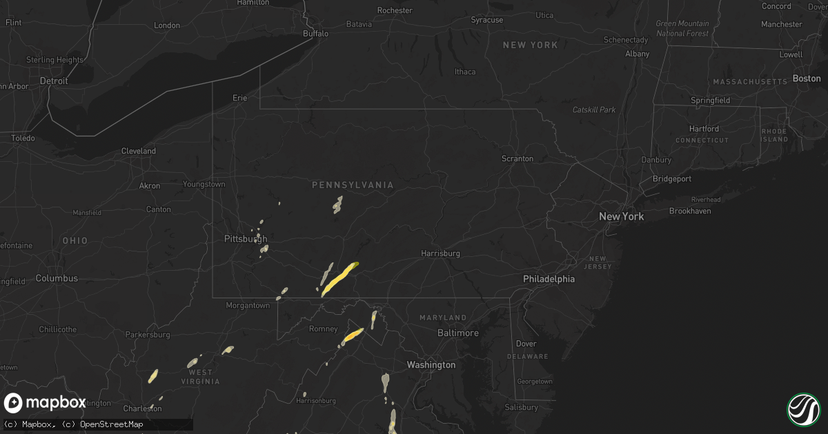
Hail Map in Pennsylvania on June 11, 2014
Get this storm
June 11 map
$229
one time, instant access
Download today. No call, no setup
Keep the $229
Bought the map and want the full workflow? Apply the entire $229 to a subscription within 7 days. None of it is wasted.
Every map, not just this one
This buys you this map. Subscription and you get every map we run, in the markets you choose from a few cities to whole states to nationwide. Plus real-time alerts the moment a storm fires.
Contact data
Name, contact info, occupancy, even credit band for addresses in the footprint. You go from where it hit to who to call.
Become the source they trust
Unlimited branding weather history reports on demand. You already have the documented answer ready for the property owner, and you are the one who showed up with it.
Property data and RoofTrace estimates
Pull up any address you have got, its value and the exact code rules for that jurisdiction, straight from One Click Code. Then RoofTrace estimates the squares, pitch, and roof value, priced the way you price.
Storm reports in Pennsylvania
Pennsylvania
| Date | Description |
|---|---|
| 06/11/20146:55 PM CDT | Lines down on cypress st. And trees down on lane ave. |
| 06/11/20146:30 PM CDT | Large tree on house |
| 06/11/20146:12 PM CDT | Trees down in upper turkey foot on weaver road. |
| 06/11/20146:10 PM CDT | Numerous trees down along route 30. Road is closed. |
| 06/11/20145:58 PM CDT | Numerous trees and power lines down along lower snake spring rd. Possible tornado |
| 06/11/20145:57 PM CDT | Measured at lbe airport |
| 06/11/20145:55 PM CDT | Large branches down. Pea sized hail. 0.80 inches rain in 15 min. |
| 06/11/20145:50 PM CDT | A local report indicates 1.75 inch wind near EVERETT |
| 06/11/20145:50 PM CDT | A local report indicates 1.75 inch wind near BEDFORD |
| 06/11/20145:50 PM CDT | Large branches down |
| 06/11/20145:47 PM CDT | Large tree uprooted |
| 06/11/20145:45 PM CDT | Trees and large branches down |
| 06/11/20145:45 PM CDT | 1 large tree and several large limbs down |
| 06/11/20145:45 PM CDT | Large tree limbs snapped |
| 06/11/20145:42 PM CDT | Inconclusive spotty wind damage consisting of three uprooted trees along brewer road |
| 06/11/20145:41 PM CDT | Inconclusive damage to large limbs along saxonburg boulevard |
| 06/11/20145:30 PM CDT | Trees and wires down at the 1400 block of grandview ave |
| 06/11/20145:30 PM CDT | Numerous trees down in elizabeth and forward townships |
| 06/11/20145:15 PM CDT | Multiple trees down |
| 06/11/20145:15 PM CDT | Tree and power lines blocking orchard ave |
| 06/11/20145:15 PM CDT | Multiple trees down along route 88. |
| 06/11/20145:15 PM CDT | Large limb down in bellevue |
| 06/11/20145:13 PM CDT | Tree down |
| 06/11/20145:12 PM CDT | Large tree down on route 60 near west end village |
| 06/11/20145:12 PM CDT | Trees and wires down |
| 06/11/20145:12 PM CDT | Tree on mccracken road |
| 06/11/20145:12 PM CDT | Tree down blocking lincoln ave |
| 06/11/20145:11 PM CDT | Tree down on hazel kirk ave |
| 06/11/20145:10 PM CDT | Trees and wires down in west end on middletown road. |
| 06/11/20145:10 PM CDT | Tree blocking know road |
| 06/11/20145:10 PM CDT | A local report indicates a tornado near 1 ESE PATIENCE |
| 06/11/20145:10 PM CDT | A local report indicates a tornado near EVERETT |
| 06/11/20145:10 PM CDT | Tree blocking route 88 |
| 06/11/20145:08 PM CDT | Tree down on scenic drive |
| 06/11/20145:07 PM CDT | Trees and wires down along berry street near charlton street and middletown road. |
| 06/11/20145:05 PM CDT | Live wires down on ridge road |
| 06/11/20144:55 PM CDT | Tree blocking cecil henderson road |
| 06/11/20144:55 PM CDT | Tree and wires blocking greenfield drive. |
| 06/11/20144:55 PM CDT | Trees down on chartiers road |
| 06/11/20144:54 PM CDT | A local report indicates 1.25 inch wind near HYNDMAN |
| 06/11/20144:50 PM CDT | Tree down on route 68. |
| 06/11/20144:50 PM CDT | Tree blocking mcdowell lane |
| 06/11/20144:45 PM CDT | Trees down |
| 06/11/20144:39 PM CDT | Tree down across 1500 block of w wylie ave |
| 06/11/20144:35 PM CDT | Tree down onto house on wilbert ave |
| 06/11/20144:26 PM CDT | Tree blocking roadway on burnsville ridge road. |
| 06/11/20144:22 PM CDT | Tree down blocking traffic on burnsville ridge road |
| 06/11/20144:15 PM CDT | Trees down in west finley twp |
| 06/10/20148:10 PM CDT | Trees and power lines down across clear creek road. |
| 06/10/20147:55 PM CDT | Trees and power lines down across glen hazel road |
| 06/10/20147:45 PM CDT | Tree blocking cecil henderson road |
| 06/10/20147:20 PM CDT | Possible tornado. Numerous trees down across greenville pike sr 4005 . |
| 06/10/20147:05 PM CDT | Trees down on long ave. |
| 06/10/20147:00 PM CDT | Multiple trees down in big run |
| 06/10/20147:00 PM CDT | Trees down at the intersecton of graffius ave and highland park rd. |
All States Impacted by Hail Map on June 11, 2014
Cities Impacted by Hail Map on June 11, 2014
- Tarentum, PA
- New Kensington, PA
- Creighton, PA
- Springdale, PA
- Earlsboro, OK
- Seminole, OK
- Marienthal, KS
- Waverly, VA
- Disputanta, VA
- Spring Grove, VA
- Ionia, MI
- Orleans, MI
- Fenwick, MI
- Clendenin, WV
- Montebello, VA
- Dillwyn, VA
- Farmville, VA
- Buckingham, VA
- Perry, OK
- Billings, OK
- Marietta, SC
- Magnolia, NC
- Rose Hill, NC
- Ayr, NE
- Healy, KS
- Belding, MI
- Saranac, MI
- Gore, VA
- Winchester, VA
- Herndon, WV
- Kimball, WV
- Welch, WV
- Monroe, VA
- Bristol, VA
- Mendota, VA
- Partlow, VA
- Spotsylvania, VA
- Castlewood, VA
- Fort Blackmore, VA
- Dungannon, VA
- Nickelsville, VA
- Coeburn, VA
- Gate City, VA
- Saint Paul, VA
- Butler, MO
- Amsterdam, MO
- Archie, MO
- Adrian, MO
- Kingfisher, OK
- Clewiston, FL
- Immokalee, FL
- Winona, KS
- Graham, NC
- Haw River, NC
- Carbondale, KS
- Burlingame, KS
- Richmond, KS
- Greeley, KS
- Williamsburg, KS
- Wakarusa, KS
- Auburn, KS
- Princeton, KS
- Quenemo, KS
- Garnett, KS
- Pomona, KS
- Scranton, KS
- Harveyville, KS
- Eskridge, KS
- Ottawa, KS
- Overbrook, KS
- Charles City, VA
- Dendron, VA
- Colonial Heights, VA
- Wakefield, VA
- Prince George, VA
- Hopewell, VA
- Chester, VA
- Jarratt, VA
- Ahoskie, NC
- Cove City, NC
- Grifton, NC
- Dover, NC
- Vanceboro, NC
- Hastings, NE
- Juniata, NE
- South Hill, VA
- South Bay, FL
- Windsor, NC
- Union Mills, NC
- Blue Hill, NE
- Red Cloud, NE
- Lebanon, KS
- Inavale, NE
- Bladen, NE
- Burr Oak, KS
- Guide Rock, NE
- Freeman, MO
- Bradshaw, NE
- York, NE
- Wellington, KS
- Jamesville, NC
- Confluence, PA
- Addison, PA
- Martinsburg, WV
- Goodland, KS
- Britton, SD
- Fairfield, VA
- Raphine, VA
- Galivants Ferry, SC
- Aynor, SC
- Crawford, OK
- Durham, OK
- Gaylord, KS
- Downs, KS
- Esbon, KS
- Portis, KS
- Vona, CO
- West Newton, PA
- Clear Spring, MD
- Big Pool, MD
- Kearneysville, WV
- Hedgesville, WV
- Inwood, WV
- Falling Waters, WV
- Alamo, GA
- Wallace, KS
- Bucklin, KS
- Medford, OK
- Blountville, TN
- Bristol, TN
- Hollywood, FL
- Hialeah, FL
- Pembroke Pines, FL
- Verndale, MN
- Sebeka, MN
- Hydro, OK
- Lake City, SD
- Amherst, SD
- Langford, SD
- Hampton, NE
- Benedict, NE
- Ruther Glen, VA
- Beaverdam, VA
- Osawatomie, KS
- Higgins, TX
- Lipscomb, TX
- Holstein, NE
- Roseland, NE
- Petersburg, VA
- Warrenton, NC
- Macon, NC
- Aurora, NE
- Glenville, WV
- Robinson, KS
- Warthen, GA
- Mitchell, GA
- Scott City, KS
- Leoti, KS
- Loyal, OK
- Alma, KS
- Columbia, NC
- Middlebrook, VA
- Bassett, VA
- Beaver, WV
- Layland, WV
- Beckley, WV
- Mount Hope, WV
- Oak Hill, WV
- Lynchburg, VA
- Gladstone, VA
- Amherst, VA
- Rustburg, VA
- Madison Heights, VA
- Spencer, WV
- Gandeeville, WV
- Aulander, NC
- Manhattan, KS
- Lowell, MI
- Gloucester, VA
- Snow Camp, NC
- Pittsboro, NC
- Easley, SC
- Hobe Sound, FL
- Oskaloosa, KS
- Ozawkie, KS
- Arrington, VA
- Wingina, VA
- Howardsville, VA
- Schuyler, VA
- Norwood, VA
- Ellis, KS
- Durham, NC
- Morrisville, NC
- Cary, NC
- Giltner, NE
- Claremont, SD
- Lake City, KS
- Wilmore, KS
- Evington, VA
- Lynch Station, VA
- Plainville, KS
- Topeka, KS
- Ogallah, KS
- Gresham, NE
- Superior, NE
- Weskan, KS
- Douglas, OK
- Fairmont, OK
- Akron, CO
- Big Spring, TX
- Boydton, VA
- Mankato, KS
- Dighton, KS
- Greenleaf, KS
- Nora, VA
- Everett, PA
- Bedford, PA
- High View, WV
- Lane, KS
- Palmyra, VA
- Troy, VA
- Kents Store, VA
- Matthews, GA
- Sharon Springs, KS
- Campbell, NE
- Oakley, KS
- Henry, VA
- Dryden, TX
- Marathon, TX
- Stromsburg, NE
- Victoria, KS
- Gorham, KS
- Shattuck, OK
- Arnett, OK
- New Millport, PA
- Irvona, PA
- Olanta, PA
- Coalport, PA
- Glen Richey, PA
- Madera, PA
- Glen Hope, PA
- Clearfield, PA
- Tribune, KS
- Baskerville, VA
- Sedley, VA
- Fort Lee, VA
- Elberon, VA
- Henrico, VA
- Ivor, VA
- Apex, NC
- Hays, KS
- Wakeeney, KS
- Concordia, KS
- Belleville, KS
- Lawrence, NE
- Roper, NC
- Wright, KS
- Formoso, KS
- Alta Vista, KS
- Maple Hill, KS
- Creswell, NC
- Pickens, SC
- Liberty, SC
- Beaver, OK
- Kanorado, KS
- Green, KS
- Leonardville, KS
- Canadian, TX
- Ben Franklin, TX
- Roxton, TX
- Burlington, CO
- Bethune, CO
- Natoma, KS
- Alton, KS
- Woodston, KS
- Stockton, KS
- Osborne, KS
- West Palm Beach, FL
- Okarche, OK
- Ulysses, NE
- Pittsburgh, PA
- Cheswick, PA
- Shelby, NE
- Surprise, NE
- Seth, WV
- Bronson, KS
- Emporia, VA
- Palco, KS
- Hooker, OK
- Arapahoe, CO
- Henderson, NC
- Smithfield, NC
- Pine Level, NC
- Princeton, NC
- Selma, NC
- Swainsboro, GA
- Wamego, KS
- Paxico, KS
- McFarland, KS
- Sand Fork, WV
- Rockbridge Baths, VA
- Squire, WV
- Paynesville, WV
- Berwind, WV
- Miami, FL
- Homestead, FL
- Rotan, TX
- Franklin, VA
- Zuni, VA
- Okeechobee, FL
- Fairhope, PA
- Jewell, KS
- Hopewell, PA
- Buffalo Mills, PA
- Hyndman, PA
- Perryton, TX
- Gail, TX
- Fluvanna, TX
- Snyder, TX
- Sheridan Lake, CO
- Rhodell, WV
- Slab Fork, WV
- Piedmont, OK
- Lake Worth Beach, FL
- Lake Worth, FL
- Wishek, ND
- Ashley, ND
- Lehr, ND
- Pooler, GA
- Savannah, GA
- Delray Beach, FL
- Glenvil, NE
- Central, SC
- Six Mile, SC
- Verona, PA
- Smith Center, KS
- Mebane, NC
- Plant City, FL
- Kittrell, NC
- Franklinton, NC
- Quinter, KS
- Stratton, CO
- Cope, CO
- Anton, CO
- Rembert, SC
- Garden City, TX
- Stanton, TX
- Taloga, OK
- Goldsboro, NC
- Broad Run, VA
- Warrenton, VA
- Midland, VA
- Catlett, VA
- Bealeton, VA
- Lawrenceville, VA
- Mulhall, OK
- Coyle, OK
- Wadena, MN
- Utica, KS
- Ransom, KS
- Arnold, KS
- Warsaw, NC
- Turkey, NC
- Vesuvius, VA
- Thurmond, WV
- Harrisburg, NC
- Concord, NC
- Montpelier, VA
- Fredericksburg, VA
- Bumpass, VA
- Doswell, VA
- Joes, CO
- Trumbull, NE
- Edinburg, VA
- Corn, OK
- Weatherford, OK
- Spearville, KS
- Hollister, NC
- Chapel Hill, NC
- Valley Falls, KS
- Ellabell, GA
- Easton, KS
- Buckhannon, WV
- Pomeroy, OH
- Langsville, OH
- Rutland, OH
- Offerle, KS
- Carrboro, NC
- Booker, TX
- Rincon, GA
- Clinton, NC
- Faison, NC
- Gates, NC
- Corapeake, NC
- Ellendale, ND
- Windthorst, TX
- Cleveland, MO
- South Haven, KS
- Drexel, MO
- Harrisonville, MO
- Balko, OK
- Carson, VA
- Stony Creek, VA
- Enid, OK
- Fullerton, ND
- Bruceton Mills, WV
- Friendsville, MD
- Markleysburg, PA
- Hinton, VA
- Enfield, NC
- Jeannette, PA
- Adamsburg, PA
- Manor, PA
- Westmoreland City, PA
- Penn, PA
- Irwin, PA
- Port Wentworth, GA
- Bracey, VA
- Edson, KS
- Nardin, OK
- Lamont, OK
- Deer Creek, OK
- Whitakers, NC
- Suffolk, VA
- Sunbury, NC
- Chadbourn, NC
- Whiteville, NC
- Dante, VA
- Weber City, VA
- Kingsport, TN
- Manson, NC
- Hordville, NE
- Staunton, VA
- Greenville, VA
- Charlotte, NC
- Braman, OK
- Blackwell, OK
- Minneola, KS
- Turpin, OK
- El Reno, OK
- Yukon, OK
- Elizabeth City, NC
- Riverton, NE
- Chocowinity, NC
- La Cygne, KS
- Reidsville, NC
- Boynton Beach, FL
- Charleston, WV
- Elkview, WV
- Dwight, NE
- Waco, NE
- David City, NE
- Oceana, WV
- Four Oaks, NC
- Mount Olive, NC
- Boca Raton, FL
- Follett, TX
- Barnes, KS
- Hillsborough, NC
- Efland, NC
- Natrona Heights, PA
- Gerrardstown, WV
- San Saba, TX
- Hardy, NE
- Byron, NE
- Republic, KS
- Davin, WV
- Man, WV
- Gilbert, WV
- Verner, WV
- Mallory, WV
- Pendleton, SC
- Esmont, VA
- Long Island, VA
- Gretna, VA
- Nathalie, VA
- McCracken, KS
- La Crosse, KS
- Orlando, OK
- Keysville, GA
- Collyer, KS
- Scottsville, VA
- Vici, OK
- Six Mile Run, PA
- Louisburg, KS
- Kinsley, KS
- Hennessey, OK
- Bartow, FL
- Winter Haven, FL
- Lost Creek, WV
- North Augusta, SC
- Clarks Hill, SC
- Richmond, VA
- Staples, MN
- Linn, WV
- Normantown, WV
- Cedarville, WV
- Nebo, NC
- Knott, TX
- Turtle Creek, PA
- North Versailles, PA
- East Pittsburgh, PA
- Monroeville, PA
- Manns Choice, PA
- Fishertown, PA
- Schellsburg, PA
- New Paris, PA
- Forest, VA
- Sumerduck, VA
- Remington, VA
- Nisswa, MN
- Williamston, NC
- Frederick, SD
- Scandia, KS
- Paola, KS
- Currie, NC
- Eads, CO
- Dodge City, KS
- Weston, WV
- Volga, WV
- Hunter, OK
- Abingdon, VA
- Lebanon, VA
- Winston Salem, NC
- High Point, NC
- Thomasville, NC
- Browns Summit, NC
- Alum Bridge, WV
- Clarendon, NC
- Loris, SC
- Green Sea, SC
- Tabor City, NC
- Warsaw, MO
- Tonkawa, OK
- Garysburg, NC
- Sanford, NC
- Palm Beach, FL
- Kittanning, PA
- Templeton, PA
- Buena Vista, VA
- Pequot Lakes, MN
- Dry Creek, WV
- Holliday, TX
- McRae Helena, GA
- Brownell, KS
- Russell, KS
- Richardsville, VA
- Lignum, VA
- Jetmore, KS
- Jesse, WV
- Matheny, WV
- Belle Plaine, KS
- Herminie, PA
- Harrison City, PA
- Greensburg, PA
- Rillton, PA
- Claridge, PA
- Garden City, KS
- Belle, WV
- Chesterfield, VA
- Blythe, GA
- Plymouth, NC
- Danese, WV
- Stillwater, OK
- Ponca City, OK
- Newkirk, OK
- Kenansville, FL
- Spearman, TX
- Fargo, OK
- Fairview, OK
- Greensburg, KS
- Greensboro, NC
- Colfax, NC
- Kernersville, NC
- Eden, NC
- Crab Orchard, WV
- Hubbardston, MI
- Muir, MI
- Kirk, CO
- Stamford, TX
- Hamlin, TX
- Avoca, TX
- Roby, TX
- Hermleigh, TX
- McCaulley, TX
- Anson, TX
- Coahoma, TX
- Westbrook, TX
- Colorado City, TX
- Sterling City, TX


