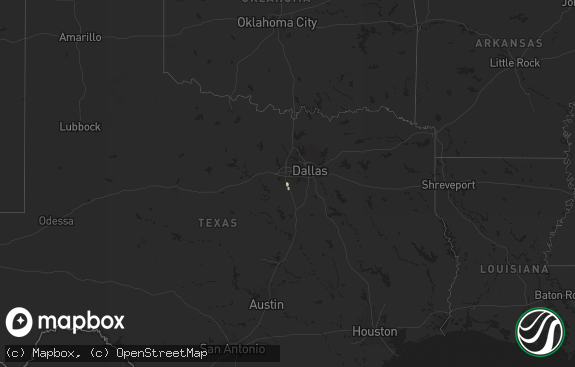
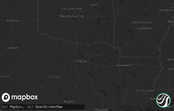
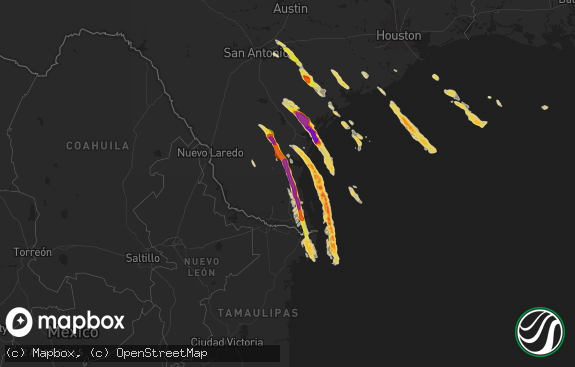
Hail Map in Texas on June 8, 2014
The weather event in Texas on June 8, 2014 includes Hail map. 19 states and 598 cities were impacted and suffered possible damage. The total estimated number of properties impacted is 0.

Hail
0
Estimated number of impacted properties by a 1.00" hail or larger2,480
Estimated number of impacted properties by a 1.75" hail or larger0
Estimated number of impacted properties by a 2.50" hail or largerStorm reports in Texas
Texas
| Date | Description |
|---|---|
| 06/08/20146:10 AM CDT | Wind damage at 3 or 4 homes and 2 businesses. Fences blown down and minor roof damage. Time is approximate. Location is near the city limits border between rockwall and |
| 06/08/20145:15 AM CDT | Wind gust was measured. Tree damage near boy scout camp. Also a brief period of half inch hail. |
| 06/08/20145:08 AM CDT | Numerous trees and large tree limbs downed by thunderstorm winds. Time is approximate. |
| 06/08/20145:05 AM CDT | Large trees down across southeast side of gainesville and near woodbine. Time is approximate. |
| 06/08/20142:50 AM CDT | A couple tree branches broken |
| 06/08/20142:40 AM CDT | West texas mesonet report |
| 06/08/20142:15 AM CDT | A local report indicates 1.00 inch wind near 10 W FLOYDADA |
| 06/07/201411:59 PM CDT | A local report indicates 1.00 inch wind near 5 ENE HAWLEY |
| 06/07/201410:35 PM CDT | Pecos asos reported 51 knot gust |
| 06/07/201410:31 PM CDT | A local report indicates 1.75 inch wind near 4 W PECOS |
| 06/07/201410:21 PM CDT | At business 20 and 2119 in pecos. Accompanied by strong winds and heavy rain. Slight flooding... But location is a low spot. |
| 06/07/20149:40 PM CDT | A local report indicates 65 MPH wind near 6 NNW AMARILLO |
| 06/07/20149:37 PM CDT | A local report indicates 63 MPH wind near 3 SSE AMARILLO |
| 06/07/20149:35 PM CDT | A local report indicates 66 MPH wind near 9 NNE AMARILLO |
| 06/07/20149:23 PM CDT | A local report indicates 60 MPH wind near BUSHLAND |
| 06/07/20149:20 PM CDT | Traffic barrel blown over at the canadian river bridge. |
| 06/07/20149:12 PM CDT | Several trees blown down. Estimated 60 mph. Very heavy rain also. |
| 06/07/20148:30 PM CDT | Several trees were blown down by thunderstorm winds. Area observations and spotter reports indicate gusts in the 50 mph range. Time estimated by radar. |
| 06/07/20148:19 PM CDT | Richmond road |
All States Impacted by Hail Map on June 8, 2014
Cities Impacted by Hail Map on June 8, 2014
- Amarillo, TX
- Matador, TX
- Masterson, TX
- Wagon Mound, NM
- El Dorado, AR
- Junction City, AR
- Smackover, AR
- Brownfield, TX
- Grenada, MS
- Roaring Springs, TX
- Paducah, TX
- Kenansville, FL
- San Angelo, TX
- Carlsbad, NM
- Trementina, NM
- Abernathy, TX
- Blakely, GA
- Bluffton, GA
- Clayton, NM
- Madison, FL
- Greenville, FL
- Seagraves, TX
- Garita, NM
- Marathon, TX
- Boise City, OK
- Pecos, TX
- Mentone, TX
- Causey, NM
- Castleberry, AL
- Lenox, AL
- Repton, AL
- Range, AL
- High Springs, FL
- Valley View, TX
- Petersburg, WV
- Maurertown, VA
- Moorefield, WV
- Woodstock, VA
- Edinburg, VA
- Lost City, WV
- Mathias, WV
- Wardensville, WV
- Mora, NM
- Rainsville, NM
- Capitan, NM
- Roswell, NM
- Hagerman, NM
- Lake Arthur, NM
- Dexter, NM
- Alexander City, AL
- Kellyton, AL
- Selma, AL
- Texarkana, AR
- Nash, TX
- Texarkana, TX
- Franktown, CO
- Castle Rock, CO
- Pine Bluffs, WY
- Bard, NM
- Hereford, TX
- San Jon, NM
- Adrian, TX
- Brewton, AL
- Artesia, NM
- Solano, NM
- Evergreen, AL
- Fort Stockton, TX
- Bastrop, LA
- Nocona, TX
- Holly Springs, MS
- Red Banks, MS
- Labelle, FL
- Baker, FL
- Greenwood, MS
- Jersey, AR
- Strong, AR
- Sarepta, LA
- Shongaloo, LA
- Houston, MS
- Calhoun City, MS
- Mantee, MS
- Vardaman, MS
- Houlka, MS
- Woodland, MS
- Eupora, MS
- Walthall, MS
- Inverness, MS
- Fort Davis, TX
- Texico, NM
- Bushnell, NE
- Las Vegas, NM
- Hermitage, AR
- House, NM
- Melrose, NM
- Floyd, NM
- Briggsdale, CO
- Morton, MS
- Pelahatchie, MS
- Brandon, MS
- Flowood, MS
- Ocate, NM
- Starkville, MS
- Elizabeth, CO
- Walters, OK
- Brooksville, MS
- Savannah, GA
- Latrobe, PA
- Forest Home, AL
- Arcadia, FL
- Starke, FL
- Lake Butler, FL
- Conchas Dam, NM
- Quincy, FL
- Jay, FL
- Milton, FL
- Wing, AL
- Camden, AL
- Pine Apple, AL
- Montgomery, AL
- Lafayette, AL
- Colquitt, GA
- Downsville, LA
- Farmerville, LA
- Clayton, AL
- Midway, AL
- Ochopee, FL
- Cuervo, NM
- Newkirk, NM
- Highland Home, AL
- Grady, AL
- Lapine, AL
- Luverne, AL
- Waldo, AR
- Mathews, AL
- Hayneville, AL
- Tyler, AL
- Lowndesboro, AL
- Aurora, CO
- Nesbit, MS
- Lewisville, AR
- Vredenburgh, AL
- Beatrice, AL
- Franklin, AL
- Peterman, AL
- Sterlington, LA
- Marion, LA
- Brent, AL
- Bennett, CO
- Canyon, TX
- Westville, FL
- Hartford, AL
- Samson, AL
- Coffee Springs, AL
- Kinston, AL
- Enterprise, AL
- Black, AL
- Slocomb, AL
- Bonifay, FL
- Geneva, AL
- Chancellor, AL
- Fort Benning, GA
- Aliceville, AL
- Hooks, TX
- Homer, LA
- Bernice, LA
- Dubach, LA
- Farwell, TX
- Carrollton, AL
- Tucumcari, NM
- Merkel, TX
- Daleville, AL
- Newton, AL
- Plain Dealing, LA
- Ashdown, AR
- Georgetown, FL
- Vernon, FL
- Lake City, FL
- Crescent City, FL
- Fort McCoy, FL
- Dunbar, PA
- Vanderbilt, PA
- Lemont Furnace, PA
- Connellsville, PA
- Alpine, TX
- Valmora, NM
- Big Creek, MS
- Duck Hill, MS
- Holcomb, MS
- McCarley, MS
- Carrollton, MS
- Como, MS
- Rogers, NM
- Portales, NM
- Fosters, AL
- Buhl, AL
- Tuscaloosa, AL
- Ralph, AL
- Marion, AL
- Snyder, TX
- McCool, MS
- Weir, MS
- West Milford, WV
- Lost Creek, WV
- Clarksburg, WV
- Bartow, FL
- Sedalia, CO
- Elba, AL
- New Brockton, AL
- Goree, TX
- Seymour, TX
- Milan, GA
- Bellefontaine, MS
- Newberry, FL
- Alachua, FL
- Troy, AL
- Goshen, AL
- Lake George, CO
- Bristol, FL
- Fort Meade, FL
- Altha, FL
- Watkins, CO
- Stewart, MS
- Kilmichael, MS
- Hamilton, GA
- Fortson, GA
- Cataula, GA
- Valley, AL
- Lanett, AL
- Cusseta, AL
- West Point, GA
- Eufaula, AL
- Lamar, MS
- Lakeland, GA
- Pierson, FL
- Branford, FL
- Homerville, GA
- Hernando, MS
- Gunter, TX
- Howe, TX
- Gainesville, TX
- Collinsville, TX
- Ringgold, TX
- Ridgeway, SC
- Camden, SC
- Liberty Hill, SC
- Columbus, MS
- Ethelsville, AL
- Lumpkin, GA
- Leonard, TX
- Hawthorne, FL
- Micanopy, FL
- Gainesville, FL
- Calhan, CO
- Peyton, CO
- Georgetown, GA
- Morris, GA
- Fort Gaines, GA
- Tinnie, NM
- Mer Rouge, LA
- Oak Grove, LA
- Meadow, TX
- Minden, LA
- Haughton, LA
- Princeton, LA
- Laurel Hill, FL
- Crestview, FL
- Punta Gorda, FL
- Odonnell, TX
- Verona, PA
- Florissant, CO
- Gore Springs, MS
- Blue Ridge, TX
- Henrietta, TX
- Bellevue, TX
- Bunnell, FL
- Orange Park, FL
- Jacksonville, FL
- Lake Providence, LA
- Pioneer, LA
- Hawley, TX
- Orchard, CO
- Dothan, AL
- Defuniak Springs, FL
- Fountain, CO
- Happy, TX
- Aledo, TX
- Cresson, TX
- Weatherford, TX
- Winona, MS
- Floydada, TX
- Commerce, TX
- Klondike, TX
- Seminole, TX
- Loop, TX
- Kaufman, TX
- Venus, FL
- Mayo, FL
- Encino, NM
- Havana, FL
- Tallahassee, FL
- Picacho, NM
- Shreveport, LA
- Bossier City, LA
- Sapello, NM
- Watrous, NM
- Tuskegee, AL
- Union Springs, AL
- Hardaway, AL
- Gordon, NE
- Friona, TX
- Loving, NM
- Byhalia, MS
- Goldsboro, TX
- Ovalo, TX
- Lawn, TX
- Duchesne, UT
- Roosevelt, UT
- Pearson, GA
- Duncanville, AL
- Lawtey, FL
- Dalhart, TX
- Fort White, FL
- Macon, MS
- Melissa, TX
- Vega, TX
- Bonham, TX
- Ravenna, TX
- Savoy, TX
- Roggen, CO
- Lancaster, SC
- Sardis, MS
- Vicksburg, MS
- Novice, TX
- Coleman, TX
- Monument, CO
- Mcalister, NM
- Andalusia, AL
- Florala, AL
- Sylacauga, AL
- Childersburg, AL
- Barksdale Afb, LA
- West Blocton, AL
- Centreville, AL
- Strasburg, CO
- Lexington, MS
- Durant, MS
- Midway, FL
- Willacoochee, GA
- Douglas, GA
- Dadeville, AL
- Choudrant, LA
- Eglin Afb, FL
- Raton, NM
- O'Brien, FL
- Larkspur, CO
- Hosford, FL
- Lineville, AL
- Wedowee, AL
- Naylor, GA
- Nashville, GA
- Oviedo, FL
- Rockvale, CO
- Coal Creek, CO
- Florence, CO
- Canon City, CO
- Penrose, CO
- Isola, MS
- Eden, TX
- Cruger, MS
- Tchula, MS
- Youngstown, FL
- Panama City, FL
- Chipley, FL
- Midlothian, TX
- Cedar Hill, TX
- Letohatchee, AL
- Fort Deposit, AL
- Magnolia, AR
- Jack, AL
- Grandfield, OK
- Alberta, AL
- North Carrollton, MS
- Coldwater, MS
- Grady, NM
- Palatka, FL
- Saint Jo, TX
- Muenster, TX
- Clyde, TX
- Wetmore, CO
- Canton, MS
- Newton, GA
- Coffeeville, MS
- Grover, CO
- Keenesburg, CO
- Safford, AL
- Orrville, AL
- Ropesville, TX
- Skellytown, TX
- Panhandle, TX
- Box Springs, GA
- Upatoi, GA
- Smock, PA
- Perryopolis, PA
- Grindstone, PA
- Santa Rosa, NM
- Satsuma, FL
- Orlando, FL
- Fountain, FL
- Crowell, TX
- Lugoff, SC
- Winter Springs, FL
- Fitzpatrick, AL
- West Leisenring, PA
- Mount Braddock, PA
- Waltersburg, PA
- Uniontown, PA
- New Raymer, CO
- Eldorado, TX
- Altheimer, AR
- Webb, AL
- Cowarts, AL
- Denver, CO
- Farmersville, TX
- Kiowa, CO
- Marion Junction, AL
- Catherine, AL
- Frostproof, FL
- Winter Haven, FL
- Felt, OK
- Williston, FL
- Morriston, FL
- Ashford, AL
- Eutaw, AL
- Knoxville, AL
- Sarah, MS
- Daisytown, PA
- Coal Center, PA
- Opp, AL
- Lockney, TX
- Burneyville, OK
- Leon, OK
- Ackerman, MS
- Weldona, CO
- Portland, AR
- Parkdale, AR
- Abbeville, GA
- Genoa, CO
- Talpa, TX
- Immokalee, FL
- Bovina, TX
- Buckner, AR
- Ponce De Leon, FL
- Tahoka, TX
- Minter, AL
- Sardis, AL
- Abilene, TX
- Perry, FL
- Colorado Springs, CO
- Weston, CO
- Dickens, TX
- Palmer Lake, CO
- Deer Trail, CO
- Borger, TX
- Tuscola, TX
- Winters, TX
- Cottondale, AL
- Brookston, TX
- Sumner, TX
- Wildorado, TX
- Salem, WV
- Heath Springs, SC
- Randolph, AL
- Maplesville, AL
- Lawley, AL
- Emerson, AR
- Dimmitt, TX
- Grand Ridge, FL
- Marianna, FL
- Mosquero, NM
- Great Falls, SC
- Blackstock, SC
- Georgiana, AL
- Jane Lew, WV
- Gordo, AL
- San Cristobal, NM
- Stephens, AR
- Conroe, TX
- Midland, GA
- Saint Cloud, FL
- Kissimmee, FL
- Coila, MS
- Debary, FL
- Fleming Island, FL
- Dalton, NE
- Garvin, OK
- De Queen, AR
- Texline, TX
- Crawfordville, FL
- Warren, AR
- East Palatka, FL
- Arroyo Hondo, NM
- El Prado, NM
- Hollywood, FL
- Miami, FL
- Shuqualak, MS
- Bisbee, ND
- Monticello, FL
- Stamps, AR
- Flomot, TX
- Afton, TX
- Jacksons Gap, AL
- Glenwood, AL
- Buffalo Creek, CO
- Conifer, CO
- Goodwater, AL
- Louisville, MS
- Freeport, FL
- Pueblo, CO
- Cottonwood, AL
- Baird, TX
- Clewiston, FL
- Axson, GA
- Columbus, NC
- Campobello, SC
- Landrum, SC
- Middleburg, FL
- Senatobia, MS
- Vaughan, MS
- Bentonia, MS
- England, AR
- Olive Branch, MS
- Minter City, MS
- Philipp, MS
- Schlater, MS
- Wolfforth, TX
- Broken Bow, OK
- Arlington, GA
- Albin, WY
- Olla, LA
- Okeechobee, FL
- New Boston, TX
- Fort Davis, AL
- Benton, MS
- Fitzgerald, GA
- Morgan, GA
- Summerfield, LA
- Rocklake, ND
- Stockton, GA
- Silverton, TX
- Era, TX
- Reddick, FL
- Roanoke, AL
- Wadley, AL
- Mckinney, TX
- Godley, TX
- Shannon, MS
- Pontotoc, MS
- McRae Helena, GA
- Sturgis, MS
- Burkburnett, TX
- Stuttgart, AR
- Lake Mary, FL
- Sanford, FL
- Grayson, LA
- Tioga, TX
- Brantley, AL
- Banks, AR
- Corona, NM
- Bowie, TX
- Clinton, MS
- Jackson, MS
- Tougaloo, MS
- Ridgeland, MS
- Paris, TX
- Eola, TX
- Vancourt, TX
- Maud, TX
- Gainestown, AL
- Jackson, AL
- Waterford, MS
- Byers, CO
- Tulia, TX
- Celeste, TX
- Iuka, MS
- Leary, GA
- Belzoni, MS
- Paint Rock, TX
- Millersview, TX
- Pine Mountain, GA
- Hialeah, FL
- Cotton Valley, LA
- Mathiston, MS
- Whiteface, TX
- Archer, FL
- Fort Lauderdale, FL
- Green Cove Springs, FL
- Mount Clare, WV
- Bridgeport, WV


