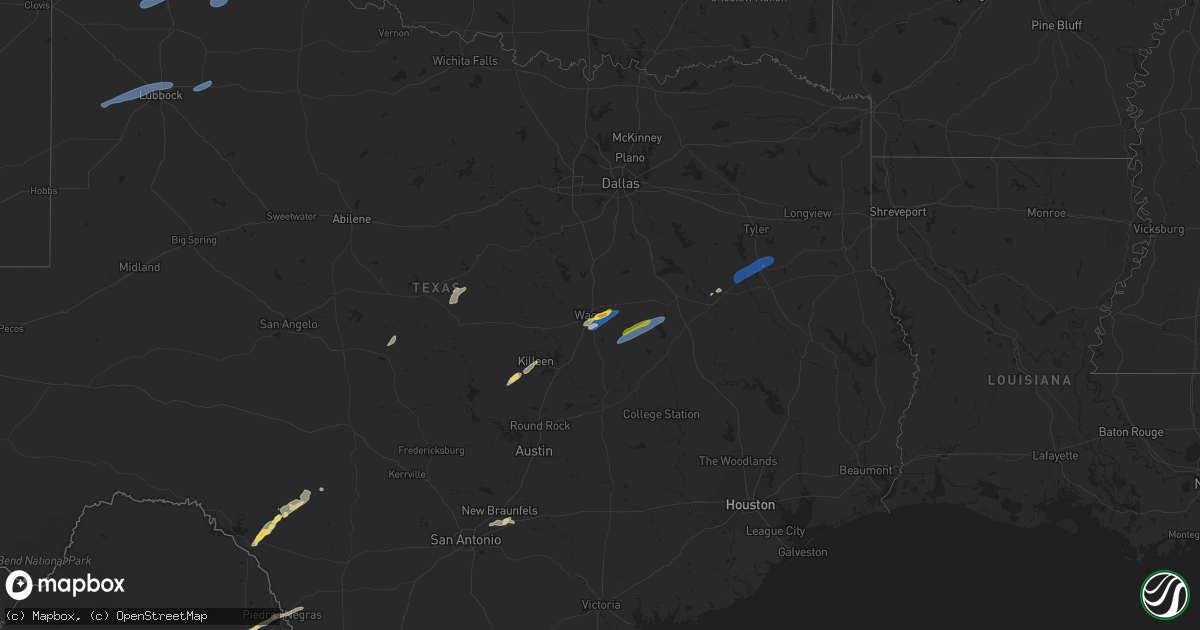
Hail Map on November 20, 2025
Get this storm
November 20 map
$229
one time, instant access
Download today. No call, no setup
Keep the $229
Bought the map and want the full workflow? Apply the entire $229 to a subscription within 7 days. None of it is wasted.
Every map, not just this one
This buys you this map. Subscription and you get every map we run, in the markets you choose from a few cities to whole states to nationwide. Plus real-time alerts the moment a storm fires.
Contact data
Name, contact info, occupancy, even credit band for addresses in the footprint. You go from where it hit to who to call.
Become the source they trust
Unlimited branding weather history reports on demand. You already have the documented answer ready for the property owner, and you are the one who showed up with it.
Property data and RoofTrace estimates
Pull up any address you have got, its value and the exact code rules for that jurisdiction, straight from One Click Code. Then RoofTrace estimates the squares, pitch, and roof value, priced the way you price.
Storm reports
Texas
| Date | Description |
|---|---|
| 11/20/20255:45 PM CST | Facebook photo showed a sheet metal roof partially blown off a building near hallsburg. Other facebook reports also indicate a camper moved 3 feet and windows blown out |
| 11/20/20255:44 PM CST | Facebook photo showed large tree limbs down on harrison road. |
| 11/20/20254:45 PM CST | Corrects previous tstm wnd dmg report from hallsburg. Facebook photo showed a sheet metal roof partially blown off a building near hallsburg. Other facebook reports als |
| 11/20/20254:44 PM CST | Corrects previous tstm wnd dmg report from 3 wsw hallsburg. Facebook photo showed large tree limbs down on harrison road. |
| 11/20/20254:35 PM CST | Social media image of snapped power pole in robinson along highway 77. Time estimated. |
| 11/20/20253:56 PM CST | A local report indicates 64 MPH wind near 7 ESE Silverton |
| 11/20/20253:34 PM CST | A local report indicates 62 MPH wind near 2 ENE Tulia |
| 11/20/20252:58 PM CST | The west texas mesonet station 84 2wnw tarzan/martin county measured a 61 mph wind gust associated with strong thunderstorm outflow. |
| 11/20/20252:50 PM CST | The asos station kmaf midland measured a 59mph wind gust due to strong thunderstorm outflow. |
| 11/20/20252:45 PM CST | The mesonet station fw9685 odessa measured a 60mph wind gust associated with strong thunderstorm outflow. |
| 11/20/20252:44 PM CST | Associated with low-topped convection with minimal lightning. Blowing dust also reduced the visibility to 1/4 mile. |
| 11/20/20252:44 PM CST | Associated with low-topped convection with min |
| 11/20/20252:33 PM CST | The west texas mesonet station 18 lamesa 2se measured a 58mph wind gust associated with strong thunderstorm outflow. |
| 11/20/20252:27 PM CST | Measured by the west texas mesonet. A gust to 58 mph was also observed at 2:26 pm. The parent convection had minimal lightning... But the outflow was lofting copious am |
| 11/20/20252:01 PM CST | Measured by the west texas mesonet as low-topped convection... With minimal lightning... Moved through. |
| 11/20/20251:29 PM CST | The mesonet station ur226 6.6 w pyote |
| 11/19/20259:10 PM CST | Facebook report of tree down on cr 2202 one half mile from westwood elementary school. Time estimated. |
| 11/19/20259:02 PM CST | Damage reported to a house and a pole barn at tx hwy 135 and cr 4212 ne of jacksonville. |
| 11/19/20258:10 PM CST | Corrects previous tstm wnd dmg report from 2 wsw palestine. Facebook report of tree down on cr 2202 one half mile from westwood elementary school. Time estimated. |
Cities Impacted by Hail Map on November 20, 2025
- Christoval, TX
- San Angelo, TX
- Mertzon, TX
- Eldorado, TX
- Fort McKavett, TX
- Menard, TX
- Junction, TX
- Lohn, TX
- Rochelle, TX
- Del Rio, TX
- Mullin, TX
- Comanche, TX
- Brackettville, TX
- Gustine, TX
- Rocksprings, TX
- Levelland, TX
- Barksdale, TX
- Ropesville, TX
- Lubbock, TX
- Laughlin Afb, TX
- Smyer, TX
- Shallowater, TX
- Eagle Pass, TX
- Bertram, TX
- Briggs, TX
- Tulia, TX
- Hart, TX
- Kress, TX
- Happy, TX
- Silverton, TX
- Claude, TX
- Kempner, TX
- Killeen, TX
- Canyon, TX
- Lorena, TX
- Hewitt, TX
- Waco, TX
- Riesel, TX
- Woodway, TX
- Mart, TX
- Axtell, TX
- Marlin, TX
- Kosse, TX
- Thornton, TX
- Groesbeck, TX
- Donie, TX
- Jewett, TX
- Palestine, TX
- Cibolo, TX
- Marion, TX
- McQueeney, TX
- New Braunfels, TX
- Seguin, TX
- Frankston, TX
- Jacksonville, TX
- Rusk, TX
- Bullard, TX
- Troup, TX
- Ralls, TX
- Crosbyton, TX
- Idalou, TX
- Quitaque, TX
- Tulsa, OK