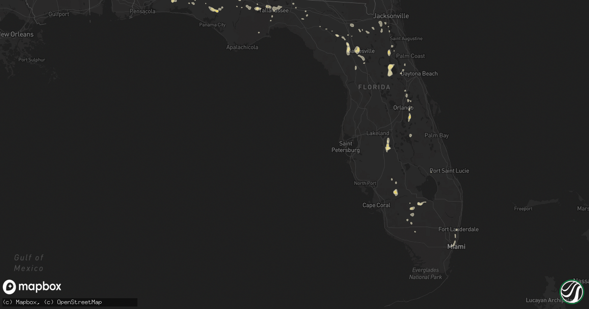
Hail Map in Florida on June 8, 2014
Get this storm
June 8 map
$229
one time, instant access
Download today. No call, no setup
Keep the $229
Bought the map and want the full workflow? Apply the entire $229 to a subscription within 7 days. None of it is wasted.
Every map, not just this one
This buys you this map. Subscription and you get every map we run, in the markets you choose from a few cities to whole states to nationwide. Plus real-time alerts the moment a storm fires.
Contact data
Name, contact info, occupancy, even credit band for addresses in the footprint. You go from where it hit to who to call.
Become the source they trust
Unlimited branding weather history reports on demand. You already have the documented answer ready for the property owner, and you are the one who showed up with it.
Property data and RoofTrace estimates
Pull up any address you have got, its value and the exact code rules for that jurisdiction, straight from One Click Code. Then RoofTrace estimates the squares, pitch, and roof value, priced the way you price.
Storm reports in Florida
Florida
| Date | Description |
|---|---|
| 06/08/20146:54 PM CDT | Tree down on post plant road. |
| 06/08/20146:49 PM CDT | Tree down on c and e farm road. |
| 06/08/20146:20 PM CDT | The emergency management had numerous reports of trees down in obrien on both sides of u.s. Highway 129. The time given was based on radar. |
| 06/08/20146:00 PM CDT | Osceola fire rescue reported power lines down at intersection of wiggins rd. And jones road... And also on runmmel road. Time estimated from radar. |
| 06/08/20145:44 PM CDT | Tree down at sr 2 and hwy 71 in malone. |
| 06/08/20145:15 PM CDT | Wcjb-tv relayed a report of a tree falling onto a house near southwest archer road as strong wind gusts from thunderstorms moved through the area. |
| 06/08/20145:15 PM CDT | 911 dispatch reports a large tree downed over an apartment complex building. Time of damage based on radar data. |
| 06/08/20145:05 PM CDT | 911 dispatch reports a tree downed by strong wind gusts along us-441 near paynes prairie as thunderstorms moved through the region. Time of damage based on radar data. |
| 06/08/20145:05 PM CDT | 911 dispatch reports multiple large trees of 15-20 inches in diameter downed by strong wind gusts as thunderstorms moved through the region. Time of damage based on rad |
| 06/08/20145:02 PM CDT | A tree fell on apartment complex on the 4100 block of sw archer road. Some residents had to vacate their apartment due to damage. |
| 06/08/20145:02 PM CDT | A tree fell on apartment complex on the 4400 block of sw archer road. Some residents had to vacate their apartment due to damage. |
| 06/08/20144:45 PM CDT | Trees down |
| 06/08/20144:45 PM CDT | 911 dispatch reports powerlines downed by strong wind gusts as thunderstorms moved through the region. Time of damage based on radar data. |
| 06/08/20144:15 PM CDT | Tree down near the intersection of mahan drive and veterans memorial road |
| 06/08/20144:10 PM CDT | Juniper springs campground personnel reported a few trees down and blocking some camp sites. |
| 06/08/20144:00 PM CDT | Multiple trees and power lines felled in the shadeville road area. |
| 06/08/20143:55 PM CDT | Multiple trees down on baum road. |
| 06/08/20143:50 PM CDT | Tree down on crump and opal roads. |
| 06/08/20143:50 PM CDT | Ocala star banner reported trees and power lines down in salt springs. Time of damage is based on radar data. |
| 06/08/20143:47 PM CDT | Tree down on sage run lane. |
| 06/08/20143:40 PM CDT | Multiple trees down on miccosukee rd. |
| 06/08/20143:36 PM CDT | Multiple trees down on fred george road at mission and old bainbridge roads. |
| 06/08/20143:30 PM CDT | Large tree branch blown onto west carolina street |
| 06/08/20143:30 PM CDT | Tree down on grey fox run |
| 06/08/20143:30 PM CDT | Steeple of st peter primitive baptist church on oak ridge road blown over |
| 06/08/20143:30 PM CDT | Multiple trees down in the bob miller road area |
| 06/08/20143:26 PM CDT | Multiple trees down on fred george road at mission and old bainbridge roads. |
| 06/08/20143:25 PM CDT | Multiple trees down on natural bridge road. |
| 06/08/20143:25 PM CDT | Trees and powerlines down on grubbs road and wide road. |
| 06/08/20143:20 PM CDT | 911 dispatch reports numerous trees and powerlines downed and numerous reports of small hail from palatka to satsuma. |
| 06/08/20143:15 PM CDT | Putnam county dispatch reports numerous trees and powerlines downed along state road 19 in the vicinity of silver lake drive. Time of damage based on radar data |
| 06/08/20143:15 PM CDT | Trees fell on powerlines and a car near theressa. A outdoor shed also blown over. Time of event based on radar imagery. |
| 06/08/20143:10 PM CDT | Powerlines were reported down near brownley and weldon street in starke. |
| 06/08/20142:50 PM CDT | Several trees fell throughout quincy. One tree caught on fire as it struck a power line. |
| 06/08/20141:30 PM CDT | Public report of quarter sized hail via social media. Time of event based on radar data. |
| 06/08/201412:30 PM CDT | 3 trees down near corner of lem turner blvd and hodges street. One tree fell on house. |
| 06/08/201412:15 PM CDT | Wjxt relayed a report of a large tree downed by thunderstorm wind gusts on a home near callahan. Time of damage based on radar data. |
| 06/08/201411:40 AM CDT | Up to quarter size hail reported via social media |
| 06/07/20147:15 PM CDT | A building suffered moderate damage at 10 nw 250th street and a gas station canopy toppled over. |
All States Impacted by Hail Map on June 8, 2014
Cities Impacted by Hail Map on June 8, 2014
- Amarillo, TX
- Matador, TX
- Masterson, TX
- Wagon Mound, NM
- El Dorado, AR
- Junction City, AR
- Smackover, AR
- Brownfield, TX
- Grenada, MS
- Roaring Springs, TX
- Paducah, TX
- Kenansville, FL
- San Angelo, TX
- Carlsbad, NM
- Trementina, NM
- Abernathy, TX
- Blakely, GA
- Bluffton, GA
- Clayton, NM
- Madison, FL
- Greenville, FL
- Seagraves, TX
- Garita, NM
- Marathon, TX
- Boise City, OK
- Pecos, TX
- Mentone, TX
- Causey, NM
- Castleberry, AL
- Lenox, AL
- Repton, AL
- Range, AL
- High Springs, FL
- Valley View, TX
- Petersburg, WV
- Maurertown, VA
- Moorefield, WV
- Woodstock, VA
- Edinburg, VA
- Lost City, WV
- Mathias, WV
- Wardensville, WV
- Mora, NM
- Rainsville, NM
- Capitan, NM
- Roswell, NM
- Hagerman, NM
- Lake Arthur, NM
- Dexter, NM
- Alexander City, AL
- Kellyton, AL
- Selma, AL
- Texarkana, AR
- Nash, TX
- Texarkana, TX
- Franktown, CO
- Castle Rock, CO
- Pine Bluffs, WY
- Bard, NM
- Hereford, TX
- San Jon, NM
- Adrian, TX
- Brewton, AL
- Artesia, NM
- Solano, NM
- Evergreen, AL
- Fort Stockton, TX
- Bastrop, LA
- Nocona, TX
- Holly Springs, MS
- Red Banks, MS
- Labelle, FL
- Baker, FL
- Greenwood, MS
- Jersey, AR
- Strong, AR
- Sarepta, LA
- Shongaloo, LA
- Houston, MS
- Calhoun City, MS
- Mantee, MS
- Vardaman, MS
- Houlka, MS
- Woodland, MS
- Eupora, MS
- Walthall, MS
- Inverness, MS
- Fort Davis, TX
- Texico, NM
- Bushnell, NE
- Las Vegas, NM
- Hermitage, AR
- House, NM
- Melrose, NM
- Floyd, NM
- Briggsdale, CO
- Morton, MS
- Pelahatchie, MS
- Brandon, MS
- Flowood, MS
- Ocate, NM
- Starkville, MS
- Elizabeth, CO
- Walters, OK
- Brooksville, MS
- Savannah, GA
- Latrobe, PA
- Forest Home, AL
- Arcadia, FL
- Starke, FL
- Lake Butler, FL
- Conchas Dam, NM
- Quincy, FL
- Jay, FL
- Milton, FL
- Wing, AL
- Camden, AL
- Pine Apple, AL
- Montgomery, AL
- Lafayette, AL
- Colquitt, GA
- Downsville, LA
- Farmerville, LA
- Clayton, AL
- Midway, AL
- Ochopee, FL
- Cuervo, NM
- Newkirk, NM
- Highland Home, AL
- Grady, AL
- Lapine, AL
- Luverne, AL
- Waldo, AR
- Mathews, AL
- Hayneville, AL
- Tyler, AL
- Lowndesboro, AL
- Aurora, CO
- Nesbit, MS
- Lewisville, AR
- Vredenburgh, AL
- Beatrice, AL
- Franklin, AL
- Peterman, AL
- Sterlington, LA
- Marion, LA
- Brent, AL
- Bennett, CO
- Canyon, TX
- Westville, FL
- Hartford, AL
- Samson, AL
- Coffee Springs, AL
- Kinston, AL
- Enterprise, AL
- Black, AL
- Slocomb, AL
- Bonifay, FL
- Geneva, AL
- Chancellor, AL
- Fort Benning, GA
- Aliceville, AL
- Hooks, TX
- Homer, LA
- Bernice, LA
- Dubach, LA
- Farwell, TX
- Carrollton, AL
- Tucumcari, NM
- Merkel, TX
- Daleville, AL
- Newton, AL
- Plain Dealing, LA
- Ashdown, AR
- Georgetown, FL
- Vernon, FL
- Lake City, FL
- Crescent City, FL
- Fort McCoy, FL
- Dunbar, PA
- Vanderbilt, PA
- Lemont Furnace, PA
- Connellsville, PA
- Alpine, TX
- Valmora, NM
- Big Creek, MS
- Duck Hill, MS
- Holcomb, MS
- McCarley, MS
- Carrollton, MS
- Como, MS
- Rogers, NM
- Portales, NM
- Fosters, AL
- Buhl, AL
- Tuscaloosa, AL
- Ralph, AL
- Marion, AL
- Snyder, TX
- McCool, MS
- Weir, MS
- West Milford, WV
- Lost Creek, WV
- Clarksburg, WV
- Bartow, FL
- Sedalia, CO
- Elba, AL
- New Brockton, AL
- Goree, TX
- Seymour, TX
- Milan, GA
- Bellefontaine, MS
- Newberry, FL
- Alachua, FL
- Troy, AL
- Goshen, AL
- Lake George, CO
- Bristol, FL
- Fort Meade, FL
- Altha, FL
- Watkins, CO
- Stewart, MS
- Kilmichael, MS
- Hamilton, GA
- Fortson, GA
- Cataula, GA
- Valley, AL
- Lanett, AL
- Cusseta, AL
- West Point, GA
- Eufaula, AL
- Lamar, MS
- Lakeland, GA
- Pierson, FL
- Branford, FL
- Homerville, GA
- Hernando, MS
- Gunter, TX
- Howe, TX
- Gainesville, TX
- Collinsville, TX
- Ringgold, TX
- Ridgeway, SC
- Camden, SC
- Liberty Hill, SC
- Columbus, MS
- Ethelsville, AL
- Lumpkin, GA
- Leonard, TX
- Hawthorne, FL
- Micanopy, FL
- Gainesville, FL
- Calhan, CO
- Peyton, CO
- Georgetown, GA
- Morris, GA
- Fort Gaines, GA
- Tinnie, NM
- Mer Rouge, LA
- Oak Grove, LA
- Meadow, TX
- Minden, LA
- Haughton, LA
- Princeton, LA
- Laurel Hill, FL
- Crestview, FL
- Punta Gorda, FL
- Odonnell, TX
- Verona, PA
- Florissant, CO
- Gore Springs, MS
- Blue Ridge, TX
- Henrietta, TX
- Bellevue, TX
- Bunnell, FL
- Orange Park, FL
- Jacksonville, FL
- Lake Providence, LA
- Pioneer, LA
- Hawley, TX
- Orchard, CO
- Dothan, AL
- Defuniak Springs, FL
- Fountain, CO
- Happy, TX
- Aledo, TX
- Cresson, TX
- Weatherford, TX
- Winona, MS
- Floydada, TX
- Commerce, TX
- Klondike, TX
- Seminole, TX
- Loop, TX
- Kaufman, TX
- Venus, FL
- Mayo, FL
- Encino, NM
- Havana, FL
- Tallahassee, FL
- Picacho, NM
- Shreveport, LA
- Bossier City, LA
- Sapello, NM
- Watrous, NM
- Tuskegee, AL
- Union Springs, AL
- Hardaway, AL
- Gordon, NE
- Friona, TX
- Loving, NM
- Byhalia, MS
- Goldsboro, TX
- Ovalo, TX
- Lawn, TX
- Duchesne, UT
- Roosevelt, UT
- Pearson, GA
- Duncanville, AL
- Lawtey, FL
- Dalhart, TX
- Fort White, FL
- Macon, MS
- Melissa, TX
- Vega, TX
- Bonham, TX
- Ravenna, TX
- Savoy, TX
- Roggen, CO
- Lancaster, SC
- Sardis, MS
- Vicksburg, MS
- Novice, TX
- Coleman, TX
- Monument, CO
- Mcalister, NM
- Andalusia, AL
- Florala, AL
- Sylacauga, AL
- Childersburg, AL
- Barksdale Afb, LA
- West Blocton, AL
- Centreville, AL
- Strasburg, CO
- Lexington, MS
- Durant, MS
- Midway, FL
- Willacoochee, GA
- Douglas, GA
- Dadeville, AL
- Choudrant, LA
- Eglin Afb, FL
- Raton, NM
- O'Brien, FL
- Larkspur, CO
- Hosford, FL
- Lineville, AL
- Wedowee, AL
- Naylor, GA
- Nashville, GA
- Oviedo, FL
- Rockvale, CO
- Coal Creek, CO
- Florence, CO
- Canon City, CO
- Penrose, CO
- Isola, MS
- Eden, TX
- Cruger, MS
- Tchula, MS
- Youngstown, FL
- Panama City, FL
- Chipley, FL
- Midlothian, TX
- Cedar Hill, TX
- Letohatchee, AL
- Fort Deposit, AL
- Magnolia, AR
- Jack, AL
- Grandfield, OK
- Alberta, AL
- North Carrollton, MS
- Coldwater, MS
- Grady, NM
- Palatka, FL
- Saint Jo, TX
- Muenster, TX
- Clyde, TX
- Wetmore, CO
- Canton, MS
- Newton, GA
- Coffeeville, MS
- Grover, CO
- Keenesburg, CO
- Safford, AL
- Orrville, AL
- Ropesville, TX
- Skellytown, TX
- Panhandle, TX
- Box Springs, GA
- Upatoi, GA
- Smock, PA
- Perryopolis, PA
- Grindstone, PA
- Santa Rosa, NM
- Satsuma, FL
- Orlando, FL
- Fountain, FL
- Crowell, TX
- Lugoff, SC
- Winter Springs, FL
- Fitzpatrick, AL
- West Leisenring, PA
- Mount Braddock, PA
- Waltersburg, PA
- Uniontown, PA
- New Raymer, CO
- Eldorado, TX
- Altheimer, AR
- Webb, AL
- Cowarts, AL
- Denver, CO
- Farmersville, TX
- Kiowa, CO
- Marion Junction, AL
- Catherine, AL
- Frostproof, FL
- Winter Haven, FL
- Felt, OK
- Williston, FL
- Morriston, FL
- Ashford, AL
- Eutaw, AL
- Knoxville, AL
- Sarah, MS
- Daisytown, PA
- Coal Center, PA
- Opp, AL
- Lockney, TX
- Burneyville, OK
- Leon, OK
- Ackerman, MS
- Weldona, CO
- Portland, AR
- Parkdale, AR
- Abbeville, GA
- Genoa, CO
- Talpa, TX
- Immokalee, FL
- Bovina, TX
- Buckner, AR
- Ponce De Leon, FL
- Tahoka, TX
- Minter, AL
- Sardis, AL
- Abilene, TX
- Perry, FL
- Colorado Springs, CO
- Weston, CO
- Dickens, TX
- Palmer Lake, CO
- Deer Trail, CO
- Borger, TX
- Tuscola, TX
- Winters, TX
- Cottondale, AL
- Brookston, TX
- Sumner, TX
- Wildorado, TX
- Salem, WV
- Heath Springs, SC
- Randolph, AL
- Maplesville, AL
- Lawley, AL
- Emerson, AR
- Dimmitt, TX
- Grand Ridge, FL
- Marianna, FL
- Mosquero, NM
- Great Falls, SC
- Blackstock, SC
- Georgiana, AL
- Jane Lew, WV
- Gordo, AL
- San Cristobal, NM
- Stephens, AR
- Conroe, TX
- Midland, GA
- Saint Cloud, FL
- Kissimmee, FL
- Coila, MS
- Debary, FL
- Fleming Island, FL
- Dalton, NE
- Garvin, OK
- De Queen, AR
- Texline, TX
- Crawfordville, FL
- Warren, AR
- East Palatka, FL
- Arroyo Hondo, NM
- El Prado, NM
- Hollywood, FL
- Miami, FL
- Shuqualak, MS
- Bisbee, ND
- Monticello, FL
- Stamps, AR
- Flomot, TX
- Afton, TX
- Jacksons Gap, AL
- Glenwood, AL
- Buffalo Creek, CO
- Conifer, CO
- Goodwater, AL
- Louisville, MS
- Freeport, FL
- Pueblo, CO
- Cottonwood, AL
- Baird, TX
- Clewiston, FL
- Axson, GA
- Columbus, NC
- Campobello, SC
- Landrum, SC
- Middleburg, FL
- Senatobia, MS
- Vaughan, MS
- Bentonia, MS
- England, AR
- Olive Branch, MS
- Minter City, MS
- Philipp, MS
- Schlater, MS
- Wolfforth, TX
- Broken Bow, OK
- Arlington, GA
- Albin, WY
- Olla, LA
- Okeechobee, FL
- New Boston, TX
- Fort Davis, AL
- Benton, MS
- Fitzgerald, GA
- Morgan, GA
- Summerfield, LA
- Rocklake, ND
- Stockton, GA
- Silverton, TX
- Era, TX
- Reddick, FL
- Roanoke, AL
- Wadley, AL
- Mckinney, TX
- Godley, TX
- Shannon, MS
- Pontotoc, MS
- McRae Helena, GA
- Sturgis, MS
- Burkburnett, TX
- Stuttgart, AR
- Lake Mary, FL
- Sanford, FL
- Grayson, LA
- Tioga, TX
- Brantley, AL
- Banks, AR
- Corona, NM
- Bowie, TX
- Clinton, MS
- Jackson, MS
- Tougaloo, MS
- Ridgeland, MS
- Paris, TX
- Eola, TX
- Vancourt, TX
- Maud, TX
- Gainestown, AL
- Jackson, AL
- Waterford, MS
- Byers, CO
- Tulia, TX
- Celeste, TX
- Iuka, MS
- Leary, GA
- Belzoni, MS
- Paint Rock, TX
- Millersview, TX
- Pine Mountain, GA
- Hialeah, FL
- Cotton Valley, LA
- Mathiston, MS
- Whiteface, TX
- Archer, FL
- Fort Lauderdale, FL
- Green Cove Springs, FL
- Mount Clare, WV
- Bridgeport, WV


