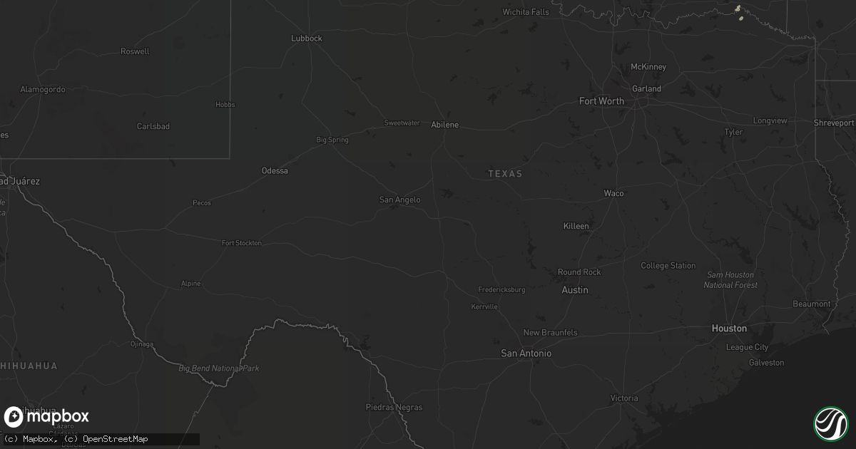
Hail Map in Texas on June 7, 2022
Get this storm
June 7 map
$229
one time, instant access
Download today. No call, no setup
Keep the $229
Bought the map and want the full workflow? Apply the entire $229 to a subscription within 7 days. None of it is wasted.
Every map, not just this one
This buys you this map. Subscription and you get every map we run, in the markets you choose from a few cities to whole states to nationwide. Plus real-time alerts the moment a storm fires.
Contact data
Name, contact info, occupancy, even credit band for addresses in the footprint. You go from where it hit to who to call.
Become the source they trust
Unlimited branding weather history reports on demand. You already have the documented answer ready for the property owner, and you are the one who showed up with it.
Property data and RoofTrace estimates
Pull up any address you have got, its value and the exact code rules for that jurisdiction, straight from One Click Code. Then RoofTrace estimates the squares, pitch, and roof value, priced the way you price.
Storm reports in Texas
Texas
| Date | Description |
|---|---|
| 06/07/20227:47 AM CDT | At 1247 AM CDT, severe thunderstorms were located along a line extending from 6 miles east of Adams to 5 miles south of Hardesty to 12 miles north of Gruver, moving southeast at 55 mph. HAZARD...70 mph wind gusts and quarter size hail. SOURCE...Radar indicated. IMPACT...Expect some tree damage. Damage is likely to mobile homes, roofs, and outbuildings. Hail damage to vehicles is expected. Locations impacted include... Perryton, Spearman, Lipscomb, Beaver, Booker, Gruver, Forgan, Follett, Darrouzett, Gate, Knowles, Wolf Creek Park, Elmwood, Farnsworth, Waka, Morse, Mocane, Slapout and Balko. |
| 06/07/20226:58 AM CDT | At 1158 PM CDT, a severe thunderstorm was located 5 miles southwest of Wolf Creek Park, or 18 miles south of Perryton, moving southeast at 15 mph. HAZARD...Golf ball size hail and 70 mph wind gusts. SOURCE...Radar indicated. IMPACT...Expect some tree damage. Damage is likely to mobile homes, roofs, and outbuildings. People and animals outdoors will be injured. Expect hail damage to roofs, siding, windows, and vehicles. Locations impacted include... Canadian, Glazier and Wolf Creek Park. |
| 06/07/20226:58 AM CDT | Asos station kama amarillo |
| 06/07/20226:55 AM CDT | Awos station kppa pampa |
| 06/07/20226:55 AM CDT | Power line |
| 06/07/20226:55 AM CDT | Power line downed at 58th and interstate 27. Time estimated from radar. |
| 06/07/20226:53 AM CDT | West texas mesonet station panhandle 1ssw. Gusts to 58 mph or greater occurred at time |
| 06/07/20226:53 AM CDT | West texas mesonet station panhandle 1ssw. Gusts to 58 mph or greater occurred at times from 650 to 715 am cdt. |
| 06/07/20226:40 AM CDT | West texas mesonet station amarillo 9nne. 58 mph or greater gusts occurred from 636 to 642 am cdt. |
| 06/07/20226:32 AM CDT | West texas mesonet site 10 e miami. 58 mph or greater gusts occurred from 631 to 634 am cdt. |
| 06/07/20226:31 AM CDT | West texas mesonet station stinnett 1nnw gusted to 58 mph once again from 627 to 631 am cdt. |
| 06/07/20226:28 AM CDT | West texas mesonet station fritch 1wnw. |
| 06/07/20226:28 AM CDT | West texas mesonet station amarillo 15nnw. |
| 06/07/20226:15 AM CDT | Awos station kbpc mesa vista ranch |
| 06/07/20226:13 AM CDT | At 1113 PM CDT, a severe thunderstorm was located 6 miles southwest of Glenrio, or 34 miles south of Nara Visa, moving east at 30 mph. HAZARD...Golf ball size hail and 60 mph wind gusts. SOURCE...Radar indicated. IMPACT...Minor damage to roofs, siding, and trees is possible. People and animals outdoors will be injured. Expect hail damage to roofs, siding, windows, and vehicles. Locations impacted include... Simms and Bootleg. |
| 06/07/20226:09 AM CDT | At 1108 PM CDT, a severe thunderstorm was located over Optima, or 8 miles northeast of Guymon, moving east at 30 mph. HAZARD...60 mph wind gusts and quarter size hail. SOURCE...Radar indicated. IMPACT...Minor damage to roofs, siding, and trees is possible. Hail damage to vehicles is expected. Locations impacted include... Guymon, Optima, Hardesty, Bryans Corner, Adams and Boyd. |
| 06/07/20226:03 AM CDT | West texas mesonet site dumas 3 se. 58 mph or greater gusts occurred from 551 through 611 am cdt. |
| 06/07/20226:00 AM CDT | West texas mesonet 8 w lipscomb. 58 mph or greater gusts occurred from 559 to 601 am cdt. |
| 06/07/20226:00 AM CDT | West texas mesonet station stinnett 1nnw. 58 mph or greater gusts occurred between 551 and 611 am cdt. |
| 06/07/20225:55 AM CDT | Awos station kdux dumas |
| 06/07/20225:53 AM CDT | Gas station canopy destroyed in dumas. Time estimated from radar. |
| 06/07/20225:49 AM CDT | 8 power poles downed along highway 281 3 miles east of highway 70. Time estimated from radar. |
| 06/07/20225:44 AM CDT | 8 power poles downed along highway 759 south of farnsworth. Time estimated from radar. |
| 06/07/20225:30 AM CDT | Reported by both local radio and law enforcement. Time estimated from radar. |
| 06/07/20225:28 AM CDT | Report from mping: 3-inch tree limbs broken; power poles broken. |
| 06/07/20225:28 AM CDT | Grain bins destroyed in spearman. Time estimated from radar. |
| 06/07/20225:25 AM CDT | Awos station ke42 major samuel b cornelius field spearman. Peak gust reported in 535 am metar without peak wind remarks. Thus... Exact time in the preceding 10 minute w |
| 06/07/20225:22 AM CDT | 2 transmission line poles down in waka. Time estimated from radar. |
| 06/07/20225:12 AM CDT | West texas mesonet station palo duro reservoir 1nw. 58 mph or greater gusts occurred from 505 am to 514 am cdt with the peak gust at 512. |
| 06/07/20225:04 AM CDT | At 1004 PM CDT, a severe thunderstorm was located 5 miles southeast of Guymon, moving southeast at 20 mph. HAZARD...Two inch hail and 70 mph wind gusts. SOURCE...Radar indicated. IMPACT...Expect some tree damage. Damage is likely to mobile homes, roofs, and outbuildings. People and animals outdoors will be injured. Expect hail damage to roofs, siding, windows, and vehicles. Locations impacted include... Guymon, Optima and Hardesty. |
| 06/07/20224:55 AM CDT | At 954 PM CDT, a severe thunderstorm was located 4 miles north of Glenrio, or 25 miles south of Nara Visa, moving east at 30 mph. HAZARD...60 mph wind gusts and quarter size hail. SOURCE...Radar indicated. IMPACT...Minor damage to roofs, siding, and trees is possible. Hail damage to vehicles is expected. Locations impacted include... Adrian, Simms and Glenrio. |
| 06/07/20224:41 AM CDT | At 941 AM CDT, severe thunderstorms were located along a line extending from 7 miles west of Daisy to 6 miles southeast of Caney, moving east at 45 mph. HAZARD...60 mph wind gusts and quarter size hail. SOURCE...Radar indicated. IMPACT...Hail damage to vehicles is expected. Expect wind damage to roofs, siding, and trees. Locations in or near the path include... Hugo... Antlers... Boswell... Rattan... Soper... Kent... Snow... Goodland... Messer... Stanley... Moyers... Kosoma... Kellond... Dunbar... Grant... Ord... Eubanks... Darwin... Apple... Speer... |
| 06/07/20223:11 AM CDT | At 811 PM MDT, a severe thunderstorm was located 8 miles south of Ute Lake State Park, or 13 miles northeast of Tucumcari, moving southeast at 15 mph. HAZARD...Tennis ball size hail and 60 mph wind gusts. SOURCE...Radar indicated. IMPACT...People and animals outdoors will be injured. Expect hail damage to roofs, siding, windows, and vehicles. Expect wind damage to roofs, siding, and trees. Locations impacted include... Tucumcari, Logan, San Jon, Glenrio, Ute Lake State Park, Wheatland and Bard.This includes the following highways... Interstate 40 between Mile Markers 334 and 373. State Road 104 between Mile Markers 104 and 105. |
| 06/07/20222:14 AM CDT | At 714 PM MDT, severe thunderstorms were located along a line extending from 17 miles southeast of Mosquero to 15 miles west of Ute Lake State Park, moving southeast at 20 mph. HAZARD...Ping pong ball size hail and 60 mph wind gusts. SOURCE...Radar indicated. IMPACT...People and animals outdoors will be injured. Expect hail damage to roofs, siding, windows, and vehicles. Expect wind damage to roofs, siding, and trees. Locations impacted include... Tucumcari, Logan, Nara Visa and Ute Lake State Park. This includes the following highways... Interstate 40 between Mile Markers 325 and 354. State Road 104 between Mile Markers 89 and 105. |
| 06/07/20221:08 AM CDT | Report with picture from social media. Hail fell for about 3 minutes. |
| 06/07/20221:03 AM CDT | Deputy reported nickel to quarter sized hail fell in town for about 6 minutes. Hail started at 1:03 am. |
| 06/07/202212:06 AM CDT | Hail ranging from nickel size up to around the size of an egg. |
| 06/06/202211:19 PM CDT | A local report indicates 1.75 inch wind near FARNSWORTH |
| 06/06/20228:14 PM CDT | A local report indicates 68 MPH wind near 3 SW DALHART |
All States Impacted by Hail Map on June 7, 2022
Cities Impacted by Hail Map on June 7, 2022
- Harrison, NE
- Humphrey, NE
- Newman Grove, NE
- Albion, NE
- Lindsay, NE
- Saint Edward, NE
- Rapid City, SD
- Manville, WY
- Piedmont, SD
- Sutherland, NE
- Bayard, NE
- Harrisburg, NE
- Bridgeport, NE
- Broadwater, NE
- Gering, NE
- Mitchell, NE
- Lyman, NE
- Lusk, WY
- Rock Port, MO
- Sturgis, SD
- Vale, SD
- Eagle, NE
- Unadilla, NE
- Palmyra, NE
- Walton, NE
- Alvo, NE
- Greenwood, NE
- Lincoln, NE
- Shickley, NE
- Strang, NE
- Geneva, NE
- Sutton, NE
- Ohiowa, NE
- Grafton, NE
- Crawford, NE
- Torrington, WY
- Pisgah, IA
- Dunlap, IA
- Woodbine, IA
- Moorhead, IA
- Pine Ridge, SD
- Alliance, NE
- Hay Springs, NE
- Hill City, SD
- Belgrade, NE
- Genoa, NE
- Brainard, NE
- Rising City, NE
- Cedar Rapids, NE
- Weston, NE
- David City, NE
- Fullerton, NE
- Monroe, NE
- Dwight, NE
- Ulysses, NE
- Bellwood, NE
- Shelby, NE
- Bee, NE
- Surprise, NE
- Platte Center, NE
- Columbus, NE
- Davey, NE
- Primrose, NE
- Valparaiso, NE
- Seward, NE
- Osceola, NE
- Waverly, NE
- Duncan, NE
- Ceresco, NE
- Raymond, NE
- Silver Creek, NE
- Fairfax, MO
- York, NE
- Saronville, NE
- Mount Carmel, IL
- Owensville, IN
- Prague, NE
- Bruno, NE
- Ramah, CO
- Orleans, NE
- Culbertson, NE
- Trenton, NE
- Stratton, NE
- Barnett, MO
- Eldon, MO
- Rocky Mount, MO
- Gravois Mills, MO
- Sharon Springs, KS
- Sidney, NE
- Peetz, CO
- Lakeside, NE
- Hemingford, NE
- Marsland, NE
- Ellsworth, NE
- Eustis, NE
- Solano, NM
- Imogene, IA
- Red Oak, IA
- Essex, IA
- Columbia, MO
- Centralia, MO
- Harrisburg, MO
- Fayette, MO
- Clark, MO
- Hallsville, MO
- Armstrong, MO
- Sturgeon, MO
- Glasgow, MO
- Higbee, MO
- New Franklin, MO
- Franklin, MO
- Petersburg, TN
- Fayetteville, TN
- Manter, KS
- Colorado Springs, CO
- Carrollton, MO
- De Witt, MO
- Gypsum, KS
- Abilene, KS
- Hope, KS
- Salina, KS
- Solomon, KS
- Lebanon, TN
- Argyle, MO
- Saint Elizabeth, MO
- Camdenton, MO
- Brinktown, MO
- Kaiser, MO
- Lake Ozark, MO
- Osage Beach, MO
- Saint Thomas, MO
- Olean, MO
- Ulman, MO
- Brumley, MO
- Tuscumbia, MO
- Iberia, MO
- Eugene, MO
- Henley, MO
- Meta, MO
- Dixon, MO
- Sunrise Beach, MO
- Vienna, MO
- Usaf Academy, CO
- Slater, MO
- Blue Rapids, KS
- Salisbury, MO
- Strong City, KS
- Miami, MO
- Raymondville, MO
- Burlington, CO
- Plattsburg, MO
- Osborn, MO
- Stewartsville, MO
- Liberty, MO
- Kansas City, MO
- White Bluff, TN
- Ashland City, TN
- Charlotte, TN
- Odessa, MO
- Centerview, MO
- Bates City, MO
- Holden, MO
- Lone Jack, MO
- Oak Grove, MO
- Joiner, AR
- Bassett, AR
- Frenchmans Bayou, AR
- Gleason, TN
- Huntsville, AL
- Meridianville, AL
- Bloomington Springs, TN
- Gainesboro, TN
- Elmwood, NE
- Murdock, NE
- Kansas City, KS
- Danville, AL
- Hartselle, AL
- Stringtown, OK
- Trenton, TN
- Lithia, FL
- Wimauma, FL
- Silver Point, TN
- Smithville, TN
- Baxter, TN
- Aurora, NE
- Giltner, NE
- Phillips, NE
- Doniphan, NE
- Butler, MO
- Wagon Mound, NM
- Rattan, OK
- Ringold, OK
- Rufe, OK
- Fort Towson, OK
- Valliant, OK
- Boncarbo, CO
- Weston, CO
- Trinidad, CO
- Huntingdon, TN
- McKenzie, TN
- Dumas, TX
- Sunray, TX
- Lane, OK
- Moulton, AL
- Ohatchee, AL
- Gadsden, AL
- Fitzhugh, OK
- Ada, OK
- New Hope, AL
- Gurley, AL
- Woodville, AL
- Paint Rock, AL
- Graham, MO
- Rea, MO
- King City, MO
- Barnard, MO
- Darlington, MO
- Bolckow, MO
- Stanberry, MO
- Albany, MO
- Guilford, MO
- Panhandle, TX
- Amarillo, TX
- Akron, CO
- Otis, CO
- Anita, IA
- Wiota, IA
- Wray, CO
- Yuma, CO
- Eckley, CO
- Lindon, CO
- Woodrow, CO
- Atwood, KS
- West Blocton, AL
- Brent, AL
- Centreville, AL
- Mulberry, TN
- Lynchburg, TN
- Winchester, TN
- Canadian, TX
- Walsh, CO
- Mullen, NE
- Merriman, NE
- Bingham, NE
- Whitman, NE
- Valentine, NE
- Seneca, NE
- Ashby, NE
- Tupelo, OK
- Arapahoe, NE
- Holbrook, NE
- Cambridge, NE
- Holyoke, CO
- Lodgepole, NE
- Ovid, CO
- Norton, KS
- Herndon, KS
- Hayes Center, NE
- Norcatur, KS
- Jennings, KS
- Venango, NE
- Julesburg, CO
- Potter, NE
- Dix, NE
- Parks, NE
- Grant, NE
- Imperial, NE
- McCook, NE
- Clayton, KS
- Palisade, NE
- Wauneta, NE
- Max, NE
- Amherst, CO
- Lenora, KS
- Enders, NE
- Dresden, KS
- Champion, NE
- Sedgwick, CO
- Benkelman, NE
- Chappell, NE
- Oberlin, KS
- Grant, AL
- Ludell, KS
- McDonald, KS
- Hildreth, NE
- Minden, NE
- Elwood, NE
- Bertrand, NE
- Smithfield, NE
- Holdrege, NE
- Funk, NE
- Axtell, NE
- Loomis, NE
- Sullivan, MO
- Owens Cross Roads, AL
- New Hampton, MO
- Rolla, KS
- Campbell, NE
- Dannebrog, NE
- Boelus, NE
- Farwell, NE
- Stanton, IA
- New Market, IA
- Clarinda, IA
- Blockton, IA
- Hopkins, MO
- Villisca, IA
- Bedford, IA
- Shenandoah, IA
- Sheridan, MO
- Franklin, TN
- Dickson, TN
- Robbins, TN
- Sunbright, TN
- Saint James, MO
- Bon Aqua, TN
- Cottondale, AL
- Detroit, TX
- Wesley Chapel, FL
- Tampa, FL
- Syracuse, NE
- Dresden, TN
- Hooker, OK
- Stearns, KY
- Mount Juliet, TN
- Tecumseh, NE
- Wymore, NE
- Liberty, NE
- Westmoreland, KS
- Peyton, CO
- Calhan, CO
- Granada, CO
- Warrensburg, MO
- Paron, AR
- Kit Carson, CO
- Coalgate, OK
- Watertown, TN
- Fittstown, OK
- Roff, OK
- Stratford, OK
- Beverly, KS
- Lincoln, KS
- Tescott, KS
- Anton, CO
- Guymon, OK
- Edgar, NE
- Ong, NE
- Davenport, NE
- Oak, NE
- Butler, OK
- Hammon, OK
- Atoka, OK
- Ansley, NE
- Ordway, CO
- Wallace, KS
- Ashton, NE
- Clarksville, AR
- Goodland, KS
- Fredericktown, MO
- Sainte Genevieve, MO
- Saint Mary, MO
- Perryville, MO
- Holladay, TN
- Celina, TN
- Burkesville, KY
- Tompkinsville, KY
- Doe Run, MO
- Farmington, MO
- Nashville, TN
- Fairview, TN
- Kingston Springs, TN
- Burns, TN
- Pegram, TN
- Hohenwald, TN
- Waynesboro, TN
- Model, CO
- Scottsboro, AL
- Section, AL
- Dutton, AL
- Warsaw, MO
- Edwards, MO
- McEwen, TN
- Blanchard, OK
- Trezevant, TN
- Atwood, TN
- Madison, AL
- Wapanucka, OK
- Antlers, OK
- Wardville, OK
- Moyers, OK
- Concord, AR
- Piedmont, AL
- Boaz, AL
- Neola, IA
- Persia, IA
- Judsonia, AR
- Humeston, IA
- Leon, IA
- Van Wert, IA
- Weldon, IA
- Massena, IA
- Allerton, IA
- Garden Grove, IA
- Bridgewater, IA
- Walnut, IA
- Creston, IA
- Grand River, IA
- Atlantic, IA
- Cumberland, IA
- Ellston, IA
- Shannon City, IA
- Shelby, IA
- Marne, IA
- Greenfield, IA
- Corydon, IA
- Afton, IA
- Murray, IA
- Fontanelle, IA
- Orient, IA
- Avoca, IA
- Thayer, IA
- Osceola, IA
- Cope, CO
- Salem, MO
- Trimble, TN
- Newbern, TN
- Durham, OK
- Foss, OK
- Elk City, OK
- Crawford, OK
- Cheyenne, OK
- Clinton, OK
- Reydon, OK
- Arapaho, OK
- Weatherford, OK
- Rainbow City, AL
- Callaway, NE
- Merna, NE
- Broken Bow, NE
- Lamar, CO
- Hugo, CO
- Sugar City, CO
- Rush, CO
- Karval, CO
- Deadwood, SD
- Nemo, SD
- Wahoo, NE
- Haxtun, CO
- Saint Paul, NE
- Elba, NE
- Logan, IA
- Minden, IA
- Clio, IA
- Tingley, IA
- Lineville, IA
- Watson, MO
- Tarkio, MO
- Byers, CO
- Brunswick, MO
- Pleasant Shade, TN
- Carthage, TN
- Burr, NE
- Talmage, NE
- Nebraska City, NE
- Mound City, MO
- Cook, NE
- Julian, NE
- Dunbar, NE
- Nemaha, NE
- Verdon, NE
- Craig, MO
- Douglas, NE
- Oregon, MO
- Brock, NE
- Maryville, MO
- Peru, NE
- Skidmore, MO
- Maitland, MO
- Shubert, NE
- Humboldt, NE
- Sterling, NE
- Lorton, NE
- Falls City, NE
- Rulo, NE
- Stella, NE
- Brownville, NE
- Otoe, NE
- Auburn, NE
- Rosendale, MO
- Johnson, NE
- Berryton, KS
- Topeka, KS
- Kim, CO
- Mustang, OK
- Oklahoma City, OK
- Wheatland, OK
- Miami, NM
- Lavinia, TN
- Milan, TN
- Richfield, KS
- Johnson, KS
- Hugoton, KS
- Mountain Grove, MO
- Vega, TX
- Licking, MO
- Stonewall, OK
- Maysville, OK
- Pauls Valley, OK
- Wynnewood, OK
- Amber, OK
- Lexington, OK
- Centrahoma, OK
- Allen, OK
- Chickasha, OK
- Lindsay, OK
- Paoli, OK
- Washington, OK
- Wanette, OK
- Wayne, OK
- Byars, OK
- Purcell, OK
- Alex, OK
- Bard, NM
- Trementina, NM
- San Jon, NM
- Adrian, TX
- Tucumcari, NM
- Logan, NM
- Conchas Dam, NM
- Mosquero, NM
- Jay Em, WY
- Hubbell, NE
- Morrowville, KS
- Fairfield, NE
- Narka, KS
- Deshler, NE
- Deweese, NE
- Haddam, KS
- Clay Center, NE
- Hanover, KS
- Harvard, NE
- Chester, NE
- Fairbury, NE
- Hebron, NE
- Reynolds, NE
- Mahaska, KS
- Washington, KS
- Hordville, NE
- Curtis, NE
- Moorefield, NE
- Stockville, NE
- Farnam, NE
- Glenrock, WY
- Savannah, MO
- Bourbon, MO
- Glenwood, IA
- Malvern, IA
- Pacific Junction, IA
- Hastings, IA
- Emerson, IA
- Durham, KS
- Tampa, KS
- Bradshaw, NE
- Benedict, NE
- Polk, NE
- Bellevue, NE
- Council Bluffs, IA
- Mineola, IA
- Waterloo, NE
- Yutan, NE
- Elkhorn, NE
- Silver City, IA
- Boys Town, NE
- Omaha, NE
- Henderson, IA
- La Vista, NE
- Kingsville, MO
- College Grove, TN
- Eagleville, TN
- Arrington, TN
- Rockvale, TN
- Eldridge, MO
- Lebanon, MO
- Channing, TX
- Bethune, CO
- Edson, KS
- Flagler, CO
- Seibert, CO
- Kanorado, KS
- Weskan, KS
- Deer Trail, CO
- Vona, CO
- Fort Morgan, CO
- Stratton, CO
- Holly, CO
- Natoma, KS
- Waldo, KS
- Paradise, KS
- Yuma, TN
- Attalla, AL
- Union Grove, AL
- Bismarck, MO
- Ironton, MO
- Rocky Ford, CO
- Beulah, CO
- Pueblo, CO
- Rye, CO
- Fowler, CO
- Litchfield, NE
- Mason City, NE
- Hazard, NE
- Pleasanton, NE
- Firth, NE
- Adams, NE
- Plattsmouth, NE
- Murray, NE
- Bladen, NE
- Roseland, NE
- Holstein, NE
- Easton, KS
- Versailles, MO
- Stratford, TX
- Texhoma, OK
- Goodwell, OK
- Gruver, TX
- Texhoma, TX
- Jamestown, TN
- Hollow Rock, TN
- Cactus, TX
- Brownsville, TN
- Summertown, TN
- Avondale, CO
- Trinchera, CO
- Laceys Spring, AL
- Cullman, AL
- Eva, AL
- Somerville, AL
- Jacksonville, AL
- Treynor, IA
- Valley, NE
- Papillion, NE
- Beaver City, NE
- Hendley, NE
- Madison, TN
- Goodlettsville, TN
- Joes, CO
- Paris, TN
- Palmersville, TN
- Campo, CO
- Cedar Grove, TN
- Roy, NM
- Beatrice, NE
- Fairmont, NE
- Henderson, NE
- De Witt, NE
- Grand Island, NE
- Exeter, NE
- Dorchester, NE
- Swanton, NE
- McCool Junction, NE
- Friend, NE
- Western, NE
- Marquette, NE
- Hampton, NE
- Wilber, NE
- Milligan, NE
- Lamar, AR
- London, AR
- Knoxville, AR
- Conception Junction, MO
- Conception, MO
- Mead, NE
- Yoder, CO
- California, MO
- Belleview, MO
- Middle Brook, MO
- Central City, NE
- Clarks, NE
- Palmer, NE
- Wellington, AL
- Home, KS
- Frankfort, KS
- Beattie, KS
- Marysville, KS
- Crook, CO
- Kidder, MO
- Cameron, MO
- Lees Summit, MO
- Independence, MO
- Blue Springs, MO
- Monterey, TN
- Cookeville, TN
- Cadet, MO
- Beech Grove, AR
- Lyles, TN
- Okeechobee, FL
- Ayr, NE
- Trumbull, NE
- Wood River, NE
- Ravenna, NE
- Cairo, NE
- Blue Hill, NE
- Alda, NE
- Stapleton, NE
- Anselmo, NE
- Arnold, NE
- Glenvil, NE
- Thedford, NE
- Kenesaw, NE
- Westerville, NE
- Gibbon, NE
- Loup City, NE
- Hastings, NE
- Inland, NE
- Arcadia, NE
- Oconto, NE
- Rockville, NE
- Juniata, NE
- Shelton, NE
- Elkhart, KS
- Chapman, NE
- Barnes, KS
- Waterville, KS
- Carleton, NE
- Plymouth, NE
- Tobias, NE
- Ruskin, NE
- Cordova, NE
- Lawrence, NE
- Greenleaf, KS
- Hollenberg, KS
- Nelson, NE
- Munden, KS
- Bremen, KS
- Heartwell, NE
- Avoca, NE
- Weeping Water, NE
- Henry, TN
- Hazel Green, AL
- Herington, KS
- Potosi, MO
- Goff, KS
- Wetmore, KS
- Netawaka, KS
- Vanleer, TN
- Cumberland Furnace, TN
- Fort Leavenworth, KS
- Leavenworth, KS
- Burlington Junction, MO
- New Cambria, KS
- Pangburn, AR
- Edison, NE
- Blackwell, MO
- Richwoods, MO
- Elmwood, TN
- Lancaster, TN
- Buffalo Valley, TN
- Arab, AL
- Guntersville, AL
- Fruithurst, AL
- Magazine, AR
- New Market, AL
- Erin, TN
- Mills, NM
- Chestnut Mound, TN
- Granville, TN
- Scranton, AR
- Delaware, AR
- New Blaine, AR
- Bland, MO
- Vichy, MO
- Belle, MO
- Miami, TX
- Osceola, AR
- Linwood, NE
- Leslie, MO
- Gerald, MO
- Rosebud, MO
- Boonville, IN
- Lynnville, IN
- Tennyson, IN
- Valhermoso Springs, AL
- Paragould, AR
- Bono, AR
- Bennet, NE
- Roca, NE
- Atlanta, NE
- Wilcox, NE
- Atchison, KS
- Syracuse, KS
- Rolla, MO
- Williamsburg, KY
- Mount Pleasant, TN
- Culleoka, TN
- Lynnville, TN
- Danbury, NE
- Haigler, NE
- Grain Valley, MO
- Logan, KS
- Owensville, MO
- Limon, CO
- Haswell, CO
- Eads, CO
- Hasty, CO
- Elbert, CO
- Perryton, TX
- Hardesty, OK
- Spearman, TX
- McClave, CO
- Arlington, CO
- Las Animas, CO
- La Junta, CO
- Wiley, CO
- Corn, OK
- Matheson, CO
- Briscoe, TX
- Balko, OK
- Sayre, OK
- Keyes, OK
- Centre, AL
- Bagwell, TX
- Randolph, AL
- Manning, IA
- Audubon, IA
- Kyle, SD
- New Bloomfield, MO
- Hartsburg, MO
- Ashland, MO
- Prescott, IA
- Calera, AL
- Hancock, IA
- Lenexa, KS
- Leawood, KS
- Overland Park, KS
- Dalton, NE
- Melbeta, NE
- Hyannis, NE
- Gurley, NE
- Oshkosh, NE
- Crete, NE
- Sawyer, OK
- Finley, OK
- Hugo, OK
- Sulphur, OK
- Soper, OK
- Milburn, OK
- Davis, OK
- Tishomingo, OK
- Spencerville, OK
- Mill Creek, OK
- Stuart, OK
- Calvin, OK
- Brownsboro, AL
- Uniontown, AR
- Natural Dam, AR
- Cedarville, AR
- Van Buren, AR
- Rudy, AR
- Stinnett, TX
- Morse, TX
- White Deer, TX
- Fritch, TX
- Canyon, TX
- Borger, TX
- Skellytown, TX
- Claude, TX
- Masterson, TX
- Pampa, TX
- Groom, TX
- Van Tassell, WY
- Lewellen, NE
- Oketo, KS
- Meriden, KS
- Scandia, KS
- Muscotah, KS
- Powhattan, KS
- Excelsior Springs, MO
- Weston, MO
- Whiting, KS
- Grandview, MO
- Formoso, KS
- Diller, NE
- Sedalia, MO
- Rossville, KS
- Circleville, KS
- Mankato, KS
- Nortonville, KS
- Superior, NE
- Corder, MO
- Bonner Springs, KS
- Higginsville, MO
- Olsburg, KS
- Eudora, KS
- Syracuse, MO
- Jewell, KS
- Wamego, KS
- Guide Rock, NE
- Leonardville, KS
- Norway, KS
- Green Ridge, MO
- Farley, MO
- Belvue, KS
- Odell, NE
- Linwood, KS
- Tecumseh, KS
- Pilot Grove, MO
- Concordia, KS
- Morganville, KS
- Saint Marys, KS
- Lexington, MO
- Bunceton, MO
- Otterville, MO
- Missouri City, MO
- Olathe, KS
- Clifton, KS
- Oneida, KS
- Webber, KS
- Summerfield, KS
- Horton, KS
- Tipton, MO
- Ozawkie, KS
- Manhattan, KS
- Green, KS
- Mission, KS
- Concordia, MO
- Centralia, KS
- Chapman, KS
- Junction City, KS
- Seneca, KS
- Palmer, KS
- Hughesville, MO
- Randolph, KS
- Basehor, KS
- Baileyville, KS
- Riley, KS
- Camden, MO
- Onaga, KS
- Wakefield, KS
- Esbon, KS
- Buckner, MO
- Effingham, KS
- Clay Center, KS
- Milford, KS
- Houstonia, MO
- Axtell, KS
- Sabetha, KS
- Valley Falls, KS
- Boonville, MO
- Fairview, KS
- Lecompton, KS
- Marshall, MO
- Tonganoxie, KS
- Alma, KS
- Longford, KS
- Jansen, NE
- Clyde, KS
- Silver Lake, KS
- Holton, KS
- Clarksburg, MO
- Lawrence, KS
- Waldron, MO
- Levasy, MO
- Pleasant Hill, MO
- Aurora, KS
- Havensville, KS
- Prairie Village, KS
- Nelson, MO
- Napoleon, MO
- Oskaloosa, KS
- Byron, NE
- Sweet Springs, MO
- Cuba, KS
- Courtland, KS
- Agenda, KS
- Ogden, KS
- Paxico, KS
- Sibley, MO
- Winchester, KS
- Greenwood, MO
- Miltonvale, KS
- Jamestown, KS
- Cummings, KS
- Mayetta, KS
- Fort Riley, KS
- Perry, KS
- Denison, KS
- Smithton, MO
- Republic, KS
- Endicott, NE
- Steele City, NE
- Corning, KS
- Henrietta, MO
- Mayview, MO
- Blackwater, MO
- Orrick, MO
- Linn, KS
- Emmett, KS
- Lebanon, KS
- Soldier, KS
- Burr Oak, KS
- Belvidere, NE
- Saint George, KS
- Vermillion, KS
- Blackburn, MO
- Lansing, KS
- Maple Hill, KS
- Platte City, MO
- Shawnee, KS
- Hoyt, KS
- Kearney, MO
- Knob Noster, MO
- Randall, KS
- Delia, KS
- La Monte, MO
- McLouth, KS
- Wellington, MO
- Riverside, MO
- Red Cloud, NE
- Florence, MO
- De Soto, KS
- Smithville, MO
- Richmond, MO
- Hardy, NE
- Grantville, KS
- Whiteman Air Force Base, MO
- Belleville, KS
- Selden, KS
- Gretna, NE
- Offutt Afb, NE
- Bloomington, NE
- Naponee, NE
- Alma, NE
- Oxford, NE
- Upland, NE
- Republican City, NE
- Franklin, NE
- Stamford, NE
- Elk Creek, NE
- Panama, NE
- Winona, KS
- Simla, CO
- Decatur, IA


