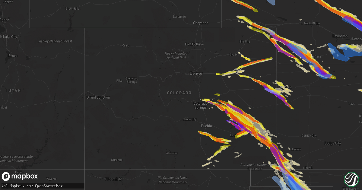
Hail Map in Colorado on June 7, 2022
Get this storm
June 7 map
$229
one time, instant access
Download today. No call, no setup
Keep the $229
Bought the map and want the full workflow? Apply the entire $229 to a subscription within 7 days. None of it is wasted.
Every map, not just this one
This buys you this map. Subscription and you get every map we run, in the markets you choose from a few cities to whole states to nationwide. Plus real-time alerts the moment a storm fires.
Contact data
Name, contact info, occupancy, even credit band for addresses in the footprint. You go from where it hit to who to call.
Become the source they trust
Unlimited branding weather history reports on demand. You already have the documented answer ready for the property owner, and you are the one who showed up with it.
Property data and RoofTrace estimates
Pull up any address you have got, its value and the exact code rules for that jurisdiction, straight from One Click Code. Then RoofTrace estimates the squares, pitch, and roof value, priced the way you price.
Storm reports in Colorado
Colorado
| Date | Description |
|---|---|
| 06/07/20226:57 PM CDT | Corrects previous hail report from 4 w burlington. At least golf ball hail... Smashed windshield of person on interstate 70. |
| 06/07/20226:57 PM CDT | At least golf ball hail... Smashed windshield of person on interstate 70. |
| 06/07/20226:53 PM CDT | Dime to two size hail. |
| 06/07/20226:50 PM CDT | Reported via social media. Hail varied in size from quarter to ping pong ball. Hail finished by 6:10 pm mt. |
| 06/07/20226:50 PM CDT | Spotter reported quarter sized hail accumulating to a depth of 1 inch. Hail lasted for 6 minutes. |
| 06/07/20226:46 PM CDT | Spotter reported hail ranging from dime to golfball in size for an ongoing duration of 10 minutes as of 5:56 pm mt. Small tree limbs were damaged due to hail. |
| 06/07/20226:40 PM CDT | Brief landspout. |
| 06/07/20226:40 PM CDT | A local report indicates 1.25 inch wind near 10 S FORDER |
| 06/07/20226:36 PM CDT | Delayed report via twitter. Time estimated by radar. |
| 06/07/20226:29 PM CDT | Hail lasted approximately 10 minutes. Time estimated by radar. |
| 06/07/20226:27 PM CDT | Delayed report via social media. Dime to quarter sized hail. Time estimated by radar. |
| 06/07/20226:20 PM CDT | Caller reported 60 to 70 mph winds. |
| 06/07/20226:20 PM CDT | Caller reported quarter to half dollar sized hail that lasted for duration of 5 minutes. |
| 06/07/20226:17 PM CDT | A local report indicates 2.50 inch wind near 7 SSE JULESBURG |
| 06/07/20226:17 PM CDT | A local report indicates 2.50 inch wind near 7 SSE JULESBURG |
| 06/07/20226:15 PM CDT | Delayed report via social media. Time estimated by radar. |
| 06/07/20226:05 PM CDT | A local report indicates a tornado near 3 NE SEDGWICK |
| 06/07/20226:04 PM CDT | A local report indicates 76 MPH wind near 3 N SEDGWICK |
| 06/07/20226:01 PM CDT | Landspout tornado ended at 504 pm mdt. |
| 06/07/20225:41 PM CDT | Observed from las animas dollar general. |
| 06/07/20225:31 PM CDT | Spotter reported dime to quarter hail. Hail ongoing as of 4:35 pm. |
| 06/07/20225:20 PM CDT | A local report indicates 1.75 inch wind near 6 SE CHERAW |
| 06/07/20225:19 PM CDT | A local report indicates 1.00 inch wind near 4 NE ELBA |
| 06/07/20224:42 PM CDT | Hail to quarter size ongoing as reported by trained spotter. |
| 06/07/20224:35 PM CDT | A local report indicates 1.75 inch wind near 7 NW FORDER |
| 06/07/20224:35 PM CDT | Time estimated from radar. |
| 06/07/20224:30 PM CDT | A local report indicates 1.00 inch wind near WOODLIN SCHOOL |
| 06/07/20224:29 PM CDT | A local report indicates 1.00 inch wind near 7 NW FORDER |
| 06/07/20224:15 PM CDT | A local report indicates 1.00 inch wind near 3 N DEER TRAIL |
| 06/07/20224:10 PM CDT | Delayed report via social media. Photo of several quarter to half dollar hailstones in byers. |
| 06/07/20223:29 PM CDT | Picture relayed via social media. |
| 06/07/20223:22 PM CDT | Report of hail up to quarter-size on the north side of trinidad with earlier severe thunderstorm. |
| 06/07/20222:58 PM CDT | A local report indicates 1.50 inch wind near 3 NE FALCON |
| 06/07/20222:55 PM CDT | Picture emailed from trained spotter. |
| 06/07/20222:45 PM CDT | Trained spotter measured 1.6-inch hail with a severe thunderstorm that passed through the falcon area. |
| 06/07/20222:45 PM CDT | A local report indicates 1.00 inch wind near 3 NNE FALCON |
| 06/07/20222:25 PM CDT | Cocorahs spotter measured 1.63-inch hail with earlier severe storm. |
| 06/07/20226:19 AM CDT | At 1119 PM MDT, severe thunderstorms were located along a line extending from near Las Animas to 6 miles southeast of Queens Reservoir, moving southeast at 45 mph. These storms will impact the Highway 50 corridor from Las Animas to Lamar. HAZARD...Two inch hail and 70 mph wind gusts. SOURCE...Radar indicated. IMPACT...People and animals outdoors will be injured. Expect hail damage to roofs, siding, windows, and vehicles. Expect considerable tree damage. Wind damage is also likely to mobile homes, roofs, and outbuildings. Locations impacted include... Lamar, Las Animas, Holly, Granada, Wiley, Hartman, McClave, Bristol, Hasty, John Martin Reservoir, Fort Lyon and Caddoa. |
| 06/07/20225:40 AM CDT | At 1039 PM MDT, severe thunderstorms were located along a line extending from near Sweetwater Reservoir to 9 miles west of Arlington, moving southeast at 25 mph. HAZARD...Golf ball size hail and 60 mph wind gusts. SOURCE...Radar indicated. IMPACT...People and animals outdoors will be injured. Expect hail damage to roofs, siding, windows, and vehicles. Expect wind damage to roofs, siding, and trees. Severe thunderstorms will be near... Sweetwater Reservoir around 1050 PM MDT. Neegronda Reservoir around 1055 PM MDT. Neeoshe Reservoir around 1100 PM MDT. Wiley, Queens Reservoir and Blue Lake around 1110 PM MDT. Lamar around 1130 PM MDT. Las Animas around 1135 PM MDT. John Martin Reservoir around 1140 PM MDT. Hasty around 1155 PM MDT.Other locations impacted by these severe thunderstorms include FortLyon and Caddoa. |
| 06/07/20224:54 AM CDT | At 954 PM MDT, a severe thunderstorm was located near Forder, or 45 miles south of Limon, moving southeast at 25 mph. HAZARD...Ping pong ball size hail and 60 mph wind gusts. SOURCE...Radar indicated. IMPACT...People and animals outdoors will be injured. Expect hail damage to roofs, siding, windows, and vehicles. Expect wind damage to roofs, siding, and trees. Locations impacted include... Arlington and Blue Lake. |
| 06/07/20224:43 AM CDT | At 942 PM MDT, a severe thunderstorm was located 6 miles west of Forder, or 42 miles south of Limon, moving southeast at 30 mph. HAZARD...Ping pong ball size hail and 60 mph wind gusts. SOURCE...Radar indicated. IMPACT...Expect damage to roofs, siding, and trees. People and animals outdoors will be injured. Expect hail damage to roofs, siding, windows, and vehicles. Locations impacted include... Forder and Wild Horse Point. |
| 06/07/20224:37 AM CDT | At 937 PM MDT, a severe thunderstorm was located 11 miles northeast of Wild Horse Point, or 46 miles south of Flagler, moving southeast at 30 mph. HAZARD...Golf ball size hail and 60 mph wind gusts. SOURCE...Radar indicated. IMPACT...People and animals outdoors will be injured. Expect hail damage to roofs, siding, windows, and vehicles. Expect wind damage to roofs, siding, and trees. Locations impacted include... Eads, Sweetwater Reservoir and Neeoshe Reservoir. |
| 06/07/20224:36 AM CDT | At 935 PM MDT, a severe thunderstorm was located 10 miles northeast of Wild Horse Point, or 45 miles north of North La Junta, moving southeast at 30 mph. HAZARD...Golf ball size hail and 60 mph wind gusts. SOURCE...Radar indicated. At 912 PM MDT, golf ball size hail was reported in Karval. IMPACT...Expect damage to roofs, siding, and trees. People and animals outdoors will be injured. Expect hail damage to roofs, siding, windows, and vehicles. This severe thunderstorm will remain over mainly rural areas of southeastern Lincoln County. |
| 06/07/20224:16 AM CDT | At 916 PM MDT, a severe thunderstorm was located 7 miles northeast of Two Buttes, or 19 miles northwest of The Saunders Elevator, moving southeast at 30 mph. HAZARD...Tennis ball size hail and 70 mph wind gusts. SOURCE...Radar indicated. IMPACT...People and animals outdoors will be injured. Expect hail damage to roofs, siding, windows, and vehicles. Expect considerable tree damage. Wind damage is also likely to mobile homes, roofs, and outbuildings. Locations impacted include... Walsh, Two Buttes and Stonington. |
| 06/07/20224:02 AM CDT | At 901 PM MDT, a severe thunderstorm was located 9 miles north of Kanorado, moving southeast at 25 mph. HAZARD...60 mph wind gusts and quarter size hail. SOURCE...Radar indicated. IMPACT...Hail damage to vehicles is expected. Expect wind damage to roofs, siding, and trees. Locations impacted include... Ruleton and Goodland.This includes Interstate 70 in Kansas between mile markers 8 and 25. |
| 06/07/20223:55 AM CDT | At 854 PM MDT, a severe thunderstorm was located near Punkin Center, or 31 miles south of Limon, moving southeast at 35 mph. HAZARD...60 mph wind gusts and half dollar size hail. SOURCE...Radar indicated. At 845 PM, quarter size hail was reported near Highway 94 near Punkin Center. IMPACT...Expect damage to roofs, siding, and trees. Hail damage to vehicles is expected. Locations impacted include... Karval, Wild Horse Point, Forder and Punkin Center. |
| 06/07/20223:14 AM CDT | At 814 PM MDT, a severe thunderstorm was located 6 miles west of Kutch, or 29 miles southwest of Limon, moving southeast at 30 mph. HAZARD...60 mph wind gusts and quarter size hail. SOURCE...Radar indicated. IMPACT...Expect damage to roofs, siding, and trees. Hail damage to vehicles is expected. This severe thunderstorm will be near... Kutch around 825 PM MDT.Other locations in the path of this severe thunderstorm includePunkin Center and Forder. |
| 06/07/20223:09 AM CDT | At 809 PM MDT, a severe thunderstorm was located near Akron, moving southeast at 45 mph. HAZARD...60 mph wind gusts and quarter size hail. SOURCE...Trained weather spotters. IMPACT...Expect damage to roofs, siding, and trees. Hail damage to vehicles is expected. This severe thunderstorm will remain over mainly rural areas of eastern Washington County. |
| 06/07/20222:57 AM CDT | At 757 PM MDT, severe thunderstorms were developing along a line extending from 14 miles south of McClave to 18 miles south of John Martin Reservoir, moving south at 20 mph. HAZARD...60 mph wind gusts and half dollar size hail. SOURCE...Radar indicated. IMPACT...Hail damage to vehicles is expected. Expect wind damage to roofs, siding, and trees. These severe thunderstorms will remain over mainly rural areas of southwestern Prowers and southeastern Bent Counties. |
| 06/07/20221:27 AM CDT | At 625 PM MDT, a severe thunderstorm was located over McClave, or 10 miles west of Lamar, moving southeast at 15 mph. HAZARD...Ping pong ball size hail and 60 mph wind gusts. SOURCE...Trained spotter around McClave reported quarter-size hail. IMPACT...People and animals outdoors will be injured. Expect hail damage to roofs, siding, windows, and vehicles. Expect wind damage to roofs, siding, and trees. This severe thunderstorm will be near... Wiley around 635 PM MDT.Other locations in the path of this severe thunderstorm includeLamar. |
| 06/07/20221:10 AM CDT | At 610 PM MDT, a severe thunderstorm was located 9 miles west of Arlington, or 24 miles north of La Junta, moving south at 30 mph. HAZARD...Tennis ball size hail and 70 mph wind gusts. SOURCE...Radar indicated. IMPACT...People and animals outdoors will be injured. Expect hail damage to roofs, siding, windows, and vehicles. Expect considerable tree damage. Wind damage is also likely to mobile homes, roofs, and outbuildings. Locations impacted include... Cheraw, Blue Lake and Arlington. |
| 06/07/20221:00 AM CDT | Power outages and multiple downed trees reported. |
| 06/07/202212:55 AM CDT | At 555 PM MDT, a severe thunderstorm was located 4 miles southeast of Bethune, or 5 miles southwest of Burlington, moving southeast at 45 mph. THIS IS A DESTRUCTIVE STORM FOR BETHUNE AND EASTERN KIT CARSON COUNTY. HAZARD...Baseball size hail and 70 mph wind gusts. SOURCE...Radar indicated. IMPACT...People and animals outdoors will be severely injured. Expect shattered windows, extensive damage to roofs, siding, and vehicles. Locations impacted include... Weskan.This includes the following highways... Interstate 70 in Kansas between mile markers 0 and 1. Interstate 70 in Colorado between mile markers 429 and 450. Highway 385 between mile markers 158 and 193. |
| 06/07/202212:36 AM CDT | At 536 PM MDT, a severe thunderstorm was located 7 miles south of Model, or 18 miles east of Trinidad, moving east at 35 mph. HAZARD...60 mph wind gusts and quarter size hail. SOURCE...Radar indicated. IMPACT...Hail damage to vehicles is expected. Expect wind damage to roofs, siding, and trees. This severe thunderstorm will remain over mainly rural areas of south central Las Animas County. |
| 06/07/202212:30 AM CDT | At 530 PM MDT, a severe thunderstorm was located 7 miles south of Forder, or 42 miles north of La Junta, moving southeast at 35 mph. HAZARD...Golf ball size hail and 60 mph wind gusts. SOURCE...Radar indicated. IMPACT...People and animals outdoors will be injured. Expect hail damage to roofs, siding, windows, and vehicles. Expect wind damage to roofs, siding, and trees. Locations impacted include... Haswell. |
| 06/07/202212:30 AM CDT | At 529 PM MDT, a severe thunderstorm was located 6 miles south of Forder, or 42 miles north of North La Junta, moving southeast at 25 mph. HAZARD...Ping pong ball size hail and 60 mph wind gusts. SOURCE...Radar indicated. IMPACT...Expect damage to roofs, siding, and trees. People and animals outdoors will be injured. Expect hail damage to roofs, siding, windows, and vehicles. Locations impacted include... Wild Horse Point. |
| 06/07/202212:14 AM CDT | At 514 PM MDT, a severe thunderstorm was located 12 miles southeast of Cope, or 15 miles northeast of Seibert, moving southeast at 30 mph. HAZARD...Golf ball size hail and 60 mph wind gusts. SOURCE...Radar indicated. IMPACT...People and animals outdoors will be injured. Expect hail damage to roofs, siding, windows, and vehicles. Expect wind damage to roofs, siding, and trees. Locations impacted include... Bethune and Burlington.This includes the following highways... Interstate 70 in Colorado between mile markers 422 and 437. Highway 385 between mile markers 186 and 199. |
| 06/07/202212:09 AM CDT | At 509 PM MDT, severe thunderstorms were located along a line extending from near Timpas to 16 miles northeast of Thatcher to 10 miles north of Delhi, moving southeast at 35 mph. HAZARD...Ping pong ball size hail and 60 mph wind gusts. SOURCE...Radar indicated. IMPACT...People and animals outdoors will be injured. Expect hail damage to roofs, siding, windows, and vehicles. Expect wind damage to roofs, siding, and trees. Locations impacted include... Timpas. |
| 06/06/202211:58 PM CDT | At 457 PM MDT, a severe thunderstorm was located 4 miles southeast of Lorenzo, or 10 miles south of Sidney, moving southeast at 55 mph. HAZARD...60 mph wind gusts and quarter size hail. SOURCE...Radar indicated. IMPACT...Expect damage to roofs, siding, and trees. Hail damage to vehicles is expected. This severe thunderstorm will be near... Crook and Twin Buttes around 510 PM MDT.Other locations in the path of this severe thunderstorm include MarksButte, Fairfield and Sixteen-Mile Corner. |
| 06/06/202211:55 PM CDT | At 453 PM MDT, a severe thunderstorm was located near Haswell, or 32 miles northeast of North La Junta, moving southeastward. Another severe thunderstorm will continue moving northeastward from northern Bent County into southern Kiowa County. Storm motion is 40 mph. HAZARD...Two inch hail and 70 mph wind gusts. SOURCE...Radar indicated. IMPACT...People and animals outdoors will be injured. Expect hail damage to roofs, siding, windows, and vehicles. Expect considerable tree damage. Wind damage is also likely to mobile homes, roofs, and outbuildings. Locations impacted include... McClave, Sweetwater Reservoir, Blue Lake, Hasty, Neegronda Reservoir, John Martin Reservoir, Fort Lyon and Caddoa. |
| 06/06/202211:41 PM CDT | At 441 PM MDT, a severe thunderstorm was located near Rush, or 37 miles east of Colorado Springs, moving southeast at 35 mph. HAZARD...Golf ball size hail and 60 mph wind gusts. SOURCE...Radar indicated. IMPACT...Expect damage to roofs, siding, and trees. People and animals outdoors will be injured. Expect hail damage to roofs, siding, windows, and vehicles. Locations impacted include... Forder. |
| 06/06/202211:35 PM CDT | At 435 PM MDT, a severe thunderstorm was located 23 miles northwest of Delhi, or 32 miles southeast of Pueblo, moving southeast at 30 mph. HAZARD...Ping pong ball size hail and 60 mph wind gusts. SOURCE...Radar indicated. IMPACT...People and animals outdoors will be injured. Expect hail damage to roofs, siding, windows, and vehicles. Expect wind damage to roofs, siding, and trees. This severe thunderstorm will remain over mainly rural areas of southwestern Otero, northeastern Huerfano, north central Las Animas and southeastern Pueblo Counties. |
| 06/06/202211:34 PM CDT | At 434 PM MDT, a severe thunderstorm was located 5 miles south of Sunol, or 10 miles southeast of Sidney, moving southeast at 30 mph. HAZARD...Ping pong ball size hail and 60 mph wind gusts. SOURCE...Radar indicated. IMPACT...Expect damage to roofs, siding, and trees. People and animals outdoors will be injured. Expect hail damage to roofs, siding, windows, and vehicles. Locations impacted include... Julesburg, Ovid and Sedgwick. |
| 06/06/202211:29 PM CDT | At 429 PM MDT, a severe thunderstorm was located near Colton, or 7 miles southeast of Sidney, moving southeast at 30 mph. HAZARD...Ping pong ball size hail. SOURCE...Radar indicated. IMPACT...People and animals outdoors will be injured. Expect damage to roofs, siding, windows, and vehicles. This severe thunderstorm will remain over mainly rural areas of southwestern Deuel County.This includes Interstate 80 in Nebraska between mile markers 78 and84, and between mile markers 87 and 89. |
| 06/06/202211:25 PM CDT | At 425 PM MDT, a severe thunderstorm was located near Las Animas, or 12 miles northeast of North La Junta, moving northeast at 40 mph. HAZARD...60 mph wind gusts and quarter size hail. SOURCE...Radar indicated. IMPACT...Hail damage to vehicles is expected. Expect wind damage to roofs, siding, and trees. Locations impacted include... Las Animas, Hasty, John Martin Reservoir, Fort Lyon and Caddoa. |
| 06/06/202211:22 PM CDT | At 422 PM MDT, a severe thunderstorm was located near Colton, or near Sidney, moving southeast at 40 mph. HAZARD...60 mph wind gusts and half dollar size hail. SOURCE...Radar indicated. IMPACT...Hail damage to vehicles is expected. Expect wind damage to roofs, siding, and trees. Locations impacted include... Sidney, Colton, Sunol, Sidney Airport and Lorenzo. This includes Interstate 80 in Nebraska between mile markers 57 and77. |
| 06/06/202211:13 PM CDT | A local report indicates 1.75 inch wind near 10 S FORDER |
| 06/06/202211:13 PM CDT | At 412 PM MDT, a severe thunderstorm was located near Thurman, or 24 miles north of Flagler, moving east at 30 mph. HAZARD...60 mph wind gusts and half dollar size hail. SOURCE...Radar indicated. IMPACT...Hail damage to vehicles is expected. Expect wind damage to roofs, siding, and trees. This severe thunderstorm will remain over mainly rural areas of southwestern Yuma and northwestern Kit Carson Counties, including the following locations... Joes and Kirk. |
| 06/06/202211:12 PM CDT | At 412 PM MDT, a severe thunderstorm was located near Ellicott, or 24 miles east of Colorado Springs, moving east at 30 mph. HAZARD...Ping pong ball size hail and 60 mph wind gusts. SOURCE...Radar indicated. IMPACT...People and animals outdoors will be injured. Expect hail damage to roofs, siding, windows, and vehicles. Expect wind damage to roofs, siding, and trees. Locations impacted include... Truckton, Yoder, Ellicott and Rush. |
| 06/06/202211:07 PM CDT | At 407 PM MDT, a severe thunderstorm was located near Wild Horse Point, or 43 miles north of La Junta, moving southeast at 30 mph. HAZARD...Golf ball size hail and 60 mph wind gusts. SOURCE...Radar indicated. IMPACT...People and animals outdoors will be injured. Expect hail damage to roofs, siding, windows, and vehicles. Expect wind damage to roofs, siding, and trees. Locations impacted include... Haswell, Neegronda Reservoir, Arlington and Blue Lake. |
| 06/06/202211:04 PM CDT | At 403 PM MDT, a severe thunderstorm was located 6 miles northwest of Wild Horse Point, or 44 miles south of Limon, moving east at 20 mph. HAZARD...Two inch hail and 60 mph wind gusts. SOURCE...Trained weather spotters. At 335 PM MDT, golf ball sized hail was reported at near Forder. IMPACT...Expect damage to roofs, siding, and trees. People and animals outdoors will be injured. Expect hail damage to roofs, siding, windows, and vehicles. This severe thunderstorm will be near... Wild Horse Point around 420 PM MDT. |
| 06/06/202211:00 PM CDT | At 400 PM MDT, a severe thunderstorm was located 6 miles northwest of Thurman, or 28 miles northwest of Flagler, moving east at 30 mph. HAZARD...60 mph wind gusts and quarter size hail. SOURCE...Radar indicated. IMPACT...Expect damage to roofs, siding, and trees. Hail damage to vehicles is expected. This severe thunderstorm will be near... Thurman around 410 PM MDT. |
| 06/06/202210:55 PM CDT | At 354 PM MDT, a severe thunderstorm was located 14 miles south of Salt Creek, or 16 miles south of Pueblo, moving east at 30 mph. HAZARD...Two inch hail and 60 mph wind gusts. SOURCE...Public reported half dollar size hail. This storm remains capable of producing 2 inch hail. IMPACT...People and animals outdoors will be injured. Expect hail damage to roofs, siding, windows, and vehicles. Expect wind damage to roofs, siding, and trees. Locations impacted include... Fowler and Olney Springs. |
| 06/06/202210:50 PM CDT | At 350 PM MDT, a severe thunderstorm was located 4 miles west of Elba, or 14 miles south of Akron, moving northeast at 45 mph. HAZARD...60 mph wind gusts and half dollar size hail. SOURCE...Radar indicated. IMPACT...Expect damage to roofs, siding, and trees. Hail damage to vehicles is expected. This severe thunderstorm will be near... Elba around 355 PM MDT.Other locations in the path of this severe thunderstorm includePlatner and Otis. |
| 06/06/202210:48 PM CDT | At 348 PM MDT, a severe thunderstorm was located 9 miles northeast of Delhi, or 26 miles southwest of La Junta, moving northeast at 35 mph. HAZARD...60 mph wind gusts and half dollar size hail. SOURCE...Radar indicated. IMPACT...Hail damage to vehicles is expected. Expect wind damage to roofs, siding, and trees. This severe thunderstorm will be near... Timpas around 405 PM MDT.Other locations in the path of this severe thunderstorm include LaJunta and North La Junta. |
| 06/06/202210:35 PM CDT | At 335 PM MDT, a severe thunderstorm was located near Black Forest, or 12 miles northeast of Colorado Springs, moving southeast at 20 mph. HAZARD...60 mph wind gusts and half dollar size hail. SOURCE...Radar indicated. IMPACT...Hail damage to vehicles is expected. Expect wind damage to roofs, siding, and trees. Locations impacted include... Eastern Colorado Springs, Calhan, Black Forest, Ellicott, Peyton, Schriever AFB, Falcon and Cimarron Hills. |
| 06/06/202210:25 PM CDT | At 324 PM MDT, a severe thunderstorm was located 7 miles northwest of Forder, or 38 miles south of Limon, moving east at 25 mph. HAZARD...Two inch hail and 60 mph wind gusts. SOURCE...Radar indicated. IMPACT...Expect damage to roofs, siding, and trees. People and animals outdoors will be injured. Expect hail damage to roofs, siding, windows, and vehicles. Locations impacted include... Forder and Karval. |
| 06/06/202210:19 PM CDT | At 319 PM MDT, a severe thunderstorm was located 11 miles east of Junkins Burn Scar, moving east at 15 mph. HAZARD...60 mph wind gusts and quarter size hail. SOURCE...Radar indicated. IMPACT...Hail damage to vehicles is expected. Expect wind damage to roofs, siding, and trees. Locations impacted include... Colorado City. |
| 06/06/202210:17 PM CDT | At 316 PM MDT, a severe thunderstorm was located over Woodlin School, or 30 miles southwest of Akron, moving east at 30 mph. HAZARD...60 mph wind gusts and quarter size hail. SOURCE...Radar indicated. IMPACT...Expect damage to roofs, siding, and trees. Hail damage to vehicles is expected. Locations impacted include... Woodlin School and Elba. |
| 06/06/202210:16 PM CDT | A local report indicates 1.75 inch wind near 1 WNW KARVAL |
| 06/06/202210:15 PM CDT | A local report indicates 1.00 inch wind near 1 NW KARVAL |
| 06/06/202210:13 PM CDT | At 313 PM MDT, a severe thunderstorm was located near Tyrone, or 30 miles northeast of Trinidad, moving northeast at 45 mph. HAZARD...Ping pong ball size hail and 60 mph wind gusts. SOURCE...Radar indicated. IMPACT...People and animals outdoors will be injured. Expect hail damage to roofs, siding, windows, and vehicles. Expect wind damage to roofs, siding, and trees. Locations impacted include... Delhi, Thatcher and Timpas. |
| 06/06/202210:12 PM CDT | Ground covered... But mostly with smaller marble to quarter sized hail. |
| 06/06/202210:08 PM CDT | Cocorahs station co-ln-34 karval 4.8w. Delayed report. Time estimated by radar. |
| 06/06/202210:02 PM CDT | At 302 PM MDT, a severe thunderstorm was located over Byers, or 39 miles east of Denver, moving east at 25 mph. HAZARD...60 mph wind gusts and quarter size hail. SOURCE...Radar indicated. IMPACT...Expect damage to roofs, siding, and trees. Hail damage to vehicles is expected. Locations impacted include... Deer Trail. |
| 06/06/20229:54 PM CDT | A local report indicates 1.00 inch wind near 5 SE KUTCH |
| 06/06/20229:44 PM CDT | At 244 PM MDT, a severe thunderstorm was located 8 miles northwest of Cottonwood Valley, or 33 miles north of Limon, moving northeast at 25 mph. HAZARD...60 mph wind gusts and quarter size hail. SOURCE...Radar indicated. IMPACT...Expect damage to roofs, siding, and trees. Hail damage to vehicles is expected. Locations impacted include... Woodlin School, Cottonwood Valley, Shamrock and Last Chance. |
| 06/06/20229:39 PM CDT | At 239 PM MDT, a severe thunderstorm was located over Rush, or 35 miles southwest of Limon, moving east at 35 mph. HAZARD...Ping pong ball size hail and 60 mph wind gusts. SOURCE...Radar indicated. IMPACT...Expect damage to roofs, siding, and trees. People and animals outdoors will be injured. Expect hail damage to roofs, siding, windows, and vehicles. Locations impacted include... Kutch and Punkin Center. |
| 06/06/20229:18 PM CDT | A local report indicates 3.50 inch wind near 15 ENE TWO BUTTES |
| 06/06/20229:18 PM CDT | Law enforcement confirmed tornado touched the ground. |
| 06/06/20229:10 PM CDT | Location estimated. Source: social media photo. |
| 06/06/20229:09 PM CDT | Cocorahs station co-wa-16 akron 1.9ne. Delayed report. Time estimated by radar. |
| 06/06/20229:05 PM CDT | A local report indicates 1.25 inch wind near AKRON |
| 06/06/20229:05 PM CDT | Report via facebook. |
| 06/06/20229:03 PM CDT | At 203 PM MDT, a severe thunderstorm was located over Segundo, or 12 miles west of Trinidad, moving east at 30 mph. HAZARD...60 mph wind gusts and quarter size hail. SOURCE...Radar indicated. IMPACT...Hail damage to vehicles is expected. Expect wind damage to roofs, siding, and trees. Locations impacted include... Trinidad, Cokedale, Starkville, Hoehne and Segundo. |
| 06/06/20229:00 PM CDT | A local report indicates 1.50 inch wind near 12 NE TWO BUTTES |
| 06/06/20228:57 PM CDT | At 156 PM MDT, a severe thunderstorm was located near Falcon, or 17 miles east of Colorado Springs, moving east at 30 mph. HAZARD...Golf ball size hail and 60 mph wind gusts. SOURCE...Trained weather spotters earlier reported ping pong ball sized hail. IMPACT...People and animals outdoors will be injured. Expect hail damage to roofs, siding, windows, and vehicles. Expect wind damage to roofs, siding, and trees. Locations impacted include... Yoder, Ellicott and Rush. |
| 06/06/20228:22 PM CDT | At 122 PM MDT, a severe thunderstorm was located near Black Forest, or 11 miles northeast of Colorado Springs, moving southeast at 30 mph. HAZARD...60 mph wind gusts and quarter size hail. SOURCE...Radar indicated. IMPACT...Hail damage to vehicles is expected. Expect wind damage to roofs, siding, and trees. Locations impacted include... Colorado Springs, Schriever AFB, Black Forest, Ellicott, Falcon and Cimarron Hills. |
| 06/06/20228:05 PM CDT | Picture via social media. |
| 06/06/20228:01 PM CDT | Report from mping: quarter |
| 06/06/20227:58 PM CDT | Video of tornado. |
| 06/06/20227:56 PM CDT | Off duty nws employee reported tornado touchdown. |
| 06/06/20227:51 PM CDT | Corrects time of previous hail report from 1 w fort lyon. Picture via social media. |
| 06/06/20227:45 PM CDT | A local report indicates 2.75 inch wind near 9 S ARLINGTON |
| 06/06/20227:36 PM CDT | Via social media. |
| 06/06/20227:28 PM CDT | A local report indicates 1.00 inch wind near HWY 50 AND CR 30 |
| 06/06/20227:23 PM CDT | Report from mping: quarter |
| 06/06/20227:22 PM CDT | A local report indicates 64 MPH wind near 5 SE BURLINGTON |
| 06/06/20227:19 PM CDT | Delayed report via social media. Four overturned irrigation pivots in field between county rds k and g along county rd 55. Time estimated by radar. |
| 06/06/20227:12 PM CDT | A local report indicates 73 MPH wind near 8 SSE BURLINGTON |
| 06/06/20227:08 PM CDT | Reported via social media. Time estimated. |
| 06/06/20227:06 PM CDT | Multiple social media report of quarter sized hail. Large amounts of hail fell in the city. |
| 06/06/20227:05 PM CDT | Reported via social media. Broken windows and one whole side of a mobile home had siding and under pining ripped off the house to the plywood underneath. Time estimated |
| 06/06/20227:05 PM CDT | Brief landspout. |
| 06/06/20227:05 PM CDT | Reported via social media. |
| 06/06/20227:05 PM CDT | Corrects previous hail report from 1 e burlington. Reported via social media. Broken windows and one whole side of a mobile home had siding and under pining ripped off |
| 06/06/20227:04 PM CDT | Asos station kitr burlington co airport. |
| 06/06/20227:03 PM CDT | Report from mping: quarter |
| 06/06/20227:00 PM CDT | A local report indicates 60 MPH wind near 3 WSW BURLINGTON |
| 06/06/20227:00 PM CDT | A local report indicates 1.75 inch wind near 1 WSW AMHERST |
| 06/06/20227:00 PM CDT | Delayed report. Multiple photos of quarter to 2 inch diameter hail from social media. Time estimated by radar. |
All States Impacted by Hail Map on June 7, 2022
Cities Impacted by Hail Map on June 7, 2022
- Harrison, NE
- Humphrey, NE
- Newman Grove, NE
- Albion, NE
- Lindsay, NE
- Saint Edward, NE
- Rapid City, SD
- Manville, WY
- Piedmont, SD
- Sutherland, NE
- Bayard, NE
- Harrisburg, NE
- Bridgeport, NE
- Broadwater, NE
- Gering, NE
- Mitchell, NE
- Lyman, NE
- Lusk, WY
- Rock Port, MO
- Sturgis, SD
- Vale, SD
- Eagle, NE
- Unadilla, NE
- Palmyra, NE
- Walton, NE
- Alvo, NE
- Greenwood, NE
- Lincoln, NE
- Shickley, NE
- Strang, NE
- Geneva, NE
- Sutton, NE
- Ohiowa, NE
- Grafton, NE
- Crawford, NE
- Torrington, WY
- Pisgah, IA
- Dunlap, IA
- Woodbine, IA
- Moorhead, IA
- Pine Ridge, SD
- Alliance, NE
- Hay Springs, NE
- Hill City, SD
- Belgrade, NE
- Genoa, NE
- Brainard, NE
- Rising City, NE
- Cedar Rapids, NE
- Weston, NE
- David City, NE
- Fullerton, NE
- Monroe, NE
- Dwight, NE
- Ulysses, NE
- Bellwood, NE
- Shelby, NE
- Bee, NE
- Surprise, NE
- Platte Center, NE
- Columbus, NE
- Davey, NE
- Primrose, NE
- Valparaiso, NE
- Seward, NE
- Osceola, NE
- Waverly, NE
- Duncan, NE
- Ceresco, NE
- Raymond, NE
- Silver Creek, NE
- Fairfax, MO
- York, NE
- Saronville, NE
- Mount Carmel, IL
- Owensville, IN
- Prague, NE
- Bruno, NE
- Ramah, CO
- Orleans, NE
- Culbertson, NE
- Trenton, NE
- Stratton, NE
- Barnett, MO
- Eldon, MO
- Rocky Mount, MO
- Gravois Mills, MO
- Sharon Springs, KS
- Sidney, NE
- Peetz, CO
- Lakeside, NE
- Hemingford, NE
- Marsland, NE
- Ellsworth, NE
- Eustis, NE
- Solano, NM
- Imogene, IA
- Red Oak, IA
- Essex, IA
- Columbia, MO
- Centralia, MO
- Harrisburg, MO
- Fayette, MO
- Clark, MO
- Hallsville, MO
- Armstrong, MO
- Sturgeon, MO
- Glasgow, MO
- Higbee, MO
- New Franklin, MO
- Franklin, MO
- Petersburg, TN
- Fayetteville, TN
- Manter, KS
- Colorado Springs, CO
- Carrollton, MO
- De Witt, MO
- Gypsum, KS
- Abilene, KS
- Hope, KS
- Salina, KS
- Solomon, KS
- Lebanon, TN
- Argyle, MO
- Saint Elizabeth, MO
- Camdenton, MO
- Brinktown, MO
- Kaiser, MO
- Lake Ozark, MO
- Osage Beach, MO
- Saint Thomas, MO
- Olean, MO
- Ulman, MO
- Brumley, MO
- Tuscumbia, MO
- Iberia, MO
- Eugene, MO
- Henley, MO
- Meta, MO
- Dixon, MO
- Sunrise Beach, MO
- Vienna, MO
- Usaf Academy, CO
- Slater, MO
- Blue Rapids, KS
- Salisbury, MO
- Strong City, KS
- Miami, MO
- Raymondville, MO
- Burlington, CO
- Plattsburg, MO
- Osborn, MO
- Stewartsville, MO
- Liberty, MO
- Kansas City, MO
- White Bluff, TN
- Ashland City, TN
- Charlotte, TN
- Odessa, MO
- Centerview, MO
- Bates City, MO
- Holden, MO
- Lone Jack, MO
- Oak Grove, MO
- Joiner, AR
- Bassett, AR
- Frenchmans Bayou, AR
- Gleason, TN
- Huntsville, AL
- Meridianville, AL
- Bloomington Springs, TN
- Gainesboro, TN
- Elmwood, NE
- Murdock, NE
- Kansas City, KS
- Danville, AL
- Hartselle, AL
- Stringtown, OK
- Trenton, TN
- Lithia, FL
- Wimauma, FL
- Silver Point, TN
- Smithville, TN
- Baxter, TN
- Aurora, NE
- Giltner, NE
- Phillips, NE
- Doniphan, NE
- Butler, MO
- Wagon Mound, NM
- Rattan, OK
- Ringold, OK
- Rufe, OK
- Fort Towson, OK
- Valliant, OK
- Boncarbo, CO
- Weston, CO
- Trinidad, CO
- Huntingdon, TN
- McKenzie, TN
- Dumas, TX
- Sunray, TX
- Lane, OK
- Moulton, AL
- Ohatchee, AL
- Gadsden, AL
- Fitzhugh, OK
- Ada, OK
- New Hope, AL
- Gurley, AL
- Woodville, AL
- Paint Rock, AL
- Graham, MO
- Rea, MO
- King City, MO
- Barnard, MO
- Darlington, MO
- Bolckow, MO
- Stanberry, MO
- Albany, MO
- Guilford, MO
- Panhandle, TX
- Amarillo, TX
- Akron, CO
- Otis, CO
- Anita, IA
- Wiota, IA
- Wray, CO
- Yuma, CO
- Eckley, CO
- Lindon, CO
- Woodrow, CO
- Atwood, KS
- West Blocton, AL
- Brent, AL
- Centreville, AL
- Mulberry, TN
- Lynchburg, TN
- Winchester, TN
- Canadian, TX
- Walsh, CO
- Mullen, NE
- Merriman, NE
- Bingham, NE
- Whitman, NE
- Valentine, NE
- Seneca, NE
- Ashby, NE
- Tupelo, OK
- Arapahoe, NE
- Holbrook, NE
- Cambridge, NE
- Holyoke, CO
- Lodgepole, NE
- Ovid, CO
- Norton, KS
- Herndon, KS
- Hayes Center, NE
- Norcatur, KS
- Jennings, KS
- Venango, NE
- Julesburg, CO
- Potter, NE
- Dix, NE
- Parks, NE
- Grant, NE
- Imperial, NE
- McCook, NE
- Clayton, KS
- Palisade, NE
- Wauneta, NE
- Max, NE
- Amherst, CO
- Lenora, KS
- Enders, NE
- Dresden, KS
- Champion, NE
- Sedgwick, CO
- Benkelman, NE
- Chappell, NE
- Oberlin, KS
- Grant, AL
- Ludell, KS
- McDonald, KS
- Hildreth, NE
- Minden, NE
- Elwood, NE
- Bertrand, NE
- Smithfield, NE
- Holdrege, NE
- Funk, NE
- Axtell, NE
- Loomis, NE
- Sullivan, MO
- Owens Cross Roads, AL
- New Hampton, MO
- Rolla, KS
- Campbell, NE
- Dannebrog, NE
- Boelus, NE
- Farwell, NE
- Stanton, IA
- New Market, IA
- Clarinda, IA
- Blockton, IA
- Hopkins, MO
- Villisca, IA
- Bedford, IA
- Shenandoah, IA
- Sheridan, MO
- Franklin, TN
- Dickson, TN
- Robbins, TN
- Sunbright, TN
- Saint James, MO
- Bon Aqua, TN
- Cottondale, AL
- Detroit, TX
- Wesley Chapel, FL
- Tampa, FL
- Syracuse, NE
- Dresden, TN
- Hooker, OK
- Stearns, KY
- Mount Juliet, TN
- Tecumseh, NE
- Wymore, NE
- Liberty, NE
- Westmoreland, KS
- Peyton, CO
- Calhan, CO
- Granada, CO
- Warrensburg, MO
- Paron, AR
- Kit Carson, CO
- Coalgate, OK
- Watertown, TN
- Fittstown, OK
- Roff, OK
- Stratford, OK
- Beverly, KS
- Lincoln, KS
- Tescott, KS
- Anton, CO
- Guymon, OK
- Edgar, NE
- Ong, NE
- Davenport, NE
- Oak, NE
- Butler, OK
- Hammon, OK
- Atoka, OK
- Ansley, NE
- Ordway, CO
- Wallace, KS
- Ashton, NE
- Clarksville, AR
- Goodland, KS
- Fredericktown, MO
- Sainte Genevieve, MO
- Saint Mary, MO
- Perryville, MO
- Holladay, TN
- Celina, TN
- Burkesville, KY
- Tompkinsville, KY
- Doe Run, MO
- Farmington, MO
- Nashville, TN
- Fairview, TN
- Kingston Springs, TN
- Burns, TN
- Pegram, TN
- Hohenwald, TN
- Waynesboro, TN
- Model, CO
- Scottsboro, AL
- Section, AL
- Dutton, AL
- Warsaw, MO
- Edwards, MO
- McEwen, TN
- Blanchard, OK
- Trezevant, TN
- Atwood, TN
- Madison, AL
- Wapanucka, OK
- Antlers, OK
- Wardville, OK
- Moyers, OK
- Concord, AR
- Piedmont, AL
- Boaz, AL
- Neola, IA
- Persia, IA
- Judsonia, AR
- Humeston, IA
- Leon, IA
- Van Wert, IA
- Weldon, IA
- Massena, IA
- Allerton, IA
- Garden Grove, IA
- Bridgewater, IA
- Walnut, IA
- Creston, IA
- Grand River, IA
- Atlantic, IA
- Cumberland, IA
- Ellston, IA
- Shannon City, IA
- Shelby, IA
- Marne, IA
- Greenfield, IA
- Corydon, IA
- Afton, IA
- Murray, IA
- Fontanelle, IA
- Orient, IA
- Avoca, IA
- Thayer, IA
- Osceola, IA
- Cope, CO
- Salem, MO
- Trimble, TN
- Newbern, TN
- Durham, OK
- Foss, OK
- Elk City, OK
- Crawford, OK
- Cheyenne, OK
- Clinton, OK
- Reydon, OK
- Arapaho, OK
- Weatherford, OK
- Rainbow City, AL
- Callaway, NE
- Merna, NE
- Broken Bow, NE
- Lamar, CO
- Hugo, CO
- Sugar City, CO
- Rush, CO
- Karval, CO
- Deadwood, SD
- Nemo, SD
- Wahoo, NE
- Haxtun, CO
- Saint Paul, NE
- Elba, NE
- Logan, IA
- Minden, IA
- Clio, IA
- Tingley, IA
- Lineville, IA
- Watson, MO
- Tarkio, MO
- Byers, CO
- Brunswick, MO
- Pleasant Shade, TN
- Carthage, TN
- Burr, NE
- Talmage, NE
- Nebraska City, NE
- Mound City, MO
- Cook, NE
- Julian, NE
- Dunbar, NE
- Nemaha, NE
- Verdon, NE
- Craig, MO
- Douglas, NE
- Oregon, MO
- Brock, NE
- Maryville, MO
- Peru, NE
- Skidmore, MO
- Maitland, MO
- Shubert, NE
- Humboldt, NE
- Sterling, NE
- Lorton, NE
- Falls City, NE
- Rulo, NE
- Stella, NE
- Brownville, NE
- Otoe, NE
- Auburn, NE
- Rosendale, MO
- Johnson, NE
- Berryton, KS
- Topeka, KS
- Kim, CO
- Mustang, OK
- Oklahoma City, OK
- Wheatland, OK
- Miami, NM
- Lavinia, TN
- Milan, TN
- Richfield, KS
- Johnson, KS
- Hugoton, KS
- Mountain Grove, MO
- Vega, TX
- Licking, MO
- Stonewall, OK
- Maysville, OK
- Pauls Valley, OK
- Wynnewood, OK
- Amber, OK
- Lexington, OK
- Centrahoma, OK
- Allen, OK
- Chickasha, OK
- Lindsay, OK
- Paoli, OK
- Washington, OK
- Wanette, OK
- Wayne, OK
- Byars, OK
- Purcell, OK
- Alex, OK
- Bard, NM
- Trementina, NM
- San Jon, NM
- Adrian, TX
- Tucumcari, NM
- Logan, NM
- Conchas Dam, NM
- Mosquero, NM
- Jay Em, WY
- Hubbell, NE
- Morrowville, KS
- Fairfield, NE
- Narka, KS
- Deshler, NE
- Deweese, NE
- Haddam, KS
- Clay Center, NE
- Hanover, KS
- Harvard, NE
- Chester, NE
- Fairbury, NE
- Hebron, NE
- Reynolds, NE
- Mahaska, KS
- Washington, KS
- Hordville, NE
- Curtis, NE
- Moorefield, NE
- Stockville, NE
- Farnam, NE
- Glenrock, WY
- Savannah, MO
- Bourbon, MO
- Glenwood, IA
- Malvern, IA
- Pacific Junction, IA
- Hastings, IA
- Emerson, IA
- Durham, KS
- Tampa, KS
- Bradshaw, NE
- Benedict, NE
- Polk, NE
- Bellevue, NE
- Council Bluffs, IA
- Mineola, IA
- Waterloo, NE
- Yutan, NE
- Elkhorn, NE
- Silver City, IA
- Boys Town, NE
- Omaha, NE
- Henderson, IA
- La Vista, NE
- Kingsville, MO
- College Grove, TN
- Eagleville, TN
- Arrington, TN
- Rockvale, TN
- Eldridge, MO
- Lebanon, MO
- Channing, TX
- Bethune, CO
- Edson, KS
- Flagler, CO
- Seibert, CO
- Kanorado, KS
- Weskan, KS
- Deer Trail, CO
- Vona, CO
- Fort Morgan, CO
- Stratton, CO
- Holly, CO
- Natoma, KS
- Waldo, KS
- Paradise, KS
- Yuma, TN
- Attalla, AL
- Union Grove, AL
- Bismarck, MO
- Ironton, MO
- Rocky Ford, CO
- Beulah, CO
- Pueblo, CO
- Rye, CO
- Fowler, CO
- Litchfield, NE
- Mason City, NE
- Hazard, NE
- Pleasanton, NE
- Firth, NE
- Adams, NE
- Plattsmouth, NE
- Murray, NE
- Bladen, NE
- Roseland, NE
- Holstein, NE
- Easton, KS
- Versailles, MO
- Stratford, TX
- Texhoma, OK
- Goodwell, OK
- Gruver, TX
- Texhoma, TX
- Jamestown, TN
- Hollow Rock, TN
- Cactus, TX
- Brownsville, TN
- Summertown, TN
- Avondale, CO
- Trinchera, CO
- Laceys Spring, AL
- Cullman, AL
- Eva, AL
- Somerville, AL
- Jacksonville, AL
- Treynor, IA
- Valley, NE
- Papillion, NE
- Beaver City, NE
- Hendley, NE
- Madison, TN
- Goodlettsville, TN
- Joes, CO
- Paris, TN
- Palmersville, TN
- Campo, CO
- Cedar Grove, TN
- Roy, NM
- Beatrice, NE
- Fairmont, NE
- Henderson, NE
- De Witt, NE
- Grand Island, NE
- Exeter, NE
- Dorchester, NE
- Swanton, NE
- McCool Junction, NE
- Friend, NE
- Western, NE
- Marquette, NE
- Hampton, NE
- Wilber, NE
- Milligan, NE
- Lamar, AR
- London, AR
- Knoxville, AR
- Conception Junction, MO
- Conception, MO
- Mead, NE
- Yoder, CO
- California, MO
- Belleview, MO
- Middle Brook, MO
- Central City, NE
- Clarks, NE
- Palmer, NE
- Wellington, AL
- Home, KS
- Frankfort, KS
- Beattie, KS
- Marysville, KS
- Crook, CO
- Kidder, MO
- Cameron, MO
- Lees Summit, MO
- Independence, MO
- Blue Springs, MO
- Monterey, TN
- Cookeville, TN
- Cadet, MO
- Beech Grove, AR
- Lyles, TN
- Okeechobee, FL
- Ayr, NE
- Trumbull, NE
- Wood River, NE
- Ravenna, NE
- Cairo, NE
- Blue Hill, NE
- Alda, NE
- Stapleton, NE
- Anselmo, NE
- Arnold, NE
- Glenvil, NE
- Thedford, NE
- Kenesaw, NE
- Westerville, NE
- Gibbon, NE
- Loup City, NE
- Hastings, NE
- Inland, NE
- Arcadia, NE
- Oconto, NE
- Rockville, NE
- Juniata, NE
- Shelton, NE
- Elkhart, KS
- Chapman, NE
- Barnes, KS
- Waterville, KS
- Carleton, NE
- Plymouth, NE
- Tobias, NE
- Ruskin, NE
- Cordova, NE
- Lawrence, NE
- Greenleaf, KS
- Hollenberg, KS
- Nelson, NE
- Munden, KS
- Bremen, KS
- Heartwell, NE
- Avoca, NE
- Weeping Water, NE
- Henry, TN
- Hazel Green, AL
- Herington, KS
- Potosi, MO
- Goff, KS
- Wetmore, KS
- Netawaka, KS
- Vanleer, TN
- Cumberland Furnace, TN
- Fort Leavenworth, KS
- Leavenworth, KS
- Burlington Junction, MO
- New Cambria, KS
- Pangburn, AR
- Edison, NE
- Blackwell, MO
- Richwoods, MO
- Elmwood, TN
- Lancaster, TN
- Buffalo Valley, TN
- Arab, AL
- Guntersville, AL
- Fruithurst, AL
- Magazine, AR
- New Market, AL
- Erin, TN
- Mills, NM
- Chestnut Mound, TN
- Granville, TN
- Scranton, AR
- Delaware, AR
- New Blaine, AR
- Bland, MO
- Vichy, MO
- Belle, MO
- Miami, TX
- Osceola, AR
- Linwood, NE
- Leslie, MO
- Gerald, MO
- Rosebud, MO
- Boonville, IN
- Lynnville, IN
- Tennyson, IN
- Valhermoso Springs, AL
- Paragould, AR
- Bono, AR
- Bennet, NE
- Roca, NE
- Atlanta, NE
- Wilcox, NE
- Atchison, KS
- Syracuse, KS
- Rolla, MO
- Williamsburg, KY
- Mount Pleasant, TN
- Culleoka, TN
- Lynnville, TN
- Danbury, NE
- Haigler, NE
- Grain Valley, MO
- Logan, KS
- Owensville, MO
- Limon, CO
- Haswell, CO
- Eads, CO
- Hasty, CO
- Elbert, CO
- Perryton, TX
- Hardesty, OK
- Spearman, TX
- McClave, CO
- Arlington, CO
- Las Animas, CO
- La Junta, CO
- Wiley, CO
- Corn, OK
- Matheson, CO
- Briscoe, TX
- Balko, OK
- Sayre, OK
- Keyes, OK
- Centre, AL
- Bagwell, TX
- Randolph, AL
- Manning, IA
- Audubon, IA
- Kyle, SD
- New Bloomfield, MO
- Hartsburg, MO
- Ashland, MO
- Prescott, IA
- Calera, AL
- Hancock, IA
- Lenexa, KS
- Leawood, KS
- Overland Park, KS
- Dalton, NE
- Melbeta, NE
- Hyannis, NE
- Gurley, NE
- Oshkosh, NE
- Crete, NE
- Sawyer, OK
- Finley, OK
- Hugo, OK
- Sulphur, OK
- Soper, OK
- Milburn, OK
- Davis, OK
- Tishomingo, OK
- Spencerville, OK
- Mill Creek, OK
- Stuart, OK
- Calvin, OK
- Brownsboro, AL
- Uniontown, AR
- Natural Dam, AR
- Cedarville, AR
- Van Buren, AR
- Rudy, AR
- Stinnett, TX
- Morse, TX
- White Deer, TX
- Fritch, TX
- Canyon, TX
- Borger, TX
- Skellytown, TX
- Claude, TX
- Masterson, TX
- Pampa, TX
- Groom, TX
- Van Tassell, WY
- Lewellen, NE
- Oketo, KS
- Meriden, KS
- Scandia, KS
- Muscotah, KS
- Powhattan, KS
- Excelsior Springs, MO
- Weston, MO
- Whiting, KS
- Grandview, MO
- Formoso, KS
- Diller, NE
- Sedalia, MO
- Rossville, KS
- Circleville, KS
- Mankato, KS
- Nortonville, KS
- Superior, NE
- Corder, MO
- Bonner Springs, KS
- Higginsville, MO
- Olsburg, KS
- Eudora, KS
- Syracuse, MO
- Jewell, KS
- Wamego, KS
- Guide Rock, NE
- Leonardville, KS
- Norway, KS
- Green Ridge, MO
- Farley, MO
- Belvue, KS
- Odell, NE
- Linwood, KS
- Tecumseh, KS
- Pilot Grove, MO
- Concordia, KS
- Morganville, KS
- Saint Marys, KS
- Lexington, MO
- Bunceton, MO
- Otterville, MO
- Missouri City, MO
- Olathe, KS
- Clifton, KS
- Oneida, KS
- Webber, KS
- Summerfield, KS
- Horton, KS
- Tipton, MO
- Ozawkie, KS
- Manhattan, KS
- Green, KS
- Mission, KS
- Concordia, MO
- Centralia, KS
- Chapman, KS
- Junction City, KS
- Seneca, KS
- Palmer, KS
- Hughesville, MO
- Randolph, KS
- Basehor, KS
- Baileyville, KS
- Riley, KS
- Camden, MO
- Onaga, KS
- Wakefield, KS
- Esbon, KS
- Buckner, MO
- Effingham, KS
- Clay Center, KS
- Milford, KS
- Houstonia, MO
- Axtell, KS
- Sabetha, KS
- Valley Falls, KS
- Boonville, MO
- Fairview, KS
- Lecompton, KS
- Marshall, MO
- Tonganoxie, KS
- Alma, KS
- Longford, KS
- Jansen, NE
- Clyde, KS
- Silver Lake, KS
- Holton, KS
- Clarksburg, MO
- Lawrence, KS
- Waldron, MO
- Levasy, MO
- Pleasant Hill, MO
- Aurora, KS
- Havensville, KS
- Prairie Village, KS
- Nelson, MO
- Napoleon, MO
- Oskaloosa, KS
- Byron, NE
- Sweet Springs, MO
- Cuba, KS
- Courtland, KS
- Agenda, KS
- Ogden, KS
- Paxico, KS
- Sibley, MO
- Winchester, KS
- Greenwood, MO
- Miltonvale, KS
- Jamestown, KS
- Cummings, KS
- Mayetta, KS
- Fort Riley, KS
- Perry, KS
- Denison, KS
- Smithton, MO
- Republic, KS
- Endicott, NE
- Steele City, NE
- Corning, KS
- Henrietta, MO
- Mayview, MO
- Blackwater, MO
- Orrick, MO
- Linn, KS
- Emmett, KS
- Lebanon, KS
- Soldier, KS
- Burr Oak, KS
- Belvidere, NE
- Saint George, KS
- Vermillion, KS
- Blackburn, MO
- Lansing, KS
- Maple Hill, KS
- Platte City, MO
- Shawnee, KS
- Hoyt, KS
- Kearney, MO
- Knob Noster, MO
- Randall, KS
- Delia, KS
- La Monte, MO
- McLouth, KS
- Wellington, MO
- Riverside, MO
- Red Cloud, NE
- Florence, MO
- De Soto, KS
- Smithville, MO
- Richmond, MO
- Hardy, NE
- Grantville, KS
- Whiteman Air Force Base, MO
- Belleville, KS
- Selden, KS
- Gretna, NE
- Offutt Afb, NE
- Bloomington, NE
- Naponee, NE
- Alma, NE
- Oxford, NE
- Upland, NE
- Republican City, NE
- Franklin, NE
- Stamford, NE
- Elk Creek, NE
- Panama, NE
- Winona, KS
- Simla, CO
- Decatur, IA


