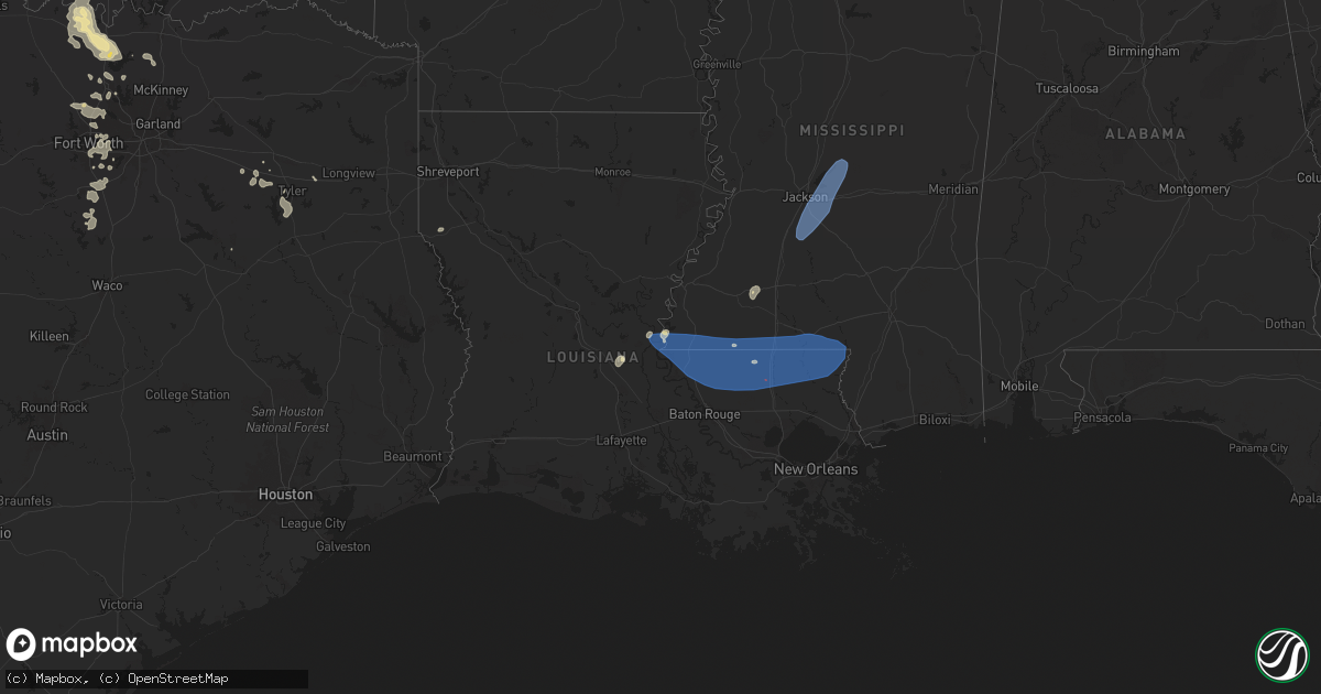
Hail Map in Louisiana on June 4, 2024
Get this storm
June 4 map
$229
one time, instant access
Download today. No call, no setup
Keep the $229
Bought the map and want the full workflow? Apply the entire $229 to a subscription within 7 days. None of it is wasted.
Every map, not just this one
This buys you this map. Subscription and you get every map we run, in the markets you choose from a few cities to whole states to nationwide. Plus real-time alerts the moment a storm fires.
Contact data
Name, contact info, occupancy, even credit band for addresses in the footprint. You go from where it hit to who to call.
Become the source they trust
Unlimited branding weather history reports on demand. You already have the documented answer ready for the property owner, and you are the one who showed up with it.
Property data and RoofTrace estimates
Pull up any address you have got, its value and the exact code rules for that jurisdiction, straight from One Click Code. Then RoofTrace estimates the squares, pitch, and roof value, priced the way you price.
Storm reports in Louisiana
Louisiana
| Date | Description |
|---|---|
| 06/04/20246:39 PM CDT | Two trees snapped and fell on a large shed off of susan ln in slidell. |
| 06/04/20246:34 PM CDT | Knew asos... Lakefront airport recorded a wind gust of 60 mph. |
| 06/04/20245:11 PM CDT | Trees down and blocking both northbound and southbound lanes of i-55 at amite. Possible tornado. |
| 06/04/20245:11 PM CDT | Trees and power lines down along la 1054 just south of troy spears rd. |
| 06/04/20245:08 PM CDT | Widespread trees down across the parish reported be em. More details expected later. |
| 06/04/20245:05 PM CDT | Multiple trees down around kentwood. |
| 06/04/20245:03 PM CDT | Multiple trees down are southeastern st helena parish. |
| 06/04/20244:59 PM CDT | Widespread tree damage across the area. |
| 06/04/20244:55 PM CDT | Powerlines down on cheray dr. Relayed via social media. |
| 06/04/20244:48 PM CDT | Large oak tree snapped on lazy lake dr. |
| 06/04/20244:32 PM CDT | Widespread tree and powerline damage across the area. Further details will be sent later. |
| 06/04/20244:20 PM CDT | Widespread tree and powerline damage reported by the parish. More details still to come. |
| 06/04/20243:45 PM CDT | Tree down on car at highway 1 in mansura. No injury. |
| 06/04/20242:11 PM CDT | A tree was blown down across coco bed road in the cloutierville community. |
| 06/04/20241:45 PM CDT | A large tree was downed at the 3000 block of north blvd in provencal. |
| 06/04/20243:38 AM CDT | Numerous trees down in the rodessa... Hosston and ida vicinities. |
All States Impacted by Hail Map on June 4, 2024
Cities Impacted by Hail Map on June 4, 2024
- Oberlin, KS
- Atwood, KS
- Norcatur, KS
- Norton, KS
- Selden, KS
- Lenora, KS
- Hill City, KS
- Colby, KS
- Winona, KS
- Phillipsburg, KS
- Glade, KS
- Kirwin, KS
- Agra, KS
- Kensington, KS
- Canton, TX
- Gaylord, KS
- Van, TX
- Ben Wheeler, TX
- Athol, KS
- Lindale, TX
- Tyler, TX
- Mineola, TX
- Chandler, TX
- Flint, TX
- Dighton, KS
- Utica, KS
- Winona, TX
- Bullard, TX
- Hays, KS
- Ellis, KS
- Ransom, KS
- Arnold, KS
- Victoria, KS
- Gorham, KS
- Burnsville, NC
- Russell, KS
- Catharine, KS
- Bison, KS
- Vining, MN
- Paradise, KS
- Natoma, KS
- Otis, KS
- Henning, MN
- Grand Cane, LA
- Thief River Falls, MN
- Saint Hilaire, MN
- Pfeifer, KS
- Bunker Hill, KS
- Hoisington, KS
- Olmitz, KS
- Solway, MN
- Mansfield, LA
- Bemidji, MN
- Kerkhoven, MN
- Murdock, MN
- Deer Creek, MN
- Luray, KS
- Lucas, KS
- Wadena, MN
- Granite Falls, MN
- Sacred Heart, MN
- Maynard, MN
- Akeley, MN
- Nevis, MN
- Claflin, KS
- Raymond, MN
- Sunburg, MN
- Dorrance, KS
- Sylvan Grove, KS
- Beloit, KS
- Tenstrike, MN
- Clara City, MN
- Wannaska, MN
- Holyrood, KS
- Lincoln, KS
- Clarissa, MN
- Eagle Bend, MN
- Hines, MN
- Osakis, MN
- Pennock, MN
- Walker, MN
- Cass Lake, MN
- Long Prairie, MN
- Mount Pleasant, NC
- Concord, NC
- Simpson, KS
- Moreauville, LA
- Glasco, KS
- Browerville, MN
- Hatley, WI
- Willmar, MN
- Concordia, KS
- Rosholt, WI
- Bushton, KS
- Monterey, LA
- Ocheyedan, IA
- Lorraine, KS
- Geneseo, KS
- Polkton, NC
- Woodville, MS
- Irma, WI
- Ellsworth, KS
- Chase, KS
- Wittenberg, WI
- Frontenac, MN
- Banks, AL
- Lyons, KS
- Brantwood, WI
- Hutchinson, MN
- Union Springs, AL
- Windom, MN
- Darwin, MN
- Phillips, WI
- Deer River, MN
- Midway, AL
- Plaucheville, LA
- Evergreen, LA
- Little River, KS
- Ridgeway, SC
- Lugoff, SC
- Cottonport, LA
- Durham, KS
- Canton, KS
- Mosinee, WI
- Madison Heights, VA
- Lynchburg, VA
- Troy, AL
- Algona, IA
- Whittemore, IA
- West Bend, IA
- Ottosen, IA
- Bode, IA
- Burt, IA
- Lu Verne, IA
- Auburn, NE
- Humboldt, NE
- Glencoe, MN
- Stevens Point, WI
- Morrow, LA
- Silver Lake, MN
- Windom, KS
- Nemaha, NE
- Brownville, NE
- Wesley, IA
- Mcpherson, KS
- Lafayette, MN
- Inman, KS
- Centreville, MS
- Liberty, MS
- Cokato, MN
- South Haven, MN
- Saint Francisville, LA
- Angola, LA
- Jackson, LA
- Zachary, LA
- Slaughter, LA
- Ethel, LA
- Wilson, LA
- Norwood, LA
- Clinton, LA
- Osyka, MS
- Greensburg, LA
- Greenwell Springs, LA
- Kentwood, LA
- Pride, LA
- Amite, LA
- Holden, LA
- Pine Grove, LA
- Denham Springs, LA
- Walker, LA
- McCall Creek, MS
- Meadville, MS
- Brookhaven, MS
- Winter, WI
- Ladysmith, WI
- Stella, NE
- Lehigh, KS
- Repton, AL
- Burns, KS
- Newton, KS
- Walton, KS
- Ellinwood, KS
- Galva, KS
- Hudson, KS
- Tigerton, WI
- Peabody, KS
- Rock Port, MO
- Fairfax, MO
- Harrisville, MS
- Florence, MS
- Crystal Springs, MS
- Richland, MS
- Terry, MS
- Georgetown, MS
- Brandon, MS
- Braxton, MS
- Pearl, MS
- Flowood, MS
- Morton, MS
- Pelahatchie, MS
- Lena, MS
- Canton, MS
- Magnolia, MS
- Mount Hermon, LA
- Fluker, LA
- Roseland, LA
- Mccomb, MS
- Tylertown, MS
- Independence, LA
- Loranger, LA
- Franklinton, LA
- Husser, LA
- Roxbury, KS
- Hillsboro, KS
- Marion, KS
- Paton, IA
- Ogden, IA
- Shubert, NE
- Florence, KS
- Cedar Point, KS
- Lindsborg, KS
- Raymond, KS
- Green Bay, WI
- Red Oak, IA
- St John, KS
- Dana, IA
- Jefferson, IA
- Stanton, IA
- Sylvia, KS
- Villisca, IA
- Sandy Hook, MS
- Angie, LA
- Bogalusa, LA
- Plevna, KS
- Grand Junction, IA
- Bowler, WI
- Boxholm, IA
- Sterling, KS
- Rulo, NE
- Falls City, NE
- Pilot Mound, IA
- Kanopolis, KS
- Abbyville, KS
- Saint Ansgar, IA
- Craig, MO
- Spring Valley, MN
- Le Roy, MN
- Elmdale, KS
- Turon, KS
- Park Falls, WI
- Cottonwood Falls, KS
- Stafford, KS
- Matfield Green, KS
- Preston, MN
- Harmony, MN
- Lime Springs, IA
- Hutchinson, KS
- Partridge, KS
- Pretty Prairie, KS
- Quitaque, TX
- Kingman, KS
- Maize, KS
- Woodward, IA
- Colwich, KS
- Whitewater, KS
- Boone, IA
- Andale, KS
- Wichita, KS
- Valley Center, KS
- Granger, IA
- Bouton, IA
- Olpe, KS
- Benton, KS
- Marenisco, MI
- Madison, KS
- Hamilton, KS
- Virgil, KS
- Mercer, WI
- Oakboro, NC
- Haysville, KS
- Emelle, AL
- Derby, KS
- Towanda, KS
- Epes, AL
- Peck, KS
- Mcconnell Afb, KS
- Clearwater, KS
- New Hampton, IA
- Ionia, IA
- Alta Vista, IA
- Elma, IA
- Cresco, IA
- Gracemont, OK
- Dallas Center, IA
- Savanna, IL
- El Dorado, KS
- Goddard, KS
- Andover, KS
- Rose Hill, KS
- Anthony, KS
- Boligee, AL
- Fort Cobb, OK
- Medford, OK
- Leon, KS
- Minco, OK
- South Haven, KS
- Wellington, KS
- Anadarko, OK
- Albion, IA
- Belle Plaine, KS
- Mulvane, KS
- Udall, KS
- Douglass, KS
- Rock, KS
- Oxford, KS
- Winfield, KS
- Atlanta, KS
- Augusta, KS
- Burden, KS
- Latham, KS
- Beaumont, KS
- Piedmont, KS
- Geuda Springs, KS
- Arkansas City, KS
- Eutaw, AL
- Attica, KS
- Oklahoma City, OK
- Mustang, OK
- Tuttle, OK
- Pocasset, OK
- Neosho Falls, KS
- Wilsonville, AL
- Yates Center, KS
- Piqua, KS
- Union City, OK
- Kechi, KS
- Cambridge, KS
- Choctaw, OK
- Iola, KS
- Colony, KS
- Harrah, OK
- Keshena, WI
- Amber, OK
- Vincent, AL
- Harpersville, AL
- Yukon, OK
- Newcastle, OK
- Blanchard, OK
- Sterrett, AL
- Mcloud, OK
- Madrid, IA
- La Harpe, KS
- Minburn, IA
- Blackwell, OK
- Gridley, KS
- Caldwell, KS
- Shawnee, OK
- Humboldt, KS
- Suring, WI
- Mountain, WI
- Newalla, OK
- Norman, OK
- Nardin, OK
- Braman, OK
- Lawton, OK
- Tonkawa, OK
- Cement, OK
- Moran, KS
- Prague, OK
- Elgin, OK
- Paden, OK
- Meeker, OK
- Noble, OK
- Macomb, OK
- Tecumseh, OK
- Billings, OK
- Greenwich, KS
- Depew, OK
- Bristow, OK
- Castle, OK
- Cache, OK
- Stroud, OK
- Medicine Park, OK
- Beggs, OK
- Mounds, OK
- Broken Arrow, OK
- Okmulgee, OK
- Perry, OK
- Marlow, OK
- Faxon, OK
- Douglas, OK
- Coweta, OK
- Haskell, OK
- Orlando, OK
- Stillwater, OK
- Mulhall, OK
- Coyle, OK
- Elmore City, OK
- Duncan, OK
- Bixby, OK
- Foster, OK
- Morris, OK
- Porter, OK
- Boynton, OK
- Oktaha, OK
- Okemah, OK
- Healdton, OK
- Wagoner, OK
- Ratliff City, OK
- Graham, OK
- Walters, OK
- Sedgwick, KS
- Norborne, MO
- Eufaula, OK
- Devol, OK
- Randlett, OK
- Savannah, MO
- Hanna, OK
- Indianola, OK
- Checotah, OK
- Sheldon, MO
- Nevada, MO
- Moundville, MO
- Redbird, OK
- Marshall, MO
- Wilson, OK
- La Cygne, KS
- Lamar, MO
- Evergreen, AL
- Antlers, OK
- Tussy, OK
- Ringling, OK
- Keysville, GA
- Louisville, GA
- Waynesboro, GA
- Overbrook, OK
- Burneyville, OK
- Saint Jo, TX
- Leon, OK
- Hennepin, OK
- Wilburton, OK
- Fayette, MO
- Springer, OK
- Nocona, TX
- Gainesville, TX
- Muenster, TX
- Glasgow, MO
- Wichita Falls, TX
- Fort Sill, OK
- Gentry, AR
- Buffalo, MO
- Chickasha, OK
- Ninnekah, OK
- Apache, OK
- Lindsay, TX
- Forestburg, TX
- Ardmore, OK
- Phillipsburg, MO
- Long Lane, MO
- Lebanon, MO
- Lone Grove, OK
- Collinsville, TX
- Valley View, TX
- New Florence, MO
- Montgomery City, MO
- Era, TX
- Tioga, TX
- Gunter, TX
- Celina, TX
- Van Alstyne, TX
- Bellflower, MO
- Truxton, MO
- High Hill, MO
- Jonesburg, MO
- Middletown, MO
- Bowling Green, MO
- Locust, NC
- Silex, MO
- Howe, TX
- Anna, TX
- Eolia, MO
- Troy, MO
- Elsberry, MO
- Sanger, TX
- Denton, TX
- Krum, TX
- Little Elm, TX
- Aubrey, TX
- Clarksville, MO
- Hamburg, IL
- Rhome, TX
- Batchtown, IL
- Argyle, TX
- Hardin, IL
- Foley, MO
- Justin, TX
- Ponder, TX
- Flower Mound, TX
- Haslet, TX
- White Hall, IL
- Roodhouse, IL
- Greenfield, IL
- Jerseyville, IL
- Kane, IL
- Roanoke, TX
- Fort Worth, TX
- Keller, TX
- Southlake, TX
- Carrollton, IL
- Rockbridge, IL
- Brighton, IL
- Palmyra, IL
- Modesto, IL
- Medora, IL
- Montalba, TX
- Tennessee Colony, TX
- Kennedale, TX
- Arlington, TX
- Piasa, IL
- Shipman, IL
- Burrton, KS
- Mount Hope, KS
- Haven, KS
- Halstead, KS
- Mansfield, TX
- Burleson, TX
- Grand Prairie, TX
- Cleburne, TX
- Alvarado, TX
- Venus, TX
- Grandview, TX
- Covington, TX
- Blum, TX
- Glenmora, LA
- Smithdale, MS
- North Richland Hills, TX
- Haltom City, TX
- Hurst, TX
- Euless, TX
- Hillsboro, TX
- Whitney, TX
- Washington, OK
- Lexington, OK
- Wanette, OK
- Maud, OK
- Seminole, OK
- Earlsboro, OK
- Wewoka, OK
- Holdenville, OK
- Bowlegs, OK
- Asher, OK
- Sasakwa, OK
- Konawa, OK
- Calvin, OK
- Stuart, OK
- Stratford, OK
- Atwood, OK
- Allen, OK
- Fitzhugh, OK
- Stonewall, OK
- Ada, OK
- Byars, OK
- Sulphur, OK
- Tishomingo, OK
- Mill Creek, OK
- Roff, OK
- Fittstown, OK
- Pauls Valley, OK
- Dougherty, OK
- Wynnewood, OK
- Davis, OK
- Wayne, OK
- Paoli, OK
- Maysville, OK
- Lindsay, OK
- Purcell, OK
- Alex, OK
- Tupelo, OK
- Centrahoma, OK
- Coalgate, OK
- Milburn, OK
- Mannsville, OK
- Wapanucka, OK
- Coleman, OK
- Kenefic, OK
- Atoka, OK
- Madill, OK
- Caddo, OK
- Durant, OK
- Mead, OK
- Loco, OK
- Marietta, OK
- Whitesboro, TX
- Kingston, OK
- Lebanon, OK
- Bokchito, OK
- Pottsboro, TX
- Cartwright, OK
- Calera, OK
- Sherman, TX
- Savoy, TX
- Ravenna, TX
- Hendrix, OK
- Bells, TX
- Thackerville, OK
- Gordonville, TX
- Denison, TX
- Colbert, OK
- Sadler, TX
- Whitewright, TX
- Tom Bean, TX
- Carney, OK
- Perkins, OK
- Wellston, OK
- Chandler, OK
- Sparks, OK
- Meridian, OK
- Muskogee, OK
- Fort Gibson, OK
- Braggs, OK
- Biloxi, MS
- Fountain, MN
- Wykoff, MN
- Chatfield, MN


