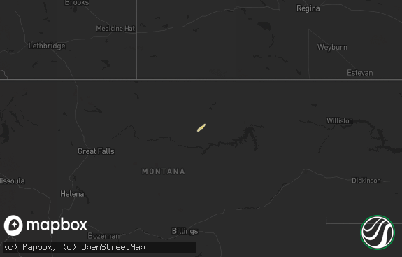
Hail Map in Montana on June 4, 2012
The weather event in Montana on June 4, 2012 includes Hail map. 18 states and 413 cities were impacted and suffered possible damage. The total estimated number of properties impacted is 0.

Hail
0
Estimated number of impacted properties by a 1.00" hail or larger0
Estimated number of impacted properties by a 1.75" hail or larger0
Estimated number of impacted properties by a 2.50" hail or largerStorm reports in Montana
Montana
| Date | Description |
|---|---|
| 06/04/20126:20 PM CDT | Quater size hail near stemple pass |
| 06/04/20125:40 PM CDT | A local report indicates 1.00 inch wind near E CLEARWATER |
| 06/04/20125:07 PM CDT | Heavy rain also. |
| 06/04/20124:40 PM CDT | Very heavy rain also. |
| 06/04/20124:33 PM CDT | A local report indicates 1.00 inch wind near 7 NE CORVALLIS |
| 06/04/20124:30 PM CDT | A local report indicates 1.00 inch wind near 1 WSW GEORGETOWN |
| 06/04/20124:15 PM CDT | Photo with ruler. |
| 06/03/201211:23 PM CDT | Golfball sized hail |
| 06/03/201210:18 PM CDT | A local report indicates 1.75 inch wind near 12 ENE BRADY |
| 06/03/20129:30 PM CDT | Pieces of siding from a grain bin reported on hwy 87 |
| 06/03/20129:24 PM CDT | Roof blown off garage and 3 to 4 inch diameter tree branches down |
| 06/03/20129:17 PM CDT | Estimated winds 75 mph...storm shows rotation |
| 06/03/20129:14 PM CDT | 87 mph wind gust at the dot sensor just north of loma. |
| 06/03/20128:40 PM CDT | Window damage on houses |
| 06/03/20128:35 PM CDT | Damage to police vehicles |
| 06/03/20128:35 PM CDT | A local report indicates 2.00 inch wind near 1 S CARTER |
| 06/03/20128:35 PM CDT | A local report indicates 65 MPH wind near 1 S CARTER |
| 06/03/20128:28 PM CDT | Estimated 2.5 inch hail....70 mph wind...and debris along hwy 87. Vehicle windowshields blown out |
| 06/03/20128:28 PM CDT | Estimated 2.5 inch hail....70 mph wind...and debris along hwy 87. Vehicle windowshields blown out |
| 06/03/20128:17 PM CDT | Estimated 1 inch hail in sun prairie |
| 06/03/20128:15 PM CDT | Damage to small buildings and fences at local race track...loose equipment displaced 200 feet |
| 06/03/20128:08 PM CDT | Estimated 1 inch hail near power |
| 06/03/20128:01 PM CDT | Golf ball size hail a few miles southeast of power. |
| 06/03/20127:49 PM CDT | Marble size hail...wind estimated to 60 mph...gustnado |
| 06/03/20127:48 PM CDT | Estimated 1 inch hail just south of vaughn. |
| 06/03/20127:45 PM CDT | Estimated 50 kts....58 mph 10 w great falls....retired nws employee |
All States Impacted by Hail Map on June 4, 2012
Cities Impacted by Hail Map on June 4, 2012
- Paducah, TX
- Seymour, TX
- Superior, MT
- Olton, TX
- Leola, AR
- Tulia, TX
- Carter, MT
- Brunswick, GA
- Darien, GA
- Jesup, GA
- Townsend, GA
- Hortense, GA
- Corvallis, MT
- Lockney, TX
- Floydada, TX
- Dongola, IL
- Rison, AR
- Spur, TX
- Girard, TX
- Dickens, TX
- Woodburn, KY
- Franklin, KY
- Bowling Green, KY
- Matador, TX
- Cairo, IL
- Fitzgerald, GA
- Ambrose, GA
- Wray, GA
- Broxton, GA
- Harrold, SD
- Paron, AR
- Ludowici, GA
- Walsh, CO
- Ballwin, MO
- High Ridge, MO
- Eureka, MO
- Lincoln, MT
- Bard, NM
- San Jon, NM
- Seminole, TX
- Fort Shaw, MT
- Morton, TX
- Mccall, ID
- Donnelly, ID
- Fairfield, MT
- Mershon, GA
- Alma, GA
- Happy, TX
- Silverton, TX
- Sunray, TX
- Sheridan, AR
- Blackshear, GA
- Bristol, GA
- Old Glory, TX
- Rochester, TX
- O'Brien, TX
- Eagle Pass, TX
- Cohagen, MT
- Turkey, TX
- Mcadoo, TX
- Claude, TX
- Quitaque, TX
- McClure, IL
- Jonesboro, IL
- Vaughn, MT
- Power, MT
- Gildford, MT
- Kremlin, MT
- Box Elder, MT
- Benton, KY
- Calvert City, KY
- Gilbertsville, KY
- Borger, TX
- O'Fallon, MO
- Saint Peters, MO
- Loraine, TX
- Glennville, GA
- Shelby, MT
- Valier, MT
- Cypress, IL
- Ullin, IL
- Sun River, MT
- Oxford, MS
- Batesville, MS
- Sardis, MS
- Floweree, MT
- Brussels, IL
- Golden Eagle, IL
- Gold Creek, MT
- Quanah, TX
- Odum, GA
- Fort Benton, MT
- Snyder, TX
- Gail, TX
- Plains, TX
- Red Boiling Springs, TN
- Courtland, MS
- Crenshaw, MS
- Dutton, MT
- Ralls, TX
- Abernathy, TX
- Cascade, ID
- Holly, CO
- Sheridan Lake, CO
- Tribune, KS
- Dalhart, TX
- Paris, TN
- Batchtown, IL
- Eldorado, OK
- Sikeston, MO
- Hamilton, MT
- Lakin, KS
- Elk City, ID
- Roswell, NM
- Frederick, OK
- Big Spring, TX
- Fort Stewart, GA
- Hinesville, GA
- Villa Ridge, IL
- Olmsted, IL
- La Center, KY
- Barlow, KY
- Russellville, KY
- Lewisburg, KY
- Auburn, KY
- Syracuse, KS
- Midway, GA
- Crosbyton, TX
- Pritchett, CO
- Savannah, GA
- Greenville, MS
- Justiceburg, TX
- Chinook, MT
- Chesterfield, MO
- Wildwood, MO
- Imperial, MO
- Barnhart, MO
- House Springs, MO
- Loma, MT
- Tunica, MS
- Seeley Lake, MT
- Ovando, MT
- Bonner, MT
- Hale Center, TX
- Cottonwood, ID
- Buncombe, IL
- Vienna, IL
- Kingsland, AR
- Stevensville, MT
- Wisdom, MT
- Pendroy, MT
- West Green, GA
- Patterson, GA
- Hazlehurst, GA
- Stinnett, TX
- Springfield, CO
- Golconda, IL
- Metropolis, IL
- Dermott, AR
- Lake Village, AR
- Burlington, CO
- Plummer, ID
- Saint Maries, ID
- Harrison, ID
- Fluvanna, TX
- Post, TX
- Conrad, MT
- Ledger, MT
- Brady, MT
- Eudora, AR
- Hollandale, MS
- Jordan, MT
- White Bird, ID
- Grangeville, ID
- Sweet Grass, MT
- Cut Bank, MT
- Bynum, MT
- Sunburst, MT
- Kevin, MT
- Choteau, MT
- Ethridge, MT
- Big Sandy, MT
- North Little Rock, AR
- Brownfield, TX
- Adrian, TX
- Hereford, TX
- Vega, TX
- Karnak, IL
- Grand Chain, IL
- Weippe, ID
- Kamiah, ID
- Wolf Creek, MT
- Cascade, MT
- Augusta, MT
- Kress, TX
- Westbrook, TX
- Coahoma, TX
- Sterling City, TX
- Littlefield, TX
- Council, ID
- Cadiz, KY
- Traskwood, AR
- Baxley, GA
- Wayside, TX
- Chaffee, MO
- Hardin, IL
- Lorenzo, TX
- Clarendon, TX
- Petersburg, TX
- Aspermont, TX
- Afton, TX
- Riggins, ID
- Laredo, TX
- Stratford, TX
- Reidsville, GA
- Cottonwood, CA
- McGehee, AR
- Benton, MO
- Scott City, MO
- Oran, MO
- Emmett, ID
- Molt, MT
- Fritch, TX
- Rotan, TX
- Henry, TN
- Plainview, TX
- Brockway, MT
- Circle, MT
- Brookport, IL
- Clovis, NM
- Orofino, ID
- Senatobia, MS
- Roaring Springs, TX
- Hasty, CO
- Tompkinsville, KY
- Carrollton, AL
- Columbus, MS
- Ethelsville, AL
- Coffeeville, MS
- Sundance, WY
- Sweet, ID
- Saint Charles, MO
- Winfield, MO
- Flomot, TX
- Philipsburg, MT
- Riceboro, GA
- Great Falls, MT
- Rohwer, AR
- Benoit, MS
- Arkansas City, AR
- Musselshell, MT
- Seagraves, TX
- Puryear, TN
- Nara Visa, NM
- Lamar, CO
- Wiley, CO
- Saint Simons Island, GA
- Charleston, MO
- Thebes, IL
- Miller City, IL
- Clinton, MT
- Celina, TN
- Gamaliel, KY
- Mount Hermon, KY
- Moss, TN
- Whitleyville, TN
- Gainesboro, TN
- Summer Shade, KY
- Glasgow, KY
- Boise City, OK
- Talladega, AL
- Munford, AL
- Drummond, MT
- Holly Springs, MS
- Jemison, AL
- Anaconda, MT
- Canyon, TX
- Crowell, TX
- Olive Branch, IL
- Welch, TX
- Fort Peck, MT
- Olney, TX
- Kooskia, ID
- Leland, MS
- Cookeville, TN
- Leoti, KS
- Surrency, GA
- Hart, TX
- Missoula, MT
- Redding, CA
- Anderson, CA
- Morse, TX
- New Meadows, ID
- Malvern, AR
- Moriarty, NM
- Pollock, SD
- McClave, CO
- Lovington, NM
- Hamburg, IL
- Tillar, AR
- Allenhurst, GA
- Andrews, TX
- Camden, TN
- Gruver, TX
- Levelland, TX
- Helmville, MT
- Tishomingo, OK
- Stonewall, OK
- Mansfield, TN
- Coldwater, MS
- Cottage Grove, TN
- Belzoni, MS
- Isola, MS
- Elsberry, MO
- Old Monroe, MO
- Foley, MO
- Wickliffe, KY
- Hartley, TX
- Springville, TN
- Buchanan, TN
- Ingomar, MT
- Grapevine, AR
- Garrison, MT
- Causey, NM
- Gould, OK
- Warren, AR
- Maple, TX
- Mesa, ID
- Dupuyer, MT
- Glenham, SD
- Mill Creek, OK
- Red Bluff, CA
- Ledbetter, KY
- West Paducah, KY
- Kevil, KY
- Paducah, KY
- Elida, NM
- Dimmitt, TX
- Lindsay, MT
- Trail City, SD
- Carthage, AR
- Dow, IL
- Godfrey, IL
- West Alton, MO
- Denver City, TX
- Tatum, NM
- Cambridge, ID
- Mountain Grove, MO
- Cedar Grove, TN
- Childress, TX
- Havre, MT
- Saint Louis, MO
- Stites, ID
- Olivehill, TN
- Matthews, MO
- Cape Girardeau, MO
- Bertrand, MO
- Rochelle, GA
- Cheyenne Wells, CO
- Scott, AR
- Lonoke, AR
- Estancia, NM
- Oilmont, MT
- Knox City, TX
- Fieldton, TX
- Jayton, TX
- Poyen, AR
- Ivan, AR
- Tamms, IL
- Avon, MT
- Hall, MT
- Hingham, MT
- Highwood, MT
- Simms, MT
- Galata, MT
- Water Valley, MS
- Calera, AL
- Grantsburg, IL
- New Concord, KY
- Hernando, MS
- Benton, AR
- Midvale, ID
- Paris, MS
- Felt, OK
- Screven, GA
- Fenton, MO
- Annada, MO
- Atoka, OK
- Pittsburg, OK
- Clayton, NM
- Tensed, ID
- Lyons, GA
- Soperton, GA
- Reform, AL
- Desmet, ID
- Ira, TX
- Presho, SD
- Smithland, KY
- Belknap, IL
- Anna, IL
- Darby, MT
- Hazel, KY
- McKenzie, TN
- Hollow Rock, TN
- Huntingdon, TN
- Colorado City, TX
- Kuttawa, KY
- Nicholls, GA
- Breckenridge, TX
- Lonsdale, AR
- Anton, TX
- Denton, GA
- Dumas, TX


