Hail Map in Georgia on June 4, 2012
Get this storm
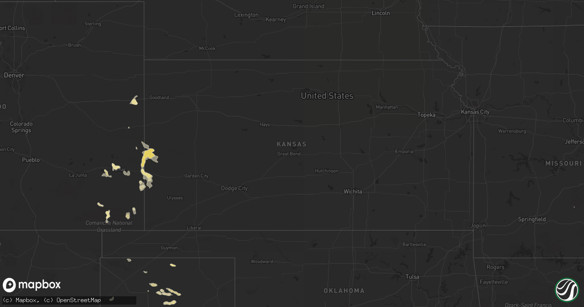
June 4 map
$229
one time, instant access
Download today. No call, no setup
Keep the $229
Bought the map and want the full workflow? Apply the entire $229 to a subscription within 7 days. None of it is wasted.
Every map, not just this one
This buys you this map. Subscription and you get every map we run, in the markets you choose from a few cities to whole states to nationwide. Plus real-time alerts the moment a storm fires.
Contact data
Name, contact info, occupancy, even credit band for addresses in the footprint. You go from where it hit to who to call.
Become the source they trust
Unlimited branding weather history reports on demand. You already have the documented answer ready for the property owner, and you are the one who showed up with it.
Property data and RoofTrace estimates
Pull up any address you have got, its value and the exact code rules for that jurisdiction, straight from One Click Code. Then RoofTrace estimates the squares, pitch, and roof value, priced the way you price.
Storm reports in Georgia
Georgia
| Date | Description |
|---|---|
| 06/04/20122:31 PM CDT | Tree reported down at peachtree street and beach drive. |
| 06/04/20122:29 PM CDT | Tree reported down on village drive. |
| 06/04/20122:25 PM CDT | Tree reported down on tupelo circle near highway 17. |
| 06/04/20122:01 PM CDT | Trees and powerlines were reported blown down along highway 17 just north of darien. Time estimated based on radar. |
| 06/04/20122:00 PM CDT | A emergency manager reported a tree down in carnigan georgia. |
| 06/04/20121:59 PM CDT | A emergency manager reported 2 trees down along highway 99. |
| 06/04/20121:57 PM CDT | Trees and powerlines were reported blown down near highway 251 and townsend cox road. Time estimated based on radar. |
| 06/04/20121:42 PM CDT | Numerous trees and powerlines down in the patterson area. |
| 06/04/20121:33 PM CDT | Numerous trees and powerlines down in the bristol area. |
| 06/04/20121:30 PM CDT | Tree reported down on old waynesville road. |
| 06/04/20121:30 PM CDT | Law enforcement reported golf ball size hail in the mershon area. |
| 06/04/20121:30 PM CDT | Numerous trees and powerlines down in the mershon area. |
| 06/04/20121:21 PM CDT | A emergency manager reported a tree down along presley road. |
| 06/04/20121:20 PM CDT | A emergency manager reported one tree down near the intersection of highway 84 and doyle durrence lane. |
| 06/04/20121:18 PM CDT | Officials with the harris neck national wildlife refuge reported trees blown down in several locations on the refuge. The damage assessment is ongoing. Time estimated b |
| 06/04/20121:12 PM CDT | A emergency manager reported one tree down along highway 301 near jones creek georgia. |
| 06/04/201212:53 PM CDT | Law enforcement reported trees down along highway 144 near richmond hill georgia. |
| 06/04/201212:45 PM CDT | The public reported golf ball size hail. |
| 06/04/201212:45 PM CDT | The public reported a large oak tree uprooted in a front yard. |
| 06/04/201212:44 PM CDT | A trained weather spotter reported quarter size hail along main trail road. |
| 06/04/201212:40 PM CDT | Spotter reported golf ball size hail and numerous large limbs don on stewart drive. |
| 06/04/201212:40 PM CDT | Several large branches down northwest of broxton on fitzgerald highway |
| 06/04/201212:40 PM CDT | Spotter reported golf ball size hail and numerous large limbs don on stewart drive. |
| 06/04/201212:37 PM CDT | Numerous reports of golf ball size hail near the hospital in hinesville. |
| 06/04/201212:35 PM CDT | Several reports of quarter and golf ball size hail at fort stewart. |
| 06/04/201212:32 PM CDT | Golfball size hail fell at the liberty county warning point. |
| 06/04/201212:32 PM CDT | The fort stewart warning point reported golf ball to baseball size hail. 1 vehicle had major damage. |
| 06/04/201212:32 PM CDT | Several spotters reported numerous large trees down on fort stewart. |
| 06/04/201212:32 PM CDT | Spotter reported quarter size hail near gate 3 of fort stewart. |
| 06/04/201212:23 PM CDT | Tree down near mile marker 5. |
| 06/04/201212:15 PM CDT | Numerous trees down in baxley. Time estimated by radar. |
| 06/04/201212:13 PM CDT | Tree down at intersection of altamaha st. And sherman st. |
| 06/04/201212:05 PM CDT | The public reported quarter size hail. |
All States Impacted by Hail Map on June 4, 2012
Cities Impacted by Hail Map on June 4, 2012
- Paducah, TX
- Seymour, TX
- Superior, MT
- Olton, TX
- Leola, AR
- Tulia, TX
- Carter, MT
- Brunswick, GA
- Darien, GA
- Jesup, GA
- Townsend, GA
- Hortense, GA
- Corvallis, MT
- Lockney, TX
- Floydada, TX
- Dongola, IL
- Rison, AR
- Spur, TX
- Girard, TX
- Dickens, TX
- Woodburn, KY
- Franklin, KY
- Bowling Green, KY
- Matador, TX
- Cairo, IL
- Fitzgerald, GA
- Ambrose, GA
- Wray, GA
- Broxton, GA
- Harrold, SD
- Paron, AR
- Ludowici, GA
- Walsh, CO
- Ballwin, MO
- High Ridge, MO
- Eureka, MO
- Lincoln, MT
- Bard, NM
- San Jon, NM
- Seminole, TX
- Fort Shaw, MT
- Morton, TX
- Mccall, ID
- Donnelly, ID
- Fairfield, MT
- Mershon, GA
- Alma, GA
- Happy, TX
- Silverton, TX
- Sunray, TX
- Sheridan, AR
- Blackshear, GA
- Bristol, GA
- Old Glory, TX
- Rochester, TX
- O'Brien, TX
- Eagle Pass, TX
- Cohagen, MT
- Turkey, TX
- Mcadoo, TX
- Claude, TX
- Quitaque, TX
- McClure, IL
- Jonesboro, IL
- Vaughn, MT
- Power, MT
- Gildford, MT
- Kremlin, MT
- Box Elder, MT
- Benton, KY
- Calvert City, KY
- Gilbertsville, KY
- Borger, TX
- O'Fallon, MO
- Saint Peters, MO
- Loraine, TX
- Glennville, GA
- Shelby, MT
- Valier, MT
- Cypress, IL
- Ullin, IL
- Sun River, MT
- Oxford, MS
- Batesville, MS
- Sardis, MS
- Floweree, MT
- Brussels, IL
- Golden Eagle, IL
- Gold Creek, MT
- Quanah, TX
- Odum, GA
- Fort Benton, MT
- Snyder, TX
- Gail, TX
- Plains, TX
- Red Boiling Springs, TN
- Courtland, MS
- Crenshaw, MS
- Dutton, MT
- Ralls, TX
- Abernathy, TX
- Cascade, ID
- Holly, CO
- Sheridan Lake, CO
- Tribune, KS
- Dalhart, TX
- Paris, TN
- Batchtown, IL
- Eldorado, OK
- Sikeston, MO
- Hamilton, MT
- Lakin, KS
- Elk City, ID
- Roswell, NM
- Frederick, OK
- Big Spring, TX
- Fort Stewart, GA
- Hinesville, GA
- Villa Ridge, IL
- Olmsted, IL
- La Center, KY
- Barlow, KY
- Russellville, KY
- Lewisburg, KY
- Auburn, KY
- Syracuse, KS
- Midway, GA
- Crosbyton, TX
- Pritchett, CO
- Savannah, GA
- Greenville, MS
- Justiceburg, TX
- Chinook, MT
- Chesterfield, MO
- Wildwood, MO
- Imperial, MO
- Barnhart, MO
- House Springs, MO
- Loma, MT
- Tunica, MS
- Seeley Lake, MT
- Ovando, MT
- Bonner, MT
- Hale Center, TX
- Cottonwood, ID
- Buncombe, IL
- Vienna, IL
- Kingsland, AR
- Stevensville, MT
- Wisdom, MT
- Pendroy, MT
- West Green, GA
- Patterson, GA
- Hazlehurst, GA
- Stinnett, TX
- Springfield, CO
- Golconda, IL
- Metropolis, IL
- Dermott, AR
- Lake Village, AR
- Burlington, CO
- Plummer, ID
- Saint Maries, ID
- Harrison, ID
- Fluvanna, TX
- Post, TX
- Conrad, MT
- Ledger, MT
- Brady, MT
- Eudora, AR
- Hollandale, MS
- Jordan, MT
- White Bird, ID
- Grangeville, ID
- Sweet Grass, MT
- Cut Bank, MT
- Bynum, MT
- Sunburst, MT
- Kevin, MT
- Choteau, MT
- Ethridge, MT
- Big Sandy, MT
- North Little Rock, AR
- Brownfield, TX
- Adrian, TX
- Hereford, TX
- Vega, TX
- Karnak, IL
- Grand Chain, IL
- Weippe, ID
- Kamiah, ID
- Wolf Creek, MT
- Cascade, MT
- Augusta, MT
- Kress, TX
- Westbrook, TX
- Coahoma, TX
- Sterling City, TX
- Littlefield, TX
- Council, ID
- Cadiz, KY
- Traskwood, AR
- Baxley, GA
- Wayside, TX
- Chaffee, MO
- Hardin, IL
- Lorenzo, TX
- Clarendon, TX
- Petersburg, TX
- Aspermont, TX
- Afton, TX
- Riggins, ID
- Laredo, TX
- Stratford, TX
- Reidsville, GA
- Cottonwood, CA
- McGehee, AR
- Benton, MO
- Scott City, MO
- Oran, MO
- Emmett, ID
- Molt, MT
- Fritch, TX
- Rotan, TX
- Henry, TN
- Plainview, TX
- Brockway, MT
- Circle, MT
- Brookport, IL
- Clovis, NM
- Orofino, ID
- Senatobia, MS
- Roaring Springs, TX
- Hasty, CO
- Tompkinsville, KY
- Carrollton, AL
- Columbus, MS
- Ethelsville, AL
- Coffeeville, MS
- Sundance, WY
- Sweet, ID
- Saint Charles, MO
- Winfield, MO
- Flomot, TX
- Philipsburg, MT
- Riceboro, GA
- Great Falls, MT
- Rohwer, AR
- Benoit, MS
- Arkansas City, AR
- Musselshell, MT
- Seagraves, TX
- Puryear, TN
- Nara Visa, NM
- Lamar, CO
- Wiley, CO
- Saint Simons Island, GA
- Charleston, MO
- Thebes, IL
- Miller City, IL
- Clinton, MT
- Celina, TN
- Gamaliel, KY
- Mount Hermon, KY
- Moss, TN
- Whitleyville, TN
- Gainesboro, TN
- Summer Shade, KY
- Glasgow, KY
- Boise City, OK
- Talladega, AL
- Munford, AL
- Drummond, MT
- Holly Springs, MS
- Jemison, AL
- Anaconda, MT
- Canyon, TX
- Crowell, TX
- Olive Branch, IL
- Welch, TX
- Fort Peck, MT
- Olney, TX
- Kooskia, ID
- Leland, MS
- Cookeville, TN
- Leoti, KS
- Surrency, GA
- Hart, TX
- Missoula, MT
- Redding, CA
- Anderson, CA
- Morse, TX
- New Meadows, ID
- Malvern, AR
- Moriarty, NM
- Pollock, SD
- McClave, CO
- Lovington, NM
- Hamburg, IL
- Tillar, AR
- Allenhurst, GA
- Andrews, TX
- Camden, TN
- Gruver, TX
- Levelland, TX
- Helmville, MT
- Tishomingo, OK
- Stonewall, OK
- Mansfield, TN
- Coldwater, MS
- Cottage Grove, TN
- Belzoni, MS
- Isola, MS
- Elsberry, MO
- Old Monroe, MO
- Foley, MO
- Wickliffe, KY
- Hartley, TX
- Springville, TN
- Buchanan, TN
- Ingomar, MT
- Grapevine, AR
- Garrison, MT
- Causey, NM
- Gould, OK
- Warren, AR
- Maple, TX
- Mesa, ID
- Dupuyer, MT
- Glenham, SD
- Mill Creek, OK
- Red Bluff, CA
- Ledbetter, KY
- West Paducah, KY
- Kevil, KY
- Paducah, KY
- Elida, NM
- Dimmitt, TX
- Lindsay, MT
- Trail City, SD
- Carthage, AR
- Dow, IL
- Godfrey, IL
- West Alton, MO
- Denver City, TX
- Tatum, NM
- Cambridge, ID
- Mountain Grove, MO
- Cedar Grove, TN
- Childress, TX
- Havre, MT
- Saint Louis, MO
- Stites, ID
- Olivehill, TN
- Matthews, MO
- Cape Girardeau, MO
- Bertrand, MO
- Rochelle, GA
- Cheyenne Wells, CO
- Scott, AR
- Lonoke, AR
- Estancia, NM
- Oilmont, MT
- Knox City, TX
- Fieldton, TX
- Jayton, TX
- Poyen, AR
- Ivan, AR
- Tamms, IL
- Avon, MT
- Hall, MT
- Hingham, MT
- Highwood, MT
- Simms, MT
- Galata, MT
- Water Valley, MS
- Calera, AL
- Grantsburg, IL
- New Concord, KY
- Hernando, MS
- Benton, AR
- Midvale, ID
- Paris, MS
- Felt, OK
- Screven, GA
- Fenton, MO
- Annada, MO
- Atoka, OK
- Pittsburg, OK
- Clayton, NM
- Tensed, ID
- Lyons, GA
- Soperton, GA
- Reform, AL
- Desmet, ID
- Ira, TX
- Presho, SD
- Smithland, KY
- Belknap, IL
- Anna, IL
- Darby, MT
- Hazel, KY
- McKenzie, TN
- Hollow Rock, TN
- Huntingdon, TN
- Colorado City, TX
- Kuttawa, KY
- Nicholls, GA
- Breckenridge, TX
- Lonsdale, AR
- Anton, TX
- Denton, GA
- Dumas, TX


