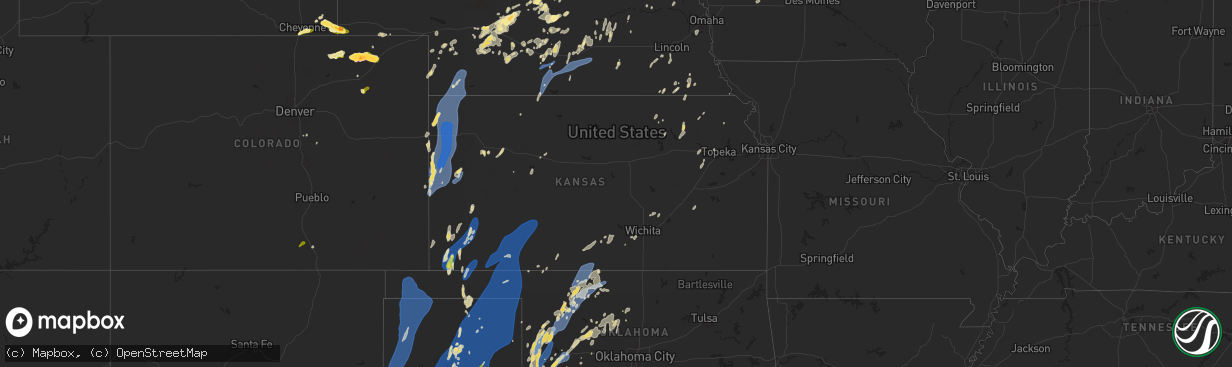
Hail Map in Kansas on June 2, 2025
The weather event in Kansas on June 2, 2025 includes Hail, Wind, and Tornado maps. 13 states and 665 cities were impacted and suffered possible damage. The total estimated number of properties impacted is 54.
Want more than just the map?
Turn this storm into a full workflow.
- Owner + property data so you know who to knock
- OnDemand branded weather history reports to win the "did we even have hail?" argument
- RoofTrace estimate so reps stop guessing numbers at the door
Bought this map? Upgrade within 7 days and we'll credit the $230. (10-15 min setup call)
Hail
Wind
Tornado
54
Estimated number of impacted properties by a 1.00" hail or larger0
Estimated number of impacted properties by a 1.75" hail or larger0
Estimated number of impacted properties by a 2.50" hail or largerStorm reports in Kansas
Kansas
| Date | Description |
|---|---|
| 06/02/20256:54 PM CDT | A local report indicates 80 MPH wind near Sharon Springs |
| 06/02/20256:53 PM CDT | Awn site section 22 reports 64 mph wind gust. |
| 06/02/20256:50 PM CDT | Delayed report. |
| 06/02/20256:49 PM CDT | Ks-wallace. |
| 06/02/20256:44 PM CDT | Weather link site farm location reports 59 mph wind gust. |
| 06/02/20256:36 PM CDT | Weather link site section 32 reports 71 mph wind gust. |
| 06/02/20256:27 PM CDT | Report received from awn casade rodney observation site. |
| 06/02/20256:17 PM CDT | Nw_tribune_ks_ |
| 06/02/20255:30 PM CDT | A local report indicates 70 MPH wind near 5 W Liberal |
| 06/02/20255:15 PM CDT | Awos station keha elkhart awos site. |
| 06/02/20254:28 PM CDT | A local report indicates 1.00 inch wind near 4 SE Rolla |
| 06/02/20254:38 AM CDT | Delayed report... Courtesy of ksu mesonet. |
| 06/01/20259:55 PM CDT | Awos station koin oberlin decaying showers in the area. |
| 06/01/20259:27 PM CDT | Awn site selden reports 61 mph wind gust. |
| 06/01/20259:14 PM CDT | Pws site kksselde20 reports 58 mph wind gust. |
| 06/01/20258:35 PM CDT | Awos station koin oberlin. |
| 06/01/20258:29 PM CDT | Trained spotter reports winds around 40 with gusts to 60 mph. |
| 06/01/20258:25 PM CDT | Report of 60 mph winds between 8:15-8:30 pm lt. |
| 06/01/20258:25 PM CDT | Kzlf transmitter site. |
| 06/01/20258:15 PM CDT | Awos station ksyf st. Francis city. |
| 06/01/20258:10 PM CDT | Ksyf reports wind gust of 61 mph. |
| 06/01/20257:59 PM CDT | Awn site 3350 reports 62 mph wind gust. |
| 06/01/20257:58 PM CDT | Two inch diameter tree limb blown down. |
| 06/01/20257:50 PM CDT | Trained spotter estimates 60-70 mph wind gust. |
| 06/01/20257:47 PM CDT | Awn site 1730 rd q reports 62 mph wind gust. |
| 06/01/20257:46 PM CDT | Koel reports 67 mph wind gust with half mile visibility. |
| 06/01/20257:30 PM CDT | Report of numerous blow overs from mm 32 east to mm 36 on i-70. |
| 06/01/20257:30 PM CDT | Corrects previous tstm wnd dmg report from 1 w edson. Camper tipped over on i-70 mm 26 westbound lanes on i-70 blocked at this location due to overturned vehicles. |
| 06/01/20257:30 PM CDT | Camper tipped over on i-70 mm 26. |
| 06/01/20257:28 PM CDT | Downed limbs along the 900 block of broadway. |
| 06/01/20257:23 PM CDT | Awn site cm_kistler reports 58 mph wind gust. |
| 06/01/20257:19 PM CDT | Asos station kddc dodge city regional airport. |
| 06/01/20257:19 PM CDT | Weather link site rietcheck farms reports 79 mph wind gust. |
| 06/01/20257:19 PM CDT | Kgld reports 74 mph wind gust. |
All States Impacted by Hail Map on June 2, 2025
Cities Impacted by Hail Map on June 2, 2025
- Goree, TX
- Tampa, FL
- Gibsonton, FL
- Riverview, FL
- Brandon, FL
- Boca Grande, FL
- Seffner, FL
- Dimmitt, TX
- Adrian, TX
- Vega, TX
- Brentford, SD
- Immokalee, FL
- Mellette, SD
- Conde, SD
- Stratford, SD
- Miami, FL
- Opa Locka, FL
- Hollywood, FL
- Ortley, SD
- Hialeah, FL
- Peever, SD
- Grenville, SD
- Summit, SD
- Wilmot, SD
- Aguilar, CO
- Fort Lauderdale, FL
- Walsenburg, CO
- Bovina, TX
- Milbank, SD
- Beardsley, MN
- Ortonville, MN
- Clinton, MN
- Stockholm, SD
- Ochopee, FL
- Miami Gardens, FL
- Browns Valley, MN
- Quemado, NM
- Friona, TX
- Dumont, MN
- Graceville, MN
- Twin Brooks, SD
- Barry, MN
- Pompano Beach, FL
- Appleton, MN
- Chokio, MN
- Key Biscayne, FL
- Hereford, TX
- Boca Raton, FL
- Deerfield Beach, FL
- Morris, MN
- Hancock, MN
- Cyrus, MN
- Alberta, MN
- Holloway, MN
- Donnelly, MN
- Herman, MN
- Barrett, MN
- Norcross, MN
- Elbow Lake, MN
- Ashby, MN
- Evansville, MN
- Danvers, MN
- Delray Beach, FL
- Benson, MN
- Clontarf, MN
- Kensington, MN
- Starbuck, MN
- Hoffman, MN
- Garfield, MN
- Brandon, MN
- Farwell, MN
- Alexandria, MN
- Dalton, MN
- Battle Lake, MN
- Glenwood, MN
- Lowry, MN
- Villard, MN
- Carlos, MN
- Clitherall, MN
- Parkers Prairie, MN
- Miltona, MN
- Vining, MN
- Texico, NM
- Broadview, NM
- Clovis, NM
- Cannon Afb, NM
- Portales, NM
- Nelson, MN
- Osakis, MN
- Murdock, MN
- Brooten, MN
- Sunburg, MN
- Pennock, MN
- Belgrade, MN
- Sauk Centre, MN
- New London, MN
- Henning, MN
- Elrosa, MN
- Melrose, MN
- Deer Creek, MN
- Wadena, MN
- Hewitt, MN
- West Union, MN
- Happy, TX
- Canyon, TX
- Dalhart, TX
- Channing, TX
- Hartley, TX
- Augusta, AR
- Balmorhea, TX
- Laguna, NM
- Tulia, TX
- Silverton, TX
- Amarillo, TX
- Kress, TX
- Montevideo, MN
- Madison, MN
- Albuquerque, NM
- Clewiston, FL
- Bosque Farms, NM
- Maynard, MN
- Watson, MN
- Alcester, SD
- Lubbock, TX
- Idalou, TX
- Petersburg, TX
- Abernathy, TX
- New Deal, TX
- Hale Center, TX
- Wayside, TX
- Claude, TX
- Fritch, TX
- Panhandle, TX
- Stratford, TX
- Groom, TX
- Floydada, TX
- Clara City, MN
- Hudson, SD
- Kerkhoven, MN
- Plainview, TX
- Nazareth, TX
- Clarendon, TX
- Quitaque, TX
- Van Tassell, WY
- Hawarden, IA
- Rock Valley, IA
- Raymond, MN
- Lovington, NM
- Palm City, FL
- Indiantown, FL
- Tokio, TX
- Sioux Center, IA
- Rolla, KS
- Meadow, TX
- Castle Rock, CO
- Guymon, OK
- Franktown, CO
- Stinnett, TX
- White Deer, TX
- Pampa, TX
- Skellytown, TX
- Borger, TX
- Willmar, MN
- Fairview, SD
- Hugoton, KS
- Richfield, KS
- Texhoma, OK
- Keyes, OK
- Boise City, OK
- Lockney, TX
- Slaton, TX
- Ransom Canyon, TX
- Fort Stockton, TX
- Hector, MN
- Sacred Heart, MN
- Big Falls, MN
- Glendo, WY
- Renville, MN
- Cheyenne, WY
- Inwood, IA
- Doon, IA
- Granite Falls, MN
- Spicer, MN
- Prinsburg, MN
- Danube, MN
- Blomkest, MN
- Littlefork, MN
- Gruver, TX
- Spearman, TX
- Lake Lillian, MN
- Estancia, NM
- Broken Bow, NE
- Hardesty, OK
- Belen, NM
- Taylor, NE
- Burwell, NE
- Westbrook, MN
- Alvord, IA
- Mountainair, NM
- Anselmo, NE
- Johnson, KS
- Vermillion, SD
- Rock Rapids, IA
- Atwater, MN
- Wynot, NE
- Mclean, TX
- Perryton, TX
- Miami, TX
- Orr, MN
- Olivia, MN
- Manter, KS
- Grove City, MN
- Bird Island, MN
- Wheatland, WY
- Guernsey, WY
- Hartville, WY
- Newcastle, NE
- Ulysses, KS
- Rushmore, MN
- Kandiyohi, MN
- Cosmos, MN
- Lamberton, MN
- Storden, MN
- Burbank, SD
- Elk Point, SD
- George, IA
- Yoder, WY
- Fort Laramie, WY
- Jay Em, WY
- Orchard, NE
- Hooker, OK
- Moriarty, NM
- Sargent, NE
- Ewing, NE
- Chambers, NE
- Brady, NE
- Maxwell, NE
- Callaway, NE
- Litchfield, MN
- Redwood Falls, MN
- Hull, IA
- Tribune, KS
- Levelland, TX
- Ireton, IA
- Pecos, TX
- Worthington, MN
- Reading, MN
- Kendall, KS
- Lingle, WY
- Crane Lake, MN
- Morton, MN
- Franklin, MN
- Liberal, KS
- Tyrone, OK
- Burns, WY
- Brewster, MN
- Arnold, NE
- Hershey, NE
- Royal, NE
- Brunswick, NE
- Imperial, TX
- Satanta, KS
- Fairfax, MN
- Elbert, CO
- Plainview, NE
- Buffalo Lake, MN
- North Platte, NE
- Hollis, OK
- Merna, NE
- Carpenter, WY
- Clearwater, NE
- Lakin, KS
- Stapleton, NE
- Ropesville, TX
- Boyden, IA
- Orange City, IA
- Torrington, WY
- Kismet, KS
- Plains, KS
- Meade, KS
- Garden City, KS
- Holcomb, KS
- Morgan, MN
- Gould, OK
- Sleepy Eye, MN
- Pine Bluffs, WY
- Hospers, IA
- Sheldon, IA
- Ribera, NM
- Duke, OK
- Wolfforth, TX
- Smyer, TX
- Shallowater, TX
- Ponca, NE
- Lorenzo, TX
- Mobeetie, TX
- Canadian, TX
- Briscoe, TX
- Sheridan Lake, CO
- Mangum, OK
- Beaver, OK
- Vinson, OK
- Deerfield, KS
- Neligh, NE
- Veguita, NM
- Leoti, KS
- Balko, OK
- Lipscomb, TX
- Higgins, TX
- Booker, TX
- Laverne, OK
- Darrouzett, TX
- Follett, TX
- Gothenburg, NE
- Bushnell, NE
- Dixon, NE
- Gate, OK
- Winona, KS
- Jefferson, SD
- New Ulm, MN
- Gibbon, MN
- Winthrop, MN
- Lafayette, MN
- Lake Crystal, MN
- Courtland, MN
- Mankato, MN
- Nicollet, MN
- Saint Peter, MN
- Archer, IA
- Willow, OK
- Briggsdale, CO
- Tahoka, TX
- Weskan, KS
- Sayre, OK
- Fowler, KS
- Granite, OK
- Sharon Springs, KS
- Erick, OK
- Burlington, CO
- Yeso, NM
- Ansley, NE
- Westerville, NE
- Waterbury, NE
- Allen, NE
- Roswell, NM
- Rosston, OK
- Carter, OK
- Wallace, KS
- Edson, KS
- Goodland, KS
- Kanorado, KS
- Dill City, OK
- Sentinel, OK
- Cheyenne, OK
- Jackson, NE
- Ashland, KS
- Oakley, KS
- Oneill, NE
- Brewster, KS
- Emerson, NE
- Hubbard, NE
- Grinnell, KS
- Gove, KS
- Canute, OK
- Socorro, NM
- Hammon, OK
- Willard, NM
- Grant, NE
- New Raymer, CO
- Alamo, NV
- Leedey, OK
- Englewood, KS
- Forgan, OK
- Grainfield, KS
- Reydon, OK
- Sharon, OK
- Lynch, NE
- Fort Sumner, NM
- Wilson, TX
- Grover, CO
- Oconto, NE
- Madrid, NE
- Saint Francis, KS
- Foss, OK
- Mason City, NE
- Elsie, NE
- Wellfleet, NE
- Stoneham, CO
- Clinton, OK
- Venango, NE
- Mutual, OK
- Mooreland, OK
- Comstock, NE
- Park, KS
- Scotland, SD
- Vici, OK
- Arapaho, OK
- Las Vegas, NM
- Encino, NM
- Litchfield, NE
- Bessie, OK
- Corn, OK
- Merino, CO
- Taiban, NM
- Utica, KS
- Quinter, KS
- Waynoka, OK
- Ord, NE
- Ransom, KS
- Adrian, MN
- Chester, OK
- Weatherford, OK
- Imperial, NE
- Sweetwater, OK
- Hurley, SD
- Davis, SD
- Camargo, OK
- Taloga, OK
- Seiling, OK
- Alva, OK
- Hardtner, KS
- Ellis, KS
- Bigelow, MN
- Sterling, CO
- Arcadia, NE
- Loup City, NE
- Benkelman, NE
- Thomas, OK
- Custer City, OK
- Dodson, TX
- Brownell, KS
- Kiowa, KS
- Hazelton, KS
- Burlington, OK
- Fairview, OK
- Atwood, CO
- Elk City, OK
- Butler, OK
- Champion, NE
- Lenora, KS
- Haigler, NE
- Wallace, NE
- Wauneta, NE
- Aline, OK
- McDonald, KS
- Bird City, KS
- Stratton, NE
- Max, NE
- Palisade, NE
- Dodge City, KS
- Minneola, KS
- Wright, KS
- Ensign, KS
- Spearville, KS
- Montezuma, KS
- Ford, KS
- Peetz, CO
- Watonga, OK
- Wray, CO
- Snyder, CO
- Brush, CO
- Lexington, NE
- Cozad, NE
- Carmen, OK
- Dacoma, OK
- Fay, OK
- Dickens, NE
- Arnett, OK
- Cherokee, OK
- Fleming, CO
- Akron, CO
- Farnam, NE
- Eustis, NE
- Wellington, TX
- Moorefield, NE
- Stockville, NE
- Sidney, NE
- Canton, OK
- Miller, NE
- Amorita, OK
- Hayes Center, NE
- Maywood, NE
- Almena, KS
- Long Island, KS
- Curtis, NE
- Stamford, NE
- Eddyville, NE
- Elwood, NE
- Hitchcock, OK
- Okeene, OK
- Helena, OK
- Bertrand, NE
- Hazard, NE
- Loomis, NE
- Grandfalls, TX
- Cordell, OK
- Overton, NE
- Sumner, NE
- Orleans, NE
- Pleasanton, NE
- Beresford, SD
- Gail, TX
- Jet, OK
- Kingfisher, OK
- Crane, TX
- Elm Creek, NE
- Nash, OK
- Holdrege, NE
- Bloomington, NE
- Ames, OK
- Hennessey, OK
- Geary, OK
- Amherst, NE
- Kearney, NE
- Minden, NE
- Riverdale, NE
- Brule, NE
- Oakwood, OK
- Odessa, NE
- Franklin, NE
- Hildreth, NE
- Upland, NE
- Ravenna, NE
- Waukomis, OK
- Riverton, NE
- Cleo Springs, OK
- Longdale, OK
- Southard, OK
- Kenesaw, NE
- Shelton, NE
- Gibbon, NE
- Justiceburg, TX
- Odessa, TX
- Douglas, OK
- Greenfield, OK
- McCamey, TX
- Wood River, NE
- Midkiff, TX
- Doniphan, NE
- Enochs, TX
- Colony, OK
- Fairmont, OK
- Grand Island, NE
- Omega, OK
- Morton, TX
- Sudan, TX
- Cairo, NE
- Alda, NE
- Saint Paul, NE
- Palmer, NE
- Sutton, NE
- Midland, TX
- Edgar, NE
- Chapman, NE
- Marquette, NE
- Aurora, NE
- Saint Libory, NE
- Central City, NE
- Leonardville, KS
- Riley, KS
- Palmer, KS
- Linn, KS
- Green, KS
- Archer, NE
- Hydro, OK
- Hinton, OK
- Saint George, KS
- Westmoreland, KS
- Barnes, KS
- Loyal, OK
- Western, NE
- Dover, OK
- Odell, NE
- Clatonia, NE
- Garden City, TX
- Dorchester, NE
- Crete, NE
- Wilber, NE
- Lamesa, TX
- Ackerly, TX
- Stromsburg, NE
- Clarks, NE
- Beatrice, NE
- Greenleaf, KS
- Steele City, NE
- Brownfield, TX
- Diller, NE
- Wymore, NE
- Osceola, NE
- Silver Creek, NE
- Benedict, NE
- Seminole, TX
- Hallam, NE
- Cortland, NE
- Beattie, KS
- Blue Springs, NE
- Odonnell, TX
- Kermit, TX
- Burchard, NE
- Sprague, NE
- Roca, NE
- Martell, NE
- Post, TX
- Paxico, KS
- Fluvanna, TX
- Corning, KS
- Schuyler, NE
- Columbus, NE
- Steinauer, NE
- Tecumseh, NE
- Lewiston, NE
- Eskridge, KS
- Harveyville, KS
- Goldsmith, TX
- Maple Hill, KS
- Pawnee City, NE
- Goff, KS
- Oxford, NE
- Wilcox, NE
- Heartwell, NE
- Atlanta, NE
- Roseland, NE
- Holstein, NE
- Alma, NE
- Juniata, NE
- Axtell, NE
- Funk, NE
- Topeka, KS
- Gardendale, TX
- North Bend, NE
- Andrews, TX
- Ames, NE
- Hooper, NE
- Stanton, TX
- Muscotah, KS
- Louisville, NE
- Rulo, NE
- Crawford, OK
- Durham, OK
- Springfield, NE
- Buffalo, OK
- Medicine Lodge, KS
- Wilmore, KS
- Isabel, KS
- Protection, KS
- Nashville, KS
- Coldwater, KS
- Big Lake, TX
- Zenda, KS
- Spivey, KS
- Kingman, KS
- Exira, IA
- Brayton, IA
- Dryden, TX
- Murdock, KS
- Milton, KS
- Barnhart, TX
- Clearwater, KS
- Viola, KS
- Ozona, TX
- Conway Springs, KS
- Whitewater, KS
- Potwin, KS
- Comstock, TX
- Madison, KS


