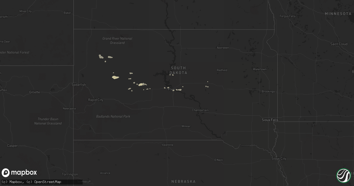
Hail Map in South Dakota on June 2, 2016
Get this storm
June 2 map
$229
one time, instant access
Download today. No call, no setup
Keep the $229
Bought the map and want the full workflow? Apply the entire $229 to a subscription within 7 days. None of it is wasted.
Every map, not just this one
This buys you this map. Subscription and you get every map we run, in the markets you choose from a few cities to whole states to nationwide. Plus real-time alerts the moment a storm fires.
Contact data
Name, contact info, occupancy, even credit band for addresses in the footprint. You go from where it hit to who to call.
Become the source they trust
Unlimited branding weather history reports on demand. You already have the documented answer ready for the property owner, and you are the one who showed up with it.
Property data and RoofTrace estimates
Pull up any address you have got, its value and the exact code rules for that jurisdiction, straight from One Click Code. Then RoofTrace estimates the squares, pitch, and roof value, priced the way you price.
Storm reports in South Dakota
South Dakota
| Date | Description |
|---|---|
| 06/02/20166:03 PM CDT | A local report indicates 60 MPH wind near 3 E ELM SPRINGS |
| 06/02/20165:20 PM CDT | A local report indicates 60 MPH wind near 8 S DATE |
| 06/02/20164:45 PM CDT | A local report indicates 60 MPH wind near 19 S REVA |
| 06/02/20164:25 PM CDT | A local report indicates 60 MPH wind near HOOVER |
| 06/01/20169:50 PM CDT | Patio furniture tossed around... Lumber and other building supplies scattered... A-frame feeder rolled... Branches 3 to 4 inches in diameter broken off trees. |
| 06/01/20169:33 PM CDT | Peak wind gust at tolstoy rwis. |
| 06/01/20169:01 PM CDT | . |
| 06/01/20168:28 PM CDT | Peak wind gust at hayes rwis. |
| 06/01/20168:25 PM CDT | . |
All States Impacted by Hail Map on June 2, 2016
Cities Impacted by Hail Map on June 2, 2016
- Bishop, TX
- Robstown, TX
- Hondo, TX
- Plaza, ND
- Palermo, ND
- Stanley, ND
- Parshall, ND
- Moore, TX
- Bigfoot, TX
- Devine, TX
- Sumter, SC
- Gladstone, ND
- Poteet, TX
- Fort Pierre, SD
- Twin City, GA
- Garfield, GA
- Bennettsville, SC
- South Padre Island, TX
- Wagon Mound, NM
- San Perlita, TX
- Rio Hondo, TX
- Los Fresnos, TX
- Edcouch, TX
- Port Isabel, TX
- Hargill, TX
- Lyford, TX
- Harlingen, TX
- Sebastian, TX
- Raymondville, TX
- Onida, SD
- Mansfield, GA
- Monticello, GA
- Pierre, SD
- Atascosa, TX
- Von Ormy, TX
- Jamestown, SC
- Huger, SC
- Taylorsville, NC
- Lenoir, NC
- Miller, SD
- Ryder, ND
- Wadley, AL
- Armstrong, TX
- Moncks Corner, SC
- Taylor, ND
- Falls City, TX
- Stockdale, TX
- Floresville, TX
- Dickinson, ND
- Castroville, TX
- La Coste, TX
- Somerset, TX
- San Antonio, TX
- Midland, SD
- Jbsa Lackland, TX
- Encino, TX
- Sarita, TX
- Smiley, TX
- Cherry Creek, SD
- White Owl, SD
- Enning, SD
- Union Center, SD
- Bloomingdale, GA
- Pooler, GA
- Savannah, GA
- Dupree, SD
- Pigeon Forge, TN
- Sevierville, TN
- Mud Butte, SD
- Albertville, AL
- Cuero, TX
- Nixon, TX
- Gillett, TX
- Mayesville, SC
- Lynchburg, SC
- Bishopville, SC
- Fort Stewart, GA
- Yorktown, TX
- Westhoff, TX
- Nordheim, TX
- Yoakum, TX
- Corpus Christi, TX
- Taft, TX
- Charlotte, TX
- Yazoo City, MS
- Tinsley, MS
- Milesville, SD
- Natalia, TX
- Lytle, TX
- Lyons, GA
- Karnes City, TX
- Weslaco, TX
- Somerville, AL
- Covington, GA
- Hemingway, SC
- Calhoun Falls, SC
- Mount Carmel, SC
- Hickory, NC
- Conover, NC
- Makoti, ND
- Douglas, ND
- La Vernia, TX
- Darlington, SC
- Summerville, SC
- Goose Creek, SC
- Newell, SD
- New Town, ND
- Uvalda, GA
- Ailey, GA
- Vidalia, GA
- Jesup, GA
- Adkins, TX
- Saint Hedwig, TX
- Manning, SC
- Rio Medina, TX
- Mico, TX
- San Benito, TX
- Swainsboro, GA
- Hortense, GA
- Pinewood, SC
- Anguilla, MS
- Reva, SD


