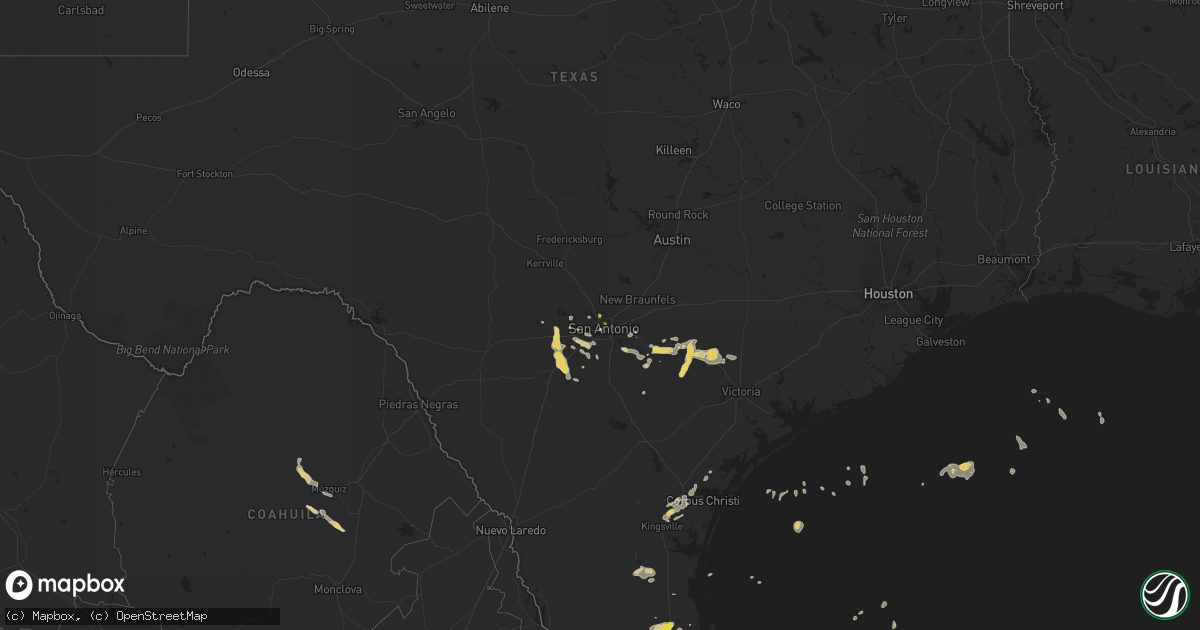
Hail Map on June 2, 2016
Get this storm
June 2 map
$229
one time, instant access
Download today. No call, no setup
Keep the $229
Bought the map and want the full workflow? Apply the entire $229 to a subscription within 7 days. None of it is wasted.
Every map, not just this one
This buys you this map. Subscription and you get every map we run, in the markets you choose from a few cities to whole states to nationwide. Plus real-time alerts the moment a storm fires.
Contact data
Name, contact info, occupancy, even credit band for addresses in the footprint. You go from where it hit to who to call.
Become the source they trust
Unlimited branding weather history reports on demand. You already have the documented answer ready for the property owner, and you are the one who showed up with it.
Property data and RoofTrace estimates
Pull up any address you have got, its value and the exact code rules for that jurisdiction, straight from One Click Code. Then RoofTrace estimates the squares, pitch, and roof value, priced the way you price.
States Impacted by Hail Map on June 2, 2016
Storm reports
North Carolina
| Date | Description |
|---|---|
| 06/02/20164:57 PM CDT | Hail up to quarter sized to the west of ellendale. |
South Carolina
| Date | Description |
|---|---|
| 06/02/20163:15 PM CDT | Large tree down near intersection of hemingway hwy and barnhill road |
| 06/02/20162:30 PM CDT | Trees down in the 14000 block of n fraser st in plantersville |
| 06/01/20168:16 PM CDT | Tree down boots branch rd x hwy 378. |
| 06/01/20168:16 PM CDT | Tree down e brewington rd x eastern school rd. |
| 06/01/20168:00 PM CDT | Tree in roadway black swamp river bridge sc76 & sc527. |
Georgia
| Date | Description |
|---|---|
| 06/02/20164:08 PM CDT | Chatham county dispatch reported a tree down on a car on pine barren rd. No injuries reported. |
| 06/02/20164:00 PM CDT | Multiple trees down along scarboro church road. |
| 06/02/20163:55 PM CDT | A tree was blown down on weber rd. |
| 06/02/20163:45 PM CDT | Wayne county 911/dispatch received reports of trees and power lines downed in the vicinity of screven along oak street and also nine run road. Time of damage based on r |
| 06/02/20163:15 PM CDT | Wayne county 911 dispatch received a report of a large tree downed across manningtown road. Time of damage based on radar data. |
| 06/02/20163:05 PM CDT | Large tree down on calico ct near old gress island rd. |
| 06/02/20163:03 PM CDT | Tree on a house along winoca dr in midway ga. Reported by liberty county 911 center. |
| 06/02/20162:56 PM CDT | The forsyth county emergency manager reported 3 trees blown down...one on a power line...in the vicinity of georgia highway 9 and spot road. |
| 06/02/20162:22 PM CDT | Trained spotter reported two trees down along hwy 196 and damage to a small cattle shed in the sand hills area. |
| 06/02/20162:20 PM CDT | Multiple trees and 4 broken power poles between alston and center. |
| 06/02/20162:20 PM CDT | Dispatch reported powerlines downed near the intersection of hwy 17 and j street. |
| 06/02/20162:20 PM CDT | The gwinnett county emergency manager reported a tree blown down on a garage and damage to a power pole on rhett butler drive in lilburn. |
| 06/02/20162:20 PM CDT | Multiple trees and 4 broken power poles between alston and center. |
| 06/02/20162:15 PM CDT | Multiple trees and powerlines down. |
| 06/02/20162:00 PM CDT | The gwinnett county emergency manager reported a house fire caused by lightning on holstein hill drive in peachtree corners. |
| 06/02/20161:30 PM CDT | The gwinnett county emergency manager reported a tree blown down on a house on audubon place in norcross. |
| 06/02/20161:15 PM CDT | Multiple trees and powerlines reported down near meadowlakes boulevard. |
| 06/02/20161:15 PM CDT | The gwinnett county emergency manager reported a tree blown down on a house on lancelot drive in norcross. |
| 06/02/20161:12 PM CDT | Corrugated roofing damage in the walmart and home depot shopping center areas along highway 27. An ornamental tree was snapped. |
| 06/02/20161:12 PM CDT | Trees down on burkhalter road and pine pitch road. |
| 06/01/20168:15 PM CDT | A tree was blown down at intersection of cr 213 and alcovy reserve way. |
| 06/01/20168:05 PM CDT | Power lines were downed on pine street in mansfield. |
Texas
| Date | Description |
|---|---|
| 06/02/20163:37 PM CDT | Video sent from public of quarter size hail in driscoll. |
| 06/01/20167:40 PM CDT | A feedlot south of devine reports minor roof damage on the property. |
| 06/01/20167:30 PM CDT | A local report indicates 1.00 inch wind near 1 NW SAN ANTONIO |
Maryland
| Date | Description |
|---|---|
| 06/02/20166:00 PM CDT | Tree down on blackberry drive in mt. Savage |
| 06/01/20167:00 PM CDT | Tree down on route 51 in oldtown |
New York
| Date | Description |
|---|---|
| 06/02/20165:39 PM CDT | Wires down on hydesville road |
South Dakota
| Date | Description |
|---|---|
| 06/02/20166:03 PM CDT | A local report indicates 60 MPH wind near 3 E ELM SPRINGS |
| 06/02/20165:20 PM CDT | A local report indicates 60 MPH wind near 8 S DATE |
| 06/02/20164:45 PM CDT | A local report indicates 60 MPH wind near 19 S REVA |
| 06/02/20164:25 PM CDT | A local report indicates 60 MPH wind near HOOVER |
| 06/01/20169:50 PM CDT | Patio furniture tossed around... Lumber and other building supplies scattered... A-frame feeder rolled... Branches 3 to 4 inches in diameter broken off trees. |
| 06/01/20169:33 PM CDT | Peak wind gust at tolstoy rwis. |
| 06/01/20169:01 PM CDT | . |
| 06/01/20168:28 PM CDT | Peak wind gust at hayes rwis. |
| 06/01/20168:25 PM CDT | . |
North Dakota
| Date | Description |
|---|---|
| 06/02/20165:14 PM CDT | A local report indicates 68 MPH wind near 1 NE GLADSTONE |
| 06/02/20165:04 PM CDT | 1 inch hail observed from 405pm mdt to 409 pm mdt |
Tennessee
| Date | Description |
|---|---|
| 06/02/20164:32 PM CDT | Couple of trees down in east knoxville. |
| 06/02/20162:30 PM CDT | 1 tree down...with several large limbs down. |
Kentucky
| Date | Description |
|---|---|
| 06/02/20165:14 PM CDT | Tree reported down northwest of williamsburg on cumberland falls highway. |
Virginia
| Date | Description |
|---|---|
| 06/02/20166:30 PM CDT | Large tree limb about as wide as a small trash can and 4 feet long broken off at buckingham court house. Time estimated from radar. |
| 06/02/20166:10 PM CDT | 911 call center reports one tree down along route 60. Time estimated by radar. |
| 06/02/20165:36 PM CDT | Tree down on old sand road |
| 06/02/20165:30 PM CDT | Tree down near intersection of laurel rd and pine ridge rd |
| 06/02/20165:20 PM CDT | Tree down on irish road |
| 06/02/20164:53 PM CDT | Tree down on shelton mill road |
| 06/02/20164:17 PM CDT | Tree down and numerous other large tree limbs down on decatur road approximately 0.5 miles northwest of the town of decatur. |
| 06/02/20164:17 PM CDT | Spotter reports mulitple large tree limbs greater than 2.0 inches in diameter along us 11 and red hill road in fairfield. |
Alabama
| Date | Description |
|---|---|
| 06/02/20162:30 PM CDT | Tree reported down along grand avenue sw in fort payne. Relayed by the media via twitter. |
Cities Impacted by Hail Map on June 2, 2016
- Bishop, TX
- Robstown, TX
- Hondo, TX
- Plaza, ND
- Palermo, ND
- Stanley, ND
- Parshall, ND
- Moore, TX
- Bigfoot, TX
- Devine, TX
- Sumter, SC
- Gladstone, ND
- Poteet, TX
- Fort Pierre, SD
- Twin City, GA
- Garfield, GA
- Bennettsville, SC
- South Padre Island, TX
- Wagon Mound, NM
- San Perlita, TX
- Rio Hondo, TX
- Los Fresnos, TX
- Edcouch, TX
- Port Isabel, TX
- Hargill, TX
- Lyford, TX
- Harlingen, TX
- Sebastian, TX
- Raymondville, TX
- Onida, SD
- Mansfield, GA
- Monticello, GA
- Pierre, SD
- Atascosa, TX
- Von Ormy, TX
- Jamestown, SC
- Huger, SC
- Taylorsville, NC
- Lenoir, NC
- Miller, SD
- Ryder, ND
- Wadley, AL
- Armstrong, TX
- Moncks Corner, SC
- Taylor, ND
- Falls City, TX
- Stockdale, TX
- Floresville, TX
- Dickinson, ND
- Castroville, TX
- La Coste, TX
- Somerset, TX
- San Antonio, TX
- Midland, SD
- Jbsa Lackland, TX
- Encino, TX
- Sarita, TX
- Smiley, TX
- Cherry Creek, SD
- White Owl, SD
- Enning, SD
- Union Center, SD
- Bloomingdale, GA
- Pooler, GA
- Savannah, GA
- Dupree, SD
- Pigeon Forge, TN
- Sevierville, TN
- Mud Butte, SD
- Albertville, AL
- Cuero, TX
- Nixon, TX
- Gillett, TX
- Mayesville, SC
- Lynchburg, SC
- Bishopville, SC
- Fort Stewart, GA
- Yorktown, TX
- Westhoff, TX
- Nordheim, TX
- Yoakum, TX
- Corpus Christi, TX
- Taft, TX
- Charlotte, TX
- Yazoo City, MS
- Tinsley, MS
- Milesville, SD
- Natalia, TX
- Lytle, TX
- Lyons, GA
- Karnes City, TX
- Weslaco, TX
- Somerville, AL
- Covington, GA
- Hemingway, SC
- Calhoun Falls, SC
- Mount Carmel, SC
- Hickory, NC
- Conover, NC
- Makoti, ND
- Douglas, ND
- La Vernia, TX
- Darlington, SC
- Summerville, SC
- Goose Creek, SC
- Newell, SD
- New Town, ND
- Uvalda, GA
- Ailey, GA
- Vidalia, GA
- Jesup, GA
- Adkins, TX
- Saint Hedwig, TX
- Manning, SC
- Rio Medina, TX
- Mico, TX
- San Benito, TX
- Swainsboro, GA
- Hortense, GA
- Pinewood, SC
- Anguilla, MS
- Reva, SD