Hail Map in South Dakota on June 2, 2011
Get this storm
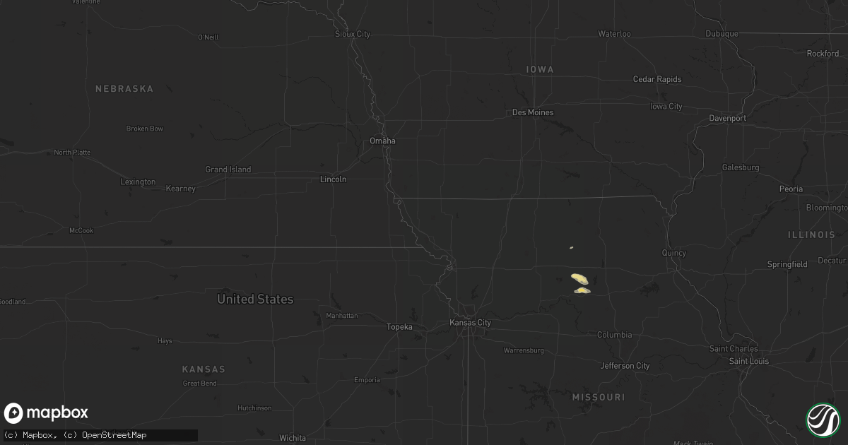
June 2 map
$229
one time, instant access
Download today. No call, no setup
Keep the $229
Bought the map and want the full workflow? Apply the entire $229 to a subscription within 7 days. None of it is wasted.
Every map, not just this one
This buys you this map. Subscription and you get every map we run, in the markets you choose from a few cities to whole states to nationwide. Plus real-time alerts the moment a storm fires.
Contact data
Name, contact info, occupancy, even credit band for addresses in the footprint. You go from where it hit to who to call.
Become the source they trust
Unlimited branding weather history reports on demand. You already have the documented answer ready for the property owner, and you are the one who showed up with it.
Property data and RoofTrace estimates
Pull up any address you have got, its value and the exact code rules for that jurisdiction, straight from One Click Code. Then RoofTrace estimates the squares, pitch, and roof value, priced the way you price.
Storm reports in South Dakota
South Dakota
| Date | Description |
|---|---|
| 06/02/201112:45 AM CDT | Hail stones ranged from nickles to golf ball sized. Estimated time based on radar. |
| 06/02/201112:45 AM CDT | Ranged between nickles to tennis ball. |
| 06/01/201111:55 PM CDT | Gettysburg super awos. Time based on nearby sdsu site. |
| 06/01/201111:47 PM CDT | A local report indicates 1.50 inch wind near MCLAUGHLIN |
| 06/01/201111:22 PM CDT | Measured at grand river raws site |
| 06/01/201111:15 PM CDT | A local report indicates 1.00 inch wind near MISSION RIDGE |
| 06/01/201111:15 PM CDT | A local report indicates 60 MPH wind near MISSION RIDGE |
| 06/01/201111:15 PM CDT | Lots of pea hail with the winds stripped the leaves from the trees. |
| 06/01/201110:42 PM CDT | Pea size hail as well |
| 06/01/201110:30 PM CDT | A local report indicates 1.00 inch wind near 6 W HAYES |
| 06/01/20119:38 PM CDT | A local report indicates 62 MPH wind near PHILIP |
| 06/01/20119:12 PM CDT | A local report indicates 1.00 inch wind near 3 SW INTERIOR |
| 06/01/20118:35 PM CDT | A local report indicates 1.00 inch wind near 6 NNW KYLE |
| 06/01/20118:18 PM CDT | A local report indicates 1.75 inch wind near 1 NNE SHARPS CORNER |
| 06/01/20118:17 PM CDT | Nssl shave report |
| 06/01/20118:05 PM CDT | Nssl shave report...avg est 1 inch...max est 1.75 inches |
| 06/01/20118:05 PM CDT | Nssl shave report |
| 06/01/20118:00 PM CDT | Nssl shave |
| 06/01/20117:55 PM CDT | A local report indicates 1.00 inch wind near 8 S KELDRON |
| 06/01/20117:30 PM CDT | Nssl shave report |
All States Impacted by Hail Map on June 2, 2011
Cities Impacted by Hail Map on June 2, 2011
- Larimore, ND
- Northwood, ND
- El Paso, TX
- Woodworth, ND
- Vance, SC
- Holly Hill, SC
- Kintyre, ND
- Linton, ND
- Hague, ND
- Wishek, ND
- Appleton, MN
- Hayes, SD
- Eutawville, SC
- Strasburg, ND
- Franklin, MN
- Morgan, MN
- Madison, MN
- Dupree, SD
- Rosebud, MT
- Kinsey, MT
- Forsyth, MT
- Deridder, LA
- Harlem, MT
- Hays, MT
- Lancaster, MN
- Lake Bronson, MN
- Carson, ND
- Selfridge, ND
- Interior, SD
- Midland, SD
- Wanblee, SD
- Scenic, SD
- Wall, SD
- Philip, SD
- Long Valley, SD
- Pine Ridge, SD
- Porcupine, SD
- Kadoka, SD
- Kyle, SD
- Sherwood, ND
- Lugoff, SC
- Twin Brooks, SD
- South Shore, SD
- Rocky Ford, GA
- Oakdale, LA
- Gaston, SC
- Columbia, SC
- Aiken, SC
- Terry, MT
- Fallon, MT
- Saint Vincent, MN
- Pembina, ND
- Saint John, ND
- Upham, ND
- Bantry, ND
- Willow City, ND
- Bottineau, ND
- Dunseith, ND
- Kramer, ND
- Keldron, SD
- Mamou, LA
- Big Sandy, MT
- Fort Benton, MT
- Loma, MT
- Chapin, SC
- Karlstad, MN
- Salisbury, MO
- Keytesville, MO
- Little Mountain, SC
- Blythewood, SC
- Windom, MN
- Waxhaw, NC
- Fort Mill, SC
- Hatchechubbee, AL
- Gilbert, SC
- Broadview, NM
- Clovis, NM
- Watauga, SD
- Morristown, SD
- New London, MN
- Spicer, MN
- Lankin, ND
- Michigan, ND
- Rogers, ND
- Dazey, ND
- Fabens, TX
- Twin City, GA
- Midville, GA
- Swainsboro, GA
- Clint, TX
- Selby, SD
- Gettysburg, SD
- Blacksburg, SC
- Jonesville, SC
- Union, SC
- Simmesport, LA
- Plaucheville, LA
- Evergreen, LA
- Bunkie, LA
- Waynesboro, GA
- Millen, GA
- Kandiyohi, MN
- Pacolet, SC
- Gaffney, SC
- Olivia, MN
- Lake Lillian, MN
- Blomkest, MN
- Danube, MN
- Mittie, LA
- Kinder, LA
- Dry Creek, LA
- Gastonia, NC
- Meadow, SD
- McIntosh, SD
- Tolna, ND
- Kings Mountain, NC
- Locust Grove, GA
- Mcdonough, GA
- Lakota, ND
- Pekin, ND
- Mill Spring, NC
- Faith, SD
- Simpsonville, SC
- Greer, SC
- Elton, LA
- Fort Pierre, SD
- Flat Rock, NC
- Hendersonville, NC
- Carrington, ND
- Grace City, ND
- Gackle, ND
- McLaughlin, SD
- Hinsdale, MT
- Cottonport, LA
- Napoleon, ND
- Pingree, ND
- Malta, MT
- Elgin, SC
- Lexington, SC
- Jamestown, ND
- Ypsilanti, ND
- Jud, ND
- Montpelier, ND
- Fort Peck, MT
- Spartanburg, SC
- Blair, SC
- Stephen, MN
- Raymond, MN
- Kerkhoven, MN
- Mcville, ND
- Aneta, ND
- Ville Platte, LA
- Marceline, MO
- Rothville, MO
- Lehr, ND
- Zeeland, ND
- Streeter, ND
- Webster, SD
- Park River, ND
- Kenmare, ND
- Stratford, TX
- Timber Lake, SD
- Isabel, SD
- Strandquist, MN
- Greenbush, MN
- Hallock, MN
- Badger, MN
- Kennedy, MN
- Halma, MN
- Donaldson, MN
- Lawton, ND
- Rutherfordton, NC
- Crystal, ND
- Hoople, ND
- Hensel, ND
- Saint Thomas, ND
- Dell City, TX
- Hector, MN
- Carlisle, SC
- Whitmire, SC
- Whiting, IA
- Onawa, IA
- Mansura, LA
- Cheneyville, LA
- Hessmer, LA
- Turton, SD
- Woodruff, SC
- Boiling Springs, SC
- Cowpens, SC
- Chesnee, SC
- Moore, SC
- Una, SC
- Roebuck, SC
- Glendale, SC
- Arcadia, SC
- Wellford, SC
- Duncan, SC
- Milner, GA
- Springfield, MN
- Clements, MN
- Moreauville, LA
- Washington, LA
- Morrow, LA
- Cordova, SC
- Cope, SC
- Tappen, ND
- Hamilton, ND
- Cavalier, ND
- Pennock, MN
- Willmar, MN
- Chester, SC
- Pinewood, SC
- Loving, NM
- Arvilla, ND
- North, SC
- Neeses, SC
- Salley, SC
- Springfield, SC
- Lake Lure, NC
- Fort Hancock, TX
- Chinook, MT
- Columbus, NC
- Dodson, MT
- Pitkin, LA
- Atwater, MN
- Cooperstown, ND
- Williston, SC
- Binford, ND
- Sutton, ND
- Rowesville, SC
- Olar, SC
- Warren, TX
- Belgrade, MN
- Batesburg, SC
- Casar, NC
- Ellenboro, NC
- Sugartown, LA
- Reeves, LA
- Fredonia, ND
- Drayton, ND
- Jonesville, LA
- Monterey, LA
- Cayce, SC
- Newington, GA
- Waubay, SD
- New Rockford, ND
- Whitewater, MT
- Saco, MT
- Sleepy Eye, MN
- Glenfield, ND
- Courtenay, ND
- Statesboro, GA
- Angola, LA
- Saint Francisville, LA
- Metter, GA
- Norway, SC
- Warwick, ND
- Braddock, ND
- Mchenry, ND
- Hazelton, ND
- Dawson, ND
- Steele, ND
- Fort Yates, ND
- Wakpala, SD
- Lamberton, MN
- Tornillo, TX
- Gadsden, SC
- Goodwell, OK
- Leesville, SC
- Eagle Butte, SD
- Nashua, MT
- Saint Matthews, SC
- Swansea, SC
- Eastover, SC
- Hopkins, SC
- Penrose, NC
- Horse Shoe, NC
- Brevard, NC
- Pisgah Forest, NC
- Etowah, NC
- Mills River, NC
- Saluda, NC
- Roseau, MN
- Brooten, MN
- Ridgeway, SC
- Union Center, SD
- Jenkinsville, SC
- Irmo, SC
- Pomaria, SC
- Winnsboro, SC
- Finley, ND
- Saint Landry, LA
- Vidalia, LA
- Woodville, MS
- Storden, MN
- Prosperity, SC
- Sanders, MT
- Edmore, ND
- Branchville, SC
- Havre, MT
- Canton, NC
- Candler, NC
- Ashton, SD
- Redfield, SD
- Wimbledon, ND
- Hannaford, ND
- Melrose, MN
- Dalhart, TX
- Miller, SD
- Milan, MN
- Danvers, MN
- Minto, ND
- Oslo, MN
- Manvel, ND
- Otto, NC
- Luverne, ND
- Bostic, NC
- Forest City, NC
- Mud Butte, SD
- Cameron, SC
- Spurger, TX
- Woodville, TX
- Morris, MN
- Black Mountain, NC
- Spindale, NC
- Lettsworth, LA
- Lawndale, NC
- Quinn, SD
- Jeffers, MN
- Sanborn, MN
- Oberlin, LA
- Rolla, KS
- Lyman, SC
- Cusseta, GA
- Currie, MN
- Slayton, MN
- Elida, NM
- Ehrhardt, SC
- New Leipzig, ND
- Blackville, SC
- Bamberg, SC
- Denmark, SC
- Girard, GA
- East Flat Rock, NC
- Lloyd, MT
- Redwood Falls, MN
- Taiban, NM
- Argyle, MN
- Benson, MN
- New Cambria, MO
- Pisek, ND
- Bowdle, SD
- Belmont, NC
- Marshall, MN
- Vesta, MN
- Milroy, MN
- Frankfort, SD
- West Columbia, SC
- Morton, MN
- Fairfax, MN
- Shields, ND
- Devils Lake, ND
- Ashley, ND
- Prinsburg, MN
- Kensal, ND
- Garfield, GA
- Pierson, IA
- Seale, AL
- Corona, SD
- Tuscaloosa, AL
- Tracy, MN
- Hilger, MT
- Medina, ND
- Pettibone, ND
- Fordville, ND
- Brocket, ND
- Fountain Inn, SC
- Winigan, MO
- Fosters, AL
- Orangeburg, SC
- Crary, ND
- Webster, ND
- Glasgow, MT
- Summerton, SC
- Towner, ND
- Wedgefield, SC
- Roswell, NM
- Clark, SD
- Conde, SD
- Hereford, TX
- Spiritwood, ND
- Bristol, SD
- Bowman, SC
- Keyes, OK
- Box Springs, GA
- Buena Vista, GA
- Fort Benning, GA
- Fairfax, SC
- Mohall, ND
- Bighorn, MT
- Bathgate, ND
- Sanborn, ND
- Lemmon, SD
- Renville, MN
- Java, SD
- Livingston, TX
- Alsen, ND
- Marksville, LA
- Washta, IA
- Pauline, SC
- Buffalo, SC
- Shelby, NC
- Grover, NC
- Doland, SD
- Phenix City, AL
- Zortman, MT


