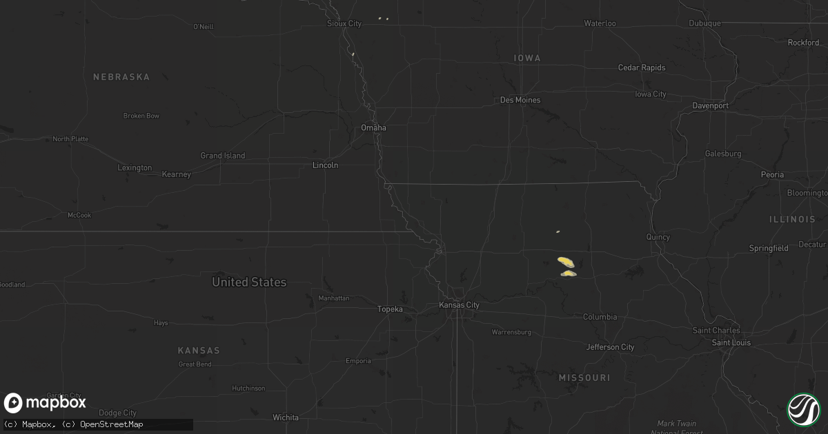
Hail Map on June 2, 2011
Get this storm
June 2 map
$229
one time, instant access
Download today. No call, no setup
Keep the $229
Bought the map and want the full workflow? Apply the entire $229 to a subscription within 7 days. None of it is wasted.
Every map, not just this one
This buys you this map. Subscription and you get every map we run, in the markets you choose from a few cities to whole states to nationwide. Plus real-time alerts the moment a storm fires.
Contact data
Name, contact info, occupancy, even credit band for addresses in the footprint. You go from where it hit to who to call.
Become the source they trust
Unlimited branding weather history reports on demand. You already have the documented answer ready for the property owner, and you are the one who showed up with it.
Property data and RoofTrace estimates
Pull up any address you have got, its value and the exact code rules for that jurisdiction, straight from One Click Code. Then RoofTrace estimates the squares, pitch, and roof value, priced the way you price.
States Impacted by Hail Map on June 2, 2011
Storm reports
Alabama
| Date | Description |
|---|---|
| 06/02/20115:35 PM CDT | Two small trees blown down...one fell onto a powerline. Winds estimated at 40 mph by emergency manager. |
Mississippi
| Date | Description |
|---|---|
| 06/02/20116:28 PM CDT | Update...numerous trees and power poles blown over in the monterey area and along state highway 129. A shed was blown across the roadway...hitting a moving vehicle. Ear |
Montana
| Date | Description |
|---|---|
| 06/02/20115:12 PM CDT | A local report indicates 1.75 inch wind near TERRY |
| 06/02/20115:08 PM CDT | A local report indicates 58 MPH wind near 10 SE GLASGOW |
| 06/02/20113:30 PM CDT | Hail falling for 10 mins...still falling at time of call |
| 06/02/20113:25 PM CDT | Dime to quarter sized hail...started hailing about 5 mins before the call. Hail is accumulating |
| 06/02/20113:23 PM CDT | A local report indicates 1.00 inch wind near 7 SSE VANANDA |
| 06/02/20113:20 PM CDT | Dime to quarter sized hail...started hailing about 5 mins before the call. Hail is accumulating |
| 06/02/20113:20 PM CDT | Hail falling for 10 mins...still falling at time of call |
North Dakota
| Date | Description |
|---|---|
| 06/02/20114:15 AM CDT | Large tree branches were blown down around town. A 58 mph wind gust was measured at the cavalier awos. |
| 06/02/20114:05 AM CDT | Large tree branches were blown down. |
| 06/02/20113:45 AM CDT | The roof to a barn built in 1985 is gone. There are also 2 to 3 inch in diameter tree branches on the ground. |
| 06/02/20113:40 AM CDT | Several mature evergreen trees were uprooted. |
| 06/02/20113:30 AM CDT | Viewer reported trees were uprooted and on a house. |
| 06/02/20113:00 AM CDT | Cattle pens were damaged and a large tank was blown across the road. |
| 06/02/20112:45 AM CDT | Many large tree branches blown down. |
| 06/02/20112:44 AM CDT | The wind gust was measured at the ndawn mesonet station located 8 miles north of mchenry in eddy county. |
| 06/02/20112:38 AM CDT | Downed trees and power lines. Relay by state radio. |
| 06/02/20112:35 AM CDT | A local report indicates 78 MPH wind near CARRINGTON |
| 06/02/20112:25 AM CDT | Relay by state radio |
| 06/02/20111:40 AM CDT | Relay by state radio |
| 06/02/201112:50 AM CDT | Pole barn destroyed. Stock trailer was rolled approximately 200 feet. |
| 06/02/201112:35 AM CDT | A local report indicates 94 MPH wind near 3 SSW LINTON |
| 06/01/201110:00 PM CDT | ...pea to half dallor sized hail... 0.53 of rainfall over last 30 to 45 minutes... |
| 06/01/20118:57 PM CDT | Report relayed by the media. |
South Dakota
| Date | Description |
|---|---|
| 06/02/201112:45 AM CDT | Ranged between nickles to tennis ball. |
| 06/02/201112:45 AM CDT | Hail stones ranged from nickles to golf ball sized. Estimated time based on radar. |
| 06/01/201111:55 PM CDT | Gettysburg super awos. Time based on nearby sdsu site. |
| 06/01/201111:47 PM CDT | A local report indicates 1.50 inch wind near MCLAUGHLIN |
| 06/01/201111:22 PM CDT | Measured at grand river raws site |
| 06/01/201111:15 PM CDT | Lots of pea hail with the winds stripped the leaves from the trees. |
| 06/01/201111:15 PM CDT | A local report indicates 60 MPH wind near MISSION RIDGE |
| 06/01/201111:15 PM CDT | A local report indicates 1.00 inch wind near MISSION RIDGE |
| 06/01/201110:42 PM CDT | Pea size hail as well |
| 06/01/201110:30 PM CDT | A local report indicates 1.00 inch wind near 6 W HAYES |
| 06/01/20119:38 PM CDT | A local report indicates 62 MPH wind near PHILIP |
| 06/01/20119:12 PM CDT | A local report indicates 1.00 inch wind near 3 SW INTERIOR |
| 06/01/20118:35 PM CDT | A local report indicates 1.00 inch wind near 6 NNW KYLE |
| 06/01/20118:18 PM CDT | A local report indicates 1.75 inch wind near 1 NNE SHARPS CORNER |
| 06/01/20118:17 PM CDT | Nssl shave report |
| 06/01/20118:05 PM CDT | Nssl shave report...avg est 1 inch...max est 1.75 inches |
| 06/01/20118:05 PM CDT | Nssl shave report |
| 06/01/20118:00 PM CDT | Nssl shave |
| 06/01/20117:55 PM CDT | A local report indicates 1.00 inch wind near 8 S KELDRON |
| 06/01/20117:30 PM CDT | Nssl shave report |
Michigan
| Date | Description |
|---|---|
| 06/01/201111:17 PM CDT | Wind gust measured from the northwest. |
South Carolina
| Date | Description |
|---|---|
| 06/02/20116:48 PM CDT | 1 inch hail reported by public |
| 06/02/20115:55 PM CDT | Local meteorologist reported marble to golf ball size hail. |
| 06/02/20115:30 PM CDT | Tree reported down on a house on sparkle drive. Also another spotter reports other trees down in the lockhart area. |
| 06/02/20115:15 PM CDT | A local report indicates 1.00 inch wind near 2 W SPARTANBURG |
| 06/02/20114:52 PM CDT | Power lines blown down. |
| 06/02/20114:35 PM CDT | A few trees were blown down. Spotter only had pea sized hail at his house. |
| 06/02/20114:35 PM CDT | Tree down on a house on winsmith avenue. |
| 06/02/20114:30 PM CDT | Quarter size hail at strange court. Also frequent lightning with structure hit by lightning. |
| 06/02/20113:37 PM CDT | A local report indicates 1.00 inch wind near 5 ENE MAULDIN |
| 06/01/201110:18 PM CDT | Trees down in the community of grays. |
| 06/01/201110:05 PM CDT | Trees downed by thunderstorm winds |
| 06/01/20119:57 PM CDT | Trees downed by thunderstorm winds |
| 06/01/20119:45 PM CDT | Law enforcement reported 1 tree down near the intersection of ruffin road and mount carmel road. |
| 06/01/20119:37 PM CDT | 2 reports of trees down on route 601 near crocketville. |
| 06/01/20119:37 PM CDT | Trees downed by thunderstorm winds |
| 06/01/20119:28 PM CDT | Law enforcement reported 1 tree down near the intersection of highway 21 and highway 63. |
| 06/01/20118:49 PM CDT | Trees in roadway reported by hwy patral near burke road and kinley |
| 06/01/20118:42 PM CDT | Trees in roadway on us 321 near neeses reported by hwy patrol |
| 06/01/20118:33 PM CDT | Sheriff dispatch reported trees and power lines down at binnicker bridge road and cope road. |
| 06/01/20118:32 PM CDT | Trees in roadway near sc 6 and us 176 reported by hwy patrol. |
| 06/01/20118:25 PM CDT | Trees in roadway near presidential drive and magnolia reported by hwy patrol |
| 06/01/20118:24 PM CDT | Sheriff dispatch reported trees and power lines down at savannah hwy and willow swamp rd. |
| 06/01/20118:23 PM CDT | Highway patrol reported tree in the roadway along highway 70 west of denmark. |
| 06/01/20118:20 PM CDT | Highway patrol reported tree down at bethel church at bethel church road. |
| 06/01/20118:16 PM CDT | Sheriff dispatch reported trees and power lines down at keiser brown road and neeses hwy. |
| 06/01/20118:15 PM CDT | Trees in roadway on bonnet rd reported by hwy patrol |
| 06/01/20118:00 PM CDT | Sheriff dispatch reported trees and power lines down at fairview road and benedict road. |
| 06/01/20117:54 PM CDT | County sheriff dispatch reported trees down at north road and slab landing road. |
| 06/01/20117:48 PM CDT | Public reported one inch hail near lugoff. |
| 06/01/20117:47 PM CDT | Tree in roadway near sc 6 and sardis church rd reported by hwy patrol |
| 06/01/20117:46 PM CDT | Tree in roadway near pleasant view rd and sc 6 reported by highway patrol. |
| 06/01/20117:46 PM CDT | Tree in roadway near us 321 and glenn rd reported by hwy patrol |
| 06/01/20117:45 PM CDT | Tree in roadway dooley rd near i-20 reported by hwy patrol |
| 06/01/20117:40 PM CDT | Trees in roadway near hines rd and smyrna rd reported by hwy patrol |
| 06/01/20117:40 PM CDT | 1 inch hail reported by public in columbia. |
| 06/01/20117:36 PM CDT | Tree in roadway near sc 277 and bull st reported by hwy patrol |
| 06/01/20117:35 PM CDT | Trees down. |
| 06/01/20117:32 PM CDT | Trees in roadway near i-26 and julius richardson rd reported by hwy patrol |
| 06/01/20117:30 PM CDT | Trees down estimated 50 mph wind reported by nws employee |
| 06/01/20117:28 PM CDT | Event occurred between 813 pm 06/02/2011 and 828 pm 06/02/2011 |
| 06/01/20117:28 PM CDT | Highway patrol reporgted trees down near the interchange of hwy 378 and i-26. |
| 06/01/20117:25 PM CDT | Highway patrol reported trees down old barnwell road near highway 1. |
| 06/01/20117:25 PM CDT | Trees down at the governors mansion. Tree fell on and crushed the first gentlemans vehicle. |
| 06/01/20117:20 PM CDT | Trees and limbs down hwy 215 near glenns bridge rd reported by sheriff |
| 06/01/20117:15 PM CDT | Trees down on coon road reported by sheriff |
| 06/01/20117:15 PM CDT | Public reported pontoon boats damaged...trees down and a sea wall damaged along power point lane at lake murray. |
| 06/01/20117:15 PM CDT | Highway patrol reported trees down at pilgram church road and cherokee road. |
| 06/01/20117:06 PM CDT | Tree down on kennerly road near us 76 reported by highway patrol |
| 06/01/20117:05 PM CDT | Trees down in irmo reported by public |
| 06/01/20117:05 PM CDT | Trees down on monticello road |
| 06/01/20117:05 PM CDT | Tree down on dreher island road. |
| 06/01/20117:00 PM CDT | Public reports quarter sized hail on usc campus |
Minnesota
| Date | Description |
|---|---|
| 06/02/20114:25 AM CDT | A local report indicates 1.00 inch wind near 7 ENE LAKE BRONSON |
| 06/02/20114:20 AM CDT | Very strongs winds also occurred knocking many large branches down. |
North Carolina
| Date | Description |
|---|---|
| 06/02/20116:30 PM CDT | Quarter size hail on franlin blvd. |
| 06/02/20116:28 PM CDT | A local report indicates 1.25 inch wind near 1 S GASTONIA |
| 06/02/20116:25 PM CDT | A local report indicates 1.00 inch wind near 2 S GASTONIA |
| 06/02/20114:45 PM CDT | Many large limbs blown down around otto. |
| 06/02/20114:37 PM CDT | A local report indicates 1.00 inch wind near FOREST CITY |
| 06/02/20114:35 PM CDT | Tree down along oak grove church rd and business hwy 74. |
| 06/02/20114:12 PM CDT | Power lines down in trees and tree on fire on charlotte road. |
| 06/02/20114:00 PM CDT | A local report indicates 1.00 inch wind near 4 ENE CRUSO |
| 06/02/20113:42 PM CDT | Dime to quarter sized hail fell on highway 9 just south of sunny view. |
| 06/02/20113:40 PM CDT | Quarter size hail at lake adger rd and coopers gap rd. |
| 06/02/20113:38 PM CDT | A tree down on garrett road. |
| 06/02/20113:21 PM CDT | Nickel to quarter sized hail fell for a short time along with some gusty wind in the shingle hollow area. |
| 06/02/20113:10 PM CDT | A local report indicates 1.00 inch wind near 1 NW ETOWAH |
| 06/02/20113:05 PM CDT | Media reports quarter size hail at highway 64 and interstate 26. |
| 06/02/20113:00 PM CDT | A local report indicates 1.75 inch wind near MOUNTAIN HOME |
| 06/02/20113:00 PM CDT | Quarter sized hail fell at clear creek elementary school. |
| 06/02/20112:58 PM CDT | Quarter sized hail reported to fall on the asheville highway between brevard and mills river. Location was matched with radar data. |
Kansas
| Date | Description |
|---|---|
| 06/01/201110:30 PM CDT | A local report indicates 58 MPH wind near 6 S DEERFIELD |
| 06/01/20119:10 PM CDT | A local report indicates 60 MPH wind near 5 SE FETERITA |
Texas
| Date | Description |
|---|---|
| 06/02/20116:43 PM CDT | A local report indicates 61 MPH wind near 6 N FORT BLISS |
New Mexico
| Date | Description |
|---|---|
| 06/01/20117:48 PM CDT | A local report indicates 65 MPH wind near 11 NNE OROGRANDE |
Georgia
| Date | Description |
|---|---|
| 06/02/20115:15 PM CDT | Public reported one inch hail. |
Louisiana
| Date | Description |
|---|---|
| 06/02/20116:42 PM CDT | Numerous reports from the public of wind damage on the west side of ville platte. Several trees were blown down with some falling on houses. Minor roof damage occurred |
| 06/02/20116:38 PM CDT | Transmition lines were blown down off the steele truss towers...not sure if the tower is down...also a few cross beam power poles are down. This damage suggests a high |
| 06/02/20116:30 PM CDT | Trees were downed across state highway 129 just north of monterey. |
| 06/02/20116:28 PM CDT | Transmition lines were blown down off the steele truss towers...not sure if the tower is down...also a few cross beam power poles are down. This damage suggests a high |
| 06/02/20116:28 PM CDT | Update...numerous trees and power poles blown over in the monterey area and along state highway 129. A shed was blown across the roadway...hitting a moving vehicle. Ear |
| 06/01/20118:45 PM CDT | Public report via kplc-tv of ping pong ball-sized hail along highway 171 between de ridder and longville |
| 06/01/20118:20 PM CDT | Public report of a mobile home in mittie suffering damage to its carport as well as a large tree branch through its roof |
| 06/01/20118:02 PM CDT | Sheriffs department reports trees down stretching from cheneyville to alexandria. |
| 06/01/20117:47 PM CDT | Public reported several trees were uprooted on meat market road northwest of oakdale. |
| 06/01/20117:45 PM CDT | Avoyelles 911 reports numerous trees down across the southern portion of the parish. Also reporting power out over most of this area. |
| 06/01/20117:30 PM CDT | Public reported several trees were blown down in big bend on hamburg road and in moreauville. |
| 06/01/20117:25 PM CDT | Evangeline 911 reports numerous trees down across the northern portion of the parish. Power is also out over most of this area. |
| 06/01/20117:02 PM CDT | A power pole and lines down. |
Cities Impacted by Hail Map on June 2, 2011
- Larimore, ND
- Northwood, ND
- El Paso, TX
- Woodworth, ND
- Vance, SC
- Holly Hill, SC
- Kintyre, ND
- Linton, ND
- Hague, ND
- Wishek, ND
- Appleton, MN
- Hayes, SD
- Eutawville, SC
- Strasburg, ND
- Franklin, MN
- Morgan, MN
- Madison, MN
- Dupree, SD
- Rosebud, MT
- Kinsey, MT
- Forsyth, MT
- Deridder, LA
- Harlem, MT
- Hays, MT
- Lancaster, MN
- Lake Bronson, MN
- Carson, ND
- Selfridge, ND
- Interior, SD
- Midland, SD
- Wanblee, SD
- Scenic, SD
- Wall, SD
- Philip, SD
- Long Valley, SD
- Pine Ridge, SD
- Porcupine, SD
- Kadoka, SD
- Kyle, SD
- Sherwood, ND
- Lugoff, SC
- Twin Brooks, SD
- South Shore, SD
- Rocky Ford, GA
- Oakdale, LA
- Gaston, SC
- Columbia, SC
- Aiken, SC
- Terry, MT
- Fallon, MT
- Saint Vincent, MN
- Pembina, ND
- Saint John, ND
- Upham, ND
- Bantry, ND
- Willow City, ND
- Bottineau, ND
- Dunseith, ND
- Kramer, ND
- Keldron, SD
- Mamou, LA
- Big Sandy, MT
- Fort Benton, MT
- Loma, MT
- Chapin, SC
- Karlstad, MN
- Salisbury, MO
- Keytesville, MO
- Little Mountain, SC
- Blythewood, SC
- Windom, MN
- Waxhaw, NC
- Fort Mill, SC
- Hatchechubbee, AL
- Gilbert, SC
- Broadview, NM
- Clovis, NM
- Watauga, SD
- Morristown, SD
- New London, MN
- Spicer, MN
- Lankin, ND
- Michigan, ND
- Rogers, ND
- Dazey, ND
- Fabens, TX
- Twin City, GA
- Midville, GA
- Swainsboro, GA
- Clint, TX
- Selby, SD
- Gettysburg, SD
- Blacksburg, SC
- Jonesville, SC
- Union, SC
- Simmesport, LA
- Plaucheville, LA
- Evergreen, LA
- Bunkie, LA
- Waynesboro, GA
- Millen, GA
- Kandiyohi, MN
- Pacolet, SC
- Gaffney, SC
- Olivia, MN
- Lake Lillian, MN
- Blomkest, MN
- Danube, MN
- Mittie, LA
- Kinder, LA
- Dry Creek, LA
- Gastonia, NC
- Meadow, SD
- McIntosh, SD
- Tolna, ND
- Kings Mountain, NC
- Locust Grove, GA
- Mcdonough, GA
- Lakota, ND
- Pekin, ND
- Mill Spring, NC
- Faith, SD
- Simpsonville, SC
- Greer, SC
- Elton, LA
- Fort Pierre, SD
- Flat Rock, NC
- Hendersonville, NC
- Carrington, ND
- Grace City, ND
- Gackle, ND
- McLaughlin, SD
- Hinsdale, MT
- Cottonport, LA
- Napoleon, ND
- Pingree, ND
- Malta, MT
- Elgin, SC
- Lexington, SC
- Jamestown, ND
- Ypsilanti, ND
- Jud, ND
- Montpelier, ND
- Fort Peck, MT
- Spartanburg, SC
- Blair, SC
- Stephen, MN
- Raymond, MN
- Kerkhoven, MN
- Mcville, ND
- Aneta, ND
- Ville Platte, LA
- Marceline, MO
- Rothville, MO
- Lehr, ND
- Zeeland, ND
- Streeter, ND
- Webster, SD
- Park River, ND
- Kenmare, ND
- Stratford, TX
- Timber Lake, SD
- Isabel, SD
- Strandquist, MN
- Greenbush, MN
- Hallock, MN
- Badger, MN
- Kennedy, MN
- Halma, MN
- Donaldson, MN
- Lawton, ND
- Rutherfordton, NC
- Crystal, ND
- Hoople, ND
- Hensel, ND
- Saint Thomas, ND
- Dell City, TX
- Hector, MN
- Carlisle, SC
- Whitmire, SC
- Whiting, IA
- Onawa, IA
- Mansura, LA
- Cheneyville, LA
- Hessmer, LA
- Turton, SD
- Woodruff, SC
- Boiling Springs, SC
- Cowpens, SC
- Chesnee, SC
- Moore, SC
- Una, SC
- Roebuck, SC
- Glendale, SC
- Arcadia, SC
- Wellford, SC
- Duncan, SC
- Milner, GA
- Springfield, MN
- Clements, MN
- Moreauville, LA
- Washington, LA
- Morrow, LA
- Cordova, SC
- Cope, SC
- Tappen, ND
- Hamilton, ND
- Cavalier, ND
- Pennock, MN
- Willmar, MN
- Chester, SC
- Pinewood, SC
- Loving, NM
- Arvilla, ND
- North, SC
- Neeses, SC
- Salley, SC
- Springfield, SC
- Lake Lure, NC
- Fort Hancock, TX
- Chinook, MT
- Columbus, NC
- Dodson, MT
- Pitkin, LA
- Atwater, MN
- Cooperstown, ND
- Williston, SC
- Binford, ND
- Sutton, ND
- Rowesville, SC
- Olar, SC
- Warren, TX
- Belgrade, MN
- Batesburg, SC
- Casar, NC
- Ellenboro, NC
- Sugartown, LA
- Reeves, LA
- Fredonia, ND
- Drayton, ND
- Jonesville, LA
- Monterey, LA
- Cayce, SC
- Newington, GA
- Waubay, SD
- New Rockford, ND
- Whitewater, MT
- Saco, MT
- Sleepy Eye, MN
- Glenfield, ND
- Courtenay, ND
- Statesboro, GA
- Angola, LA
- Saint Francisville, LA
- Metter, GA
- Norway, SC
- Warwick, ND
- Braddock, ND
- Mchenry, ND
- Hazelton, ND
- Dawson, ND
- Steele, ND
- Fort Yates, ND
- Wakpala, SD
- Lamberton, MN
- Tornillo, TX
- Gadsden, SC
- Goodwell, OK
- Leesville, SC
- Eagle Butte, SD
- Nashua, MT
- Saint Matthews, SC
- Swansea, SC
- Eastover, SC
- Hopkins, SC
- Penrose, NC
- Horse Shoe, NC
- Brevard, NC
- Pisgah Forest, NC
- Etowah, NC
- Mills River, NC
- Saluda, NC
- Roseau, MN
- Brooten, MN
- Ridgeway, SC
- Union Center, SD
- Jenkinsville, SC
- Irmo, SC
- Pomaria, SC
- Winnsboro, SC
- Finley, ND
- Saint Landry, LA
- Vidalia, LA
- Woodville, MS
- Storden, MN
- Prosperity, SC
- Sanders, MT
- Edmore, ND
- Branchville, SC
- Havre, MT
- Canton, NC
- Candler, NC
- Ashton, SD
- Redfield, SD
- Wimbledon, ND
- Hannaford, ND
- Melrose, MN
- Dalhart, TX
- Miller, SD
- Milan, MN
- Danvers, MN
- Minto, ND
- Oslo, MN
- Manvel, ND
- Otto, NC
- Luverne, ND
- Bostic, NC
- Forest City, NC
- Mud Butte, SD
- Cameron, SC
- Spurger, TX
- Woodville, TX
- Morris, MN
- Black Mountain, NC
- Spindale, NC
- Lettsworth, LA
- Lawndale, NC
- Quinn, SD
- Jeffers, MN
- Sanborn, MN
- Oberlin, LA
- Rolla, KS
- Lyman, SC
- Cusseta, GA
- Currie, MN
- Slayton, MN
- Elida, NM
- Ehrhardt, SC
- New Leipzig, ND
- Blackville, SC
- Bamberg, SC
- Denmark, SC
- Girard, GA
- East Flat Rock, NC
- Lloyd, MT
- Redwood Falls, MN
- Taiban, NM
- Argyle, MN
- Benson, MN
- New Cambria, MO
- Pisek, ND
- Bowdle, SD
- Belmont, NC
- Marshall, MN
- Vesta, MN
- Milroy, MN
- Frankfort, SD
- West Columbia, SC
- Morton, MN
- Fairfax, MN
- Shields, ND
- Devils Lake, ND
- Ashley, ND
- Prinsburg, MN
- Kensal, ND
- Garfield, GA
- Pierson, IA
- Seale, AL
- Corona, SD
- Tuscaloosa, AL
- Tracy, MN
- Hilger, MT
- Medina, ND
- Pettibone, ND
- Fordville, ND
- Brocket, ND
- Fountain Inn, SC
- Winigan, MO
- Fosters, AL
- Orangeburg, SC
- Crary, ND
- Webster, ND
- Glasgow, MT
- Summerton, SC
- Towner, ND
- Wedgefield, SC
- Roswell, NM
- Clark, SD
- Conde, SD
- Hereford, TX
- Spiritwood, ND
- Bristol, SD
- Bowman, SC
- Keyes, OK
- Box Springs, GA
- Buena Vista, GA
- Fort Benning, GA
- Fairfax, SC
- Mohall, ND
- Bighorn, MT
- Bathgate, ND
- Sanborn, ND
- Lemmon, SD
- Renville, MN
- Java, SD
- Livingston, TX
- Alsen, ND
- Marksville, LA
- Washta, IA
- Pauline, SC
- Buffalo, SC
- Shelby, NC
- Grover, NC
- Doland, SD
- Phenix City, AL
- Zortman, MT