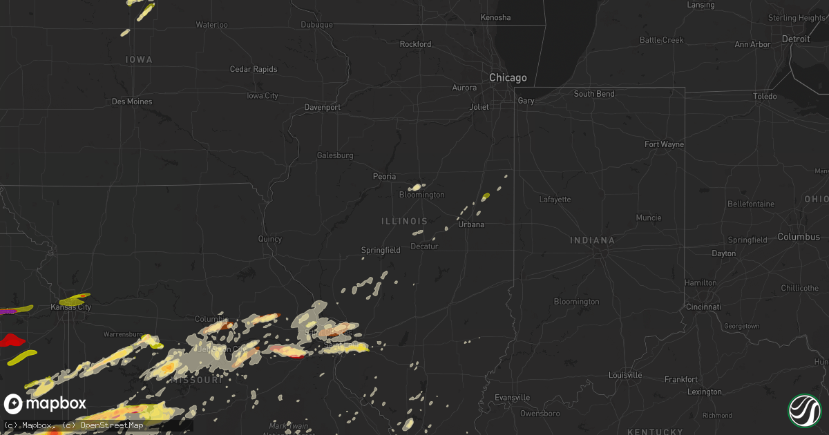
Hail Map in Illinois on May 31, 2013
Get this storm
May 31 map
$229
one time, instant access
Download today. No call, no setup
Keep the $229
Bought the map and want the full workflow? Apply the entire $229 to a subscription within 7 days. None of it is wasted.
Every map, not just this one
This buys you this map. Subscription and you get every map we run, in the markets you choose from a few cities to whole states to nationwide. Plus real-time alerts the moment a storm fires.
Contact data
Name, contact info, occupancy, even credit band for addresses in the footprint. You go from where it hit to who to call.
Become the source they trust
Unlimited branding weather history reports on demand. You already have the documented answer ready for the property owner, and you are the one who showed up with it.
Property data and RoofTrace estimates
Pull up any address you have got, its value and the exact code rules for that jurisdiction, straight from One Click Code. Then RoofTrace estimates the squares, pitch, and roof value, priced the way you price.
Storm reports in Illinois
Illinois
| Date | Description |
|---|---|
| 05/31/20135:32 PM CDT | Reports of pine trees uprooted and downed power lines. |
| 05/31/20135:29 PM CDT | Numerous trees being reported down. A semi was reported flipped over. |
| 05/31/20134:00 PM CDT | 6-9 inch tree limbs down at queenwood and main street |
| 05/31/20133:00 AM CDT | Late report...wind damage observered just norh of town. Several trees down and one pole barn damaged. |
| 05/31/20131:55 AM CDT | Late report...wind damage observed just north of town. Several trees down and one pole barn damaged. Time adjusted for radar review. |
| 05/31/20131:30 AM CDT | Winds gusted to 60 mph from carterville across southwest williamson county...resulting in downed limbs and power outages. |
| 05/31/20131:15 AM CDT | Shingles blown off roofs. 3-6 inch diameter limbs blown out of trees at north end of town near herrin road. |
| 05/30/201311:27 PM CDT | At airport |
| 05/30/201311:20 PM CDT | Numerous power lines donw around city. |
| 05/30/201311:20 PM CDT | Tree blown down in hoopeston |
| 05/30/201311:08 PM CDT | Measured with hand held anemometer |
| 05/30/201311:00 PM CDT | A local report indicates 1.00 inch wind near RANKIN |
| 05/30/201310:35 PM CDT | Large branch blocking traffic on springfield ave. Relayed via wcia twitter feed |
| 05/30/201310:29 PM CDT | 5 foot diameter tree down causing power lines down at randle and 1000 block |
| 05/30/201310:25 PM CDT | 2 foot diameter tree through the roof of a house at grand ave and 1000 block |
| 05/30/201310:18 PM CDT | A local report indicates 60 MPH wind near 2 NE CISCO |
| 05/30/201310:15 PM CDT | A local report indicates 58 MPH wind near 1 S OAKLEY |
| 05/30/201310:10 PM CDT | Damage to three houses. Numerous powerlines and two power poles blown down |
| 05/30/201310:03 PM CDT | A local report indicates 58 MPH wind near DECATUR |
| 05/30/201310:03 PM CDT | A local report indicates 60 MPH wind near BETHANY |
| 05/30/201310:00 PM CDT | Numerous large tree limbs down. Estimated 70 mph wind speed. |
| 05/30/20139:55 PM CDT | Window blown out of a house. |
| 05/30/20139:37 PM CDT | Large trees and power lines blown down...tops of trees snaped off |
| 05/30/20139:30 PM CDT | Tree limb blown down 1 mile north of vandalia on route 51 |
| 05/30/20139:25 PM CDT | A local report indicates 1.00 inch wind near O'FALLON |
| 05/30/20139:16 PM CDT | A local report indicates 1.00 inch wind near O'FALLON |
| 05/30/20139:15 PM CDT | Tree uprooted and blocking the caller in her house. She was okay with friends arriving to help remove the tree. |
| 05/30/20139:15 PM CDT | A machine shed was destroyed near taylorville. |
| 05/30/20139:07 PM CDT | A local report indicates 70 MPH wind near KINCAID |
| 05/30/20139:07 PM CDT | A tree was blown onto a house in jeiseyville just southeast of kincaid. |
| 05/30/20139:07 PM CDT | A tree was blown onto a trailer. |
| 05/30/20139:05 PM CDT | Power poles snapped |
| 05/30/20139:04 PM CDT | Montgomery county sheriff reported three tractor trailers blown over on interstate 55 - there is structural damage over this area. |
| 05/30/20139:00 PM CDT | A large tree limb was blown down onto a vehicle. |
| 05/30/20138:50 PM CDT | Roof of gymnasium blown off...25-30 homes had roofs blown off |
| 05/30/20138:50 PM CDT | Two tractor trailers were blown on their side on interstate 55. |
| 05/30/20138:50 PM CDT | Power lines blown down along with a window blown out |
| 05/30/20138:50 PM CDT | Reports of trees and fences down in alhambra. Time estimated from radar. |
| 05/30/20138:44 PM CDT | Tornado touchdown in hardford. Building was destroyed along highway 3. |
| 05/30/20138:40 PM CDT | One home was severely damaged 1.5 miles northwest of edwardsville. Several trees are down in the area. |
| 05/30/20138:38 PM CDT | A local report indicates 58 MPH wind near 1 NNW BETHALTO |
| 05/30/20138:36 PM CDT | Tornado observed west of new poag road off of 255...just e of siue...found trees snapped and uprooted along new poag road...big old trees several feet in diameter...one |
| 05/30/20138:33 PM CDT | Tornado on the ground in the wood river area. |
All States Impacted by Hail Map on May 31, 2013
Cities Impacted by Hail Map on May 31, 2013
- Marshfield, MO
- Webster City, IA
- Blairsburg, IA
- Jewell, IA
- Stanhope, IA
- Kamrar, IA
- Fredericktown, MO
- Goreville, IL
- Kellogg, MN
- Plainview, MN
- Arcola, MO
- Dadeville, MO
- Greenfield, MO
- Cole Camp, MO
- Glenwood City, WI
- Minco, OK
- Longton, KS
- Elk Falls, KS
- Sedan, KS
- Shidler, OK
- Cedar Vale, KS
- Moline, KS
- Saint Paul, MN
- Springfield, MO
- Morrisville, MO
- Willard, MO
- Holdenville, OK
- Seymour, IL
- Mahomet, IL
- Stigler, OK
- Wewoka, OK
- Carney, OK
- Circle Pines, MN
- Bloomer, WI
- Cornell, WI
- Humansville, MO
- Montgomery City, MO
- New Haven, MO
- Washington, MO
- Labadie, MO
- Whitehall, WI
- Konawa, OK
- Sasakwa, OK
- Newalla, OK
- Purcell, OK
- Washington, OK
- Bethany, OK
- Norman, OK
- Wanette, OK
- Blanchard, OK
- Hinton, OK
- Okarche, OK
- Mcloud, OK
- Meeker, OK
- Tuttle, OK
- Prague, OK
- El Reno, OK
- Boley, OK
- Mustang, OK
- Union City, OK
- Macomb, OK
- Noble, OK
- Wheatland, OK
- Yukon, OK
- Asher, OK
- Maud, OK
- Lexington, OK
- Shawnee, OK
- Byars, OK
- Spencer, OK
- Tecumseh, OK
- Harrah, OK
- Okemah, OK
- Oklahoma City, OK
- Newcastle, OK
- Lookeba, OK
- Choctaw, OK
- Calumet, OK
- Geary, OK
- Paden, OK
- Ralston, OK
- Altura, MN
- Chelsea, OK
- Stewartville, MN
- Chatfield, MN
- Rochester, MN
- Eyota, MN
- Jefferson City, MO
- Faxon, OK
- Lawton, OK
- Edwards, MO
- Versailles, MO
- Stover, MO
- Warsaw, MO
- Lincoln, MO
- Saint Louis, MO
- Hampton, KY
- Northwood, IA
- Kensett, IA
- Joice, IA
- Kevil, KY
- Geronimo, OK
- Grove, OK
- South West City, MO
- Wyandotte, OK
- Anderson, MO
- Barnett, MO
- Gravois Mills, MO
- Elgin, MN
- Wentzville, MO
- O'Fallon, MO
- Colfax, WI
- Lebanon, MO
- Wheaton, MO
- Goodman, MO
- Rocky Comfort, MO
- Exeter, MO
- Purdy, MO
- Stella, MO
- Fairview, MO
- Cassville, MO
- Butterfield, MO
- Adrian, MO
- Bison, OK
- Eufaula, OK
- Mcalester, OK
- Hanna, OK
- Quinton, OK
- Lamar, OK
- Indianola, OK
- Dustin, OK
- Henryetta, OK
- Weleetka, OK
- Canadian, OK
- Atwood, OK
- Crowder, OK
- Stuart, OK
- Calvin, OK
- Meta, MO
- Baldwin, WI
- Beldenville, WI
- River Falls, WI
- Woodville, WI
- Spring Valley, WI
- Humbird, WI
- Gillespie, IL
- Carlinville, IL
- Wheatland, MO
- Walnut, KS
- Farlington, KS
- Stockton, MO
- Thayer, KS
- Jerico Springs, MO
- Collins, MO
- Mulberry, KS
- Weaubleau, MO
- Girard, KS
- Lamar, MO
- Cherryvale, KS
- Arcadia, KS
- McCune, KS
- Milo, MO
- Parsons, KS
- Liberal, MO
- Dennis, KS
- Saint Paul, KS
- El Dorado Springs, MO
- Flemington, MO
- Pittsburg, KS
- Erie, KS
- Sheldon, MO
- Arma, KS
- Galesburg, KS
- Franklin, KS
- Mindenmines, MO
- Bronaugh, MO
- Poplar, WI
- Solon Springs, WI
- Lake Nebagamon, WI
- Gordon, WI
- Minong, WI
- Barronett, WI
- Brule, WI
- Elk City, KS
- Richview, IL
- Woodlawn, IL
- Ashley, IL
- Nelson, WI
- Wabasha, MN
- Lake City, MN
- Reads Landing, MN
- Walnut Shade, MO
- Ponca City, OK
- Marland, OK
- Clear Lake, WI
- Marlow, OK
- Rush Springs, OK
- Oakland, KY
- Holts Summit, MO
- Lohman, MO
- Russellville, MO
- Normal, IL
- Bloomington, IL
- Saint Charles, MO
- Windsor, MO
- Green Ridge, MO
- Minnesota City, MN
- Rollingstone, MN
- Walters, OK
- Stillwater, OK
- Cushing, OK
- Ripley, OK
- Perkins, OK
- Vinita, OK
- Hunter, OK
- Garber, OK
- Billings, OK
- Tonkawa, OK
- Moscow Mills, MO
- Troy, MO
- Winfield, MO
- Butler, MO
- Bolivar, MO
- Earlsboro, OK
- Hydro, OK
- Pocasset, OK
- Anadarko, OK
- Jones, OK
- Binger, OK
- Dover, MN
- California, MO
- Hettick, IL
- Palmyra, IL
- Girard, IL
- Chesterfield, IL
- Greenfield, IL
- Morrison, MO
- Chilhowee, MO
- Calhoun, MO
- Clinton, MO
- Blairstown, MO
- Leeton, MO
- Urich, MO
- Elmwood, WI
- Frederic, WI
- Grantsburg, WI
- Florence, WI
- Crystal Falls, MI
- Rogersville, MO
- Fordland, MO
- Seymour, MO
- Nowata, OK
- Talala, OK
- Plymouth, IA
- Mason City, IA
- Rock Falls, IA
- Nora Springs, IA
- Clayton, WI
- Dover, OK
- Kingfisher, OK
- Marshall, OK
- Loyal, OK
- Omega, OK
- Crescent, OK
- Watonga, OK
- Hennessey, OK
- Waukomis, OK
- Douglas, OK
- Greenfield, OK
- Billings, MO
- Mondovi, WI
- Thomasboro, IL
- Gifford, IL
- Rantoul, IL
- Urbana, IL
- Ballwin, MO
- Wildwood, MO
- Chesterfield, MO
- Fortuna, MO
- Dewey, IL
- Fisher, IL
- Eads, TN
- Dixon, MO
- Newburg, MO
- Fall Creek, WI
- Augusta, WI
- Shell Lake, WI
- Sarona, WI
- Duncan, OK
- Centerville, KS
- Rhinelander, WI
- Fletcher, OK
- Michigamme, MI
- Champion, MI
- Republic, MI
- Ashland, MO
- Columbia, MO
- Windyville, MO
- Urbana, MO
- Louisburg, MO
- Buffalo, MO
- Hermitage, MO
- Tunas, MO
- Eldridge, MO
- Havana, KS
- Dewey, OK
- Altamont, KS
- Long Lane, MO
- Everton, MO
- Edna, KS
- Fair Play, MO
- Polk, MO
- Newkirk, OK
- Moundville, MO
- Neodesha, KS
- Aurora, MO
- Caney, KS
- S Coffeyville, OK
- Tyro, KS
- Maple City, KS
- Mound Valley, KS
- Columbus, KS
- Wann, OK
- Coffeyville, KS
- Mount Vernon, MO
- Welch, OK
- Delaware, OK
- Independence, KS
- Brookline, MO
- Walnut Grove, MO
- Preston, MO
- Bartlett, KS
- Pittsburg, MO
- Half Way, MO
- Pawhuska, OK
- Frontenac, KS
- Ash Grove, MO
- Brighton, MO
- Osceola, MO
- Kaw City, OK
- Strafford, MO
- Dunnegan, MO
- Oswego, KS
- Peru, KS
- Pleasant Hope, MO
- Lenapah, OK
- Republic, MO
- Dexter, KS
- Lockwood, MO
- Altoona, KS
- Chautauqua, KS
- Fredonia, KS
- Marionville, MO
- Copan, OK
- Bois D Arc, MO
- Niotaze, KS
- Miller, MO
- Aldrich, MO
- Burbank, OK
- Dearing, KS
- Chetopa, KS
- Benedict, KS
- Scammon, KS
- Weir, KS
- Cherokee, KS
- Nevada, MO
- La Center, KY
- Wickliffe, KY
- Jamestown, MO
- Golconda, IL
- Muldrow, OK
- Hawk Point, MO
- Warrenton, MO
- Ludlow, IL
- Roland, OK
- Ogema, WI
- Westboro, WI
- Withee, WI
- Medford, WI
- Seminole, OK
- Linn, MO
- Loose Creek, MO
- Gerald, MO
- Osage, IA
- Saint Ansgar, IA
- Manly, IA
- Grafton, IA
- Scott City, MO
- Benton, MO
- Menomonie, WI
- Elk Mound, WI
- Verona, MO
- Eau Claire, WI
- Milford, IL
- Lesterville, MO
- Ironton, MO
- Golden City, MO
- Salem, MO
- Coyle, OK
- Conway, MO
- Potosi, MO
- Eleva, WI
- Oologah, OK
- Hugo, MN
- Olean, MO
- Eldon, MO
- Eugene, MO
- Agra, OK
- Chandler, OK
- Stroud, OK
- Tryon, OK
- Pulaski, IL
- Cunningham, KY
- Paducah, KY
- Boaz, KY
- Melber, KY
- Hickory, KY
- West Frankfort, IL
- Durand, WI
- Osseo, WI
- Fairfax, OK
- Pawnee, OK
- Clarion, IA
- Rowan, IA
- Belmond, IA
- Millville, MN
- Alden, IA
- Dows, IA
- Arcadia, WI
- Independence, WI
- Morrisonville, IL
- Piedmont, OK
- Hampton, IA
- Wood River, IL
- East Alton, IL
- Hartford, IL
- Roxana, IL
- Alton, IL
- O'Fallon, IL
- Fairview Heights, IL
- Marthasville, MO
- Florissant, MO
- Jim Falls, WI
- Hartsburg, MO
- New Bloomfield, MO
- Hermann, MO
- Bland, MO
- Owensville, MO
- Fountain City, WI
- Strum, WI
- Perry, OK
- Checotah, OK
- Brinktown, MO
- Sedalia, MO
- Rochester, IN
- Kewanna, IN
- Pana, IL
- Tripoli, WI
- Merrill, WI
- Tomahawk, WI
- Ava, MO
- Steelville, MO
- Nilwood, IL
- Raymond, IL
- Waggoner, IL
- Litchfield, IL
- Sikeston, MO
- Wetumka, OK
- Ramona, OK
- Chattanooga, OK
- Cache, OK
- Kincaid, KS
- Carbondale, IL
- Makanda, IL
- Porum, OK
- North Branch, MN
- Stacy, MN
- Wheeler, WI
- Knapp, WI
- Downing, WI
- Wilson, WI
- Boyceville, WI
- New Florence, MO
- Bellflower, MO
- High Hill, MO
- Spooner, WI
- Chamois, MO
- Alexander, IA
- Sheffield, IA
- Latimer, IA
- Holcombe, WI
- Chippewa Falls, WI
- Bartlesville, OK
- Havana, AR
- Big Cabin, OK
- Bonnots Mill, MO
- Westphalia, MO
- Freeburg, MO
- La Monte, MO
- Ellis Grove, IL
- Cairo, IL
- Tamms, IL
- Marissa, IL
- Sparta, IL
- Hardin, IL
- Galena, MO
- Crane, MO
- La Harpe, KS
- Williamsburg, MO
- Blue Mound, KS
- Bronson, KS
- Moran, KS
- Mound City, KS
- Sallisaw, OK
- Blair, WI
- Hixton, WI
- Alma Center, WI
- Sayner, WI
- Bruce, WI
- Chetek, WI
- Weyerhaeuser, WI
- Britt, IA
- Arkansaw, WI
- Olive Branch, IL
- Thebes, IL
- Miller City, IL
- Noel, MO
- Climax Springs, MO
- Taopi, MN
- Le Roy, MN
- Kinta, OK
- Guthrie, OK
- Ironwood, MI
- Hurley, WI
- Villa Ridge, IL
- Maple, WI
- Steeleville, IL
- Chester, IL
- Walsh, IL
- Rocky Mount, MO
- Latham, MO
- Argenta, IL
- Oreana, IL
- Vienna, MO
- Wakefield, MI
- Fulton, MO
- Meservey, IA
- Chapin, IA
- Fertile, IA
- Clear Lake, IA
- East Saint Louis, IL
- Ozark, MO
- Highlandville, MO
- Ponce De Leon, MO
- Spokane, MO
- Carlock, IL
- Hudson, IL
- Danvers, IL
- Stoutland, MO
- Richland, MO
- Smithton, MO
- Hartshorne, OK
- Blanco, OK
- Yale, OK
- Olney, IL
- Grovespring, MO
- Niangua, MO
- Hartville, MO
- Wyoming, MN
- Drumright, OK
- Thornton, IA
- Ashland, WI
- Mora, MO
- Barnsdall, OK
- Centertown, MO
- Bunker, MO
- Black, MO
- Alma, WI
- Adams, MN
- Carpenter, IA
- Hanlontown, IA
- Stacyville, IA
- Fairchild, WI
- Rhineland, MO
- Charleston, MO
- Thomas, OK
- Lake Ozark, MO
- Old Monroe, MO
- Galatia, IL
- Rosebud, MO
- Villa Ridge, MO
- Augusta, MO
- Leslie, MO
- Saint Mary, MO
- Perryville, MO
- Maramec, OK
- Orlando, OK
- Glencoe, OK
- Fenton, MO
- Valley Park, MO
- Cochrane, WI
- Sarcoxie, MO
- Trego, WI
- Saint Thomas, MO
- Lebanon, IL
- Temple, OK
- Pomona, IL
- Mountainburg, AR
- Cushing, WI
- Saint Croix Falls, WI
- Danbury, WI
- Popejoy, IA
- Montrose, MO
- Foster, MO
- La Cygne, KS
- Amsterdam, MO
- Amoret, MO
- Mapleton, KS
- Knob Noster, MO
- Pleasanton, KS
- Colony, KS
- Welda, KS
- Ramsay, MI
- Bessemer, MI
- Thompsonville, IL
- Grand Portage, MN
- Marquand, MO
- Lake Saint Louis, MO
- Defiance, MO
- Vienna, IL
- Centerville, MO
- Redford, MO
- Sparta, MO
- Muskogee, OK
- Braggs, OK
- Red Rock, OK
- Luther, OK
- Ada, OK
- Amber, OK
- Wellston, OK
- Cashion, OK
- Edmond, OK
- Castle, OK
- Sparks, OK
- Warrensburg, IL
- Latham, IL
- Maroa, IL
- Maryland Heights, MO
- Oran, MO
- Eureka, MO
- Ochelata, OK
- Florence, MO
- Paxton, IL
- Rankin, IL
- Elkland, MO
- Cedarville, AR
- Natural Dam, AR
- Chester, AR
- Rudy, AR
- Wynona, OK
- Hoopeston, IL
- Wellington, IL
- Superior, WI
- Sheldon, WI
- Mansfield, MO
- Taylor, WI
- Baxter Springs, KS
- Fair Grove, MO
- Noble, IL
- Cape Girardeau, MO
- Hazelwood, MO
- Wister, OK
- Beaver, OK
- Covington, OK
- Center City, MN
- De Soto, IL
- Murphysboro, IL
- Tebbetts, MO
- Mokane, MO
- Winamac, IN
- West Paducah, KY
- Bruner, MO
- Galena, KS
- Turtle Lake, WI
- Norwood, MO
- Drury, MO
- Saint James, MO
- Skiatook, OK
- Belleville, IL
- Foristell, MO
- Oark, AR
- Germantown, IL
- Aviston, IL
- Trenton, IL
- Hallsville, MO
- Minneapolis, MN
- Mulkeytown, IL
- Royalton, IL
- West Alton, MO
- Cobden, IL
- Ontonagon, MI
- Hitchcock, OK
- Cross Timbers, MO
- Deer Park, WI
- Webster, WI
- Farmington, MO
- Claremore, OK
- Benton, IL
- Rolla, MO
- Breese, IL
- Gracemont, OK
- Belleview, MO
- Saint Elizabeth, MO
- Prentice, WI
- Cadott, WI
- Deer, AR
- Ponca, AR
- Quincy, MO
- Williams, IA
- Henley, MO
- Dexter, KY
- Rockbridge, IL
- Marion, KY
- Bardwell, KY
- Crocker, MO
- Christopher, IL
- Winslow, AR
- Eau Galle, WI
- Charleston, AR
- Lanagan, MO
- Highland, IL
- Greenville, MO
- Van Buren, AR
- Blackwell, OK
- Fairmont, OK
- Fort Smith, AR
- Pocola, OK
- Hackett, AR
- Lavaca, AR
- Spiro, OK
- Arkoma, OK
- Greenwood, AR
- Barling, AR
- Glenville, MN
- Lyle, MN
- Steedman, MO
- Jonesburg, MO
- Portland, MO
- Truxton, MO
- Martinsburg, MO
- Auxvasse, MO
- Kingdom City, MO
- Andover, MN
- Forest Lake, MN
- Alto Pass, IL
- South Roxana, IL
- Bridgeton, MO
- Golden Eagle, IL
- Portage Des Sioux, MO
- Afton, OK
- Jerseyville, IL
- Mount Sterling, MO
- Tipton, MO
- Prairie Home, MO
- Bunceton, MO
- Argyle, MO
- Koeltztown, MO
- Clarksburg, MO
- Des Arc, MO
- Annapolis, MO
- Mulhall, OK
- Logansport, IN
- Glenallen, MO
- New Auburn, WI
- Swaledale, IA
- Utica, MN
- Wykoff, MN
- Metropolis, IL
- Brookport, IL
- Mercer, WI
- Meridian, OK
- Boyd, WI
- Collinsville, OK
- Chanute, KS
- Laquey, MO
- Wolf Lake, IL
- Jonesboro, IL
- Dupo, IL
- High Ridge, MO
- Caseyville, IL
- Collinsville, IL
- Granite City, IL
- East Carondelet, IL
- Whitefield, OK
- Hepler, KS
- Keota, OK
- Elizabethtown, IL
- Bloomfield, MO
- Thorp, WI
- Lublin, WI
- Sainte Genevieve, MO
- Iola, KS
- Puxico, MO
- Bixby, MO
- Riverton, KS
- Jackson, MO
- Nixa, MO
- Oldfield, MO
- Clever, MO
- Lucerne, IN
- Royal Center, IN
- Hazelhurst, WI
- Batchtown, IL
- Wayne, OK
- Maysville, OK
- Gilbertsville, KY
- Springbrook, WI
- Warner, OK
- Racine, MN
- Grand Meadow, MN
- New Berlin, IL
- Red Oak, OK
- Pacific, MO
- Mountain Grove, MO
- Falcon, MO
- Phillips, WI
- Cumberland, WI
- Joplin, MO
- Seneca, MO
- Jasper, MO
- Belle, MO
- Ava, IL
- Campbell Hill, IL
- Carl Junction, MO
- Webb City, MO
- Hillsboro, MO
- Monticello, IL
- De Land, IL
- Herrin, IL
- Syracuse, MO
- Lindstrom, MN
- Chisago City, MN
- Foley, MO
- Berger, MO
- Elsberry, MO
- Edwardsville, IL
- Saint Peters, MO
- Union, MO
- Brussels, IL
- Saint Ann, MO
- Wright City, MO
- Bethalto, IL
- Gray Summit, MO
- Madison, IL
- Earth City, MO
- Fieldon, IL
- Cottage Hills, IL
- Godfrey, IL
- Rudd, IA
- Floyd, IA
- Rockford, IA
- Charles City, IA
- Pawnee, IL
- Farmersville, IL
- Virden, IL
- Star City, IN
- Rose Creek, MN
- Brownsdale, MN
- Austin, MN
- Monticello, IN
- Francesville, IN
- Monon, IN
- Ozone, AR
- Bluejacket, OK
- Glen Carbon, IL
- Maryville, IL
- Gilman, WI
- Clay City, IL
- Saint Charles, MN
- Creal Springs, IL
- Altoona, WI
- Princeton, KS
- Ottawa, KS
- Rantoul, KS
- Waverly, KS
- Williamsburg, KS
- Scranton, KS
- Vassar, KS
- Osage City, KS
- Lyndon, KS
- Overbrook, KS
- Pomona, KS
- Quenemo, KS
- Weatherford, OK
- Scott Air Force Base, IL
- Lecompton, KS
- Oskaloosa, KS
- Tonganoxie, KS
- Grantville, KS
- Maple Hill, KS
- McLouth, KS
- Lawrence, KS
- Tecumseh, KS
- Perry, KS
- Topeka, KS
- Garnett, KS
- Liberty, MO
- Kansas City, MO
- Missouri City, MO
- Excelsior Springs, MO
- Independence, MO
- Kansas City, KS
- Riverside, MO
- Woodbine, KS
- Junction City, KS
- Alma, KS
- Alta Vista, KS
- Dwight, KS
- White City, KS
- Council Grove, KS
- Herington, KS
- Wilsey, KS
- Lincolnville, KS
- Lost Springs, KS
- Burdick, KS
- Lake Tomahawk, WI
- Woodruff, WI
- Minocqua, WI


