Hail Map in Tennessee on May 31, 2012
Get this storm
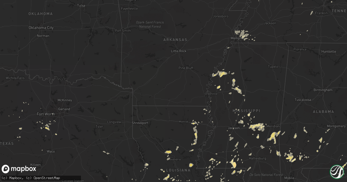
May 31 map
$229
one time, instant access
Download today. No call, no setup
Keep the $229
Bought the map and want the full workflow? Apply the entire $229 to a subscription within 7 days. None of it is wasted.
Every map, not just this one
This buys you this map. Subscription and you get every map we run, in the markets you choose from a few cities to whole states to nationwide. Plus real-time alerts the moment a storm fires.
Contact data
Name, contact info, occupancy, even credit band for addresses in the footprint. You go from where it hit to who to call.
Become the source they trust
Unlimited branding weather history reports on demand. You already have the documented answer ready for the property owner, and you are the one who showed up with it.
Property data and RoofTrace estimates
Pull up any address you have got, its value and the exact code rules for that jurisdiction, straight from One Click Code. Then RoofTrace estimates the squares, pitch, and roof value, priced the way you price.
Storm reports in Tennessee
Tennessee
| Date | Description |
|---|---|
| 05/31/20123:30 PM CDT | An 8 by 10 shed was blown 30 yards near intersection of walker parkway and edith. |
| 05/31/20123:15 PM CDT | Several trees...6 to 8 inches in diameter down in shelby forest area...walsh road...woodstock cuba road and garnet road. |
| 05/31/20123:00 PM CDT | A few small trees blown over near hwy 14 east of millington. |
| 05/31/20122:48 PM CDT | *** 1 inj *** tree fell on mobile home located on raleigh millington road. 1 minor injury...knot on head. |
| 05/30/20129:10 PM CDT | Some trees blown down throughout county. |
| 05/30/20129:02 PM CDT | Trees down 8 ne of lebanon. |
| 05/30/20128:50 PM CDT | Several trees blown down on north russell street in portland |
| 05/30/20128:47 PM CDT | Multiple trees down in the gallatin area. Power lines down as well with power loss in the city. |
| 05/30/20128:35 PM CDT | Emgr mgr reports tree down across road at 2938 benders ferry rd. |
| 05/30/20128:24 PM CDT | Tree fell on 4 cars at 860 murfreesboro pike. Report by metro nashville oem. |
| 05/30/20128:24 PM CDT | Tree fell on 4 cars at 860 murfreesboro pike. Report by metro nashville oem. |
| 05/30/20128:20 PM CDT | Numerous trees blown down just west of nashville airport including on radford drive...catina drive...and drummond drive |
| 05/30/20128:15 PM CDT | Multiple trees and power lines down in metro nashville. Reported by nashville oem. |
| 05/30/20128:15 PM CDT | Tree fell on 4 cars at 860 murfreesboro pike in hermitage. Report from metro oem. |
| 05/30/20127:05 PM CDT | Dispatch and media reported several trees down across the county. |
All States Impacted by Hail Map on May 31, 2012
Cities Impacted by Hail Map on May 31, 2012
- Defuniak Springs, FL
- Oakdale, LA
- Oberlin, LA
- Mitchell, GA
- Boncarbo, CO
- Weston, CO
- Trinidad, CO
- Sontag, MS
- Monticello, MS
- Dahlonega, GA
- Delhi, LA
- Frisco City, AL
- Chatom, AL
- Sour Lake, TX
- Waynesboro, TN
- Troy, TN
- Obion, TN
- Brunswick, GA
- Hortense, GA
- Carthage, MS
- Elba, AL
- Green Cove Springs, FL
- Live Oak, FL
- Sicily Island, LA
- Milford, TX
- Mccomb, MS
- Jayess, MS
- Tylertown, MS
- Winnsboro, LA
- Gilbert, LA
- Sweet Water, AL
- Dixons Mills, AL
- Trementina, NM
- Clarkton, MO
- Gideon, MO
- Mount Juliet, TN
- Wellborn, FL
- McAlpin, FL
- Lake City, FL
- Horse Branch, KY
- Caneyville, KY
- Gibson, MO
- Campbell, MO
- Piggott, AR
- Portageville, MO
- Holcomb, MO
- Saint Francis, AR
- Lawrence, MS
- Conehatta, MS
- Hickory, MS
- Pulaski, MS
- Forest, MS
- Lake, MS
- Morton, MS
- Newton, MS
- Decatur, MS
- Lowndesboro, AL
- Hayneville, AL
- San Antonio, TX
- Centreville, MS
- Cleburne, TX
- Keene, TX
- Barney, GA
- Adel, GA
- Cleveland, GA
- Alpine, TX
- Cedar Hill, TN
- Springfield, TN
- Cloutierville, LA
- Colfax, LA
- Dry Prong, LA
- Fredonia, KY
- Saint Martinville, LA
- Fort Davis, TX
- Owensboro, KY
- Stephensport, KY
- Hawesville, KY
- Union Star, KY
- Lewisport, KY
- Maceo, KY
- Rockport, IN
- Hardinsburg, KY
- Cannelton, IN
- Webster, KY
- Shelby, MS
- Fitzgerald, GA
- Chrisney, IN
- Richland, IN
- Terry, MS
- Talbotton, GA
- Ferriday, LA
- Jonesville, LA
- Forest Home, AL
- Pine Apple, AL
- Greenville, AL
- Minter, AL
- Alto, TX
- Wells, TX
- Pollok, TX
- Mayfield, KY
- Wagarville, AL
- Sunflower, AL
- McIntosh, AL
- White Oak, GA
- Woodbine, GA
- Belzoni, MS
- Tchula, MS
- East Prairie, MO
- Samson, AL
- Geneva, AL
- Coffee Springs, AL
- Ponce De Leon, FL
- Searcy, AR
- Lyles, TN
- Bon Aqua, TN
- Fairview, TN
- Meridian, MS
- Vossburg, MS
- Shubuta, MS
- Pachuta, MS
- Waynesboro, MS
- Heidelberg, MS
- Lisman, AL
- Butler, AL
- Quitman, MS
- Moscow, TN
- Lafayette, LA
- Scott, LA
- Cordova, TN
- Collierville, TN
- Germantown, TN
- Eads, TN
- Thomasville, GA
- Boston, GA
- Coolidge, GA
- Pavo, GA
- Liberty, MS
- Osyka, MS
- Savannah, GA
- Wagon Mound, NM
- Ocate, NM
- Rosenberg, TX
- Ekron, KY
- Fort Stewart, GA
- Springer, NM
- Black Oak, AR
- Leesville, LA
- Deridder, LA
- Marion, KY
- Clay, KY
- Groveland, FL
- Laurel, MS
- Twin City, GA
- Swainsboro, GA
- Gloster, MS
- Crosby, MS
- Rayville, LA
- Slaughter, LA
- Zachary, LA
- Ethel, LA
- Clinton, LA
- Beaver Dam, KY
- Cromwell, KY
- Morgantown, KY
- Pitkin, LA
- Raton, NM
- Earle, AR
- Anacoco, LA
- Grapeland, TX
- Center Point, TX
- Alvarado, TX
- Venus, TX
- Dawson Springs, KY
- Crofton, KY
- Saint Charles, KY
- Tibbie, AL
- Leroy, AL
- Saint Stephens, AL
- State Line, MS
- Fruitdale, AL
- Millry, AL
- Buckatunna, MS
- Garita, NM
- Orange, TX
- La Vernia, TX
- Ludowici, GA
- Atmore, AL
- Saint Hedwig, TX
- Adkins, TX
- Rose Hill, MS
- Princeton, KY
- Cerulean, KY
- Burkeville, TX
- Uriah, AL
- Bay City, TX
- Port Wentworth, GA
- Ellabell, GA
- Bloomingdale, GA
- Pooler, GA
- Wingo, KY
- Clinton, KY
- Tallahassee, FL
- Moultrie, GA
- Hammond, LA
- Springfield, LA
- Holden, LA
- Drakesboro, KY
- Browder, KY
- Belton, KY
- Saint Augustine, FL
- Trout, LA
- Ellisville, MS
- Norwood, LA
- Wilson, LA
- Williston, TN
- Jackson, LA
- Jbsa Randolph, TX
- Cibolo, TX
- Universal City, TX
- Schertz, TX
- Philipp, MS
- Charleston, MS
- West Columbia, TX
- Sweeny, TX
- Fairdale, KY
- Shaw, MS
- Canton, MS
- El Campo, TX
- Palm Coast, FL
- Hastings, FL
- Evergreen, AL
- Irvington, KY
- Brandenburg, KY
- Guston, KY
- Clayton, LA
- Baskin, LA
- Faunsdale, AL
- Linden, AL
- Milledgeville, GA
- Grandview, TX
- Opelousas, LA
- Quitman, GA
- Morven, GA
- Geneva, FL
- Mims, FL
- Turrell, AR
- Greenwood, MS
- Carrollton, MS
- Coila, MS
- Indianola, MS
- Lake Providence, LA
- McRae Helena, GA
- Minter City, MS
- Clarksdale, MS
- Duncan, MS
- Tutwiler, MS
- Camden, AL
- Fancy Farm, KY
- Jackson, AL
- Memphis, TN
- Jacksonville, FL
- Warrenton, GA
- Alamo, GA
- Deer Park, AL
- Hahira, GA
- Berlin, GA
- Fisherville, KY
- Godley, TX
- Buna, TX
- Boerne, TX
- Bergheim, TX
- Gunnison, MS
- Catherine, AL
- Jacksboro, TX
- Stockdale, TX
- Drew, MS
- Valdosta, GA
- Duson, LA
- Fred, TX
- De Leon Springs, FL
- Maxwell, NM
- Tickfaw, LA
- Independence, LA
- Albany, LA
- Bunnell, FL
- Hollandale, MS
- Greenville, MS
- Crawford, TX
- Valley Mills, TX
- Palo Pinto, TX
- Gordon, TX
- Kirbyville, TX
- Madison, MS
- Bay Springs, MS
- Louin, MS
- Fleming Island, FL
- Orange Park, FL
- Marksville, LA
- Moreauville, LA
- Augusta, AR
- Sumrall, MS
- Garyville, LA
- Quincy, FL
- Pollock, LA
- Graford, TX
- Naylor, GA
- Lexa, AR
- West Helena, AR
- Stephenville, TX
- Gainestown, AL
- Gilmore, AR
- Crawfordsville, AR
- Krotz Springs, LA
- Westlake, LA
- Taylorsville, KY
- Allenhurst, GA
- Tell City, IN
- Troy, IN
- Millington, TN
- Arlington, TN
- Mound Bayou, MS
- Snow Lake, AR
- Alligator, MS
- Boyle, MS
- Perrin, TX
- Lena, MS
- Brandon, MS
- Silver Creek, MS
- Erath, LA
- Thomaston, GA
- Fordoche, LA
- Damon, TX
- Franklinton, LA
- Frankfort, KY
- Mamou, LA
- Livingston, LA
- Eunice, LA
- Galveston, TX
- Heth, AR
- Widener, AR
- West, MS
- Richmond, TX
- Jackson, MS
- Thomasville, AL
- Strawn, TX
- Oak Grove, LA
- Sturgis, KY
- Providence, KY
- Dixon, KY
- Raleigh, MS
- Macclenny, FL
- La Place, LA
- Crystal Springs, MS
- Balmorhea, TX
- New Orleans, LA
- Middleburg, FL
- Ville Platte, LA
- Maurice, LA
- Youngsville, LA
- Rayne, LA
- Elizabeth, IN
- Laconia, IN
- Walnut Grove, MS
- Rolling Fork, MS
- Ray City, GA
- Chunky, MS
- Schlater, MS
- Maurepas, LA
- Howey In The Hills, FL
- Louisville, KY
- Devers, TX
- Summertown, TN
- Lawrenceburg, TN
- Ethridge, TN
- Pierson, FL
- Astor, FL
- Cedar Hill, TX
- Grosse Tete, LA
- Owenton, KY
- Waddy, KY
- Shelbyville, KY
- Hughes, AR
- Hornbeak, TN
- Osteen, FL
- Boyce, LA
- Marion, TX
- Seguin, TX
- Blowing Rock, NC
- Boone, NC
- Kountze, TX
- Kaplan, LA
- Vaiden, MS
- Needville, TX
- Mount Olive, MS
- Prentiss, MS
- Magee, MS
- Kinston, AL
- Sanderson, FL
- Blum, TX
- Westville, FL
- Venice, LA
- Newton, TX
- Eagle Lake, TX
- Meadville, MS
- Bude, MS
- Starke, FL
- Sparta, GA
- Eatonton, GA
- Paulina, LA
- Saint James, LA
- Convent, LA
- Church Point, LA
- Buras, LA
- Conchas Dam, NM
- Chipley, FL
- Saint Amant, LA
- Gonzales, LA
- Pleasant View, TN
- Bluffton, GA
- Ochlocknee, GA
- Angie, LA
- Philpot, KY
- Dry Creek, LA
- Simpsonville, KY
- Finchville, KY
- Smithdale, MS
- Sunset, LA
- Cloverport, KY
- Derby, IN
- Payneville, KY
- Rome, IN
- Battletown, KY
- Mauckport, IN
- Corydon, IN
- Rhodelia, KY
- Harned, KY
- Benton, MS
- Pickens, MS
- Call, TX
- Bainbridge, GA
- Hahnville, LA
- Baton Rouge, LA
- Port Barre, LA
- Washington, LA
- Azle, TX
- Wharton, TX
- Greensburg, LA
- Amite, LA
- Seminary, MS
- Cairo, GA
- Tallulah, LA
- Vine Grove, KY
- Rineyville, KY
- Custer, KY
- Belle Chasse, LA
- Dublin, TX
- Marked Tree, AR
- Tyronza, AR
- Dequincy, LA
- Kokomo, MS
- Foxworth, MS
- Altha, FL
- Longwood, FL
- Oak Vale, MS
- Vicksburg, MS
- Mount Hermon, LA
- White Castle, LA
- Columbia, MS
- Benoit, MS
- Cleveland, MS
- McKenzie, AL
- Georgiana, AL
- Newhebron, MS
- Sycamore, GA
- Chula, GA
- Pelahatchie, MS
- Robinsonville, MS
- Brookhaven, MS
- Livingston, TX
- Junction City, GA
- Loranger, LA
- Granbury, TX
- Sidon, MS
- Itta Bena, MS
- Uniontown, AL
- Junction, TX
- Port Allen, LA
- Ormond Beach, FL
- Radcliff, KY
- Lena, LA
- Bentley, LA
- North Carrollton, MS
- Winona, MS
- Vaughan, MS
- Midlothian, TX
- Erin, TN
- Pinola, MS
- O'Brien, FL
- Harrisonburg, LA
- Meigs, GA
- Lafitte, LA
- Metter, GA
- Rossville, TN
- Butler, GA
- Vance, MS
- Thibodaux, LA
- Nortonville, KY
- Grand Ridge, FL
- Marianna, FL
- Ruth, MS
- Lumberton, MS
- Poplarville, MS
- Atoka, TN
- Sulphur, LA
- La Grange, TX
- Waverly, AL
- Dauphin Island, AL
- Bulverde, TX
- Saint Johns, FL
- Ponte Vedra, FL
- Florence, MS
- Harrisville, MS
- Oakland, TN
- Summit, MS
- Waverly, GA
- Eudora, AR
- Converse, TX
- Blairsville, GA
- Murrayville, GA
- Arlington, TX
- Mount Washington, KY
- Shepherdsville, KY
- Flagler Beach, FL
- Chancellor, AL
- Elmer, LA
- Alexandria, LA
- Ragley, LA
- Raymond, MS
- Jachin, AL
- Hardeeville, SC
- Crowley, TX
- Crestwood, KY
- Joshua, TX
- Abbeville, LA
- Caddo, TX
- Falls Of Rough, KY
- Alberta, AL


