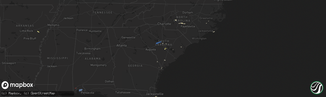
Hail Map in South Carolina on May 29, 2025
The weather event in South Carolina on May 29, 2025 includes Hail, Wind, and Tornado maps. 12 states and 280 cities were impacted and suffered possible damage. The total estimated number of properties impacted is 552.
Want more than just the map?
Turn this storm into a full workflow.
- Owner + property data so you know who to knock
- OnDemand branded weather history reports to win the "did we even have hail?" argument
- RoofTrace estimate so reps stop guessing numbers at the door
Bought this map? Upgrade within 7 days and we'll credit the $230. (10-15 min setup call)
Hail
Wind
Tornado
552
Estimated number of impacted properties by a 1.00" hail or larger0
Estimated number of impacted properties by a 1.75" hail or larger0
Estimated number of impacted properties by a 2.50" hail or largerStorm reports in South Carolina
South Carolina
| Date | Description |
|---|---|
| 05/29/20254:56 PM CDT | Sc highway patrol reported roadway flooding on summit parkway at ridge trail dr. |
| 05/29/20254:54 PM CDT | Kershaw county dispatch reported trees down on williams rd. Time estimated by radar. |
| 05/29/20254:45 PM CDT | Kershaw county dispatch reported trees downed on kirkover ln and brook drive. Time estimated by radar. |
| 05/29/20254:45 PM CDT | Kershaw county dispatch reported trees down on tickle hill rd at sc 34. Time estimated by radar. |
| 05/29/20254:08 PM CDT | Sc highway patrol reported a tree on the roadway on lost creek dr near broad river rd. Time estimated by radar. |
| 05/29/20254:07 PM CDT | Sc highway patrol reported a tree blocking the roadway on greystone blvd near i-126. Time estimated by radar. |
| 05/29/20254:04 PM CDT | Richland county dispatch reports thunderstorm wind damage near the intersection of south woodrow st and heyward st. Power lines were downed from strong winds. |
| 05/29/20253:28 PM CDT | Roof blown off dominion church along mciver rd. Emergency manager said damage was highly localized near the structure with only a single downed limb observed otherwise. |
| 05/29/20253:20 PM CDT | Trained spotter reported trees down near mile marker 42 mile marker on i-20. Estimated wind speeds to 60 mph near that location as well. |
| 05/29/20252:45 PM CDT | Em relayed a quarter sized hail report near grambling road and sleepy hollow road. |
| 05/29/202512:35 PM CDT | Emergency manager reported a power line down on the 100 block of blythe avenue off bacons road. |
All States Impacted by Hail Map on May 29, 2025
Cities Impacted by Hail Map on May 29, 2025
- Livingston, LA
- Lone Wolf, OK
- Mangum, OK
- Loveland, OK
- Walters, OK
- Chattanooga, OK
- Randlett, OK
- Grandfield, OK
- Blair, OK
- Temple, OK
- Devol, OK
- Byers, TX
- Petrolia, TX
- Ryan, OK
- Henrietta, TX
- Terral, OK
- Mobile, AL
- Semmes, AL
- Ringgold, TX
- Nocona, TX
- Daphne, AL
- Fairhope, AL
- Silverhill, AL
- Loxley, AL
- Robertsdale, AL
- Indiahoma, OK
- Comanche, OK
- Cache, OK
- Duncan, OK
- Faxon, OK
- Waurika, OK
- Yemassee, SC
- Inverness, FL
- Pineville, SC
- Hernando, FL
- Dunnellon, FL
- Savannah, GA
- Lake Panasoffkee, FL
- Georgetown, SC
- Nesmith, SC
- Hemingway, SC
- Hardeeville, SC
- Ocala, FL
- Jackson Springs, NC
- Newington, GA
- Capitan, NM
- Silver Springs, FL
- Orangeburg, SC
- Carthage, NC
- West End, NC
- Pinehurst, NC
- Gaston, SC
- Cloudcroft, NM
- Vass, NC
- Southern Pines, NC
- Eastover, SC
- Gadsden, SC
- Floral City, FL
- Elk City, OK
- Canute, OK
- Ridge Spring, SC
- Alachua, FL
- Cameron, SC
- Palatka, FL
- Bushnell, FL
- Lake Butler, FL
- Van Horn, TX
- Corona, NM
- Interlachen, FL
- Guyton, GA
- Cameron, NC
- Immokalee, FL
- Naples, FL
- Salt Flat, TX
- Batesburg, SC
- Leesville, SC
- Gilbert, SC
- Lexington, SC
- Labelle, FL
- Green Cove Springs, FL
- Foss, OK
- Webster, FL
- West Columbia, SC
- Ropesville, TX
- Levelland, TX
- Pecos, TX
- Saint Augustine, FL
- Cordell, OK
- Saint Johns, FL
- Meadow, TX
- Clarendon, AR
- Bessie, OK
- Groveland, FL
- Jacksonville, FL
- Lovington, NM
- Ponte Vedra, FL
- Saint Matthews, SC
- Citra, FL
- Reddick, FL
- Palm Coast, FL
- Roswell, NM
- Tatum, NM
- Brownfield, TX
- Springer, NM
- Carnegie, OK
- Holly Grove, AR
- Bartow, FL
- Deland, FL
- Cimarron, NM
- Gracemont, OK
- Fort Cobb, OK
- Miami, NM
- Carrizozo, NM
- Lake Helen, FL
- Elloree, SC
- Anadarko, OK
- Dover, NC
- Fort McCoy, FL
- Hawthorne, FL
- Verden, OK
- Chickasha, OK
- Barstow, TX
- Pyote, TX
- Lake Placid, FL
- Wagon Mound, NM
- Seagraves, TX
- Cement, OK
- Ninnekah, OK
- Davenport, FL
- Daytona Beach, FL
- New Smyrna Beach, FL
- Deltona, FL
- Welch, TX
- Mills, NM
- Lindsay, OK
- Alex, OK
- Blanchard, OK
- Troy, NC
- Star, NC
- Kissimmee, FL
- Coyanosa, TX
- Vanceboro, NC
- Osteen, FL
- Saint Cloud, FL
- Intercession City, FL
- Mcdonald, NM
- Lamesa, TX
- Bradley, OK
- Purcell, OK
- Merkel, TX
- Tye, TX
- Ackerly, TX
- Christmas, FL
- Abilene, TX
- Maysville, OK
- Seminole, TX
- Lenorah, TX
- Elmore City, OK
- Pauls Valley, OK
- Big Spring, TX
- Knott, TX
- Sulphur, OK
- Wynnewood, OK
- Stratford, OK
- Davis, OK
- Gail, TX
- Roff, OK
- Buffalo Gap, TX
- Hawley, TX
- Mill Creek, OK
- Colorado City, TX
- Tishomingo, OK
- Stanton, TX
- Kalispell, MT
- Essex, MT
- Tuscola, TX
- Albany, TX
- Stonewall, OK
- Coahoma, TX
- Milburn, OK
- Coleman, OK
- Wapanucka, OK
- Tupelo, OK
- Atoka, OK
- Kenefic, OK
- Wingate, TX
- Westbrook, TX
- Caddo, OK
- Midland, TX
- Ocate, NM
- Ovalo, TX
- Winters, TX
- Lawn, TX
- Goldsboro, TX
- Watrous, NM
- Garden City, TX
- Alpine, TX
- Sterling City, TX
- Talpa, TX
- Ballinger, TX
- Coleman, TX
- Novice, TX
- Augusta, MT
- Wolf Creek, MT
- Fort Shaw, MT
- Cascade, MT
- Simms, MT
- Sun River, MT
- Great Falls, MT
- Vaughn, MT
- Ulm, MT
- Fort Stockton, TX
- Bronte, TX
- Carlsbad, TX
- Robert Lee, TX
- Caney, OK
- Marathon, TX
- San Angelo, TX
- Goodfellow Afb, TX
- Mertzon, TX
- Christoval, TX
- Atlantic Beach, NC
- Rising Star, TX
- Brownwood, TX
- Burneyville, OK
- Vancourt, TX
- Eldorado, TX
- May, TX
- Eden, TX
- Menard, TX
- Sonora, TX
- Cross Plains, TX
- Burkett, TX
- Blanket, TX
- Early, TX
- Bangs, TX
- Santa Anna, TX
- Zephyr, TX
- Mullin, TX
- Rochelle, TX
- Brookesmith, TX
- Melvin, TX
- Brady, TX
- Fort McKavett, TX
- Junction, TX
- Paint Rock, TX
- Hext, TX
- London, TX
- Roosevelt, TX
- Goldthwaite, TX
- Richland Springs, TX
- Gainesville, TX
- Valley View, TX
- Arthur City, TX
- Sherman, TX
- Denison, TX
- Pottsboro, TX
- Paris, TX
- Sumner, TX
- Powderly, TX
- Bells, TX
- Comstock, TX
- Rocksprings, TX
- Del Rio, TX
- Barksdale, TX
- Camp Wood, TX
- Brackettville, TX
- Marble Falls, TX
- Kingsland, TX
- Quemado, TX
- Uvalde, TX
- Eagle Pass, TX
- Crystal City, TX
- Grapeland, TX
- Howe, TX
- Trent, TX
- Sweetwater, TX
- Sadler, TX
- Magnolia, KY
- Springfield, KY


