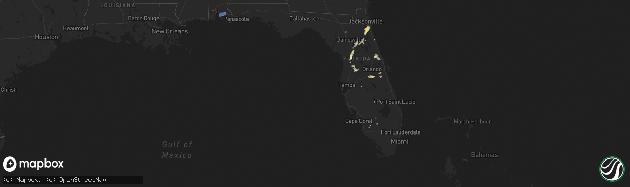
Hail Map in Florida on May 29, 2025
The weather event in Florida on May 29, 2025 includes Hail, Wind, and Tornado maps. 12 states and 280 cities were impacted and suffered possible damage. The total estimated number of properties impacted is 0.
Want more than just the map?
Turn this storm into a full workflow.
- Owner + property data so you know who to knock
- OnDemand branded weather history reports to win the "did we even have hail?" argument
- RoofTrace estimate so reps stop guessing numbers at the door
Bought this map? Upgrade within 7 days and we'll credit the $230. (10-15 min setup call)
Hail
Wind
Tornado
0
Estimated number of impacted properties by a 1.00" hail or larger0
Estimated number of impacted properties by a 1.75" hail or larger0
Estimated number of impacted properties by a 2.50" hail or largerStorm reports in Florida
Florida
| Date | Description |
|---|---|
| 05/29/20255:15 PM CDT | Highlands county em relayed reports and pictures of 2 damaged barns... Mainly consisting of peeled off metal roofing and/or siding. Time estimated from radar. |
| 05/29/20254:35 PM CDT | Weatherflow station near fort caroline reported a peak wind gust of 65 mph as thunderstorms moved across the area. |
| 05/29/20254:15 PM CDT | Public report of a large limb that fell down on a house producing a large hole in the roof. This was located along russell sampson road. |
| 05/29/20254:10 PM CDT | Action news jax relayed photos of structural damage to the loop restaurant in nocatee. Time of damage based on radar data. |
| 05/29/20254:10 PM CDT | Updated 5/30 5am et: action news jax relayed photos of structural damage to the loop restaurant in nocatee. Also a separate public report of a large maple tree downed i |
| 05/29/20253:58 PM CDT | St. Johns county sheriffs office relayed video footage of a tornado near the intersection of st. Johns parkway and state road 9-b. Nws jacksonville will conduct a storm |
| 05/29/20253:55 PM CDT | St. Johns county emergency management reports a tree downed along county road 16-a near the shearwater neighborhood. Time of event based on radar data. |
| 05/29/20253:50 PM CDT | Trained spotter reports numerous trees down in the vicinity of asbury lake. |
| 05/29/20253:45 PM CDT | Emergency manager relayed a report of a tree down across state road 13 just east of the shands bridge along the st. Johns river. Time of event based on radar data. |
| 05/29/20253:45 PM CDT | Emergency manager reports downed trees along walnut street in green cove springs. Time of event based on radar data. |
| 05/29/20253:30 PM CDT | Trained spotter reports powerlines down to the south of lake asbury. Time of event based on radar data. |
| 05/29/20252:45 PM CDT | *** 1 fatal *** marion county emergency management reports one fatality resulting from a snapped tree along southwest 46th avenue in ocala. |
| 05/29/20251:45 PM CDT | *** 1 fatal *** corrects previous tstm wnd dmg report from 2 ene ocala airport. Marion county emergency management reports one fatality resulting from a snapped tree al |
| 05/29/20258:07 AM CDT | Line down on a and n road. |
All States Impacted by Hail Map on May 29, 2025
Cities Impacted by Hail Map on May 29, 2025
- Livingston, LA
- Lone Wolf, OK
- Mangum, OK
- Loveland, OK
- Walters, OK
- Chattanooga, OK
- Randlett, OK
- Grandfield, OK
- Blair, OK
- Temple, OK
- Devol, OK
- Byers, TX
- Petrolia, TX
- Ryan, OK
- Henrietta, TX
- Terral, OK
- Mobile, AL
- Semmes, AL
- Ringgold, TX
- Nocona, TX
- Daphne, AL
- Fairhope, AL
- Silverhill, AL
- Loxley, AL
- Robertsdale, AL
- Indiahoma, OK
- Comanche, OK
- Cache, OK
- Duncan, OK
- Faxon, OK
- Waurika, OK
- Yemassee, SC
- Inverness, FL
- Pineville, SC
- Hernando, FL
- Dunnellon, FL
- Savannah, GA
- Lake Panasoffkee, FL
- Georgetown, SC
- Nesmith, SC
- Hemingway, SC
- Hardeeville, SC
- Ocala, FL
- Jackson Springs, NC
- Newington, GA
- Capitan, NM
- Silver Springs, FL
- Orangeburg, SC
- Carthage, NC
- West End, NC
- Pinehurst, NC
- Gaston, SC
- Cloudcroft, NM
- Vass, NC
- Southern Pines, NC
- Eastover, SC
- Gadsden, SC
- Floral City, FL
- Elk City, OK
- Canute, OK
- Ridge Spring, SC
- Alachua, FL
- Cameron, SC
- Palatka, FL
- Bushnell, FL
- Lake Butler, FL
- Van Horn, TX
- Corona, NM
- Interlachen, FL
- Guyton, GA
- Cameron, NC
- Immokalee, FL
- Naples, FL
- Salt Flat, TX
- Batesburg, SC
- Leesville, SC
- Gilbert, SC
- Lexington, SC
- Labelle, FL
- Green Cove Springs, FL
- Foss, OK
- Webster, FL
- West Columbia, SC
- Ropesville, TX
- Levelland, TX
- Pecos, TX
- Saint Augustine, FL
- Cordell, OK
- Saint Johns, FL
- Meadow, TX
- Clarendon, AR
- Bessie, OK
- Groveland, FL
- Jacksonville, FL
- Lovington, NM
- Ponte Vedra, FL
- Saint Matthews, SC
- Citra, FL
- Reddick, FL
- Palm Coast, FL
- Roswell, NM
- Tatum, NM
- Brownfield, TX
- Springer, NM
- Carnegie, OK
- Holly Grove, AR
- Bartow, FL
- Deland, FL
- Cimarron, NM
- Gracemont, OK
- Fort Cobb, OK
- Miami, NM
- Carrizozo, NM
- Lake Helen, FL
- Elloree, SC
- Anadarko, OK
- Dover, NC
- Fort McCoy, FL
- Hawthorne, FL
- Verden, OK
- Chickasha, OK
- Barstow, TX
- Pyote, TX
- Lake Placid, FL
- Wagon Mound, NM
- Seagraves, TX
- Cement, OK
- Ninnekah, OK
- Davenport, FL
- Daytona Beach, FL
- New Smyrna Beach, FL
- Deltona, FL
- Welch, TX
- Mills, NM
- Lindsay, OK
- Alex, OK
- Blanchard, OK
- Troy, NC
- Star, NC
- Kissimmee, FL
- Coyanosa, TX
- Vanceboro, NC
- Osteen, FL
- Saint Cloud, FL
- Intercession City, FL
- Mcdonald, NM
- Lamesa, TX
- Bradley, OK
- Purcell, OK
- Merkel, TX
- Tye, TX
- Ackerly, TX
- Christmas, FL
- Abilene, TX
- Maysville, OK
- Seminole, TX
- Lenorah, TX
- Elmore City, OK
- Pauls Valley, OK
- Big Spring, TX
- Knott, TX
- Sulphur, OK
- Wynnewood, OK
- Stratford, OK
- Davis, OK
- Gail, TX
- Roff, OK
- Buffalo Gap, TX
- Hawley, TX
- Mill Creek, OK
- Colorado City, TX
- Tishomingo, OK
- Stanton, TX
- Kalispell, MT
- Essex, MT
- Tuscola, TX
- Albany, TX
- Stonewall, OK
- Coahoma, TX
- Milburn, OK
- Coleman, OK
- Wapanucka, OK
- Tupelo, OK
- Atoka, OK
- Kenefic, OK
- Wingate, TX
- Westbrook, TX
- Caddo, OK
- Midland, TX
- Ocate, NM
- Ovalo, TX
- Winters, TX
- Lawn, TX
- Goldsboro, TX
- Watrous, NM
- Garden City, TX
- Alpine, TX
- Sterling City, TX
- Talpa, TX
- Ballinger, TX
- Coleman, TX
- Novice, TX
- Augusta, MT
- Wolf Creek, MT
- Fort Shaw, MT
- Cascade, MT
- Simms, MT
- Sun River, MT
- Great Falls, MT
- Vaughn, MT
- Ulm, MT
- Fort Stockton, TX
- Bronte, TX
- Carlsbad, TX
- Robert Lee, TX
- Caney, OK
- Marathon, TX
- San Angelo, TX
- Goodfellow Afb, TX
- Mertzon, TX
- Christoval, TX
- Atlantic Beach, NC
- Rising Star, TX
- Brownwood, TX
- Burneyville, OK
- Vancourt, TX
- Eldorado, TX
- May, TX
- Eden, TX
- Menard, TX
- Sonora, TX
- Cross Plains, TX
- Burkett, TX
- Blanket, TX
- Early, TX
- Bangs, TX
- Santa Anna, TX
- Zephyr, TX
- Mullin, TX
- Rochelle, TX
- Brookesmith, TX
- Melvin, TX
- Brady, TX
- Fort McKavett, TX
- Junction, TX
- Paint Rock, TX
- Hext, TX
- London, TX
- Roosevelt, TX
- Goldthwaite, TX
- Richland Springs, TX
- Gainesville, TX
- Valley View, TX
- Arthur City, TX
- Sherman, TX
- Denison, TX
- Pottsboro, TX
- Paris, TX
- Sumner, TX
- Powderly, TX
- Bells, TX
- Comstock, TX
- Rocksprings, TX
- Del Rio, TX
- Barksdale, TX
- Camp Wood, TX
- Brackettville, TX
- Marble Falls, TX
- Kingsland, TX
- Quemado, TX
- Uvalde, TX
- Eagle Pass, TX
- Crystal City, TX
- Grapeland, TX
- Howe, TX
- Trent, TX
- Sweetwater, TX
- Sadler, TX
- Magnolia, KY
- Springfield, KY


