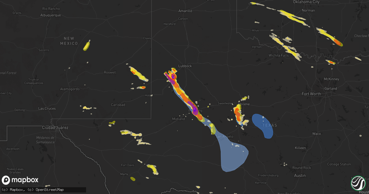
Hail Map on May 29, 2025
Get this storm
May 29 map
$229
one time, instant access
Download today. No call, no setup
Keep the $229
Bought the map and want the full workflow? Apply the entire $229 to a subscription within 7 days. None of it is wasted.
Every map, not just this one
This buys you this map. Subscription and you get every map we run, in the markets you choose from a few cities to whole states to nationwide. Plus real-time alerts the moment a storm fires.
Contact data
Name, contact info, occupancy, even credit band for addresses in the footprint. You go from where it hit to who to call.
Become the source they trust
Unlimited branding weather history reports on demand. You already have the documented answer ready for the property owner, and you are the one who showed up with it.
Property data and RoofTrace estimates
Pull up any address you have got, its value and the exact code rules for that jurisdiction, straight from One Click Code. Then RoofTrace estimates the squares, pitch, and roof value, priced the way you price.
States Impacted by Hail Map on May 29, 2025
Storm reports
Colorado
| Date | Description |
|---|---|
| 05/29/20252:04 PM CDT | [landspout] landspout tornado reported via social media. |
North Carolina
| Date | Description |
|---|---|
| 05/29/20254:52 PM CDT | Trees down in stokesdale. |
| 05/29/20254:43 PM CDT | Multiple branches and a few large trees down on spainhour road. |
| 05/29/20254:26 PM CDT | Tree down on power lines at oak forest rd and hayes rd... Resulting in power outages. |
| 05/29/20254:09 PM CDT | Corrects time on previous tstm wnd dmg report from 1 s king. Multiple branches and a few large trees down on spainhour road. |
| 05/29/20254:07 PM CDT | Tree down near the intersection of us 52 and south key street... Blocking the right lane of traffic. |
| 05/29/20254:00 PM CDT | Tree down at dunn rd and rhodes pond rd. |
| 05/29/20253:56 PM CDT | Tree down near the intersection of hauser road and caudle road... Blocking the road. |
| 05/29/20253:56 PM CDT | Tree down near the intersection of hauser road and hicks farm trail... Blocking both lanes of travel. |
| 05/29/20253:56 PM CDT | Tree down on horne creek farm road... Blocking both lanes. |
| 05/29/20253:53 PM CDT | Tree down at dunn rd and mclean st. |
| 05/29/20253:10 PM CDT | A local report indicates 1.00 inch wind near 1 ENE Anderson Creek |
| 05/29/20252:35 PM CDT | Tree down in vass. |
| 05/29/20252:35 PM CDT | Tree down in vass. |
| 05/29/20252:30 PM CDT | A local report indicates 1.00 inch wind near Whispering Pines |
Oklahoma
| Date | Description |
|---|---|
| 05/29/20256:22 PM CDT | A local report indicates 1.00 inch wind near Lindsay |
| 05/29/20255:55 PM CDT | Delayed report. Image relayed through broadcast media. Time is estimated from radar. |
| 05/29/20253:18 PM CDT | Delayed report. Relayed image. Time estimated from radar. |
| 05/29/20252:54 PM CDT | A local report indicates 1.00 inch wind near 1 SE Elk City |
| 05/28/20258:07 PM CDT | Report relayed by emergency management. Time estimated from radar. |
Montana
| Date | Description |
|---|---|
| 05/28/20258:55 PM CDT | Awos station k1gm golf. |
| 05/28/20257:30 PM CDT | Mesonet station mtbwg browning |
Georgia
| Date | Description |
|---|---|
| 05/29/20252:33 PM CDT | Photos were submitted on social media of tree branches and trees down alongside i-75. Probable tornado. |
| 05/29/20252:32 PM CDT | Multiple videos of a tornado crossing interstate 75. |
| 05/29/20252:30 PM CDT | Broadcast media reports multiple homes with damage and one home destroyed along fresh laurel ln in henry county... Ga. |
Kentucky
| Date | Description |
|---|---|
| 05/29/20256:25 AM CDT | Tree down on the 400 block of hogue lane. |
| 05/29/20256:09 AM CDT | Tree down on ky 152 where mackville road meets mooreland avenue. |
| 05/29/20256:07 AM CDT | Tree down on ky 152 at oakland lane. |
| 05/29/20255:53 AM CDT | Report of two homes damaged. Tds present on radar... Likely tornado. |
| 05/29/20255:51 AM CDT | Multiple trees snapped and barn damage on the 3200 block of long run road. Debris was scattered at least 100 yards downstream. |
| 05/29/20255:17 AM CDT | Damage reported on hazy downs road. |
| 05/29/20252:50 AM CDT | Kytc reports trees down on highways 132... 138... 1525... And 493 in webster county. Time estimated from radar. Location approximate. |
Idaho
| Date | Description |
|---|---|
| 05/28/20257:10 PM CDT | Mesonet station dea dead man canyon. |
Texas
| Date | Description |
|---|---|
| 05/29/20256:46 PM CDT | This was the estimated path of a brief tornado in the vicinity of sparenberg to the southeast of lamesa. Irrigation pivots were found lying towards the southeast. This |
| 05/29/20256:34 PM CDT | Mesonet station 18 lamesa 2se. |
| 05/29/20256:32 PM CDT | There were reports of damage to signs... Power poles... And trees in the town of lamesa. Time is estimated from radar. |
| 05/29/20256:32 PM CDT | There were reports of damage to signs... Power poles... And trees in the town of lamesa. Time is estimated from radar. |
| 05/29/20256:22 PM CDT | A metal irrigation spool was thrown 20 yards towards the south-southeast. Spool weighs approximately 200 lbs. Time is estimated from radar. |
| 05/29/20256:17 PM CDT | Three broken power poles were found lying to the south. These poles were broken near the base or towards the middle. |
| 05/29/20256:15 PM CDT | Metal roof panels from a small building were found lying to the south and southeast of the building. Time is estimated from radar. |
| 05/29/20256:10 PM CDT | Report from mping: hen egg+ |
| 05/29/20256:09 PM CDT | A dusty tornado was reported west of highway 137... Northwest of lamesa. Damage was surveyed at a home... With the awning and trees being damaged. This tornado had an e |
| 05/29/20256:09 PM CDT | A fully loaded shipping container was rolled approximately 100 yards towards the southeast. Drone footage showed no clear indication of a tornado path. Time is estimate |
| 05/29/20256:07 PM CDT | The doors to a building were blown inward and through the building. Irrigation pivots were found lying towards the southeast. Time is estimated from radar. |
| 05/29/20256:06 PM CDT | A stop sign was broken away from its base. Time is estimated from radar. |
| 05/29/20256:06 PM CDT | A transformer block was knocked off a power pole towards the south. Location of an empty semi-trailer flipped on its side. Time is estimated from radar. |
| 05/29/20256:04 PM CDT | Mesonet station 96 welch dawson county. |
| 05/29/20255:38 PM CDT | Report from mping: golf ball |
| 05/29/20255:21 PM CDT | [landspout] picture of landspout tornado near brownfield. Location is estimated. |
| 05/29/20255:10 PM CDT | Measured by the icechip experiment well after it fell. Time of hail fall is estimated from radar. |
| 05/29/20255:10 PM CDT | Picture of half dollar to ping pong ball sized hail in brownfield. Relayed by media. Exact location is estimated. |
| 05/29/20255:02 PM CDT | Mesonet station ur222 2.8 ne pecos |
| 05/29/20255:02 PM CDT | Report from mping: baseball++ |
| 05/29/20254:54 PM CDT | Report from mping: baseball+ |
| 05/29/20254:30 PM CDT | Estimated largest hail of 1 inch diameter based on impacts. Most hail was 1/2 inch diameter. Time estimated from radar. |
| 05/29/20254:28 PM CDT | Reported by nws trained weather spotter. |
| 05/29/20254:16 PM CDT | Report from mping: ping pong ball |
| 05/29/20254:15 PM CDT | Measured by the icechip experiment. |
| 05/29/20254:15 PM CDT | Corrects previous hail report from 2 nw ropesville. Measured by the icechip experiment. |
| 05/29/20254:14 PM CDT | Report from mping: quarter |
| 05/29/20253:19 PM CDT | [landspout] pictures of a landspout about 6 miles north of ropesville... Received via x. The landspout lasted from 3:10 to 3:19 pm. |
| 05/29/20253:15 PM CDT | [landspout] video of a landspout near levelland. |
| 05/29/20253:15 PM CDT | [landspout] video of a landspout near levelland... Received via x. Location estimated. |
| 05/29/20251:05 AM CDT | Facebook photo showed golfball size hail fell near sherman town center. |
| 05/29/20251:05 AM CDT | Facebook photo showed go |
| 05/29/20251:01 AM CDT | Report from mping: ping pong ball |
| 05/28/202510:36 PM CDT | A local report indicates 59 MPH wind near 7 SSW San Angelo |
| 05/28/20259:31 PM CDT | Delayed report. Video from a storm chaser on social media of a night-time tornado south of novice in the same location where there was a tight rotation couplet on radar |
| 05/28/20259:18 PM CDT | A local report indicates 70 MPH wind near 4 S Sterling City |
| 05/28/20259:13 PM CDT | A local report indicates 59 MPH wind near 5 W Sterling City |
| 05/28/20259:10 PM CDT | Possible broken windows from hail in winters. |
| 05/28/20258:57 PM CDT | Report from mping: quarter |
| 05/28/20258:21 PM CDT | Mesonet station 77 1sse lomax lomax/howard county. |
| 05/28/20258:13 PM CDT | A local report indicates 1.75 inch wind near 9 SW View |
| 05/28/20258:10 PM CDT | A local report indicates 1.00 inch wind near 1 W Westbrook |
| 05/28/20258:09 PM CDT | Report from mping: tea cup |
| 05/28/20257:47 PM CDT | Downed powerline near hwy 191 near the home depot reported by the public via social media. Time was estimated by radar. |
| 05/28/20257:41 PM CDT | Report from mping: half dollar |
| 05/28/20257:25 PM CDT | There were reports of downed power lines and a downed tree along fm 846 near knott. Time is estimated from radar. |
Utah
| Date | Description |
|---|---|
| 05/29/20254:53 PM CDT | [landspout] time and location estimated from photo sent to broadcast media and corroborated |
| 05/29/20254:53 PM CDT | [landspout] time and location estimated from photo sent to broadcast media and corroborated with radar. |
| 05/29/20252:56 PM CDT | [landspout] media sent video received from the public which showed a well defined landspout... With time described as early afternoon. Lsr time approximated by satelli |
Alabama
| Date | Description |
|---|---|
| 05/29/202510:08 AM CDT | Large tree downed and doing structural damage to twin bridge trail bridge near the sportsplex in orange beach al. |
| 05/29/202510:02 AM CDT | Baldwin co. So reported a large tree down in vicinity of old brady rd in pine grove. Report via ema. |
| 05/29/20259:48 AM CDT | Several trees down on barlow rd. |
| 05/29/20259:45 AM CDT | Baldwin co. Al so reported trees down at cr 54 vicinity of belforest cemetery rd and austin rd. Via ema. |
| 05/29/20259:45 AM CDT | A downed tree split a mobile home in the belforest area. |
| 05/29/20259:43 AM CDT | Trees reported down in nws employee neighborhood. Fence damage. |
| 05/29/20259:39 AM CDT | Weather station at fairhope yacht club. |
| 05/29/20259:39 AM CDT | Corrects previous tstm wnd gst report from 1 n fairhope. Weather station at fairhope yacht club. |
| 05/29/20259:36 AM CDT | Fairhope al pd reported trees snapped and downed in the rock creek s/d and in colonial acres. |
| 05/29/20259:04 AM CDT | Tree damage reported in the princeton woods neighborhood. |
| 05/29/20259:03 AM CDT | Ef0 tornado first touched down just west of orchard dr... North of howells ferry rd. It continued northeast and moved across the princeton woods subdivision. After that |
Florida
| Date | Description |
|---|---|
| 05/29/20255:15 PM CDT | Highlands county em relayed reports and pictures of 2 damaged barns... Mainly consisting of peeled off metal roofing and/or siding. Time estimated from radar. |
| 05/29/20254:35 PM CDT | Weatherflow station near fort caroline reported a peak wind gust of 65 mph as thunderstorms moved across the area. |
| 05/29/20254:15 PM CDT | Public report of a large limb that fell down on a house producing a large hole in the roof. This was located along russell sampson road. |
| 05/29/20254:10 PM CDT | Action news jax relayed photos of structural damage to the loop restaurant in nocatee. Time of damage based on radar data. |
| 05/29/20254:10 PM CDT | Updated 5/30 5am et: action news jax relayed photos of structural damage to the loop restaurant in nocatee. Also a separate public report of a large maple tree downed i |
| 05/29/20253:58 PM CDT | St. Johns county sheriffs office relayed video footage of a tornado near the intersection of st. Johns parkway and state road 9-b. Nws jacksonville will conduct a storm |
| 05/29/20253:55 PM CDT | St. Johns county emergency management reports a tree downed along county road 16-a near the shearwater neighborhood. Time of event based on radar data. |
| 05/29/20253:50 PM CDT | Trained spotter reports numerous trees down in the vicinity of asbury lake. |
| 05/29/20253:45 PM CDT | Emergency manager reports downed trees along walnut street in green cove springs. Time of event based on radar data. |
| 05/29/20253:45 PM CDT | Emergency manager relayed a report of a tree down across state road 13 just east of the shands bridge along the st. Johns river. Time of event based on radar data. |
| 05/29/20253:30 PM CDT | Trained spotter reports powerlines down to the south of lake asbury. Time of event based on radar data. |
| 05/29/20252:45 PM CDT | *** 1 fatal *** marion county emergency management reports one fatality resulting from a snapped tree along southwest 46th avenue in ocala. |
| 05/29/20251:45 PM CDT | *** 1 fatal *** corrects previous tstm wnd dmg report from 2 ene ocala airport. Marion county emergency management reports one fatality resulting from a snapped tree al |
| 05/29/20258:07 AM CDT | Line down on a and n road. |
South Carolina
| Date | Description |
|---|---|
| 05/29/20254:56 PM CDT | Sc highway patrol reported roadway flooding on summit parkway at ridge trail dr. |
| 05/29/20254:54 PM CDT | Kershaw county dispatch reported trees down on williams rd. Time estimated by radar. |
| 05/29/20254:45 PM CDT | Kershaw county dispatch reported trees downed on kirkover ln and brook drive. Time estimated by radar. |
| 05/29/20254:45 PM CDT | Kershaw county dispatch reported trees down on tickle hill rd at sc 34. Time estimated by radar. |
| 05/29/20254:08 PM CDT | Sc highway patrol reported a tree on the roadway on lost creek dr near broad river rd. Time estimated by radar. |
| 05/29/20254:07 PM CDT | Sc highway patrol reported a tree blocking the roadway on greystone blvd near i-126. Time estimated by radar. |
| 05/29/20254:04 PM CDT | Richland county dispatch reports thunderstorm wind damage near the intersection of south woodrow st and heyward st. Power lines were downed from strong winds. |
| 05/29/20253:28 PM CDT | Roof blown off dominion church along mciver rd. Emergency manager said damage was highly localized near the structure with only a single downed limb observed otherwise. |
| 05/29/20253:20 PM CDT | Trained spotter reported trees down near mile marker 42 mile marker on i-20. Estimated wind speeds to 60 mph near that location as well. |
| 05/29/20252:45 PM CDT | Em relayed a quarter sized hail report near grambling road and sleepy hollow road. |
| 05/29/202512:35 PM CDT | Emergency manager reported a power line down on the 100 block of blythe avenue off bacons road. |
New Mexico
| Date | Description |
|---|---|
| 05/29/20255:31 PM CDT | Mesonet station 51 2sw tatum nm. |
| 05/29/20254:10 PM CDT | Multiple tree branches down near main street on the east side of carlsbad due to thunderstorm wind gusts. |
| 05/29/20253:05 PM CDT | [landspout] spotter reported landspout west of loving... Nm. |
Cities Impacted by Hail Map on May 29, 2025
- Livingston, LA
- Lone Wolf, OK
- Mangum, OK
- Loveland, OK
- Walters, OK
- Chattanooga, OK
- Randlett, OK
- Grandfield, OK
- Blair, OK
- Temple, OK
- Devol, OK
- Byers, TX
- Petrolia, TX
- Ryan, OK
- Henrietta, TX
- Terral, OK
- Mobile, AL
- Semmes, AL
- Ringgold, TX
- Nocona, TX
- Daphne, AL
- Fairhope, AL
- Silverhill, AL
- Loxley, AL
- Robertsdale, AL
- Indiahoma, OK
- Comanche, OK
- Cache, OK
- Duncan, OK
- Faxon, OK
- Waurika, OK
- Yemassee, SC
- Inverness, FL
- Pineville, SC
- Hernando, FL
- Dunnellon, FL
- Savannah, GA
- Lake Panasoffkee, FL
- Georgetown, SC
- Nesmith, SC
- Hemingway, SC
- Hardeeville, SC
- Ocala, FL
- Jackson Springs, NC
- Newington, GA
- Capitan, NM
- Silver Springs, FL
- Orangeburg, SC
- Carthage, NC
- West End, NC
- Pinehurst, NC
- Gaston, SC
- Cloudcroft, NM
- Vass, NC
- Southern Pines, NC
- Eastover, SC
- Gadsden, SC
- Floral City, FL
- Elk City, OK
- Canute, OK
- Ridge Spring, SC
- Alachua, FL
- Cameron, SC
- Palatka, FL
- Bushnell, FL
- Lake Butler, FL
- Van Horn, TX
- Corona, NM
- Interlachen, FL
- Guyton, GA
- Cameron, NC
- Immokalee, FL
- Naples, FL
- Salt Flat, TX
- Batesburg, SC
- Leesville, SC
- Gilbert, SC
- Lexington, SC
- Labelle, FL
- Green Cove Springs, FL
- Foss, OK
- Webster, FL
- West Columbia, SC
- Ropesville, TX
- Levelland, TX
- Pecos, TX
- Saint Augustine, FL
- Cordell, OK
- Saint Johns, FL
- Meadow, TX
- Clarendon, AR
- Bessie, OK
- Groveland, FL
- Jacksonville, FL
- Lovington, NM
- Ponte Vedra, FL
- Saint Matthews, SC
- Citra, FL
- Reddick, FL
- Palm Coast, FL
- Roswell, NM
- Tatum, NM
- Brownfield, TX
- Springer, NM
- Carnegie, OK
- Holly Grove, AR
- Bartow, FL
- Deland, FL
- Cimarron, NM
- Gracemont, OK
- Fort Cobb, OK
- Miami, NM
- Carrizozo, NM
- Lake Helen, FL
- Elloree, SC
- Anadarko, OK
- Dover, NC
- Fort McCoy, FL
- Hawthorne, FL
- Verden, OK
- Chickasha, OK
- Barstow, TX
- Pyote, TX
- Lake Placid, FL
- Wagon Mound, NM
- Seagraves, TX
- Cement, OK
- Ninnekah, OK
- Davenport, FL
- Daytona Beach, FL
- New Smyrna Beach, FL
- Deltona, FL
- Welch, TX
- Mills, NM
- Lindsay, OK
- Alex, OK
- Blanchard, OK
- Troy, NC
- Star, NC
- Kissimmee, FL
- Coyanosa, TX
- Vanceboro, NC
- Osteen, FL
- Saint Cloud, FL
- Intercession City, FL
- Mcdonald, NM
- Lamesa, TX
- Bradley, OK
- Purcell, OK
- Merkel, TX
- Tye, TX
- Ackerly, TX
- Christmas, FL
- Abilene, TX
- Maysville, OK
- Seminole, TX
- Lenorah, TX
- Elmore City, OK
- Pauls Valley, OK
- Big Spring, TX
- Knott, TX
- Sulphur, OK
- Wynnewood, OK
- Stratford, OK
- Davis, OK
- Gail, TX
- Roff, OK
- Buffalo Gap, TX
- Hawley, TX
- Mill Creek, OK
- Colorado City, TX
- Tishomingo, OK
- Stanton, TX
- Kalispell, MT
- Essex, MT
- Tuscola, TX
- Albany, TX
- Stonewall, OK
- Coahoma, TX
- Milburn, OK
- Coleman, OK
- Wapanucka, OK
- Tupelo, OK
- Atoka, OK
- Kenefic, OK
- Wingate, TX
- Westbrook, TX
- Caddo, OK
- Midland, TX
- Ocate, NM
- Ovalo, TX
- Winters, TX
- Lawn, TX
- Goldsboro, TX
- Watrous, NM
- Garden City, TX
- Alpine, TX
- Sterling City, TX
- Talpa, TX
- Ballinger, TX
- Coleman, TX
- Novice, TX
- Augusta, MT
- Wolf Creek, MT
- Fort Shaw, MT
- Cascade, MT
- Simms, MT
- Sun River, MT
- Great Falls, MT
- Vaughn, MT
- Ulm, MT
- Fort Stockton, TX
- Bronte, TX
- Carlsbad, TX
- Robert Lee, TX
- Caney, OK
- Marathon, TX
- San Angelo, TX
- Goodfellow Afb, TX
- Mertzon, TX
- Christoval, TX
- Atlantic Beach, NC
- Rising Star, TX
- Brownwood, TX
- Burneyville, OK
- Vancourt, TX
- Eldorado, TX
- May, TX
- Eden, TX
- Menard, TX
- Sonora, TX
- Cross Plains, TX
- Burkett, TX
- Blanket, TX
- Early, TX
- Bangs, TX
- Santa Anna, TX
- Zephyr, TX
- Mullin, TX
- Rochelle, TX
- Brookesmith, TX
- Melvin, TX
- Brady, TX
- Fort McKavett, TX
- Junction, TX
- Paint Rock, TX
- Hext, TX
- London, TX
- Roosevelt, TX
- Goldthwaite, TX
- Richland Springs, TX
- Gainesville, TX
- Valley View, TX
- Arthur City, TX
- Sherman, TX
- Denison, TX
- Pottsboro, TX
- Paris, TX
- Sumner, TX
- Powderly, TX
- Bells, TX
- Comstock, TX
- Rocksprings, TX
- Del Rio, TX
- Barksdale, TX
- Camp Wood, TX
- Brackettville, TX
- Marble Falls, TX
- Kingsland, TX
- Quemado, TX
- Uvalde, TX
- Eagle Pass, TX
- Crystal City, TX
- Grapeland, TX
- Howe, TX
- Trent, TX
- Sweetwater, TX
- Sadler, TX
- Magnolia, KY
- Springfield, KY