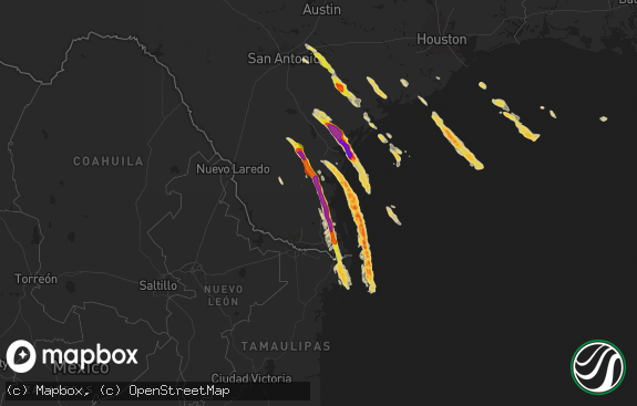
Hail Map in Texas on May 28, 2023
The weather event in Texas on May 28, 2023 includes Hail, Wind, and Tornado maps. 10 states and 188 cities were impacted and suffered possible damage. The total estimated number of properties impacted is 886.

Hail
Wind
Tornado
886
Estimated number of impacted properties by a 1.00" hail or larger464
Estimated number of impacted properties by a 1.75" hail or larger70
Estimated number of impacted properties by a 2.50" hail or largerStorm reports in Texas
Texas
| Date | Description |
|---|---|
| 05/28/20236:58 PM CDT | West texas mesonet peak gust. Initial severe gust was at 6:48 pm with occasional severe gusts through 7:07 pm. |
| 05/28/20236:50 PM CDT | A local report indicates 1.25 inch wind near 14 WSW GRUVER |
| 05/28/20236:50 PM CDT | . |
| 05/28/20236:48 PM CDT | Report from mping: hen egg |
| 05/28/20236:44 PM CDT | Off-duty nws employee reports estimated hen egg hail falling at this moment. |
| 05/28/20236:05 PM CDT | Chaser reports several different hail sizes from golf ball to tennis ball sized hail. |
| 05/28/20236:04 PM CDT | Quarter to golf ball sized hail reported by the silverton vfd. |
| 05/28/20235:49 PM CDT | Report from mping: hen egg |
| 05/28/20235:44 PM CDT | Dimes to quarter size hail coating us 62/180 across state line in tx. |
| 05/28/20235:23 PM CDT | A local report indicates 1.75 inch wind near MORSE |
| 05/28/20235:23 PM CDT | . |
| 05/28/20235:12 PM CDT | Hansford county sheriffs office. |
| 05/28/20235:05 PM CDT | Hail ranging from quarters to golf balls. |
| 05/28/20234:06 PM CDT | A local report indicates 2.00 inch wind near 3 SSE MORSE |
| 05/28/20234:06 PM CDT | . |
| 05/28/20233:56 PM CDT | Report from mping: quarter |
| 05/28/20233:52 PM CDT | Time estimated by radar. |
| 05/27/20239:16 PM CDT | A local report indicates 70 MPH wind near 9 NNE SUNRAY |
| 05/27/20238:44 PM CDT | Peak wind gust from the west texas mesonet. Initial severe gust was at 8:38 pm. |
| 05/27/20238:12 PM CDT | West texas mesonet. |
| 05/27/20237:48 PM CDT | Tornado on the ground from roughly 7:48 pm to 7:56 pm. Confirmed touchdown and persistence confirmed via local media/livestream... Tornado lift confirmed by off-duty nw |
| 05/27/20237:48 PM CDT | Corrects previous tornado report from 12 nne cactus. Tornado on the ground from roughly 7:48 pm to 7:56 pm. Confirmed touchdown and persistence confirmed via local medi |
| 05/27/20237:13 PM CDT | A local report indicates 1.50 inch wind near 14 SSE TEXHOMA |
| 05/27/20237:13 PM CDT | . |
All States Impacted by Hail Map on May 28, 2023
Cities Impacted by Hail Map on May 28, 2023
- Turpin, OK
- Beaver, OK
- Rush Center, KS
- Kaycee, WY
- Bison, KS
- La Crosse, KS
- Morse, TX
- Stinnett, TX
- Tulia, TX
- Timnath, CO
- Windsor, CO
- Fort Collins, CO
- Greeley, CO
- Longmont, CO
- Balko, OK
- Waldo, KS
- Luray, KS
- Osborne, KS
- Norcatur, KS
- Norton, KS
- Orleans, NE
- Alma, NE
- Spearman, TX
- Larned, KS
- Ellis, KS
- Ogallah, KS
- Hill City, KS
- Palco, KS
- Salt Flat, TX
- Tatum, NM
- Plains, TX
- Hendley, NE
- Beaver City, NE
- Nekoma, KS
- New Raymer, CO
- Stoneham, CO
- Lovington, NM
- Hays, KS
- Plainville, KS
- Gaylord, KS
- Anselmo, NE
- Merna, NE
- Fort Davis, TX
- Burns, WY
- Wilsonville, NE
- Happy, TX
- Buffalo Gap, SD
- Fairburn, SD
- Smith Center, KS
- Eustis, NE
- Keystone, SD
- Natoma, KS
- Upton, WY
- Lebanon, KS
- Newcastle, WY
- Catharine, KS
- Victoria, KS
- Allen, SD
- Tuthill, SD
- Carpenter, WY
- Plains, KS
- Meade, KS
- Sylvan Grove, KS
- Dorrance, KS
- Gillette, WY
- Midwest, WY
- Dix, NE
- Fort Stockton, TX
- Alton, KS
- Kress, TX
- Silverton, TX
- Oberlin, KS
- Mason City, NE
- Litchfield, NE
- Hazard, NE
- Hugoton, KS
- Rolla, KS
- Merino, CO
- Snyder, CO
- Cheyenne, WY
- Denver City, TX
- Nunn, CO
- Grover, CO
- Woodrow, CO
- Deer Trail, CO
- Fort Morgan, CO
- Hooker, OK
- Buffalo, OK
- Elida, NM
- Akron, CO
- Merriman, NE
- Gruver, TX
- Stratford, TX
- Byers, CO
- Amherst, NE
- Sunray, TX
- Portales, NM
- Clovis, NM
- Grady, NM
- Broadview, NM
- Lockney, TX
- Bogue, KS
- Turkey, TX
- Lenora, KS
- Phillipsburg, KS
- Matador, TX
- Quitaque, TX
- Wolfforth, TX
- Ropesville, TX
- Dalhart, TX
- Dumas, TX
- Cactus, TX
- Hartley, TX
- Perryton, TX
- Wounded Knee, SD
- Martin, SD
- Lubbock, TX
- Roswell, NM
- Edgemont, SD
- Iliff, CO
- Wilson, KS
- Alliance, NE
- Porcupine, SD
- Midland, TX
- Stanton, TX
- Jal, NM
- Potter, NE
- Spalding, NE
- Hobbs, NM
- Guymon, OK
- Cannon Afb, NM
- Andrews, TX
- Red Cloud, NE
- Guide Rock, NE
- Texhoma, OK
- Goodwell, OK
- Oelrichs, SD
- Kyle, SD
- Morland, KS
- Lucas, KS
- Boise City, OK
- Felt, OK
- Okaton, SD
- Murdo, SD
- Turtle Lake, ND
- Buffalo, SD
- Otter, MT
- Scenic, SD
- Cody, NE
- Republican City, NE
- Stamford, NE
- Burr Oak, KS
- Clayton, KS
- Jennings, KS
- Naponee, NE
- Lincoln, KS
- Sidney, NE
- Mankato, KS
- Paradise, KS
- Meadow, TX
- Seagraves, TX
- Seminole, TX
- Crook, CO
- Souris, ND
- Flomot, TX
- Harrisburg, NE
- Eunice, NM
- Floydada, TX
- Earth, TX
- Sudan, TX
- Dickens, TX
- Kanorado, KS
- Burlington, CO
- Vega, TX
- Kit Carson, CO
- Amherst, TX
- Valentine, NE
- Cheyenne Wells, CO
- Ralls, TX
- Lorenzo, TX
- Muleshoe, TX
- Slaton, TX
- Rozel, KS
- Tuscola, TX
- Rosston, OK
- Gorham, KS
- Walsh, CO
- Harper, KS


