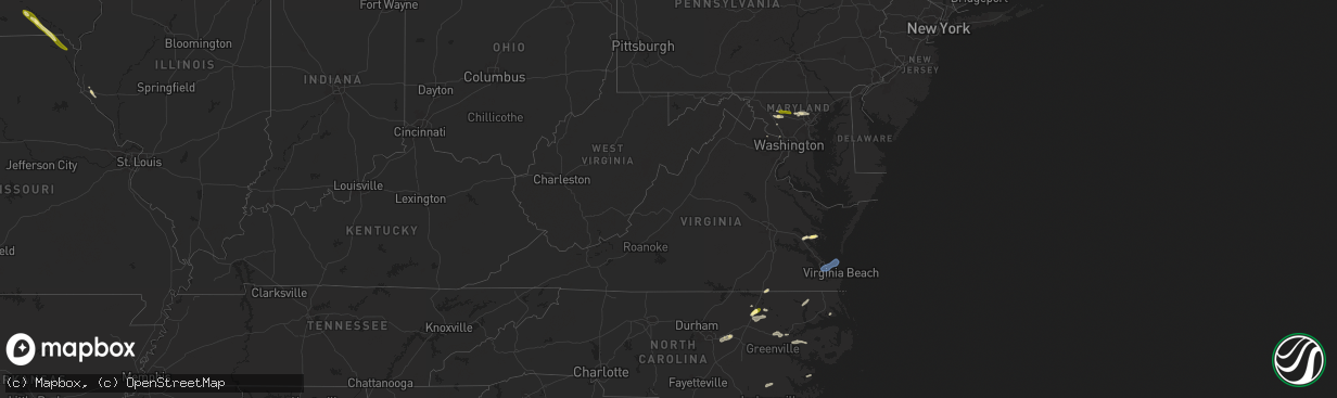
Hail Map in Virginia on May 27, 2024
The weather event in Virginia on May 27, 2024 includes Hail, Wind, and Tornado maps. 21 states and 946 cities were impacted and suffered possible damage. The total estimated number of properties impacted is 1,525.
Want more than just the map?
Turn this storm into a full workflow.
- Owner + property data so you know who to knock
- OnDemand branded weather history reports to win the "did we even have hail?" argument
- RoofTrace estimate so reps stop guessing numbers at the door
Bought this map? Upgrade within 7 days and we'll credit the $230. (10-15 min setup call)
Hail
Wind
Tornado
1,525
Estimated number of impacted properties by a 1.00" hail or larger0
Estimated number of impacted properties by a 1.75" hail or larger0
Estimated number of impacted properties by a 2.50" hail or largerStorm reports in Virginia
Virginia
| Date | Description |
|---|---|
| 05/27/20245:18 PM CDT | Reports of power lines down near bookers lane and route 14. Relayed via social media. |
| 05/27/20245:11 PM CDT | Awos station kngu norfolk nas cham. |
| 05/27/20245:09 PM CDT | Large tree was knocked down on commodore drive in the commodore park neighborhood of norfolk. Pictures relayed via social media and time is estimated from radar. |
| 05/27/20245:06 PM CDT | Relayed via social media. |
| 05/27/20245:05 PM CDT | Wires down on florence and milton drive in hampton. Time estimated. |
| 05/27/20244:58 PM CDT | Corrects previous tstm wnd dmg report from northampton. Wires down on florence and milton drive in hampton. Time estimated. |
| 05/27/20244:45 PM CDT | Tree down on mill creek rd in zuni. |
| 05/26/20247:03 PM CDT | Several trees blew down in clifton... Including near the intersection of va-612 old yates ford road and va-643 henderson road. |
All States Impacted by Hail Map on May 27, 2024
Cities Impacted by Hail Map on May 27, 2024
- Paducah, KY
- Ledbetter, KY
- Calvert City, KY
- Benton, KY
- Smithland, KY
- Grand Rivers, KY
- Paragould, AR
- Marmaduke, AR
- Success, AR
- Corning, AR
- Maynard, AR
- Yellville, AR
- Green Forest, AR
- Berryville, AR
- Alpena, AR
- Fairmount, GA
- Ranger, GA
- Talking Rock, GA
- Jasper, GA
- Chatsworth, GA
- Ellijay, GA
- Waleska, GA
- Canton, GA
- Rydal, GA
- White, GA
- Marble Hill, GA
- Tate, GA
- Ball Ground, GA
- Peachtree Corners, GA
- Duluth, GA
- Alpharetta, GA
- Norcross, GA
- Roswell, GA
- Dawsonville, GA
- Cumming, GA
- Woodstock, GA
- Marietta, GA
- Atlanta, GA
- Lawrenceville, GA
- Buford, GA
- Suwanee, GA
- Snellville, GA
- Lilburn, GA
- Grayson, GA
- Dacula, GA
- Loganville, GA
- Sanford, NC
- Moncure, NC
- Camp Hill, AL
- Waverly, AL
- Dadeville, AL
- Lafayette, AL
- Cusseta, AL
- Lanett, AL
- West Point, GA
- Valley, AL
- Pine Mountain, GA
- Hamilton, GA
- Trenton, NC
- Pine Mountain Valley, GA
- Shiloh, GA
- Woodland, GA
- Talbotton, GA
- Thomaston, GA
- Harrellsville, NC
- Cofield, NC
- Hobbsville, NC
- Gatesville, NC
- Sunbury, NC
- Culloden, GA
- Musella, GA
- Roberta, GA
- Shorter, AL
- Tallassee, AL
- Butler, GA
- Knoxville, GA
- Merritt, NC
- Lizella, GA
- Tuskegee, AL
- Auburn, AL
- Box Springs, GA
- New Ulm, MN
- Fairmont, MN
- Granada, MN
- Chillicothe, MO
- Hale, MO
- Nicollet, MN
- Junction City, GA
- Byron, GA
- Mapleton, MN
- Good Thunder, MN
- Amboy, MN
- Hamburg, MN
- Reynolds, GA
- Eufaula, AL
- Hatchechubbee, AL
- Union Springs, AL
- Seale, AL
- Waldorf, MN
- Abbeville, AL
- Fort Valley, GA
- Silver Lake, MN
- Pemberton, MN
- Morris, GA
- Easton, MN
- Minnesota Lake, MN
- Winsted, MN
- Lumpkin, GA
- Georgetown, GA
- Whitakers, NC
- Cuthbert, GA
- New Richland, MN
- Preston, GA
- Richland, GA
- Enfield, NC
- Cochran, GA
- Hurtsboro, AL
- Wendell, NC
- Clayton, NC
- Zebulon, NC
- Pittsview, AL
- Middlesex, NC
- Danville, GA
- Omaha, GA
- Laurel, IA
- Melbourne, IA
- Haverhill, IA
- Buena Vista, GA
- Parrott, GA
- Weston, GA
- Fort Mitchell, AL
- Plains, GA
- Dawson, GA
- Americus, GA
- Pleasant Hill, NC
- Garysburg, NC
- Walker, IA
- Brandon, IA
- Rowley, IA
- Gilman, IA
- Grinnell, IA
- Marshalltown, IA
- Battleboro, NC
- Kellogg, IA
- Pleasantville, IA
- Knoxville, IA
- Smithville, GA
- Emporia, VA
- Seaboard, NC
- Hope Hull, AL
- Montgomery, AL
- Cusseta, GA
- Central City, IA
- Center Point, IA
- Waverly, IA
- Leslie, GA
- De Soto, GA
- Alburnett, IA
- Excelsior, MN
- Minnetonka, MN
- Brooklyn, IA
- Deep River, IA
- Minneapolis, MN
- Madison Lake, MN
- Mankato, MN
- Waterloo, IA
- Chanhassen, MN
- Wayzata, MN
- Scotland Neck, NC
- Bussey, IA
- Tracy, IA
- Cobb, GA
- Hudson, IA
- Guernsey, IA
- Springville, IA
- Hamilton, IA
- Green Isle, MN
- Long Lake, MN
- Leakey, TX
- Robersonville, NC
- Bethel, NC
- Anamosa, IA
- Cordele, GA
- Shorterville, AL
- Fort Gaines, GA
- Martelle, IA
- Maple Grove, MN
- Dallas, TX
- Dunkerton, IA
- Dewar, IA
- Ramer, AL
- Pike Road, AL
- Mathews, AL
- Forest Home, AL
- Eagle Lake, MN
- Jesup, IA
- Kasota, MN
- Olin, IA
- La Porte City, IA
- Independence, IA
- Greenville, AL
- Warwick, GA
- Arabi, GA
- Ashburn, GA
- Shellman, GA
- Castell, TX
- Llano, TX
- Williamsburg, VA
- Hunt, TX
- Richardson, TX
- Garland, TX
- Caney, KS
- Atchison, KS
- Oskaloosa, KS
- Calera, OK
- Copan, OK
- Coleman, OK
- Le Roy, KS
- Wapanucka, OK
- Pomona, KS
- Holdenville, OK
- Valley Falls, KS
- Buffalo, KS
- Weleetka, OK
- Independence, KS
- Kenefic, OK
- Sperry, OK
- Okemah, OK
- Okmulgee, OK
- Bartlesville, OK
- Mckinney, TX
- Van Alstyne, TX
- Westphalia, KS
- Tupelo, OK
- Allen, OK
- Plano, TX
- Yates Center, KS
- Williamsburg, KS
- Milburn, OK
- Dewey, OK
- Sapulpa, OK
- Celina, TX
- Mead, OK
- Durant, OK
- Anna, TX
- Beggs, OK
- Wann, OK
- Melvern, KS
- Calvin, OK
- Overbrook, KS
- Winchester, KS
- Neosho Falls, KS
- Wetumka, OK
- Colbert, OK
- Waverly, KS
- Fredonia, KS
- Sherman, TX
- Centrahoma, OK
- Skiatook, OK
- Cummings, KS
- Mounds, OK
- Perry, KS
- Tulsa, OK
- Allen, TX
- Altoona, KS
- Atwood, OK
- Tyro, KS
- Nortonville, KS
- Lecompton, KS
- Lancaster, KS
- Neodesha, KS
- Ochelata, OK
- Benedict, KS
- Howe, TX
- Lawrence, KS
- Denison, TX
- Kiefer, OK
- Quenemo, KS
- Ramona, OK
- Vanderpool, TX
- Winthrop, IA
- Oxford Junction, IA
- Clarence, IA
- Irving, TX
- Halifax, NC
- Williamston, NC
- Fitzpatrick, AL
- Littleton, NC
- Wyoming, IA
- Lost Nation, IA
- Wheatland, IA
- Lowden, IA
- Barksdale, TX
- Whatley, AL
- Gloucester, VA
- North, VA
- Notasulga, AL
- Rebecca, GA
- Medina, TX
- Pontotoc, TX
- Sumner, GA
- Honoraville, AL
- Troy, AL
- Grady, AL
- Bloomfield, IA
- Ottumwa, IA
- Drakesville, IA
- Leroy, AL
- Saint Stephens, AL
- Grove Hill, AL
- Albertville, MN
- Elk River, MN
- Janesville, IA
- New Hartford, IA
- Cedar Falls, IA
- Valley Spring, TX
- Franklin, AL
- Chula, GA
- Tifton, GA
- Sycamore, GA
- Jackson, AL
- Jamesville, NC
- Floris, IA
- Evansdale, IA
- Raymond, IA
- Lowndesboro, AL
- Senoia, GA
- Frederick, MD
- Ijamsville, MD
- Rochelle, GA
- Fitzgerald, GA
- Sylvester, GA
- Poulan, GA
- Camp Wood, TX
- Shell Rock, IA
- Fairbank, IA
- Gilbertville, IA
- Quasqueton, IA
- Ryan, IA
- Manchester, IA
- Masonville, IA
- Coggon, IA
- Vinton, IA
- Urbana, IA
- Monticello, IA
- Hopkinton, IA
- Prairieburg, IA
- Marion, IA
- Monmouth, IA
- Onslow, IA
- Cascade, IA
- Langworthy, IA
- Center Junction, IA
- Fredericksburg, TX
- Monrovia, MD
- Damascus, MD
- Hutchins, TX
- Mount Airy, MD
- Pine Apple, AL
- Georgiana, AL
- Bluffton, GA
- Coleman, GA
- Blakely, GA
- Luverne, AL
- Windsor, NC
- Ocilla, GA
- Willow City, TX
- Lancaster, TX
- Wilmer, TX
- Seagoville, TX
- Sharpsburg, GA
- Salem, AL
- Opelika, AL
- Hertford, NC
- Elizabeth City, NC
- Banks, AL
- Milton, IA
- Douds, IA
- Cantril, IA
- Arlington, GA
- Pinetown, NC
- Plymouth, NC
- Edison, GA
- Uriah, AL
- Princeton, IA
- Long Grove, IA
- Ferris, TX
- Crandall, TX
- Forney, TX
- Hayneville, AL
- Ashburn, VA
- Pantego, NC
- Enigma, GA
- Louisville, AL
- Clayton, AL
- Tuskegee Institute, AL
- Kerrville, TX
- Arbela, MO
- Luray, MO
- Rutledge, AL
- Wagarville, AL
- Ingram, TX
- Mount Sterling, IA
- Port Byron, IL
- Morgan, GA
- Marriottsville, MD
- Randallstown, MD
- Woodstock, MD
- Owings Mills, MD
- Comfort, TX
- Blakesburg, IA
- Kahoka, MO
- Pulaski, IA
- Portsmouth, VA
- Norfolk, VA
- Virginia Beach, VA
- Alapaha, GA
- Round Mountain, TX
- San Saba, TX
- Richland Springs, TX
- Winston Salem, NC
- Cedar Park, TX
- Carrollton, VA
- Bryson City, NC
- Chickamauga, GA
- Sylva, NC
- Winona, MS
- Oak Grove, LA
- Collinston, LA
- Cohutta, GA
- Haleyville, AL
- Hiddenite, NC
- Elon, NC
- Nebo, NC
- Eupora, MS
- Choudrant, LA
- Clemmons, NC
- Hutto, TX
- Ivor, VA
- Canton, NC
- Lenoir, NC
- Tunnel Hill, GA
- La Crosse, VA
- Copperhill, TN
- Crockett, TX
- Sidon, MS
- Crandall, GA
- Lewisville, NC
- Ider, AL
- Murphy, NC
- Tenaha, TX
- Nacogdoches, TX
- Old Fort, NC
- Capron, VA
- Amory, MS
- Rising Fawn, GA
- Woodville, AL
- Normangee, TX
- Reidsville, NC
- Cruger, MS
- Cedarbluff, MS
- Hollandale, MS
- Union Grove, AL
- Prairie, MS
- Morganton, NC
- Roxboro, NC
- Oxford, NC
- Bullock, NC
- Centerville, TX
- Guin, AL
- Rock Spring, GA
- Turtletown, TN
- Taylorsville, NC
- Round Rock, TX
- Gibsonville, NC
- Oak Ridge, NC
- Gasburg, VA
- Ebony, VA
- West Point, MS
- Douglass, TX
- Topton, NC
- Sedley, VA
- Cameron, TX
- Greensboro, NC
- Brilliant, AL
- Smithfield, VA
- Vinemont, AL
- Candler, NC
- Andrews, NC
- Sterlington, LA
- Downsville, LA
- Boydton, VA
- Yanceyville, NC
- Yadkinville, NC
- White Plains, VA
- Rockdale, TX
- Hudson, NC
- Walkertown, NC
- Addison, AL
- Waynesville, NC
- Kernersville, NC
- Garrison, TX
- Windsor, VA
- Marion, NC
- Austin, TX
- Falkville, AL
- Leasburg, NC
- Kilmichael, MS
- Black Mountain, NC
- Dalton, GA
- Swannanoa, NC
- Grand Cane, LA
- Scottsboro, AL
- Woodland, MS
- Mer Rouge, LA
- Somerville, AL
- Hamilton, AL
- Eva, AL
- Bastrop, LA
- Asheville, NC
- Double Springs, AL
- Lawrenceville, VA
- Greenwood Springs, MS
- Franklin, TX
- Harmony, NC
- Dutton, AL
- Joaquin, TX
- Summerfield, NC
- Pisgah, AL
- Sulligent, AL
- Granite Falls, NC
- Olin, NC
- Henderson, NC
- Leander, TX
- Grapeland, TX
- Brodnax, VA
- Logansport, LA
- Ruston, LA
- Courtland, VA
- Zuni, VA
- Ringgold, GA
- Balsam, NC
- Browns Summit, NC
- Alto, TX
- Mantee, MS
- Whittier, NC
- Spicewood, TX
- Statesville, NC
- Grant, AL
- Bracey, VA
- Mocksville, NC
- Aberdeen, MS
- Coila, MS
- Mansfield, LA
- Willacoochee, GA
- Justin, TX
- Southlake, TX
- Grapevine, TX
- Argyle, TX
- Flower Mound, TX
- Lewisville, TX
- Roanoke, TX
- Wray, GA
- Sterling, VA
- Hillsdale, IL
- Ennis, TX
- Mason, TX
- Windsor Mill, MD
- Pikesville, MD
- Fort Worth, TX
- Griffin, GA
- Milner, GA
- Ambrose, GA
- Great Falls, VA
- Potomac, MD
- Baltimore, MD
- Stevenson, MD
- Palmer, TX
- Geneseo, IL
- Erie, IL
- Prophetstown, IL
- Horseshoe Bay, TX
- Atmore, AL
- Woodbury, GA
- Brantley, AL
- Nashville, GA
- Lenox, GA
- Bronwood, GA
- Fort Deposit, AL
- Letohatchee, AL
- Saint Patrick, MO
- Tampico, IL
- Hooppole, IL
- Annawan, IL
- Mineral, IL
- Sheffield, IL
- Marble Falls, TX
- Goldthwaite, TX
- Keller, TX
- Molena, GA
- Kingsland, TX
- Stockton, AL
- Rocksprings, TX
- Little River, AL
- Red Oak, TX
- Johnson City, TX
- Harper, TX
- McIntosh, AL
- Dozier, AL
- Pearson, GA
- Chatham, LA
- Mendenhall, MS
- Bienville, LA
- Ringgold, LA
- Winnsboro, LA
- Elba, AL
- Sale City, GA
- Jamestown, LA
- Jonesboro, LA
- Ozark, AL
- Coffeeville, AL
- Heidelberg, MS
- Kaufman, TX
- Bay Springs, MS
- Gilbertown, AL
- Grayson, LA
- Shreveport, LA
- Tatum, TX
- Kemp, TX
- Newville, AL
- Magee, MS
- Lower Peach Tree, AL
- Utica, MS
- Scurry, TX
- Tyler, TX
- Elm Grove, LA
- Terry, MS
- Dickinson, AL
- Leary, GA
- Norman Park, GA
- Crystal Springs, MS
- Columbia, LA
- Newton, GA
- Keithville, LA
- Headland, AL
- Braxton, MS
- Taylorsville, MS
- Kilgore, TX
- Longview, TX
- Raleigh, MS
- Mize, MS
- Shubuta, MS
- Port Gibson, MS
- Mabank, TX
- Beatrice, AL
- Marshall, TX
- Vossburg, MS
- Florence, MS
- Ben Wheeler, TX
- De Berry, TX
- Moultrie, GA
- Canton, TX
- Stonewall, LA
- Jack, AL
- Peterman, AL
- Bethany, LA
- Hardaway, AL
- Colleyville, TX
- North Richland Hills, TX
- Herndon, VA
- Center Point, TX
- Mountain Home, TX
- Hurst, TX
- Lometa, TX
- Gwynn Oak, MD
- Glenwood, AL
- Burnet, TX
- Bedford, TX
- Euless, TX
- Lapine, AL
- Barnesville, GA
- Laredo, TX
- Adel, GA
- Lakeland, GA
- Vienna, VA
- Reston, VA
- Albany, GA
- Luthersville, GA
- Grand Prairie, TX
- Arlington, TX
- Grantville, GA
- Moreland, GA
- Yatesville, GA
- Homerville, GA
- Midway, AL
- Citronelle, AL
- Chunchula, AL
- Highland Home, AL
- Brooks, GA
- Baconton, GA
- McNabb, IL
- Lostant, IL
- Axis, AL
- Duncanville, TX
- Mansfield, TX
- Doerun, GA
- Saraland, AL
- Creola, AL
- Plainville, IL
- Hogansville, GA
- Greenville, GA
- Kinderhook, IL
- Barry, IL
- Cedar Hill, TX
- Leesburg, GA
- Du Pont, GA
- Quitman, GA
- Dixie, GA
- New Canton, IL
- Camilla, GA
- Omega, GA
- Haslet, TX
- Rhome, TX
- Roma, TX
- Sykesville, MD
- Boyds, MD
- Germantown, MD
- Oakfield, GA
- New Market, MD
- Sullivan City, TX
- Decatur, TX
- Ponder, TX
- Rio Grande City, TX
- Grulla, TX
- Springtown, TX
- Zapata, TX
- Krum, TX
- Mission, TX
- Edinburg, TX
- Damascus, GA
- Valdosta, GA
- Perrin, TX
- Whitt, TX
- Guerra, TX
- Denton, TX
- Sanger, TX
- Lake Park, GA
- Jacksboro, TX
- Graford, TX
- Jennings, FL
- Bryson, TX
- Morven, GA
- Barney, GA
- Bennington, OK
- Willow Spring, NC
- Nashville, NC
- Garner, NC
- Rocky Mount, NC
- Wagram, NC
- Laurel Hill, NC
- Wallace, SC
- Lillington, NC
- Spring Hope, NC
- Marston, NC
- Raeford, NC
- Spring Lake, NC
- Angier, NC
- Cheraw, SC
- Bennettsville, SC
- Bunnlevel, NC
- Fort Bragg, NC
- Woodbine, MD
- Seymour, TX
- Towson, MD
- Waurika, OK
- Ryan, OK
- Throckmorton, TX
- Electra, TX
- Temple, OK
- Walters, OK
- Comanche, OK
- Kulm, ND
- Harrold, TX
- Tallahassee, FL
- Havana, FL
- Ringling, OK
- Chillicothe, TX
- Edgeley, ND
- Grandfield, OK
- Faxon, OK
- Lawton, OK
- Loveland, OK
- Forbes, ND
- Loco, OK
- Duncan, OK
- Geronimo, OK
- Oklaunion, TX
- Frederick, OK
- Davidson, OK
- Healdton, OK
- Ratliff City, OK
- Graham, OK
- Chattanooga, OK
- Hastings, OK
- Marlow, OK
- Foster, OK
- Hennepin, OK
- Tussy, OK
- Springer, OK
- Elmore City, OK
- Elmer, OK
- Apache, OK
- Davis, OK
- Elgin, OK
- Iowa Park, TX
- Wichita Falls, TX
- Wynnewood, OK
- Lindsay, OK
- Vernon, TX
- Fletcher, OK
- Rush Springs, OK
- Mountain View, OK
- Henrietta, TX
- Roosevelt, OK
- Indiahoma, OK
- Snyder, OK
- Ringgold, TX
- Hollis, OK
- Carnegie, OK
- Wellington, TX
- Wilson, OK
- Gainesville, TX
- Sulphur, OK
- Carter, OK
- Rocky, OK
- Whitesboro, TX
- Thackerville, OK
- Marietta, OK
- Sentinel, OK
- Burneyville, OK
- Roff, OK
- Dill City, OK
- Hobart, OK
- Bellevue, TX
- Lone Wolf, OK
- Byers, TX
- Petrolia, TX
- Bowie, TX
- Nocona, TX
- Gotebo, OK
- Maud, OK
- Gould, OK
- Tecumseh, OK
- Collinsville, TX
- Earlsboro, OK
- Shawnee, OK
- Burkburnett, TX
- Devol, OK
- Randlett, OK
- Sunset, TX
- Chico, TX
- Seminole, OK
- Tioga, TX
- Valley View, TX
- Alvord, TX
- Forestburg, TX
- Hugo, OK
- Saint Jo, TX
- Duke, OK
- Aubrey, TX
- Pilot Point, TX
- Gunter, TX
- Grant, OK
- Fort Towson, OK
- Bridgeport, TX
- Olustee, OK
- Paradise, TX
- Rosston, TX
- Sawyer, OK
- Detroit, TX
- Prosper, TX
- Frisco, TX
- Mountain Park, OK
- Little Elm, TX
- Princeton, TX
- Altus, OK
- Headrick, OK
- Cache, OK
- Boyd, TX
- Lake Dallas, TX
- The Colony, TX
- Bonham, TX
- Newark, TX
- Carrollton, TX
- St John, KS
- Tipton, OK
- Blue Ridge, TX
- Hollister, OK
- Addison, TX
- Coppell, TX
- Azle, TX
- Pawnee Rock, KS
- Greenville, TX
- Melissa, TX
- Farmersville, TX
- Caddo Mills, TX
- Sachse, TX
- Royse City, TX
- Lavon, TX
- Naval Air Station Jrb, TX
- Nevada, TX
- Wylie, TX
- Haltom City, TX
- Rockwall, TX
- Rowlett, TX
- Alexander, KS
- Wolfe City, TX
- Mesquite, TX
- Sunnyvale, TX
- Midlothian, TX
- Desoto, TX
- Balch Springs, TX
- Montague, TX
- Era, TX
- Muenster, TX
- Whitewright, TX
- Rush Center, KS
- Terrell, TX
- Waxahachie, TX
- Larned, KS
- Leonard, TX
- Celeste, TX
- Rosser, TX
- Rice, TX
- Holliday, TX
- Olney, TX
- Windthorst, TX
- Chatfield, TX
- Trinidad, TX
- Powell, TX
- Kerens, TX
- Eustace, TX
- Malakoff, TX
- Ada, OK
- Barnesville, PA
- Anadarko, OK


