Hail Map in Woodland, GA on May 27, 2024
The weather event in Woodland, GA on May 27, 2024 includes Hail, Wind, and Tornado maps. 21 states and 946 cities were impacted and suffered possible damage. The total estimated number of properties impacted is 0.
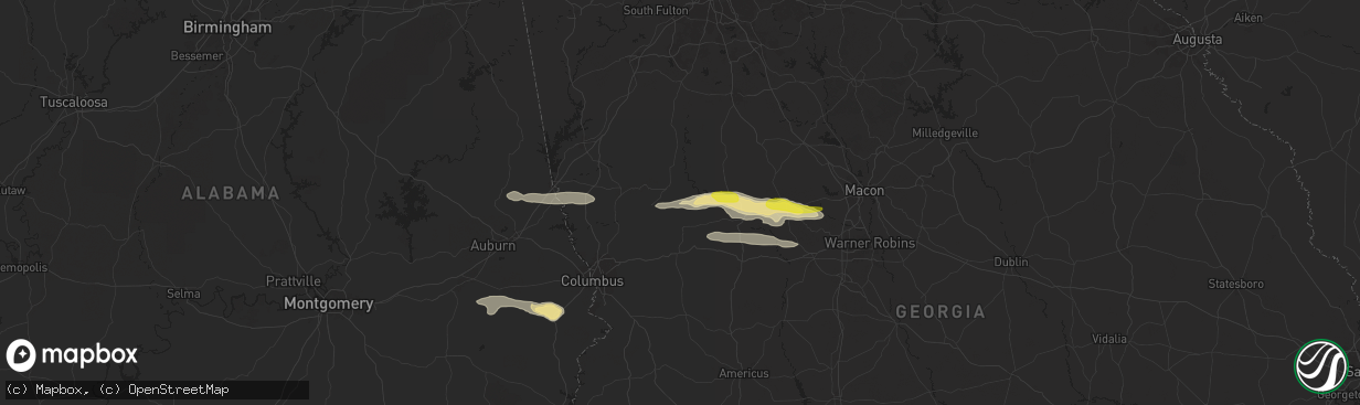
Hail
Wind
Tornado
0
Estimated number of impacted properties by a 1.00" hail or larger0
Estimated number of impacted properties by a 1.75" hail or larger0
Estimated number of impacted properties by a 2.50" hail or largerStorm reports in Woodland, GA
Woodland, GA
| Date | Description |
|---|---|
| 05/27/202411:58 AM CDT | Several trees and powerlines reported down in the pleasant valley rd / manchester hwy area in woodland. |
| 05/27/202411:39 AM CDT | Trees down at intersection of manchester highway and pleasant valley road. |
| 05/27/202411:39 AM CDT | Trees down at intersection of manchester highway and pleasant valley road. |
All States Impacted by Hail Map on May 27, 2024
All Cities Impacted by Hail Map on May 27, 2024
- Paducah, KY
- Ledbetter, KY
- Calvert City, KY
- Benton, KY
- Smithland, KY
- Grand Rivers, KY
- Paragould, AR
- Marmaduke, AR
- Success, AR
- Corning, AR
- Maynard, AR
- Yellville, AR
- Green Forest, AR
- Berryville, AR
- Alpena, AR
- Fairmount, GA
- Ranger, GA
- Talking Rock, GA
- Jasper, GA
- Chatsworth, GA
- Ellijay, GA
- Waleska, GA
- Canton, GA
- Rydal, GA
- White, GA
- Marble Hill, GA
- Tate, GA
- Ball Ground, GA
- Peachtree Corners, GA
- Duluth, GA
- Alpharetta, GA
- Norcross, GA
- Roswell, GA
- Dawsonville, GA
- Cumming, GA
- Woodstock, GA
- Marietta, GA
- Atlanta, GA
- Lawrenceville, GA
- Buford, GA
- Suwanee, GA
- Snellville, GA
- Lilburn, GA
- Grayson, GA
- Dacula, GA
- Loganville, GA
- Sanford, NC
- Moncure, NC
- Camp Hill, AL
- Waverly, AL
- Dadeville, AL
- Lafayette, AL
- Cusseta, AL
- Lanett, AL
- West Point, GA
- Valley, AL
- Pine Mountain, GA
- Hamilton, GA
- Trenton, NC
- Pine Mountain Valley, GA
- Shiloh, GA
- Woodland, GA
- Talbotton, GA
- Thomaston, GA
- Harrellsville, NC
- Cofield, NC
- Hobbsville, NC
- Gatesville, NC
- Sunbury, NC
- Culloden, GA
- Musella, GA
- Roberta, GA
- Shorter, AL
- Tallassee, AL
- Butler, GA
- Knoxville, GA
- Merritt, NC
- Lizella, GA
- Tuskegee, AL
- Auburn, AL
- Box Springs, GA
- New Ulm, MN
- Fairmont, MN
- Granada, MN
- Chillicothe, MO
- Hale, MO
- Nicollet, MN
- Junction City, GA
- Byron, GA
- Mapleton, MN
- Good Thunder, MN
- Amboy, MN
- Hamburg, MN
- Reynolds, GA
- Eufaula, AL
- Hatchechubbee, AL
- Union Springs, AL
- Seale, AL
- Waldorf, MN
- Abbeville, AL
- Fort Valley, GA
- Silver Lake, MN
- Pemberton, MN
- Morris, GA
- Easton, MN
- Minnesota Lake, MN
- Winsted, MN
- Lumpkin, GA
- Georgetown, GA
- Whitakers, NC
- Cuthbert, GA
- New Richland, MN
- Preston, GA
- Richland, GA
- Enfield, NC
- Cochran, GA
- Hurtsboro, AL
- Wendell, NC
- Clayton, NC
- Zebulon, NC
- Pittsview, AL
- Middlesex, NC
- Danville, GA
- Omaha, GA
- Laurel, IA
- Melbourne, IA
- Haverhill, IA
- Buena Vista, GA
- Parrott, GA
- Weston, GA
- Fort Mitchell, AL
- Plains, GA
- Dawson, GA
- Americus, GA
- Pleasant Hill, NC
- Garysburg, NC
- Walker, IA
- Brandon, IA
- Rowley, IA
- Gilman, IA
- Grinnell, IA
- Marshalltown, IA
- Battleboro, NC
- Kellogg, IA
- Pleasantville, IA
- Knoxville, IA
- Smithville, GA
- Emporia, VA
- Seaboard, NC
- Hope Hull, AL
- Montgomery, AL
- Cusseta, GA
- Central City, IA
- Center Point, IA
- Waverly, IA
- Leslie, GA
- De Soto, GA
- Alburnett, IA
- Excelsior, MN
- Minnetonka, MN
- Brooklyn, IA
- Deep River, IA
- Minneapolis, MN
- Madison Lake, MN
- Mankato, MN
- Waterloo, IA
- Chanhassen, MN
- Wayzata, MN
- Scotland Neck, NC
- Bussey, IA
- Tracy, IA
- Cobb, GA
- Hudson, IA
- Guernsey, IA
- Springville, IA
- Hamilton, IA
- Green Isle, MN
- Long Lake, MN
- Leakey, TX
- Robersonville, NC
- Bethel, NC
- Anamosa, IA
- Cordele, GA
- Shorterville, AL
- Fort Gaines, GA
- Martelle, IA
- Maple Grove, MN
- Dallas, TX
- Dunkerton, IA
- Dewar, IA
- Ramer, AL
- Pike Road, AL
- Mathews, AL
- Forest Home, AL
- Eagle Lake, MN
- Jesup, IA
- Kasota, MN
- Olin, IA
- La Porte City, IA
- Independence, IA
- Greenville, AL
- Warwick, GA
- Arabi, GA
- Ashburn, GA
- Shellman, GA
- Castell, TX
- Llano, TX
- Williamsburg, VA
- Hunt, TX
- Richardson, TX
- Garland, TX
- Caney, KS
- Atchison, KS
- Oskaloosa, KS
- Calera, OK
- Copan, OK
- Coleman, OK
- Le Roy, KS
- Wapanucka, OK
- Pomona, KS
- Holdenville, OK
- Valley Falls, KS
- Buffalo, KS
- Weleetka, OK
- Independence, KS
- Kenefic, OK
- Sperry, OK
- Okemah, OK
- Okmulgee, OK
- Bartlesville, OK
- Mckinney, TX
- Van Alstyne, TX
- Westphalia, KS
- Tupelo, OK
- Allen, OK
- Plano, TX
- Yates Center, KS
- Williamsburg, KS
- Milburn, OK
- Dewey, OK
- Sapulpa, OK
- Celina, TX
- Mead, OK
- Durant, OK
- Anna, TX
- Beggs, OK
- Wann, OK
- Melvern, KS
- Calvin, OK
- Overbrook, KS
- Winchester, KS
- Neosho Falls, KS
- Wetumka, OK
- Colbert, OK
- Waverly, KS
- Fredonia, KS
- Sherman, TX
- Centrahoma, OK
- Skiatook, OK
- Cummings, KS
- Mounds, OK
- Perry, KS
- Tulsa, OK
- Allen, TX
- Altoona, KS
- Atwood, OK
- Tyro, KS
- Nortonville, KS
- Lecompton, KS
- Lancaster, KS
- Neodesha, KS
- Ochelata, OK
- Benedict, KS
- Howe, TX
- Lawrence, KS
- Denison, TX
- Kiefer, OK
- Quenemo, KS
- Ramona, OK
- Vanderpool, TX
- Winthrop, IA
- Oxford Junction, IA
- Clarence, IA
- Irving, TX
- Halifax, NC
- Williamston, NC
- Fitzpatrick, AL
- Littleton, NC
- Wyoming, IA
- Lost Nation, IA
- Wheatland, IA
- Lowden, IA
- Barksdale, TX
- Whatley, AL
- Gloucester, VA
- North, VA
- Notasulga, AL
- Rebecca, GA
- Medina, TX
- Pontotoc, TX
- Sumner, GA
- Honoraville, AL
- Troy, AL
- Grady, AL
- Bloomfield, IA
- Ottumwa, IA
- Drakesville, IA
- Leroy, AL
- Saint Stephens, AL
- Grove Hill, AL
- Albertville, MN
- Elk River, MN
- Janesville, IA
- New Hartford, IA
- Cedar Falls, IA
- Valley Spring, TX
- Franklin, AL
- Chula, GA
- Tifton, GA
- Sycamore, GA
- Jackson, AL
- Jamesville, NC
- Floris, IA
- Evansdale, IA
- Raymond, IA
- Lowndesboro, AL
- Senoia, GA
- Frederick, MD
- Ijamsville, MD
- Rochelle, GA
- Fitzgerald, GA
- Sylvester, GA
- Poulan, GA
- Camp Wood, TX
- Shell Rock, IA
- Fairbank, IA
- Gilbertville, IA
- Quasqueton, IA
- Ryan, IA
- Manchester, IA
- Masonville, IA
- Coggon, IA
- Vinton, IA
- Urbana, IA
- Monticello, IA
- Hopkinton, IA
- Prairieburg, IA
- Marion, IA
- Monmouth, IA
- Onslow, IA
- Cascade, IA
- Langworthy, IA
- Center Junction, IA
- Fredericksburg, TX
- Monrovia, MD
- Damascus, MD
- Hutchins, TX
- Mount Airy, MD
- Pine Apple, AL
- Georgiana, AL
- Bluffton, GA
- Coleman, GA
- Blakely, GA
- Luverne, AL
- Windsor, NC
- Ocilla, GA
- Willow City, TX
- Lancaster, TX
- Wilmer, TX
- Seagoville, TX
- Sharpsburg, GA
- Salem, AL
- Opelika, AL
- Hertford, NC
- Elizabeth City, NC
- Banks, AL
- Milton, IA
- Douds, IA
- Cantril, IA
- Arlington, GA
- Pinetown, NC
- Plymouth, NC
- Edison, GA
- Uriah, AL
- Princeton, IA
- Long Grove, IA
- Ferris, TX
- Crandall, TX
- Forney, TX
- Hayneville, AL
- Ashburn, VA
- Pantego, NC
- Enigma, GA
- Louisville, AL
- Clayton, AL
- Tuskegee Institute, AL
- Kerrville, TX
- Arbela, MO
- Luray, MO
- Rutledge, AL
- Wagarville, AL
- Ingram, TX
- Mount Sterling, IA
- Port Byron, IL
- Morgan, GA
- Marriottsville, MD
- Randallstown, MD
- Woodstock, MD
- Owings Mills, MD
- Comfort, TX
- Blakesburg, IA
- Kahoka, MO
- Pulaski, IA
- Portsmouth, VA
- Norfolk, VA
- Virginia Beach, VA
- Alapaha, GA
- Round Mountain, TX
- San Saba, TX
- Richland Springs, TX
- Winston Salem, NC
- Cedar Park, TX
- Carrollton, VA
- Bryson City, NC
- Chickamauga, GA
- Sylva, NC
- Winona, MS
- Oak Grove, LA
- Collinston, LA
- Cohutta, GA
- Haleyville, AL
- Hiddenite, NC
- Elon, NC
- Nebo, NC
- Eupora, MS
- Choudrant, LA
- Clemmons, NC
- Hutto, TX
- Ivor, VA
- Canton, NC
- Lenoir, NC
- Tunnel Hill, GA
- La Crosse, VA
- Copperhill, TN
- Crockett, TX
- Sidon, MS
- Crandall, GA
- Lewisville, NC
- Ider, AL
- Murphy, NC
- Tenaha, TX
- Nacogdoches, TX
- Old Fort, NC
- Capron, VA
- Amory, MS
- Rising Fawn, GA
- Woodville, AL
- Normangee, TX
- Reidsville, NC
- Cruger, MS
- Cedarbluff, MS
- Hollandale, MS
- Union Grove, AL
- Prairie, MS
- Morganton, NC
- Roxboro, NC
- Oxford, NC
- Bullock, NC
- Centerville, TX
- Guin, AL
- Rock Spring, GA
- Turtletown, TN
- Taylorsville, NC
- Round Rock, TX
- Gibsonville, NC
- Oak Ridge, NC
- Gasburg, VA
- Ebony, VA
- West Point, MS
- Douglass, TX
- Topton, NC
- Sedley, VA
- Cameron, TX
- Greensboro, NC
- Brilliant, AL
- Smithfield, VA
- Vinemont, AL
- Candler, NC
- Andrews, NC
- Sterlington, LA
- Downsville, LA
- Boydton, VA
- Yanceyville, NC
- Yadkinville, NC
- White Plains, VA
- Rockdale, TX
- Hudson, NC
- Walkertown, NC
- Addison, AL
- Waynesville, NC
- Kernersville, NC
- Garrison, TX
- Windsor, VA
- Marion, NC
- Austin, TX
- Falkville, AL
- Leasburg, NC
- Kilmichael, MS
- Black Mountain, NC
- Dalton, GA
- Swannanoa, NC
- Grand Cane, LA
- Scottsboro, AL
- Woodland, MS
- Mer Rouge, LA
- Somerville, AL
- Hamilton, AL
- Eva, AL
- Bastrop, LA
- Asheville, NC
- Double Springs, AL
- Lawrenceville, VA
- Greenwood Springs, MS
- Franklin, TX
- Harmony, NC
- Dutton, AL
- Joaquin, TX
- Summerfield, NC
- Pisgah, AL
- Sulligent, AL
- Granite Falls, NC
- Olin, NC
- Henderson, NC
- Leander, TX
- Grapeland, TX
- Brodnax, VA
- Logansport, LA
- Ruston, LA
- Courtland, VA
- Zuni, VA
- Ringgold, GA
- Balsam, NC
- Browns Summit, NC
- Alto, TX
- Mantee, MS
- Whittier, NC
- Spicewood, TX
- Statesville, NC
- Grant, AL
- Bracey, VA
- Mocksville, NC
- Aberdeen, MS
- Coila, MS
- Mansfield, LA
- Willacoochee, GA
- Justin, TX
- Southlake, TX
- Grapevine, TX
- Argyle, TX
- Flower Mound, TX
- Lewisville, TX
- Roanoke, TX
- Wray, GA
- Sterling, VA
- Hillsdale, IL
- Ennis, TX
- Mason, TX
- Windsor Mill, MD
- Pikesville, MD
- Fort Worth, TX
- Griffin, GA
- Milner, GA
- Ambrose, GA
- Great Falls, VA
- Potomac, MD
- Baltimore, MD
- Stevenson, MD
- Palmer, TX
- Geneseo, IL
- Erie, IL
- Prophetstown, IL
- Horseshoe Bay, TX
- Atmore, AL
- Woodbury, GA
- Brantley, AL
- Nashville, GA
- Lenox, GA
- Bronwood, GA
- Fort Deposit, AL
- Letohatchee, AL
- Saint Patrick, MO
- Tampico, IL
- Hooppole, IL
- Annawan, IL
- Mineral, IL
- Sheffield, IL
- Marble Falls, TX
- Goldthwaite, TX
- Keller, TX
- Molena, GA
- Kingsland, TX
- Stockton, AL
- Rocksprings, TX
- Little River, AL
- Red Oak, TX
- Johnson City, TX
- Harper, TX
- McIntosh, AL
- Dozier, AL
- Pearson, GA
- Chatham, LA
- Mendenhall, MS
- Bienville, LA
- Ringgold, LA
- Winnsboro, LA
- Elba, AL
- Sale City, GA
- Jamestown, LA
- Jonesboro, LA
- Ozark, AL
- Coffeeville, AL
- Heidelberg, MS
- Kaufman, TX
- Bay Springs, MS
- Gilbertown, AL
- Grayson, LA
- Shreveport, LA
- Tatum, TX
- Kemp, TX
- Newville, AL
- Magee, MS
- Lower Peach Tree, AL
- Utica, MS
- Scurry, TX
- Tyler, TX
- Elm Grove, LA
- Terry, MS
- Dickinson, AL
- Leary, GA
- Norman Park, GA
- Crystal Springs, MS
- Columbia, LA
- Newton, GA
- Keithville, LA
- Headland, AL
- Braxton, MS
- Taylorsville, MS
- Kilgore, TX
- Longview, TX
- Raleigh, MS
- Mize, MS
- Shubuta, MS
- Port Gibson, MS
- Mabank, TX
- Beatrice, AL
- Marshall, TX
- Vossburg, MS
- Florence, MS
- Ben Wheeler, TX
- De Berry, TX
- Moultrie, GA
- Canton, TX
- Stonewall, LA
- Jack, AL
- Peterman, AL
- Bethany, LA
- Hardaway, AL
- Colleyville, TX
- North Richland Hills, TX
- Herndon, VA
- Center Point, TX
- Mountain Home, TX
- Hurst, TX
- Lometa, TX
- Gwynn Oak, MD
- Glenwood, AL
- Burnet, TX
- Bedford, TX
- Euless, TX
- Lapine, AL
- Barnesville, GA
- Laredo, TX
- Adel, GA
- Lakeland, GA
- Vienna, VA
- Reston, VA
- Albany, GA
- Luthersville, GA
- Grand Prairie, TX
- Arlington, TX
- Grantville, GA
- Moreland, GA
- Yatesville, GA
- Homerville, GA
- Midway, AL
- Citronelle, AL
- Chunchula, AL
- Highland Home, AL
- Brooks, GA
- Baconton, GA
- McNabb, IL
- Lostant, IL
- Axis, AL
- Duncanville, TX
- Mansfield, TX
- Doerun, GA
- Saraland, AL
- Creola, AL
- Plainville, IL
- Hogansville, GA
- Greenville, GA
- Kinderhook, IL
- Barry, IL
- Cedar Hill, TX
- Leesburg, GA
- Du Pont, GA
- Quitman, GA
- Dixie, GA
- New Canton, IL
- Camilla, GA
- Omega, GA
- Haslet, TX
- Rhome, TX
- Roma, TX
- Sykesville, MD
- Boyds, MD
- Germantown, MD
- Oakfield, GA
- New Market, MD
- Sullivan City, TX
- Decatur, TX
- Ponder, TX
- Rio Grande City, TX
- Grulla, TX
- Springtown, TX
- Zapata, TX
- Krum, TX
- Mission, TX
- Edinburg, TX
- Damascus, GA
- Valdosta, GA
- Perrin, TX
- Whitt, TX
- Guerra, TX
- Denton, TX
- Sanger, TX
- Lake Park, GA
- Jacksboro, TX
- Graford, TX
- Jennings, FL
- Bryson, TX
- Morven, GA
- Barney, GA
- Bennington, OK
- Willow Spring, NC
- Nashville, NC
- Garner, NC
- Rocky Mount, NC
- Wagram, NC
- Laurel Hill, NC
- Wallace, SC
- Lillington, NC
- Spring Hope, NC
- Marston, NC
- Raeford, NC
- Spring Lake, NC
- Angier, NC
- Cheraw, SC
- Bennettsville, SC
- Bunnlevel, NC
- Fort Bragg, NC
- Woodbine, MD
- Seymour, TX
- Towson, MD
- Waurika, OK
- Ryan, OK
- Throckmorton, TX
- Electra, TX
- Temple, OK
- Walters, OK
- Comanche, OK
- Kulm, ND
- Harrold, TX
- Tallahassee, FL
- Havana, FL
- Ringling, OK
- Chillicothe, TX
- Edgeley, ND
- Grandfield, OK
- Faxon, OK
- Lawton, OK
- Loveland, OK
- Forbes, ND
- Loco, OK
- Duncan, OK
- Geronimo, OK
- Oklaunion, TX
- Frederick, OK
- Davidson, OK
- Healdton, OK
- Ratliff City, OK
- Graham, OK
- Chattanooga, OK
- Hastings, OK
- Marlow, OK
- Foster, OK
- Hennepin, OK
- Tussy, OK
- Springer, OK
- Elmore City, OK
- Elmer, OK
- Apache, OK
- Davis, OK
- Elgin, OK
- Iowa Park, TX
- Wichita Falls, TX
- Wynnewood, OK
- Lindsay, OK
- Vernon, TX
- Fletcher, OK
- Rush Springs, OK
- Mountain View, OK
- Henrietta, TX
- Roosevelt, OK
- Indiahoma, OK
- Snyder, OK
- Ringgold, TX
- Hollis, OK
- Carnegie, OK
- Wellington, TX
- Wilson, OK
- Gainesville, TX
- Sulphur, OK
- Carter, OK
- Rocky, OK
- Whitesboro, TX
- Thackerville, OK
- Marietta, OK
- Sentinel, OK
- Burneyville, OK
- Roff, OK
- Dill City, OK
- Hobart, OK
- Bellevue, TX
- Lone Wolf, OK
- Byers, TX
- Petrolia, TX
- Bowie, TX
- Nocona, TX
- Gotebo, OK
- Maud, OK
- Gould, OK
- Tecumseh, OK
- Collinsville, TX
- Earlsboro, OK
- Shawnee, OK
- Burkburnett, TX
- Devol, OK
- Randlett, OK
- Sunset, TX
- Chico, TX
- Seminole, OK
- Tioga, TX
- Valley View, TX
- Alvord, TX
- Forestburg, TX
- Hugo, OK
- Saint Jo, TX
- Duke, OK
- Aubrey, TX
- Pilot Point, TX
- Gunter, TX
- Grant, OK
- Fort Towson, OK
- Bridgeport, TX
- Olustee, OK
- Paradise, TX
- Rosston, TX
- Sawyer, OK
- Detroit, TX
- Prosper, TX
- Frisco, TX
- Mountain Park, OK
- Little Elm, TX
- Princeton, TX
- Altus, OK
- Headrick, OK
- Cache, OK
- Boyd, TX
- Lake Dallas, TX
- The Colony, TX
- Bonham, TX
- Newark, TX
- Carrollton, TX
- St John, KS
- Tipton, OK
- Blue Ridge, TX
- Hollister, OK
- Addison, TX
- Coppell, TX
- Azle, TX
- Pawnee Rock, KS
- Greenville, TX
- Melissa, TX
- Farmersville, TX
- Caddo Mills, TX
- Sachse, TX
- Royse City, TX
- Lavon, TX
- Naval Air Station Jrb, TX
- Nevada, TX
- Wylie, TX
- Haltom City, TX
- Rockwall, TX
- Rowlett, TX
- Alexander, KS
- Wolfe City, TX
- Mesquite, TX
- Sunnyvale, TX
- Midlothian, TX
- Desoto, TX
- Balch Springs, TX
- Montague, TX
- Era, TX
- Muenster, TX
- Whitewright, TX
- Rush Center, KS
- Terrell, TX
- Waxahachie, TX
- Larned, KS
- Leonard, TX
- Celeste, TX
- Rosser, TX
- Rice, TX
- Holliday, TX
- Olney, TX
- Windthorst, TX
- Chatfield, TX
- Trinidad, TX
- Powell, TX
- Kerens, TX
- Eustace, TX
- Malakoff, TX
- Ada, OK
- Barnesville, PA
- Anadarko, OK


