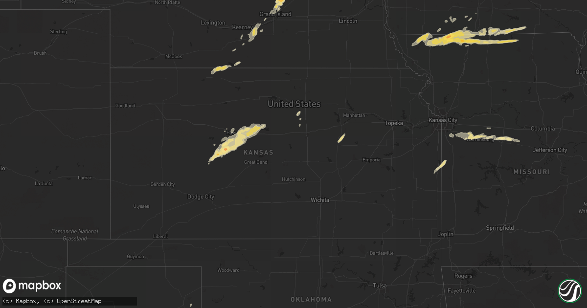
Hail Map in Kansas on May 25, 2012
Get this storm
May 25 map
$229
one time, instant access
Download today. No call, no setup
Keep the $229
Bought the map and want the full workflow? Apply the entire $229 to a subscription within 7 days. None of it is wasted.
Every map, not just this one
This buys you this map. Subscription and you get every map we run, in the markets you choose from a few cities to whole states to nationwide. Plus real-time alerts the moment a storm fires.
Contact data
Name, contact info, occupancy, even credit band for addresses in the footprint. You go from where it hit to who to call.
Become the source they trust
Unlimited branding weather history reports on demand. You already have the documented answer ready for the property owner, and you are the one who showed up with it.
Property data and RoofTrace estimates
Pull up any address you have got, its value and the exact code rules for that jurisdiction, straight from One Click Code. Then RoofTrace estimates the squares, pitch, and roof value, priced the way you price.
Storm reports in Kansas
Kansas
| Date | Description |
|---|---|
| 05/25/20126:53 PM CDT | A local report indicates a tornado near 2 W WALKER |
| 05/25/20126:48 PM CDT | Trained spotter reports tornado at the location indicated. |
| 05/24/201211:47 PM CDT | A local report indicates 1.00 inch wind near 4 N PFEIFER |
| 05/24/201210:47 PM CDT | A local report indicates 1.00 inch wind near 4 N PFEIFER |
| 05/24/201210:40 PM CDT | Cyclic repeated tornadogenesis |
| 05/24/201210:36 PM CDT | Damage to the grocery store |
| 05/24/201210:27 PM CDT | Delayed report of a tornado by a trained spotter which was just south of gorham. |
| 05/24/201210:27 PM CDT | A local report indicates a tornado near 5 N OTIS |
| 05/24/201210:17 PM CDT | A local report indicates a tornado near 5 N BISON |
| 05/24/201210:12 PM CDT | A local report indicates a tornado near 4 N BISON |
| 05/24/201210:10 PM CDT | A local report indicates a tornado near 7 NE LA CROSSE |
| 05/24/201210:00 PM CDT | A local report indicates a tornado near 4 NE LA CROSSE |
| 05/24/201210:00 PM CDT | Second tornado has developed |
| 05/24/20129:51 PM CDT | Large tornado continues |
| 05/24/20129:48 PM CDT | Framed homes were damaged on the south side of russell city limits. |
| 05/24/20129:45 PM CDT | *** 1 inj *** trained spotter reported damage from the rope tornado which destroyed one modular home on the south side of russell. Occupant had a few cuts and was later |
| 05/24/20129:43 PM CDT | Large rain wrapped wedge tornado |
| 05/24/20129:42 PM CDT | Tornado located just to the south of russell and no power in the city thus sirens will not be able to sound. |
| 05/24/20129:40 PM CDT | Storm chaser reports small rope tornado located near the town of russell. |
| 05/24/20129:36 PM CDT | Wedge tornado |
| 05/24/20129:31 PM CDT | Wedge tornado |
| 05/24/20129:28 PM CDT | A local report indicates a tornado near 5 W LA CROSSE |
| 05/24/20129:26 PM CDT | A local report indicates 1.00 inch wind near 4 W SCHOENCHEN |
| 05/24/20129:25 PM CDT | Elephant trunk tornado |
| 05/24/20129:16 PM CDT | A local report indicates a tornado near 1 WNW HARGRAVE |
| 05/24/20129:15 PM CDT | A local report indicates 1.75 inch wind near 5 NW HARGRAVE |
| 05/24/20129:00 PM CDT | A local report indicates a tornado near 5 ESE HARGRAVE |
| 05/24/20128:48 PM CDT | Spotter located 9s. Russell on 281. Tornado approx. 5wnw of his location. Cone tornado on the ground. |
| 05/24/20128:45 PM CDT | A local report indicates a tornado near 3 SW HARGRAVE |
| 05/24/20128:45 PM CDT | A local report indicates a tornado near 9 SW RUSSELL |
| 05/24/20128:45 PM CDT | A local report indicates 1.25 inch wind near GORHAM |
| 05/24/20128:44 PM CDT | A local report indicates a tornado near 7 S GORHAM |
| 05/24/20128:41 PM CDT | A local report indicates 1.00 inch wind near 3 E MCCRACKEN |
| 05/24/20128:35 PM CDT | Trained spotter reports a tornado near the russell and ellis county line. |
| 05/24/20128:30 PM CDT | A local report indicates a tornado near 6 S WALKER |
| 05/24/20128:10 PM CDT | Stove pipe tornado |
| 05/24/20128:06 PM CDT | A local report indicates 1.25 inch wind near 17 ENE NESS CITY |
| 05/24/20127:56 PM CDT | A local report indicates a tornado near 2 W ALEXANDER |
| 05/24/20127:53 PM CDT | A local report indicates 1.00 inch wind near 6 NNW BAZINE |
| 05/24/20127:41 PM CDT | A local report indicates 1.00 inch wind near 3 E MCCRACKEN |
| 05/24/20127:25 PM CDT | A local report indicates 1.00 inch wind near BAZINE |
| 05/24/20127:16 PM CDT | A local report indicates 1.00 inch wind near 11 E NESS CITY |
| 05/24/20127:05 PM CDT | A local report indicates a tornado near 6 W HARGRAVE |
| 05/24/20127:05 PM CDT | A local report indicates 1.00 inch wind near 4 SW ANTONINO |
All States Impacted by Hail Map on May 25, 2012
Cities Impacted by Hail Map on May 25, 2012
- Carey, OH
- Mount Carroll, IL
- Minden, NE
- Shelton, NE
- Kenesaw, NE
- Wood River, NE
- Heartwell, NE
- Gibbon, NE
- Charles City, IA
- Colwell, IA
- Winner, SD
- Laurel, NE
- Volga, SD
- Ericson, NE
- Bartlett, NE
- Ewing, NE
- Wisner, NE
- Pilger, NE
- Howard, SD
- Canova, SD
- Diagonal, IA
- Hoskins, NE
- Pierce, NE
- Randolph, NE
- Lineville, IA
- Davis City, IA
- Cainsville, MO
- Leon, IA
- Cushing, IA
- Anthon, IA
- Danbury, IA
- Battle Creek, IA
- Oto, IA
- Correctionville, IA
- Worth, MO
- Denver, MO
- Grant City, MO
- Clearwater, NE
- Archer, NE
- Chapman, NE
- Central City, NE
- Saint Libory, NE
- Palmer, NE
- Grand Island, NE
- Pipestone, MN
- Holland, MN
- Colome, SD
- Spencerville, OH
- Mendon, OH
- Ridgeway, MO
- Blythedale, MO
- Hatfield, MO
- Eagleville, MO
- Martinsville, MO
- Madison, SD
- Clearmont, MO
- Albion, NE
- Freeport, IL
- Ridott, IL
- Crofton, NE
- West Salem, OH
- Lodi, OH
- Burbank, OH
- Sullivan, OH
- Spencer, OH
- Homerville, OH
- Minneapolis, KS
- Delphos, KS
- Hughesville, MO
- Sedalia, MO
- Bazine, KS
- La Crosse, KS
- Alexander, KS
- McCracken, KS
- Norfolk, NE
- Cassville, WI
- Bloomington, WI
- Childress, TX
- Dixon, IA
- New Liberty, IA
- Dundee, IA
- Lamont, IA
- Manchester, IA
- Winthrop, IA
- Independence, IA
- Hazleton, IA
- Masonville, IA
- Aurora, IA
- Axtell, NE
- Hildreth, NE
- Wilcox, NE
- Hardwick, MN
- Luverne, MN
- Jasper, MN
- Winfred, SD
- Decatur, NE
- Tekamah, NE
- Punta Gorda, FL
- Vinson, OK
- Hollis, OK
- Gould, OK
- Texola, OK
- Erick, OK
- Mangum, OK
- Litchfield, OH
- Valley City, OH
- Brunswick, OH
- Medina, OH
- Madison, OH
- Geneva, OH
- Amsterdam, MO
- Pleasanton, KS
- Amoret, MO
- Hays, KS
- Gorham, KS
- Pfeifer, KS
- Victoria, KS
- Bison, KS
- Otis, KS
- Lyons, NE
- Bancroft, NE
- West Point, NE
- Wentworth, SD
- Bedford, IA
- Burlington Junction, MO
- Elmo, MO
- Braddyville, IA
- Onawa, IA
- Thurston, NE
- Neligh, NE
- Mission, SD
- Shamrock, TX
- Newman Grove, NE
- Tilden, NE
- Clio, IA
- Allerton, IA
- Wheeler, TX
- Alma, NE
- Lees Summit, MO
- Pleasant Hill, MO
- Raymore, MO
- Tipton, IA
- Atalissa, IA
- West Branch, IA
- West Liberty, IA
- Iowa City, IA
- Mclean, TX
- Plankinton, SD
- White Lake, SD
- Stickney, SD
- Reydon, OK
- Cheyenne, OK
- Castana, IA
- Moorhead, IA
- Soldier, IA
- Blencoe, IA
- North Port, FL
- Russell, KS
- Flandreau, SD
- Trent, SD
- Platte, SD
- Sioux Center, IA
- Ireton, IA
- Hawarden, IA
- Belvidere, IL
- Poplar Grove, IL
- Magnet, NE
- Bloomfield, NE
- Galena, IL
- Bellevue, IA
- Waverly, IA
- Sweetwater, OK
- Beemer, NE
- Holstein, IA
- Hornick, IA
- Moville, IA
- Ida Grove, IA
- Sheridan, MO
- Centerville, IA
- La Monte, MO
- Knob Noster, MO
- Kimball, SD
- Burke, SD
- Dixon, NE
- Republican City, NE
- Naponee, NE
- Stockton, IL
- Holden, MO
- Petersburg, NE
- Stanton, NE
- Meadow Grove, NE
- Battle Creek, NE
- Centerview, MO
- Warrensburg, MO
- German Valley, IL
- Coleridge, NE
- Belden, NE
- Carroll, NE
- Mount Vernon, SD
- Smithton, MO
- Pilot Grove, MO
- Otterville, MO
- Sayre, OK
- Grand River, IA
- Colton, SD
- Meservey, IA
- Thornton, IA
- Dell Rapids, SD
- Egan, SD
- Loudonville, OH
- Perrysville, OH
- Jeromesville, OH
- Ellston, IA
- Ellis, KS
- Exline, IA
- Powersville, MO
- Cincinnati, IA
- Corydon, IA
- Moulton, IA
- Unionville, MO
- Seymour, IA
- Mapleton, IA
- Charter Oak, IA
- Ute, IA
- Mineral Point, WI
- Plainfield, IA
- Clarksville, IA
- Shell Rock, IA
- Tripoli, IA
- Garden Prairie, IL
- Harvard, IL
- Denver, IA
- Readlyn, IA
- Mclean, NE
- Osmond, NE
- Salix, IA
- Sloan, IA
- Pender, NE
- Winnebago, NE
- Walthill, NE
- Whiting, IA
- Fulton, SD
- Artesian, SD
- Mitchell, SD
- Clarendon, TX
- Bernard, IA
- Cascade, IA
- Epworth, IA
- Long Island, KS
- Almena, KS
- Humboldt, SD
- Canistota, SD
- Swaledale, IA
- Osceola, IA
- Madison, NE
- Oakland, NE
- Howells, NE
- Dodge, NE
- Clarkson, NE
- Craig, NE
- Janesville, IA
- Letcher, SD
- Ramona, SD
- Harrison, SD
- Carthage, SD
- Corsica, SD
- Gregory, SD
- Fedora, SD
- Mobeetie, TX
- Briscoe, TX
- Colman, SD
- Grafton, OH
- Olmsted Falls, OH
- North Ridgeville, OH
- Columbia Station, OH
- Elyria, OH
- Bethany, MO
- Mount Ayr, IA
- Redding, IA
- Tescott, KS
- Pollock, MO
- Lucerne, MO
- Hopkins, MO
- Princeton, MO
- Maryville, MO
- Kellerton, IA
- Lamoni, IA
- Ravenwood, MO
- Parnell, MO
- Pickering, MO
- Newtown, MO
- Mercer, MO
- Dubuque, IA
- Zwingle, IA
- Peosta, IA
- Delhi, IA
- Gilmore City, IA
- Estherville, IA
- Dolliver, IA
- Port Charlotte, FL
- Herington, KS
- White City, KS
- Rome, OH
- Chardon, OH
- Thompson, OH
- Montville, OH
- Painesville, OH
- Rock Creek, OH
- Belmont, WI
- Fairfax, MO
- Tarkio, MO
- Walker, KS
- Brownell, KS
- Perry, OH
- Ossian, IA
- Castalia, IA
- Ness City, KS
- Schoenchen, KS
- Bunker Hill, KS
- Luray, KS
- Wadena, IA
- Pearl City, IL
- Woodstock, MN
- Edgerton, MN
- Elizabeth, IL
- Eldridge, IA
- Long Grove, IA
- Le Claire, IA
- Princeton, IA
- La Porte City, IA
- Buckingham, IA
- Ord, NE
- Hudson, SD
- Emmetsburg, IA
- Cylinder, IA
- Lucas, KS
- Hull, IA
- Waterloo, IA
- Cedar Falls, IA
- Woden, IA
- Titonka, IA
- Greenwood, MO
- Stamford, NE
- Phillipsburg, KS
- Beaver City, NE
- Orleans, NE
- Galva, IA
- Rockwell, IA
- Sheffield, IA
- Goodell, IA
- New Vienna, IA
- Lena, IL
- Pecatonica, IL
- Winnebago, IL
- Kent, IL
- Leaf River, IL
- Waterford, PA
- Norton, KS
- Fairview, PA
- Erie, PA
- Glen Haven, WI
- Mansfield, OH
- Bellville, OH
- Odebolt, IA
- Salem, SD
- Bloomville, OH
- Arthur, IA
- Laurens, IA
- Waldo, KS
- Liebenthal, KS
- Fairbank, IA
- Oelwein, IA
- New Hartford, IA
- Platteville, WI
- Donahue, IA
- Canadian, TX
- Clearfield, IA
- Springview, NE
- Calamus, IA
- Stockton, IA
- Bennett, IA
- Englewood, FL
- Venice, FL
- Upper Sandusky, OH
- Sycamore, OH
- Crystal Lake, IL
- Mchenry, IL
- Lancaster, WI
- Center, NE
- McCutchenville, OH
- Tiffin, OH
- Creighton, NE
- Winnetoon, NE
- Early, IA
- Kingsville, MO
- Grundy Center, IA
- Holland, IA
- Wellsburg, IA
- Allen, NE
- Niobrara, NE
- Sheridan, IN
- Concord, NE
- Amherst, OH
- Dyersville, IA
- Guttenberg, IA
- Elgin, NE
- Parker, SD
- Hartford, SD
- Concordia, MO
- Union City, PA
- Mound City, KS
- Butler, MO
- Mount Vernon, OH
- Utica, OH
- Centerburg, OH
- Hawkeye, IA
- West Union, IA
- Oberlin, OH
- Marble Rock, IA
- Wood, SD
- Quail, TX
- Newton, IA
- Colfax, IA
- Portland, IN
- Rockford, IL
- New Riegel, OH
- Dickens, IA
- Ruthven, IA
- Schleswig, IA
- Strongsville, OH
- Spencer, SD
- Alexandria, SD
- Dallas, SD
- Smithland, IA
- Leigh, NE
- Rodney, IA
- Bronson, IA
- Rosalie, NE
- Schaller, IA
- Macy, NE
- Ricketts, IA
- Climbing Hill, IA
- Blunt, SD
- Greeley, IA
- Earlville, IA
- New London, OH
- Westfield Center, OH
- Polk, OH
- Ashland, OH
- Lagrange, OH
- Seville, OH
- Wellington, OH
- Jesup, IA
- Hartington, NE
- La Motte, IA
- Hanover, IL
- Rockford, OH
- Monroe, SD
- Bunceton, MO
- Odessa, MO
- Lone Jack, MO
- Bates City, MO
- North Olmsted, OH
- Lelia Lake, TX
- Montrose, SD
- Lake View, IA
- Wall Lake, IA
- Traer, IA
- Ethan, SD
- Sumner, IA
- Allison, IA
- Albert City, IA
- Naples, FL
- McKean, PA
- Fredericktown, OH
- Scotia, NE
- Hopkinton, IA
- Worthington, IA
- Emerson, NE
- Wakefield, NE


