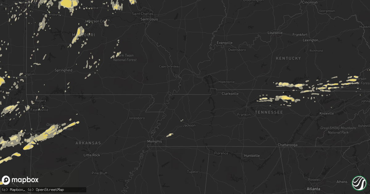
Hail Map in Virginia on May 24, 2011
Get this storm
May 24 map
$229
one time, instant access
Download today. No call, no setup
Keep the $229
Bought the map and want the full workflow? Apply the entire $229 to a subscription within 7 days. None of it is wasted.
Every map, not just this one
This buys you this map. Subscription and you get every map we run, in the markets you choose from a few cities to whole states to nationwide. Plus real-time alerts the moment a storm fires.
Contact data
Name, contact info, occupancy, even credit band for addresses in the footprint. You go from where it hit to who to call.
Become the source they trust
Unlimited branding weather history reports on demand. You already have the documented answer ready for the property owner, and you are the one who showed up with it.
Property data and RoofTrace estimates
Pull up any address you have got, its value and the exact code rules for that jurisdiction, straight from One Click Code. Then RoofTrace estimates the squares, pitch, and roof value, priced the way you price.
Storm reports in Virginia
Virginia
| Date | Description |
|---|---|
| 05/24/20116:48 PM CDT | Trees down on old richmond road. |
| 05/24/20116:43 PM CDT | A local report indicates 73 MPH wind near GRETNA |
| 05/24/20116:32 PM CDT | Power line down |
| 05/24/20116:30 PM CDT | A local report indicates 73 MPH wind near 3 S GRETNA |
| 05/24/20116:02 PM CDT | A local report indicates 60 MPH wind near SNOW CREEK |
| 05/24/20115:53 PM CDT | One tree down along central academy road. |
| 05/24/20115:45 PM CDT | Franklin county public safety director reported numerous trees down due to straight-line winds blocking henry road near the intersection with providence church road in |
| 05/24/20115:33 PM CDT | Few trees down around town |
| 05/24/20115:28 PM CDT | Few trees down around town |
| 05/24/20114:45 PM CDT | Power lines down |
| 05/24/20114:45 PM CDT | One tree down. |
| 05/24/20114:42 PM CDT | Tree down on flanary bridge road. |
| 05/24/20114:10 PM CDT | Possible tornado in the bolton area. |
| 05/24/20114:00 PM CDT | Homes in subdivision sustained shingle and roof damage. |
| 05/24/20113:44 PM CDT | Sustained 55 gusts to 72 mph...oceana naval air station ntu |
| 05/24/20113:42 PM CDT | A local report indicates 1.00 inch wind near 6 N KEMPSVILLE |
| 05/24/20113:41 PM CDT | At kmfv |
| 05/24/20113:40 PM CDT | Numerous trees down or snapped. |
| 05/24/20113:37 PM CDT | Occurred at pizza hut at 107 front street |
| 05/24/20113:36 PM CDT | A local report indicates 70 MPH wind near 3 WSW VIRGINIA BEACH OC |
| 05/24/20113:33 PM CDT | Vadot site va007 at high rise bridge. |
| 05/24/20113:30 PM CDT | *** 5 inj *** pole vault mat and other debris blown around...injuries at landstown h.s. |
| 05/24/20113:30 PM CDT | Homes in subdivision sustained shingle and roof damage. |
| 05/24/20113:30 PM CDT | Trees down. One tree on home. |
| 05/24/20113:30 PM CDT | Golfball hail reported. |
| 05/24/20113:30 PM CDT | Numerous trees and power lines down...howe farms subdivision. |
| 05/24/20113:24 PM CDT | Money point nos-ports...mnpv2. |
| 05/24/20113:22 PM CDT | Large tree branch down on vehicle. Damage to ntelos pavilion. |
| 05/24/20113:20 PM CDT | A local report indicates 1.00 inch wind near 1 SSW ATLANTIC |
| 05/24/20113:20 PM CDT | Silos knocked down and other damage in the area |
| 05/24/20113:20 PM CDT | Trees snapped and power lines down near st. Juliens creek naval annex. |
| 05/24/20113:19 PM CDT | At lfi |
| 05/24/20113:15 PM CDT | *** 1 fatal *** tstm wind gust pushed crane against building pinning shipyard employee. |
| 05/24/20113:15 PM CDT | *** 1 fatal *** crane pushed against building pinning shipyard employee |
| 05/24/20113:00 PM CDT | One tree down on dunbar rd |
| 05/24/20112:41 PM CDT | Tree down as well as large tree limbs...shingle damage to house |
| 05/24/20112:34 PM CDT | A local report indicates 60 MPH wind near COURTLAND |
| 05/24/20112:27 PM CDT | Numerous trees down on property including one on the house. Call from individual and from law enforcement in the area... |
| 05/24/20111:15 PM CDT | Large tree blown over |
| 05/24/201112:55 PM CDT | 5-6 large limbs blown down. |
| 05/24/201112:30 PM CDT | Many trees down. |
| 05/24/201112:27 PM CDT | A local report indicates 1.00 inch wind near DANVILLE AIRPORT |
| 05/24/201112:15 PM CDT | Trees down countywide. |
| 05/24/201111:57 AM CDT | Trees down. |
| 05/24/201111:47 AM CDT | Trees down along riceville road. |
| 05/24/201111:45 AM CDT | Trees down south part of lake area. |
| 05/24/201111:42 AM CDT | Trees down in patrick springs. |
| 05/24/201111:29 AM CDT | A local report indicates 1.00 inch wind near PENHOOK |
| 05/24/201111:25 AM CDT | A local report indicates 1.75 inch wind near PENHOOK |
| 05/24/201111:10 AM CDT | Trees down north of town. |
| 05/24/201111:00 AM CDT | Trees down near town of sontag. |
| 05/24/20119:45 AM CDT | Few trees down. |
| 05/24/20119:45 AM CDT | Few trees down. |
| 05/24/20119:40 AM CDT | 1 tree down. |
| 05/24/20119:35 AM CDT | Trees down in city. |
| 05/24/20119:25 AM CDT | 1 tree down. |
| 05/24/20118:53 AM CDT | A local report indicates 1.25 inch wind near GRUNDY |
| 05/23/20119:05 PM CDT | Tree down on power line |
| 05/23/20118:51 PM CDT | Tree down across road |
| 05/23/20118:35 PM CDT | Numerous trees down blocking intersection |
| 05/23/20118:35 PM CDT | Tree down on power line |
| 05/23/20118:30 PM CDT | Numerous trees down. |
| 05/23/20118:22 PM CDT | Tree down on south bound lane of interstate 85 |
| 05/23/20118:15 PM CDT | Tree 4 feet in diameter uprooted |
| 05/23/20118:13 PM CDT | Tree down across road |
| 05/23/20118:06 PM CDT | Tree blocking road. |
| 05/23/20117:52 PM CDT | Tree down on a house |
| 05/23/20117:29 PM CDT | Trees down in the randolph area. |
| 05/23/20117:16 PM CDT | Power line blown down on wolf trap road. |
| 05/23/20117:15 PM CDT | Tree and power line blown down on higway 58. |
| 05/23/20117:11 PM CDT | 2 trees down in kentuck |
| 05/23/20117:11 PM CDT | Power line down |
All States Impacted by Hail Map on May 24, 2011
Cities Impacted by Hail Map on May 24, 2011
- Nickerson, KS
- Abbyville, KS
- Hutchinson, KS
- Partridge, KS
- Arlington, KS
- Genoa, CO
- Franklin, VA
- Haskell, OK
- Mount Ayr, IA
- Winfield, TN
- Newcomb, TN
- Oneida, TN
- Pioneer, TN
- Jefferson, NC
- Carlinville, IL
- Princeton, KS
- Kanorado, KS
- Ozark, AR
- Altus, AR
- Cecil, AR
- Hudson, KS
- Mckinney, TX
- Allen, TX
- Plano, TX
- Moran, KS
- La Harpe, KS
- Okmulgee, OK
- Amherst, CO
- Arapahoe, CO
- Burlington, CO
- Milburn, OK
- Kingston, OK
- Mill Creek, OK
- Madill, OK
- Ardmore, OK
- Burneyville, OK
- Marietta, OK
- Gainesville, TX
- Muenster, TX
- Wilson, OK
- Mannsville, OK
- Tishomingo, OK
- Overbrook, OK
- Elliott, IA
- Weatherford, OK
- Alvord, TX
- Chico, TX
- Baskerville, VA
- South Hill, VA
- Moscow, KS
- Hugoton, KS
- Elkhart, KS
- Rolla, KS
- Richfield, KS
- Frankford, MO
- Murchison, TX
- Athens, TX
- Chilhowee, MO
- Plattsburg, MO
- Virginia Beach, VA
- Norfolk, VA
- Cumberland, KY
- Partridge, KY
- Skiatook, OK
- Hominy, OK
- Slater, IA
- Ankeny, IA
- Alleman, IA
- Cleveland, OK
- Sand Springs, OK
- Osage, OK
- Mannford, OK
- Prue, OK
- Pineville, KY
- Miracle, KY
- Boyd, TX
- Paradise, TX
- Rich Hill, MO
- Butler, MO
- Kim, CO
- Neosho Falls, KS
- Yates Center, KS
- Piqua, KS
- Oologah, OK
- Irving, TX
- Haviland, KS
- Alexander, KS
- Duffield, VA
- Gate City, VA
- Carrollton, TX
- Coppell, TX
- Dallas, TX
- Bath, IL
- Luray, KS
- Waldo, KS
- Lucas, KS
- Sylvan Grove, KS
- Hunter, KS
- Bunker Hill, KS
- Virgil, KS
- Eureka, KS
- Hamilton, KS
- Albany, KY
- Tyler, TX
- Pierceville, KS
- Garden City, KS
- Livingston, TN
- Lebanon, OK
- Ness City, KS
- Castalian Springs, TN
- Iredell, TX
- Meridian, TX
- Hico, TX
- Geronimo, OK
- Walters, OK
- Onancock, VA
- Parksley, VA
- Bloxom, VA
- Portsmouth, VA
- Quinton, OK
- Point, TX
- Fairview, OK
- Waynoka, OK
- Aline, OK
- Cleo Springs, OK
- Beloit, KS
- Cimarron, KS
- Triplett, MO
- Glade Hill, VA
- Ulysses, KS
- Delphos, KS
- Miltonvale, KS
- Cantrall, IL
- Sherman, IL
- Mulvane, KS
- Udall, KS
- Azle, TX
- Springtown, TX
- Springer, OK
- Drexel, MO
- Rhome, TX
- Decatur, TX
- Blackburn, MO
- Marshall, MO
- Sweet Springs, MO
- Paola, KS
- Grand Prairie, TX
- Crandall, TX
- Kaufman, TX
- Terrell, TX
- Goodland, KS
- Francesville, IN
- Calumet, OK
- Okarche, OK
- El Reno, OK
- Roodhouse, IL
- White Hall, IL
- Hillview, IL
- Leslie, AR
- Jerusalem, AR
- Hector, AR
- Tilly, AR
- Accomac, VA
- Onley, VA
- Marion, IN
- Wellington, KS
- Grapevine, TX
- Ringgold, TX
- Nocona, TX
- Mount Sterling, IL
- Midlothian, TX
- Powhattan, KS
- Horton, KS
- Success, MO
- Licking, MO
- Syracuse, KS
- Hamilton, IL
- Warsaw, IL
- Victoria, KS
- Sherman, TX
- Howe, TX
- Clarksville, AR
- Gretna, VA
- Penhook, VA
- Union Hall, VA
- Seagoville, TX
- Wilmer, TX
- Hutchins, TX
- Burnside, KY
- Monticello, KY
- Bronston, KY
- Norman, OK
- Washington, OK
- Noble, OK
- Rocky Mount, VA
- Callaway, VA
- Jarrell, TX
- Georgetown, TX
- Mason, TN
- Somerville, TN
- Lamar, AR
- Bartlett, KS
- Welch, OK
- Humeston, IA
- Garden Grove, IA
- Bullard, TX
- Jacksonville, TX
- Burden, KS
- Atlanta, KS
- Ryan, IA
- Coggon, IA
- Glen Elder, KS
- Winfield, KS
- Royse City, TX
- Midland, AR
- Huntington, AR
- Hackett, AR
- Wills Point, TX
- Augusta, KS
- Rose Hill, KS
- Douglass, KS
- Andover, KS
- Wapanucka, OK
- Coleman, OK
- Suffolk, VA
- Chesapeake, VA
- Ravenna, TX
- Ivanhoe, TX
- Bonham, TX
- Corn, OK
- Beeler, KS
- Ada, OK
- Poteau, OK
- Howe, OK
- Heavener, OK
- Wister, OK
- Rockdale, TX
- Denison, TX
- Sandy Level, VA
- Minneapolis, KS
- Clay Center, KS
- Mooreland, OK
- Elgin, OK
- Apache, OK
- Ryan, OK
- Bluffs, IL
- Meredosia, IL
- Chambersburg, IL
- Versailles, IL
- McGrady, NC
- Elkin, NC
- Traphill, NC
- Thurmond, NC
- Hays, NC
- Millers Creek, NC
- Hartsville, TN
- Goddard, KS
- Artemus, KY
- Barbourville, KY
- Trosper, KY
- Ransom, KS
- Jetmore, KS
- Evant, TX
- Mayfield, KS
- Caldwell, KS
- Milan, KS
- Prophetstown, IL
- Newark, TX
- Colleyville, TX
- Lancaster, TX
- Keller, TX
- Millsap, TX
- Addison, TX
- Euless, TX
- Weatherford, TX
- Graford, TX
- Haslet, TX
- Justin, TX
- Bridgeport, TX
- Duncanville, TX
- Hurst, TX
- North Richland Hills, TX
- Roanoke, TX
- Aledo, TX
- Haltom City, TX
- Naval Air Station Jrb, TX
- Mineral Wells, TX
- Perrin, TX
- Fort Worth, TX
- Southlake, TX
- Palo Pinto, TX
- Arlington, TX
- Bedford, TX
- Whitt, TX
- Poolville, TX
- Jacksonville, IL
- Watonga, OK
- El Dorado, KS
- Belle Plaine, KS
- Wichita, KS
- Towanda, KS
- Benton, KS
- Derby, KS
- Clinton, MO
- Tipton, IA
- West Branch, IA
- Corydon, IA
- Emporia, KS
- Cawker City, KS
- Tipton, KS
- Mankato, KS
- Esbon, KS
- Sulphur, OK
- Dover, AR
- Pelsor, AR
- Witts Springs, AR
- Winamac, IN
- Monon, IN
- Rensselaer, IN
- Wolcott, IN
- Bells, TX
- Foster, OK
- Duncan, OK
- Hastings, OK
- Comanche, OK
- Waurika, OK
- Elmore City, OK
- Marlow, OK
- Temple, OK
- Humboldt, KS
- Troy, KS
- Highland, KS
- Tulsa, OK
- Russell, KS
- Madrid, IA
- Polk City, IA
- Havensville, KS
- Onaga, KS
- Fruitvale, TX
- Grand Saline, TX
- Crescent, OK
- Hartville, MO
- Stratford, OK
- Toronto, KS
- Wichita Falls, TX
- Holliday, TX
- Hopedale, IL
- Barnard, KS
- Sterling, KS
- Wilson, KS
- Dorrance, KS
- Kerens, TX
- De Witt, MO
- Carrollton, MO
- Lawson, MO
- Smithfield, VA
- Scurry, TX
- Zenda, KS
- Valley Mills, TX
- Crawford, TX
- Rural Hall, NC
- King, NC
- Celina, TX
- Aubrey, TX
- Prosper, TX
- Healdton, OK
- South Boston, VA
- Halifax, VA
- Calvin, KY
- Frakes, KY
- Powderly, TX
- Whitesboro, TX
- Pilot Point, TX
- Van Alstyne, TX
- Henrietta, TX
- Bellevue, TX
- Sunset, TX
- Boswell, OK
- Ringling, OK
- Bennington, OK
- Lone Grove, OK
- Colbert, OK
- Ector, TX
- Hendrix, OK
- Sadler, TX
- Hugo, OK
- Tioga, TX
- Petrolia, TX
- Thackerville, OK
- Sumner, TX
- Honey Grove, TX
- Gunter, TX
- Arthur City, TX
- Forestburg, TX
- Tom Bean, TX
- Era, TX
- Montague, TX
- Stonewall, OK
- Saint Jo, TX
- Telephone, TX
- Grant, OK
- Valley View, TX
- Savoy, TX
- Collinsville, TX
- Terral, OK
- Sanger, TX
- Lindsay, TX
- Whitewright, TX
- Pottsboro, TX
- Bowie, TX
- Rosston, TX
- Byers, TX
- Richland Springs, TX
- San Saba, TX
- Cedar Point, KS
- Burns, KS
- Cassoday, KS
- Archie, MO
- Vernon Hill, VA
- Clayton, OK
- New London, MO
- Cheney, KS
- Pretty Prairie, KS
- Star, TX
- Hamilton, TX
- Goldthwaite, TX
- Scranton, AR
- Hartman, AR
- Lincoln, KS
- Boonville, MO
- Wooldridge, MO
- Salado, TX
- Alta Vista, KS
- Sheldon, MO
- Milo, MO
- Nevada, MO
- West Jefferson, NC
- Smithville, MO
- Kearney, MO
- Liberty, MO
- Avon, IL
- Frankston, TX
- Lampasas, TX
- Bonner Springs, KS
- Kansas City, KS
- Boley, OK
- Paden, OK
- Mutual, OK
- Florence, TX
- Cement, OK
- Chickasha, OK
- Palmyra, MO
- Evarts, KY
- Benham, KY
- Closplint, KY
- Holmes Mill, KY
- Mason, TX
- Art, TX
- Bogard, MO
- Mansfield, AR
- Holton, KS
- Keene, TX
- Cleburne, TX
- Thomas, OK
- Geary, OK
- Bison, KS
- La Crosse, KS
- Rush Center, KS
- Otis, KS
- La Harpe, IL
- Blandinsville, IL
- Dallas City, IL
- Lomax, IL
- Pawnee, OK
- Abilene, KS
- Cumby, TX
- Briggs, TX
- Bertram, TX
- Burnet, TX
- Lewisville, TX
- Saint George, KS
- McFarland, KS
- Eskridge, KS
- Wamego, KS
- Dwight, KS
- Belvue, KS
- Junction City, KS
- Riley, KS
- Fort Riley, KS
- Alma, KS
- Paxico, KS
- Maple Hill, KS
- Ogden, KS
- Manhattan, KS
- Topeka, KS
- Lucerne, MO
- New Blaine, AR
- Vermillion, KS
- Nekoma, KS
- McCracken, KS
- Brownell, KS
- Bazine, KS
- Hemingford, NE
- Alliance, NE
- Brashear, MO
- Gibbs, MO
- Medford, OK
- Drury, MO
- Norwood, MO
- Clover, VA
- Nathalie, VA
- Ingalls, KS
- Middletown, MO
- Bowling Green, MO
- Curryville, MO
- Cheyenne Wells, CO
- Kit Carson, CO
- Fredonia, KS
- Moscow, IA
- Wilton, IA
- Mesquite, TX
- Balch Springs, TX
- Hagarville, AR
- Melfa, VA
- Harper, KS
- Beggs, OK
- Axtell, TX
- Holland, TX
- Medicine Lodge, KS
- Rockwall, TX
- Isabel, KS
- Cantril, IA
- Arbela, MO
- Macksville, KS
- St John, KS
- Keota, OK
- Kinta, OK
- Stigler, OK
- Dighton, KS
- Green City, MO
- Milan, MO
- Chester, OK
- Dover, OK
- Hennessey, OK
- Edgewood, TX
- Canton, TX
- Pineville, MO
- Wyaconda, MO
- Kahoka, MO
- Meeker, OK
- Chandler, OK
- Amber, OK
- Pocasset, OK
- Luther, OK
- Wellston, OK
- Fort Sill, OK
- Fletcher, OK
- Sparks, OK
- Blanchard, OK
- Jones, OK
- Cyril, OK
- Oklahoma City, OK
- Newcastle, OK
- Verden, OK
- Bristow, OK
- Harrah, OK
- Cushing, OK
- Drumright, OK
- Mcloud, OK
- Spencer, OK
- Depew, OK
- Tuttle, OK
- Stroud, OK
- Choctaw, OK
- Davenport, OK
- Lawton, OK
- Maquon, IL
- Gilson, IL
- Farber, MO
- Laddonia, MO
- Lone Oak, TX
- Ringwood, OK
- Wagoner, OK
- Jonesboro, TX
- Allen, OK
- Lancaster, KS
- Argonia, KS
- Viola, KS
- Clearwater, KS
- Garden Plain, KS
- Milton, KS
- Conway Springs, KS
- Perkins, OK
- Meridian, OK
- Stillwater, OK
- Coyle, OK
- Olpe, KS
- Oxford, KS
- Braman, OK
- South Haven, KS
- Geuda Springs, KS
- Monroe City, MO
- Grenola, KS
- Piedmont, KS
- Moline, KS
- Howard, KS
- Havana, IL
- Peck, KS
- Pfafftown, NC
- Vilas, NC
- Boone, NC
- Larned, KS
- Centerton, AR
- Bella Vista, AR
- Bentonville, AR
- Effingham, KS
- Austin, TX
- Williamsburg, KY
- Rockholds, KY
- Knoxville, IA
- Rayville, MO
- Richmond, MO
- Orrick, MO
- Excelsior Springs, MO
- Purlear, NC
- Fleetwood, NC
- Glendale Springs, NC
- Forney, TX
- Green, KS
- Hoisington, KS
- Olmitz, KS
- Yale, VA
- Capron, VA
- Gorham, KS
- Natoma, KS
- Paradise, KS
- Downs, KS
- Osborne, KS
- Hays, KS
- Burkesville, KY
- Windsor, VA
- Waterville, KS
- Brule, NE
- Fay, OK
- Talihina, OK
- Locust Grove, OK
- Chouteau, OK
- Boise City, OK
- Keyes, OK
- Goodwell, OK
- Montgomery City, MO
- New Florence, MO
- Bellflower, MO
- High Hill, MO
- Chelsea, OK
- Amazonia, MO
- Ava, MO
- Slater, MO
- Mcalester, OK
- Indianola, OK
- Aledo, IL
- Elsberry, MO
- Silex, MO
- Eolia, MO
- Marquette, KS
- Lindsborg, KS
- Falun, KS
- Fairfax, OK
- Clayton, IL
- Brady, TX
- Luray, MO
- Faxon, OK
- Cache, OK
- Chattanooga, OK
- Fort Smith, AR
- Paris, AR
- Magazine, AR
- Booneville, AR
- Branch, AR
- Charleston, AR
- Coal Hill, AR
- Ratcliff, AR
- Greenwood, AR
- Lavaca, AR
- Roff, OK
- Hartford, AR
- Rocheport, MO
- Columbia, MO
- Girard, IL
- Nilwood, IL
- Waggoner, IL
- Litchfield, IL
- Gillespie, IL
- Laurel Springs, NC
- Crumpler, NC
- Church Hill, TN
- Eudora, KS
- Carthage, TN
- Bosworth, MO
- Mendon, MO
- Belhaven, NC
- Copper Hill, VA
- Check, VA
- Floyd, VA
- Malta Bend, MO
- Miami, MO
- Blackwater, MO
- Nelson, MO
- Buckholts, TX
- Thorndale, TX
- Granger, TX
- Taylor, TX
- Milano, TX
- Leedey, OK
- Eldon, MO
- Walnut Springs, TX
- Neosho Rapids, KS
- Reading, KS
- Dill City, OK
- Foss, OK
- Subiaco, AR
- Piedmont, OK
- Yukon, OK
- Gainesboro, TN
- Whitleyville, TN
- Mears, VA
- Hallwood, VA
- La Belle, MO
- Williamstown, MO
- Danville, KS
- Whiting, KS
- Mounds, OK
- Mccurtain, OK
- Cordell, OK
- Mountain View, OK
- Plano, IA
- Waxahachie, TX
- Joshua, TX
- Godley, TX
- Gotebo, OK
- Cashion, OK
- Hinton, OK
- Lookeba, OK
- Carnegie, OK
- Colony, OK
- Kingfisher, OK
- Hydro, OK
- Callands, VA
- Henry, VA
- Ferrum, VA
- Bassett, VA
- Martinsville, VA
- Belle Plaine, IA
- Lone Wolf, OK
- Hobart, OK
- Roosevelt, OK
- Rochelle, TX
- Kenvir, KY
- Cawood, KY
- Arjay, KY
- Stoney Fork, KY
- Kettle Island, KY
- Hulen, KY
- Iowa City, IA
- Chase, KS
- Sun City, KS
- Pratt, KS
- Claflin, KS
- Lake City, KS
- Lyons, KS
- Stafford, KS
- Bushton, KS
- Raymond, KS
- Alva, OK
- Lorraine, KS
- Turon, KS
- Byers, KS
- Great Bend, KS
- Ellinwood, KS
- Iuka, KS
- Sawyer, KS
- Coats, KS
- Leavenworth, KS
- Lewistown, IL
- Table Grove, IL
- Cuba, IL
- Ipava, IL
- Smithfield, IL
- Assawoman, VA
- Wallops Island, VA
- Greenbush, VA
- Sanford, VA
- Temperanceville, VA
- Mount Airy, NC
- Assumption, IL
- Purcell, OK
- Newalla, OK
- Lindsay, OK
- Lexington, OK
- Alex, OK
- Lavon, TX
- Sallisaw, OK
- Danville, VA
- Dry Fork, VA
- Chatham, VA
- Axton, VA
- Sedan, KS
- Riverton, IL
- Tompkinsville, KY
- Summer Shade, KY
- Onslow, IA
- Cascade, IA
- Monmouth, IA
- Monticello, IA
- Ramona, OK
- Murdock, KS
- Kingman, KS
- Quitman, TX
- Albert, KS
- Hugo, CO
- Karval, CO
- Bradley, OK
- Barry, IL
- Cameron, MO
- Hartsburg, IL
- Cookeville, TN
- Rickman, TN
- Cummings, KS
- Atchison, KS
- Ellis, KS
- Larue, TX
- Rye, CO
- New Cambria, MO
- Boss, MO
- Salem, MO
- Courtland, VA
- Higginsville, MO
- London Mills, IL
- Clyde, KS
- Clifton, KS
- Paris, MO
- Osceola, IA
- Weldon, IA
- Deep Gap, NC
- Clifton, IL
- Strunk, KY
- Pine Knot, KY
- Pall Mall, TN
- Ben Wheeler, TX
- Eustace, TX
- Mabank, TX
- Saint Francis, KS
- Frisco, TX
- Spring Hill, KS
- Olathe, KS
- Tecumseh, OK
- Lamar, OK
- Quinlan, TX
- Pilot Mountain, NC
- Westfield, NC
- Bogata, TX
- Otley, IA
- Monroe, IA
- Madison, MO
- Philadelphia, MO
- Huntsville, MO
- Independence, MO
- Ronda, NC
- Hamptonville, NC
- Scranton, NC
- Sturgeon, MO
- Clark, MO
- Rocky Mount, MO
- Gravois Mills, MO
- Barnett, MO
- Dover, MO
- Waverly, MO
- Alma, MO
- Corder, MO
- Ordway, CO
- Glade Valley, NC
- Sparta, NC
- Spivey, KS
- West, TX
- Elm Mott, TX
- Antlers, OK
- Stringtown, OK
- Nashoba, OK
- Arthur, NE
- Salina, OK
- Rose, OK
- Wanette, OK
- Macomb, OK
- State Road, NC
- Mart, TX
- Bolckow, MO
- Waco, TX
- Griggsville, IL
- Bryants Store, KY
- Siler, KY
- Fourmile, KY
- Keeling, VA
- Beardstown, IL
- Anadarko, OK
- Knox City, MO
- Rush, CO
- Ferguson, NC
- Inman, KS
- Brashear, TX
- Emory, TX
- Sulphur Springs, TX
- Yantis, TX
- Minco, OK
- Caldwell, TX
- Hitchcock, OK
- Little River, KS
- Ellsworth, KS
- Mcpherson, KS
- Geneseo, KS
- Windom, KS
- Steelville, MO
- Tiffin, IA
- Oxford, IA
- Lexington, TX
- Miami, OK
- Afton, OK
- Fort Gibson, OK
- Liberal, MO
- Lenapah, OK
- Nowata, OK
- S Coffeyville, OK
- Delaware, OK
- Elkhorn City, KY
- Cascade, VA
- Kansas City, MO
- Holt, MO
- Yoder, CO
- Ralston, OK
- Wynona, OK
- Reynolds, IL
- Loveland, OK
- Wellington, MO
- Wray, CO
- Erie, IL
- Coalgate, OK
- Blue Rapids, KS
- Lakin, KS
- McCook, NE
- Bouton, IA
- Attica, KS
- Gans, OK
- Arcadia, OK
- Edmond, OK
- Pawhuska, OK
- Lafayette, IN
- West Lafayette, IN
- Saint Joseph, MO
- De Kalb, MO
- Speedwell, TN
- Dobson, NC
- Hallsville, MO
- Dixon Springs, TN
- Lebanon, TN
- Pleasant Shade, TN
- Riddleton, TN
- Elmwood, TN
- Norborne, MO
- Hardin, MO
- Atwood, OK
- Calvin, OK
- Holdenville, OK
- Eads, CO
- Boonville, NC
- Yadkinville, NC
- New Holland, IL
- Lincoln, IL
- Kechi, KS
- Valley Center, KS
- Chandlerville, IL
- Eufaula, OK
- Rush Springs, OK
- Ninnekah, OK
- Killeen, TX
- Bath, NC
- Walnut Cove, NC
- Germanton, NC
- Hiawatha, KS
- Scranton, KS
- Tescott, KS
- Cresson, TX
- Sharon Springs, KS
- Altoona, KS
- Benedict, KS
- Home, KS
- Rowlett, TX
- Mountain Grove, MO
- Graff, MO
- Monmouth, IL
- Milford, KS
- Chapman, KS
- Macclesfield, NC
- Tarboro, NC
- Pinetops, NC
- Pilot Grove, MO
- Yanceyville, NC
- Lowgap, NC
- Lambsburg, VA
- Nortonville, KS
- Winchester, KS
- Monterey, TN
- Pinetown, NC
- Udell, IA
- Calhan, CO
- Prairie City, IL
- Bushnell, IL
- Martinsburg, MO
- Rock, KS
- Latham, KS
- Leon, KS
- Franklin, MO
- Glasgow, MO
- Kirksville, MO
- Leonard, TX
- Torrington, WY
- Emporia, VA
- Jarratt, VA
- Sublette, KS
- Satanta, KS
- Warrensburg, MO
- Gilliam, MO
- Dalton, MO
- New Franklin, MO
- Fayette, MO
- Arrow Rock, MO
- Bunceton, MO
- Salisbury, MO
- Hughesville, MO
- Houstonia, MO
- Sedalia, MO
- Otterville, MO
- Celina, TN
- Felt, OK
- Union City, OK
- Versailles, MO
- Lake Ozark, MO
- Kaiser, MO
- Climax Springs, MO
- Sunrise Beach, MO
- Osage Beach, MO
- Camdenton, MO
- Roach, MO
- Macks Creek, MO
- Gatesville, TX
- Chariton, IA
- Ripley, OK
- Mayview, MO
- Catoosa, OK
- Thrall, TX
- Rushville, MO
- Wilburton, OK
- Hartshorne, OK
- Altamont, KS
- Edna, KS
- Siloam, NC
- Turney, MO
- Osborn, MO
- Littleton, IL
- Rushville, IL
- Whitefield, OK
- Bokoshe, OK
- Silver Lake, KS
- Inola, OK
- Claremore, OK
- Overland Park, KS
- Media, IL
- Valley Falls, KS
- Pittsville, VA
- Holyoke, CO
- Shidler, OK
- Carrsville, VA
- Broken Arrow, OK
- Barnes, KS
- Monroe, TN
- Allons, TN
- Hilham, TN
- Como, TX
- Canton, MO
- Yale, OK
- Tribune, KS
- Blairstown, MO
- Urich, MO
- Holden, MO
- Creighton, MO
- Stearns, KY
- Clifton Hill, MO
- Alexander, IL
- Franklin, IL
- Waverly, IL
- Edgerton, KS
- Wellsville, KS
- Urbana, MO
- Tunas, MO
- Lancaster, MO
- Weston, MO
- Platte City, MO
- Mustang, OK
- Byrdstown, TN
- Lexington, MO
- Whitewater, KS
- Newton, KS
- Sedgwick, KS
- Concordia, KS
- Oakwood, OK
- Longdale, OK
- Seiling, OK
- Butler, OK
- Clinton, OK
- Putnam, OK
- Taloga, OK
- Custer City, OK
- West Liberty, IA
- Ottawa, KS
- Easton, KS
- Alpha, KY
- La Monte, MO
- Graham, MO
- Skidmore, MO
- Barnard, MO
- Siloam Springs, AR
- Watts, OK
- Glencoe, OK
- Atlanta, MO
- Middlesboro, KY
- Glasco, KS
- Moulton, IA
- Hopkinton, IA
- Allardt, TN
- Edgerton, MO
- Brumley, MO
- Williamsville, IL
- Keokee, VA
- Whitley City, KY
- Pfeifer, KS
- Rozel, KS
- Liebenthal, KS
- Colwich, KS
- Mount Hope, KS
- Andale, KS
- Williamston, NC
- Kemp, TX
- Fayetteville, AR
- Hutto, TX
- Baxter Springs, KS
- Galena, KS
- Williamsburg, MO
- Morrison, MO
- Cherokee, TX
- Diagonal, IA
- Alvarado, TX
- Burleson, TX
- Nebo, IL
- Kampsville, IL
- Pearl, IL
- Coweta, OK
- Lusk, WY
- Iowa Park, TX
- Sheppard Afb, TX
- Albia, IA
- Colony, KS
- Drakes Branch, VA
- Belton, MO
- Stilwell, KS
- Granger, IA
- Woodward, IA
- Clifton, TX
- Rocky Ford, CO
- Model, CO
- Vinita, OK
- Westmoreland, KS
- Biggsville, IL
- Canadian, OK
- Elk Falls, KS
- Swisher, IA
- Cedar Rapids, IA
- Argyle, TX
- Keytesville, MO
- Blue Mound, IL
- Bristol, VA
- Stuart, OK
- Randall, KS
- Jewell, KS
- Kilbourne, IL
- Oakford, IL
- Crowley, TX
- Cherokee, OK
- Castle, OK
- Fort Leavenworth, KS
- Dearborn, MO
- Faucett, MO
- Palmer, KS
- Greenville, NC
- Woodburn, IA
- Coolidge, TX
- Akron, CO
- Belews Creek, NC
- Harrisonville, MO
- Chelsea, IA
- Billings, OK
- Bristol, TN
- Abingdon, VA
- Burdett, KS
- Marysville, KS
- Tahlequah, OK
- Clarence, MO
- Moberly, MO
- Jacksonville, MO
- Cairo, MO
- Polo, MO
- Trimble, MO
- Camden, MO
- Stoutsville, MO
- Voca, TX
- Daisy, OK
- Snow, OK
- Coalgood, KY
- Mary Alice, KY
- Wallins Creek, KY
- Grays Knob, KY
- Cranks, KY
- Gulston, KY
- Pennington Gap, VA
- Harlan, KY
- Hampton, VA
- Llano, TX
- Marceline, MO
- Jamestown, KS
- Guthrie, OK
- Heidrick, KY
- Solomon, KS
- Pilot, VA
- Jenks, OK
- Owasso, OK
- Cameron, OK
- Fancy Gap, VA
- Hillsville, VA
- Folsom, NM
- Madison, KS
- Porter, OK
- Tow, TX
- Coffeyville, KS
- Bartlesville, OK
- Surgoinsville, TN
- Salina, KS
- New Cambria, KS
- Fall River, KS
- Kiowa, OK
- Blanco, OK
- Okemah, OK
- Kellyville, OK
- Gorin, MO
- Lewistown, MO
- Fortuna, MO
- Hope, IN
- Carmen, OK
- Holly, CO
- Pollock, MO
- Flint, TX
- Barnsdall, OK
- Lindale, TX
- Bucyrus, MO
- Plato, MO
- Mendota, VA
- Olsburg, KS
- Lafayette, TN
- Cana, VA
- Matfield Green, KS
- Cottonwood Falls, KS
- Garland, TX
- Simpson, KS
- Petersburg, IL
- Perry, MO
- Mount Calm, TX
- Severy, KS
- Sunnyvale, TX
- Ogallala, NE
- North Wilkesboro, NC
- Wilkesboro, NC
- Hulbert, OK
- Camden Point, MO
- Seneca, KS
- Red Oak, OK
- Pittsburg, OK
- Peggs, OK
- Blakesburg, IA
- Lake Creek, TX
- Deport, TX
- Aurora, KS
- Sutter, IL
- Maryville, MO
- Arlington, CO
- Longton, KS
- Chanute, KS
- Buffalo, KS
- Boydton, VA
- Chase City, VA
- Neodesha, KS
- Gower, MO
- Springdale, AR
- Arkansas City, KS
- Muscotah, KS
- Braymer, MO
- Jefferson City, MO
- Corryton, TN
- Ladonia, TX
- Windom, TX
- Rozet, WY
- Odell, IL
- Payson, IL
- Haswell, CO
- Adair, IL
- Centerville, IA
- Big Springs, NE
- Baring, MO
- Glasgow, KY
- Redding, IA
- Gentry, AR
- Decatur, AR
- Enid, OK
- Carrier, OK
- Lahoma, OK
- Walker, MO
- Schell City, MO
- Cambridge, KS
- Dugspur, VA
- Pocola, OK
- Halstead, KS
- Burrton, KS
- Winnsboro, TX
- Burlington, OK
- Arapaho, OK
- Westville, OK
- Colcord, OK
- Summers, AR
- Camargo, OK
- Jamestown, TN
- Wilder, TN
- Wilsey, KS
- Ochelata, OK
- Flagler, CO
- Clintwood, VA
- Alba, TX
- Moravia, IA
- Oregon, MO
- Gridley, KS
- Memphis, MO
- Burbank, OK
- Lipan, TX
- Lathrop, MO
- Waukomis, OK
- Bison, OK
- Mulhall, OK
- Lenexa, KS
- Macon, MO
- Anabel, MO
- Troy, MO
- Foley, MO
- Blountville, TN
- Bokchito, OK
- Winfield, MO
- Clarksville, MO
- Annada, MO
- Bird City, KS
- Nashville, KS
- Sharon, KS
- Randlett, OK
- Lebo, KS
- Winthrop, IA
- Aurora, IA
- Independence, IA
- Denton, TX
- Lake Dallas, TX
- Gordon, KY
- Roaring River, NC
- Pinnacle, NC
- Roaring Gap, NC
- McLouth, KS
- Grundy, VA
- Oakwood, VA
- Wayne, OK
- Shady Point, OK
- Purdy, MO
- Buffalo, IL
- Illiopolis, IL
- Laurel Fork, VA
- Arlington, TN
- Randolph, KS
- Leonardville, KS
- Niantic, IL
- Republic, KS
- Peru, KS
- Bledsoe, KY
- Castell, TX
- Welling, OK
- Ashland, IL
- Tallula, IL
- Mineola, TX
- White Cloud, KS
- Robinson, KS
- Winston, MO
- Weatherby, MO
- Pond Creek, OK
- Latham, IL
- Tennessee, IL
- Jacksboro, TX
- Woodlawn, VA
- Limon, CO
- Waldron, MO
- Novelty, MO
- Leonard, MO
- Newtown, MO
- Harris, MO
- Tobaccoville, NC
- Manor, TX
- Pflugerville, TX
- Farmington, IA
- Bonaparte, IA
- Liberty, IL
- Baylis, IL
- Vandalia, MO
- Big Cabin, OK
- Adair, OK
- Atoka, OK
- Centertown, MO
- Lohman, MO
- Paoli, OK
- Appalachia, VA
- Lyndon, KS
- Wakefield, KS
- Frederick, IL
- Burlington, KS
- Brodnax, VA
- Jay, OK
- Linn, KS
- Mendon, IL
- Bethany, MO
- Farmington, IL
- Oketo, KS
- Pryor, OK
- Leasburg, MO
- Cuba, MO
- Maxwell, IA
- Garfield, KS
- Perry, OK
- Hannibal, MO
- Jennings, OK
- Plymouth, NC
- Roper, NC
- Richland, MO
- Montreal, MO
- Stoutland, MO
- Yuma, CO
- Harveyville, KS
- Alpine, TN
- Pantego, NC
- Proctor, OK
- Carthage, IL
- Kidder, MO
- Palestine, TX
- Oneida, KS
- Sabetha, KS
- Vona, CO
- Louisiana, MO
- Springfield, IL
- Nardin, OK
- Blackwell, OK
- Frankfort, KS
- Bartlett, TX
- Bimble, KY
- Ames, OK
- Meno, OK
- Lebanon, MO
- Ivor, VA
- Hoyt, KS
- Mayetta, KS
- Prague, OK
- Bixby, OK
- Seminole, OK
- Earlsboro, OK
- Shawnee, OK
- Maud, OK
- Blairs, VA
- Odessa, MO
- Lone Jack, MO
- Cowgill, MO
- Buckner, MO
- Oak Grove, MO
- Levasy, MO
- Napoleon, MO
- Bates City, MO
- Henrietta, MO
- Grain Valley, MO
- Sibley, MO
- Newport News, VA
- Kenefic, OK
- Fort Monroe, VA
- Groesbeck, TX
- Bells, TN
- Gadsden, TN
- Sasakwa, OK
- Armstrong, MO
- Osage City, KS
- Leawood, KS
- New Boston, MO
- Brookville, KS
- Kanopolis, KS
- Granbury, TX
- Richardson, TX
- Ferris, TX
- Greenville, TX
- Kennedale, TX
- Little Elm, TX
- Sachse, TX
- Van, TX
- Wylie, TX
- Ennis, TX
- Desoto, TX
- Santo, TX
- Shelbina, MO
- Taylor, MO
- Durham, MO
- Hunnewell, MO
- Ewing, MO
- La Grange, MO
- Emden, MO
- Maywood, MO
- Morrill, KS
- Duff, TN
- La Follette, TN
- Corbin, KY
- Iola, KS
- Glen Rose, TX
- Rainbow, TX
- Healy, KS
- Haven, KS
- Everest, KS
- Auxvasse, MO
- Mexico, MO
- Elbert, CO
- Arkoma, OK
- Ozone, AR
- Barling, AR
- Spiro, OK
- Oark, AR
- Hartford City, IN
- La Junta, CO
- Lamar, MO
- Monticello, IN
- Randolph, VA
- Astoria, IL
- Vermont, IL
- Forest City, MO
- Humphreys, MO
- Star City, IN
- Remington, IN
- Louisburg, KS
- Canton, IL
- Trivoli, IL
- Elmwood, IL
- Buxton, NC
- Sentinel, OK
- Formoso, KS
- Saint Joe, AR
- Marshall, AR
- Greenview, IL
- Athens, IL
- Norwich, KS
- Patterson, IL
- Plymouth, IL
- Johnson, KS
- Rockport, IL
- Baldwin City, KS
- Jonesboro, IN
- Upland, IN
- Fairmount, IN
- Beverly, KS
- Tupelo, OK
- Taylorville, IL
- Muscatine, IA
- Nichols, IA
- Savanna, OK
- Grimsley, TN
- Saint Marys, KS
- Haysville, KS
- Maize, KS
- Virginia, IL
- Pawnee Rock, KS
- Wellsville, MO
- Warrenton, MO
- Hawk Point, MO
- Jonesburg, MO
- Truxton, MO
- Falcon, MO
- Reynolds, IN
- Venus, TX
- Jamesville, NC
- Peabody, KS
- Cherryvale, KS
- Marietta, IL
- Asher, OK
- Haysi, VA
- Winchester, IL
- Leeton, MO
- Quincy, IL
- Hull, IL
- Camden, IL
- Stilwell, OK
- Fairfield, TX
- Vici, OK
- Bluejacket, OK
- Centralia, MO
- Gallatin, TN
- Wortham, TX
- Linefork, KY
- Kilgore, TX
- Lynchburg, MO
- Mount Judea, AR
- Lockwood, MO
- Jerico Springs, MO
- Cornell, IL
- Collinsville, OK
- Denison, KS
- Branson, MO
- Forsyth, MO
- Centerview, MO
- Oronogo, MO
- Jasper, MO
- Denton, KS
- Cooper, TX
- Hollister, MO
- Excello, MO
- Ponca City, OK
- Geneseo, IL
- Huntsville, TN
- Columbus, KS
- Riverton, KS
- Robbins, TN
- Helenwood, TN
- Dalton City, IL
- Dallas Center, IA
- Minburn, IA
- Edson, KS
- Muldrow, OK
- Goff, KS
- Lenoir, NC
- La Crosse, VA
- Bluff City, KS
- Cedar Vale, KS
- Russellville, MO
- Eckley, CO
- Cabool, MO
- Stockport, IA
- Keosauqua, IA
- Peculiar, MO
- Manchester, OK
- Phillipsburg, KS
- Agenda, KS
- Cuba, KS
- Freeport, KS
- Chandler, TX
- Brownsboro, TX
- Malakoff, TX
- Trinidad, TX
- Kremlin, OK
- Morganville, KS
- Washington, KS
- Sapulpa, OK
- Bonnots Mill, MO
- Chamois, MO
- Bland, MO
- Linn, MO
- Purdin, MO
- Linneus, MO
- Garden City, MO
- Montrose, MO
- Glenpool, OK
- Hermann, MO
- Vera, OK
- Talala, OK
- Laredo, MO
- Chula, MO
- Downing, MO
- Stronghurst, IL
- Chadwick, MO
- Corsicana, TX
- Madison, NC
- Danbury, NC
- Lawrence, KS
- Bardolph, IL
- Ellisville, IL
- Macomb, IL
- Longford, KS
- Greentop, MO
- Plainville, KS
- Tennessee Colony, TX
- Blowing Rock, NC
- East Bend, NC
- Laquey, MO
- Fairview, IL
- Yates City, IL
- Williamsfield, IL
- Wathena, KS
- Wheatfield, IN
- Oskaloosa, KS
- Paloma, IL
- Coatsburg, IL
- Centrahoma, OK
- Mount Enterprise, TX
- Greenleaf, KS
- Ogallah, KS
- Wakeeney, KS
- Linn Creek, MO
- Pelham, NC
- Red Rock, OK
- Zuni, VA
- Haxtun, CO
- Manchester, KY
- Scalf, KY
- Flat Lick, KY
- New Canton, IL
- Colchester, IL
- Alton, KS
- Marland, OK
- Eldred, IL
- Carrollton, IL
- Winona, TX
- Netawaka, KS
- Long Island, VA
- Hurt, VA
- Caddo Mills, TX
- Hunter, OK
- Tampico, IL
- Wann, OK
- Soldier, KS
- Center, MO
- Pleasant Hill, IL
- Tonkawa, OK
- Walker, KS
- Agra, OK
- Bethany, OK
- Terlton, OK
- Golden City, MO
- Hickman, TN
- Gordonsville, TN
- Pleasant Plains, IL
- New Berlin, IL
- Maysville, OK
- Baldwin, IA
- Mason City, IL
- Collettsville, NC
- Courtland, KS
- Stockton, MO
- Pella, IA
- Reasnor, IA
- Timewell, IL
- Cedar Hill, TX
- Superior, NE
- Lentner, MO
- Shelbyville, MO
- Maramec, OK
- Bethpage, TN
- Elgin, TX
- Coupland, TX
- Bevier, MO
- Tonganoxie, KS
- Linwood, KS
- Bluffton, TX
- Valley Spring, TX
- Kempner, TX
- Lometa, TX
- Slemp, KY
- Lebanon, KS
- Marengo, IA
- Williamsburg, IA
- South Amana, IA
- Cook Sta, MO
- De Soto, KS
- Laneville, TX
- Washington, NC
- Ladora, IA
- Princeton, TX
- Nevada, TX
- Farmersville, TX
- Orlando, OK
- Monticello, MO
- Lewis, KS
- Powell, TX
- Rice, TX
- Fairview, KS
- Lees Summit, MO
- Coralville, IA
- Rochester, IL
- Rocky, OK
- Pittsfield, IL
- Quapaw, OK
- Melvern, KS
- Emmett, KS
- Stony Creek, VA
- Crowder, OK
- Rosendale, MO
- Fillmore, MO
- Van Buren, AR
- Okeene, OK
- Strong City, KS
- Crisfield, MD
- Niangua, MO
- Marshfield, MO
- Easton, IL
- Gardner, KS
- Big Stone Gap, VA
- Dryden, VA
- Saint Charles, VA
- Binger, OK
- Tuscumbia, MO
- Holyrood, KS
- Glenwood, MD
- Woodbine, MD
- Cooksville, MD
- Bryson, TX


