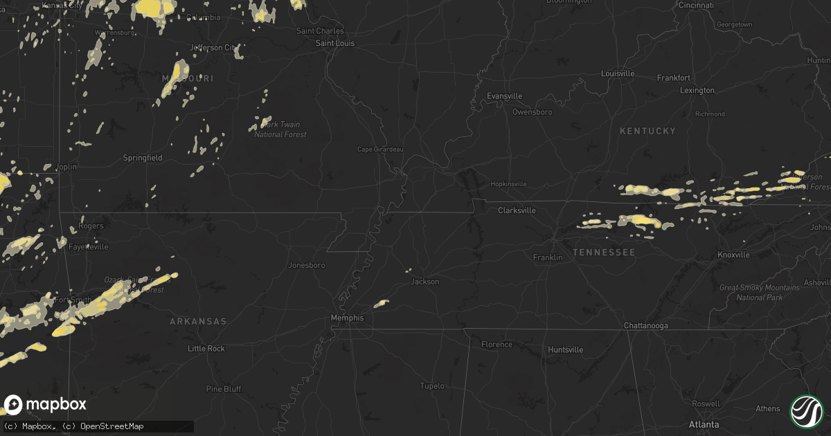
Hail Map in Oklahoma on May 24, 2011
Get this storm
May 24 map
$229
one time, instant access
Download today. No call, no setup
Keep the $229
Bought the map and want the full workflow? Apply the entire $229 to a subscription within 7 days. None of it is wasted.
Every map, not just this one
This buys you this map. Subscription and you get every map we run, in the markets you choose from a few cities to whole states to nationwide. Plus real-time alerts the moment a storm fires.
Contact data
Name, contact info, occupancy, even credit band for addresses in the footprint. You go from where it hit to who to call.
Become the source they trust
Unlimited branding weather history reports on demand. You already have the documented answer ready for the property owner, and you are the one who showed up with it.
Property data and RoofTrace estimates
Pull up any address you have got, its value and the exact code rules for that jurisdiction, straight from One Click Code. Then RoofTrace estimates the squares, pitch, and roof value, priced the way you price.
Storm reports in Oklahoma
Oklahoma
| Date | Description |
|---|---|
| 05/24/20116:57 PM CDT | Svr367 / tor 081 |
| 05/24/20116:51 PM CDT | Intesection of main and wyndemere drive |
| 05/24/20116:50 PM CDT | Tor081- trees downed in pawnee. |
| 05/24/20116:50 PM CDT | Beginning point of a 17 mile long tornado that blew down power poles and trees. Rated ef-2. |
| 05/24/20116:45 PM CDT | Beginning point of 2.8 mile long tornado that downed trees and power lines. Rated ef-1. |
| 05/24/20116:36 PM CDT | This tornado continued northeast crossing interstate 40 near mcloud overturning a semi truck. The tornado dissipated at around 639 pm. |
| 05/24/20116:35 PM CDT | A local report indicates 1.00 inch wind near HEALDTON |
| 05/24/20116:31 PM CDT | A local report indicates 69 MPH wind near TINKER AIR FORCE BASE |
| 05/24/20116:23 PM CDT | A local report indicates 1.50 inch wind near TINKER AIR FORCE BASE |
| 05/24/20116:14 PM CDT | A local report indicates 1.00 inch wind near DEL CITY |
| 05/24/20116:07 PM CDT | National weather center |
| 05/24/20116:05 PM CDT | The hail was reported at hwy 9 and 60th street. Golf-ball size hail was also reported at rock creek road and 60th street. The hail occurred from 605 pm to 615 pm. |
| 05/24/20116:00 PM CDT | A local report indicates 2.00 inch wind near 4 ENE NOBLE |
| 05/24/20115:52 PM CDT | Homes damaged. |
| 05/24/20115:50 PM CDT | A local report indicates 2.51 inch wind near NOBLE |
| 05/24/20115:50 PM CDT | A local report indicates 1.50 inch wind near 1 N NORMAN |
| 05/24/20115:50 PM CDT | A local report indicates 2.50 inch wind near 3 N WASHINGTON |
| 05/24/20115:42 PM CDT | Damage along sh-76 north of norman turnpike spur. |
| 05/24/20115:37 PM CDT | A local report indicates 2.75 inch wind near 2 SW NEWCASTLE |
| 05/24/20115:31 PM CDT | A local report indicates a tornado near 1 N GUTHRIE |
| 05/24/20115:30 PM CDT | A local report indicates 58 MPH wind near 8 E NEWKIRK |
| 05/24/20115:30 PM CDT | A local report indicates 59 MPH wind near 4 WSW GUTHRIE |
| 05/24/20115:10 PM CDT | Homes damaged and mobile homes destroyed in chickasha. |
| 05/24/20115:02 PM CDT | 40 homes damaged in the southwest logan county. |
| 05/24/20115:02 PM CDT | A local report indicates 61 MPH wind near 2 NW PONCA CITY |
| 05/24/20114:52 PM CDT | Homes damaged. |
| 05/24/20114:43 PM CDT | A local report indicates 1.75 inch wind near MIDWEST CITY |
| 05/24/20114:38 PM CDT | Homes damaged. |
| 05/24/20114:31 PM CDT | A local report indicates 1.75 inch wind near 1 NE LAKE ELLSWORTH |
| 05/24/20114:16 PM CDT | West lawton |
| 05/24/20114:10 PM CDT | Extensive damage along interstate 40. |
| 05/24/20113:48 PM CDT | This tornado lasted approximately 3 minutes to 351 pm. |
| 05/24/20113:37 PM CDT | A local report indicates a tornado near 4 W LOOKEBA |
| 05/24/20113:33 PM CDT | A local report indicates 3.00 inch wind near 5 ESE FAY |
| 05/24/20113:29 PM CDT | A local report indicates 1.75 inch wind near 2 WSW EAKLY |
| 05/24/20113:23 PM CDT | A local report indicates a tornado near 2 N CANTON |
| 05/24/20112:30 PM CDT | A local report indicates 1.75 inch wind near HOBART |
| 05/24/20112:29 PM CDT | A local report indicates 1.25 inch wind near HOBART |
| 05/24/20111:50 PM CDT | A local report indicates 1.00 inch wind near KEYES |
| 05/23/201111:39 PM CDT | Beginning point of a 5.25 mile long tornado that destroyed a barn...damaged homes and a metal building...and snapped or uprooted a number of trees. Rated ef-1. Tornado |
| 05/23/201111:20 PM CDT | Residentail wind damage at spiro and howe. |
| 05/23/201111:15 PM CDT | Tor 096 trees blown down in bokoshe. |
| 05/23/201111:15 PM CDT | Tor096 powerlines downed in monroe. |
| 05/23/201111:14 PM CDT | Many trees blown down and damaged. Power lines downed. One tree fell on a moving car. Occupant was pinned in car. No serious injury. |
| 05/23/201111:07 PM CDT | A local report indicates 70 MPH wind near BOKOSHE |
| 05/23/201111:00 PM CDT | Tree damage. Large limbs down. Strong rotation shown on radar. |
| 05/23/201110:59 PM CDT | Power poles downed. Several trees down and had blocked part of hwy 59 between heavener and how. Possible tornado damage. |
| 05/23/201110:57 PM CDT | Several trees down. |
| 05/23/201110:56 PM CDT | Many large trees blown down. Damage extends to southwest about 4 miles. Probable tornado. |
| 05/23/201110:55 PM CDT | Houses damaged...people trapped. |
| 05/23/201110:48 PM CDT | Small barn destroyed...mobile home shifted off foundation...severeal trees snapped. Possible tornado. |
| 05/23/201110:44 PM CDT | Beginning point of a 12 mile long tornado that destroyed a mobile home and damaged several others. Also damaged permanent homes...and snapped or uprooted many trees. Ra |
| 05/23/201110:44 PM CDT | A local report indicates 1.75 inch wind near 5 SSW WISTER |
| 05/23/201110:15 PM CDT | Tree damage. Several large limbs broken. |
| 05/23/201110:08 PM CDT | A local report indicates 1.00 inch wind near 4 S TALIHINA |
| 05/23/201110:08 PM CDT | Light tree damage from about 3 south of talihina to about 3 east of talihina and crossing talihina drive abotu 7 miles east of talihina. No large limbs. |
| 05/23/201110:02 PM CDT | A local report indicates 1.00 inch wind near HUGO |
| 05/23/201110:00 PM CDT | Mostly dime sized by a few quarter sized |
| 05/23/20119:58 PM CDT | A local report indicates 1.50 inch wind near 2 S HUGO |
| 05/23/20119:53 PM CDT | Investigated by person in atv in san bois mountains. No roads. 100 or more trees down or snapped. Width of damage estimated 200 to 400 yards in places. Length of damage |
| 05/23/20119:49 PM CDT | A few large limbs blown down. Many small limbs broken and down. |
| 05/23/20119:30 PM CDT | A local report indicates 60 MPH wind near QUAPAW |
| 05/23/20119:27 PM CDT | Several pine trees broken off half way up. |
| 05/23/20119:26 PM CDT | Trees down and power lines down. Trapped a family in their house. |
| 05/23/20119:24 PM CDT | Svr371 - large one ton plus construction sign blown across road. |
| 05/23/20119:20 PM CDT | 30 homes damaged. 10 destroyed. |
| 05/23/20119:18 PM CDT | Power flashes reported east of wagoner. Tornado reported observed. |
| 05/23/20119:18 PM CDT | A local report indicates a tornado near 5 SE WAGONER |
| 05/23/20119:15 PM CDT | Several large trees down. Metal storage building damaged. |
| 05/23/20119:01 PM CDT | A local report indicates 1.75 inch wind near ADA |
| 05/23/20119:00 PM CDT | Svr-371 |
| 05/23/20119:00 PM CDT | Roof blown off house near town of red bird. |
| 05/23/20118:50 PM CDT | A local report indicates 1.25 inch wind near ADA |
| 05/23/20118:50 PM CDT | Many structures damaged. 12 inch diameter trees blown down. |
| 05/23/20118:50 PM CDT | A local report indicates 70 MPH wind near 2 N JAMESVILLE |
| 05/23/20118:49 PM CDT | Numerous trees down and damaged. Some trees blown onto houses. |
| 05/23/20118:32 PM CDT | Trees down at hectorville road and bixby road. |
| 05/23/20118:25 PM CDT | A local report indicates 67 MPH wind near 4 W HECTORVILLE |
| 05/23/20118:25 PM CDT | Many large limbs broken by wind. Trees and limbs had to cleared from roads just south and southeast of ashland. Possible tornado. |
| 05/23/20118:25 PM CDT | A local report indicates 100 MPH wind near 5 NW HOLLOW |
| 05/23/20118:22 PM CDT | Tulsa int airport |
| 05/23/20118:22 PM CDT | A local report indicates 65 MPH wind near 4 NNE TULSA |
| 05/23/20118:20 PM CDT | A local report indicates 60 MPH wind near 3 SE DELAWARE |
| 05/23/20118:20 PM CDT | 241st south and hwy 75a |
| 05/23/20118:17 PM CDT | A local report indicates 1.75 inch wind near 5 W BEGGS |
| 05/23/20118:15 PM CDT | Tor085 trees blown down. |
| 05/23/20118:10 PM CDT | 4 foot diameter tree down. |
| 05/23/20118:02 PM CDT | A local report indicates 60 MPH wind near MADILL |
| 05/23/20118:00 PM CDT | Svr368 |
| 05/23/20117:53 PM CDT | Estimated 60 to 70 mph in downtown area from tv media. |
| 05/23/20117:53 PM CDT | Estimated 50 to 60 mph. |
| 05/23/20117:50 PM CDT | Shingles off roof and double wide garage door creased by wind. |
| 05/23/20117:35 PM CDT | Frank phillips and virginia ave. Church damaged. Hospital also damaged at frank phillips near hwy 75. |
| 05/23/20117:30 PM CDT | 70 to 80 mph gusts. Power line flashes. |
| 05/23/20117:20 PM CDT | 10 inch trees down and across highway 60 |
| 05/23/20117:18 PM CDT | A local report indicates 60 MPH wind near HALLETT |
| 05/23/20117:16 PM CDT | Trees reported down from the wind. Location approximate. |
| 05/23/20117:16 PM CDT | A local report indicates 1.00 inch wind near 3 W DEPEW |
| 05/23/20117:15 PM CDT | Svr-367 trees and some powerlines downed in cleveland. |
| 05/23/20117:10 PM CDT | House destroyed and trees down. Possible tornado. About one mile from airport. |
| 05/23/20117:08 PM CDT | A local report indicates 65 MPH wind near 5 E RUBOTTOM |
| 05/23/20117:01 PM CDT | A local report indicates 1.00 inch wind near 1 SE HEALDTON |
| 05/23/20117:00 PM CDT | A local report indicates 69 MPH wind near 3 W MARLOW |
All States Impacted by Hail Map on May 24, 2011
Cities Impacted by Hail Map on May 24, 2011
- Nickerson, KS
- Abbyville, KS
- Hutchinson, KS
- Partridge, KS
- Arlington, KS
- Genoa, CO
- Franklin, VA
- Haskell, OK
- Mount Ayr, IA
- Winfield, TN
- Newcomb, TN
- Oneida, TN
- Pioneer, TN
- Jefferson, NC
- Carlinville, IL
- Princeton, KS
- Kanorado, KS
- Ozark, AR
- Altus, AR
- Cecil, AR
- Hudson, KS
- Mckinney, TX
- Allen, TX
- Plano, TX
- Moran, KS
- La Harpe, KS
- Okmulgee, OK
- Amherst, CO
- Arapahoe, CO
- Burlington, CO
- Milburn, OK
- Kingston, OK
- Mill Creek, OK
- Madill, OK
- Ardmore, OK
- Burneyville, OK
- Marietta, OK
- Gainesville, TX
- Muenster, TX
- Wilson, OK
- Mannsville, OK
- Tishomingo, OK
- Overbrook, OK
- Elliott, IA
- Weatherford, OK
- Alvord, TX
- Chico, TX
- Baskerville, VA
- South Hill, VA
- Moscow, KS
- Hugoton, KS
- Elkhart, KS
- Rolla, KS
- Richfield, KS
- Frankford, MO
- Murchison, TX
- Athens, TX
- Chilhowee, MO
- Plattsburg, MO
- Virginia Beach, VA
- Norfolk, VA
- Cumberland, KY
- Partridge, KY
- Skiatook, OK
- Hominy, OK
- Slater, IA
- Ankeny, IA
- Alleman, IA
- Cleveland, OK
- Sand Springs, OK
- Osage, OK
- Mannford, OK
- Prue, OK
- Pineville, KY
- Miracle, KY
- Boyd, TX
- Paradise, TX
- Rich Hill, MO
- Butler, MO
- Kim, CO
- Neosho Falls, KS
- Yates Center, KS
- Piqua, KS
- Oologah, OK
- Irving, TX
- Haviland, KS
- Alexander, KS
- Duffield, VA
- Gate City, VA
- Carrollton, TX
- Coppell, TX
- Dallas, TX
- Bath, IL
- Luray, KS
- Waldo, KS
- Lucas, KS
- Sylvan Grove, KS
- Hunter, KS
- Bunker Hill, KS
- Virgil, KS
- Eureka, KS
- Hamilton, KS
- Albany, KY
- Tyler, TX
- Pierceville, KS
- Garden City, KS
- Livingston, TN
- Lebanon, OK
- Ness City, KS
- Castalian Springs, TN
- Iredell, TX
- Meridian, TX
- Hico, TX
- Geronimo, OK
- Walters, OK
- Onancock, VA
- Parksley, VA
- Bloxom, VA
- Portsmouth, VA
- Quinton, OK
- Point, TX
- Fairview, OK
- Waynoka, OK
- Aline, OK
- Cleo Springs, OK
- Beloit, KS
- Cimarron, KS
- Triplett, MO
- Glade Hill, VA
- Ulysses, KS
- Delphos, KS
- Miltonvale, KS
- Cantrall, IL
- Sherman, IL
- Mulvane, KS
- Udall, KS
- Azle, TX
- Springtown, TX
- Springer, OK
- Drexel, MO
- Rhome, TX
- Decatur, TX
- Blackburn, MO
- Marshall, MO
- Sweet Springs, MO
- Paola, KS
- Grand Prairie, TX
- Crandall, TX
- Kaufman, TX
- Terrell, TX
- Goodland, KS
- Francesville, IN
- Calumet, OK
- Okarche, OK
- El Reno, OK
- Roodhouse, IL
- White Hall, IL
- Hillview, IL
- Leslie, AR
- Jerusalem, AR
- Hector, AR
- Tilly, AR
- Accomac, VA
- Onley, VA
- Marion, IN
- Wellington, KS
- Grapevine, TX
- Ringgold, TX
- Nocona, TX
- Mount Sterling, IL
- Midlothian, TX
- Powhattan, KS
- Horton, KS
- Success, MO
- Licking, MO
- Syracuse, KS
- Hamilton, IL
- Warsaw, IL
- Victoria, KS
- Sherman, TX
- Howe, TX
- Clarksville, AR
- Gretna, VA
- Penhook, VA
- Union Hall, VA
- Seagoville, TX
- Wilmer, TX
- Hutchins, TX
- Burnside, KY
- Monticello, KY
- Bronston, KY
- Norman, OK
- Washington, OK
- Noble, OK
- Rocky Mount, VA
- Callaway, VA
- Jarrell, TX
- Georgetown, TX
- Mason, TN
- Somerville, TN
- Lamar, AR
- Bartlett, KS
- Welch, OK
- Humeston, IA
- Garden Grove, IA
- Bullard, TX
- Jacksonville, TX
- Burden, KS
- Atlanta, KS
- Ryan, IA
- Coggon, IA
- Glen Elder, KS
- Winfield, KS
- Royse City, TX
- Midland, AR
- Huntington, AR
- Hackett, AR
- Wills Point, TX
- Augusta, KS
- Rose Hill, KS
- Douglass, KS
- Andover, KS
- Wapanucka, OK
- Coleman, OK
- Suffolk, VA
- Chesapeake, VA
- Ravenna, TX
- Ivanhoe, TX
- Bonham, TX
- Corn, OK
- Beeler, KS
- Ada, OK
- Poteau, OK
- Howe, OK
- Heavener, OK
- Wister, OK
- Rockdale, TX
- Denison, TX
- Sandy Level, VA
- Minneapolis, KS
- Clay Center, KS
- Mooreland, OK
- Elgin, OK
- Apache, OK
- Ryan, OK
- Bluffs, IL
- Meredosia, IL
- Chambersburg, IL
- Versailles, IL
- McGrady, NC
- Elkin, NC
- Traphill, NC
- Thurmond, NC
- Hays, NC
- Millers Creek, NC
- Hartsville, TN
- Goddard, KS
- Artemus, KY
- Barbourville, KY
- Trosper, KY
- Ransom, KS
- Jetmore, KS
- Evant, TX
- Mayfield, KS
- Caldwell, KS
- Milan, KS
- Prophetstown, IL
- Newark, TX
- Colleyville, TX
- Lancaster, TX
- Keller, TX
- Millsap, TX
- Addison, TX
- Euless, TX
- Weatherford, TX
- Graford, TX
- Haslet, TX
- Justin, TX
- Bridgeport, TX
- Duncanville, TX
- Hurst, TX
- North Richland Hills, TX
- Roanoke, TX
- Aledo, TX
- Haltom City, TX
- Naval Air Station Jrb, TX
- Mineral Wells, TX
- Perrin, TX
- Fort Worth, TX
- Southlake, TX
- Palo Pinto, TX
- Arlington, TX
- Bedford, TX
- Whitt, TX
- Poolville, TX
- Jacksonville, IL
- Watonga, OK
- El Dorado, KS
- Belle Plaine, KS
- Wichita, KS
- Towanda, KS
- Benton, KS
- Derby, KS
- Clinton, MO
- Tipton, IA
- West Branch, IA
- Corydon, IA
- Emporia, KS
- Cawker City, KS
- Tipton, KS
- Mankato, KS
- Esbon, KS
- Sulphur, OK
- Dover, AR
- Pelsor, AR
- Witts Springs, AR
- Winamac, IN
- Monon, IN
- Rensselaer, IN
- Wolcott, IN
- Bells, TX
- Foster, OK
- Duncan, OK
- Hastings, OK
- Comanche, OK
- Waurika, OK
- Elmore City, OK
- Marlow, OK
- Temple, OK
- Humboldt, KS
- Troy, KS
- Highland, KS
- Tulsa, OK
- Russell, KS
- Madrid, IA
- Polk City, IA
- Havensville, KS
- Onaga, KS
- Fruitvale, TX
- Grand Saline, TX
- Crescent, OK
- Hartville, MO
- Stratford, OK
- Toronto, KS
- Wichita Falls, TX
- Holliday, TX
- Hopedale, IL
- Barnard, KS
- Sterling, KS
- Wilson, KS
- Dorrance, KS
- Kerens, TX
- De Witt, MO
- Carrollton, MO
- Lawson, MO
- Smithfield, VA
- Scurry, TX
- Zenda, KS
- Valley Mills, TX
- Crawford, TX
- Rural Hall, NC
- King, NC
- Celina, TX
- Aubrey, TX
- Prosper, TX
- Healdton, OK
- South Boston, VA
- Halifax, VA
- Calvin, KY
- Frakes, KY
- Powderly, TX
- Whitesboro, TX
- Pilot Point, TX
- Van Alstyne, TX
- Henrietta, TX
- Bellevue, TX
- Sunset, TX
- Boswell, OK
- Ringling, OK
- Bennington, OK
- Lone Grove, OK
- Colbert, OK
- Ector, TX
- Hendrix, OK
- Sadler, TX
- Hugo, OK
- Tioga, TX
- Petrolia, TX
- Thackerville, OK
- Sumner, TX
- Honey Grove, TX
- Gunter, TX
- Arthur City, TX
- Forestburg, TX
- Tom Bean, TX
- Era, TX
- Montague, TX
- Stonewall, OK
- Saint Jo, TX
- Telephone, TX
- Grant, OK
- Valley View, TX
- Savoy, TX
- Collinsville, TX
- Terral, OK
- Sanger, TX
- Lindsay, TX
- Whitewright, TX
- Pottsboro, TX
- Bowie, TX
- Rosston, TX
- Byers, TX
- Richland Springs, TX
- San Saba, TX
- Cedar Point, KS
- Burns, KS
- Cassoday, KS
- Archie, MO
- Vernon Hill, VA
- Clayton, OK
- New London, MO
- Cheney, KS
- Pretty Prairie, KS
- Star, TX
- Hamilton, TX
- Goldthwaite, TX
- Scranton, AR
- Hartman, AR
- Lincoln, KS
- Boonville, MO
- Wooldridge, MO
- Salado, TX
- Alta Vista, KS
- Sheldon, MO
- Milo, MO
- Nevada, MO
- West Jefferson, NC
- Smithville, MO
- Kearney, MO
- Liberty, MO
- Avon, IL
- Frankston, TX
- Lampasas, TX
- Bonner Springs, KS
- Kansas City, KS
- Boley, OK
- Paden, OK
- Mutual, OK
- Florence, TX
- Cement, OK
- Chickasha, OK
- Palmyra, MO
- Evarts, KY
- Benham, KY
- Closplint, KY
- Holmes Mill, KY
- Mason, TX
- Art, TX
- Bogard, MO
- Mansfield, AR
- Holton, KS
- Keene, TX
- Cleburne, TX
- Thomas, OK
- Geary, OK
- Bison, KS
- La Crosse, KS
- Rush Center, KS
- Otis, KS
- La Harpe, IL
- Blandinsville, IL
- Dallas City, IL
- Lomax, IL
- Pawnee, OK
- Abilene, KS
- Cumby, TX
- Briggs, TX
- Bertram, TX
- Burnet, TX
- Lewisville, TX
- Saint George, KS
- McFarland, KS
- Eskridge, KS
- Wamego, KS
- Dwight, KS
- Belvue, KS
- Junction City, KS
- Riley, KS
- Fort Riley, KS
- Alma, KS
- Paxico, KS
- Maple Hill, KS
- Ogden, KS
- Manhattan, KS
- Topeka, KS
- Lucerne, MO
- New Blaine, AR
- Vermillion, KS
- Nekoma, KS
- McCracken, KS
- Brownell, KS
- Bazine, KS
- Hemingford, NE
- Alliance, NE
- Brashear, MO
- Gibbs, MO
- Medford, OK
- Drury, MO
- Norwood, MO
- Clover, VA
- Nathalie, VA
- Ingalls, KS
- Middletown, MO
- Bowling Green, MO
- Curryville, MO
- Cheyenne Wells, CO
- Kit Carson, CO
- Fredonia, KS
- Moscow, IA
- Wilton, IA
- Mesquite, TX
- Balch Springs, TX
- Hagarville, AR
- Melfa, VA
- Harper, KS
- Beggs, OK
- Axtell, TX
- Holland, TX
- Medicine Lodge, KS
- Rockwall, TX
- Isabel, KS
- Cantril, IA
- Arbela, MO
- Macksville, KS
- St John, KS
- Keota, OK
- Kinta, OK
- Stigler, OK
- Dighton, KS
- Green City, MO
- Milan, MO
- Chester, OK
- Dover, OK
- Hennessey, OK
- Edgewood, TX
- Canton, TX
- Pineville, MO
- Wyaconda, MO
- Kahoka, MO
- Meeker, OK
- Chandler, OK
- Amber, OK
- Pocasset, OK
- Luther, OK
- Wellston, OK
- Fort Sill, OK
- Fletcher, OK
- Sparks, OK
- Blanchard, OK
- Jones, OK
- Cyril, OK
- Oklahoma City, OK
- Newcastle, OK
- Verden, OK
- Bristow, OK
- Harrah, OK
- Cushing, OK
- Drumright, OK
- Mcloud, OK
- Spencer, OK
- Depew, OK
- Tuttle, OK
- Stroud, OK
- Choctaw, OK
- Davenport, OK
- Lawton, OK
- Maquon, IL
- Gilson, IL
- Farber, MO
- Laddonia, MO
- Lone Oak, TX
- Ringwood, OK
- Wagoner, OK
- Jonesboro, TX
- Allen, OK
- Lancaster, KS
- Argonia, KS
- Viola, KS
- Clearwater, KS
- Garden Plain, KS
- Milton, KS
- Conway Springs, KS
- Perkins, OK
- Meridian, OK
- Stillwater, OK
- Coyle, OK
- Olpe, KS
- Oxford, KS
- Braman, OK
- South Haven, KS
- Geuda Springs, KS
- Monroe City, MO
- Grenola, KS
- Piedmont, KS
- Moline, KS
- Howard, KS
- Havana, IL
- Peck, KS
- Pfafftown, NC
- Vilas, NC
- Boone, NC
- Larned, KS
- Centerton, AR
- Bella Vista, AR
- Bentonville, AR
- Effingham, KS
- Austin, TX
- Williamsburg, KY
- Rockholds, KY
- Knoxville, IA
- Rayville, MO
- Richmond, MO
- Orrick, MO
- Excelsior Springs, MO
- Purlear, NC
- Fleetwood, NC
- Glendale Springs, NC
- Forney, TX
- Green, KS
- Hoisington, KS
- Olmitz, KS
- Yale, VA
- Capron, VA
- Gorham, KS
- Natoma, KS
- Paradise, KS
- Downs, KS
- Osborne, KS
- Hays, KS
- Burkesville, KY
- Windsor, VA
- Waterville, KS
- Brule, NE
- Fay, OK
- Talihina, OK
- Locust Grove, OK
- Chouteau, OK
- Boise City, OK
- Keyes, OK
- Goodwell, OK
- Montgomery City, MO
- New Florence, MO
- Bellflower, MO
- High Hill, MO
- Chelsea, OK
- Amazonia, MO
- Ava, MO
- Slater, MO
- Mcalester, OK
- Indianola, OK
- Aledo, IL
- Elsberry, MO
- Silex, MO
- Eolia, MO
- Marquette, KS
- Lindsborg, KS
- Falun, KS
- Fairfax, OK
- Clayton, IL
- Brady, TX
- Luray, MO
- Faxon, OK
- Cache, OK
- Chattanooga, OK
- Fort Smith, AR
- Paris, AR
- Magazine, AR
- Booneville, AR
- Branch, AR
- Charleston, AR
- Coal Hill, AR
- Ratcliff, AR
- Greenwood, AR
- Lavaca, AR
- Roff, OK
- Hartford, AR
- Rocheport, MO
- Columbia, MO
- Girard, IL
- Nilwood, IL
- Waggoner, IL
- Litchfield, IL
- Gillespie, IL
- Laurel Springs, NC
- Crumpler, NC
- Church Hill, TN
- Eudora, KS
- Carthage, TN
- Bosworth, MO
- Mendon, MO
- Belhaven, NC
- Copper Hill, VA
- Check, VA
- Floyd, VA
- Malta Bend, MO
- Miami, MO
- Blackwater, MO
- Nelson, MO
- Buckholts, TX
- Thorndale, TX
- Granger, TX
- Taylor, TX
- Milano, TX
- Leedey, OK
- Eldon, MO
- Walnut Springs, TX
- Neosho Rapids, KS
- Reading, KS
- Dill City, OK
- Foss, OK
- Subiaco, AR
- Piedmont, OK
- Yukon, OK
- Gainesboro, TN
- Whitleyville, TN
- Mears, VA
- Hallwood, VA
- La Belle, MO
- Williamstown, MO
- Danville, KS
- Whiting, KS
- Mounds, OK
- Mccurtain, OK
- Cordell, OK
- Mountain View, OK
- Plano, IA
- Waxahachie, TX
- Joshua, TX
- Godley, TX
- Gotebo, OK
- Cashion, OK
- Hinton, OK
- Lookeba, OK
- Carnegie, OK
- Colony, OK
- Kingfisher, OK
- Hydro, OK
- Callands, VA
- Henry, VA
- Ferrum, VA
- Bassett, VA
- Martinsville, VA
- Belle Plaine, IA
- Lone Wolf, OK
- Hobart, OK
- Roosevelt, OK
- Rochelle, TX
- Kenvir, KY
- Cawood, KY
- Arjay, KY
- Stoney Fork, KY
- Kettle Island, KY
- Hulen, KY
- Iowa City, IA
- Chase, KS
- Sun City, KS
- Pratt, KS
- Claflin, KS
- Lake City, KS
- Lyons, KS
- Stafford, KS
- Bushton, KS
- Raymond, KS
- Alva, OK
- Lorraine, KS
- Turon, KS
- Byers, KS
- Great Bend, KS
- Ellinwood, KS
- Iuka, KS
- Sawyer, KS
- Coats, KS
- Leavenworth, KS
- Lewistown, IL
- Table Grove, IL
- Cuba, IL
- Ipava, IL
- Smithfield, IL
- Assawoman, VA
- Wallops Island, VA
- Greenbush, VA
- Sanford, VA
- Temperanceville, VA
- Mount Airy, NC
- Assumption, IL
- Purcell, OK
- Newalla, OK
- Lindsay, OK
- Lexington, OK
- Alex, OK
- Lavon, TX
- Sallisaw, OK
- Danville, VA
- Dry Fork, VA
- Chatham, VA
- Axton, VA
- Sedan, KS
- Riverton, IL
- Tompkinsville, KY
- Summer Shade, KY
- Onslow, IA
- Cascade, IA
- Monmouth, IA
- Monticello, IA
- Ramona, OK
- Murdock, KS
- Kingman, KS
- Quitman, TX
- Albert, KS
- Hugo, CO
- Karval, CO
- Bradley, OK
- Barry, IL
- Cameron, MO
- Hartsburg, IL
- Cookeville, TN
- Rickman, TN
- Cummings, KS
- Atchison, KS
- Ellis, KS
- Larue, TX
- Rye, CO
- New Cambria, MO
- Boss, MO
- Salem, MO
- Courtland, VA
- Higginsville, MO
- London Mills, IL
- Clyde, KS
- Clifton, KS
- Paris, MO
- Osceola, IA
- Weldon, IA
- Deep Gap, NC
- Clifton, IL
- Strunk, KY
- Pine Knot, KY
- Pall Mall, TN
- Ben Wheeler, TX
- Eustace, TX
- Mabank, TX
- Saint Francis, KS
- Frisco, TX
- Spring Hill, KS
- Olathe, KS
- Tecumseh, OK
- Lamar, OK
- Quinlan, TX
- Pilot Mountain, NC
- Westfield, NC
- Bogata, TX
- Otley, IA
- Monroe, IA
- Madison, MO
- Philadelphia, MO
- Huntsville, MO
- Independence, MO
- Ronda, NC
- Hamptonville, NC
- Scranton, NC
- Sturgeon, MO
- Clark, MO
- Rocky Mount, MO
- Gravois Mills, MO
- Barnett, MO
- Dover, MO
- Waverly, MO
- Alma, MO
- Corder, MO
- Ordway, CO
- Glade Valley, NC
- Sparta, NC
- Spivey, KS
- West, TX
- Elm Mott, TX
- Antlers, OK
- Stringtown, OK
- Nashoba, OK
- Arthur, NE
- Salina, OK
- Rose, OK
- Wanette, OK
- Macomb, OK
- State Road, NC
- Mart, TX
- Bolckow, MO
- Waco, TX
- Griggsville, IL
- Bryants Store, KY
- Siler, KY
- Fourmile, KY
- Keeling, VA
- Beardstown, IL
- Anadarko, OK
- Knox City, MO
- Rush, CO
- Ferguson, NC
- Inman, KS
- Brashear, TX
- Emory, TX
- Sulphur Springs, TX
- Yantis, TX
- Minco, OK
- Caldwell, TX
- Hitchcock, OK
- Little River, KS
- Ellsworth, KS
- Mcpherson, KS
- Geneseo, KS
- Windom, KS
- Steelville, MO
- Tiffin, IA
- Oxford, IA
- Lexington, TX
- Miami, OK
- Afton, OK
- Fort Gibson, OK
- Liberal, MO
- Lenapah, OK
- Nowata, OK
- S Coffeyville, OK
- Delaware, OK
- Elkhorn City, KY
- Cascade, VA
- Kansas City, MO
- Holt, MO
- Yoder, CO
- Ralston, OK
- Wynona, OK
- Reynolds, IL
- Loveland, OK
- Wellington, MO
- Wray, CO
- Erie, IL
- Coalgate, OK
- Blue Rapids, KS
- Lakin, KS
- McCook, NE
- Bouton, IA
- Attica, KS
- Gans, OK
- Arcadia, OK
- Edmond, OK
- Pawhuska, OK
- Lafayette, IN
- West Lafayette, IN
- Saint Joseph, MO
- De Kalb, MO
- Speedwell, TN
- Dobson, NC
- Hallsville, MO
- Dixon Springs, TN
- Lebanon, TN
- Pleasant Shade, TN
- Riddleton, TN
- Elmwood, TN
- Norborne, MO
- Hardin, MO
- Atwood, OK
- Calvin, OK
- Holdenville, OK
- Eads, CO
- Boonville, NC
- Yadkinville, NC
- New Holland, IL
- Lincoln, IL
- Kechi, KS
- Valley Center, KS
- Chandlerville, IL
- Eufaula, OK
- Rush Springs, OK
- Ninnekah, OK
- Killeen, TX
- Bath, NC
- Walnut Cove, NC
- Germanton, NC
- Hiawatha, KS
- Scranton, KS
- Tescott, KS
- Cresson, TX
- Sharon Springs, KS
- Altoona, KS
- Benedict, KS
- Home, KS
- Rowlett, TX
- Mountain Grove, MO
- Graff, MO
- Monmouth, IL
- Milford, KS
- Chapman, KS
- Macclesfield, NC
- Tarboro, NC
- Pinetops, NC
- Pilot Grove, MO
- Yanceyville, NC
- Lowgap, NC
- Lambsburg, VA
- Nortonville, KS
- Winchester, KS
- Monterey, TN
- Pinetown, NC
- Udell, IA
- Calhan, CO
- Prairie City, IL
- Bushnell, IL
- Martinsburg, MO
- Rock, KS
- Latham, KS
- Leon, KS
- Franklin, MO
- Glasgow, MO
- Kirksville, MO
- Leonard, TX
- Torrington, WY
- Emporia, VA
- Jarratt, VA
- Sublette, KS
- Satanta, KS
- Warrensburg, MO
- Gilliam, MO
- Dalton, MO
- New Franklin, MO
- Fayette, MO
- Arrow Rock, MO
- Bunceton, MO
- Salisbury, MO
- Hughesville, MO
- Houstonia, MO
- Sedalia, MO
- Otterville, MO
- Celina, TN
- Felt, OK
- Union City, OK
- Versailles, MO
- Lake Ozark, MO
- Kaiser, MO
- Climax Springs, MO
- Sunrise Beach, MO
- Osage Beach, MO
- Camdenton, MO
- Roach, MO
- Macks Creek, MO
- Gatesville, TX
- Chariton, IA
- Ripley, OK
- Mayview, MO
- Catoosa, OK
- Thrall, TX
- Rushville, MO
- Wilburton, OK
- Hartshorne, OK
- Altamont, KS
- Edna, KS
- Siloam, NC
- Turney, MO
- Osborn, MO
- Littleton, IL
- Rushville, IL
- Whitefield, OK
- Bokoshe, OK
- Silver Lake, KS
- Inola, OK
- Claremore, OK
- Overland Park, KS
- Media, IL
- Valley Falls, KS
- Pittsville, VA
- Holyoke, CO
- Shidler, OK
- Carrsville, VA
- Broken Arrow, OK
- Barnes, KS
- Monroe, TN
- Allons, TN
- Hilham, TN
- Como, TX
- Canton, MO
- Yale, OK
- Tribune, KS
- Blairstown, MO
- Urich, MO
- Holden, MO
- Creighton, MO
- Stearns, KY
- Clifton Hill, MO
- Alexander, IL
- Franklin, IL
- Waverly, IL
- Edgerton, KS
- Wellsville, KS
- Urbana, MO
- Tunas, MO
- Lancaster, MO
- Weston, MO
- Platte City, MO
- Mustang, OK
- Byrdstown, TN
- Lexington, MO
- Whitewater, KS
- Newton, KS
- Sedgwick, KS
- Concordia, KS
- Oakwood, OK
- Longdale, OK
- Seiling, OK
- Butler, OK
- Clinton, OK
- Putnam, OK
- Taloga, OK
- Custer City, OK
- West Liberty, IA
- Ottawa, KS
- Easton, KS
- Alpha, KY
- La Monte, MO
- Graham, MO
- Skidmore, MO
- Barnard, MO
- Siloam Springs, AR
- Watts, OK
- Glencoe, OK
- Atlanta, MO
- Middlesboro, KY
- Glasco, KS
- Moulton, IA
- Hopkinton, IA
- Allardt, TN
- Edgerton, MO
- Brumley, MO
- Williamsville, IL
- Keokee, VA
- Whitley City, KY
- Pfeifer, KS
- Rozel, KS
- Liebenthal, KS
- Colwich, KS
- Mount Hope, KS
- Andale, KS
- Williamston, NC
- Kemp, TX
- Fayetteville, AR
- Hutto, TX
- Baxter Springs, KS
- Galena, KS
- Williamsburg, MO
- Morrison, MO
- Cherokee, TX
- Diagonal, IA
- Alvarado, TX
- Burleson, TX
- Nebo, IL
- Kampsville, IL
- Pearl, IL
- Coweta, OK
- Lusk, WY
- Iowa Park, TX
- Sheppard Afb, TX
- Albia, IA
- Colony, KS
- Drakes Branch, VA
- Belton, MO
- Stilwell, KS
- Granger, IA
- Woodward, IA
- Clifton, TX
- Rocky Ford, CO
- Model, CO
- Vinita, OK
- Westmoreland, KS
- Biggsville, IL
- Canadian, OK
- Elk Falls, KS
- Swisher, IA
- Cedar Rapids, IA
- Argyle, TX
- Keytesville, MO
- Blue Mound, IL
- Bristol, VA
- Stuart, OK
- Randall, KS
- Jewell, KS
- Kilbourne, IL
- Oakford, IL
- Crowley, TX
- Cherokee, OK
- Castle, OK
- Fort Leavenworth, KS
- Dearborn, MO
- Faucett, MO
- Palmer, KS
- Greenville, NC
- Woodburn, IA
- Coolidge, TX
- Akron, CO
- Belews Creek, NC
- Harrisonville, MO
- Chelsea, IA
- Billings, OK
- Bristol, TN
- Abingdon, VA
- Burdett, KS
- Marysville, KS
- Tahlequah, OK
- Clarence, MO
- Moberly, MO
- Jacksonville, MO
- Cairo, MO
- Polo, MO
- Trimble, MO
- Camden, MO
- Stoutsville, MO
- Voca, TX
- Daisy, OK
- Snow, OK
- Coalgood, KY
- Mary Alice, KY
- Wallins Creek, KY
- Grays Knob, KY
- Cranks, KY
- Gulston, KY
- Pennington Gap, VA
- Harlan, KY
- Hampton, VA
- Llano, TX
- Marceline, MO
- Jamestown, KS
- Guthrie, OK
- Heidrick, KY
- Solomon, KS
- Pilot, VA
- Jenks, OK
- Owasso, OK
- Cameron, OK
- Fancy Gap, VA
- Hillsville, VA
- Folsom, NM
- Madison, KS
- Porter, OK
- Tow, TX
- Coffeyville, KS
- Bartlesville, OK
- Surgoinsville, TN
- Salina, KS
- New Cambria, KS
- Fall River, KS
- Kiowa, OK
- Blanco, OK
- Okemah, OK
- Kellyville, OK
- Gorin, MO
- Lewistown, MO
- Fortuna, MO
- Hope, IN
- Carmen, OK
- Holly, CO
- Pollock, MO
- Flint, TX
- Barnsdall, OK
- Lindale, TX
- Bucyrus, MO
- Plato, MO
- Mendota, VA
- Olsburg, KS
- Lafayette, TN
- Cana, VA
- Matfield Green, KS
- Cottonwood Falls, KS
- Garland, TX
- Simpson, KS
- Petersburg, IL
- Perry, MO
- Mount Calm, TX
- Severy, KS
- Sunnyvale, TX
- Ogallala, NE
- North Wilkesboro, NC
- Wilkesboro, NC
- Hulbert, OK
- Camden Point, MO
- Seneca, KS
- Red Oak, OK
- Pittsburg, OK
- Peggs, OK
- Blakesburg, IA
- Lake Creek, TX
- Deport, TX
- Aurora, KS
- Sutter, IL
- Maryville, MO
- Arlington, CO
- Longton, KS
- Chanute, KS
- Buffalo, KS
- Boydton, VA
- Chase City, VA
- Neodesha, KS
- Gower, MO
- Springdale, AR
- Arkansas City, KS
- Muscotah, KS
- Braymer, MO
- Jefferson City, MO
- Corryton, TN
- Ladonia, TX
- Windom, TX
- Rozet, WY
- Odell, IL
- Payson, IL
- Haswell, CO
- Adair, IL
- Centerville, IA
- Big Springs, NE
- Baring, MO
- Glasgow, KY
- Redding, IA
- Gentry, AR
- Decatur, AR
- Enid, OK
- Carrier, OK
- Lahoma, OK
- Walker, MO
- Schell City, MO
- Cambridge, KS
- Dugspur, VA
- Pocola, OK
- Halstead, KS
- Burrton, KS
- Winnsboro, TX
- Burlington, OK
- Arapaho, OK
- Westville, OK
- Colcord, OK
- Summers, AR
- Camargo, OK
- Jamestown, TN
- Wilder, TN
- Wilsey, KS
- Ochelata, OK
- Flagler, CO
- Clintwood, VA
- Alba, TX
- Moravia, IA
- Oregon, MO
- Gridley, KS
- Memphis, MO
- Burbank, OK
- Lipan, TX
- Lathrop, MO
- Waukomis, OK
- Bison, OK
- Mulhall, OK
- Lenexa, KS
- Macon, MO
- Anabel, MO
- Troy, MO
- Foley, MO
- Blountville, TN
- Bokchito, OK
- Winfield, MO
- Clarksville, MO
- Annada, MO
- Bird City, KS
- Nashville, KS
- Sharon, KS
- Randlett, OK
- Lebo, KS
- Winthrop, IA
- Aurora, IA
- Independence, IA
- Denton, TX
- Lake Dallas, TX
- Gordon, KY
- Roaring River, NC
- Pinnacle, NC
- Roaring Gap, NC
- McLouth, KS
- Grundy, VA
- Oakwood, VA
- Wayne, OK
- Shady Point, OK
- Purdy, MO
- Buffalo, IL
- Illiopolis, IL
- Laurel Fork, VA
- Arlington, TN
- Randolph, KS
- Leonardville, KS
- Niantic, IL
- Republic, KS
- Peru, KS
- Bledsoe, KY
- Castell, TX
- Welling, OK
- Ashland, IL
- Tallula, IL
- Mineola, TX
- White Cloud, KS
- Robinson, KS
- Winston, MO
- Weatherby, MO
- Pond Creek, OK
- Latham, IL
- Tennessee, IL
- Jacksboro, TX
- Woodlawn, VA
- Limon, CO
- Waldron, MO
- Novelty, MO
- Leonard, MO
- Newtown, MO
- Harris, MO
- Tobaccoville, NC
- Manor, TX
- Pflugerville, TX
- Farmington, IA
- Bonaparte, IA
- Liberty, IL
- Baylis, IL
- Vandalia, MO
- Big Cabin, OK
- Adair, OK
- Atoka, OK
- Centertown, MO
- Lohman, MO
- Paoli, OK
- Appalachia, VA
- Lyndon, KS
- Wakefield, KS
- Frederick, IL
- Burlington, KS
- Brodnax, VA
- Jay, OK
- Linn, KS
- Mendon, IL
- Bethany, MO
- Farmington, IL
- Oketo, KS
- Pryor, OK
- Leasburg, MO
- Cuba, MO
- Maxwell, IA
- Garfield, KS
- Perry, OK
- Hannibal, MO
- Jennings, OK
- Plymouth, NC
- Roper, NC
- Richland, MO
- Montreal, MO
- Stoutland, MO
- Yuma, CO
- Harveyville, KS
- Alpine, TN
- Pantego, NC
- Proctor, OK
- Carthage, IL
- Kidder, MO
- Palestine, TX
- Oneida, KS
- Sabetha, KS
- Vona, CO
- Louisiana, MO
- Springfield, IL
- Nardin, OK
- Blackwell, OK
- Frankfort, KS
- Bartlett, TX
- Bimble, KY
- Ames, OK
- Meno, OK
- Lebanon, MO
- Ivor, VA
- Hoyt, KS
- Mayetta, KS
- Prague, OK
- Bixby, OK
- Seminole, OK
- Earlsboro, OK
- Shawnee, OK
- Maud, OK
- Blairs, VA
- Odessa, MO
- Lone Jack, MO
- Cowgill, MO
- Buckner, MO
- Oak Grove, MO
- Levasy, MO
- Napoleon, MO
- Bates City, MO
- Henrietta, MO
- Grain Valley, MO
- Sibley, MO
- Newport News, VA
- Kenefic, OK
- Fort Monroe, VA
- Groesbeck, TX
- Bells, TN
- Gadsden, TN
- Sasakwa, OK
- Armstrong, MO
- Osage City, KS
- Leawood, KS
- New Boston, MO
- Brookville, KS
- Kanopolis, KS
- Granbury, TX
- Richardson, TX
- Ferris, TX
- Greenville, TX
- Kennedale, TX
- Little Elm, TX
- Sachse, TX
- Van, TX
- Wylie, TX
- Ennis, TX
- Desoto, TX
- Santo, TX
- Shelbina, MO
- Taylor, MO
- Durham, MO
- Hunnewell, MO
- Ewing, MO
- La Grange, MO
- Emden, MO
- Maywood, MO
- Morrill, KS
- Duff, TN
- La Follette, TN
- Corbin, KY
- Iola, KS
- Glen Rose, TX
- Rainbow, TX
- Healy, KS
- Haven, KS
- Everest, KS
- Auxvasse, MO
- Mexico, MO
- Elbert, CO
- Arkoma, OK
- Ozone, AR
- Barling, AR
- Spiro, OK
- Oark, AR
- Hartford City, IN
- La Junta, CO
- Lamar, MO
- Monticello, IN
- Randolph, VA
- Astoria, IL
- Vermont, IL
- Forest City, MO
- Humphreys, MO
- Star City, IN
- Remington, IN
- Louisburg, KS
- Canton, IL
- Trivoli, IL
- Elmwood, IL
- Buxton, NC
- Sentinel, OK
- Formoso, KS
- Saint Joe, AR
- Marshall, AR
- Greenview, IL
- Athens, IL
- Norwich, KS
- Patterson, IL
- Plymouth, IL
- Johnson, KS
- Rockport, IL
- Baldwin City, KS
- Jonesboro, IN
- Upland, IN
- Fairmount, IN
- Beverly, KS
- Tupelo, OK
- Taylorville, IL
- Muscatine, IA
- Nichols, IA
- Savanna, OK
- Grimsley, TN
- Saint Marys, KS
- Haysville, KS
- Maize, KS
- Virginia, IL
- Pawnee Rock, KS
- Wellsville, MO
- Warrenton, MO
- Hawk Point, MO
- Jonesburg, MO
- Truxton, MO
- Falcon, MO
- Reynolds, IN
- Venus, TX
- Jamesville, NC
- Peabody, KS
- Cherryvale, KS
- Marietta, IL
- Asher, OK
- Haysi, VA
- Winchester, IL
- Leeton, MO
- Quincy, IL
- Hull, IL
- Camden, IL
- Stilwell, OK
- Fairfield, TX
- Vici, OK
- Bluejacket, OK
- Centralia, MO
- Gallatin, TN
- Wortham, TX
- Linefork, KY
- Kilgore, TX
- Lynchburg, MO
- Mount Judea, AR
- Lockwood, MO
- Jerico Springs, MO
- Cornell, IL
- Collinsville, OK
- Denison, KS
- Branson, MO
- Forsyth, MO
- Centerview, MO
- Oronogo, MO
- Jasper, MO
- Denton, KS
- Cooper, TX
- Hollister, MO
- Excello, MO
- Ponca City, OK
- Geneseo, IL
- Huntsville, TN
- Columbus, KS
- Riverton, KS
- Robbins, TN
- Helenwood, TN
- Dalton City, IL
- Dallas Center, IA
- Minburn, IA
- Edson, KS
- Muldrow, OK
- Goff, KS
- Lenoir, NC
- La Crosse, VA
- Bluff City, KS
- Cedar Vale, KS
- Russellville, MO
- Eckley, CO
- Cabool, MO
- Stockport, IA
- Keosauqua, IA
- Peculiar, MO
- Manchester, OK
- Phillipsburg, KS
- Agenda, KS
- Cuba, KS
- Freeport, KS
- Chandler, TX
- Brownsboro, TX
- Malakoff, TX
- Trinidad, TX
- Kremlin, OK
- Morganville, KS
- Washington, KS
- Sapulpa, OK
- Bonnots Mill, MO
- Chamois, MO
- Bland, MO
- Linn, MO
- Purdin, MO
- Linneus, MO
- Garden City, MO
- Montrose, MO
- Glenpool, OK
- Hermann, MO
- Vera, OK
- Talala, OK
- Laredo, MO
- Chula, MO
- Downing, MO
- Stronghurst, IL
- Chadwick, MO
- Corsicana, TX
- Madison, NC
- Danbury, NC
- Lawrence, KS
- Bardolph, IL
- Ellisville, IL
- Macomb, IL
- Longford, KS
- Greentop, MO
- Plainville, KS
- Tennessee Colony, TX
- Blowing Rock, NC
- East Bend, NC
- Laquey, MO
- Fairview, IL
- Yates City, IL
- Williamsfield, IL
- Wathena, KS
- Wheatfield, IN
- Oskaloosa, KS
- Paloma, IL
- Coatsburg, IL
- Centrahoma, OK
- Mount Enterprise, TX
- Greenleaf, KS
- Ogallah, KS
- Wakeeney, KS
- Linn Creek, MO
- Pelham, NC
- Red Rock, OK
- Zuni, VA
- Haxtun, CO
- Manchester, KY
- Scalf, KY
- Flat Lick, KY
- New Canton, IL
- Colchester, IL
- Alton, KS
- Marland, OK
- Eldred, IL
- Carrollton, IL
- Winona, TX
- Netawaka, KS
- Long Island, VA
- Hurt, VA
- Caddo Mills, TX
- Hunter, OK
- Tampico, IL
- Wann, OK
- Soldier, KS
- Center, MO
- Pleasant Hill, IL
- Tonkawa, OK
- Walker, KS
- Agra, OK
- Bethany, OK
- Terlton, OK
- Golden City, MO
- Hickman, TN
- Gordonsville, TN
- Pleasant Plains, IL
- New Berlin, IL
- Maysville, OK
- Baldwin, IA
- Mason City, IL
- Collettsville, NC
- Courtland, KS
- Stockton, MO
- Pella, IA
- Reasnor, IA
- Timewell, IL
- Cedar Hill, TX
- Superior, NE
- Lentner, MO
- Shelbyville, MO
- Maramec, OK
- Bethpage, TN
- Elgin, TX
- Coupland, TX
- Bevier, MO
- Tonganoxie, KS
- Linwood, KS
- Bluffton, TX
- Valley Spring, TX
- Kempner, TX
- Lometa, TX
- Slemp, KY
- Lebanon, KS
- Marengo, IA
- Williamsburg, IA
- South Amana, IA
- Cook Sta, MO
- De Soto, KS
- Laneville, TX
- Washington, NC
- Ladora, IA
- Princeton, TX
- Nevada, TX
- Farmersville, TX
- Orlando, OK
- Monticello, MO
- Lewis, KS
- Powell, TX
- Rice, TX
- Fairview, KS
- Lees Summit, MO
- Coralville, IA
- Rochester, IL
- Rocky, OK
- Pittsfield, IL
- Quapaw, OK
- Melvern, KS
- Emmett, KS
- Stony Creek, VA
- Crowder, OK
- Rosendale, MO
- Fillmore, MO
- Van Buren, AR
- Okeene, OK
- Strong City, KS
- Crisfield, MD
- Niangua, MO
- Marshfield, MO
- Easton, IL
- Gardner, KS
- Big Stone Gap, VA
- Dryden, VA
- Saint Charles, VA
- Binger, OK
- Tuscumbia, MO
- Holyrood, KS
- Glenwood, MD
- Woodbine, MD
- Cooksville, MD
- Bryson, TX


