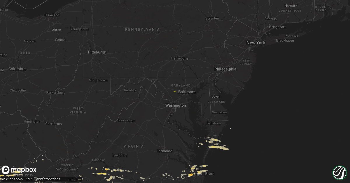
Hail Map on May 24, 2011
Get this storm
May 24 map
$229
one time, instant access
Download today. No call, no setup
Keep the $229
Bought the map and want the full workflow? Apply the entire $229 to a subscription within 7 days. None of it is wasted.
Every map, not just this one
This buys you this map. Subscription and you get every map we run, in the markets you choose from a few cities to whole states to nationwide. Plus real-time alerts the moment a storm fires.
Contact data
Name, contact info, occupancy, even credit band for addresses in the footprint. You go from where it hit to who to call.
Become the source they trust
Unlimited branding weather history reports on demand. You already have the documented answer ready for the property owner, and you are the one who showed up with it.
Property data and RoofTrace estimates
Pull up any address you have got, its value and the exact code rules for that jurisdiction, straight from One Click Code. Then RoofTrace estimates the squares, pitch, and roof value, priced the way you price.
States Impacted by Hail Map on May 24, 2011
Storm reports
Tennessee
| Date | Description |
|---|---|
| 05/24/20115:45 PM CDT | Several trees down. |
| 05/24/20115:40 PM CDT | Several trees down in gibbs...reported by public. |
| 05/24/20115:20 PM CDT | One tree down on war creek rd |
| 05/24/20114:55 PM CDT | One tree down. |
| 05/24/20114:35 PM CDT | Few trees down in the speedwell area. |
| 05/24/20113:50 PM CDT | Few trees down. |
| 05/24/20113:40 PM CDT | Tree down in jamestown. |
| 05/24/20112:53 PM CDT | Spotter rpt of two inch hail in livingston. |
| 05/24/20112:45 PM CDT | Spotter rpts golf ball sized hail. |
| 05/24/20112:00 PM CDT | Few trees down in the kingsport area. |
| 05/24/20111:41 PM CDT | Public rpt of quarter sized hail. |
| 05/24/201112:48 PM CDT | A local report indicates 1.00 inch wind near HARTSVILLE |
| 05/24/201110:17 AM CDT | A local report indicates 1.00 inch wind near BRISTOL TN |
Iowa
| Date | Description |
|---|---|
| 05/24/20115:35 PM CDT | Penny to quarter size hail reported. |
| 05/24/20115:30 PM CDT | Roof blown off a barn. |
| 05/24/20115:24 PM CDT | Time estimated by radar... |
| 05/24/20115:20 PM CDT | Downed power lines on 21st ave. |
| 05/24/20114:40 PM CDT | A local report indicates 60 MPH wind near E VICTOR |
| 05/24/20114:28 PM CDT | At least golfballs. Hail 2 plus inches deep. Hail broke visor on truck. |
| 05/24/20114:17 PM CDT | A local report indicates 60 MPH wind near 5 NW HAVERHILL |
| 05/24/20113:42 PM CDT | Several three inch diameter tree limbs down at the dmacc campus in ankeny |
| 05/24/20113:24 PM CDT | From story county emergency manager |
| 05/24/20113:10 PM CDT | 6in tree branch and 14in tree branch blown down...time estimated |
| 05/24/20113:00 PM CDT | Power lines down due to wind. |
| 05/24/20112:58 PM CDT | Highway sign at the exit blown down. |
| 05/24/20112:55 PM CDT | Awos measurement at perry airport |
| 05/24/20112:53 PM CDT | Damage to large wooden railing on front porch. Winds estimaed up to 60 mph. |
| 05/24/20112:50 PM CDT | Trained spotter reports 55 to 60 mph at the walmart in grimes. 4 inch diameter trees snapped with wind. |
| 05/24/20112:45 PM CDT | Grain bin and shed damaged by straight line winds. Estimated gust to 60 mph. Along wood road. From guthrie county emergency manager. |
North Carolina
| Date | Description |
|---|---|
| 05/24/20116:34 PM CDT | About 4 trees blown down in the hamptonville area. |
| 05/24/20116:10 PM CDT | Two large trees down on crossroads church road. |
| 05/24/20116:00 PM CDT | Sevral trees reported down by amateur radio operator. |
| 05/24/20115:57 PM CDT | Trees down on power lines approximately 3 miles wnw of intersection of state route 16 and highway 421 |
| 05/24/20115:49 PM CDT | A couple of trees down near millers creek. |
| 05/24/20115:25 PM CDT | Trees down near mulberry |
| 05/24/20115:00 PM CDT | Fell for several minutes. |
| 05/24/20114:58 PM CDT | Dime to quarter size hail just north of boone. |
| 05/24/20114:55 PM CDT | A local report indicates 1.00 inch wind near 2 W BOONE |
| 05/24/20114:52 PM CDT | A local report indicates 2.00 inch wind near GLENDALE SPRINGS |
| 05/24/20114:02 PM CDT | Quarter size hail covering the ground on boles road. |
| 05/24/20113:53 PM CDT | Mainly marble size hail but a few up to quarter size on musket drive. |
| 05/24/20113:32 PM CDT | Quarter size hail on atkinson road. |
| 05/24/20113:25 PM CDT | Trees down. |
| 05/24/20113:23 PM CDT | A local report indicates 1.50 inch wind near 1 S FAIRVIEW |
| 05/24/20113:10 PM CDT | A local report indicates 1.50 inch wind near 4 N ELKIN |
| 05/24/20113:03 PM CDT | A local report indicates 1.25 inch wind near 5 WSW MOUNTAIN PARK |
| 05/24/20113:00 PM CDT | Large bradford pear tree split |
| 05/24/20112:48 PM CDT | A local report indicates 1.75 inch wind near E TRAPHILL |
| 05/24/20112:28 PM CDT | A local report indicates 1.50 inch wind near 1 SSW MC GRADY |
| 05/24/201112:54 PM CDT | 911 center reported one tree down on cunningham road in northwestern person county |
| 05/24/201112:30 PM CDT | Trees down in town. |
| 05/24/201112:01 PM CDT | One tree down on chestnut street. |
| 05/24/201112:00 PM CDT | One tree down on east warren avenue. |
| 05/24/20117:30 AM CDT | Trees down on forbush high school property. |
| 05/23/20117:55 PM CDT | Several large tree limbs blown down on brandy trace lane. |
| 05/23/20117:40 PM CDT | Numerous large tree limbs down |
| 05/23/20117:30 PM CDT | Trees down on forbush high school property. |
| 05/23/20117:15 PM CDT | Trees down on fieldcrest road. |
| 05/23/20117:11 PM CDT | Trees down on mizpah church road. |
| 05/23/20117:10 PM CDT | Trees down on elm grove church road. |
Wyoming
| Date | Description |
|---|---|
| 05/24/20114:57 PM CDT | A local report indicates 1.00 inch wind near 5 NW ROZET |
Colorado
| Date | Description |
|---|---|
| 05/24/20114:30 PM CDT | A local report indicates 1.00 inch wind near 9 ESE CLARKVILLE |
| 05/24/20113:14 PM CDT | Cdot reported tornado moving northeast. |
| 05/24/20113:10 PM CDT | Hail beginning to cover the ground |
| 05/24/20113:08 PM CDT | A local report indicates 61 MPH wind near BURLINGTON |
| 05/24/20113:05 PM CDT | A local report indicates 59 MPH wind near BURLINGTON |
| 05/24/20111:25 PM CDT | A local report indicates 1.00 inch wind near 4 SSW COLORADO CITY |
| 05/24/201110:16 AM CDT | A local report indicates 1.00 inch wind near 2 S TRUCKTON |
Maryland
| Date | Description |
|---|---|
| 05/24/20113:49 PM CDT | Hail was smaller than golfballs more near the size of quarters. |
| 05/24/20113:49 PM CDT | A local report indicates 1.00 inch wind near GLENWOOD |
Kansas
| Date | Description |
|---|---|
| 05/24/20116:55 PM CDT | A local report indicates 62 MPH wind near GREAT BEND AIRPORT |
| 05/24/20116:45 PM CDT | Law enforcement estimates 70 mph winds. |
| 05/24/20116:36 PM CDT | A local report indicates 1.75 inch wind near 9 SSE LA CROSSE |
| 05/24/20116:30 PM CDT | A local report indicates 1.75 inch wind near 9 SSE LA CROSSE |
| 05/24/20116:28 PM CDT | A local report indicates 1.00 inch wind near 8 S GORHAM |
| 05/24/20116:26 PM CDT | Florence fire department reports winds of 60 mph and heavy rain. |
| 05/24/20116:24 PM CDT | Emergency manager reports that a semi trailer was blown over between mile markers 82 and 83 on the kansas turnpike. |
| 05/24/20116:21 PM CDT | A local report indicates 1.00 inch wind near 4 WNW GALATIA |
| 05/24/20116:20 PM CDT | Trained spotter reports quarter and nickel sized hail. |
| 05/24/20116:17 PM CDT | Trained spotter reports 8 to 10 inch diameter tree limbs down on 3rd street. |
| 05/24/20116:16 PM CDT | Fire fighter reports winds of 65 mph if not greater. |
| 05/24/20116:15 PM CDT | A roof was blown from a building and power poles were blown down in lacrosse. |
| 05/24/20116:15 PM CDT | Law enforcement reports 60 mph winds at timber south of 40th. |
| 05/24/20116:00 PM CDT | A local report indicates 2.75 inch wind near ALEXANDER |
| 05/24/20115:53 PM CDT | Trained spotter estimates wind gusts to 60 to 65 mph. |
| 05/24/20115:49 PM CDT | A local report indicates 1.50 inch wind near 4 NNW LORETTA |
| 05/24/20115:48 PM CDT | A local report indicates 1.75 inch wind near ENE ALEXANDER |
| 05/24/20115:44 PM CDT | Emergency manager reports the city of nickerson is without power. |
| 05/24/20115:44 PM CDT | Emergency manager reports power lines down at 143rd street and us 54. |
| 05/24/20115:44 PM CDT | Emergency manager reports power lines down at k96 and us 54 which blocked traffic on the ramp from south bound k96 to east bound 54. |
| 05/24/20115:37 PM CDT | This tornado a reported a possible very large and rain wrapped. Location estimated. |
| 05/24/20115:36 PM CDT | Report was from storm chasers relayed from nws wichita. |
| 05/24/20115:35 PM CDT | Amateur radio reports 70 mph winds for approximately 5 minutes. |
| 05/24/20115:34 PM CDT | A local report indicates 59 MPH wind near HUTCHINSON AIRPORT |
| 05/24/20115:30 PM CDT | Hail was covering the ground. |
| 05/24/20115:30 PM CDT | Moderate to severe tornado damage north of st. John on us 281. |
| 05/24/20115:27 PM CDT | A local report indicates a tornado near 10 S OTIS |
| 05/24/20115:25 PM CDT | Houses damaged |
| 05/24/20115:24 PM CDT | Kwch storm chaser reports 50 to 60 mph winds near caldwell. |
| 05/24/20115:22 PM CDT | Amateur radio reports 18 to 20 inch diameter trees down north of k19 and 281. |
| 05/24/20115:21 PM CDT | Giant hail measured at 6 inches in diameter fell through the roof of a church in timken. |
| 05/24/20115:20 PM CDT | A local report indicates 1.50 inch wind near 6 NNE NESS CITY |
| 05/24/20115:20 PM CDT | A local report indicates 2.75 inch wind near NESS CITY |
| 05/24/20115:20 PM CDT | A local report indicates a tornado near 3 S TIMKEN |
| 05/24/20115:18 PM CDT | Trained spotter reports 70 mph winds 1 east of highway 4 and 156. |
| 05/24/20115:17 PM CDT | Amateur radio reports heavy rain and 60 mph winds. |
| 05/24/20115:16 PM CDT | A local report indicates 2.75 inch wind near 2 S BISON |
| 05/24/20115:15 PM CDT | A local report indicates a tornado near 3 E SEWARD |
| 05/24/20115:12 PM CDT | Power lines reported down via emergency manager at 82nd and riverton. |
| 05/24/20115:11 PM CDT | Kwch storm chaser reports 60 mph winds in andale. |
| 05/24/20115:10 PM CDT | *** 1 inj *** law enforcement reports an undetermined number of houses destroyed and one injury. |
| 05/24/20115:09 PM CDT | A local report indicates 2.75 inch wind near 1 WSW NESS CITY |
| 05/24/20115:08 PM CDT | A local report indicates 2.75 inch wind near 2 S NESS CITY |
| 05/24/20115:06 PM CDT | Emergency manager reports 6 to 8 inch tree limbs down as well as square hay bales thrown 30 feet and an unoccupied porta potty thrown 50 yards. |
| 05/24/20115:06 PM CDT | Two fatalities occurred when a tornado blew a tree onto a van traveling along highway 281. |
| 05/24/20115:04 PM CDT | Railroad crossing arm damaged according to emergency manager at k14 and us 50. |
| 05/24/20115:02 PM CDT | Amateur radio reports some quarter sized hail but mostly dime or smaller. |
| 05/24/20115:02 PM CDT | Power lines reported down via emergency manager at 82nd and riverton. |
| 05/24/20115:00 PM CDT | A local report indicates a tornado near 3 E SEWARD |
| 05/24/20115:00 PM CDT | Live seven-inch diameter tree limb down. Several pieces of tin roofing removed from a shed. Time of event estimated from nearby reports. |
| 05/24/20115:00 PM CDT | A local report indicates 1.75 inch wind near 5 N SEWARD |
| 05/24/20114:59 PM CDT | Power pole down |
| 05/24/20114:56 PM CDT | Eight power poles broken near monument. Poles all laying to the east. Correction from previous report of five poles down. |
| 05/24/20114:56 PM CDT | Several baseball sized hail stones were reported in addition to a couple that were softball sized. |
| 05/24/20114:56 PM CDT | Emergency manager reports 12 inch diameter tree down in hutchinson. |
| 05/24/20114:51 PM CDT | Asos measures 69 mph wind gust. |
| 05/24/20114:48 PM CDT | A local report indicates 62 MPH wind near W SCOTT CITY |
| 05/24/20114:45 PM CDT | A local report indicates 1.75 inch wind near 8 WNW ASH VALLEY |
| 05/24/20114:45 PM CDT | Emergency manager reports a 6 inch tree limb through a roof in west central hutchinson. |
| 05/24/20114:41 PM CDT | Emergency manager reports tree limbs down in arlington but no size was specified. |
| 05/24/20114:41 PM CDT | Ksn weather lab site measures 59 mph wind gust. |
| 05/24/20114:37 PM CDT | A local report indicates 60 MPH wind near KINGMAN |
| 05/24/20114:35 PM CDT | Power pole down hwy 24 |
| 05/24/20114:35 PM CDT | A local report indicates 80 MPH wind near EDSON |
| 05/24/20114:30 PM CDT | Sections of fence blown down as well as a tree. Wind driven half inch hail persisted for 20 minutes causing hail damage to trees and property. |
| 05/24/20114:27 PM CDT | A local report indicates 63 MPH wind near KINGMAN |
| 05/24/20114:25 PM CDT | A local report indicates 1.00 inch wind near 5 SSW PENDENNIS |
| 05/24/20114:25 PM CDT | Game warden reported two circle pivot irrigation systems damaged. Time estimated. |
| 05/24/20114:24 PM CDT | Estimated by an experience storm spotter. |
| 05/24/20114:24 PM CDT | This report by the public was heard over the police scanner. |
| 05/24/20114:24 PM CDT | 69 knot wind gust reported at goodland asos |
| 05/24/20114:18 PM CDT | A local report indicates 1.75 inch wind near 3 W COATS |
| 05/24/20114:15 PM CDT | A local report indicates 1.00 inch wind near GOODLAND |
| 05/24/20114:10 PM CDT | A local report indicates 60 MPH wind near 6 S DIGHTON |
| 05/24/20114:06 PM CDT | A local report indicates 62 MPH wind near 4 W GOODLAND |
| 05/24/20114:06 PM CDT | A local report indicates 1.75 inch wind near 9 SSW LAKE CITY |
| 05/24/20114:00 PM CDT | A local report indicates 2.00 inch wind near 6 W KALVESTA |
| 05/24/20114:00 PM CDT | A local report indicates a tornado near 3 E SEWARD |
| 05/24/20114:00 PM CDT | Employee also reported nickel-sized hail...three broken windows and some roof damage to residence. |
| 05/24/20113:50 PM CDT | A local report indicates 1.00 inch wind near 10 W KALVESTA |
| 05/24/20113:45 PM CDT | A brief tornado occurred in a wheat field. |
| 05/24/20113:37 PM CDT | Most hail varied from the size of peas to quarters. Funnel clouds also were observed. |
| 05/24/20113:35 PM CDT | A local report indicates a tornado near 1 NE CHARLESTON |
| 05/24/20113:27 PM CDT | Baseball to softball sized hail was reported. |
| 05/24/20113:23 PM CDT | A local report indicates 1.75 inch wind near 1 W PIERCEVILLE |
| 05/24/20113:20 PM CDT | Reported from garden city faa tower personnel. |
| 05/24/20113:15 PM CDT | Tennis ball to baseball sized hail reported. |
| 05/24/20113:15 PM CDT | A local report indicates 1.00 inch wind near 13 SSE BIG BOW |
| 05/24/20113:05 PM CDT | A local report indicates 1.00 inch wind near GARDEN CITY |
| 05/24/20112:37 PM CDT | Most hail varied from the size of peas to quarters. Funnel clouds also were observed. |
| 05/24/20112:35 PM CDT | Hail covered the ground and accumulated to a depth of six inches along the side of buildings. The wind gusted to 60 mph. |
| 05/24/20112:27 PM CDT | A local report indicates 1.00 inch wind near 4 N RYUS |
| 05/24/20111:48 PM CDT | A local report indicates 1.00 inch wind near 6 NW HUGOTON |
| 05/24/20111:10 PM CDT | A local report indicates 1.00 inch wind near 8 S ROLLA |
| 05/24/20111:05 PM CDT | Hail is covering the ground. |
| 05/24/201111:20 AM CDT | A local report indicates 1.75 inch wind near LANCASTER KS |
| 05/24/20119:43 AM CDT | A local report indicates 1.75 inch wind near LANCASTER KS |
| 05/24/20117:58 AM CDT | A local report indicates 1.00 inch wind near 2 NW SYLVAN GROVE |
| 05/24/20117:58 AM CDT | A local report indicates 60 MPH wind near 2 NW SYLVAN GROVE |
| 05/24/20117:35 AM CDT | A local report indicates 60 MPH wind near 6 SSW WALDO |
| 05/23/201111:16 PM CDT | A local report indicates 60 MPH wind near CHANUTE |
| 05/23/201110:06 PM CDT | A local report indicates 60 MPH wind near 4 NNW LEAVENWORTH |
| 05/23/201110:02 PM CDT | A local report indicates 68 MPH wind near CRESTLINE |
| 05/23/201110:00 PM CDT | *** 1 inj *** suv was blown off the road at 7th and chico road. |
| 05/23/20119:59 PM CDT | A local report indicates 75 MPH wind near GALENA |
| 05/23/20119:58 PM CDT | A local report indicates 60 MPH wind near LEAVENWORTH |
| 05/23/20119:58 PM CDT | Power poles and trees down 6 miles west of columbus on hwy 160 |
| 05/23/20119:55 PM CDT | Trees and power poles blown down. |
| 05/23/20119:46 PM CDT | A local report indicates 58 MPH wind near DE SOTO |
| 05/23/20119:23 PM CDT | A local report indicates 1.00 inch wind near EDGERTON KS |
| 05/23/20119:20 PM CDT | A local report indicates 60 MPH wind near 9 N CHAPMAN |
| 05/23/20119:20 PM CDT | Spotter estimated 50 to 60 mph winds with gust front. |
| 05/23/20119:10 PM CDT | Power lines down |
| 05/23/20119:05 PM CDT | A local report indicates 60 MPH wind near ST. PAUL |
| 05/23/20119:05 PM CDT | 2 outbuildings flattened. 1 car flipped. |
| 05/23/20119:05 PM CDT | Kake storm chasers report powerlines blocking santa fe and crawford. |
| 05/23/20118:58 PM CDT | Trees down on 90th road between faulkner and melrose kansas. |
| 05/23/20118:51 PM CDT | Emergency manager reports one business at cloud and s 9th streets having windows blown out of their store. A 10 inch diameter and a 15 to 18 inch diameter trees reporte |
| 05/23/20118:45 PM CDT | Power is out around minneapolis |
| 05/23/20118:35 PM CDT | Powerlines downed in south coffeyville. |
| 05/23/20118:34 PM CDT | A local report indicates 80 MPH wind near PARSONS |
| 05/23/20118:30 PM CDT | A local report indicates 82 MPH wind near COFFEYVILLE AIRPORT |
| 05/23/20118:21 PM CDT | Amateur radio reports an 18 inch tree down on chautauqua street. |
| 05/23/20118:17 PM CDT | Several power lines down in the city of chautauqua. |
| 05/23/20118:15 PM CDT | A local report indicates 60 MPH wind near LINCOLN |
| 05/23/20117:57 PM CDT | Trained spotter reports wind gusts of 70 mph. |
| 05/23/20117:52 PM CDT | Trained spotter estimates 70 to 80 mph winds 2 north and 5 west of lyons. |
| 05/23/20117:50 PM CDT | Brief rope tornado reported to emergency management via trained spotter. |
| 05/23/20117:47 PM CDT | A local report indicates 60 MPH wind near 4 ENE WILSON |
| 05/23/20117:45 PM CDT | Law enforcement reports roof off of a barn and tree damage of undetermined size. |
| 05/23/20117:45 PM CDT | A local report indicates 60 MPH wind near 6 NE EUREKA |
| 05/23/20117:44 PM CDT | Emergency manager reports several trees uprooted up to 3.5 feet in diameter. |
| 05/23/20117:44 PM CDT | Amateur radio reports a 12 inch diameter tree limb down. |
| 05/23/20117:43 PM CDT | A local report indicates 65 MPH wind near LUCAS |
| 05/23/20117:35 PM CDT | A local report indicates 80 MPH wind near HOLYROOD |
| 05/23/20117:28 PM CDT | A local report indicates 60 MPH wind near GRENOLA |
| 05/23/20117:20 PM CDT | A local report indicates 60 MPH wind near 4 SW CLAFLIN |
| 05/23/20117:15 PM CDT | A local report indicates 75 MPH wind near 6 W CLAFLIN |
| 05/23/20117:11 PM CDT | Amateur radio reports sustained 60 mph winds. |
| 05/23/20117:08 PM CDT | A local report indicates 1.00 inch wind near 6 ESE ST. JOHN |
| 05/23/20117:05 PM CDT | Law enforcement reports a roof was blown off of a building. |
| 05/23/20117:05 PM CDT | A local report indicates 70 MPH wind near HOISINGTON |
| 05/23/20117:00 PM CDT | A local report indicates 65 MPH wind near 3 E ANDOVER |
Nebraska
| Date | Description |
|---|---|
| 05/24/20116:20 PM CDT | Hail broke windows |
| 05/24/201112:20 PM CDT | Branches up to 5 inches in diameter broken off trees |
Indiana
| Date | Description |
|---|---|
| 05/24/20116:11 PM CDT | Small limbs down |
| 05/24/20116:04 PM CDT | A local report indicates 1.00 inch wind near ROSEBURG |
| 05/23/201111:25 PM CDT | Hail up to golf ball size...lasted for 15 min |
Illinois
| Date | Description |
|---|---|
| 05/24/20112:45 PM CDT | Hail started as pea sized and increased to golf ball size. Altogether the hail lasted for about 20 minutes. |
| 05/24/20116:15 AM CDT | Windows blown out of a house...and a metal shed blown onto road. |
| 05/24/20116:15 AM CDT | Part of the roof blown off high school. Power out for much of south side of delavan. |
| 05/24/20116:03 AM CDT | Large tree limbs down |
| 05/24/20115:41 AM CDT | About 1 mile stretch of power poles down on rt 104 between auburn and i55 |
| 05/24/20115:30 AM CDT | Power lines down and several uprooted trees |
| 05/24/20115:30 AM CDT | Large tree limbs and ham radio antenna blown down |
| 05/24/20115:30 AM CDT | Shed blown down and blocking road |
| 05/24/20115:15 AM CDT | The tops of several 8 to 10-inch diameter trees were snapped off near 67 and old 36 just west of jacksonville. |
| 05/24/20115:00 AM CDT | Large tree limbs down in town. Time estimated. |
| 05/24/20115:00 AM CDT | Large tree limbs blown down causing roof damage to a barn. Tv antenna toppled. |
Virginia
| Date | Description |
|---|---|
| 05/24/20116:48 PM CDT | Trees down on old richmond road. |
| 05/24/20116:43 PM CDT | A local report indicates 73 MPH wind near GRETNA |
| 05/24/20116:32 PM CDT | Power line down |
| 05/24/20116:30 PM CDT | A local report indicates 73 MPH wind near 3 S GRETNA |
| 05/24/20116:02 PM CDT | A local report indicates 60 MPH wind near SNOW CREEK |
| 05/24/20115:53 PM CDT | One tree down along central academy road. |
| 05/24/20115:45 PM CDT | Franklin county public safety director reported numerous trees down due to straight-line winds blocking henry road near the intersection with providence church road in |
| 05/24/20115:33 PM CDT | Few trees down around town |
| 05/24/20115:28 PM CDT | Few trees down around town |
| 05/24/20114:45 PM CDT | Power lines down |
| 05/24/20114:45 PM CDT | One tree down. |
| 05/24/20114:42 PM CDT | Tree down on flanary bridge road. |
| 05/24/20114:10 PM CDT | Possible tornado in the bolton area. |
| 05/24/20114:00 PM CDT | Homes in subdivision sustained shingle and roof damage. |
| 05/24/20113:44 PM CDT | Sustained 55 gusts to 72 mph...oceana naval air station ntu |
| 05/24/20113:42 PM CDT | A local report indicates 1.00 inch wind near 6 N KEMPSVILLE |
| 05/24/20113:41 PM CDT | At kmfv |
| 05/24/20113:40 PM CDT | Numerous trees down or snapped. |
| 05/24/20113:37 PM CDT | Occurred at pizza hut at 107 front street |
| 05/24/20113:36 PM CDT | A local report indicates 70 MPH wind near 3 WSW VIRGINIA BEACH OC |
| 05/24/20113:33 PM CDT | Vadot site va007 at high rise bridge. |
| 05/24/20113:30 PM CDT | *** 5 inj *** pole vault mat and other debris blown around...injuries at landstown h.s. |
| 05/24/20113:30 PM CDT | Golfball hail reported. |
| 05/24/20113:30 PM CDT | Numerous trees and power lines down...howe farms subdivision. |
| 05/24/20113:30 PM CDT | Homes in subdivision sustained shingle and roof damage. |
| 05/24/20113:30 PM CDT | Trees down. One tree on home. |
| 05/24/20113:24 PM CDT | Money point nos-ports...mnpv2. |
| 05/24/20113:22 PM CDT | Large tree branch down on vehicle. Damage to ntelos pavilion. |
| 05/24/20113:20 PM CDT | A local report indicates 1.00 inch wind near 1 SSW ATLANTIC |
| 05/24/20113:20 PM CDT | Trees snapped and power lines down near st. Juliens creek naval annex. |
| 05/24/20113:20 PM CDT | Silos knocked down and other damage in the area |
| 05/24/20113:19 PM CDT | At lfi |
| 05/24/20113:15 PM CDT | *** 1 fatal *** crane pushed against building pinning shipyard employee |
| 05/24/20113:15 PM CDT | *** 1 fatal *** tstm wind gust pushed crane against building pinning shipyard employee. |
| 05/24/20113:00 PM CDT | One tree down on dunbar rd |
| 05/24/20112:41 PM CDT | Tree down as well as large tree limbs...shingle damage to house |
| 05/24/20112:34 PM CDT | A local report indicates 60 MPH wind near COURTLAND |
| 05/24/20112:27 PM CDT | Numerous trees down on property including one on the house. Call from individual and from law enforcement in the area... |
| 05/24/20111:15 PM CDT | Large tree blown over |
| 05/24/201112:55 PM CDT | 5-6 large limbs blown down. |
| 05/24/201112:30 PM CDT | Many trees down. |
| 05/24/201112:27 PM CDT | A local report indicates 1.00 inch wind near DANVILLE AIRPORT |
| 05/24/201112:15 PM CDT | Trees down countywide. |
| 05/24/201111:57 AM CDT | Trees down. |
| 05/24/201111:47 AM CDT | Trees down along riceville road. |
| 05/24/201111:45 AM CDT | Trees down south part of lake area. |
| 05/24/201111:42 AM CDT | Trees down in patrick springs. |
| 05/24/201111:29 AM CDT | A local report indicates 1.00 inch wind near PENHOOK |
| 05/24/201111:25 AM CDT | A local report indicates 1.75 inch wind near PENHOOK |
| 05/24/201111:10 AM CDT | Trees down north of town. |
| 05/24/201111:00 AM CDT | Trees down near town of sontag. |
| 05/24/20119:45 AM CDT | Few trees down. |
| 05/24/20119:45 AM CDT | Few trees down. |
| 05/24/20119:40 AM CDT | 1 tree down. |
| 05/24/20119:35 AM CDT | Trees down in city. |
| 05/24/20119:25 AM CDT | 1 tree down. |
| 05/24/20118:53 AM CDT | A local report indicates 1.25 inch wind near GRUNDY |
| 05/23/20119:05 PM CDT | Tree down on power line |
| 05/23/20118:51 PM CDT | Tree down across road |
| 05/23/20118:35 PM CDT | Numerous trees down blocking intersection |
| 05/23/20118:35 PM CDT | Tree down on power line |
| 05/23/20118:30 PM CDT | Numerous trees down. |
| 05/23/20118:22 PM CDT | Tree down on south bound lane of interstate 85 |
| 05/23/20118:15 PM CDT | Tree 4 feet in diameter uprooted |
| 05/23/20118:13 PM CDT | Tree down across road |
| 05/23/20118:06 PM CDT | Tree blocking road. |
| 05/23/20117:52 PM CDT | Tree down on a house |
| 05/23/20117:29 PM CDT | Trees down in the randolph area. |
| 05/23/20117:16 PM CDT | Power line blown down on wolf trap road. |
| 05/23/20117:15 PM CDT | Tree and power line blown down on higway 58. |
| 05/23/20117:11 PM CDT | 2 trees down in kentuck |
| 05/23/20117:11 PM CDT | Power line down |
Kentucky
| Date | Description |
|---|---|
| 05/24/20115:40 PM CDT | Several trees down in gibbs...reported by public. |
| 05/24/20113:35 PM CDT | Tree blown down blocking hwy 25e. |
| 05/24/20113:34 PM CDT | Tree down in jamestown. |
| 05/24/20113:12 PM CDT | Began hailing at 410pm as dime sized. |
| 05/24/20113:09 PM CDT | Trees down on rock creek road...whirly circle and lum strunk road. |
| 05/24/20113:09 PM CDT | Trees down over ky 92. Time est from radar. |
| 05/24/20112:47 PM CDT | Trees down on alum ford road at yahoo falls. |
| 05/24/20112:43 PM CDT | Trees down over rt 856 around the williamsburg area. Time est from radar. |
| 05/24/20112:43 PM CDT | Several trees down along ky 628 and ky 2996 near emlyn. Time est from radar. |
| 05/24/20112:34 PM CDT | Trees down along hwy 25w near mm16. Time est from radar. |
| 05/24/20112:26 PM CDT | Tree across 1103. |
| 05/24/201112:30 PM CDT | Two trees down across road. |
| 05/24/20119:30 AM CDT | Trees down on telephone lines in paw paw community. |
| 05/24/20118:30 AM CDT | Trees are down across the area. One tree fell onto a car and same tree into house. Two homes sustained damage. |
| 05/24/20118:09 AM CDT | Leslie county transportation director reported 2-3 trees down on cars along ky 3427 near wolfe creek. Time est from radar. |
| 05/24/20117:49 AM CDT | Limbs that are 2 to 3 inches in diameter are broken on hwy 26. |
| 05/24/20117:33 AM CDT | Trees down north end of the county. |
| 05/24/20117:06 AM CDT | Trees and limbs were blown down in monticello. |
| 05/24/20117:03 AM CDT | Power lines and trees are down and blocking the road in the delta community on brammer hill road. |
Texas
| Date | Description |
|---|---|
| 05/24/20116:50 PM CDT | Quarter size hail south of muenster. |
| 05/24/20116:50 PM CDT | A local report indicates 1.75 inch wind near 4 W KELLER |
| 05/24/20116:48 PM CDT | A local report indicates 1.75 inch wind near FORESTBURG |
| 05/24/20116:40 PM CDT | Brief tornado touchdown east side of lake nocona. |
| 05/24/20116:25 PM CDT | A local report indicates 60 MPH wind near RINGGOLD |
| 05/24/20116:19 PM CDT | Golfball hail in springtown |
| 05/24/20116:00 PM CDT | A local report indicates 1.50 inch wind near 3 E SPRINGTOWN |
| 05/24/20115:55 PM CDT | Reported at hwy 199 and midway |
| 05/24/20115:53 PM CDT | Hwy 730 |
| 05/24/20115:46 PM CDT | Brief - west of muenster on 82 |
| 05/24/20115:40 PM CDT | A local report indicates 1.75 inch wind near ST. JO |
| 05/24/20115:19 PM CDT | A local report indicates 2.75 inch wind near SPRINGTOWN |
| 05/24/20115:06 PM CDT | A local report indicates 2.75 inch wind near 1 S MINERAL WELLS |
| 05/24/20115:03 PM CDT | A local report indicates 1.00 inch wind near MINERAL WELLS |
| 05/24/20114:58 PM CDT | A local report indicates 1.75 inch wind near MILLSAP |
| 05/24/20114:49 PM CDT | A local report indicates 1.00 inch wind near 2 E POSTOAK |
| 05/24/20114:29 PM CDT | A local report indicates 1.00 inch wind near BRYSON |
| 05/24/20114:18 PM CDT | Loop 11 ans us 287 |
| 05/24/20114:17 PM CDT | A local report indicates 1.75 inch wind near JACKSBORO |
| 05/24/20114:16 PM CDT | 2n jacksboro near hwy 281 |
| 05/24/20114:16 PM CDT | Reported west of jacksboro on hwy 380 |
| 05/24/20114:15 PM CDT | A local report indicates 1.00 inch wind near STRAWN |
| 05/24/20115:07 AM CDT | Quarter to half dollar size hail |
| 05/24/20115:05 AM CDT | A local report indicates 1.00 inch wind near 4 NNE AUSTIN |
| 05/24/20114:15 AM CDT | Media relayed report from the public of golf ball size hail near taylor. |
| 05/24/20112:54 AM CDT | A local report indicates 1.00 inch wind near 2 S JARRELL |
| 05/24/20112:11 AM CDT | A local report indicates 1.00 inch wind near 9 NNE BERTRAM |
| 05/23/201111:34 PM CDT | A local report indicates 1.00 inch wind near SAN SABA |
| 05/23/201111:17 PM CDT | Hwy 243 and hwy 175 |
| 05/23/201110:50 PM CDT | Spotter reports brief tornado between kuafman and cedarvale |
| 05/23/201110:40 PM CDT | Large trees down in highland park. |
| 05/23/201110:40 PM CDT | A local report indicates 1.00 inch wind near 3 N KEENE |
| 05/23/201110:40 PM CDT | Hail 3/4 inch short bursts lasted less 2 min |
| 05/23/201110:37 PM CDT | 62 mph measured wind power flashes and power outages |
| 05/23/201110:33 PM CDT | Estimated wind gust 65 mph with sheets of rain |
| 05/23/201110:25 PM CDT | A local report indicates 70 MPH wind near PLANO |
| 05/23/201110:24 PM CDT | A local report indicates 2.75 inch wind near 1 N KAUFMAN |
| 05/23/201110:23 PM CDT | A local report indicates 1.75 inch wind near 5 W KAUFMAN |
| 05/23/201110:23 PM CDT | A local report indicates 1.00 inch wind near EULESS |
| 05/23/201110:13 PM CDT | Large tree approx 2-4 ft wide lying in road at beltline |
| 05/23/201110:11 PM CDT | Just s of crandall baseball hail |
| 05/23/201110:00 PM CDT | A local report indicates 60 MPH wind near CORINTH |
| 05/23/20119:50 PM CDT | A local report indicates 70 MPH wind near ARLINGTON |
| 05/23/20119:50 PM CDT | A local report indicates 1.00 inch wind near ARGYLE |
| 05/23/20119:48 PM CDT | Large limbs down |
| 05/23/20119:48 PM CDT | A local report indicates 1.00 inch wind near 2 N JUSTIN |
| 05/23/20119:48 PM CDT | I-20 and trinity river |
| 05/23/20119:45 PM CDT | A local report indicates 1.75 inch wind near AVONDALE |
| 05/23/20119:42 PM CDT | A local report indicates 1.00 inch wind near 7 S RHOME |
| 05/23/20119:40 PM CDT | A local report indicates 1.75 inch wind near 1 E SHERMAN |
| 05/23/20119:38 PM CDT | A local report indicates 58 MPH wind near SHERMAN |
| 05/23/20119:37 PM CDT | A local report indicates 1.00 inch wind near 1 S SHERMAN |
| 05/23/20119:34 PM CDT | A local report indicates 70 MPH wind near ARLINGTON |
| 05/23/20119:30 PM CDT | Near downtown dallas. |
| 05/23/20119:30 PM CDT | Very large tree branches broken and wood fence blown down. One inch hail occurred as well. |
| 05/23/20119:29 PM CDT | A local report indicates 1.00 inch wind near 4 NW PILOT POINT |
| 05/23/20119:27 PM CDT | A local report indicates 1.00 inch wind near 2 S SADLER |
| 05/23/20119:20 PM CDT | 2 s euless penny to quarter size hail |
| 05/23/20119:20 PM CDT | A local report indicates 1.75 inch wind near ARLINGTON |
| 05/23/20119:20 PM CDT | A local report indicates 1.75 inch wind near 1 S EULESS |
| 05/23/20119:19 PM CDT | A local report indicates 1.75 inch wind near ARLINGTON |
| 05/23/20119:08 PM CDT | A local report indicates 1.75 inch wind near 3 SW WHITESBORO |
| 05/23/20119:05 PM CDT | I-20 and bowen |
| 05/23/20119:04 PM CDT | 70-85 mph wind |
| 05/23/20119:03 PM CDT | A local report indicates 1.75 inch wind near FORT WORTH |
| 05/23/20119:02 PM CDT | I-20 and bowen |
| 05/23/20119:02 PM CDT | I-30 and beach |
| 05/23/20119:01 PM CDT | A local report indicates 1.75 inch wind near GAINESVILLE |
| 05/23/20119:01 PM CDT | A local report indicates 2.75 inch wind near 1 S FORT WORTH |
| 05/23/20118:49 PM CDT | Skillman & southwestern |
| 05/23/20118:35 PM CDT | A local report indicates 1.75 inch wind near FARMERS BRANCH |
| 05/23/20118:33 PM CDT | At 183 and mockingbird |
| 05/23/20118:30 PM CDT | Estimated 70 mph winds knocked down two very large trees just se of e loop 820 and i-30 intersection. |
| 05/23/20118:28 PM CDT | A local report indicates 1.75 inch wind near COPPELL |
| 05/23/20118:27 PM CDT | 116 chesterfield circle dallas |
| 05/23/20118:25 PM CDT | Ping pong size hail in irving. |
| 05/23/20118:22 PM CDT | A local report indicates 2.75 inch wind near SHERMAN |
| 05/23/20118:22 PM CDT | A local report indicates 1.75 inch wind near KELLER |
| 05/23/20118:20 PM CDT | A local report indicates 4.25 inch wind near IRVING |
| 05/23/20118:19 PM CDT | A local report indicates 1.75 inch wind near WHITE SETTLEMENT |
| 05/23/20118:19 PM CDT | A local report indicates 1.75 inch wind near BEDFORD |
| 05/23/20118:15 PM CDT | Nw side of keller between hwy 170 and golden triangle blvd. |
| 05/23/20118:14 PM CDT | A local report indicates 1.00 inch wind near COPPELL |
| 05/23/20118:11 PM CDT | Interstate 820 and hwy 377 |
| 05/23/20118:03 PM CDT | Reported at old alton and teasley |
| 05/23/20118:02 PM CDT | Golfball size hail reported in grapevine |
| 05/23/20118:01 PM CDT | Extensive house damage |
| 05/23/20118:00 PM CDT | Multiple trees down & shingles torn from roof |
| 05/23/20118:00 PM CDT | Golfball size hail at intersection of hwy 114 and macarthur blvd. |
| 05/23/20117:56 PM CDT | A local report indicates a tornado near 1 E AVONDALE |
| 05/23/20117:55 PM CDT | A local report indicates 4.25 inch wind near AVONDALE |
| 05/23/20117:55 PM CDT | A local report indicates 2.50 inch wind near 1 W KELLER |
| 05/23/20117:54 PM CDT | A local report indicates 1.75 inch wind near AVONDALE |
| 05/23/20117:51 PM CDT | At i-35w and fm 407 |
| 05/23/20117:50 PM CDT | Trees down and shingles blown off apartment building roof |
| 05/23/20117:48 PM CDT | Several homes damaged near hwy 199 |
| 05/23/20117:46 PM CDT | A local report indicates 2.50 inch wind near AVONDALE |
| 05/23/20117:42 PM CDT | A local report indicates 1.25 inch wind near HASLET |
| 05/23/20117:42 PM CDT | A local report indicates 4.00 inch wind near 1 N SANCTUARY |
| 05/23/20117:40 PM CDT | A local report indicates 1.75 inch wind near AVONDALE |
| 05/23/20117:39 PM CDT | A local report indicates 1.00 inch wind near AZLE |
| 05/23/20117:38 PM CDT | A local report indicates a tornado near 2 W AZLE |
| 05/23/20117:38 PM CDT | A local report indicates a tornado near 3 N RHOME |
| 05/23/20117:32 PM CDT | Trained spotter observed and took video of a tornado just w of i-35w for 4 minutes. |
| 05/23/20117:30 PM CDT | A local report indicates 2.00 inch wind near HASLET |
| 05/23/20117:28 PM CDT | A local report indicates a tornado near 1 E SPRINGTOWN |
| 05/23/20117:28 PM CDT | A local report indicates 1.25 inch wind near 1 SW LINDSAY |
| 05/23/20117:27 PM CDT | Baseball size hail north of springtown. |
| 05/23/20117:25 PM CDT | A local report indicates 1.75 inch wind near 2 N SPRINGTOWN |
| 05/23/20117:20 PM CDT | A local report indicates 1.50 inch wind near 2 S EULESS |
| 05/23/20117:20 PM CDT | A local report indicates 1.75 inch wind near SPRINGTOWN |
| 05/23/20117:19 PM CDT | A local report indicates 70 MPH wind near ERA |
| 05/23/20117:11 PM CDT | A local report indicates 1.75 inch wind near ROSSTON |
Missouri
| Date | Description |
|---|---|
| 05/24/20111:15 PM CDT | A local report indicates 1.50 inch wind near EXCELSIOR SPRINGS |
| 05/24/20111:03 PM CDT | A local report indicates 1.00 inch wind near GLADSTONE |
| 05/24/201112:57 PM CDT | A local report indicates 60 MPH wind near NORTH KANSAS CITY |
| 05/24/201112:50 PM CDT | A local report indicates 1.00 inch wind near SMITHVILLE |
| 05/24/201112:50 PM CDT | A local report indicates 60 MPH wind near SMITHVILLE |
| 05/24/201112:45 PM CDT | A local report indicates 60 MPH wind near 2 NW HOLT |
| 05/24/201112:35 PM CDT | 1-2 inch branches down in platte city |
| 05/24/20114:05 AM CDT | Sullivan rgnl arpt |
| 05/24/20113:55 AM CDT | Public reports window blown out of house on co rd 239 one mile south of hwy 76. Possible tornado damage |
| 05/24/20113:43 AM CDT | A local report indicates 1.00 inch wind near BUTLER |
| 05/24/20113:15 AM CDT | Power lines and trees down north of gladden. One tree is blocking hwy 68 north of gladden. Time estimated from radar. |
| 05/24/20112:28 AM CDT | Part of barn damaged and power lines down on state road uu |
| 05/24/20112:26 AM CDT | Carport roof blown down...numerous shingles from a house missing...5 trees blown down up to 18 inches in diameter at 7209 state road c |
| 05/24/20112:00 AM CDT | Tree uprooted and a few powerlines down. |
| 05/24/20111:15 AM CDT | Tree blown down over dock miller road. |
| 05/24/20111:05 AM CDT | An eight inch tree limb was reported down. Wind gusts were estimated to 40 mph. |
| 05/23/201110:45 PM CDT | Four large grain bins blown down |
| 05/23/201110:35 PM CDT | Power poles and trees blown down |
| 05/23/201110:27 PM CDT | Trees on home with heavy roof damage |
| 05/23/201110:22 PM CDT | Roof damge was reported to the granby publics works building. |
| 05/23/201110:07 PM CDT | 46th and paseo. |
| 05/23/201110:07 PM CDT | A local report indicates 60 MPH wind near JOPLIN |
Arkansas
| Date | Description |
|---|---|
| 05/24/201112:42 AM CDT | A local report indicates 1.00 inch wind near CLARKSVILLE |
| 05/24/201112:40 AM CDT | Reports of structural damage in ozone. |
| 05/24/201112:40 AM CDT | Extensive damage was noted in the strawberry community. |
| 05/24/201112:29 AM CDT | Reports of houses damaged and people trapped in houses. |
| 05/24/201112:29 AM CDT | Houses damaged in clarksville. |
| 05/24/201112:25 AM CDT | Tornado caused damage in community of bethlehem. |
| 05/24/201112:20 AM CDT | A local report indicates 1.00 inch wind near 3 N COAL HILL |
| 05/24/201112:20 AM CDT | 4 ft tree snapped |
| 05/24/201112:15 AM CDT | A local report indicates 60 MPH wind near ELKINS |
| 05/24/201112:10 AM CDT | Tornado denning and altus. Time estimated. |
| 05/24/201112:10 AM CDT | Homes damaged. Time estimated. |
| 05/24/201112:05 AM CDT | A local report indicates 60 MPH wind near NATURAL DAM |
| 05/24/201112:00 AM CDT | Houses detroyed in meg. |
| 05/23/201111:54 PM CDT | Beginning point of a violent tornado that damaged or destroyed many permanent homes and mobile homes. Metal power poles were bent over at the ground and many trees were |
| 05/23/201111:40 PM CDT | A local report indicates 70 MPH wind near BARLING |
| 05/23/201111:40 PM CDT | Structural house damage. House siding blown off. Two windows blown out. Barn damaged. Possible tornado. |
| 05/23/201111:30 PM CDT | At fianna hills..power outages...numerous small trees broken. Several large tree limbs broken. |
| 05/23/201111:20 PM CDT | A local report indicates 1.00 inch wind near HUNTINGTON |
Oklahoma
| Date | Description |
|---|---|
| 05/24/20116:57 PM CDT | Svr367 / tor 081 |
| 05/24/20116:51 PM CDT | Intesection of main and wyndemere drive |
| 05/24/20116:50 PM CDT | Beginning point of a 17 mile long tornado that blew down power poles and trees. Rated ef-2. |
| 05/24/20116:50 PM CDT | Tor081- trees downed in pawnee. |
| 05/24/20116:45 PM CDT | Beginning point of 2.8 mile long tornado that downed trees and power lines. Rated ef-1. |
| 05/24/20116:36 PM CDT | This tornado continued northeast crossing interstate 40 near mcloud overturning a semi truck. The tornado dissipated at around 639 pm. |
| 05/24/20116:35 PM CDT | A local report indicates 1.00 inch wind near HEALDTON |
| 05/24/20116:31 PM CDT | A local report indicates 69 MPH wind near TINKER AIR FORCE BASE |
| 05/24/20116:23 PM CDT | A local report indicates 1.50 inch wind near TINKER AIR FORCE BASE |
| 05/24/20116:14 PM CDT | A local report indicates 1.00 inch wind near DEL CITY |
| 05/24/20116:07 PM CDT | National weather center |
| 05/24/20116:05 PM CDT | The hail was reported at hwy 9 and 60th street. Golf-ball size hail was also reported at rock creek road and 60th street. The hail occurred from 605 pm to 615 pm. |
| 05/24/20116:00 PM CDT | A local report indicates 2.00 inch wind near 4 ENE NOBLE |
| 05/24/20115:52 PM CDT | Homes damaged. |
| 05/24/20115:50 PM CDT | A local report indicates 1.50 inch wind near 1 N NORMAN |
| 05/24/20115:50 PM CDT | A local report indicates 2.51 inch wind near NOBLE |
| 05/24/20115:50 PM CDT | A local report indicates 2.50 inch wind near 3 N WASHINGTON |
| 05/24/20115:42 PM CDT | Damage along sh-76 north of norman turnpike spur. |
| 05/24/20115:37 PM CDT | A local report indicates 2.75 inch wind near 2 SW NEWCASTLE |
| 05/24/20115:31 PM CDT | A local report indicates a tornado near 1 N GUTHRIE |
| 05/24/20115:30 PM CDT | A local report indicates 58 MPH wind near 8 E NEWKIRK |
| 05/24/20115:30 PM CDT | A local report indicates 59 MPH wind near 4 WSW GUTHRIE |
| 05/24/20115:10 PM CDT | Homes damaged and mobile homes destroyed in chickasha. |
| 05/24/20115:02 PM CDT | 40 homes damaged in the southwest logan county. |
| 05/24/20115:02 PM CDT | A local report indicates 61 MPH wind near 2 NW PONCA CITY |
| 05/24/20114:52 PM CDT | Homes damaged. |
| 05/24/20114:43 PM CDT | A local report indicates 1.75 inch wind near MIDWEST CITY |
| 05/24/20114:38 PM CDT | Homes damaged. |
| 05/24/20114:31 PM CDT | A local report indicates 1.75 inch wind near 1 NE LAKE ELLSWORTH |
| 05/24/20114:16 PM CDT | West lawton |
| 05/24/20114:10 PM CDT | Extensive damage along interstate 40. |
| 05/24/20113:48 PM CDT | This tornado lasted approximately 3 minutes to 351 pm. |
| 05/24/20113:37 PM CDT | A local report indicates a tornado near 4 W LOOKEBA |
| 05/24/20113:33 PM CDT | A local report indicates 3.00 inch wind near 5 ESE FAY |
| 05/24/20113:29 PM CDT | A local report indicates 1.75 inch wind near 2 WSW EAKLY |
| 05/24/20113:23 PM CDT | A local report indicates a tornado near 2 N CANTON |
| 05/24/20112:30 PM CDT | A local report indicates 1.75 inch wind near HOBART |
| 05/24/20112:29 PM CDT | A local report indicates 1.25 inch wind near HOBART |
| 05/24/20111:50 PM CDT | A local report indicates 1.00 inch wind near KEYES |
| 05/23/201111:39 PM CDT | Beginning point of a 5.25 mile long tornado that destroyed a barn...damaged homes and a metal building...and snapped or uprooted a number of trees. Rated ef-1. Tornado |
| 05/23/201111:20 PM CDT | Residentail wind damage at spiro and howe. |
| 05/23/201111:15 PM CDT | Tor096 powerlines downed in monroe. |
| 05/23/201111:15 PM CDT | Tor 096 trees blown down in bokoshe. |
| 05/23/201111:14 PM CDT | Many trees blown down and damaged. Power lines downed. One tree fell on a moving car. Occupant was pinned in car. No serious injury. |
| 05/23/201111:07 PM CDT | A local report indicates 70 MPH wind near BOKOSHE |
| 05/23/201111:00 PM CDT | Tree damage. Large limbs down. Strong rotation shown on radar. |
| 05/23/201110:59 PM CDT | Power poles downed. Several trees down and had blocked part of hwy 59 between heavener and how. Possible tornado damage. |
| 05/23/201110:57 PM CDT | Several trees down. |
| 05/23/201110:56 PM CDT | Many large trees blown down. Damage extends to southwest about 4 miles. Probable tornado. |
| 05/23/201110:55 PM CDT | Houses damaged...people trapped. |
| 05/23/201110:48 PM CDT | Small barn destroyed...mobile home shifted off foundation...severeal trees snapped. Possible tornado. |
| 05/23/201110:44 PM CDT | A local report indicates 1.75 inch wind near 5 SSW WISTER |
| 05/23/201110:44 PM CDT | Beginning point of a 12 mile long tornado that destroyed a mobile home and damaged several others. Also damaged permanent homes...and snapped or uprooted many trees. Ra |
| 05/23/201110:15 PM CDT | Tree damage. Several large limbs broken. |
| 05/23/201110:08 PM CDT | Light tree damage from about 3 south of talihina to about 3 east of talihina and crossing talihina drive abotu 7 miles east of talihina. No large limbs. |
| 05/23/201110:08 PM CDT | A local report indicates 1.00 inch wind near 4 S TALIHINA |
| 05/23/201110:02 PM CDT | A local report indicates 1.00 inch wind near HUGO |
| 05/23/201110:00 PM CDT | Mostly dime sized by a few quarter sized |
| 05/23/20119:58 PM CDT | A local report indicates 1.50 inch wind near 2 S HUGO |
| 05/23/20119:53 PM CDT | Investigated by person in atv in san bois mountains. No roads. 100 or more trees down or snapped. Width of damage estimated 200 to 400 yards in places. Length of damage |
| 05/23/20119:49 PM CDT | A few large limbs blown down. Many small limbs broken and down. |
| 05/23/20119:30 PM CDT | A local report indicates 60 MPH wind near QUAPAW |
| 05/23/20119:27 PM CDT | Several pine trees broken off half way up. |
| 05/23/20119:26 PM CDT | Trees down and power lines down. Trapped a family in their house. |
| 05/23/20119:24 PM CDT | Svr371 - large one ton plus construction sign blown across road. |
| 05/23/20119:20 PM CDT | 30 homes damaged. 10 destroyed. |
| 05/23/20119:18 PM CDT | Power flashes reported east of wagoner. Tornado reported observed. |
| 05/23/20119:18 PM CDT | A local report indicates a tornado near 5 SE WAGONER |
| 05/23/20119:15 PM CDT | Several large trees down. Metal storage building damaged. |
| 05/23/20119:01 PM CDT | A local report indicates 1.75 inch wind near ADA |
| 05/23/20119:00 PM CDT | Svr-371 |
| 05/23/20119:00 PM CDT | Roof blown off house near town of red bird. |
| 05/23/20118:50 PM CDT | A local report indicates 70 MPH wind near 2 N JAMESVILLE |
| 05/23/20118:50 PM CDT | Many structures damaged. 12 inch diameter trees blown down. |
| 05/23/20118:50 PM CDT | A local report indicates 1.25 inch wind near ADA |
| 05/23/20118:49 PM CDT | Numerous trees down and damaged. Some trees blown onto houses. |
| 05/23/20118:32 PM CDT | Trees down at hectorville road and bixby road. |
| 05/23/20118:25 PM CDT | A local report indicates 100 MPH wind near 5 NW HOLLOW |
| 05/23/20118:25 PM CDT | Many large limbs broken by wind. Trees and limbs had to cleared from roads just south and southeast of ashland. Possible tornado. |
| 05/23/20118:25 PM CDT | A local report indicates 67 MPH wind near 4 W HECTORVILLE |
| 05/23/20118:22 PM CDT | A local report indicates 65 MPH wind near 4 NNE TULSA |
| 05/23/20118:22 PM CDT | Tulsa int airport |
| 05/23/20118:20 PM CDT | 241st south and hwy 75a |
| 05/23/20118:20 PM CDT | A local report indicates 60 MPH wind near 3 SE DELAWARE |
| 05/23/20118:17 PM CDT | A local report indicates 1.75 inch wind near 5 W BEGGS |
| 05/23/20118:15 PM CDT | Tor085 trees blown down. |
| 05/23/20118:10 PM CDT | 4 foot diameter tree down. |
| 05/23/20118:02 PM CDT | A local report indicates 60 MPH wind near MADILL |
| 05/23/20118:00 PM CDT | Svr368 |
| 05/23/20117:53 PM CDT | Estimated 50 to 60 mph. |
| 05/23/20117:53 PM CDT | Estimated 60 to 70 mph in downtown area from tv media. |
| 05/23/20117:50 PM CDT | Shingles off roof and double wide garage door creased by wind. |
| 05/23/20117:35 PM CDT | Frank phillips and virginia ave. Church damaged. Hospital also damaged at frank phillips near hwy 75. |
| 05/23/20117:30 PM CDT | 70 to 80 mph gusts. Power line flashes. |
| 05/23/20117:20 PM CDT | 10 inch trees down and across highway 60 |
| 05/23/20117:18 PM CDT | A local report indicates 60 MPH wind near HALLETT |
| 05/23/20117:16 PM CDT | Trees reported down from the wind. Location approximate. |
| 05/23/20117:16 PM CDT | A local report indicates 1.00 inch wind near 3 W DEPEW |
| 05/23/20117:15 PM CDT | Svr-367 trees and some powerlines downed in cleveland. |
| 05/23/20117:10 PM CDT | House destroyed and trees down. Possible tornado. About one mile from airport. |
| 05/23/20117:08 PM CDT | A local report indicates 65 MPH wind near 5 E RUBOTTOM |
| 05/23/20117:01 PM CDT | A local report indicates 1.00 inch wind near 1 SE HEALDTON |
| 05/23/20117:00 PM CDT | A local report indicates 69 MPH wind near 3 W MARLOW |
Cities Impacted by Hail Map on May 24, 2011
- Nickerson, KS
- Abbyville, KS
- Hutchinson, KS
- Partridge, KS
- Arlington, KS
- Genoa, CO
- Franklin, VA
- Haskell, OK
- Mount Ayr, IA
- Winfield, TN
- Newcomb, TN
- Oneida, TN
- Pioneer, TN
- Jefferson, NC
- Carlinville, IL
- Princeton, KS
- Kanorado, KS
- Ozark, AR
- Altus, AR
- Cecil, AR
- Hudson, KS
- Mckinney, TX
- Allen, TX
- Plano, TX
- Moran, KS
- La Harpe, KS
- Okmulgee, OK
- Amherst, CO
- Arapahoe, CO
- Burlington, CO
- Milburn, OK
- Kingston, OK
- Mill Creek, OK
- Madill, OK
- Ardmore, OK
- Burneyville, OK
- Marietta, OK
- Gainesville, TX
- Muenster, TX
- Wilson, OK
- Mannsville, OK
- Tishomingo, OK
- Overbrook, OK
- Elliott, IA
- Weatherford, OK
- Alvord, TX
- Chico, TX
- Baskerville, VA
- South Hill, VA
- Moscow, KS
- Hugoton, KS
- Elkhart, KS
- Rolla, KS
- Richfield, KS
- Frankford, MO
- Murchison, TX
- Athens, TX
- Chilhowee, MO
- Plattsburg, MO
- Virginia Beach, VA
- Norfolk, VA
- Cumberland, KY
- Partridge, KY
- Skiatook, OK
- Hominy, OK
- Slater, IA
- Ankeny, IA
- Alleman, IA
- Cleveland, OK
- Sand Springs, OK
- Osage, OK
- Mannford, OK
- Prue, OK
- Pineville, KY
- Miracle, KY
- Boyd, TX
- Paradise, TX
- Rich Hill, MO
- Butler, MO
- Kim, CO
- Neosho Falls, KS
- Yates Center, KS
- Piqua, KS
- Oologah, OK
- Irving, TX
- Haviland, KS
- Alexander, KS
- Duffield, VA
- Gate City, VA
- Carrollton, TX
- Coppell, TX
- Dallas, TX
- Bath, IL
- Luray, KS
- Waldo, KS
- Lucas, KS
- Sylvan Grove, KS
- Hunter, KS
- Bunker Hill, KS
- Virgil, KS
- Eureka, KS
- Hamilton, KS
- Albany, KY
- Tyler, TX
- Pierceville, KS
- Garden City, KS
- Livingston, TN
- Lebanon, OK
- Ness City, KS
- Castalian Springs, TN
- Iredell, TX
- Meridian, TX
- Hico, TX
- Geronimo, OK
- Walters, OK
- Onancock, VA
- Parksley, VA
- Bloxom, VA
- Portsmouth, VA
- Quinton, OK
- Point, TX
- Fairview, OK
- Waynoka, OK
- Aline, OK
- Cleo Springs, OK
- Beloit, KS
- Cimarron, KS
- Triplett, MO
- Glade Hill, VA
- Ulysses, KS
- Delphos, KS
- Miltonvale, KS
- Cantrall, IL
- Sherman, IL
- Mulvane, KS
- Udall, KS
- Azle, TX
- Springtown, TX
- Springer, OK
- Drexel, MO
- Rhome, TX
- Decatur, TX
- Blackburn, MO
- Marshall, MO
- Sweet Springs, MO
- Paola, KS
- Grand Prairie, TX
- Crandall, TX
- Kaufman, TX
- Terrell, TX
- Goodland, KS
- Francesville, IN
- Calumet, OK
- Okarche, OK
- El Reno, OK
- Roodhouse, IL
- White Hall, IL
- Hillview, IL
- Leslie, AR
- Jerusalem, AR
- Hector, AR
- Tilly, AR
- Accomac, VA
- Onley, VA
- Marion, IN
- Wellington, KS
- Grapevine, TX
- Ringgold, TX
- Nocona, TX
- Mount Sterling, IL
- Midlothian, TX
- Powhattan, KS
- Horton, KS
- Success, MO
- Licking, MO
- Syracuse, KS
- Hamilton, IL
- Warsaw, IL
- Victoria, KS
- Sherman, TX
- Howe, TX
- Clarksville, AR
- Gretna, VA
- Penhook, VA
- Union Hall, VA
- Seagoville, TX
- Wilmer, TX
- Hutchins, TX
- Burnside, KY
- Monticello, KY
- Bronston, KY
- Norman, OK
- Washington, OK
- Noble, OK
- Rocky Mount, VA
- Callaway, VA
- Jarrell, TX
- Georgetown, TX
- Mason, TN
- Somerville, TN
- Lamar, AR
- Bartlett, KS
- Welch, OK
- Humeston, IA
- Garden Grove, IA
- Bullard, TX
- Jacksonville, TX
- Burden, KS
- Atlanta, KS
- Ryan, IA
- Coggon, IA
- Glen Elder, KS
- Winfield, KS
- Royse City, TX
- Midland, AR
- Huntington, AR
- Hackett, AR
- Wills Point, TX
- Augusta, KS
- Rose Hill, KS
- Douglass, KS
- Andover, KS
- Wapanucka, OK
- Coleman, OK
- Suffolk, VA
- Chesapeake, VA
- Ravenna, TX
- Ivanhoe, TX
- Bonham, TX
- Corn, OK
- Beeler, KS
- Ada, OK
- Poteau, OK
- Howe, OK
- Heavener, OK
- Wister, OK
- Rockdale, TX
- Denison, TX
- Sandy Level, VA
- Minneapolis, KS
- Clay Center, KS
- Mooreland, OK
- Elgin, OK
- Apache, OK
- Ryan, OK
- Bluffs, IL
- Meredosia, IL
- Chambersburg, IL
- Versailles, IL
- McGrady, NC
- Elkin, NC
- Traphill, NC
- Thurmond, NC
- Hays, NC
- Millers Creek, NC
- Hartsville, TN
- Goddard, KS
- Artemus, KY
- Barbourville, KY
- Trosper, KY
- Ransom, KS
- Jetmore, KS
- Evant, TX
- Mayfield, KS
- Caldwell, KS
- Milan, KS
- Prophetstown, IL
- Newark, TX
- Colleyville, TX
- Lancaster, TX
- Keller, TX
- Millsap, TX
- Addison, TX
- Euless, TX
- Weatherford, TX
- Graford, TX
- Haslet, TX
- Justin, TX
- Bridgeport, TX
- Duncanville, TX
- Hurst, TX
- North Richland Hills, TX
- Roanoke, TX
- Aledo, TX
- Haltom City, TX
- Naval Air Station Jrb, TX
- Mineral Wells, TX
- Perrin, TX
- Fort Worth, TX
- Southlake, TX
- Palo Pinto, TX
- Arlington, TX
- Bedford, TX
- Whitt, TX
- Poolville, TX
- Jacksonville, IL
- Watonga, OK
- El Dorado, KS
- Belle Plaine, KS
- Wichita, KS
- Towanda, KS
- Benton, KS
- Derby, KS
- Clinton, MO
- Tipton, IA
- West Branch, IA
- Corydon, IA
- Emporia, KS
- Cawker City, KS
- Tipton, KS
- Mankato, KS
- Esbon, KS
- Sulphur, OK
- Dover, AR
- Pelsor, AR
- Witts Springs, AR
- Winamac, IN
- Monon, IN
- Rensselaer, IN
- Wolcott, IN
- Bells, TX
- Foster, OK
- Duncan, OK
- Hastings, OK
- Comanche, OK
- Waurika, OK
- Elmore City, OK
- Marlow, OK
- Temple, OK
- Humboldt, KS
- Troy, KS
- Highland, KS
- Tulsa, OK
- Russell, KS
- Madrid, IA
- Polk City, IA
- Havensville, KS
- Onaga, KS
- Fruitvale, TX
- Grand Saline, TX
- Crescent, OK
- Hartville, MO
- Stratford, OK
- Toronto, KS
- Wichita Falls, TX
- Holliday, TX
- Hopedale, IL
- Barnard, KS
- Sterling, KS
- Wilson, KS
- Dorrance, KS
- Kerens, TX
- De Witt, MO
- Carrollton, MO
- Lawson, MO
- Smithfield, VA
- Scurry, TX
- Zenda, KS
- Valley Mills, TX
- Crawford, TX
- Rural Hall, NC
- King, NC
- Celina, TX
- Aubrey, TX
- Prosper, TX
- Healdton, OK
- South Boston, VA
- Halifax, VA
- Calvin, KY
- Frakes, KY
- Powderly, TX
- Whitesboro, TX
- Pilot Point, TX
- Van Alstyne, TX
- Henrietta, TX
- Bellevue, TX
- Sunset, TX
- Boswell, OK
- Ringling, OK
- Bennington, OK
- Lone Grove, OK
- Colbert, OK
- Ector, TX
- Hendrix, OK
- Sadler, TX
- Hugo, OK
- Tioga, TX
- Petrolia, TX
- Thackerville, OK
- Sumner, TX
- Honey Grove, TX
- Gunter, TX
- Arthur City, TX
- Forestburg, TX
- Tom Bean, TX
- Era, TX
- Montague, TX
- Stonewall, OK
- Saint Jo, TX
- Telephone, TX
- Grant, OK
- Valley View, TX
- Savoy, TX
- Collinsville, TX
- Terral, OK
- Sanger, TX
- Lindsay, TX
- Whitewright, TX
- Pottsboro, TX
- Bowie, TX
- Rosston, TX
- Byers, TX
- Richland Springs, TX
- San Saba, TX
- Cedar Point, KS
- Burns, KS
- Cassoday, KS
- Archie, MO
- Vernon Hill, VA
- Clayton, OK
- New London, MO
- Cheney, KS
- Pretty Prairie, KS
- Star, TX
- Hamilton, TX
- Goldthwaite, TX
- Scranton, AR
- Hartman, AR
- Lincoln, KS
- Boonville, MO
- Wooldridge, MO
- Salado, TX
- Alta Vista, KS
- Sheldon, MO
- Milo, MO
- Nevada, MO
- West Jefferson, NC
- Smithville, MO
- Kearney, MO
- Liberty, MO
- Avon, IL
- Frankston, TX
- Lampasas, TX
- Bonner Springs, KS
- Kansas City, KS
- Boley, OK
- Paden, OK
- Mutual, OK
- Florence, TX
- Cement, OK
- Chickasha, OK
- Palmyra, MO
- Evarts, KY
- Benham, KY
- Closplint, KY
- Holmes Mill, KY
- Mason, TX
- Art, TX
- Bogard, MO
- Mansfield, AR
- Holton, KS
- Keene, TX
- Cleburne, TX
- Thomas, OK
- Geary, OK
- Bison, KS
- La Crosse, KS
- Rush Center, KS
- Otis, KS
- La Harpe, IL
- Blandinsville, IL
- Dallas City, IL
- Lomax, IL
- Pawnee, OK
- Abilene, KS
- Cumby, TX
- Briggs, TX
- Bertram, TX
- Burnet, TX
- Lewisville, TX
- Saint George, KS
- McFarland, KS
- Eskridge, KS
- Wamego, KS
- Dwight, KS
- Belvue, KS
- Junction City, KS
- Riley, KS
- Fort Riley, KS
- Alma, KS
- Paxico, KS
- Maple Hill, KS
- Ogden, KS
- Manhattan, KS
- Topeka, KS
- Lucerne, MO
- New Blaine, AR
- Vermillion, KS
- Nekoma, KS
- McCracken, KS
- Brownell, KS
- Bazine, KS
- Hemingford, NE
- Alliance, NE
- Brashear, MO
- Gibbs, MO
- Medford, OK
- Drury, MO
- Norwood, MO
- Clover, VA
- Nathalie, VA
- Ingalls, KS
- Middletown, MO
- Bowling Green, MO
- Curryville, MO
- Cheyenne Wells, CO
- Kit Carson, CO
- Fredonia, KS
- Moscow, IA
- Wilton, IA
- Mesquite, TX
- Balch Springs, TX
- Hagarville, AR
- Melfa, VA
- Harper, KS
- Beggs, OK
- Axtell, TX
- Holland, TX
- Medicine Lodge, KS
- Rockwall, TX
- Isabel, KS
- Cantril, IA
- Arbela, MO
- Macksville, KS
- St John, KS
- Keota, OK
- Kinta, OK
- Stigler, OK
- Dighton, KS
- Green City, MO
- Milan, MO
- Chester, OK
- Dover, OK
- Hennessey, OK
- Edgewood, TX
- Canton, TX
- Pineville, MO
- Wyaconda, MO
- Kahoka, MO
- Meeker, OK
- Chandler, OK
- Amber, OK
- Pocasset, OK
- Luther, OK
- Wellston, OK
- Fort Sill, OK
- Fletcher, OK
- Sparks, OK
- Blanchard, OK
- Jones, OK
- Cyril, OK
- Oklahoma City, OK
- Newcastle, OK
- Verden, OK
- Bristow, OK
- Harrah, OK
- Cushing, OK
- Drumright, OK
- Mcloud, OK
- Spencer, OK
- Depew, OK
- Tuttle, OK
- Stroud, OK
- Choctaw, OK
- Davenport, OK
- Lawton, OK
- Maquon, IL
- Gilson, IL
- Farber, MO
- Laddonia, MO
- Lone Oak, TX
- Ringwood, OK
- Wagoner, OK
- Jonesboro, TX
- Allen, OK
- Lancaster, KS
- Argonia, KS
- Viola, KS
- Clearwater, KS
- Garden Plain, KS
- Milton, KS
- Conway Springs, KS
- Perkins, OK
- Meridian, OK
- Stillwater, OK
- Coyle, OK
- Olpe, KS
- Oxford, KS
- Braman, OK
- South Haven, KS
- Geuda Springs, KS
- Monroe City, MO
- Grenola, KS
- Piedmont, KS
- Moline, KS
- Howard, KS
- Havana, IL
- Peck, KS
- Pfafftown, NC
- Vilas, NC
- Boone, NC
- Larned, KS
- Centerton, AR
- Bella Vista, AR
- Bentonville, AR
- Effingham, KS
- Austin, TX
- Williamsburg, KY
- Rockholds, KY
- Knoxville, IA
- Rayville, MO
- Richmond, MO
- Orrick, MO
- Excelsior Springs, MO
- Purlear, NC
- Fleetwood, NC
- Glendale Springs, NC
- Forney, TX
- Green, KS
- Hoisington, KS
- Olmitz, KS
- Yale, VA
- Capron, VA
- Gorham, KS
- Natoma, KS
- Paradise, KS
- Downs, KS
- Osborne, KS
- Hays, KS
- Burkesville, KY
- Windsor, VA
- Waterville, KS
- Brule, NE
- Fay, OK
- Talihina, OK
- Locust Grove, OK
- Chouteau, OK
- Boise City, OK
- Keyes, OK
- Goodwell, OK
- Montgomery City, MO
- New Florence, MO
- Bellflower, MO
- High Hill, MO
- Chelsea, OK
- Amazonia, MO
- Ava, MO
- Slater, MO
- Mcalester, OK
- Indianola, OK
- Aledo, IL
- Elsberry, MO
- Silex, MO
- Eolia, MO
- Marquette, KS
- Lindsborg, KS
- Falun, KS
- Fairfax, OK
- Clayton, IL
- Brady, TX
- Luray, MO
- Faxon, OK
- Cache, OK
- Chattanooga, OK
- Fort Smith, AR
- Paris, AR
- Magazine, AR
- Booneville, AR
- Branch, AR
- Charleston, AR
- Coal Hill, AR
- Ratcliff, AR
- Greenwood, AR
- Lavaca, AR
- Roff, OK
- Hartford, AR
- Rocheport, MO
- Columbia, MO
- Girard, IL
- Nilwood, IL
- Waggoner, IL
- Litchfield, IL
- Gillespie, IL
- Laurel Springs, NC
- Crumpler, NC
- Church Hill, TN
- Eudora, KS
- Carthage, TN
- Bosworth, MO
- Mendon, MO
- Belhaven, NC
- Copper Hill, VA
- Check, VA
- Floyd, VA
- Malta Bend, MO
- Miami, MO
- Blackwater, MO
- Nelson, MO
- Buckholts, TX
- Thorndale, TX
- Granger, TX
- Taylor, TX
- Milano, TX
- Leedey, OK
- Eldon, MO
- Walnut Springs, TX
- Neosho Rapids, KS
- Reading, KS
- Dill City, OK
- Foss, OK
- Subiaco, AR
- Piedmont, OK
- Yukon, OK
- Gainesboro, TN
- Whitleyville, TN
- Mears, VA
- Hallwood, VA
- La Belle, MO
- Williamstown, MO
- Danville, KS
- Whiting, KS
- Mounds, OK
- Mccurtain, OK
- Cordell, OK
- Mountain View, OK
- Plano, IA
- Waxahachie, TX
- Joshua, TX
- Godley, TX
- Gotebo, OK
- Cashion, OK
- Hinton, OK
- Lookeba, OK
- Carnegie, OK
- Colony, OK
- Kingfisher, OK
- Hydro, OK
- Callands, VA
- Henry, VA
- Ferrum, VA
- Bassett, VA
- Martinsville, VA
- Belle Plaine, IA
- Lone Wolf, OK
- Hobart, OK
- Roosevelt, OK
- Rochelle, TX
- Kenvir, KY
- Cawood, KY
- Arjay, KY
- Stoney Fork, KY
- Kettle Island, KY
- Hulen, KY
- Iowa City, IA
- Chase, KS
- Sun City, KS
- Pratt, KS
- Claflin, KS
- Lake City, KS
- Lyons, KS
- Stafford, KS
- Bushton, KS
- Raymond, KS
- Alva, OK
- Lorraine, KS
- Turon, KS
- Byers, KS
- Great Bend, KS
- Ellinwood, KS
- Iuka, KS
- Sawyer, KS
- Coats, KS
- Leavenworth, KS
- Lewistown, IL
- Table Grove, IL
- Cuba, IL
- Ipava, IL
- Smithfield, IL
- Assawoman, VA
- Wallops Island, VA
- Greenbush, VA
- Sanford, VA
- Temperanceville, VA
- Mount Airy, NC
- Assumption, IL
- Purcell, OK
- Newalla, OK
- Lindsay, OK
- Lexington, OK
- Alex, OK
- Lavon, TX
- Sallisaw, OK
- Danville, VA
- Dry Fork, VA
- Chatham, VA
- Axton, VA
- Sedan, KS
- Riverton, IL
- Tompkinsville, KY
- Summer Shade, KY
- Onslow, IA
- Cascade, IA
- Monmouth, IA
- Monticello, IA
- Ramona, OK
- Murdock, KS
- Kingman, KS
- Quitman, TX
- Albert, KS
- Hugo, CO
- Karval, CO
- Bradley, OK
- Barry, IL
- Cameron, MO
- Hartsburg, IL
- Cookeville, TN
- Rickman, TN
- Cummings, KS
- Atchison, KS
- Ellis, KS
- Larue, TX
- Rye, CO
- New Cambria, MO
- Boss, MO
- Salem, MO
- Courtland, VA
- Higginsville, MO
- London Mills, IL
- Clyde, KS
- Clifton, KS
- Paris, MO
- Osceola, IA
- Weldon, IA
- Deep Gap, NC
- Clifton, IL
- Strunk, KY
- Pine Knot, KY
- Pall Mall, TN
- Ben Wheeler, TX
- Eustace, TX
- Mabank, TX
- Saint Francis, KS
- Frisco, TX
- Spring Hill, KS
- Olathe, KS
- Tecumseh, OK
- Lamar, OK
- Quinlan, TX
- Pilot Mountain, NC
- Westfield, NC
- Bogata, TX
- Otley, IA
- Monroe, IA
- Madison, MO
- Philadelphia, MO
- Huntsville, MO
- Independence, MO
- Ronda, NC
- Hamptonville, NC
- Scranton, NC
- Sturgeon, MO
- Clark, MO
- Rocky Mount, MO
- Gravois Mills, MO
- Barnett, MO
- Dover, MO
- Waverly, MO
- Alma, MO
- Corder, MO
- Ordway, CO
- Glade Valley, NC
- Sparta, NC
- Spivey, KS
- West, TX
- Elm Mott, TX
- Antlers, OK
- Stringtown, OK
- Nashoba, OK
- Arthur, NE
- Salina, OK
- Rose, OK
- Wanette, OK
- Macomb, OK
- State Road, NC
- Mart, TX
- Bolckow, MO
- Waco, TX
- Griggsville, IL
- Bryants Store, KY
- Siler, KY
- Fourmile, KY
- Keeling, VA
- Beardstown, IL
- Anadarko, OK
- Knox City, MO
- Rush, CO
- Ferguson, NC
- Inman, KS
- Brashear, TX
- Emory, TX
- Sulphur Springs, TX
- Yantis, TX
- Minco, OK
- Caldwell, TX
- Hitchcock, OK
- Little River, KS
- Ellsworth, KS
- Mcpherson, KS
- Geneseo, KS
- Windom, KS
- Steelville, MO
- Tiffin, IA
- Oxford, IA
- Lexington, TX
- Miami, OK
- Afton, OK
- Fort Gibson, OK
- Liberal, MO
- Lenapah, OK
- Nowata, OK
- S Coffeyville, OK
- Delaware, OK
- Elkhorn City, KY
- Cascade, VA
- Kansas City, MO
- Holt, MO
- Yoder, CO
- Ralston, OK
- Wynona, OK
- Reynolds, IL
- Loveland, OK
- Wellington, MO
- Wray, CO
- Erie, IL
- Coalgate, OK
- Blue Rapids, KS
- Lakin, KS
- McCook, NE
- Bouton, IA
- Attica, KS
- Gans, OK
- Arcadia, OK
- Edmond, OK
- Pawhuska, OK
- Lafayette, IN
- West Lafayette, IN
- Saint Joseph, MO
- De Kalb, MO
- Speedwell, TN
- Dobson, NC
- Hallsville, MO
- Dixon Springs, TN
- Lebanon, TN
- Pleasant Shade, TN
- Riddleton, TN
- Elmwood, TN
- Norborne, MO
- Hardin, MO
- Atwood, OK
- Calvin, OK
- Holdenville, OK
- Eads, CO
- Boonville, NC
- Yadkinville, NC
- New Holland, IL
- Lincoln, IL
- Kechi, KS
- Valley Center, KS
- Chandlerville, IL
- Eufaula, OK
- Rush Springs, OK
- Ninnekah, OK
- Killeen, TX
- Bath, NC
- Walnut Cove, NC
- Germanton, NC
- Hiawatha, KS
- Scranton, KS
- Tescott, KS
- Cresson, TX
- Sharon Springs, KS
- Altoona, KS
- Benedict, KS
- Home, KS
- Rowlett, TX
- Mountain Grove, MO
- Graff, MO
- Monmouth, IL
- Milford, KS
- Chapman, KS
- Macclesfield, NC
- Tarboro, NC
- Pinetops, NC
- Pilot Grove, MO
- Yanceyville, NC
- Lowgap, NC
- Lambsburg, VA
- Nortonville, KS
- Winchester, KS
- Monterey, TN
- Pinetown, NC
- Udell, IA
- Calhan, CO
- Prairie City, IL
- Bushnell, IL
- Martinsburg, MO
- Rock, KS
- Latham, KS
- Leon, KS
- Franklin, MO
- Glasgow, MO
- Kirksville, MO
- Leonard, TX
- Torrington, WY
- Emporia, VA
- Jarratt, VA
- Sublette, KS
- Satanta, KS
- Warrensburg, MO
- Gilliam, MO
- Dalton, MO
- New Franklin, MO
- Fayette, MO
- Arrow Rock, MO
- Bunceton, MO
- Salisbury, MO
- Hughesville, MO
- Houstonia, MO
- Sedalia, MO
- Otterville, MO
- Celina, TN
- Felt, OK
- Union City, OK
- Versailles, MO
- Lake Ozark, MO
- Kaiser, MO
- Climax Springs, MO
- Sunrise Beach, MO
- Osage Beach, MO
- Camdenton, MO
- Roach, MO
- Macks Creek, MO
- Gatesville, TX
- Chariton, IA
- Ripley, OK
- Mayview, MO
- Catoosa, OK
- Thrall, TX
- Rushville, MO
- Wilburton, OK
- Hartshorne, OK
- Altamont, KS
- Edna, KS
- Siloam, NC
- Turney, MO
- Osborn, MO
- Littleton, IL
- Rushville, IL
- Whitefield, OK
- Bokoshe, OK
- Silver Lake, KS
- Inola, OK
- Claremore, OK
- Overland Park, KS
- Media, IL
- Valley Falls, KS
- Pittsville, VA
- Holyoke, CO
- Shidler, OK
- Carrsville, VA
- Broken Arrow, OK
- Barnes, KS
- Monroe, TN
- Allons, TN
- Hilham, TN
- Como, TX
- Canton, MO
- Yale, OK
- Tribune, KS
- Blairstown, MO
- Urich, MO
- Holden, MO
- Creighton, MO
- Stearns, KY
- Clifton Hill, MO
- Alexander, IL
- Franklin, IL
- Waverly, IL
- Edgerton, KS
- Wellsville, KS
- Urbana, MO
- Tunas, MO
- Lancaster, MO
- Weston, MO
- Platte City, MO
- Mustang, OK
- Byrdstown, TN
- Lexington, MO
- Whitewater, KS
- Newton, KS
- Sedgwick, KS
- Concordia, KS
- Oakwood, OK
- Longdale, OK
- Seiling, OK
- Butler, OK
- Clinton, OK
- Putnam, OK
- Taloga, OK
- Custer City, OK
- West Liberty, IA
- Ottawa, KS
- Easton, KS
- Alpha, KY
- La Monte, MO
- Graham, MO
- Skidmore, MO
- Barnard, MO
- Siloam Springs, AR
- Watts, OK
- Glencoe, OK
- Atlanta, MO
- Middlesboro, KY
- Glasco, KS
- Moulton, IA
- Hopkinton, IA
- Allardt, TN
- Edgerton, MO
- Brumley, MO
- Williamsville, IL
- Keokee, VA
- Whitley City, KY
- Pfeifer, KS
- Rozel, KS
- Liebenthal, KS
- Colwich, KS
- Mount Hope, KS
- Andale, KS
- Williamston, NC
- Kemp, TX
- Fayetteville, AR
- Hutto, TX
- Baxter Springs, KS
- Galena, KS
- Williamsburg, MO
- Morrison, MO
- Cherokee, TX
- Diagonal, IA
- Alvarado, TX
- Burleson, TX
- Nebo, IL
- Kampsville, IL
- Pearl, IL
- Coweta, OK
- Lusk, WY
- Iowa Park, TX
- Sheppard Afb, TX
- Albia, IA
- Colony, KS
- Drakes Branch, VA
- Belton, MO
- Stilwell, KS
- Granger, IA
- Woodward, IA
- Clifton, TX
- Rocky Ford, CO
- Model, CO
- Vinita, OK
- Westmoreland, KS
- Biggsville, IL
- Canadian, OK
- Elk Falls, KS
- Swisher, IA
- Cedar Rapids, IA
- Argyle, TX
- Keytesville, MO
- Blue Mound, IL
- Bristol, VA
- Stuart, OK
- Randall, KS
- Jewell, KS
- Kilbourne, IL
- Oakford, IL
- Crowley, TX
- Cherokee, OK
- Castle, OK
- Fort Leavenworth, KS
- Dearborn, MO
- Faucett, MO
- Palmer, KS
- Greenville, NC
- Woodburn, IA
- Coolidge, TX
- Akron, CO
- Belews Creek, NC
- Harrisonville, MO
- Chelsea, IA
- Billings, OK
- Bristol, TN
- Abingdon, VA
- Burdett, KS
- Marysville, KS
- Tahlequah, OK
- Clarence, MO
- Moberly, MO
- Jacksonville, MO
- Cairo, MO
- Polo, MO
- Trimble, MO
- Camden, MO
- Stoutsville, MO
- Voca, TX
- Daisy, OK
- Snow, OK
- Coalgood, KY
- Mary Alice, KY
- Wallins Creek, KY
- Grays Knob, KY
- Cranks, KY
- Gulston, KY
- Pennington Gap, VA
- Harlan, KY
- Hampton, VA
- Llano, TX
- Marceline, MO
- Jamestown, KS
- Guthrie, OK
- Heidrick, KY
- Solomon, KS
- Pilot, VA
- Jenks, OK
- Owasso, OK
- Cameron, OK
- Fancy Gap, VA
- Hillsville, VA
- Folsom, NM
- Madison, KS
- Porter, OK
- Tow, TX
- Coffeyville, KS
- Bartlesville, OK
- Surgoinsville, TN
- Salina, KS
- New Cambria, KS
- Fall River, KS
- Kiowa, OK
- Blanco, OK
- Okemah, OK
- Kellyville, OK
- Gorin, MO
- Lewistown, MO
- Fortuna, MO
- Hope, IN
- Carmen, OK
- Holly, CO
- Pollock, MO
- Flint, TX
- Barnsdall, OK
- Lindale, TX
- Bucyrus, MO
- Plato, MO
- Mendota, VA
- Olsburg, KS
- Lafayette, TN
- Cana, VA
- Matfield Green, KS
- Cottonwood Falls, KS
- Garland, TX
- Simpson, KS
- Petersburg, IL
- Perry, MO
- Mount Calm, TX
- Severy, KS
- Sunnyvale, TX
- Ogallala, NE
- North Wilkesboro, NC
- Wilkesboro, NC
- Hulbert, OK
- Camden Point, MO
- Seneca, KS
- Red Oak, OK
- Pittsburg, OK
- Peggs, OK
- Blakesburg, IA
- Lake Creek, TX
- Deport, TX
- Aurora, KS
- Sutter, IL
- Maryville, MO
- Arlington, CO
- Longton, KS
- Chanute, KS
- Buffalo, KS
- Boydton, VA
- Chase City, VA
- Neodesha, KS
- Gower, MO
- Springdale, AR
- Arkansas City, KS
- Muscotah, KS
- Braymer, MO
- Jefferson City, MO
- Corryton, TN
- Ladonia, TX
- Windom, TX
- Rozet, WY
- Odell, IL
- Payson, IL
- Haswell, CO
- Adair, IL
- Centerville, IA
- Big Springs, NE
- Baring, MO
- Glasgow, KY
- Redding, IA
- Gentry, AR
- Decatur, AR
- Enid, OK
- Carrier, OK
- Lahoma, OK
- Walker, MO
- Schell City, MO
- Cambridge, KS
- Dugspur, VA
- Pocola, OK
- Halstead, KS
- Burrton, KS
- Winnsboro, TX
- Burlington, OK
- Arapaho, OK
- Westville, OK
- Colcord, OK
- Summers, AR
- Camargo, OK
- Jamestown, TN
- Wilder, TN
- Wilsey, KS
- Ochelata, OK
- Flagler, CO
- Clintwood, VA
- Alba, TX
- Moravia, IA
- Oregon, MO
- Gridley, KS
- Memphis, MO
- Burbank, OK
- Lipan, TX
- Lathrop, MO
- Waukomis, OK
- Bison, OK
- Mulhall, OK
- Lenexa, KS
- Macon, MO
- Anabel, MO
- Troy, MO
- Foley, MO
- Blountville, TN
- Bokchito, OK
- Winfield, MO
- Clarksville, MO
- Annada, MO
- Bird City, KS
- Nashville, KS
- Sharon, KS
- Randlett, OK
- Lebo, KS
- Winthrop, IA
- Aurora, IA
- Independence, IA
- Denton, TX
- Lake Dallas, TX
- Gordon, KY
- Roaring River, NC
- Pinnacle, NC
- Roaring Gap, NC
- McLouth, KS
- Grundy, VA
- Oakwood, VA
- Wayne, OK
- Shady Point, OK
- Purdy, MO
- Buffalo, IL
- Illiopolis, IL
- Laurel Fork, VA
- Arlington, TN
- Randolph, KS
- Leonardville, KS
- Niantic, IL
- Republic, KS
- Peru, KS
- Bledsoe, KY
- Castell, TX
- Welling, OK
- Ashland, IL
- Tallula, IL
- Mineola, TX
- White Cloud, KS
- Robinson, KS
- Winston, MO
- Weatherby, MO
- Pond Creek, OK
- Latham, IL
- Tennessee, IL
- Jacksboro, TX
- Woodlawn, VA
- Limon, CO
- Waldron, MO
- Novelty, MO
- Leonard, MO
- Newtown, MO
- Harris, MO
- Tobaccoville, NC
- Manor, TX
- Pflugerville, TX
- Farmington, IA
- Bonaparte, IA
- Liberty, IL
- Baylis, IL
- Vandalia, MO
- Big Cabin, OK
- Adair, OK
- Atoka, OK
- Centertown, MO
- Lohman, MO
- Paoli, OK
- Appalachia, VA
- Lyndon, KS
- Wakefield, KS
- Frederick, IL
- Burlington, KS
- Brodnax, VA
- Jay, OK
- Linn, KS
- Mendon, IL
- Bethany, MO
- Farmington, IL
- Oketo, KS
- Pryor, OK
- Leasburg, MO
- Cuba, MO
- Maxwell, IA
- Garfield, KS
- Perry, OK
- Hannibal, MO
- Jennings, OK
- Plymouth, NC
- Roper, NC
- Richland, MO
- Montreal, MO
- Stoutland, MO
- Yuma, CO
- Harveyville, KS
- Alpine, TN
- Pantego, NC
- Proctor, OK
- Carthage, IL
- Kidder, MO
- Palestine, TX
- Oneida, KS
- Sabetha, KS
- Vona, CO
- Louisiana, MO
- Springfield, IL
- Nardin, OK
- Blackwell, OK
- Frankfort, KS
- Bartlett, TX
- Bimble, KY
- Ames, OK
- Meno, OK
- Lebanon, MO
- Ivor, VA
- Hoyt, KS
- Mayetta, KS
- Prague, OK
- Bixby, OK
- Seminole, OK
- Earlsboro, OK
- Shawnee, OK
- Maud, OK
- Blairs, VA
- Odessa, MO
- Lone Jack, MO
- Cowgill, MO
- Buckner, MO
- Oak Grove, MO
- Levasy, MO
- Napoleon, MO
- Bates City, MO
- Henrietta, MO
- Grain Valley, MO
- Sibley, MO
- Newport News, VA
- Kenefic, OK
- Fort Monroe, VA
- Groesbeck, TX
- Bells, TN
- Gadsden, TN
- Sasakwa, OK
- Armstrong, MO
- Osage City, KS
- Leawood, KS
- New Boston, MO
- Brookville, KS
- Kanopolis, KS
- Granbury, TX
- Richardson, TX
- Ferris, TX
- Greenville, TX
- Kennedale, TX
- Little Elm, TX
- Sachse, TX
- Van, TX
- Wylie, TX
- Ennis, TX
- Desoto, TX
- Santo, TX
- Shelbina, MO
- Taylor, MO
- Durham, MO
- Hunnewell, MO
- Ewing, MO
- La Grange, MO
- Emden, MO
- Maywood, MO
- Morrill, KS
- Duff, TN
- La Follette, TN
- Corbin, KY
- Iola, KS
- Glen Rose, TX
- Rainbow, TX
- Healy, KS
- Haven, KS
- Everest, KS
- Auxvasse, MO
- Mexico, MO
- Elbert, CO
- Arkoma, OK
- Ozone, AR
- Barling, AR
- Spiro, OK
- Oark, AR
- Hartford City, IN
- La Junta, CO
- Lamar, MO
- Monticello, IN
- Randolph, VA
- Astoria, IL
- Vermont, IL
- Forest City, MO
- Humphreys, MO
- Star City, IN
- Remington, IN
- Louisburg, KS
- Canton, IL
- Trivoli, IL
- Elmwood, IL
- Buxton, NC
- Sentinel, OK
- Formoso, KS
- Saint Joe, AR
- Marshall, AR
- Greenview, IL
- Athens, IL
- Norwich, KS
- Patterson, IL
- Plymouth, IL
- Johnson, KS
- Rockport, IL
- Baldwin City, KS
- Jonesboro, IN
- Upland, IN
- Fairmount, IN
- Beverly, KS
- Tupelo, OK
- Taylorville, IL
- Muscatine, IA
- Nichols, IA
- Savanna, OK
- Grimsley, TN
- Saint Marys, KS
- Haysville, KS
- Maize, KS
- Virginia, IL
- Pawnee Rock, KS
- Wellsville, MO
- Warrenton, MO
- Hawk Point, MO
- Jonesburg, MO
- Truxton, MO
- Falcon, MO
- Reynolds, IN
- Venus, TX
- Jamesville, NC
- Peabody, KS
- Cherryvale, KS
- Marietta, IL
- Asher, OK
- Haysi, VA
- Winchester, IL
- Leeton, MO
- Quincy, IL
- Hull, IL
- Camden, IL
- Stilwell, OK
- Fairfield, TX
- Vici, OK
- Bluejacket, OK
- Centralia, MO
- Gallatin, TN
- Wortham, TX
- Linefork, KY
- Kilgore, TX
- Lynchburg, MO
- Mount Judea, AR
- Lockwood, MO
- Jerico Springs, MO
- Cornell, IL
- Collinsville, OK
- Denison, KS
- Branson, MO
- Forsyth, MO
- Centerview, MO
- Oronogo, MO
- Jasper, MO
- Denton, KS
- Cooper, TX
- Hollister, MO
- Excello, MO
- Ponca City, OK
- Geneseo, IL
- Huntsville, TN
- Columbus, KS
- Riverton, KS
- Robbins, TN
- Helenwood, TN
- Dalton City, IL
- Dallas Center, IA
- Minburn, IA
- Edson, KS
- Muldrow, OK
- Goff, KS
- Lenoir, NC
- La Crosse, VA
- Bluff City, KS
- Cedar Vale, KS
- Russellville, MO
- Eckley, CO
- Cabool, MO
- Stockport, IA
- Keosauqua, IA
- Peculiar, MO
- Manchester, OK
- Phillipsburg, KS
- Agenda, KS
- Cuba, KS
- Freeport, KS
- Chandler, TX
- Brownsboro, TX
- Malakoff, TX
- Trinidad, TX
- Kremlin, OK
- Morganville, KS
- Washington, KS
- Sapulpa, OK
- Bonnots Mill, MO
- Chamois, MO
- Bland, MO
- Linn, MO
- Purdin, MO
- Linneus, MO
- Garden City, MO
- Montrose, MO
- Glenpool, OK
- Hermann, MO
- Vera, OK
- Talala, OK
- Laredo, MO
- Chula, MO
- Downing, MO
- Stronghurst, IL
- Chadwick, MO
- Corsicana, TX
- Madison, NC
- Danbury, NC
- Lawrence, KS
- Bardolph, IL
- Ellisville, IL
- Macomb, IL
- Longford, KS
- Greentop, MO
- Plainville, KS
- Tennessee Colony, TX
- Blowing Rock, NC
- East Bend, NC
- Laquey, MO
- Fairview, IL
- Yates City, IL
- Williamsfield, IL
- Wathena, KS
- Wheatfield, IN
- Oskaloosa, KS
- Paloma, IL
- Coatsburg, IL
- Centrahoma, OK
- Mount Enterprise, TX
- Greenleaf, KS
- Ogallah, KS
- Wakeeney, KS
- Linn Creek, MO
- Pelham, NC
- Red Rock, OK
- Zuni, VA
- Haxtun, CO
- Manchester, KY
- Scalf, KY
- Flat Lick, KY
- New Canton, IL
- Colchester, IL
- Alton, KS
- Marland, OK
- Eldred, IL
- Carrollton, IL
- Winona, TX
- Netawaka, KS
- Long Island, VA
- Hurt, VA
- Caddo Mills, TX
- Hunter, OK
- Tampico, IL
- Wann, OK
- Soldier, KS
- Center, MO
- Pleasant Hill, IL
- Tonkawa, OK
- Walker, KS
- Agra, OK
- Bethany, OK
- Terlton, OK
- Golden City, MO
- Hickman, TN
- Gordonsville, TN
- Pleasant Plains, IL
- New Berlin, IL
- Maysville, OK
- Baldwin, IA
- Mason City, IL
- Collettsville, NC
- Courtland, KS
- Stockton, MO
- Pella, IA
- Reasnor, IA
- Timewell, IL
- Cedar Hill, TX
- Superior, NE
- Lentner, MO
- Shelbyville, MO
- Maramec, OK
- Bethpage, TN
- Elgin, TX
- Coupland, TX
- Bevier, MO
- Tonganoxie, KS
- Linwood, KS
- Bluffton, TX
- Valley Spring, TX
- Kempner, TX
- Lometa, TX
- Slemp, KY
- Lebanon, KS
- Marengo, IA
- Williamsburg, IA
- South Amana, IA
- Cook Sta, MO
- De Soto, KS
- Laneville, TX
- Washington, NC
- Ladora, IA
- Princeton, TX
- Nevada, TX
- Farmersville, TX
- Orlando, OK
- Monticello, MO
- Lewis, KS
- Powell, TX
- Rice, TX
- Fairview, KS
- Lees Summit, MO
- Coralville, IA
- Rochester, IL
- Rocky, OK
- Pittsfield, IL
- Quapaw, OK
- Melvern, KS
- Emmett, KS
- Stony Creek, VA
- Crowder, OK
- Rosendale, MO
- Fillmore, MO
- Van Buren, AR
- Okeene, OK
- Strong City, KS
- Crisfield, MD
- Niangua, MO
- Marshfield, MO
- Easton, IL
- Gardner, KS
- Big Stone Gap, VA
- Dryden, VA
- Saint Charles, VA
- Binger, OK
- Tuscumbia, MO
- Holyrood, KS
- Glenwood, MD
- Woodbine, MD
- Cooksville, MD
- Bryson, TX