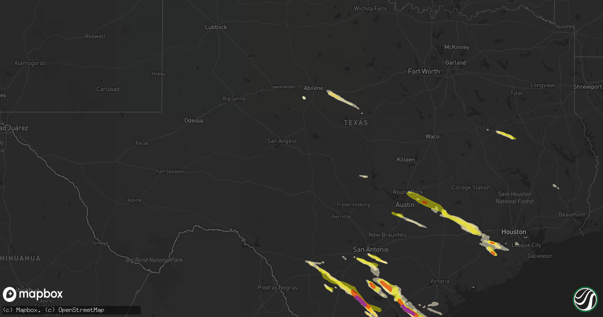
Hail Map in Texas on May 23, 2017
Get this storm
May 23 map
$229
one time, instant access
Download today. No call, no setup
Keep the $229
Bought the map and want the full workflow? Apply the entire $229 to a subscription within 7 days. None of it is wasted.
Every map, not just this one
This buys you this map. Subscription and you get every map we run, in the markets you choose from a few cities to whole states to nationwide. Plus real-time alerts the moment a storm fires.
Contact data
Name, contact info, occupancy, even credit band for addresses in the footprint. You go from where it hit to who to call.
Become the source they trust
Unlimited branding weather history reports on demand. You already have the documented answer ready for the property owner, and you are the one who showed up with it.
Property data and RoofTrace estimates
Pull up any address you have got, its value and the exact code rules for that jurisdiction, straight from One Click Code. Then RoofTrace estimates the squares, pitch, and roof value, priced the way you price.
Storm reports in Texas
Texas
| Date | Description |
|---|---|
| 05/23/20176:35 PM CDT | Part of fm-109 in frelsburg blocked by a downed tree. |
| 05/23/20176:18 PM CDT | Fayette county em reports damage to trees and a structure west of warrenton. |
| 05/23/20176:14 PM CDT | Quarter sized hail at cabelas in buda |
| 05/23/20176:01 PM CDT | Reports of large oak trees snapped on the south side of giddings. |
| 05/23/20176:01 PM CDT | Quarter sized hail along interstate 37 near leming. Time estimated from radar. |
| 05/23/20176:00 PM CDT | Quarter up to the size of half dollars in giddings. Time estimated from radar. |
| 05/23/20176:00 PM CDT | Storm spotter measured 75 mph wind gust in giddings. Also reported quarter sized hail. Time estimated from radar. |
| 05/23/20175:50 PM CDT | Received photos of hail up to the size of half dollars accumulated on the ground in paige. Also received photos of extensive damage to the siding of a house from wind-d |
| 05/23/20175:49 PM CDT | Hail slightly larger than quarters in paige. Time estimated from radar. |
| 05/23/20175:39 PM CDT | Golf ball sized hail east of elgin. |
| 05/23/20175:34 PM CDT | Bastrop county em reports widespread wind damage in and around elgin. Reports of both power lines and trees downed across the area. |
| 05/23/20175:32 PM CDT | Small tree limbs down in elgin. |
| 05/23/20175:31 PM CDT | Quarter size hail reported along highway 290 just west of elgin. Time estimated from radar. |
| 05/23/20175:30 PM CDT | Quarter sized hail in somerset. Time estimated from radar. |
| 05/23/20175:22 PM CDT | Quarter sized hail near the bexar and atascosa county line. Time estimated from radar. |
| 05/23/20175:20 PM CDT | Public report of golf ball size hail along hwy 181. |
| 05/23/20175:18 PM CDT | Quarter sized hail report from spotter. |
| 05/23/20175:16 PM CDT | Hail up to the size of quarters reported in pflugerville |
| 05/23/20175:16 PM CDT | Large tree snapped in half. |
| 05/23/20175:14 PM CDT | Quarter sized hail reported near interstate 35 and toll road 45 in south round rock. |
| 05/23/20175:01 PM CDT | Quarter size hail near percilla. |
| 05/23/20174:44 PM CDT | Quarter size hail reported on county road 1705 |
| 05/23/20174:34 PM CDT | Emergency manager reports power lines down across highway 83 south of uvalde. Time estimated from radar. |
| 05/23/20174:30 PM CDT | Quarter sized hail on cr 130 near elkhart |
| 05/23/20177:10 AM CDT | Coronado camp area reported several large trees blown down. Hail ranged from pea to marble size. |
| 05/22/20178:30 PM CDT | Rockport nos measured thunderstorm gust of 51 kts |
| 05/22/20178:22 PM CDT | Ping pong ball size hail near sparks colony drive. |
| 05/22/20178:15 PM CDT | Images submitted of power lines down across hwy 181 |
| 05/22/20178:10 PM CDT | Series of fences blown down in western league city along maple leaf between league city pkwy and 528. |
| 05/22/20178:09 PM CDT | Images submitted of radio tower damaged/partially downed east of taft |
| 05/22/20178:08 PM CDT | Numerous trees damaged in taft. Report via social media |
| 05/22/20177:54 PM CDT | Images sbumitted of large trees down and storage sheds flipped over |
| 05/22/20177:51 PM CDT | A local report indicates 1.00 inch wind near SINTON |
| 05/22/20177:51 PM CDT | A local report indicates 60 MPH wind near SINTON |
| 05/22/20177:50 PM CDT | Large tree limb downed on top of an suv on masterson street near the disney street intersection. |
| 05/22/20177:40 PM CDT | Ham operator reports golf ball size hail. |
| 05/22/20177:33 PM CDT | Video submitted of intense winds blowing over large trees near corrigan rd in skimore |
| 05/22/20177:31 PM CDT | Mesonet observation site measured 61 mph gust |
| 05/22/20177:30 PM CDT | A local report indicates 1.75 inch wind near 3 SE ROSENBERG |
| 05/22/20177:30 PM CDT | Numerous large trees down in needville subdivision. |
| 05/22/20177:26 PM CDT | Tx dps reports large tress split ... Multiple power poles down... Missing shingles on roofs... And lots of debris on the ground . |
| 05/22/20177:26 PM CDT | Grain silos down and damage to bonnie plant farm. |
| 05/22/20177:25 PM CDT | A local report indicates 81 MPH wind near 4 SW BEEVILLE |
| 05/22/20177:25 PM CDT | Fort bend co sheriffs office reports a trampoline around a light pole and fence down in beasley via twitter |
| 05/22/20177:22 PM CDT | Tx dps official reports multiple telephone poles and large branches down. |
| 05/22/20177:21 PM CDT | A local report indicates 81 MPH wind near 4 SW BEEVILLE |
| 05/22/20177:18 PM CDT | Picture submitted of tennis ball sized hail. |
| 05/22/20177:18 PM CDT | Trees down on fm-350 south. |
| 05/22/20177:15 PM CDT | Multiple reports of damage out of simonton including large limbs down... Fence down... Roof damage... And power lines down via fbcso twitter |
| 05/22/20177:10 PM CDT | Nws survey team concluded a macroburst of straight line winds impacted bee and san patricio co. Greatest concentration of damage occurred roughly along a 40 mile long p |
| 05/22/20177:08 PM CDT | Storm spotter reports 1.5 inch hail. |
| 05/22/20177:08 PM CDT | Pictures of significant property damage near mineral |
| 05/22/20177:00 PM CDT | Off duty nws employee reports car windows blown out and part of a roof blown off at sealy high school |
| 05/22/20177:00 PM CDT | Tree limbs and fences down. |
| 05/22/20177:00 PM CDT | 18-wheel truck blown over on i-10 near sealy reported by off-duty nws employee. |
All States Impacted by Hail Map on May 23, 2017
Cities Impacted by Hail Map on May 23, 2017
- Guntersville, AL
- Langston, AL
- Scottsboro, AL
- Grant, AL
- Rosenberg, TX
- Whitsett, TX
- Calliham, TX
- Three Rivers, TX
- Campbellton, TX
- Christine, TX
- Pleasanton, TX
- Jourdanton, TX
- Missouri City, TX
- Odem, TX
- Mathis, TX
- Sinton, TX
- Industry, TX
- Sealy, TX
- Fayetteville, TX
- Cat Spring, TX
- New Ulm, TX
- Pine Apple, AL
- Minter, AL
- Hayneville, AL
- Kenedy, TX
- Pasadena, TX
- Karnes City, TX
- Rockport, TX
- Woodsboro, TX
- Portland, TX
- Beeville, TX
- Skidmore, TX
- Port Aransas, TX
- Taft, TX
- Falls City, TX
- Aransas Pass, TX
- Hilton Head Island, SC
- Daufuskie Island, SC
- Tilden, TX
- Pearsall, TX
- Batesville, TX
- Livingston, TX
- Elmendorf, TX
- Uvalde, TX
- Somerset, TX
- Von Ormy, TX
- Atascosa, TX
- Lytle, TX
- Poteet, TX
- San Antonio, TX
- Mount Pleasant, TX
- Omaha, TX
- Devine, TX
- Hondo, TX
- Whitwell, TN
- Tracy City, TN
- Elkhart, TX
- Grapeland, TX
- Oakwood, TX
- Warren, TX
- Richmond, TX
- Dilley, TX
- Beatrice, AL
- Floresville, TX
- Needville, TX
- Giddings, TX
- Refugio, TX
- Rising Star, TX
- Cisco, TX
- Baird, TX
- Cross Plains, TX
- Dale, TX
- Lockhart, TX
- Peterman, AL
- Vredenburgh, AL
- Round Top, TX
- Guy, TX
- Beasley, TX
- Damon, TX
- Wallis, TX
- Gregory, TX
- Tuscola, TX
- Abilene, TX
- Buda, TX
- Fort Stewart, GA
- East Bernard, TX
- Comanche, TX
- Carbon, TX
- Robstown, TX
- Corpus Christi, TX
- Sequatchie, TN
- Kingsville, TX
- Cotulla, TX
- Crystal City, TX
- Ingleside, TX
- Atmore, AL
- Mershon, GA
- Patterson, GA
- Blackshear, GA
- Llano, TX
- Red Rock, TX
- Fowlerton, TX
- San Diego, TX
- Orange Grove, TX
- Sabinal, TX
- George West, TX
- Round Rock, TX
- Pflugerville, TX
- Hutto, TX
- Fairfax, SC
- Ledbetter, TX
- Alleyton, TX
- Brenham, TX
- Bellville, TX
- La Grange, TX
- Brunson, SC
- Savannah, GA
- Kyle, TX
- Manor, TX
- Elgin, TX
- Fulshear, TX
- Brookshire, TX
- Rosharon, TX
- Alvin, TX
- Pearland, TX
- Flatonia, TX
- Rosanky, TX
- Waelder, TX
- Bishop, TX
- Palacios, TX
- La Coste, TX
- Natalia, TX
- Brewton, AL
- Castleberry, AL
- Paige, TX
- Smithville, TX
- Bayside, TX
- La Porte, TX
- Buchanan Dam, TX
- Oneonta, AL
- Coupland, TX
- Tivoli, TX
- Cookville, TX
- Signal Mountain, TN
- Chattanooga, TN
- Austin, TX
- McDade, TX
- Bastrop, TX
- Taylor, TX
- Lexington, TX
- Lincoln, TX
- Driftwood, TX


