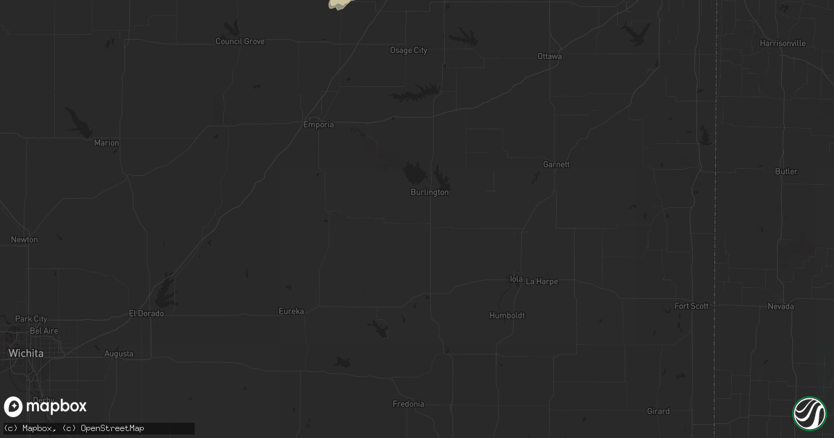
Hail Map in Omaha, NE on May 21, 2011
Get this storm
May 21 map
$229
one time, instant access
Download today. No call, no setup
Keep the $229
Bought the map and want the full workflow? Apply the entire $229 to a subscription within 7 days. None of it is wasted.
Every map, not just this one
This buys you this map. Subscription and you get every map we run, in the markets you choose from a few cities to whole states to nationwide. Plus real-time alerts the moment a storm fires.
Contact data
Name, contact info, occupancy, even credit band for addresses in the footprint. You go from where it hit to who to call.
Become the source they trust
Unlimited branding weather history reports on demand. You already have the documented answer ready for the property owner, and you are the one who showed up with it.
Property data and RoofTrace estimates
Pull up any address you have got, its value and the exact code rules for that jurisdiction, straight from One Click Code. Then RoofTrace estimates the squares, pitch, and roof value, priced the way you price.
Storm reports in Omaha, NE
Omaha, NE
| Date | Description |
|---|---|
| 05/20/20119:06 PM CDT | A local report indicates 1.75 inch wind near OMAHA |
| 05/20/20118:11 PM CDT | 108th and blondo street. |
| 05/20/20118:10 PM CDT | 90th and burt street. |
| 05/20/20117:51 PM CDT | Quarter size hail reported at 156th and state street in omaha |
| 05/20/20117:45 PM CDT | A local report indicates 1.00 inch wind near OMAHA |
| 05/20/20117:44 PM CDT | 144th and fort street |
| 05/20/20117:40 PM CDT | Few quarter size hail stones near 145th and blondo. |
| 05/20/20117:35 PM CDT | 146th and chandler road. |
| 05/20/20117:35 PM CDT | 163rd and harrison st. |
| 05/20/20117:30 PM CDT | A local report indicates 1.00 inch wind near OMAHA |
| 05/20/20117:25 PM CDT | A local report indicates 1.00 inch wind near 3 ENE GRETNA |
All States Impacted by Hail Map on May 21, 2011
All Cities Impacted by Hail Map on May 21, 2011
- Neola, IA
- Ada, OK
- Sasakwa, OK
- Stratford, OK
- Konawa, OK
- Byars, OK
- Revere, MN
- Lamberton, MN
- Hancock, MN
- Hartley, IA
- Primghar, IA
- Sanborn, IA
- Garvin, MN
- Cogswell, ND
- Forman, ND
- Schleswig, IA
- Ida Grove, IA
- Hopkins, MO
- Goldthwaite, TX
- Carson, IA
- Macedonia, IA
- Oakland, IA
- Hancock, IA
- Griswold, IA
- Henderson, IA
- Logan, IA
- Woodbine, IA
- Dunlap, IA
- Scotia, NE
- Greeley, NE
- Lidgerwood, ND
- Cayuga, ND
- Wakefield, NE
- Wayne, NE
- Pender, NE
- Thurston, NE
- Laurel, NE
- Emerson, NE
- Allen, NE
- Dixon, NE
- Concord, NE
- Maple Plain, MN
- Mound, MN
- Center, KY
- Horse Cave, KY
- Offutt Afb, NE
- Plattsmouth, NE
- Council Bluffs, IA
- Bellevue, NE
- McClelland, IA
- Zwolle, LA
- Many, LA
- Cameron, MO
- Osborn, MO
- Gallatin, TN
- Shreveport, LA
- Britt, IA
- Okolona, AR
- Modale, IA
- Mondamin, IA
- Missouri Valley, IA
- Winside, NE
- Evant, TX
- Buffalo, MN
- Loretto, MN
- Rockford, MN
- Royal, AR
- Bonnerdale, AR
- Bertram, TX
- Briggs, TX
- Lampasas, TX
- Madison, NE
- Humphrey, NE
- Louisville, NE
- Ashland, NE
- Murdock, NE
- Casey, IA
- Guthrie Center, IA
- Craig, MO
- Rulo, NE
- Hiawatha, KS
- Falls City, NE
- Purmela, TX
- Orange City, IA
- Stroud, OK
- Depew, OK
- Olaton, KY
- Knob Lick, KY
- Cave City, KY
- Glasgow, KY
- Oakland, NE
- Scribner, NE
- West Point, NE
- Gatesville, TX
- Sheldon, IA
- Papillion, NE
- Springfield, NE
- Hector, MN
- Fairfax, MN
- Panama, IA
- Earling, IA
- Dearborn, MO
- Easton, KS
- Walnut Grove, MN
- Alma, KS
- Downs, KS
- Riverton, IA
- Sidney, IA
- Hamburg, IA
- Kirwin, KS
- Cedar, KS
- Gaylord, KS
- Ashland, LA
- Castor, LA
- Omaha, NE
- La Vista, NE
- Sabetha, KS
- Alta Vista, KS
- Kidder, MO
- Gallatin, MO
- Winston, MO
- Altamont, MO
- Hamilton, MO
- Danvers, MN
- Appleton, MN
- Irwin, IA
- Kirkman, IA
- Lindsay, NE
- Percival, IA
- Amity, AR
- Emerson, AR
- Cherokee, TX
- Anoka, MN
- Andover, MN
- Wallingford, IA
- Graettinger, IA
- Mapleton, IA
- Sulphur, OK
- Jonesboro, TX
- Valley Mills, TX
- Morgan, MN
- Effingham, KS
- Horton, KS
- Everest, KS
- Lancaster, KS
- Muscotah, KS
- Bronson, TX
- Meadville, MO
- Roff, OK
- Malvern, AR
- Emporia, KS
- Strong City, KS
- Copperas Cove, TX
- Surprise, NE
- Ulysses, NE
- Rising City, NE
- Shelby, NE
- Osborne, KS
- Portis, KS
- Waverly, MN
- Montrose, MN
- Arkadelphia, AR
- Rock Port, MO
- Newcastle, NE
- Elk Point, SD
- Burbank, SD
- Vermillion, SD
- Montevideo, MN
- Benson, MN
- Troy, KS
- Jackson, MN
- Mount Holly, AR
- Stephens, AR
- White Cloud, KS
- Forest City, MO
- Highland, KS
- Powhattan, KS
- Fairview, KS
- Robinson, KS
- Morrill, KS
- Osage City, KS
- Greensburg, KY
- Edmonton, KY
- Higginsville, MO
- Hurley, SD
- Viborg, SD
- Reading, KS
- Lyndon, KS
- Waldo, AR
- Kimballton, IA
- Morris, MN
- Sherburn, MN
- Greenwood, LA
- Keithville, LA
- Bossier City, LA
- Hamel, MN
- Long Lake, MN
- Spring Park, MN
- Howard Lake, MN
- Cokato, MN
- Mountain Lake, MN
- Odin, MN
- Burnet, TX
- Florence, TX
- Brainerd, MN
- Magnolia, AR
- Taylor, AR
- Stratford, SD
- Davis, SD
- Centerville, SD
- Irene, SD
- Randolph, NE
- Bancroft, NE
- Rosalie, NE
- Walthill, NE
- Grant City, MO
- Mount Ayr, IA
- Kellerton, IA
- Lamoni, IA
- Martinsville, MO
- Hatfield, MO
- Sumner, IA
- Hartington, NE
- Park Falls, WI
- Phillips, WI
- Osceola, NE
- Platte City, MO
- Smithville, MO
- Mullin, TX
- Ringsted, IA
- Dunnell, MN
- Ceylon, MN
- Dolliver, IA
- Estherville, IA
- Underwood, IA
- Hope, AR
- Malvern, IA
- Brunswick, MO
- Skidmore, MO
- Cowgill, MO
- Polo, MO
- Braymer, MO
- Breckenridge, MO
- Kingston, MO
- McNeil, AR
- Rosston, AR
- Worthington, MN
- Lake Park, IA
- Round Lake, MN
- Harris, IA
- Oskaloosa, KS
- Hubbard, NE
- Kempner, TX
- Fort Hood, TX
- Beresford, SD
- Tolar, TX
- Granbury, TX
- Rison, AR
- Bethany, LA
- Volin, SD
- Melvern, KS
- Quenemo, KS
- Oregon, MO
- Rosendale, MO
- Bolckow, MO
- Fillmore, MO
- Groton, SD
- Ferney, SD
- Conde, SD
- El Dorado, AR
- North Branch, MN
- Stacy, MN
- Oneida, KS
- Boys Town, NE
- Tow, TX
- Bluffton, TX
- San Saba, TX
- Verdigre, NE
- Lometa, TX
- Hamilton, TX
- Crescent, IA
- Leawood, KS
- Overland Park, KS
- Richland Springs, TX
- Donaldson, AR
- Veblen, SD
- Osage, IA
- Sheldon, WI
- Chidester, AR
- Fenton, IA
- Lone Rock, IA
- Glade, KS
- Lester Prairie, MN
- Silver Lake, MN
- Winsted, MN
- Mayer, MN
- New Germany, MN
- Hutchinson, MN
- De Witt, MO
- Carrollton, MO
- Bancroft, IA
- Burt, IA
- Williamsburg, KS
- Pomona, KS
- Wakonda, SD
- Edgerton, MO
- Gower, MO
- Peru, NE
- Nebraska City, NE
- Hoyt, KS
- Meriden, KS
- Denison, KS
- Creston, NE
- Columbus, NE
- Leigh, NE
- Sparkman, AR
- Carthage, AR
- Leola, AR
- Maryville, MO
- Maitland, MO
- Mound City, MO
- Fairfax, MO
- Burlington Junction, MO
- Moorhead, IA
- Paxico, KS
- Maple Hill, KS
- Cosby, MO
- Easton, MO
- Stewartsville, MO
- Clarksdale, MO
- Saint Joseph, MO
- Ottawa, KS
- Lebo, KS
- Eskridge, KS
- Elmo, MO
- Westboro, MO
- Glenwood, IA
- Castle, OK
- Bristow, OK
- Glen Rose, TX
- Hico, TX
- Stephenville, TX
- Bluff Dale, TX
- Dublin, TX
- Portsmouth, IA
- Cottonwood Falls, KS
- Colton, SD
- Gresham, NE
- David City, NE
- Waco, NE
- York, NE
- Karnack, TX
- Belcher, LA
- Benton, LA
- Vivian, LA
- Hosston, LA
- Plain Dealing, LA
- Gilliam, LA
- Jefferson, TX
- Cotton Valley, LA
- Oil City, LA
- Mooringsport, LA
- Herman, MN
- Barrett, MN
- Hoffman, MN
- Delia, KS
- Holton, KS
- Mayetta, KS
- Tecumseh, KS
- Rossville, KS
- Rushville, MO
- Winchester, KS
- Harveyville, KS
- Grantville, KS
- Ozawkie, KS
- Leavenworth, KS
- Weston, MO
- Auburn, KS
- McLouth, KS
- Saint Marys, KS
- Silver Lake, KS
- Faucett, MO
- Cummings, KS
- Topeka, KS
- Nortonville, KS
- Atchison, KS
- De Kalb, MO
- Valley Falls, KS
- Shubert, NE
- Stella, NE
- Auburn, NE
- Nemaha, NE
- Brownville, NE
- Rush City, MN
- Harris, MN
- Little Falls, MN
- Salisbury, MO
- South Bend, NE
- Gretna, NE
- Maysville, MO
- Excello, MO
- Jacksonville, MO
- Lucan, MN
- Gwinner, ND
- Stuart, IA
- Butterfield, MN
- Trimont, MN
- Alpha, MN
- Jessieville, AR
- Allen, KS
- Glencoe, MN
- Lonsdale, AR
- Benton, AR
- Hot Springs Village, AR
- Hot Springs National Park, AR
- Chillicothe, MO
- Hale, MO
- Jefferson, AR
- Sherrill, AR
- White Hall, AR
- Bruno, NE
- Minneapolis, MN
- Cresson, TX
- Mountain Pine, AR
- Palmyra, MO
- Taylor, MO
- Wood River, NE
- Americus, KS
- Admire, KS
- Osakis, MN
- Scandia, MN
- Macomb, IL
- Doddridge, AR
- Forest City, IA
- Speer, IL
- Overbrook, KS
- Lawrence, KS
- Corning, KS
- Goff, KS
- Evansville, MN
- Battle Lake, MN
- Clitherall, MN
- Kingsland, AR
- Fordyce, AR
- Maple Grove, MN
- Wayzata, MN
- Lake Crystal, MN
- Colchester, IL
- Plymouth, IL
- Stanton, NE
- Windom, MN
- Glenwood, AR
- Norman, AR
- Heron Lake, MN
- Agency, MO
- Perry, KS
- Fort Leavenworth, KS
- Saint Paul, MN
- Utica, NE
- Bellwood, NE
- Stromsburg, NE
- Brainard, NE
- Benedict, NE
- Redding, IA
- Wells, MN
- Alden, MN
- Lakefield, MN
- Trenton, MO
- Penfield, IL
- Faulkton, SD
- Hardwick, MN
- Jasper, MN
- Springhill, LA
- Sarepta, LA
- Shongaloo, LA
- Elmwood, NE
- Turton, SD
- Dwight, KS
- Honey Creek, IA
- Smiths Grove, KY
- Centerville, IA
- Osseo, MN
- Worthing, SD
- Canton, SD
- South Haven, MN
- Kellyville, OK
- Lu Verne, IA
- Corwith, IA
- Prescott, AR
- Buckner, AR
- Stamps, AR
- Garland City, AR
- Emmet, AR
- Lewisville, AR
- Norfolk, NE
- Shenandoah, IA
- Coin, IA
- Northboro, IA
- Vassar, KS
- Oakland, KY
- Wetmore, KS
- Jamesport, MO
- Stirum, ND
- Minden, IA
- Truman, MN
- Murfreesboro, AR
- Bismarck, AR
- Pearcy, AR
- Delight, AR
- Kirby, AR
- Guilford, MO
- Savannah, MO
- Rea, MO
- Kathryn, ND
- Hoskins, NE
- Mammoth Cave, KY
- Llano, TX
- Becker, MN
- Pine Bluff, AR
- Craig, NE
- Caddo Gap, AR
- Broaddus, TX
- Pineland, TX
- Castana, IA
- Kansas City, MO
- Whiting, KS
- Netawaka, KS
- Shelby, IA
- Mendon, MO
- Lyons, NE
- Lennox, SD
- Lake View, IA
- Callao, MO
- Long Prairie, MN
- Dassel, MN
- Cedar, MN
- Imogene, IA
- Sheridan, AR
- Coleridge, NE
- Keytesville, MO
- Milroy, MN
- Prattsville, AR
- Randolph, IA
- Hastings, IA
- Silver City, IA
- Tabor, IA
- Burnsville, MN
- Ruthven, IA
- Emmetsburg, IA
- Ayrshire, IA
- Comfrey, MN
- Bingham Lake, MN
- Jeffers, MN
- Welcome, MN
- Armstrong, IA
- Springfield, MN
- Sanborn, MN
- Bartlett, NE
- Plattsburg, MO
- Langley, AR
- Corydon, IA
- Buffalo Lake, MN
- Stewart, MN
- Hartford, KY
- Dundee, KY
- Camden, AR
- Echo, MN
- Livermore, IA
- Jesup, IA
- Barnard, MO
- Farmington, MN
- Lakeville, MN
- Elbow Lake, MN
- Pilger, NE
- Amity, MO
- Coushatta, LA
- Delano, MN
- Watertown, MN
- Okabena, MN
- Emerson, IA
- Lees Summit, MO
- Glenwood, MN
- Avoca, IA
- Clarence, MO
- Saint Paul, NE
- Platte Center, NE
- Lathrop, MO
- Holt, MO
- Maynard, MN
- Wynot, NE
- Altheimer, AR
- Corning, IA
- Lenox, IA
- Buffalo Center, IA
- Paden, OK
- Browerville, MN
- Medford, WI
- Cedar Creek, NE
- San Augustine, TX
- Treynor, IA
- Decorah, IA
- Loup City, NE
- Hudson, SD
- Alcester, SD
- Moulton, IA
- Onawa, IA
- Elba, NE
- Lake Wilson, MN
- Laredo, MO
- Galt, MO
- Charleston, MS
- Cascilla, MS
- Wellsville, KS
- Princeton, KS
- Waverly, KS
- Burlingame, KS
- Council Grove, KS
- Rantoul, KS
- Neosho Rapids, KS
- Scranton, KS
- Baldwin City, KS
- Clarkson, NE
- Correll, MN
- Amazonia, MO
- Chula, MO
- Humphreys, MO
- Britton, SD
- Clifton, TX
- Horse Branch, KY
- Fordsville, KY
- Stilwell, KS
- Belton, MO
- Manilla, IA
- Vail, IA
- Orchard, NE
- Salem, NE
- Brownton, MN
- Fulda, MN
- Spirit Lake, IA
- Gurdon, AR
- England, AR
- Rochelle, TX
- Marceline, MO
- Carlton, TX
- Wesley, IA
- Granville, IA
- Alton, IA
- Fordyce, NE
- Trimble, MO
- Hemphill, TX
- Huntington, TX
- Concordia, MO
- Hospers, IA
- Harrisburg, SD
- Milam, TX
- Fouke, AR
- Beggs, OK
- Sapulpa, OK
- Weatherford, TX
- Barnum, IA
- Manson, IA
- Creston, IA
- Starbuck, MN
- Allerton, IA
- Parnell, MO
- Westboro, WI
- Grandview, MO
- Gayville, SD
- Osceola, IA
- Lisbon, ND
- Minden, LA
- Circleville, KS
- Maywood, MO
- La Grange, MO
- Seymour, IA
- Milnor, ND
- Grapevine, AR
- Winter, WI
- Ojibwa, WI
- Union Star, MO
- Sisseton, SD
- Tekamah, NE
- Henning, MN
- Ottertail, MN
- Etoile, TX
- Quincy, IL
- Ashton, NE
- North Loup, NE
- West Bend, IA
- Pottsville, TX
- Denton, KS
- Bendena, KS
- White Heath, IL
- Murdock, MN
- Shawnee, OK
- Prague, OK
- New Cambria, MO
- Napoleon, MO
- Bates City, MO
- Oak Grove, MO
- Buchanan Dam, TX
- Hawkins, WI
- Glen Flora, WI
- Bradley, AR
- Cawker City, KS
- Mayview, MO
- Georgetown, TX
- Winnebago, NE
- Reliance, SD
- Wyoming, IL
- Phillipsburg, KS
- Prairie View, KS
- Willisville, AR
- Orient, IA
- Mercer, MO
- Spring Hill, KS
- Bucyrus, KS
- Olathe, KS
- Blencoe, IA
- Roscoe, TX
- Fontanelle, IA
- Mitchell, SD
- Annandale, MN
- Mineola, IA
- Lower Brule, SD
- Cottonwood, MN
- Saint Michael, MN
- Dayton, MN
- Champlin, MN
- Dannebrog, NE
- Henry, IL
- Sparland, IL
- Grain Valley, MO
- Blue Springs, MO
- Lakota, IA
- Swea City, IA
- Bluff City, AR
- Gardner, KS
- Edgerton, KS
- Hardyville, KY
- Haughton, LA
- Beemer, NE
- Cedar Rapids, NE
- Wolbach, NE
- Fort Thompson, SD
- Rogers, MN
- Rothville, MO
- Havana, ND
- Doland, SD
- Hornbeck, LA
- Fonda, IA
- Bertha, MN
- Staples, MN
- Clarissa, MN
- Ericson, NE
- Humboldt, NE
- Wheaton, MN
- Thompson, IA
- Holly Grove, AR
- Elm Grove, LA
- Paola, KS
- Powersville, MO
- Pierpont, SD
- Magnolia, KY
- Cedar Point, KS
- Aldrich, MN
- Anabel, MO
- Fitzhugh, OK
- Fittstown, OK
- Stonewall, OK
- Green City, MO
- Garner, IA
- Sturgeon Lake, MN
- Oakes, ND
- Bradley, SD
- Tyler, MN
- Ruthton, MN
- Oto, IA
- Farwell, NE
- Elk Horn, IA
- Exeland, WI
- Madison, MO
- Loraine, TX
- Zephyr, TX
- Star, TX
- Melvin, IA
- Greenfield, IA
- Wyoming, MN
- Rutland, ND
- Ocheyedan, IA
- Homer, NE
- Shelton, NE
- Big Lake, MN
- Soldier, IA
- Pisgah, IA
- Harlan, IA
- Myakka City, FL
- Slayton, MN
- Pickering, MO
- Mabelvale, AR
- Bauxite, AR
- Carroll, IA
- Verdon, NE
- Carroll, NE
- Ravenwood, MO
- Tomahawk, WI
- Huntsville, MO
- Edgerton, MN
- Ivan, AR
- Redfield, AR
- Eagle Bend, MN
- Albany, MO
- Denver, MO
- New Century, KS
- Eudora, KS
- Early, IA
- Schaller, IA
- Stanberry, MO
- Chandler, MN
- Dickens, IA
- Jolley, IA
- Rockwell City, IA
- Carthage, TX
- Miller, SD
- Ute, IA
- Charter Oak, IA
- Denison, IA
- Ricketts, IA
- Dow City, IA
- Monroe, NE
- Liberty, IL
- Bend, TX
- Liberty Hill, TX
- Ludlow, MO
- Mooresville, MO
- Marthaville, LA
- Pipestone, MN
- Durham, MO
- Rice, MN
- Fort Calhoun, NE
- Walnut, IA
- Farragut, IA
- Shelbyville, MO
- Saint Charles, IA
- Spalding, NE
- Forest Lake, MN
- Belvue, KS
- King City, MO
- Seneca, KS
- Helena, MO
- Tarkio, MO
- Dewitt, IL
- Ord, NE
- Thurman, IA
- Arthur, IA
- Sheridan, MO
- Blockton, IA
- Tyndall, SD
- Scotland, SD
- Storden, MN
- Nicollet, MN
- Denver, IA
- Meridian, TX
- Cranfills Gap, TX
- Jarrell, TX
- Stonewall, LA
- Bethel, MO
- Emden, MO
- Philadelphia, MO
- Tucker, AR
- Cromwell, IA
- Florien, LA
- Odessa, MO
- Hanover, MN
- Randall, MN
- Schuyler, NE
- Waite Park, MN
- Lawson, MO
- Munfordville, KY
- Ewing, MO
- Jackson, NE
- Tulsa, OK
- Pacific Junction, IA
- Lineville, IA
- Davis City, IA
- Leon, IA
- Cainsville, MO
- Maple Lake, MN
- Bethel, MN
- Franklin, MN
- Sioux City, IA
- Bedford, IA


